Back from Alaska (Seattle, Washington & Idaho Falls)
June 13 found us sailing back toward Vancouver through the Inside Passage. It was still overcast but much less foggy than on the trip north. Lots of mountains on both sides of the channel & impressive vistas. It must be very nice on a sunny day.


")
Our final dinner in the main dining room was the best of the trip (apart from the always great meal in the Pinnacle). A huge, thick cut of rare & flavorful prime rib. Unfortunately, things went downhill after that. Rick had a very swollen & painful throat the last night of the cruise. He felt worse the next day as we drove south from Vancouver. When we got to Portland we visited Urgent Care, where he was diagnosed with pneumonia! What a parting gift from HAL! And very unfair, because Rick had had both pneumonia vaccination shots.
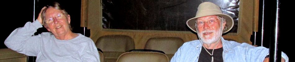
After disembarking we drove to Seattle where we visited with Mary’s Aunt Josie and her son & daughter in law, Russ & Karen.


From Seattle we proceeded to Portland, where we had scheduled three fun days with Barb & Brian. Unfortunately, those plans were ruined by Rick’s pneumonia, with which he spent all three days in bed until a farewell dinner on the last day. Fortunately, all the drugs the Kaiser Urgent Care doctor prescribed had Rick on his feet in time for our scheduled departure from Portland.
We drove four long days to Ft Worth, Texas, which seemed even longer because neither of us was really well. There was a lot of beautiful scenery, varying as we went, as you always see driving through the American West. One night we stopped in Twin Falls, Idaho, our first visit there. This city is located next to a huge gorge cut by the Snake River, which you don’t even know is there until you get right up to it. In the morning we visited the gorge before leaving. It was a beautiful morning and the views were really something. Hang gliders were jumping from just under the bridge to land on a large target painted on a spot near the bottom. We spotted one waterfall down the side of the gorge, but don’t know where the twins are that gave the city its name.


So much for pictures. We visited for a few days with Mary’s mother, Roxane, in Ft Worth then spent a day with Mary’s brother & sister in law, Joe & Janet, in East Texas. After that we drove for three days to get home, the most notable stop being for barbecue in Memphis, which is always great. We arrived home on July 1, which happened to be our 45th anniversary. After such a long, eventful & at times trying journey, just being at home & sleeping in our own bed was a great anniversary present to ourselves. That’s all for this story; see you next time.
Ketchikan, Alaska
We docked right in downtown Ketchikan in the morning of June 12. Founded in 1885, Ketchikan is the 5th most populous city in Alaska with something over 8,000 residents. The town has dubbed itself the “Salmon Capital of the World,” and commercial fishing is its major industry besides tourism. Volendam was, during our visit, one of the tallest buildings in town.

We explored this town on our own on foot. First stop was the Tongass Historical Museum (which was, until recently, attached to the public library). Nearby was the first totem pole we encountered, the Chief Kyan pole. Totem poles were (and are) created for a variety of reasons: to honor a dead person, record history or social events, or to honor a clan or family. They were not religious objects & were never worshipped. Made of wood, usually tough Red Cedar, they deteriorated over time spent outdoors in the adverse weather conditions of Alaska, as they were expected to do. The Chief Kyan pole is the second reproduction, in 1992, of one that was carved in the early part of the 20th century. The figures on the pole, starting at the top, are the Crane, the Thunderbird & the Brown Bear.


This small museum was packed with vintage photos & artifacts arranged to tell the story of Ketchikan chronologically. Old photographs are always interesting to us. Many of the artifacts, including colorful & eye catching pottery, basketry & clothing, are quite beautiful & the older ones are well preserved.

 figure")


We walked on to Creek Street. On our way we saw the “Raven Stealing The Sun” totem pole. Carved in 1983, it represents a story about how Raven released the sun, moon & stars from their boxes. The figures (top to bottom) are Raven, Sun, the Chief’s Daughter, a baby’s face & the Chief who had kept the heavenly bodies in boxes.


Creek Street is about a block of old but refurbished buildings on stilts above the Ketchikan Creek. A wooden boardwalk runs in front of the buildings above the creek. In season the creek is crowded with salmon fighting their way upstream to breed, but it was still calm when we were there. This street is famous as the center for houses of prostitution after they were outlawed in other parts of town in 1903. The brothels operated until 1954 when they were outlawed. The most famous is Dolly’s House, the blue house in the last picture, where one of the premiere madams lived unto she died around 1970. The largest establishment was the Star House, the pink building in the pictures below. Most of these buildings are now shops or boutiques. Running behind these buildings up the hill is a trail called Married Man’s Way, where patrons fled when the bordello’s were raided.


We walked up (and I do mean up) to the Totem Heritage Center. This is another fairly small museum dedicated to antique totem poles, many carved in the late 19th century, the high point of totem pole carving throughout the Northwest coast. The poles were retrieved from abandoned Tlingit & Haida villages. The villages were abandoned in the early 20th century when their people decided to live closer to churches, schools and places of employment. These vintage totem poles are being preserved, but have not been restored. Almost all of their paint is gone & the wood is weathered.

There are more totem poles stored horizontally in another room and yet more that are not on display, some 35 in all. They were photographed in their original setting before being brought to the museum. The totem on the left above represents Stone Ribs, a legendary shape-shifter of the Haida people, in the skin of a sea lion whose head faces the ceiling. The middle one has a brown bear looking down from the top holding a small person. The one on the right is a mortuary pole


The museum has other artifacts as well, and also operates a school to teach young Indians the traditional arts.

Outside were two large totem poles, commissioned to commemorate the opening of the museum. Leaving the museum we crossed a bridge over the creek & walked back toward town.


Along the way we passed many lovely Spring flowers. Here are a few examples.


We came to a bridge over a rapids in the creek. On one side was a salmon ladder, built to help the salmon make it up a particularly difficult portion of the creek. And, of course, there was the Salmon Ladder Gift Shop!


Down the creek from the ladder was a large sculpture of a salmon, pointing the way upstream. I guess this is to guide any salmon unsure of which way to go.


At this point we headed back to the ship, since it had been a lot of walking and one of us had a painful knee. We saw a lot here, but there is plenty left for next time.
Glacier Bay, Alaska
June 11 found us in Glacier Bay, a 3.3 million acre national park containing dozens of glaciers, several of which are large tidewater glaciers that reach the water. We spent a very full day there beginning early in the morning. It was foggy & overcast, but the viewing was very interesting nonetheless.
People have lived in this area for 10,000 years. By the mid 17th century it was occupied by the Tlingit people. At that time there was no bay; this was a wide valley with rivers running through & a huge glacier looming further back. At the height of the Little Ice Age the glacier advanced until by 1750 the Tlingit were forced out. When Captain Cook sailed up Icy Strait in 1778, and when George Vancouver did the same in 1794, there was no bay at all because the glacier, several thousand feet thick, extended all the way out into the Strait. However, by the time John Muir visited about 85 years later the glacier had receded some 44 miles, cutting out the bay as it went, & he reported that it was then retreating at a rate of about a mile per year.
Today it is about a 65 mile sail to the tidewater glaciers at the end of the bay. In 1926 Glacier Bay was declared a National Monument & it was promoted to National Park in 1980. It is also a UNESCO World Heritage Site. There are no roads into the Park so the only access is by air or water. To protect the Bay & its abundant wildlife, the Park Service restricts cruise ship traffic to two per day & most of those are operated by HAL & Princess.
By the time we woke up the ship was already well into Glacier Bay. Here is some of what we saw from our balcony & window as we dressed for breakfast: a cloud covered inlet and a bald eagle in flight.


After breakfast we passed what may have been Lamplugh Glacier, which is located in Johns Hopkins Inlet (photographed here through a streaky window). As recently as 1892 this area was still covered by the retreating glacier. (With a couple of exceptions that will be noted, we are not sure of the names of the glaciers we saw, so we will make our best guess based on a map).


 Glacier as we sail away")
We turned north into Tarr Inlet & sailed on to the main event: Margerie Glacier. It is a mile wide & rises about 250 feet above the water at its face. It extends 21 miles back to its origin in the mountains on the Canadian border.

We spent a long time, probably an hour or more, in front of this glacier. It is one of the biggest in the bay & one of the few glaciers that is not receding. Some reports say it is advancing up to 30 feet per year & some say it is stable, neither advancing or retreating. There are some substantial mountains behind it, but as you can see the fog kept us from seeing them. I guess we should be thankful that we could see anything at all.


The blue color is created when the heavy ice packs so tightly that air bubbles are eliminated. This resulting hard-packed ice absorbs all the colors of light except blue. This is an actively calving glacier, which means that large chunks of ice fall off the face and become icebergs. This happened at least four times while we were there, but it happens so fast that it is hard to get a picture before it is all over. We did manage to get one picture of the splash made by the falling ice.
Sadly, we did not see any whales or sea otters in Glacier Bay, although they are supposed to be plentiful there. But we did see seals & birds perched on ice flows near Margerie Glacier.


At the very end of the bay, just beyond the Margerie Glacier & perpendicular to it, is the Grand Pacific Glacier. This is said to be the one that once reached Icy Strait & carved the bay as it retreated. Today it doesn’t look like much . . . relatively small & very dirty so it’s not white. I’m not sure I even took a picture of it, but if I did the one on the left below is it. On the right is a photo showing how low the fog came at times, obscuring the view of the glaciers. As mentioned above, we were lucky to see as much as we did on a day like this.


As we headed back toward the mouth of Glacier Bay we passed a couple more glaciers, one of which which looks like the Reid Glacier and the other a reprise of the Lamplugh Glacier. The fog had lifted some by now & we could see mountains behind them, some of which were actually glowing in the sun.


Having passed pretty much all the glaciers, we went into the show lounge where a Tlingit woman sang & danced & told stories of the Tlingit people.


Finally, as we neared the mouth of the bay we sailed past North & South Marble Islands, a major hangout for sea lions. We were not close enough to see them with the naked eye but they were there ,all crowded together on small islands. These pictures were taken with a very long lens on somewhat choppy seas, so they are not as sharp as might be hoped. It was getting very cold & windy by this time, so we stayed inside after that.


This was the second gala night, a lot for a seven day cruise (we missed the first one because we were in the Pinnacle restaurant). Rick read the new HAL dress code & some online commenters who said gala nights in Alaska were less formal & required men only to wear a shirt with a collar. So he wore a polo shirt to dinner, but was refused admission without donning an ugly black polyester jacket that was too big. He had to sit through the whole dinner in this uncomfortable jacket. It appeared that, at least on Volendam, your shirt not only had to have a collar but also long sleeves, even though the gala night dress code on HAL’s website does not say that. We noticed one fellow sitting at a table with a short sleeve polo shirt & a long sleeve T-shirt underneath, which looked pretty tacky but apparently satisfied this arbitrary requirement. As longtime HAL customers we were pretty offended by this & think that HAL should have a uniform policy to admit anyone who fully complies with the dress code printed on its web site. This was a sour ending to what had been quite a special day.
Skagway, Alaska
We docked in Skagway early on the morning of June 10. Skagway grew out of the Klondike gold rush of the late 1890’s. In 1896 gold was discovered near Dawson City in the Yukon territory of Canada and in July of 1897 a ship docked in Seattle carrying several of the successful miners. The word spread quickly across the United States, which was in the midst of a deep economic depression, and tens of thousands of hopeful prospectors set out immediately for the gold fields. Unfortunately by the time they got there the productive claims had already been taken, so very few of them actually got any real return for their efforts.
And efforts they certainly were. Even after a long trip to reach Skagway or its now long abandoned sister town of Dyea, miners had to scale the coastal mountains and travel hundreds of miles through wilderness to reach Dawson City. The gold fields were in Canada & the Mounties would not let anyone past the border who didn’t have about a ton of supplies, enough to last a year. At that time the only way to carry supplies up the mountains was on your back, so to get a ton of supplies up to the border in the mountains required climbing the mountains about 40 times carrying 50 lbs each time. As you can imagine, anyone caught stealing supplies while their owner was down to get more would be summarily executed, so few tried it. On the Chilkoot trail from Dyea, just a few miles north of Skagway, stairs were carved into the ice to enable people to climb, and it must have been quite a sight to see all those hopeful miners in a continuous line up the mountain. There is a scene portraying this in Charlie Chaplin’s movie “The Gold Rush,” and it is also shown (not to scale) on one of Alaska’s license plates.

The other route up the mountain, the White Pass trail, started in Skagway, It was longer but a little less steep, so it was possible to use pack animals. But this didn’t work out very well as several thousand horses perished along the way, inspiring the name of Dead Horse Gulch. The two routes came together at Lake Bennett, where the prospective miners created a huge tent city during the winter of 1897-1898 and began to cut down all the trees in the area to build thousands of boats and rafts to take them up the lake to the Klondike river. From there they could travel on the river to Dawson City (where they would finally find out that it was all in vain for most of them).
We did not spend much time in Skagway itself, having signed up for a full day trip into the Yukon Territory. We drove up into the mountains in a bus on the Klondike Highway. Plans to build this 110 mile highway were begun in 1905 but it wasn’t completed and opened the full way until 1978. The first part of the highway is very steep, climbing almost 3300 feet in 14 miles. In the mountains tall poles are planted on both sides of the highway to mark the road when it is covered with snow. Horizontal bars on top of the poles are color coded in red & gray, sometimes with yellow between. The guide told us that these are to guide drivers: “Gray, you’re OK, Red, you’re dead.” Yikes; glad it wasn’t snowy when we were there! We drove over the Moore Creek Bridge, named for the first settler in Skagway, a suspension bridge anchored only on its southern end with a 110 foot gorge below.
 climbing through the mountains")


We drove on to Carcross (originally “Caribou Crossing”) in the Yukon Territory, stopping at the border station in Fraser, B.C., several miles beyond the White Pass summit to show our passports. Lots of beautiful views, as there were throughout this day.


Carcross is a small town with a wilderness vibe in a spectacular mountain & lake setting. The buildings are small & mostly wood & there is a beach along the lake by the footbridge. We visited a small art gallery with some unusual items on display, including pictures made partly from cut-out computer boards. It had become a beautiful day (the best weather of the entire cruise & much better than at sea level in Skagway), & the town was full of flowers. There is a statue of a caribou (which is basically a wild reindeer) where the highway enters the town. Oh yes, there was also a public library!


In Carcross we boarded the train in the picture above for the 67.5 mile trip back to Skagway. The Whitepass & Yukon Railway was begun in 1898 to provide easier & more reliable transportation to the Klondike gold fields. It was quite a challenge to build a railroad in rough winter weather through these daunting mountain passes, but it was completed all the way to Lake Bennett by July, 1899. It has a narrow gauge, with rails only 3 feet apart on a 10 foot wide bed, because this made it easier to make tight turns around mountains and required less blasting into the sides of mountains. There are two tunnels & several spectacular bridges over mountain gorges. In July, 1900 the road reached Carcross, where it was met by a railroad being constructed from the north & a golden spike was symbolically driven to join them (It was actually an iron spike because the gold one was too soft to drive). In 1994 this was designated as one of about 250 Historic Civil Engineering Landmarks worldwide.
Of course, by the summer of 1899 the gold rush was effectively over. But the railway kept up commercial operation until 1982, hauling passengers and freight (mostly non-gold mining ore). During World War II it was taken over by the US Army & carried supplies for the builders of the Alaska Highway. By 1982 most of the mines had closed because of falling metal prices & the railroad ceased operations. But in 1988 it was reopened to run from May to September at the behest of the cruise lines whose Alaska business was growing rapidly. It has been taking passengers all the way to Carcross only since 2007.
We travelled south along the shore of Lake Bennett for about 25 miles. We were told that such beautiful sunny days are rare in this area. Some of the coaches used on this railway date all the way back to 1881, and others are modern replicas of vintage cars. We have no idea which we were on, but it sure looked vintage, complete with a coal stove at one end. About 15 miles from Carcross we crossed the Yukon – British Columbia border.


We stopped at Bennett, British Columbia, now mostly uninhabited. This is where the Chilkoot & White Pass trails converged. Tens of thousands of miners pitched tents here in 1897 & built boats to take them, once the ice melted, almost 600 miles across lakes and down the Klondike River river to Dawson City. Donald Trump’s grandfather built and ran a hotel & saloon, now long gone, on the lakefront near the train depot. When the railroad was extended to Whitehorse in 1900 Bennett lost its train-to-boat transfer business & the town was abandoned. Bennett is maintained today by Parks Canada. We had limited time, so we walked through the small museum in the train depot then set out along the path that led to the top of the hill. The view from the top was impressive. Halfway down the hill is St Andrews Presbyterian Church, the last building remaining from the original town.


Reboarding the train, we continued toward Fraser, British Columbia, where the customs office is located. This is some 7 miles inside Canada because there is no room for a building at the border on the White Pass Summit. Breathtaking scenery the entire way.


The last 20 miles from White Pass Summit to Skagway is all downhill, with tunnels, bridges & narrow paths curving around mountains. About two miles from the summit we came out of a tunnel & passed the Steel Bridge, the tallest cantilever bridge in the world when it was built in 1901. It has not been used since 1969. From Inspiration Point you can see all the way to the Lynn Canal where Skagway is located.


We continued down the mountains, clinging to the sides above steep gorges. At about 9 miles from Skagway there was a sign on rocks on the other side of the canyon saying “On To Alaska With Buchanan.” This was not a prospector’s vow, but the slogan of a group that brought Detroit youths to Skagway every summer during the 1920’s.


As we reached flat land a few miles from Skagway, we crossed the east fork of the Skagway River & followed the river the rest of the way into town.

")

We exited the train near the train depot, but the railway buildings were closed for the day. We were really too tired to explore the town so we walked back to the ship. On the way we passed the striking Arctic Brotherhood Hall. It was built in 1899 to house a fraternity formed by prospectors while on the ship for Alaska. The façade is covered with more than 8,000 pieces of driftwood gathered from Skagway bay, more than 5,000 of which are still the originals. Two doors down is the Golden North Hotel with its distinctive gold dome. Built in 1898 for the Klondike Trading Company, which sold supplies to prospectors, it became a hotel in 1908. We also, happily, encountered the Skagway Public Library. As we reached the ship, it was the end of a long but very enriching day.


Juneau, Alaska
During the morning of June 9 we sailed past Tracy Arm, a long scenic inlet leading to some famous glaciers. The ship did not enter Tracy Arm but some passengers transferred there to a small boat for a cruise to the face of the glacier. Volendam then continued on to Juneau. We sailed up the Gastineau Channel and docked at Juneau just before 1:00 PM. Approaching our berth we passed the Disney Wonder & the MS Amsterdam, on which we sailed for the World Cruise in 2016. The Amsterdam looked great & say what you will about Disney, they are very creative & do things carefully right down to the details.


Founded during a local gold rush around 1880, Juneau has been the capital of Alaska since 1906. It is named after one of the original gold miners, Joe Juneau. This is the only state capital that borders a foreign country (Canada) & the only one that is unreachable by land. There are no roads leading out of the city, so everything (& everyone) arrives by air or water. While it is a small city by population (a little over 30,000) its area is vast . . . larger than the state of Delaware!
We were docked in prime location, right next to downtown Juneau. We disembarked and walked into the area near the dock, which was lined with what looked like permanent booths for people selling sight-seeing tours. So I guess tourism is big business here. But we had signed up for a ship’s tour that took us to Mendenhall Glacier, not too long a drive from town, & the Mt. Roberts Tramway that went high above the city.


Mendenhall Glacier is just a few miles from town, one of the most accessible glaciers in Alaska. It is one of more than 30 glaciers emanating from the 1500 square mile Juneau Ice Field. The glacier is about a mile across & stretches some 13 miles from the ice field to Lake Mendenhall. The lake in front of the glacier was first created in 1929 from the glacier’s water melt & has been expanding ever since. It was an overcast day with fog sitting on top of the glacier, but it was still a pretty dramatic view.


We walked down a short trail to an observation point on a rocky outcrop near the water. The glacier has receded about 1.75 miles in the last 8 decades. At that time the place from which we took these pictures was covered in ice. We saw some kayaks that were much closer to the glacier than we were & there was a protected area near the path for Arctic Terns to nest.


 viewing the glacier")


About half a mile to the right of the glacier is Nugget Falls. There is a path to the falls, but with Mary’s recent knee surgery we didn’t think we could make it there and back before our bus left. We saw old pictures in the visitors’ center in which the falls was emerging right on the glacier, which gives a good idea of how far it has receded.


The walk back to the visitor center was quite colorful with Spring flowers.


We rode back to town in the bus, driving along the Gastineau Channel. Our bus driver was a young fellow from Hawaii who is spending the summer in Juneau with his wife, for the money & experience. In the small world department, it turned out that a woman in the seat in front of us lives in the same Hawaiian neighborhood as the driver. We took a short detour across the bridge to Douglas Island & back. There was a large sculpture of a breaching whale near the bridge on the Juneau side. From the bus stop we walked to the lower terminal of the Mt Roberts Tramway, just behind the cruise ship dock. On the trip up the fog wasn’t bad until we got near the top, almost 4,000 feet above the town.


The top of the mountain was pretty fogged in, but we went for a walk in the woods, where trees were covered in some attractive moss. There is a Raptor Center that takes care of injured birds. On display was Lady Baltimore, a Bald Eagle that has lived there since a bullet in a wing in 2006 prevented her from being able to survive in the wild. They had an eagle’s nest on the deck near the upper terminal that was big enough for humans to relax in (not sure if its real or a recreation). We watched a movie about the Tlingit tribe that is native here (they own the tramway) and, of course, there were a couple of gift shops.


Coming down on the tram it was much foggier. So there were no clear pictures until near the bottom.


We had intended to spend some time on a walking tour of Juneau, but we were already pretty tired out. Our last stop (as will surprise no one who has followed this blog) was the Juneau Public Library. It was just across the street from where Volendam was docked. Strangely, it is located apparently on the top floor of a large parking garage. We did not go inside, since it was already closed for the day & also there was some police action going on near the entrance, but it looked modern and pleasant.


We ate dinner that night in the Lido because there was a special salmon bake. It we quite tasty, but it is our understanding that they used to do this on the deck by the pool, which is a lot more fun. There have been new regulations this year restricting cooking on deck that made that impossible. We are hoping that Holland America will find a way to restore the special on deck cooking occasions since we enjoyed them a lot on previous cruises. After dinner we went to bed to rest up for a long day in Skagway.

