Ushuaia, Argentina (2019)
Starting the new month in a new country, we woke up February 1 docked in:
Ushuaia is the southernmost city in the world (Puerto Williams, Chile, which sits nearby across the Beagle Channel, is further south but has fewer than 3,000 people). It sits on the southern coast of Isla Grande, the largest island of the Tierra del Fuego archipelago and of South America. Officially founded in 1884, a little more than a decade after the first missionaries arrived, Ushuaia today is a small city of 60 to 80,000 people (depending on the source) in a spectacular setting surrounded by the imposing Martial mountains and the Beagle channel.


Although indigenous people had lived in the area for some 10,000 years, Tierra del Fuego was discovered for Europeans by Fernando Magellan in 1520 during his global circumnavigation. Seeing smoke from so many fires maintained by the locals in this cold area, Magellan called this Tierra del Humo (Land of Smoke). It was the king of Spain who (correctly) concluded that Tierra del Fuego (Land of Fire) would be more evocative.
When we were here in 2012 the water conditions were bad enough that the harbor master would not let us dock or tender, even though we were almost close enough to the pier to swim:
https://baderjournal.com/2012/02/06/ushuaia-argentina-the-beagle-channel/
This time the weather was a whole lot nicer, though still pretty cold & very windy. The worst part was walking down the long pier to shore, during which it felt like you might just be blown into the water. One of our cabin stewards told us he intended to go ashore, but turned back when he encountered the cold wind on the pier, which was nothing like he was used to at home in Indonesia. We were booked on a private tour to Tierra del Fuego National Park during the morning, so we had to be up and off the ship pretty early in the morning.


Our guide drove our small group in a van to Ensenada Bay in the Park. Our first stop was at the Post Office At The End Of The World, the southernmost post office in the Americas (there is one further south at Port Lockroy in Antarctica). It is a corrugated metal shed that looks like a shipping container with a slanted roof, sitting on top of a stilted wooden pier that extends into the bay. The walls are covered with stickers, pictures and advertisements, and there is a wood stove near the door to provide warmth in this frigid environment. As you might expect from such a remote yet popular tourist attraction, the prices in this tiny post office are usurious: $5.00 US to buy and send a postcard to the United States! It is in a beautiful spot though.


Our first hike was along the shore of Ensenada Bay, then up into a forest. The sea views were very nice, including some windblown trees known as “flag trees” because they extend in only one direction.

 & the group look out on the shore")


")

The forest in this area is primarily populated with Lenga beech trees, but there are other species as well. Our guide told us quite a bit about the flora and fauna, but unfortunately too much time has passed for us to remember much of it. We saw a beautiful bird that we think is a Chimango Caracara.


Some of these trees had what looked like tumors around the trunks. It seems that this is Pan de Indio (Indian Bread), a fungus that was an important part of the diet of the Yamana people who lived here before the Europeans came. Apparently bright orange globes of fungus grow out from it, but not while we were there. It is still used in salads and to make jam.


One of the most interesting things in this forest was the wide variety of lovely lichens, often several kinds growing together. The only one whose name we know is “Old Man’s Beard” (Usnea), the fuzzy one that looks a little like Spanish Moss.


And of course there were some woodland flowers too.


We drove in the van to Roca Lake, then walked along the Lapataia River. The lake is large with a mountainous backdrop.


As we set out on our walk (toward the left in the pictures above) we came upon a group of Upland Geese. The darker females were too busy eating to pay any attention to us, but the white headed male kept a wary eye on us the whole time we were nearby.


As we walked along the river there was much flora, including a variety of mistletoe hanging from the tree tops. On our right was the lush marshy river and on our left was a fairly dense lenga forest.


")
The river walk took us to the Alakush lodge, which had a small buffet restaurant where we could eat (but didn’t). It also had a small museum discussing the history and ecosystem of the area, but it was all in Spanish so we mostly just looked at the pictures. A statue of a penguin stood in the hall just outside the large gift shop.


Outside in and near the river was quite a bit of fauna. We saw black necked swans, a Southern (or crested) caracara and ducks that may be pintails that are known to live around here.


We drove from there to a place called the Green Lagoon, which had a nice wooden overlook of the lagoon with a beaver house in the middle. It also afforded a spectacular view of the mountains in the distance, which we think is the Cordilla Darwin.


")

We continued on to Lapataia bay, where there is a wooden walkway out to the scenic water front. We stopped at an overlook, then walked down to the sign marking the end of the Pan American Highway, the other end of which is in Prudhoe Bay, Alaska, some 19,000 miles away. We saw the bridge where it crosses the Panama Canal, but further south in Panama is the Darien Gap, where a rainforest breaks the highway’s continuity. People routinely have their pictures taken with the sign & we were no exception.


We walked across the wooden walkway that protects the environment from tourists’ feet to the dock. From there we could see a family of Steamer Ducks in the water and a group of Upland Geese on the land.


We walked back along the wooden pathway to re-board the van, in a spot where there was a stunning view of the distant snowy peaks.


At the end of World War II the economy of Tierra del Fuego was in a slump. “I have a great idea” someone said to the Argentine Navy Secretary, “lets get some beavers down here & we can start a fur industry!” We don’t know whether the conversation actually went like that, but we do know that in 1946 the Navy Secretary imported 20 beavers from Manitoba, Canada, and released them into the wild for just this purpose. It turned out to be a really bad plan, however. The fur industry never developed but the beavers did and today there are a couple of hundred thousand of them busily destroying the old growth lenga trees in this area. The population became uncontrolled because the alien beavers have no natural predators down here. They are destroying trees by gnawing them down to build dams (as anyone could have predicted they would). Unlike their favorite trees in Canada, the lenga trees do not regenerate after being cut, and the dams built by the beavers have flooded large areas filled with lengas that cannot live in a watery location. So the beavers have changed the ecosystem of some 15% of Tierra del Fuego so far, the largest alteration here since the last ice age.
We visited a site typical of the beavers’ work. There is nothing here but whitened tree stumps and branches, really an image of devastation. Argentina and Chile have recently begun a program to control and hopefully reduce the beaver population, but most experts seem to think that eliminating them is not really possible. An object lesson that a lot of thought is needed about possible consequences before introducing an alien species into a new environment.


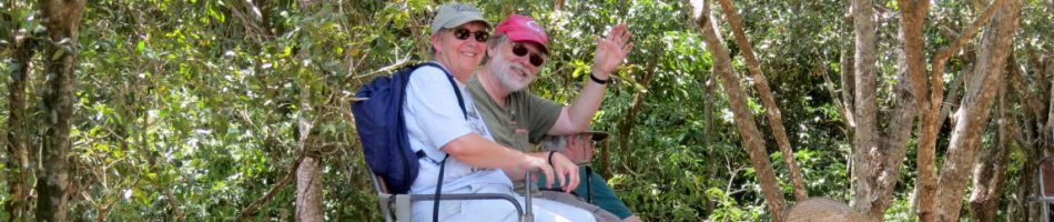
Leaving the park we returned to the ship, stopping on the way to take the picture at the beginning of this episode. We changed our clothes & spent the afternoon exploring the city. Walking up the two steep blocks to San Martin street, the main commercial thoroughfare, we turned left & found the Iglesia Nuestra Senora de la Merced (Our Lady Of Mercy Church). Billed as the southernmost Catholic church on the planet, this simple but brightly painted church was built in 1898 by convicts from the prison (Ushuaia began as a prison colony & the prison was in operation until 1947). The bell tower was added during a restoration in the 1940’s.


We walked a good way further out this commercial street, full of shops & restaurants, to find the public library, the Biblioteca Popular Sarmiento de Ushuaia. Brightly painted on the outside, it is open and airy inside.


As we walked back toward the city center we passed some colorful flowers, then stopped for a late lunch at a place called Tante Sara’s. We had huge and delicious Argentine steak sandwiches (we should have shared one) along with Beagle Beer from (you should have guessed it by now) the southernmost brewery in the world. As we sat by a large street window watching the action on the boulevard, a tall fellow came along wearing a penguin suit. When he saw Rick’s camera he stopped an posed for a picture. You just never know what you are going to see!


Quite a few birds were flying and swimming around the ship when we returned., including cormorants, kelp gulls and (probably) sooty shearwaters.


From the ship we could see the red and yellow church, the old government building (now a museum) and the current government building behind it. Off to the right we could see the old prison, shaped like the spokes of a half wheel and sitting behind some more conventional red roofed buildings. Beginning in the 1890’s Ushuaia served as a penal colony, modeled on the British one in Tasmania & the French one on Devil’s Island. Situated this far from civilization in a forbidding environment, escape was unlikely (only two prisoners managed it, and then for only a few weeks). The convicts actually built the prison, which opened in 1902 and was closed in 1947 by Juan Peron. Today it houses the Maritime Museum.

 & the current seat of the provincial government in the middle")

As we sailed away heading South away from South America, we had a nice view of Ushuaia in its storybook setting.


Beagle Channel & Cape Horn (2019)
During the night we exited the Magellan Strait and by morning we were sailing down the Beagle Channel. While there were a lot of clouds, most did not appreciably obscure the dramatic scenery as they had done last time we were here:
https://baderjournal.com/2012/02/06/ushuaia-argentina-the-beagle-channel/
During the morning we sailed along Glacier Alley, a series of glaciers falling from the Darwin ice sheet on Tierra del Fuego island. Some reach the water and some don’t and most of the large ones are named for European countries (Romanche, Alemania, Francia, Italia, Holanda, Espana), We can’t really identify which is which in the photos, but all are quite beautiful.


The Beagle Channel stretches 150 miles between the Atlantic and Pacific oceans. It is 3 to 8 miles wide and separates the main island of Tierra del Fuego from the more southerly islands in the archipelago. It is named after the ship on which Darwin travelled around the world, which discovered the channel for Europeans on its previous voyage.

When he visited here during the Beagle’s next voyage in 1833 he wrote "It is scarcely possible to imagine anything more beautiful than the beryl-like blue of these glaciers, and especially as contrasted with the dead white of the upper expanse of snow." From our vantage point most of the glaciers looked more white than blue (of course they may well have changed some in the intervening 185 years), but they were beautiful nonetheless.


Some 50 years later Darwin wrote this apt description of this scenery:
As we proceeded along the Beagle Channel, the scenery assumed a peculiar and very magnificent character … The mountains were here about three thousand feet high, and terminated in sharp and jagged points. They rose in one unbroken sweep from the water’s edge, and were covered to the height of fourteen or fifteen hundred feet by the dusky-coloured forest.


The western part of the Beagle Channel is in Chile, but the eastern part forms the border between Chile on the south and Argentina on the north. We passed a Chilean border station that appears to be a lonely spot to be stationed at.


We passed by Ushuaia, Argentina, our port for tomorrow, but this time only saw it from a distance. Closer to the ship was the airport, which is apparently on a peninsula extending a bit into the channel. Ushuaia is surrounded by stately mountains, but they were obscured by clouds as we sailed by.


On a small island near Ushuaia was the distinctive Les Eclaireurs lighthouse. Some have identified it as the “Lighthouse At The End Of The World” that gave this title to a book by Jules Verne. But we have read that this is erroneous & that Verne’s lighthouse was probably one attached to the prison in Ushuaia. We believe the birds crowding the island are cormorants.


We saw another clearly visible shipwreck today after we passed Ushuaia. The MV Logos ran aground near Snipe Island on January 5, 1988. It was a missionary ship, carrying about 120 people and a lot of bibles and other religious literature. It had visited more than 250 ports in more than 100 countries over a number of years. Apparently the ship sailed without a local pilot because they could not determine whether the pilot should be Chilean or Argentinian, which proved to be a big mistake when a storm came up. All the passengers were rescued but the ship & its cargo are still there sticking out of the water.


In 2012 we sailed to Ushuaia but were not permitted to land because of water conditions. So we left early for Antarctica and passed Cape Horn at night when we couldn’t see it. This time the Captain decided to take us to Cape Horn before Ushuaia, so we continued sailing south toward that island, with the scenery continuing to be pretty spectacular.


The Beagle Channel is reputedly full of interesting wildlife, from whales to dolphins to to sea lions to penguins, but we didn’t see any of that. We did see a number of interesting birds, but other than the cormorants near the lighthouse, they were all too far from the ship to get a sharp picture. Nonetheless, here are a few of the better ones, including what we think are South American Terns, some Black Browed Albatross, Southern Skuas and a Giant Petrel.


Tonight was Dutch Night in the main dining room, during which everybody was encouraged to wear something orange in honor of former Dutch Queen Beatrix’s birthday. Among others, the ship’s penguins were suitably attired.


During our dinner, around 8:30 PM, the Captain announced we were approaching Cape Horn. Discovered in 1616 by a Dutch captain who named it after the Dutch city of Hoorn, this island marks the beginning of the Drake Passage across the Southern Ocean to Antarctica. At Cape Horn the Atlantic, Pacific and Southern Oceans all converge, and the convergence of strong ocean currents and high winds make it one of the most dangerous sailing routes in the world. It has been estimated that since its discovery more than 800 ships have been wrecked here, costing the lives of more than 10,000 seamen. We passed some rocky islands before reaching Cape Horn, as did Charles Darwin:
Running past Cape Deceit with its stony peaks, about three o’clock [we] doubled the weather-beaten Cape Horn. The evening was calm and bright, and we enjoyed a fine view of the surrounding isles. Cape Horn, however, demanded his tribute, and before night sent us a gale of wind directly in our teeth. We stood out to sea, and on the second day again made the land, when we saw on our weather-bow this notorious promontory in its proper form—veiled in a mist, and its dim outline surrounded by a storm of wind and water.


Once we got there, Rick went out on deck to take these photos as we approached. There is a small lighthouse with a caretaker’s cottage, a small chapel and what appears to be a radio antenna atop a promontory about 130 feet above the sea. Luckily for us, the weather was much better than it was for Darwin, with the Cape standing out clearly for the most part.


The object you can see in the first two pictures far out to the left is the Cape Horn Monument. Built in 1992 to commemorate the many sailors who died here, it is a steel diamond with the outline of an albatross in flight cut out of the center. It is 22 feet tall and designed to withstand winds of 200 mph.


One of Prinsendam’s boats went ashore, which meant landing on a rocky beach then climbing to the top of the promontory. We didn’t know why at the time, but it turned out that, in addition to perhaps delivering supplies, they took our passports ashore to be stamped, a nice touch. We thought maybe some misbehaving passenger was being put off at this next stop!


As the sun was now falling rapidly we finished our dinner, said goodnight to the orange haired penguins and retired for the night since we had an early call for an excursion in the morning when we reached Ushuaia again. If the weather is decent the sail down the Beagle Channel is really spectacular, one of the best we have seen anywhere. And if we hadn’t been going to Antarctica it might have been the highlight of the entire cruise. But, of course, we were going to Antarctica!
Punta Arenas, Chile (2019)
We woke up on January 30 in our last Chilean port:

Founded in 1848,, Punta Arenas is the southernmost city in Chile. With a population around 130,000, it has often claimed also to be the southernmost city in the world but Ushuaia, Argentina, is further south. Punta Arenas has previously fudged this, calling Ushuaia a town rather than a city, but with Ushuaia growing by leaps and bounds over the last decade this position is becoming ever harder to maintain with a straight face.
Punta Arenas sits on the Strait of Magellan, fist discovered for Europeans in 1520 during Magellan’s circumnavigation of the globe. Running 534 miles from the Atlantic to the Pacific, the Strait separates the island of Tierra del Fuego from the mainland. Until the Panama Canal opened this was the main route from the Atlantic to the Pacific oceans and Punta Arenas was an important refueling stop for ships making that journey. This was particularly lucrative during the California gold rush. After starting out as a penal colony, Punta Arenas grew through the influx of immigrants from Spain, England, Germany and Croatia, among other places, and by the end of the 19th century it was a major producer of lamb and wool. Today it benefits from the tourist trade and is an important jumping off point for trips to Antarctica. 
When we visited here in 2012 we visited a Magellanic penguin colony at a place called Otway Sound. You can see that here:
https://baderjournal.com/2012/02/04/punta-arenas/
But the penguins have mysteriously disappeared from Otway and this time we decided just to walk around the town instead. It was cold and windy, even in the middle of summer, and you can see in the pictures that follow that we were bundled up. As we left the port, though, we passed another passenger out in shorts and a tee shirt. As we began walking up a hill toward the center of town we came upon a plaza with a statue of Bernardo O’Higgins, considered the liberator of Chile. Nearby was a plaque stating Chile’s claim to the Antarctic peninsula (which we would soon be visiting) in a pie cut shape all the way to the South Pole. Some seven countries claim sovereignty over parts of Antarctica, but all of these claims were put on hold by the Antarctic Treaty of 1959. All of the claiming countries signed the agreement, which sets aside Antarctica for scientific research and forbids military activity there. But Chile still maintains the claim, in case the treaty lapses or is changed.


At the top of the hill we found the very green Plaza de Armas, also called Plaza Munoz Gamero. It is supposed to contain a bustling handicrafts market, but not on the day we were there. Maybe it was too windy. What it does have in the center is a monument to Ferdinand Magellan, the leader of the first European expedition that came through these parts. Magellan stands on top facing the Strait with his eyes toward the sky, with several Fuegian Indians arrayed around the base. The legend is that kissing (or rubbing) the foot of one of the Indians gives good luck and/or ensures that you will return to Punta Arenas, and sure enough one foot is shiny bronze with the patina worn off. Asleep at the foot of the monuments were some stray dogs, not an unusual sight in south western South America.


The plaza is surrounded by impressive old buildings. Across the street is the Sacred Heart Catholic Cathedral, built in the 1890’s. It is modest for a cathedral.


On another corner is the Sara Braun palace. The Braun family were Jewish immigrants from what is now Latvia. One daughter, Sara, married a wealthy Portuguese shipper & sheep farmer and when he died in 1893 she took over the businesses. She was a leader in the community and died in 1955. Her house is one of the best examples of architecture at the height of the sheep farming boom. Today it houses a hotel and a restaurant.


Another old house, now the town hall, sits nearby.


We walked quite a way to find the library, in a largely empty neighborhood away from the center of town. And while it is always good to find that a town has a library (not every one we visit does), this one was kind of drab and we didn’t see many books in it. Great statue near the entrance though!


Mirador Cerro De La Cruz is a scenic overlook high on a hill behind the main part of the city. We walked up a steep hill, then a couple of long stairways to get there. There was a sweeping view of the city and the Strait, including our ship at the dock. We picked out the tower of the cathedral as well.


 at the dock")


On a landing just below the very top was a round mosaic design consisting of indigenous people of the area. I have added a couple of pictures that show what these people looked like, wearing nothing but paint and masks (and its really cold here!). We stayed here a little while, not only for the view but also to catch our breaths!

")

The municipal cemetery of Punta Arenas is about a 9 block hike north of the central plaza. First opened in 1894, it contains a number of elaborate crypts of the leading families of the time interspersed with rows of simpler graves outlined in stone for less illustrious residents. The grounds were donated by Sara Braun & today it is named after her. An entry portico and walls were added in 1919. Sara Braun reputedly requested that when she died she be the last person to pass through the main entrance, and so that entrance has been closed since 1955. You have to enter through a side portico, which contains a large oil portrait of Sara Braun. The cemetery is decorated with rows of carefully pruned cypress trees, some with wild tops that may be intentional or maybe just haven’t been pruned yet. This was named by CNN in 2012 to be one of the world’s 10 most beautiful cemeteries.


 cypress trees")
Perhaps the most interesting item in the cemetery is the monument to an “Unknown Indian.” It seems that in 1929 a locally formed marble company decided to start a quarry on Diego de Amagro island, which was inhabited by small groups of Alacalufe Indians. They left two employees to guard the site while the ship returned to Punta Arenas to recruit workers. The guards were attacked by Indians, one of them killed on the spot and the other hiding out in the woods until the ship returned. At the campsite two bodies were found, the company employee and an Indian. They were returned to Punta Arenas and, since no one claimed the bodies, they were buried in the cemetery in a single casket. Some time later a small headstone was erected reading “Unknown Indian.”
People began leaving burning candles and offerings of money and other things at this grave, along with written thanks for the Indian supposedly having granted favors, such as recovered health or financial security, but many left more ambiguous. In 1969 a new monument was built, with a life size bronze statue of an Indian at the center of walls covered with thank-you plaques and a secured box for monetary offerings, many of which had been stolen in the past. When the casket was exhumed to be moved to the new location it was discovered that there were two skeletons, neither of which could be identified. So they were buried together again under the new monument. People still come to pay their respects, pray, leave offerings and apparently touch or kiss the Indian’s hand, which is shiny and patina free. When we approached it there was a woman on her knees in front of the statue apparently praying, and you can see in the picture that flowers had been left there. On the ground in front of the statue is a plaque with a poem, which reads in English:
The Unknown Indian arrived
from the mists of doubt
historical and geographical.
and lies here sheltered in the
patriotic love of Chileans.
“Eternally.”


We left the cemetery in a bit of a hurry because it began to rain fairly hard. When it let up we stopped in a café a couple of blocks away for lunch and to await the end of the rain. We had the local Austral beer, brewed at what is billed as the southernmost brewery in the world. We couldn’t understand anything being said in the café, but it was interesting to watch the Chilean news on the tv as we sat there. After lunch it was sunny again, so we strolled town toward the waterfront and came up a monument to Chilean national hero Arturo Prat, who seems to have a statue in every city in Chile. Nearby was another plaque with a map setting out Chile’s Antarctic claims.


The first thing we encountered at the waterfront was a monument built in 2014 to the “trip of the schooner Ancud,” which first laid claim to this region for Chile in 1843. It depicts the landing boat apparently pushing aside (or being helped by?) some sea nymphs as it heads for shore.

As we walked along the waterfront we passed, in addition to the sign at the beginning of this episode, a large mural on buildings across the street from the water. On the water side was a host of cormorants, and possibly other birds, on the shore and on top of an old dilapidated dock no longer connected to the shore.


We reached the port (named for Arturo Prat) before long. Outside was a small green clock tower. It is apparently an antique with windows showing the works and additional information in addition to the time. As we entered our dock we passed a large sculpture of a whale’s tail, next to which was a guy dressed up in a penguin suit.


From the ship, after we reboarded, we had a good view of the whale tail with the penguin suit guy, and also of the cormorants crowded together on the old docks. This was a tiring day, so we were glad the next few days would be sea days.


Chilean Fjords (2019)
We spent January 28 cruising along the beautiful Chilean fjords. The bottom part of South America is riddled with fjords, channels and other waterways. The biggest is the Magellan Channel, discovered for Europeans (indigenous people were already living there, of course) during his voyage around the world in the early 16th century. But we didn’t get there until later.
Our itinerary said we would visit a glacier here, either El Brujo or Amalia. In 2012 we had visited Amalia Glacier during the Chilean Fjords part of our trip, which you can see here:
https://baderjournal.com/2012/02/04/strait-of-magellan/
This time Captain Schuchmann, who, happily, goes out of his way to show us all the sights during scenic cruising days, took us to visit both glaciers. We visited El Brujo first, right around sunrise. Having sailed down the Sarmiento Channel into Peel Fjord we turned into Asia Fjord, at the end of which is El Brujo glacier, part of the Southern Patagonian Ice Field. The glacier is more than a mile wide.


As you can see from the pictures, the day was quite overcast, so if the ice field is visible from the water we didn’t get a chance to see it. But the clouds moved a lot so that, as the above pictures show, sometimes the ice mountain right above the glacier glowed in the rising sun and sometimes it was hardly visible. As always with tidal glaciers, the blue & white ice front studded with crevices made for interesting patterns. The water in front of the glacier and surrounding the ship was filled with floating growlers and even smaller pieces of ice.


We stayed a while at the glacier as the Captain turned the ship 360 degrees to give everyone a good view. Then we sailed away from the glacier and out into the fjord.


We sailed out into Peel Fjord, then turned into the Amalia Fjord, at the end of which is Amalia Glacier.

The clouds were still heavy, but they were high enough to see the mountainous ice field behind the glacier and the separate wavy channel of ice descending on the right. The Amalia Glacier is more than 2 miles wide and has receded more than 5 miles since 1945. Actually, just about all of the Chilean glaciers are receding at different rates and climate change will likely accelerate that. There was no floating ice at Amalia during this visit, unlike last time. We were told that was because the line of rocky islands you can see on the right side was preventing the fallen ice from spreading. We were skeptical, since the ice wasn’t spreading from the left side either, but we can offer no better explanation.


The snow capped mountain on the right that the glacier is curving around is the Recluse Volcano. Its last recorded eruption was in 1908 and the glacier is slowly eroding its sides away. The volcano is about 3300 feet high.

After viewing the glacier (it was cold out & intermittently drizzly) we went on to breakfast in the warm & enclosed dining room. We could still see the glacier from the windows as the captain again slowly rotated the ship to give everyone a good view before sailing on.


Leaving the fjord we turned south and sailed down the Sarmiento Channel. It was lined with magnificent mountains most of the way. The highest peaks in this area reach about 1500 feet or more. As you can see the weather was pretty overcast most of the way.


Sometime after noon we sailed into the Smyth Channel, which is wider than the Sarmiento. We aren’t sure just when that happened or which pictures are from which channel, so we are making our best guess. More mountains here, reaching higher than those lining the Sarmiento. When you see each of these vistas alone it is pretty impressive, but when they appear one after the other in succession it is less so.


The weather got better in the afternoon, with intermittent sun among the clouds. We passed a number of very small lighthouses, which we have read are there to steer ships away from dangerous submerged rocks & shipwrecks. We didn’t hit any of them.


Shortly before we reached the Strait of Magellan (& we left for dinner), we came upon a visible shipwreck for which we needed no lighthouse (although one was nearby). This is the Santa Leonor, which ran into the rocks on March 31, 1968, apparently because of pilot error (at least that is what the court concluded in the subsequent litigation). No lives were lost among the few passengers and crew but the ship and its entire cargo were unsalvageable. The ship started life in 1944 as the USS Riverside and participated in the very end of the war against Japan. It was decommissioned in 1946 and sold several times before its fateful encounter with the rocks in 1968. It still sits there, more than 50 years later, rusting in the sun and water, a startling sight for those passing by. It is interesting how different it looks from different perspectives as you pass it.
 & small lighthouse (left)")


So that is it for today. As we had dinner and slept, we sailed down the Strait of Magellan toward Punta Arenas, our last stop in Chile. We will leave you here with a picture of a couple of the penguins on duty in the Lido restaurant today and a towel animal.

")

