Oranjestad, Aruba (2019)
March 22 found us docked at Oranjestad, our last port of this voyage before it ends in Ft Lauderdale. This is another formerly Dutch possession, since 1986 an autonomous country that is part of the monarchy of the Netherlands (so the locals have Dutch citizenship and governor appointed by the Dutch crown serves as the formal head of state). About 35,000 of Aruba’s 105,000 citizens live in Oranjestad. As in Curacao, the other Dutch island we visited, there are a number of colorful Dutch style buildings here, but unlike Curacao most of the ones here were renovated in that style for the tourist trade near the end of the 20th century.
The tourist industry is the main economic engine in Aruba, but there are few notable landmarks and most visitors come for the sun and beaches. On our first visit here in 2014 we explored the city on foot:
https://baderjournal.com/2014/05/01/southern-caribbean-part-2-oranjestad-aruba-willemstad-curacao/
And we did that again this time, since it was a good compromise between relaxing on the ship (which seems like a waste) and taking an excursion (we were done with that for this voyage). We visited mostly the same sights as last time, with one notable exception. Setting out after breakfast, we decided to ride the free tram into town. Although it stops right near the port it took us a little while to find the stop. It was pleasant enough, but extremely slow; you could probably walk into town faster. On the way we passed the Archaeological Museum, which we had enjoyed visiting last time but was closed this time for renovations that were apparently completed near the end of 2019. This town has a lot of outdoor art and we passed some wall paintings in the tram. We also passed the brightly painted city hall, which we saw from the side.


Leaving the tram in the center of town, we walked to Fort Zoutman. The fort was first built in 1798 and the city grew up around it. It was last renovated in 1936 and today houses the Historical Museum of Aruba. The artifacts we saw there were mostly old clothing and furnishings, along with an interesting exhibit on the history of the hat making trade that grew up on the island. A large group of school children were visiting while we were there and their teachers had some difficulty keeping them together. The Willem III tower was erected at one corner of the fort in 1868. At that time the fort and tower were at the water’s edge, but due to land reclamation projects (a specialty of the Dutch) they are now about 300 yards from the ocean. The tower was originally a lighthouse and also the city’s first public clock (which no longer keeps accurate time). We ran into Bill & Robert here and we all climbed to the top of the tower, three flights of steep, narrow, mostly open wooden steps with inadequate railing. It was a little bit daunting but we all made it to the top, where there were great views of the city on all sides. Among other things, we saw the Old Protestant (Calvinist) Church built in 1846 sitting right next to the New Protestant Church built around 1950. We also saw the 1888 school, the first public elementary in Aruba, which was the public library for a few years during the 1950’s. In front of the school is a monument to the men who wrote the Aruban national anthem, with sculptures of the three men gathered around a piano on a platform with a pool made to look like piano keys.
We had failed to find the library on our last visit but this time we had a better map. We parted from Bill & Robert and started out toward the library. It was a nice walk through a garden infested residential area. Before reaching the library we came upon the Beth Israel Synagogue, which we understand is the only synagogue in Aruba with a congregation of about 75. Across the street was a monument to two Aruban units that fought in World War II.


The library was cool and modern, with some colorful art inside . . . notably a representation of the Willem III Tower that was about 8 feet tall.


It was lunch time when we left the library, so we walked back to the shore to find the restaurant where we had lunch the last time we were here. It is in a delightful spot right on the shore. We had delicious grouper sandwiches washed down by the local Balashi beer. We told you this was a pleasant island on which to relax!


We walked back to the ship through Queen Wilhelmina Park. Wilhellmina was Queen of the Netherlands for 50 years, from 1898 until 1948. A statue of Queen Wilhelmina in the park was dedicated by her daughter, Queen Juliana, in 1955. Nearby is a statue of Dutch holocaust victim Anne Frank, erected in 2011. The park is full of Iguanas and other lizards running around freely in the grass.


Reaching the port we boarded Prinsendam for the last time . . . not just the last time on this voyage but the last time ever. She was sold to a German cruise company called Phoenix Reising at the end of 2018 and they took possession in July, 2019. So while she still has many years to sail, it will be under a different name (Amera) and with a different look. https://www.cruisemapper.com/ships/Amera-742 So this sparked a bit of nostalgia, not only because this is a particularly nice ship but also because it was the first ship on which we took a long voyage, the circumnavigation of South America in 2012.


On the morning of March 24, our last day at sea, the housekeeping staff put on an extravaganza towel animal display on the Lido deck by the pool. The white ones are room towels and the blue striped ones are beach towels.

There were large towel animals, as much as three feet tall.


There were small towel animals, hanging on a hedge and sitting on tables and the benches around the pool.

And of course, not to be forgotten, plenty of hanging chimpanzees.


So that is the end of this episode and the end of this epic voyage. The next day, after 80 days of sailing, we disembarked in Ft Lauderdale and drove home, stopping to visit some relatives along the way. It was quite an experience and we will look forward to our next international adventure, hopefully in 2020.
Willemstad, Curacao (2019)
On March 21 we stopped in Willemstad, the capital and largest city in Curacao, an independent nation within the Dutch monarchy (sounds something like the British Commonwealth) that was formerly part of the Dutch Antilles (of which Willemstad was the capital). Curacao has a population of about 130,000. 
Willemstad is a particularly nice city to explore on foot, in fact its urban center is a UNESCO world heritage site, so that is what we did. We had done that as well the first time we were here, in 2014:
https://baderjournal.com/2014/05/01/southern-caribbean-part-2-oranjestad-aruba-willemstad-curacao/
But this had been a long and eventful voyage and we were really tired of bus trips, so we spent our day enjoying this city again. The ship was docked at what is called the Megaport which is a fairly short walk from the center of town.

Willemstad is divided in two by an inlet called Sint Anna Bay. The island was inhabited by a tribe of Arawaks when the Spanish first sighted it in 1499. Deporting the entire local population to Hispaniola as slaves, they established the first settlement at what is now Willemstad in the 16th century, but the Dutch West India Company took it over in 1634 to use as a naval base. The original settlement is on one side of the bay in a district called Punda (“The Point” in the local Papiamentu language), while the district on the other side of the bay, where Prinsendam was docked, is called Otrobanda (“Other Side” in Papiamentu). During the 18th and early 19th centuries it was notorious as the busiest slaving port in the Caribbean, with Africans being kept here for about 2 years to be “trained” for their new jobs before being sold on to North and South America. The slave trade was abolished here in 1863.
Leaving the ship we walked toward the bridge, passing through the Rif Fort (Reef Fort). Built in 1828 at the mouth of Sint Anna Bay to protect the town & the bay from pirates and invaders, the fort was outfitted with bombproof five foot wide walls and 56 cannons. A chain to keep hostile ships out could be deployed across the bay entrance to the Waterfort (Water Fort), originally built in 1634 but rebuilt in 1827. During World War II a metal net was used to keep out German submarines. Today it is a trendy shopping center with many restaurants and shops. From the upper level is a very fine view of the Queen Emma Bridge that crosses the bay.


We walked on toward the bridge, passing the statue to Luis Brion in Plaza Brion. Born in Curacao in 1782, Brion was an advanced naval tactician and a top lieutenant to Bolivar during the war for South American independence from Spain. He died here in 1821. The plaza had an excellent view of the colorful Dutch colonial buildings that line the shore on the other side of the bay. Nearby was a large freestanding mural depicting the same view during the age of sailing ships. As you can see from the mural, the multicolored buildings are not just modern innovation to attract tourists. These buildings are centuries old. The story is that most of Willemstad’s buildings were originally white, but a 19th century governor concluded that his migraines were caused by the glare of the sun reflecting off the white exteriors. Thus a decree was issued requiring all buildings to be painted a color other than white. The city’s characteristic multicolor pattern has been adhered to ever since.


We walked across the 550 foot Queen Emma Bridge to Punda. Originally built in 1888, this is a floating pontoon bridge that swings open to permit ships to sail into and out of the harbor. It swings open about 10 times each day. If you are on the bridge when it opens you cannot leave until it closes. This was originally a toll bridge: those wearing shoes were charged 2 cents to cross while barefoot walkers could cross for free. It accommodated automobile traffic until the four lane Queen Juliana Bridge opened in 1974; since then it has been for pedestrians only. The Queen Juliana Bridge is much higher, with a 185 foot clearance for ships to pass underneath, the highest bridge in the Caribbean. There is a large protected harbor behind this bridge that you can’t see from town because of the hills. The beautiful yellow Penha building at the bridge’s exit in Punda dates to 1708, the oldest commercial building in town (although it started out as a private home). Today it houses a cosmetics and apparel store, but is still the most photographed building in Willemstad and possibly in the entire Caribbean. So we have included our contributions to that total here.


Leaving the bay behind us we walked into the city and soon came to the floating market. This is a row of vendors’ stands along the water front of an interior inlet with boats transporting produce from Venezuela (about 35 miles away) docked behind them. The last time we were here the market was full with boats lining the waterfront all the way down. With the severe economic & political troubles in Venezuela this year many of these vendors no longer come here & the meager line of boats only reached about half way down the line of kiosks. In the area near the market are several small pedestrian drawbridges similar to those we had seen in Amsterdam.


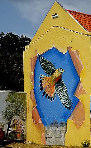
We walked on to find the Maritime Museum. It was quite interesting, with many exhibits recounting the history of sailing in Curacao. On the way we passed some interesting wall art, which is colorful and plentiful in this city.




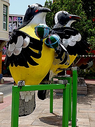
It was time for lunch so we sought out our favorite restaurant, set out over the water in a large inlet near the center of town. It was called “Timeless,” but had a different name the first time we visited a few years ago. But despite the name change, the lunch of local fish & chips, washed down with some local beer (which we discovered last time is actually bottled in Florida), was still just as tasty. From the restaurant we could see the library, which we had visited last time, with what looked like a brightly painted bookmobile (“Bus di Buki” . . . Book Bus?) parked in front. On our way to the restaurant we passed some more wall art and an installation of three birds playing in a band, created from discarded and recycled materials in 2016 by local artist Omar Sling. Then, not too far away, we encountered the actual birds, which are called banaquits. How often does that happen?





We headed for the Mikve Israel-Emanuel Synagogue, the oldest synagogue in the Americas still in use. While the Jewish community in Curacao dates to the 1650’s, when it was founded by refugees from Recife, Brazil and immigrants from the Netherlands, this synagogue opened in 1730. On the way we passed a World War II memorial and had another nice view of the small drawbridge we crossed earlier in the day.


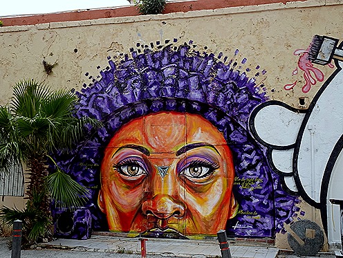
We returned to the Queen Emma Bridge to make our way back to the ship. On our way there we saw a monument to Queen Wilhelmina in (where else) Queen Wilhelmina Park. We also saw more wall art and an interesting vertical sundial near the bridge. And of course we saw our old friend the Penha building, but from a different angle.




When we reached the bridge it was fully open, so we had to wait. We listened to a family rather aggressively negotiating with one of several taxi drivers sitting nearby for a tour of the island. It took a while but they apparently came to an agreement since they all left together. Eventually we spotted a ship sailing from the harbor under the high Queen Juliana Bridge heading for the ocean. it sailed right by us, then another ship came as well. Finally they began to close the bridge. It has a hinge on the Otrobanda side and an operator’s house at the end of it where it connects to the Punda side of the bridge. Under the operator’s house are two propellers facing left and right which move the bridge across the water like a boat. While the bridge is open and no one can walk across a couple of free ferries carry passengers back and forth.
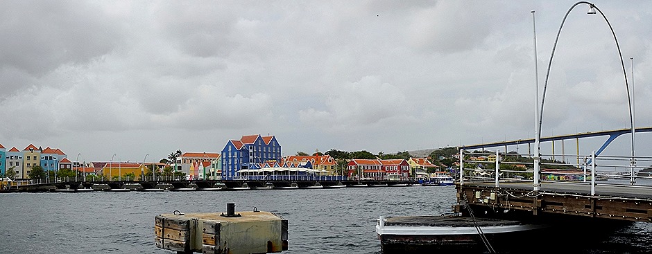


Crossing the bridge, we walked back to the Prinsendam. Unbeknownst to us, Robert was out on his balcony with his camera recording our progress.


That was, obviously, the end of our visit to Curacao. After dinner we went out on deck for a final look. The city was nicely lit up, with the hoops lining the Queen Emma Bridge constantly changing colors. A nice farewell from a very nice island port.


Port Elizabeth, Bequia, St Vincent & The Grenadines (2019)
On March 19 we were anchored in Admiralty Bay near Port Elizabeth, the only town on the island of Bequia (Beck-way), the second largest and most northerly of the Grenadines. Bequia is Arawak for “island of the clouds,” although we didn’t see very many when we were there.
Bequia has a long history stretching back to the indigenous Arawak & Carib people. It came under British rule in 1763 as part of the Treaty of Paris that ended the Seven Years War (French & Indian War in America) . The British set up a plantation economy and imported thousands of African slaves. The relatively safe harbor here was also a hangout for pirates (we have read that descendants of Captain Kidd still live here). The country of St Vincent and The Grenadines gained independence in 1979. The population of the island of Bequia today is about 4300.
This would be a leisurely day of walking around this sunny and friendly town with little in the way of important landmarks. After breakfast we tendered in to the town dock. Nearby were small boats and stands selling produce & souvenirs. The harbor itself was full of yachts.


About a block down from the jetty is St Mary’s Anglican Church, built of stone in 1829 to replace a wooden church destroyed by a hurricane. Small and unassuming, it is very bright from many large windows, many with stained glass memorial plaques hanging in them.


A little way behind the church is a cemetery, where goats were trimming the grass.


We walked down the main thoroughfare, just back from the waterfront. It is a divided street with pedestrians on the left, flora in the middle, and a car lane on the right, but it is still a pretty small street. Then we continued onto a narrow walk right along the water’s edge that eventually leads to a beach, although we didn’t go that far. The water was extraordinarily clear and the plant life growing under it was quite visible. On the land side were some restaurants, most notably the Whale Boner, whose gate was made from whale jawbones and bar seats from whale vertebrae.

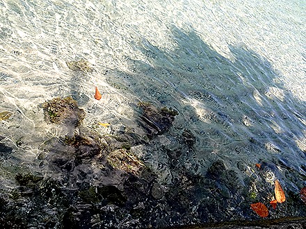


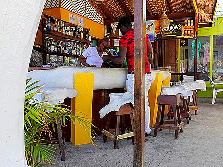
We walked back through town and then on to the north around the bay. We passed the book store and a pizza place, among other things, and many bright flowers.


Bequia has a rich history of whaling, fishing and boat building. At one time it was one of the major ship repair sites in the Caribbean. Boatbuilding is still practiced here, but it has also developed a reputation for model boat building. Two establishments in particular are well known: Sargeant Brothers and Malvern. We found both of them on our walk; Sargeant Brothers was closed but we did go into Malvern’s, which was well stocked with model sail boats. The road continues up into the hills beyond Malvern’s, but we didn’t.


As we walked back into town we passed the town’s revenue building, which houses government administration, post office and customs (at least it used to . . . there was once a sign painted over the door saying “Revenue” but it seems to have been painted over). We passed what looks like a resort on a hill, a row of clothing vendors and a bird looking down from a wire.


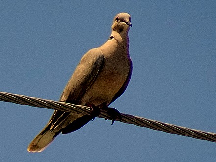

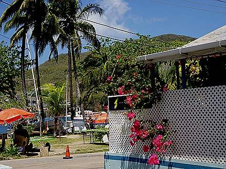

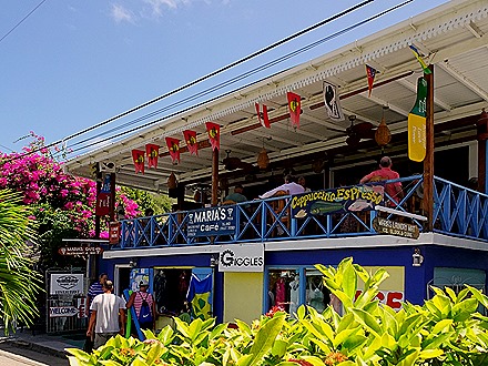

We returned to the pier & caught a tender back to the ship. From the ship we could still spot the revenue building, the church & the pier.

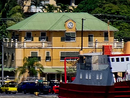


A sail-away party was held by the pool. Even after such a long sea journey the old folks can still dance!


We sailed away past hills and islands and even a sailboat. In the restaurant we had previously introduced our waiters to a tradition our friend Bob had originated on the Amsterdam world cruise. When none of the desserts appealed, he (and we) would order the always delicious chocolate cake that from the room service menu. Because there were usually six desserts listed on the menu, this one was referred to as “number 7” when ordering. On this night our waiters honored this tradition by bringing us a cake that was labeled accordingly. That is really getting into the spirit, as the voyage was nearing its close.


Bridgetown, Barbados (2019)
We spent March 18 on Barbados, the most easterly of the Caribbean islands. First settled by the British in 1628, Bridgetown today has some 110,000 inhabitants, more than a third of the total population of Barbados. Barbados achieved independence from the UK in 1966 but remains in the British Commonwealth. Unlike the other Caribbean islands Barbados is mostly coral rather than of volcanic origin. The last time we visited here we walked from the port into Bridgetown and spent our time exploring the city.
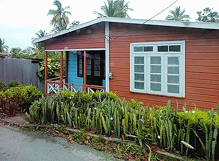
This time we signed up for an excursion with our travel agents to see some of the rest of the island. So in the morning we headed north from the port in the gray and drizzly weather. This is a very wealthy area of sandy beaches, calm waters and expensive resorts known as the Gold Coast (or more recently, the Platinum Coast). It is said that a number of foreign billionaires have beach houses here. Not only was it poor weather to view these resorts as the bus rolled by but we were on the other side of the bus, so no pictures of the Gold Coast. As we drove over the island interior to the much wilder east coast facing the Atlantic we passed a number of what seem to be typical Barbadian houses, mostly one story and painted a variety of colors.


Near the east coast we happened on some monkeys. Barbadian green monkeys are descended from some that were brought here some 350 years ago from Senegal and the Gambia by slave traders. Some of these pets escaped and today they are all over the island. Through some 75 generations they have evolved differently from their cousins in Africa and it is said that this particular species can only be found in the wild here.


We stopped in Bathsheba, a town of about 5,000 on the east coast. We have read that this is the most painted landscape in Barbados and it was easy to see why, even with the clouds & rain. The beach is highlighted by very large boulders that have been eroded at the bottom by the heavy surf. The waves in this area known to surfers as the “Soup Bowl,” and it regularly hosts international surfing competitions. Eleven time world champion surfer Kelly Slater has called this one of the “top 3 waves in the world.” Up the hill from the park where we stopped were some houses similar to what we had seen and some a little more substantial.


We were stopped in a park that sloped steeply down to the water. Next door to the park was a restaurant with a veranda in back that had a spectacular view of the Soup Bowl. In the park we encountered some local birds.


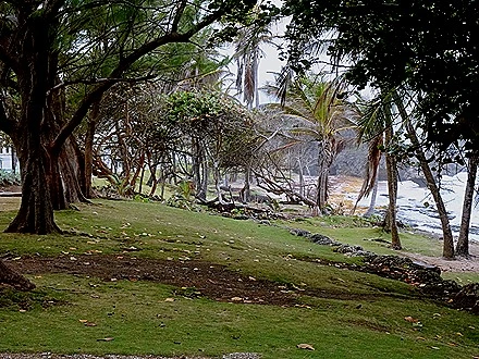


Back in the bus, we drove to the St Johns Parish Church, situated atop a hill 800 feet above the sea. The first church was built here in 1645. It was destroyed by fire and rebuilt in 1676 but hurricanes destroyed that and its successors. After the 1831 hurricane the present church was built of sturdy stone and rededicated in 1836. Gothic in style, it would look right at home in the English countryside. The outstanding features inside the church are a large pipe organ over the entrance and an elaborately hand carved pulpit.


In back of the church is a cemetery. The most eye catching tombstone is from 1678, the grave of Ferdinando Paleologus who was a member of the family of the last emperors of the Byzantine Empire in Constantinople. The cemetery had a breadfruit tree and a number of colorful flowers and it backed up to a cliff overlooking the ocean and a town below. Breadfruit is native to the South Pacific, not the Caribbean. It was first brought to the Caribbean by Captain William Bligh of Mutiny on the Bounty fame because it was thought this would be an inexpensive food for the tens of thousands of slaves that were kept here. An artist was at work there too. After exploring the cemetery we left the church.


Originally built in the 1660’s, Sunbury Plantation house was restored after a devastating fire in 1995. Its 30 inch thick walls are made of coral and ballast stones, probably from slave trading ships. This was the great house of a large sugar cane plantation. Sugar cane was by far the leading export from Barbados in earlier centuries and even today it is one of the island’s leading crops. The plantations were worked by slaves imported from Africa; at one point there were more than 15 slaves for every free person in Barbados. We toured the house, which has been furnished with antiques, many made from Barbadian mahogany. It was pretty sumptuous, but really an old house is an old house and we have seen a lot of them.


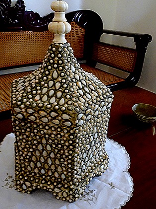

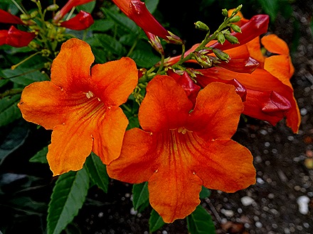
The house has lush gardens with many different flowers and trees, notably some large ficus trees.




In back of the plantation house was a pavilion containing a buffet restaurant. We had a very nice lunch there, including some delicious local fish and rum punch. Barbados has been producing rum since 1703, the first to do so in the Caribbean, which is made from the sugarcane grown throughout the island (including on this plantation). Our guide told us that the last census counted 1200 churches in Barbados . . . and 1200 rum shops.


As we drove back to Bridgetown we passed several fields of sugarcane.and some more local style houses. In one traffic circle we drove past the Emancipation Statue, erected in 1985. Many people here call it the Bussa Statue, after a slave who led a revolt in 1816, although that was not the intent of the sculptor. We drove through the center of Bridgetown, past the Parliament Building that has been the seat of government since the 1870’s, then down a commercial street and back to the port.


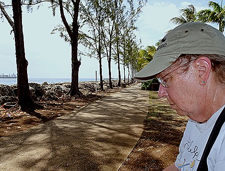
On our first visit here we walked into town from the port along a beautiful park like path along the sea wall. After returning to the port, we decided to walk up that path a little way to visit a collection of shops we believe was called the Pelican Crafts Center. Many of the shops were closed but those that were open included some very interesting textile and crafts shops as well as some more mundane souvenir stores. It also had a large statue that looked at first like a skeleton playing baseball, but probably was intended to beholding a sword or a club. After that we returned to the ship, ending our visit to Barbados.




Devil’s Island, French Guiana (2019)
The morning of March 16 found Prinsendam anchored near Ile du Royale, the largest of the three Salvation Islands. This is the one island that can be visited from a cruise ship; the other two are called Ile St-Joseph and Ile du Diable (which means Devil’s Island).

For just over 100 years this archipelago was part of a French penal colony. It was opened in 1853 by Napoleon III after his coup, and eventually more than 200 republican opponents of his regime were stashed there. After a lot of bad publicity the French stopped sending prisoners here in 1938 with the intent of closing the penal colony, which they did in 1953 after a delay caused by the German occupation of France during World War II. Today it welcomes visitors from cruise ships, private yachts and people ferried here for a look on local boats from the mainland some 8 or 9 miles away.
We tendered in as early as we could after finishing breakfast. The island is lush and beautiful, and studded with the ruins of interesting penal colony buildings. The tiny port has a small but sturdy tender dock.


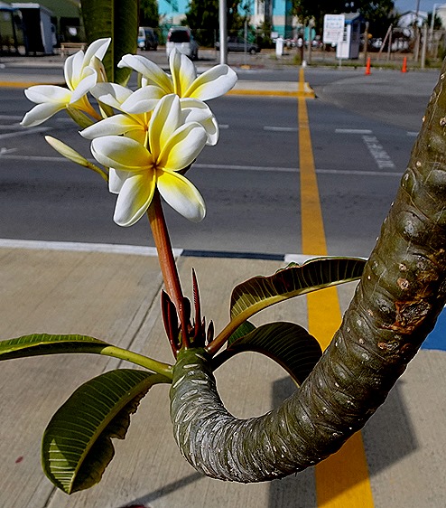
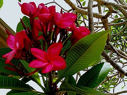
This is a beautiful tropical island, lush with palm trees and surrounded by surf. Add in the extra interest of the ruins of the prison camp and some nice weather and you have the makings of a very nice port stop. But there is little to do here other than explore the island on foot: no excursions, no busses, no beaches, no zip lines. So that is what we did, just as we did on our first visit, although our routes differed a bit.
https://baderjournal.com/2012/03/07/devils-island-french-guyana/
We walked down the path to the left in the picture above. Upon entering the forest we encountered some Capuchin monkeys and then some steep stairs to get up to the level that was the center of the prison.


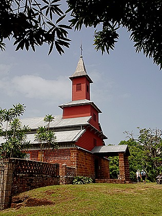
On the way up the hill we spent some time in a small museum, filled mostly with explanatory displays about the history of the prison colony and the prisoners who served time here. At the top we came upon the prison chapel, in good shape (probably restored) and perhaps currently in use. Inside were some interesting paintings on the walls by a prisoner named LaGrange who was a counterfeiter. Across from the church was the hospital, looking well restored at least on the outside, and nearby were some real ruins not restored at all.




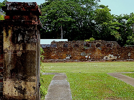
We visited the ruins of the main prison, where prisoners were chained to a long bar stretching the length of the room so they couldn’t even walk around their cells.



We visited buildings with cells for prisoners in solitary confinement. Pretty depressing looking cells, tiny and dark. These two buildings were still pretty much intact, in much better shape than the prison walls above.


We visited the much nicer area where the guards and other prison personnel lived. We think the personnel who manage the island and the space port tracking station may live there today. The French Space Agency (CNES) operates its launching facility in Kourou, on the mainland near these islands, and there is a tracking station on Ile Royale. In fact, the French Space Agency is in charge of managing the islands, which are evacuated before launches. Near these guard houses we passed the French launch tracking station.


We walked over to the hotel, which we have read started life as the guards’ mess when the prison was active. Yes, you can book a room and spend your vacation on this island, but why would you want to spend your vacation at an infamous old prison? The hotel has a restaurant and it sits on a hill with a nice vista of the sea and Devil’s island across the water. It also has a souvenir shop, but it was pretty expensive (no competition, we guess). There is a peacock living on the grounds, although we didn’t see it during our visit.




We descended some steep steps behind the hotel toward the coast nearest to Devil’s Island. Devil’s Island is only about 600 feet away from Isle Royale, but the water is very rough and infested with sharks. This is why it was almost impossible to escape. The book & movie Papillon were presented as the memoirs of Henri Charriere, a prisoner who escaped Devil’s Island on pontoons & had many adventures. But it turns out he actually was imprisoned on the mainland and never set foot on the islands (it is nevertheless worth reading). Very few of the 80,000 prisoners sent here over the century of operation ever made it back to France. A majority died on the islands and French law required prisoners to stay in French Guiana after leaving the prison for a number of years equal to their prison terms; if the term was 8 years or more they had to stay for life. And even those who were no longer prohibited from returning to France could not do so unless they could pay their own way. To keep the sharks around prisoners who died (as most of them did eventually) were rowed out from the shore and dumped in the water. This happened often, so the sharks stayed around. Because taking a boat to Devil’s Island was so treacherous there was a cable car built between the islands to transport supplies.
On our way to the coast we encountered another monkey and an agouti (a rodent related to the guinea pig).


At this point Mary & Bill decided to return to the tender pier while Rick & Robert continued the walk around the edge of the island. There were good views of Devil’s Island and a sign warning you to be careful as this is a dangerous area (no kidding!).
Probably the most famous person imprisoned on Devil’s Island was Captain Alfred Dreyfus, framed by the French Army because he was Jewish for an act of espionage committed by another soldier in order to preserve the public image of the army. Sentenced to life imprisonment on Devil’s Island in 1894 after conviction for treason, he was freed and his army rank restored after about five years because of a campaign of public protest led by Emile Zola, among others, and the discovery of the suppressed evidence that he was innocent. There is a restored stone hut near the water on Devil’s Island that we think was where he was kept, but if not, this was like the one where he lived under close supervision, with no hope of liberation because he was not told of the campaign in France to free him. We do not recall seeing this hut when we were here in 2012, so it may have been restored since then.


On the walk around the rest of the island to the tender dock Rick & Robert encountered a sea turtle in the water and an iguana sunning itself on a rock. When we reached the tender pier Bill & Mary were nowhere to be found. Rick thought we were to meet them here but Robert thought they were going straight back to the ship. Fortunately, Robert had it right.



On the ship that evening the wait staff were dressed in striped prisoner attire and one of the penguins was standing guard over some prisoners outside the dining room. We had some fruit carvings in the Lido during the afternoon. The next day was a sea day and we were invited (along with a number of other passengers) to dinner in the Pinnacle restaurant with the Captain. Everyone who took the full voyage was invited to one of these soirees but as the trip was coming to an end we had not received an invitation. Feeling a little slighted, we asked our travel agent hosts, Henk & Lucia, if they knew why. Before long we received an invitation for March 17. It turned out we were on the list for an earlier Captain’s dinner but the invitation was never delivered to our cabin. This was a good example of why it is good to have a travel agent host aboard, especially one as effective as Henk & Lucia are. Prior to the Pinnacle dinner there was a cocktail reception in the Captain’s quarters. For reasons we won’t go into here, the Prinsendam Captain’s quarters are reputed to be the largest and most lavish in the fleet, and we won’t argue with that since the reception was held in a large room next to his living space equipped with a bar. After this we headed into the Caribbean to visit four islands on the final leg of our journey.


