Katakolon, Greece (Olympia)
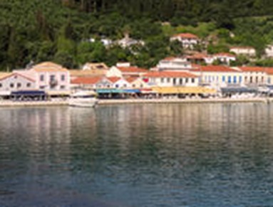
On April 13 we were docked at Katakolon, a very small town in western Greece.
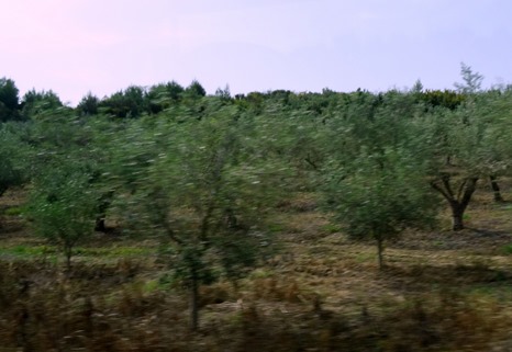
The main attraction in this area is Olympia (not Mt Olympus, which is not near here), the site of the ancient Olympic Games. So that is where we elected to spend the day. This entailed a bus trip through the beautiful countryside with hillsides of olive trees. Near the towns were large piles of bags of trash & garbage. Our guide was clearly embarrassed by this, but we didn’t fully understand her explanation which was mostly about the closing of disposal facilities in the area & controversy about how to replace them. Why would you close the facilities before ensuring an alternative, and will this piling up go on indefinitely? Maybe we missed something, but its pretty clear that the locals are not happy about what this does to their image, particularly with their big moment in the spotlight coming next week when the Olympic flame is lit at the site of the ancient Olympics.
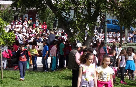
As mentioned earlier, we visited the week before Olympia’s big moment, the lighting of the Olympic torch. When we arrived there was a local celebration in progress. The big turnout seemed mostly to be school kids.
The archaeological site, a sacred religious compound to the ancient Greeks established long before the athletic games, was a short walk down the road. This was not a town, but a religious enclave. The first recorded Panhellenic athletic games here were held around 776 BC and continued for more than a millennium until the Roman Emperor Theodosius I banned them in 393 AD as part of a general campaign against pagan rituals. Earthquakes began to destroy the buildings in the 3d century and the site was abandoned in the 7th century after repeated floods & earthquakes. Floods deeply buried the site, which was rediscovered only in the mid-18th century. Excavation was begun in 1875.
Our first stop after entering the site was at the Gymnasion and the Palaestra. Participants were required to spend the month before the games training on-site & these buildings housed the training facilities for racing, javelin, and discus in the Gymnasion & wrestling, boxing and long jump in the Palaestra. Women were not allowed here. The men competed in the games naked, wearing only olive oil mixed with sand to protect from the sun. There were only two rules for wrestling: no poking in the eye with a finger & no biting. As our guide observed, many men will instantly think of another very vulnerable body part that was not protected by these rules! While a large portion of the pillars lining the Gymnasion are visible, some of it is still buried under the road that brings visitors to the site, which gave an idea of how deeply the entire site was once buried. Throughout the area Judas Trees were covered with pink flowers on this nice Spring day. (Note that we have labeled the pictures to the best of our recollections, but our recollections are not always reliable a month after the fact.)
Across from the Gymnasion is the Philippeion, the only round building here & the only one dedicated to a human. It was begun by Philip of Macedonia to commemorate his conquest of Greece in 338 BC, and may have been completed by his son, Alexander the Great. The building, now partially restored, originally held gold & ivory statues of Philip & his family. It marked a turning point for the enclave’s evolution from a religious to a more secular nature.
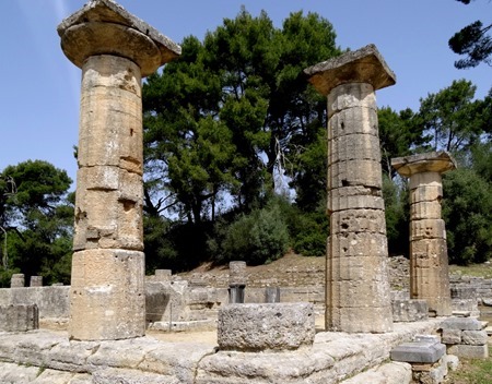
Next to the Philippeion, but much larger, is the rectangular Temple of Hera, originally built around 650 BC. It may originally have been wood, but the columns were replace by stone over the centuries as the wooden ones rotted. This is the oldest & most complete building on the site. Like the other buildings here, this one was made of local limestone rather than marble, with a coating of stucco made with marble dust to make it shine like marble. The stucco is long gone, so that what you see now is the limestone itself.
Since 1936 the Olympic flame has been lit at the Altar of Hera, just outside the end of the Temple of Hera closest to the athletic grounds. The torch is ignited by sunlight in a mirrored bowl & then the flame is transferred to a ceramic bowl. This year the official lighting of the flame was scheduled just 8 days after our visit, and we were treated to a view of a rehearsal. The women who play the temple priestesses are all professional actresses who donate their services, and they rehearse on site for about a week before the ceremony. The high priestess is a well known Greek movie & TV actress named Katerina Lechou. The two pillars behind them are remains of the Exedra of Herodes Attticus, built in 160 AD, which was a circular water fountain..
We walked over toward the athletic grounds, entered through an arch covered passageway that was once fully covered. On the hill to our left – the Hill of Kronos where Zeus was supposedly born & his father Kronos tried unsuccessfully to eat him — were the “treasuries” of the various cities, which held their equipment for sacrifices & athletics. Along the wall leading to the passageway was a row of pedestals that once held bronze statues of Zeus (called “Zanes,” plural of Zeus). They were built using fines paid by athletes found to have cheated in the games and each had an inscription on the base naming the violator, his father & city, and his offense. This walk of shame was a pretty dramatic warning to the competitors who passed them on the way to the Krypti, a 100 foot long vaulted tunnel that was the entrance to the stadium. Today there is a only single arch representing the long roof that covered the entire walkway.
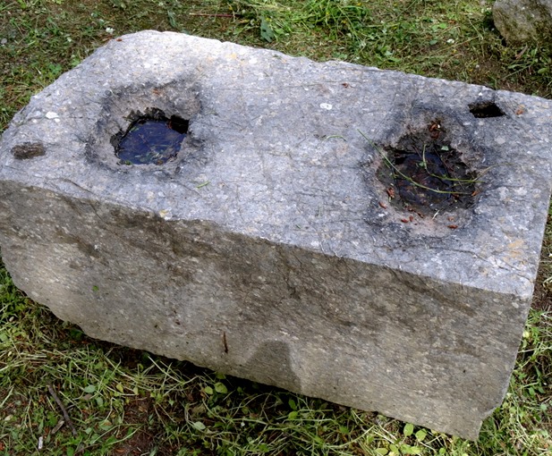
The stadium isn’t much more than a large rectangle of dirt with gentle grassy hills on each side & a few rows of stone seating on one side. Rehearsals were in progress there as well, so we didn’t have an opportunity to explore it or take any interesting pictures. We walked back into the archaeological site & headed toward the Temple of Zeus. We passed some workmen who were using a pulley system to reassemble a huge pillar inside a scaffolding. We also saw a rectangular stone that had once been a pedestal for a bronze statue (perhaps of one of the Olympic champions). The two holes cut into the top were for the statue’s brpmze feet; this was only done for bronze statues.
The Temple of Zeus was completed in the middle of the 5th century BC. This was the largest building at Olympia, its shape & size being comparable to the Parthenon. The temple was some 68 feet high & 235 feet long. In front was a large statue of Nike, goddess of victory (now in the museum), standing on a high pedestal. This was where the Olympic victors were crowned with Olive wreaths. Inside was the colossal gold & ivory statue of a seated Zeus, some 43 feet tall, which was one of the 7 wonders of the ancient world. The sculptor Pheidias spent 12 years at the site creating this statue. The statue sat in the temple for about 1,000 years before being destroyed sometime n the 5th century AD, perhaps by fire after being carried off to Constantinople & perhaps with the destruction of this temple itself. In 426 the Roman Emperor Theodosius II ordered this pagan temple burned, and two earthquakes during the 6th century competed the job.
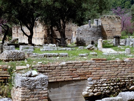
Finally, situated at the southwest corner of the area is the Leonidaion, which contained living quarters. Near it is the Workshop of Pheidias, where the sculptor spent more than a decade crafting the great statue of Zeus. It was identified by sculptural tools & a cup inscribed “I belong to Pheidias” found in the building. The two pictures of a brick building below are probably the Workshop rather than the Leonidaion (we didn’t get close enough to be sure).
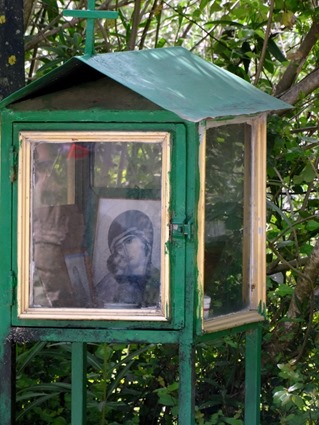
We left the archaeological sight and headed for the museums. Near the entrance we passed the Hill of Kronos that overlooks the sight & some bright red flowers (geraniums?). On the road to the museum we saw a roadside shrine, which we were told are common in Greece to commemorate those killed in accidents, and an olive grove.
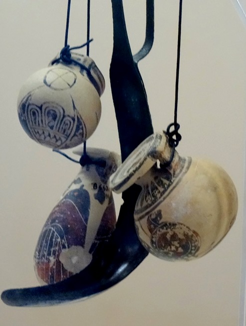
We visited the Ancient Olympic Games Museum, set on a hill above the archaeological site. Originally built in the 1880’s, this museum was abandoned after being damaged by an earthquake in 1953, but was repaired & reopened in 2004. It has a thematic organization focusing on the Olympic games. Among the items here were an ancient discus, the wheel of a chariot, small jars in which athletes carried their olive oil & iron scrapers they used to remove the oil & sand after competition, and pottery jars with athletic themes.
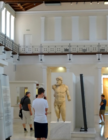
We drove to the Archaeological Museum on the other side of the site, opened in 1982, which houses a rich collection of ancient artifacts found at Olympia. In the central hall were the reassembled statuary that had been on the pediments above each end of the Temple of Zeus. Pediments were triangular in shape and these groups of statues were made to fit those dimensions. The west pediment, pictured below, depicts a battle between the Lapiths and the Centaurs (half man, half horse). This is considered some of the best surviving examples of so-called severe style of early Greek sculpture. The central figure is Apollo, attempting to restore order.
The Temple of Zeus also displayed reliefs of the twelve labors of Hercules. Called Metopes, these were situated just below the pediments, six on each end.
The Nike of Palonios is the statue that originally stood on the tall base sitting in front of the Temple of Zeus, shown above with the temple. It is quite large & its dress was originally red. An image of this sculpture was prominent on the medals awarded at the 2004 Olympics in Athens. In the Ancient Olympic Games Museum is a model of what it originally looked like, standing on its tall base.
The statue of Hermes holding the infant Dionysus was probably sculpted by Praxiteles in the 4th century BC. It was rediscovered in several pieces in the Temple of Hera in 1877. This is considered one of the masterpieces of Greek sculpture.
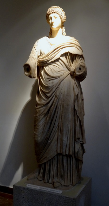
Two more statues we noted are from the Roman period: one of Emperor Hadrian & one of Poppaea Sabina, Nero’s second wife. We also saw some lion heads that were originally water spouts on the tops of buildings.
A couple of interesting ancient helmets were in a glass case together. One was a Persian helmet from the 5th century BC, with an inscription in Greek identifying it as “booty” the Athenians “took from the Medes.” The other was a helmet with the inscription “Miltiades offered to Zeus,” dedicated by the victorious general after his victory over the Persians at Marathon in 490 BC.
Leaving the museum we headed for lunch. It was a pretty good walk back to the bus, passing an area with shops & a café whose patio was covered with blooming Wisteria. We had a HUGE and delicious Greek lunch at a lovely restaurant with a swimming pool & brightly colored flowers in its garden.
We made one more stop, in the modern village of Olympia, where we spent some time exploring the many shops (this is, after all, primarily there for tourists). Then we headed back to the ship for a fairly early departure. The next day, just north of Sicily, we passed the island of Stromboli, one of the most active volcanoes on earth. We passed this island at night in 2013 and, although you couldn’t see the island very well in the dark, it was erupting regularly every 10 or 15 seconds, sending fire into the sky that was clearly visible rather far away. This time it was daylight and we passed a lot closer, but the volcano was only smoking, no fireworks. Amazingly, this island is inhabited; there’s no telling where people will choose to live! We spent one more night at sea on this welcome sea day.
Athens, Greece
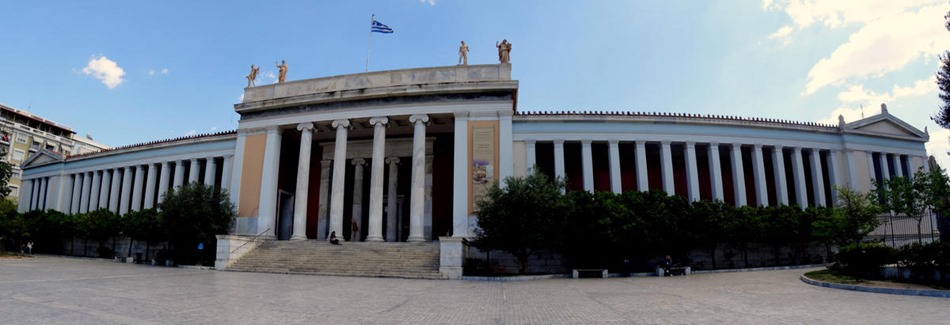
We woke up with the sunrise on the morning of April 12 near Piraeus, the port for Athens. We wanted to disembark early to maximize our time in Athens, where we would be on our own. We had toured the Acropolis & its new museum and seen other highlights on our last visit here, https://baderjournal.wordpress.com/2013/05/18/athens-greece/, so our objective this time was to see the National Archaeological Museum, one of the world’s greatest museums of antiquities.
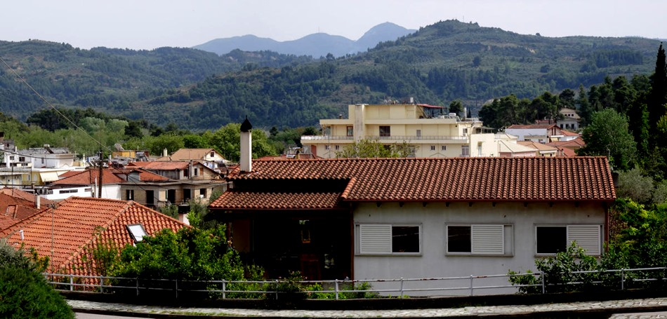
We were docked at a terminal about half a mile further from the port exit than the one we were at in 2013. This made for a much longer walk to the subway than we had anticipated, maybe 2 miles. But when we finally got there, it turned out that tickets could be purchased from real people (rather than machines), although ours didn’t speak English. However the signs were in English as well as Greek so it was easy to find our train & get into the city. The train was pretty slow until it got out of Piraeus, but we got to our stop fairly quickly overall. It was less easy finding our way from the Metro stop to the museum but it didn’t take too long. Although the neighborhood seemed a little seedy, with a lot of graffiti on the buildings, the museum is quite impressive, with some colorful flowers in the beds on the grounds.
This is a vast museum, too much to really cover in one day, but it is helpfully arranged largely in chronological order, beginning with the 5,000 year old Cycladic artifacts from the islands around Delos. We will only be able to touch on some of the things that stood out for us as we perused the museum’s collection (or at least a large part of it).
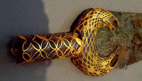
Displayed in one of the early rooms (right through the door in the picture above) were the hoard of gold artifacts from Mycenae first discovered by Heinrich Schliemann (the discoverer of Troy) in the late 19th century. Mycenae was the center of Greek culture in the time of the Trojan War, a period known as the Mycenaean era. These artifacts were recovered from a circular tomb called “Grave Circle A” that held 19 bodies, apparently members of the ruling class of the day. The most famous item is what Schliemann (jumping to desired conclusions, as was his wont) called the “Mask of Agamemnon,” a solid gold mask made to cover the face of a dead man (notice the tiny holes under the ears for tying it around the head).. This could not have been Agamemnon because it dates to about 250 years before the fall of Troy around 1300 BC, but it is still a stunning artifact.
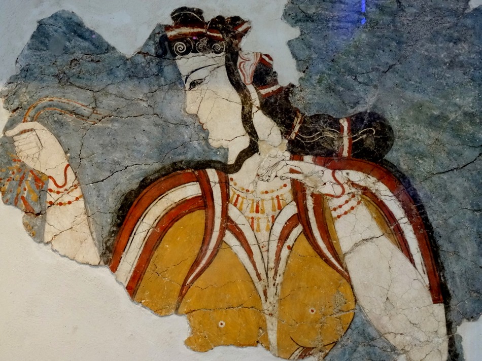
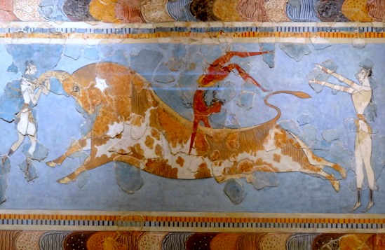
Other items from Mycenae included wall frescoes, an amphora (storage jar) & a bone helmet made of boar tusk, which was strong but also flexible. All were similar in style to items we had seen in Crete in 2013, suggesting a Minoan influence on Mycenaean style. Note that the raised stone pieces in the frescoes are original, while the completion of the painting around them is a speculative modern reconstruction.
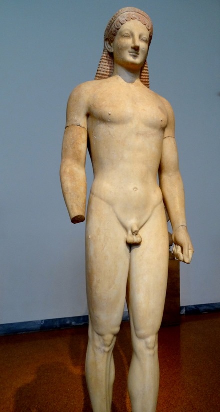
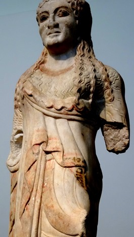
The earliest Greek sculpture (from about 700 to 500 BC) are called kouroi: Kouros (male) & Kore (female). They are stiff & straight & stylized, apparently influenced by Egyptian statues. The men are naked & the women are clothed & all of them had slight smiles (or smirks) and were brightly painted, even the skin. The first Kouros below, dating from about 600 BC, once stood at the entrance to the Temple of Poseidon at Cape Sounion. Typically, he is naked with his left foot forward but his hips straight rather than swiveled. The second, a Kore, is from about 550 BC. She holds a flower in her left hand & tugs at her dress with her right (an attempt to show movement). Her dress was once painted red & has flowers & swastikas (good luck symbols to the ancient Greeks) down the front (see closeup). The third is a later funerary Kouros from Attica, dated to the 530’s BC. It is a bit livelier than the earlier one. The fourth is a woman, seemingly in a very early flat style, notable for the traces of red paint still clearly visible on the marble. Nearby was a base for a Kouros from Athens, circa 510 BC, depicting a wrestling match in relief with the bodies in a much more animated light.
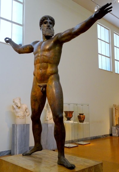
The large (6’ 10””) & imposing bronze statue below is called the “Artemision Bronze” because it was found in a shipwreck off Cape Artemision, north of Athens, in 1928. The weapon he is throwing was not found, so it is not clear whether this is Zeus, throwing a thunderbolt, or Poseidon, throwing a trident. It has been dated to 460 BC, the beginning of the Classical period of Greek sculpture (although this is more in what is called the Severe Style that preceded it). His eyes are hollow but were once filled with white bone.
An interesting sculpture that looks like it lined the roof of a building (possibly at Epidauros) includes a row of water spouts in the form of lions’ heads. A funerary urn from Marathon (probably) dating from the 420’s BC, made by a painter called Polygnotos, depicts Helen’s abduction, by Theseus. Then there is the much more dynamic “Artemision Jockey,” circa 140 BC in the Hellenistic period. It was recovered in pieces from the same shipwreck as the Zeus/Poseidon above & pieced back together in 1971. It is a large sculpture that dominates a room otherwise full of Roman copies of Greek sculptures (this was an industry for the Romans). The jockey appears to be a young boy, originally painted black with non-Greek looking features, which may indicate he was at least partly Ethiopian.
A bronze statue of a young athlete was found in the sea off Marathon, dated circa 330’s BC. Notice the white eyes still in this one. The appendage pointing up from his head is a leaf from a victory garland around his head. The bronze Statue of a Youth, circa 330’s BC, was recovered from a shipwreck near Antikythera. Some think this is Perseus, who would have been holding the head of Medusa, and others (more likely correct) think it is Paris, presenting the apple to Aphrodite as the most beautiful goddess. Found in the Aegean sea is a statue of Augustus Caesar,circa 10 BC, which was originally mounted on a horse.
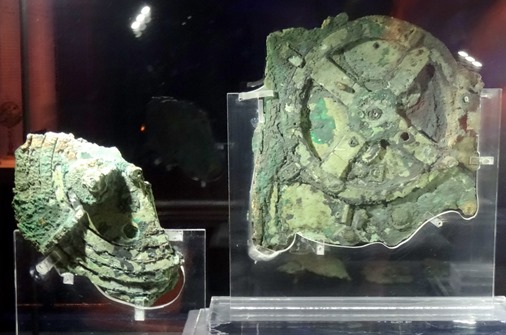
Finally, perhaps the most interesting & unusual artifact in the museum is the Antikythera Mechanism, recovered around the turn of the 20th century from the same shipwreck near Antikythera as the Statue of a Youth, above. It is in many pieces and badly corroded after a couple of millenia under the sea. It is clear from its surface that it is a mechanism operated by gears of various sizes & examination of what is inside with x-ray and other technologies has disclosed its complexity and inscriptions. After a century of study it has been concluded that this was an astronomical calculator, combining several different calendar systems, predicting eclipses, calculating the dates of various Panhellenic games, and perhaps locating the positions of the sun, moon & the 5 planets then known on any future date. It has been called the first computer and mechanisms of comparable complexity did not again appear until the European astronomical clocks of the 15th century. Several modern versions a working model of the mechanism are on display in the same room. After seeing this we left the museum, to be sure we would get back to the ship in time for our fairly early departure.
We returned to the subway & boarded a train headed for Piraeus. The train was not crowded but there were several young men standing around us making it impossible to move into the train from the area in front of the door. As we approached the next stop they circled around us and one of them started pushing Rick aside, as if trying to get to the door even though he was already there. He politely said “excuse me” a couple of times. When the door opened they all got out & Rick felt a hand reaching into his pocket from one of them who had a sweater draped over his arm. Obviously, this was a pickpocket gang. Although the whole experience was rather unnerving, the bottom line is that they got nothing before getting off the train because Rick’s wallet was well secured in his front pocket.
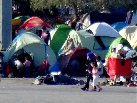
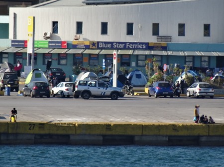
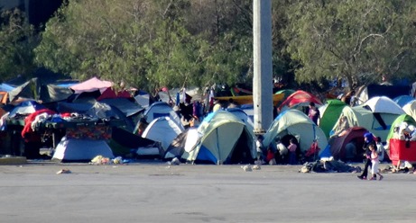
As the ship was preparing to leave the Captain made an announcement pointing out that there were a number of Syrian refugees camped on a dock not too far away. Of course, everyone has heard about the Syrian refugee crisis in Greece this Spring, but this was our first actual exposure to it. We don’t know what the status of these people might be, perhaps they are being vetted before being admitted to Europe. But it seemed clear to us that people, & whole families, would not choose to live like this unless their conditions at home were truly desperate.
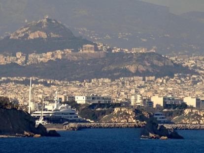
It was very sunny & the water was very blue as we sailed away. We did not visit the Acropolis on this visit, but you could see it clearly from the ship leaving the port, probably some 6 miles away. We had beautiful views of Piraeus (a city in itself) & of Athens as we reached the deep water. It seems the light is different here & makes everything sparkle on a nice day.
Haifa, Israel (Caesarea, Akko)
[Note: As I write this we are at home. As you can see, the blog fell behind a bit in the last portion of the trip, but rest assured that the entire thing will be completed, despite all the competing demands on our time here in our natural habitat. Hopefully, it won’t take too long, although we are leaving town again in June for a few weeks. It should be completed by then, but who knows?]
_________________________________________________
On April 9 we docked in Haifa, Israel. When we visited here before, https://baderjournal.wordpress.com/2013/05/01/israel-day-2-jerusalem-to-haifa/, we arrived at night after a two day tour of Israel and thus had no time to see the city. This time we took an excursion to the ancient cities of Caesarea and Akko that was promised to finish with a visit to the Bahai Gardens in Haifa. But to our disappointment it didn’t. So after two visits we have not had a chance to see Haifa at all beyond the view from the port. Maybe next time.
Caesarea
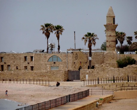
Located on the coast halfway between Haifa & Tel Aviv, Caesarea was initially built on some Phoenician ruins by Herod the Great in the last two decades BC. Named after Herod’s patron, the Emperor Augustus Caesar, it was an important port & served as the capital of the province of Palestine under the Romans and Byzantines. It was conquered by the Muslims in the 7th century & then by the Crusaders in the 12th. The Crusaders were ousted in 1265 by the Mamluks, and the town then lay largely uninhabited until 1884 when a group of Bosnian Muslims settled there. It was occupied by Israelis at the beginning of the 1947 war, when the remaining occupants were expelled and the village houses destroyed. Since then the area has been largely devoted to archaeological excavation, and is owned today by a foundation. A lot of these ruins have been reconstructed & it is difficult to tell what is original and what has been added. There are about 5,000 inhabitants in the area.
Our first stop was on the beach outside the town where a Roman aqueduct traverses the beach. This is one of three aqueducts that served Caesarea. It has two channels, built at different times, which are visible from below as a seam in the ceiling of the arches. An impressive structure, it originally extended some 11 miles.


Our first stop inside the city was at the Roman theater. It has been restored and often hosts concerts. While we were sitting in the seats another group of visitors standing on the stage sang a hymn. It was very nice, but seemed a little out of place in a Roman theater.
After viewing a movie we walked down to the harbor, which is broad and picturesque.
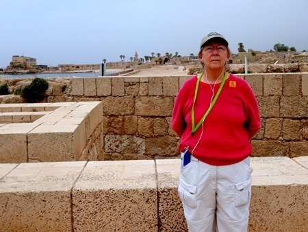
On the left of the harbor are the ruins of the palace built by Herod that was the residence of the Roman governors of the province. Notably visible is the swimming pool built on the edge of the sea. A stone was unearthed near here inscribed with the message that “Pontius Pilatus” had erected a building dedicated to the emperor Tiberius. Part of the palace was later partitioned into private quarters & the palace was abandoned entirely at the end of the Byzantine era.
In the middle, facing the harbor, was the Hippodrome, built in 9 BC and described by Josephus. The “Actian Games,” instituted by Herod & named for the naval battle in which Augustus defeated Marc Antony & Cleopatra to claim the empire, were held here every four years. In addition to athletics & gladiatorial combat, they included chariot races that went seven laps of this track, one of the largest in the Roman Empire. One part of the wall in front of the grandstand was covered by faux marble fresco, but we couldn’t tell whether that was original or a modern demonstration of something that might have been there.
Beyond the hippodrome was a complex of walls of various buildings, some with (rebuilt?) archways.
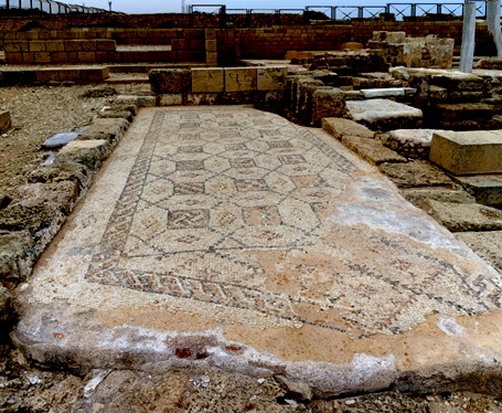
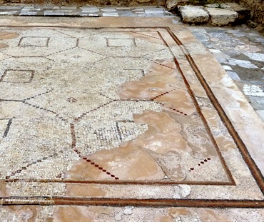
Some of the buildings in this area had mosaic floors (some reproductions?) that must have been beautiful when in use.
Of particular note is the public bathhouse, which is particularly well preserved (or restored), with marble columns & mosaic floors. This was a public meeting place where, in addition to bathing, one could exercise & get a shave, haircut or massage.
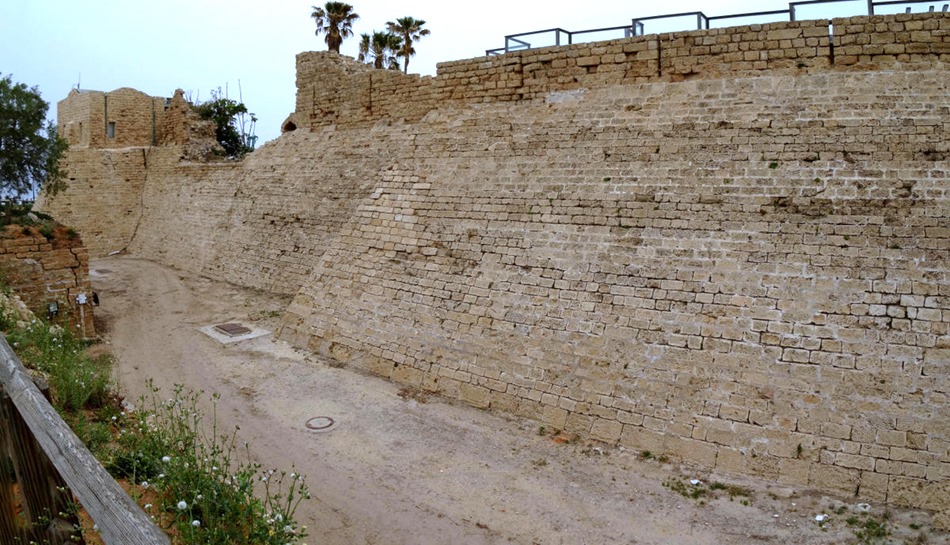
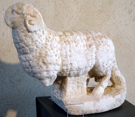
On our way to a huge & delicious lunch in a restaurant near the water we walked along the city wall built by the Crusaders, complete with moat. Near the restaurant we saw some Roman sculpture & the minaret of the mosque built by the Bosnian settlers in the 19th century. No work was being done because it was Saturday, the Jewish Sabbath. Across from the restaurant was a hillside covered with ongoing excavations called the Crusaders’ Market, thought to contain houses & commercial buildings.
After lunch we left the city through a gate built by Crusaders, designed with sharp turns inside to deter invaders, and boarded the bus for the trip to Akko.
Before leaving Caesarea, here are some of the flowers we encountered there.
Akko (Acre)
First settled about 5,000 years ago, Akko is one of the oldest continuously occupied cities in the Middle East. During the Biblical period it was a Phoenician city. While Akko is its official name today, it was known as Ptolemais during the Hellenistic through the Byzantine eras & as Acre during its occupation by the Crusaders.
Acre was an important port in the middle ages under Islamic rule starting in the 7th century. It was captured after some four years of siege by the Crusaders in 1104 and became their main port.and provided great wealth to the Crusader Kingdom of Jerusalem. Saladin recaptured it for Islam in 1187 but in 1191 it was restored to the Crusaders by forces under Richard the Lionheart of England & Philip II of France. They retained it until 1291 when the Mamluks took over. Acre was the last Crusader foothold in the Middle East.
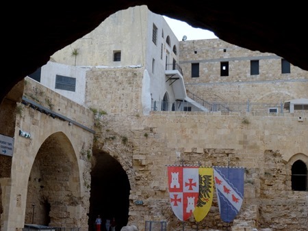
Our first visit was to the ruins of the fortress built in the 12th century by the Knights of St John Hospitallers. It was unearthed in recent times under a prison built by the Turks. A number of Zionist underground fighters were imprisoned here by the British during the period after World War II when the Zionists were pushing for independence, and some were executed here. Apparently in the movie Exodus Paul Newman’s character was imprisoned here. In 1947 the Irgun, Zionist independence fighters, broke into the prison & released the Zionist inmates (and more than 200 Arab inmates as well).
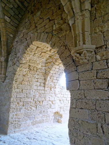
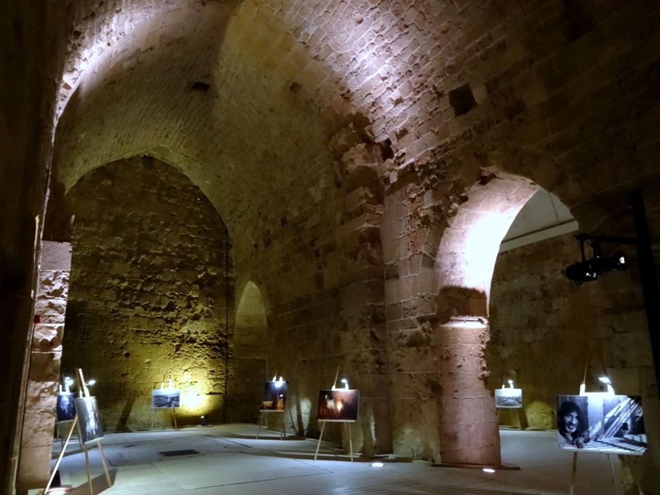
Inside the fortress were several halls and/or chambers with vaulted ceilings, all nicely lighted with historical exhibits and some art on display, called Crusader Halls. Our guide told us that before the underground fortress was discovered there were rumors of underground passage. Some of the Zionist prisoners dug down through the floor of their cell & discovered a bit of stone ceiling of a room filled to the top with dirt. Obviously this was no use for escape, but it was apparently the first modern evidence that the Crusaders’ fortress was still there.
The largest Crusader hall is the Refectory, or dining hall.
Under the Refectory is a tunnel. There is a famous tunnel here that leads to the waterfront, thought to be a means of escape in the event of a successful attack, but this was not that tunnel since it ended in what was once the Crypt of the Crusaders’ Church of St. John. The Turks used this area as a post office. This tunnel was very narrow & there were parts where even short people like us had to bend over to avoid the ceiling. It was fairly dark in the tunnel & we were moving the whole time, so the pictures are a little unfocused. As should be obvious, Mary was in front of Rick in line.
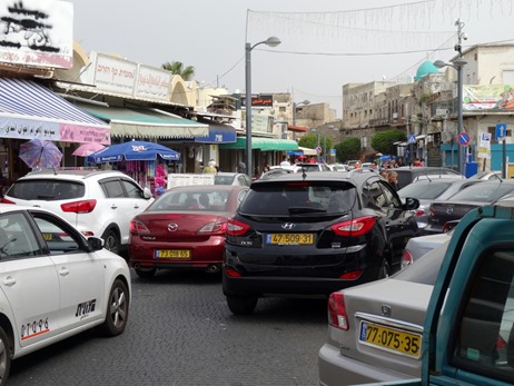
We walked up some steps to the street level where we passed through a shop & into a corridor that seems to have been part of the old prison. Today it is something of a shopping mall, with restaurants & shops (many closed for the Sabbath). We left through the souk, teeming with vendors & shoppers, & walked back to the bus through the very crowded streets. Then we drove back to Haifa, without stopping at the Baha’i Gardens.
We sailed that night to Ashdod, the port nearest Jerusalem. But we had visited Jerusalem & Masada, the prime sites in that area, just three years ago. https://baderjournal.wordpress.com/2013/04/27/israel-day-1-ashdod-to-jerusalem/. We thought about going into Ashdod for a look around (it is a very ancient port city), but Mary was still not recovered from the desert fever she picked up in Dubai & we were both quite tired. So we stayed on the ship & treated it as a sea day in the hope that some extra rest would prepare us for the port-intensive run through the Mediterranean (7 ports in 9 days).
Suez Canal
The first canal in this area was built almost 4,000 years ago, connecting the Red Sea to the Nile River. It was used off and on for a thousand years, alternately silting up and being cleared again for use. Napoleon looked into building a canal here in 1799, but his engineers erroneously calculated that the Mediterranean was 33 feet lower than the Red Sea. Forty years later it was discovered that the two seas are at the same level and in the 1850’s Said Pasha, the Ottoman governor of Egypt, approved a French canal effort directed by Ferdinand de Lesseps. Because the canal required no locks it could be built primarily by digging and moving sand & in 1869 the Suez Canal was opened to shipping. When de Lesseps tried to use the same method to dig a canal through Panama, of course, he failed miserably. Opening the canal also provided a route into the Mediterranean for numerous flora & fauna previously resident only in the Red Sea, altering its ecosystem permanently. This is called the Lessepian Migration.
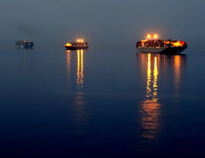
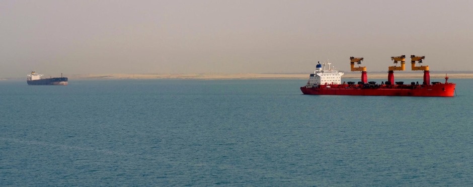
After a sea day sailing around the Sinai Peninsula we found ourselves anchored before sunup on April 8 off the city of Suez at the northern end of the Red Sea. There were a lot of other ships anchored nearby.
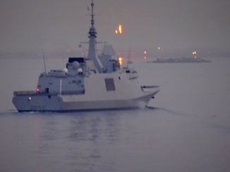
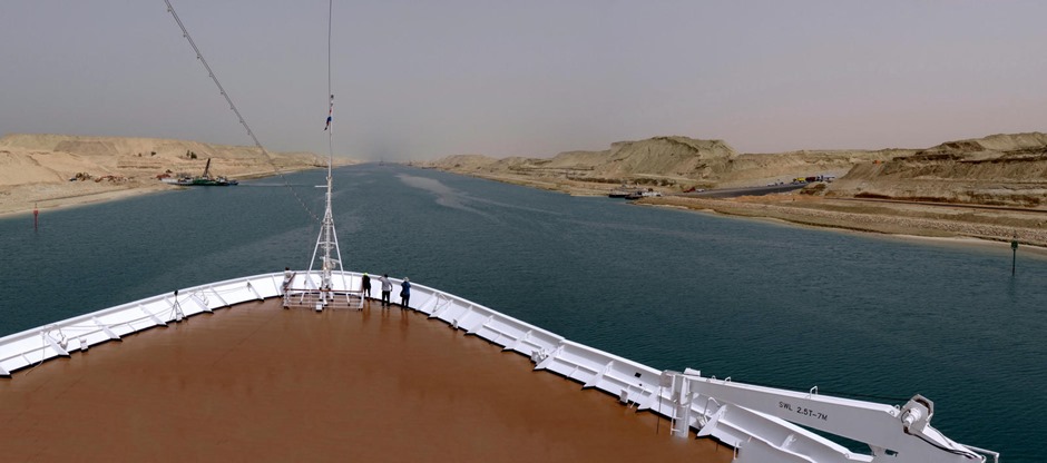
We were to be the second ship in a convoy that was set to enter the Suez Canal before sunrise to spend most of the day sailing through it into the Mediterranean Sea. The Canal is about 121 miles long and and at least two convoys of ships traverse it every day, one north bound and one south bound. Our lead ship, which looked like a small military vessel, headed for the canal as the skies began to lighten & we followed it in.
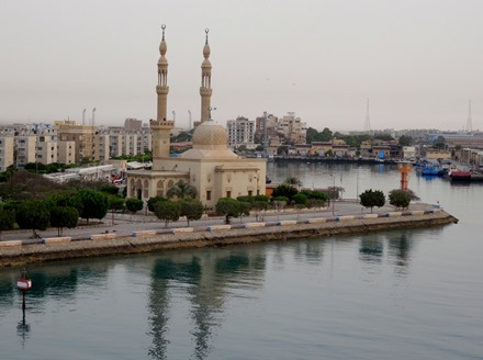
As we began sailing slowly north, the city of Suez was on our left & the barren Sinai Peninsula was on our right.
Entering the canal behind us was a huge container ship which we were told was one of several identical ships that are the largest container ships in the world. If memory serves, it has a capacity of 22,000 containers and was carrying 14,000. Each container is the size of a large tractor trailer.
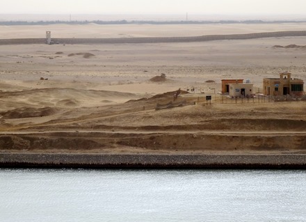
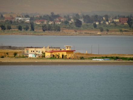
All along the canal were military posts & watchtowers. Some were obviously occupied & some less clear, & some had messages for us on the ground outside. They looked like lonely places to be stationed.
We continued up the canal, which is actually the dividing line between Asia, on our starboard (right) side, and Africa on our port (left) side. We saw some of the tall conical dovecotes common in Egypt. The pigeons drop guano on the inside that is used for fertilizer and are also eaten as squab. We came to the first of several lakes in the canal where convoys used to wait for ships going the other way to pass by (no more, as we will soon see).
We passed an oil tanker that had become disabled and had been sitting here for several months while its oil is drained into another ship, repairs are made, and the oil is pumped back in to complete the canal journey. This must be pretty unpleasant for the crew, not to mention very expensive for the owner.
We next came to the place where the canal divides into two parallel channels, one for northbound and one for southbound. This is brand new; the channel on the east (right) side for northbound ships just opened in August. Before this one of the convoys had to wait in a lake until the other passed by, slowing everything down considerably since there are quite a few ships in each convoy. The new parallel channels will enable traffic to increase by about 40%, and this will greatly increase Egypt’s income from the canal.
In this area from the lakes to the divided channels were a number of small fishing boats. After entering the parallel channel we continued to sail north. Most of the scenery consisted of large hills of sand, but they are laying asphalt roads on both sides along the waterfront.
The ongoing canal upgrade project includes more than the new channel. They are building several tunnels under the canal & a new town on the Sinai side, which we were told is expected to be a vacation destination for Egyptians. We saw a mosque & apartment buildings under construction there. Currently crossing the canal is done mostly by ferry, of which we saw a few. There is an old bridge at one point that rotates to let ships through, but it doesn’t reach across the new channel, so its difficult to see what use it will be in the future, unless they build a tunnel there to complete the journey to the Sinai side. In this area there were some statues & logos in the area between the channels relating to the canal.
We passed Ismailia, where the canal headquarters are located, but it was on the side of the other channel so we only got a distant view. This town was named after Ismail, the Egyptian pasha at the time the canal was opened. It has two noticeable monuments: a concrete monolith commemorating World War I dead, and a monument shaped (we were told) like an AK-47 to commemorate the Egyptian dead in the 6 day war with Israel.
Once we reached Ismailia we began to see ships from the southbound convoy in the opposite channel. the hills of sand (perhaps the material removed in digging the second channel) made it impossible to see more than the very top of the ships at first, but later the sandbanks in the center became lower & a better view of the ships was available. As you can see from the pictures, the ships maintain a pretty good distance between them, presumably for safety reasons.
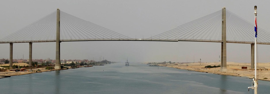
As we neared the northern end of the canal we came to the one bridge that spans the entire canal. It was built by the Japanese & is called the Japan Egypt Friendship Bridge. We spent a long time approaching it at the slow speed used by canal traffic, & only saw one car cross this imposing bridge. It reminded us of the infamous “bridge to nowhere” that was supposed to be built in Alaska a few years back.
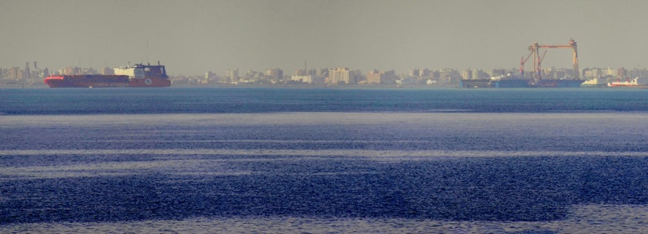
After the bridge came Port Said, the city at the Mediterranean entrance to the canal that was named for the Pasha who granted de Lesseps authority to build the canal. We had docked in Port Said during our Grand Mediterranean cruise in 2013, although we spent the day visiting Cairo rather than in Port Said. See https://baderjournal.wordpress.com/2013/04/23/port-said-cairo-egypt/. The canal was widened long ago to permit northbound ships to exit directly into the Mediterranean, bypassing Port Said. We did that, so our only glimpse of Port Said was from a distance. Having thus completed our interesting encounter with the Suez Canal, which is so different from the canal in which we crossed Panama, we sailed on toward more adventures in the Mediterranean Sea.
Aqaba, Jordan (Petra & Wadi Rum)
At its northern end the Red Sea divides in two: the left fork leads to the Suez Canal & the right fork is the Gulf of Aqaba. We sailed up the gulf & docked in Aqaba early in the morning on April 6. Aqaba is an ancient town & was an important stop on caravan routes. In biblical times the town here was called Elot. Because of its access to fresh water as well as the Red Sea this was a strategic location during World War I, when T.E. Lawrence and an Arab raiding party captured it by approaching over the desert while all of Aqaba’s defensive weapons faced the sea. This is a climactic moment in the film Lawrence of Arabia, but the director didn’t like the look of Aqaba so he shot this sequence in Spain.
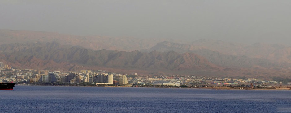
Today Aqaba is the only port of the otherwise landlocked country of Jordan. It has become a flourishing beach resort area & a popular diving spot with submerged coral reefs. Right next to Aqaba, just across the border, is the Israeli city of Eilat. From the ship we looked out on Aqaba from the seaboard & Eilat from the port side.
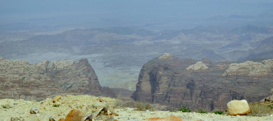
We spent the day on a private excursion. Heading out of Aqaba early in the morning, we saw a huge Jordanian flag flying on a very tall flagpole that our guide said had been the tallest in the world until (who else?) Dubai built a taller one. We drove through the mountains, passing desert villages & Bedouin encampments.
PETRA
Our major stop for the day was Petra, an ancient city carved out of rock some 2000 years ago by a group called the Nabateans. This is where Indiana Jones found the holy grail in Indiana Jones and the Last Crusade, it is the setting for Agatha Christie’s Appointment With Death, and it is on the modern list of the seven wonders of the world. Petra was an important trading center in ancient times, a crossroads on several caravan routes where the Nabateans extracted payments for passage. At the end of the first century AD it came under Roman control (the Emperor Hadrian visited), but its importance declined as sea routes replaced desert crossings for trade and the city was largely destroyed by earthquakes. Hidden away in a valley that is difficult to see, much less to visit, Petra was lost to everyone but the bedouins living in its caves for some 500 years, until rediscovered in 1812 by Jean Louis Burkhardt. After another visitor’s drawings were published in 1839 Petra became a destination for particularly hearty travellers & near the turn of the 20th century archaeological excavations began.
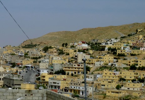
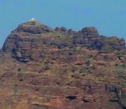
One approaches Petra through a town called Wadi Musa. This means “Valley of Moses,” and the name comes from the Bible. There is a spring here (called the Spring of Moses) that is supposed to be where Moses struck the rock with his staff to produce water for the Israelites during their wandering in the desert. The local king (of what was then Edom) is said to have denied them permission to travel through the area, but Moses’ brother Aaron died before they left & was buried on top of a nearby mountain called Jebel Haroun (Haroun is Aaron in Arabic), where there is still a white shrine visited by Jewish, Muslim & Christian pilgrims.
It is a very long walk (about 2 miles) into Petra from the gate, and the ground is very rocky & uneven. For those who can’t do that, horses & carriages are available (for a price). It is all downhill going in, so you know it will be uphill coming out (when you are already tired). While the slope is a moderate 5%, it adds up: one book said it amounted to a total equal to a 45 story building. The Romans built a road here, but most of it is still covered by rock & dirt from the flash floods that sometimes inundate the lower part of this area. They have dug down to the Roman road in some places, but it is made of worn down rocks & is almost as uneven to walk on as the rest of the path.
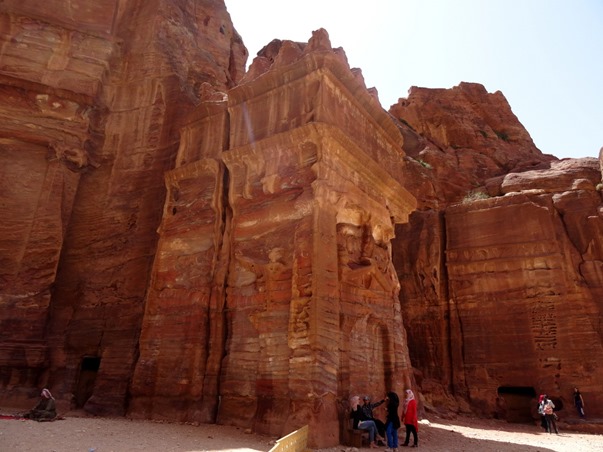
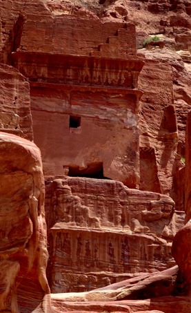
Most of what is left in Petra are tombs & caves where the Nabateans buried their dead. First we came to some “god-blocks,” huge rocks about 20 feet tall carved into cubes that may represent gods protecting the city’s water supply. A little further on is the Obelisk Tomb & Triclinium (or dining room), which may be one monument or two. The top is a cave containing graves fronted by four large obelisks, with a figure carved into the rock between the middle obelisks. The bottom is a single room with tables & chairs for holding banquets for the dead.
We passed some goats grazing near the path & came to the small bridge over the Wadi Musa stream. A dam has been built here in modern times to deflect the water during the wet season, which otherwise would flood the canyon that contains the path into Petra from here. A tunnel on one side of the road was used by the Nabateans to divert this flow.
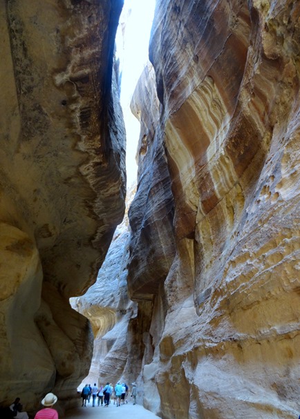
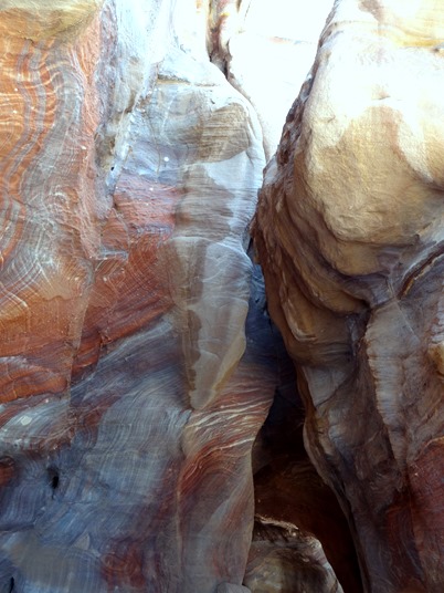
The last mile or so into Petra is along a path through a very narrow & beautiful canyon called the Siq. This narrow split in the rock was probably first opened up by an earthquake & its tall wavy walls of various colors were developed slowly by wind, sandstorms & flash floods.
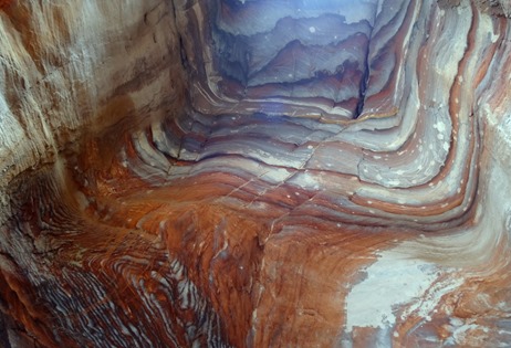
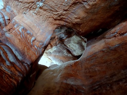
There has been a lot said about the colors of Petra. A famous 1845 poem, written by a man who had never been there, called it “a rose-red city half as old as time.” Agatha Christie described it as “blood-red” & had one of her characters say it is “very much the color of raw beef.” In actuality, as you can see from these pictures, the rocks are mostly beige or reddish brown (although some say at dusk it has a rosier hue), but on closer inspection there is great variety in the color. The variety is probably more beautiful than a flat red color would be. Some of the pictures below were taken in the Siq & some inside a restroom built inside a cave in Petra. Our guide announced a rest stop there & told those of us who declined that we really should stop in there to see the rocks, if nothing else. He was right.
The Siq has a number of stone carvings & shapes. It has a very long but narrow aqueduct running along one wall, which presumably brought water from Wadi Musa into the city.
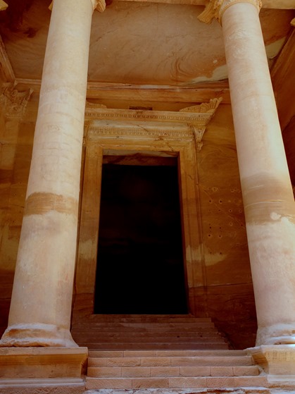
At the end of the Siq the first thing in Petra to come into view is the most famous, the so-called Treasury. Carved out of the solid rock wall, with no freestanding components (other than one pillar that replaced one that collapsed in antiquity), this is the building where Indiana Jones found the Holy Grail. The sudden appearance of this sophisticated carved building between the natural wavy walls of the Siq is quite dramatic.
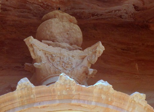
This building was probably a place of worship, built in the 1st century BC. It is called the Treasury because of a rumor that the urn carved into the top façade was full of money. You can still see the bullet marks where early visitors tried to release the money by shooting at the urn, which is actually solid rock. You can’t approach the Treasury today beyond the foot of the stairs, but there are a few rooms inside (although they are bare with none of the stuff Indiana Jones encountered there). The parallel lines up the sides of the building may have been footholds for the workers carving the rock. The Treasury from some angles actually has a reddish hue.
Recent excavations in front of the Treasury have disclosed two tombs built on a lower level. Presumably that was the original level of the ground here & the Treasury was built above these tombs. The area in front of the Treasury is the scene of a lot of hustle & bustle since it’s the entrance to the city, including souvenir stands & camel rides. There were a lot more people than normal on the day we visited, a large proportion young girls on school trips from Amman who were here on some kind of special school day. They seemed to be particularly interested in having their pictures taken with Western women for some reason.
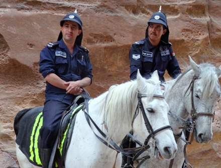
From the Treasury we continued walking downhill into what was the city. We passed several structures carved into the walls, and also some mounted police and an old man playing a string instrument. We also ran into some of our tablemates down here, who had come on a HAL excursion.
At the end of this road, where it angles to the right, is the theater, built in the 1st century AD before the Romans took over. The entire edifice, other than the pillars behind the stage & the ends of the rows of seats, is carved out of solid rock. The openings above are all that remains of some buildings that were superseded by the theater. Originally there was a high wall behind the stage that would have cut off the view of the interior from the outside. Notice how the colors can vary, depending on your perspective & the amount of sunlight.
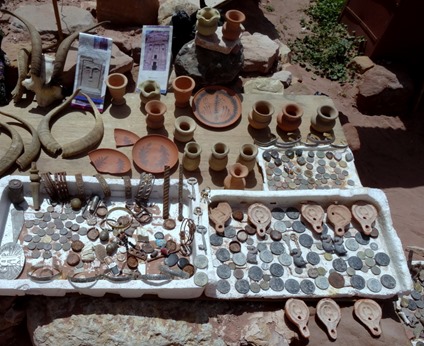
After the theater we came to what is called the Royal Tombs, a row of the biggest and most elaborate tombs in Petra high on the face of the East Cliff. There is a modern stairway up to this level. Rick climbed up for a few photos, while Mary stopped halfway up because she wasn’t feeling well. In this area there were souvenir stands, some selling “ancient coins” that our guide said were about a week old.
Among the tombs along this wall from Rick’s perspective (they continue around the cliff out of sight), three stood out. From left to right are the Corinthian Tomb, with a design similar to the Treasury but in far worse condition, the Silk Tomb, notable mainly for its multiple layers of bright colors, and the Urn Tomb. The Urn Tomb is in excellent condition, with several rows of arches below its façade supporting a large forecourt. It appears that its good condition stems from its conversion into a church (or perhaps even a cathedral) in the 5th century. The Urn Tomb & the Corinthian Tomb are thought to have been built for Nabatean kings.
From this height one could see a number of caves that have been eroded by wind & water into wavy multicolored natural sculptures. You could also see further into the valley, which was once full of houses in a teeming city of some 30,000, all of which were destroyed by earthquakes. Some archaeologists think they are all still buried there & that what has so far been uncovered here is only the bare beginning.
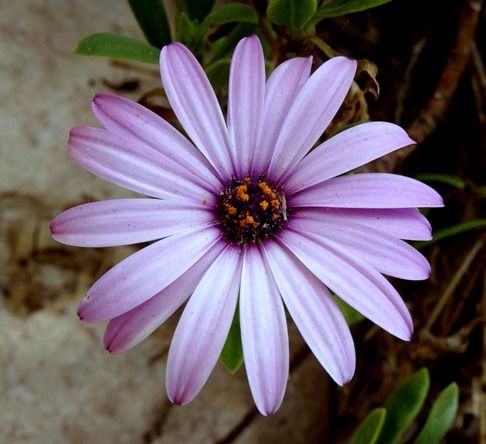
Sadly, we had no more time to explore further. It really takes 2 or 3 days to fully explore Petra, particularly its high places. Even if more time had been available we probably couldn’t have done much more, since there was still a 2 mile uphill climb to leave Petra & we were already pretty worn down. So we turned around and trudged back up through all the wonders we had already visited. Afterwards we had lunch in a restaurant in Wadi Musa. And even in the desert there are flowers. Summing up, Petra was one of the real highlights of the entire voyage; in fact at the end of the trip the passengers voted it the top sight (& site) of the entire trip.
WADI RUM
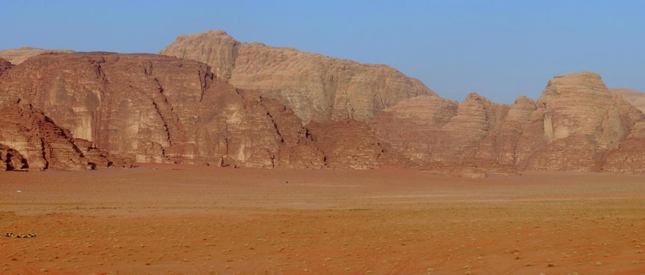
By now it was mid-afternoon and after the experience and challenges of seeing Petra one might think that would be enough for one day. But no! We climbed on the bus for the long drive to Wadi Rum, a mountainous desert area that rivals Petra for spectacular beauty.
You have probably seen Wadi Rum without knowing it, for many of the beautiful desert scenes in Lawrence of Arabia were filmed here, where Lawrence spent quite a lot of time. This is where (in the movie) Lawrence meets the Howeitat tribe’s difficult leader played by Anthony Quinn & this is where the Arab force sets out to cross the desert to capture Aqaba. (We traveled from here to Aqaba on a highway in about 1.5 hours & I have read that people often hike it, without the camels Lawrence’s forces rode, in four days, which sounds quite different from the epic & lethal desert crossing depicted in the movie.)
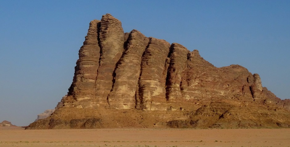
We only had a couple of hours here, driving in a caravan of 3 4X4 trucks, so we saw very little of it, but what we saw was more than worth the trip. After boarding our 4X4 we drove into the desert past some mountains shining in the late afternoon sun. One is called “The Seven Pillars of Wisdom,” although it only seems to have five pillars. This is also the name of T.E. Lawrence’s memoir of the Arab Revolt & the locals will tell you the book was named after the mountain, but in fact it is the other way around.
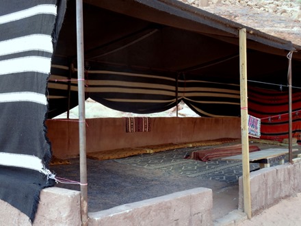
Our first stop was at a place called “Lawrence’s Spring.” There is supposed to be a spring on the mountainside where T.E. Lawrence wrote that he often brought his camel to drink. Be that as it may, we didn’t go up the mountain, but there is a water trough here that is fed by a long pipe disappearing up the mountainside. There is a Bedouin tent and nearby are some ancient inscriptions on rocks, some of which may be Nabatean & some Aramaic (if we understood correctly).
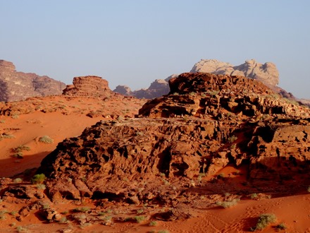
Our next stop was the most fun. It was a tall hill of red sand up against the side of a rock cliff. The sand here is very red because it is rich in iron ore. Some of us climbed the sand hill (not easy, small steps are better) from which there were wonderful views in all directions.
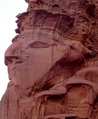
We drove to another mountain (perhaps Jebel Khazali) which had on outcropping that looked like a face, we don’t know if it is natural or not but it looks sculpted. This mountain is split by a narrow canyon on the wall of which are ancient Thalmudic petroglyphs, made by a tribe related to the Nabateans. We had to negotiate a narrow ledge well into the canyon to see all this.
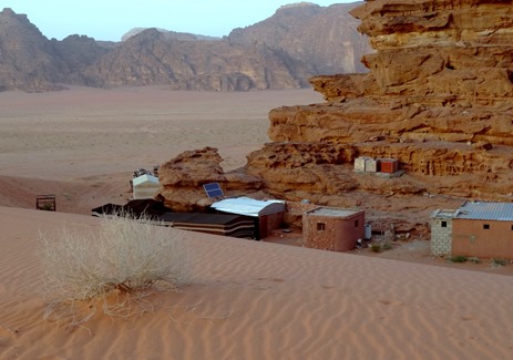
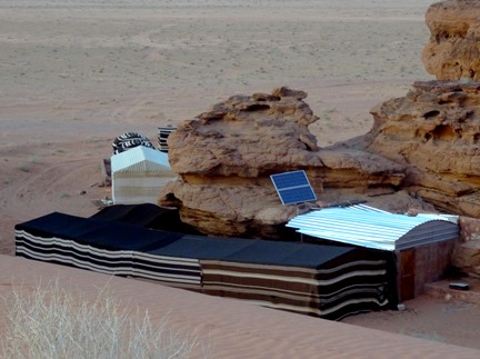
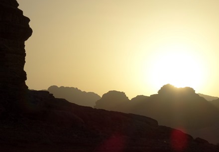
We stopped for some supersweet tea in a Bedouin tent (where souvenirs were also available), then we drove to a spot to watch the sunset. In a ravine nearby was a Bedouin encampment with a solar panel to provide electricity. We saw a number of Bedouin encampments in Wadi Rum & we were told that they are no longer nomadic because they want their children to get an education in the local schools.
We returned to the Amsterdam too late for dinner, so we ate in our room. We later discovered that while we were away most of the razor wire was removed from the ship, the water & acoustic cannons were taken down & the supplemental security team disembarked. Having made it through the danger zone unscathed, we set sail around midnight around the Sinai Peninsula toward the Suez Canal.






































![The middle line says "[Ponti]us Pilatus". This is a reproduction of an original now in a museum. 38. Haifa, Israel (Caesarea & Acre)](https://baderjournal.files.wordpress.com/2016/05/38-haifa-israel-caesarea-acre_thumb.jpg?w=450&h=495)


