Epilogue: Blacksburg, Virginia
On May 7, less than a week after getting home from the World Voyage, we set off again to drive to Blacksburg, Virginia for a memorial service for our friend and world travel companion, Lee Wolfle. His lovely family had delayed the service so that his friends on the world cruise would have an opportunity to attend. Some others would have liked to attend but for logistic obstacles, but Robert drove down with us and Karen drove up from her home in North Carolina.
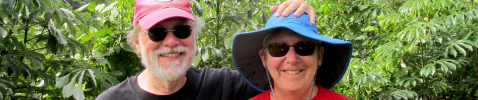
You may recall in our first post about this cruise, back on January 4, we mentioned that this voyage was a reunion of sorts for the seven people who sat at our table in 2016. We were all back at the same table for the 2018 cruise, picking up where we left off as a happy & compatible group of travelling friends. None of us was more enthusiastic about that prospect than Lee Wolfle, who had tee shirts made for all of us showing the itinerary and titled “Around The World Together Again . . . Table 65.”


 Mary, Rick, Robert, Bob, Judy, (standing) Karen, Bill, Peggy, Corinne, Kathy")
Like the first world circumnavigator, Ferdinand Magellan, Lee didn’t make it back from the trip. He began feeling poorly probably in New Zealand, was never able to get his strength back & had to leave the ship in Singapore. He was diagnosed with leukemia in Singapore and was flown as far as Los Angeles, where he entered Cedars Sinai hospital for treatment. But that didn’t work out & he died there in the middle of April as we were approaching Banjul.
")
")

")
")

")
")

All of Lee’s friends on the ship were shocked at the speed of his demise. Many of us were walking on the beach with him in the South Pacific just six weeks before he went into the hospital and at that time he seemed hale & hearty. Lee was a very big man, about 6’7”, and very active (he took an expedition to Antarctica last year) so it was hard to picture him as being so seriously ill. Needless to say, his ordeal cast a pall over the remainder of the voyage for all of us.
The memorial service in Blacksburg was not a somber affair. It was more a celebration of Lee’s life, with friends and relatives taking turns recounting memories and anecdotes about him. We were happy to meet Lee’s family, about whom he talked a lot. We spent two nights in Blacksburg and had an opportunity to see some of the town. It is the home of Virginia Tech university where Lee had been a professor and he was an avid fan of their football team. Statues of their mascot, the “Hokie” (a turkey we think), were all over town dressed up in varying painting styles. We found a street named for Lee (probably originally named for Robert E Lee, but not while we were there) and visited the local library (of course) which had an interesting exhibit of quilts. We would have enjoyed having Lee there to show it all to us, but the closest we ever got to Blacksburg with Lee was the Due South restaurant, where we shared barbecue lunches a couple of times.


")


We only knew Lee for about two years. But he was a good friend & the nicest guy you will ever meet. We all miss you, big guy.

Wrappin’ it up
On a voyage around the world there is no avoiding a lot of sea days at the end crossing the Atlantic Ocean. On this trip there were seven sea days between the Cape Verde Islands and Fort Lauderdale, broken only by the day in San Juan that was the subject of the previous episode. That doesn’t mean that everyone is napping in the sun the whole way though, since there is always plenty to do. This included the crew shows by the Indonesian & Filipino crews, a goodbye assembly featuring the officers and crew, and good-byes to all your friends on board (not to mention packing, which we won’t).
The crew shows are always entertaining, colorful and very well attended. The crew members put a lot of work into these shows, rehearsing in the little spare time they have away from their jobs. The Indonesian crew show was on April 24, the day before we reached Puerto Rico. It started with a sort of glove dance, involving interactive movements by crew members lined up and wearing white gloves.


Next up was a group of three singers, then a very impressive Indonesian dancer (who had been our waitress in the Pinnacle the day before). Note how expressive her hand gestures are; our hands won’t bend in that way at all.


A group of crew supervisors performed in sunglasses and glittery costumes, then two women danced wearing long yellow scarves.


Next was the monkey dance, depicting a story from Hindu mythology. The guys sitting on the floor are all monkeys, an evil spirit comes to take away the queen & the good king shows up in the end to make everything come out right (we may well have the story garbled). One of the guys sitting on the floor was our assistant waiter, Leo.

")


 comes to save his queen.")

Then for the finale many of the performers came back on stage to play a couple of songs on sets of tuned sticks, each of which makes a note when shaken.


The Filipino crew show was on April 26, the day after our stop in San Juan. It started with a rousing full cast number then, in contrast, a solo guitar set from a very good guitarist.


 surrounded by women in straw hats and flowers")


After an appearance between acts of an angel (played by Kaye, our wine steward), a group of women with straw hats performed a hat dance, with hats moving from head to head.


Another group of women did a dance using large scarves, which they later folded into turbans. Then Nestor, another wine steward who works near our table and produces the show, sang a solo song. The song was not in English, but he was dressed half as a man and half as a woman. We don’t know what that was about, but Nestor is a very good singer.


The last performance involved a large group wearing white gloves that glowed in the dark. They put their gloves together to form different pictures and messages. It was quite impressive and showed a lot of work. Unfortunately, we weren’t able to get a decent picture until after the lights went back on. Then everyone was back on stage for the Finale.


On April 27, the day before we arrived in Ft Lauderdale, there was a final assembly in the Queen’s Lounge for summing up and farewells. Captain Mercer and Hamish the cruise director both addressed the assembled passengers and there was a special moment as they celebrated the retirement of Barbara the location guide after some 25 years and countless voyages. She was very good and will surely be missed.


On April 24 we had a good-bye lunch in the Pinnacle with the usual crew and later a group picture at Kathy, Corinne, Kay and Karen’s table downstairs in the main dining room


Amsterdam was headed for a weeklong dry dock after it dropped us off in Ft Lauderdale and they began preparing for that work as we crossed the Atlantic. Outside our window workers were putting down a plywood covering over the teak deck. Meanwhile, inside our cabin our suitcases were being packed with what seemed like a lot more stuff than we started out with.


Our last sea day was dark and wet. During the afternoon the Captain came on the loudspeakers to inform us that a waterspout had been spotted off our starboard bow. A waterspout is basically a tornado occurring over water rather than land. We had never seen that before so we went out on deck to see it. There were actually two waterspouts, one of which moved toward and then past the other. Quite a sendoff from the ocean!


We had our final night on board then disembarked the next day, April 28. We picked up our car and drove to St Petersburg where we spent three delightful days with Mary’s aunt & uncle, Irene and Michael. Then home, where we began posting all the episodes of this amazing voyage to the blog, where you are reading them. Ending an epic voyage like this one and saying good-bye to all your friends and acquaintances is sad, but getting home after four months away is always a good feeling (even if you do have to start cooking and cleaning for yourself again). Hopefully we will get to do this again one day.


San Juan, Puerto Rico (USA)
April 25 found us docked in San Juan after five sea days. This was the last port visited on this voyage and we were looking forward to getting home.

Maybe we were just tired, but for whatever reason we did not get up early enough to see the sail in, which is a good one (we did see it once, about 10 years ago). We decided to spend the day walking around Old San Juan, the original settlement here in 1509. It is situated on an island joined to the rest of Puerto Rico by several bridges and it is also the location of the cruise ship port. So after breakfast we left the ship to walk up to one of the two great fortresses here.
On the way we walked through Plaza de Colon, named for Christopher Columbus whose statue dominates the square. Although the square is much older, the statue of Columbus was erected in 1893 to commemorate the 400th anniversary of his (European) discovery of the island in 1493. The square is lively a little later in the day; when we were there the vendors were just setting up all around the plaza. On the downhill edge of the plaza is the Teatro Alejandro Tapia y Rivera, built in 1824, which hosts ballet and other cultural events. A number of old trees were blown down in this square by Hurricane Maria in September, 2017, about seven and a half months before our arrival but the plaza seemed in pretty good shape when we were there.


We walked on to the Castillo San Cristóbal, completed in 1783, the largest fortification built by the Spanish in the New World. This is one of two fortresses in San Juan: San Cristobal was designed to defend against land attacks and El Morro to defend against attacks by sea. Today they are both under the jurisdiction of the US National Parks Service, which sells a ticket that admits you to both forts. US citizens of a certain age can buy a lifetime pass that gets you into all American national parks. We bought ours a few years ago when it was $10, an incredible bargain, but recently the price has been raised substantially (still a bargain if you want to visit a number of parks, as you should because they are wonderful). Anyway, we had to pay for admission to the fort; we had left our lifetime passes at home because we would be travelling abroad where they would be of no use, forgetting that our last port would be on US territory. Never again!

The fort has upper and lower courtyards connected by a labyrinth of tunnels that enabled soldiers to rush from one rampart to another without being exposed to enemy fire. In the tunnels was a chamber that was used as a dungeon. It had drawings on the walls that were made by a prisoner in the 19th century.


In 1942 pillboxes were added to enhance the defenses. Through the narrow opening facing the sea is quite a view of the coastline in both directions.


From the ramparts one has a nice view of the upper courtyard and of the city beyond. The domed building is the Puerto Rico capitol, completed in 1929.


Three ships were in port this day and you could see them lined up from the ramparts of the fort. Amsterdam seems pretty big when you are standing next to it but you can see from the picture how small it is by modern cruise ship standards. On the right is a Royal Caribbean ship, the Something (behemoth?) Of The Seas, in the middle is the Carnival Magic, and the little guy on the left is the Amsterdam. We like the smaller ones the best.

The Spanish built five huge cisterns under the fort, holding a total of more than 850,000 gallons of water, with an elaborate system to direct rainwater into them from all over the fort. When the US Army occupied the fort in 1898 it shut down the cisterns out of concern that the retreating Spanish might have poisoned the water. They were reopened in 2011 by the National Parks Service to provide only non-potable water to the fort’s facilities. Amusingly, Rick found a sign in a restroom that contained only a toilet warning not to drink the water because it wasn’t potable (people don’t drink from toilets and dogs can’t read the sign). The Spanish accessed the water in the cisterns from wells dug in the floor of the fort that were surrounded by masonry cylinders. Above the wall overlooking the lower courtyard fly the flags of the United States, Puerto Rico and the Spanish Empire.


We didn’t come across a library in San Juan but we did visit La Casa del Libro, a tiny book museum. For some 10 years it had been without a permanent home but about a year and a half before our visit it was re-established in the house that had been its original home. It has an extensive collection of antique books dating to the 15th century but most of the permanent displays were not open when we were there. We did visit a temporary exhibit of very tiny printed books.


We walked over to the Cathedral of San Juan Bautista. Completed in 1540 on the site of an earlier church, it is the oldest Catholic cathedral in the Americas (there is an older one in the Dominican Republic but it wasn’t always a cathedral). Inside is the tomb of the Spanish explorer Juan Ponce de Leon, founder of the city.


Across the street from the cathedral is a very nice park called the Plaza de la Catedral. This has been maintained as an open space since 1521. A whimsical nautical sculpture sits in the park. The street between the cathedral and the park is paved with cobblestones in the shape of bricks. What is unusual is that the bricks are shiny blue, as can be seen throughout Old San Juan. These bricks were made from slag discarded by Spanish iron foundries and brought to Puerto Rico as ballast in Spanish ships. An early example of efficient recycling!


By now it was mid afternoon and we were hot and tired, so we continued up the street to find a place to sit down and have something to eat. Because of the hour few restaurants were open,but we finally found one called Ostra Cosa. The food was good and the beer was refreshing, sitting in a long room open to the outside. We had a view across the street of San Jose Plaza, named for the church of the same name that sits on the plaza’s east side (left in the picture below). The church was built from 1532 to 1735 and Ponce de Leon was interred there until 1836 when his remains were moved to the cathedral. After eating (a long time because the service was exceedingly slow) we walked over to see the statue. We couldn’t visit the church because it was undergoing renovation.


We walked back toward the ocean and the city walls and first came to the Plaza del Quintro Centenario, built in 1992 to commemorate the 500th anniversary of Columbus’ first voyage to America. It is pretty impressive, if a little sterile. The plaza is dominated by the 40 foot high Totem Telurico, a sculptured column made of clay gathered from across the Americas, representing the origins of the indigenous peoples of America.


We walked toward the Castillo San Felipe del Morro, the fort guarding the entrance to the bay. It is an impressive structure, built in the 16th century. The National Parks ticket we bought to enter San Cristobol would also have admitted us to this fort but it was getting late, we were hot and tired and we had been to El Morro once before. So we just walked by it. In front of El Morro by the water is the Santa Maria Magdalena de Pazzis Cemetery, opened in the mid 19th century. It is filled with above-ground stone tombs and has a nice stone gateway to the older section of the cemetery.
. The brightly colored buildings below are part of the La Perla neighborhood, discussed below.")


We walked along the old city walls toward San Cristobal. At the end of the 18th century these thick walls completely surrounded the city but some inland ones were taken down in the1890’s to permit the city to grow toward the east. Outside the wall on the water’s edge is La Perla, which has been a shanty town housing poor people since the late 19th century. The buildings are painted in very bright colors but many were badly damaged or destroyed by Hurricane Maria in 2017. On the whole San Juan appears to have cleaned itself up nicely, at least on the surface, but we did see a few instances of what looked like hurricane damage. Situated outside the walls and exposed to the sea La Perla didn’t have much of a chance when the hurricane arrived.


 built into the old city wall")

There is an inclined road over a retaining wall running parallel to the city wall built by the Spanish in the 1760’s. It was paved in 1960 for automobile traffic. Somehow the 18th century Spanish engineers didn’t anticipate modern cars and the wall collapsed in 2004, probably from traffic vibration and air pollution. The original façade of the wall has since been restored and strengthened, but we’re not sure we would want to drive over it.

After this we visited a few shops as we walked back to the ship. Actually, walking the streets of San Juan is one of the best things here, for they are lined with different colored colonial era buildings. As we walk back to the ship, here is just a small sample.


And so we took our leave of San Juan, the last port on this world wide voyage before disembarkation.
Praia, Cabo Verde
We spent April 14 docked at Praia on Ilha de Santiago, the capital and largest city of the Cape Verde Islands.

The Portuguese discovered these islands in the mid-15th century and in 1462 established the settlement of Ribeira Grande, the first European colony in the tropics. Despite their name these islands have a very dry climate and are not very green; the name was taken from the nearest point on the African continent, Cap Vert in Senegal (where Dakar is situated). Most European colonial settlement involved suppression and/or enslavement of the indigenous population but the Cape Verde Islands were uninhabited when the Portuguese arrived. The absence of an indigenous workforce to exploit was soon overcome by the importation of slaves from western Africa so that by 1582 there were 100 Europeans and 13,700 slaves. Situated at the crossroads of shipping routes among Europe, Africa and America, Cape Verde became an important re-provisioning stop for slave ships and later a warehouse for slaves destined for the Americas. Independence from Portugal was achieved in 1975.
Our excursion took us first to the center of Praia, a fairly small city for a capital with a population of about 135,000 (about a fourth of the country’s population). The city was founded in 1615 on a spot where an earlier settlement had been destroyed by Sir Frances Drake in 1585. We walked down a pedestrian street called Avenida 5 De Julho (the date of independence), where they are trying to develop a canopy betweem trees on each side (not quite there yet). It was still early morning so the streets were largely empty.


")

We visited the market, consisting of many food kiosks contained in a large building on this avenue. Even though it was early morning this place was already bustling. It must get quite crowded later in the day. A plaque inside seemed to indicate that it was built in 1924.


We continued south to Alexandre Albuquerque Square, the center of downtown. We visited the Igreja Nossa Senhora da Graca, built 115 years ago to serve a diocese several hundred years older. At the southern border of the square is the city hall, built in the 1920’s, and beyond it the Presidential Palace, built at the end of the 19th century to house the Portuguese governor and recently renovated.


We passed a huge obelisk commemorating the discovery of Cape Verde in (it says) 1460, then came to a large statue of Diogo Gomes. He was a Portuguese navigator who has been credited with discovering these islands, but that claim is now in considerable doubt. But the statue is there next to a wall overlooking the expanse of Gamboa beach and its neighborhood. A new casino built by the Chinese (or maybe someone from Singapore) is in this area. By the statue was a black and white mosaic sidewalk of the type we have seen in many other Portuguese areas.


At the left in the photo above is an island about 130 yards from shore called Ilheu de Santa Maria (formerly Quail Island). Praia was the first stop on Charles Darwin’s famous voyage on the HMS Beagle in 1832. At that time this area was Praia’s harbor and the Beagle anchored at Santa Maria island. Darwin made his first geological observations on Santa Maria island. The island is uninhabited today, but on the island are the ruins of some buildings built hurriedly in the 1850’s to house the victims of a cholera epidemic on one of the other islands.


The Supreme Tribunal of Justice was built for Cabo Verde’s highest court. This building is still in use at least for criminal matters. Our last stop in Praia was the Quartel Jaime Mota, a military barracks built in 1826 and still in use (can’t recall whether its for police or military today). It is one of the oldest buildings in the city.


We drove just a few miles to visit Cidade Velha, the “old town,” which was established as the first settlement on Cape Verde in 1462. Its original name was Ribeira Grande. Vasco da Gama stopped here in 1497 on his way to India, Christopher Columbus stopped here in 1498 on his 3rd voyage to America and Ferdinand Magellan stopped here in 1522 on his voyage around the world. It was sacked twice: by Sir Frances Drake in 1585 and by the French in 1712. Then over ensuing decades much of its population moved to Praia and in 1770 the capital was officially moved there from Ribeira Grande.
Our first stop was at the fort, Real de Sao Filipe, that overlooks the town from above a 3500 foot hill. Built in 1590 after Drake’s sacking of the town, it was intended to prevent a recurrence, but the fort itself was sacked by the French in 1712. Near the entrance was a group of young people intermittently singing as we walked by.


")


From the fort were some great views, both of the town below and of the river valley to one side where there is some agriculture being done. From the fort we could see the ruins of the old cathedral in Cidade Velha, completed in 1693 and presumably razed by the French in 1715.


We drove down (the path probably would have been more fun) to visit the town. We walked up a street called Rua de Banana, the oldest street in the town built in the 15th century. It is lined with restored small stone houses with thatched roofs.


Up a hill and a block over from Rua de Banana is the Igreja de Nossa Senhora do Rosario, the first church built in the tropics in 1495. There are 16th and 17th century tombstones in the floor and the remains of perhaps 1,000 more people are buried under the floor. The walls have many old tiles and the step in front of the entrance appears to have been made out of an old tombstone as well. The church has been restored and is still actively used today.


We walked down to the central square of the town past numerous houses with flowers and succulents outside. A craft market had been set up in the square but the most interesting thing was the Pelourinho, a column with four metal arms extending from the top. First built in 1520, this is a pillory where disobedient slaves were tied to the metal arms for public whipping. It is preserved as a momento of the town’s history in the slave trade and a memorial to those who suffered here.


After leaving Cidade Velha we drove through the dry and rugged interior and up into the mountains where we ate lunch at a spot with excellent views.


After lunch we drove through the island’s interior to the botanical gardens, located near a town called Sao Jorge dos Orgaos. It was not the best botanical garden we have ever seen but included some nice flowers and a lot of cactus.


We drove back to the ship through some scenic landscape and a few towns along the east coast of the island.


We had a lovely sail away just as the sun was setting. There was a party going on in the Lido (which we understand ended with passengers jumping into the pool) but watching the sail away from the aft deck was more appealing. We spotted a nearby vessel labeled CIA, but it turns out to be just a ferry that transports people and cars among the islands.


As the ship sailed west we retired sometime after dinner, in the comforting knowledge that there would be five relaxing sea days before we reached our next, and last, port.


Dakar, Senegal
On April 17 we were docked in Dakar, the capital and largest city in Senegal.

The Portuguese began shipping slaves from this area in the 15th century and in the 16th century it was an important stop for Portuguese ships headed to and from India. The Portuguese established the first European settlement in the mid 16th century just off the coast on the Ile de Goree, which became one of the most important slave depots. The Dutch and English occupied this area for some time as well before France finally took control in 1677. Senegal has been independent since 1960. Dakar is the westernmost city in the Old World. In fact, since it sits west of the Prime Meridian, it is actually part of the Western Hemisphere. Its urban population is almost 2.5 million.
We spent the morning on an excursion to the Ile de Goree, an island less than 2 miles from Dakar. We walked to the ferry for the 20 minute ride. We exited to the island on a pier in a small harbor in the middle of the island.
")


Some 1500 people live on the island today but most of the buildings are hundreds of years old. Many are painted in very bold hues that made striking images in their contrasting shapes and colors as we walked past them. Colorful flowers decorated many of the streets as well.


We walked to the Maison des Esclaves (House of Slaves). Goree Island was an important center for the slave trade for about two centuries so this was the last glimpse of Africa for many who were torn from their families and brought unwillingly to the Americas. During its heyday there were perhaps a dozen slave detention houses on Goree that served as depots for transferring them to waiting ships. This one, built around 1780, is the only one that has been preserved and restored as a memorial. The museum was opened in 1962 and restored during the 1970’s. It has since hosted many visitors, including most famously Nelson Mandela and Barak Obama. The small building was filled with visitors when we were there and the director of the museum gave a talk in the front courtyard about the slave trade and the project to preserve and restore this building.


Inside the first floor were the remnants of cells and at the very back is an open doorway called the “Door of No Return.” Through this door slaves were taken down a ramp to boats that ferried them to anchored slave ships never to see their homeland again. It is a matter of some dispute how many slaves left from Goree but this place is not important so much because it was one of the largest or most important slave depots but because it is the only one left that can be visited. A visit here can be quite moving.


")


We walked to a square with a large Baobab tree and the guide explained what makes these trees unique. Most of the several types of Baobabs grow only on Madagascar, with one or two growing in Africa and Australia. They can grow almost 100 feet tall but are distinctive for their wide trunks, which can reach more than 35 feet in diameter. In those trunks they store water, often tens of thousands of gallons, to sustain them through droughts. They are extremely long-lived, with some having been determined to be more than 2,000 years old. In the last decade or so many of the oldest Baobabs have suddenly died and, while the cause has not yet been determined definitively, climate change is the most widely suspected culprit. The fruit, sometimes called “monkey bread,” is very dry and nutritious. It is ground into powder that is added to many types of dishes. The trees are deciduous and had no leaves while we were visiting.


We walked on and up the hill (there is only one prominent hill on the island). We saw the church and an artist’s village, then walked up a path lined with Baobabs.


Near the top we stopped into the Dougoub Galerie where an artist was making sand paintings. Different colors of sand are imported from many places in Africa. After spreading glue on the backing he applies each color to a part of it by sifting it out of his hand. He then lifted it up and the excess sand dropped off, leaving a surprisingly sharp sand picture you wouldn’t have known was there during the process.


We walked around the top of the hill, seeing what there was to see.


From the top were some particularly good views, both of Goree and of Dakar about a mile and a half across the water.


We walked back down the hill by a different route then across to the fort, passing animals, flowers and more brightly colored buildings.


The interestingly round Fort d’Estrees sits at the far end of the island on the edge of the harbor. It was built by the French in the 1850’s to protect the Dakar harbor but saw no action until 1940. In September of 1940 the British and Free French attempted to take Dakar from the Vichy government. A naval task force arrived but the area was not taken. During the Battle of Dakar the Tacoma, an allied merchant ship, was sunk just off shore of Goree Island. It is still there, marked with a buoy so the ferry can avoid it, and it is somewhat popular with divers.


")
The rooms ringing the courtyard of the fort contain a museum with a wide range of subjects. We particularly liked the Muslim mosaics in one of them.


The tour was now ended and we walked back along the waterfront to the harbor area where we would catch the ferry back to Dakar.


Back at the dock we stopped into a café for a beer. Across the square was a craft stand selling the colorful baskets made in this region, which we had also seen in The Gambia, very different from what we saw in South Africa. In the square and on the dock as we boarded the ferry were a number of local folks in striking clothing.


We got back to the ship early in the afternoon and decided to take the shuttle bus to Independence Square, the center of Dakar. On grand voyages HAL often provides a free shuttle into town when the ship is docked further than walking distance. This is often a good choice when you don’t have anything scheduled since it gives you an opportunity to explore the town in leisurely fashion for free. But not here! We learned later that a number of passengers had been harassed by locals in town and by vendors if they didn’t buy anything. One crew member’s phone was actually stolen on the dock (we heard later that the other crew members had pooled their money to buy him a new one). It seems that this stop is the one that most merited the warnings we received from Barbara and Captain Mercer.
But we didn’t know any of this when we boarded the shuttle to Independence Square. Then just before we left one of HAL’s security staff stepped into the bus to warn us, in no uncertain terms, not to walk back to the ship but to wait for the bus. We had never encountered anything like that before. As we headed downtown a Senegalese guide began narrating the trip. When we got to Independence Square he said the folks near the bus stop looked dangerous to him and asked everybody to stay on the bus and he would take us on a drive past the highlights of town. No one got off so off we went. The guide was very good and we drove on past the presidential palace, the National Assembly, the IFAN Art Museum, some resort hotels popular with French vacationers (some surrounded by razor wire), then back to the port via the coastal road. It was a bit of a whirlwind and we really can’t remember everything we saw, but here are some pictures we managed to take on the way through the bus windows.


As we had seen in Banjul, there was a craft market laid out all along the dock in front of the ship. This one was much bigger though. We walked around and even bought something. A lot of these things look interesting but after a while most of it fades into “more of the same” and you had to bargain just to find out how much something might cost. Not really what we like. From the ship you could see in the distance the silhouette of the African Renaissance Monument, the tallest sculpture in Africa, completed in 2010 to mark 50 years of Senegalese independence. It is impressive in size but many consider it an ugly example of Stalinist art. Not having seen it up close we have no opinion.


We sailed away as the sun was setting. We passed the Ile de Goree glowing in the late afternoon light & looking back our final view of Dakar was golden, a fitting farewell to the fascinating continent of Africa.


