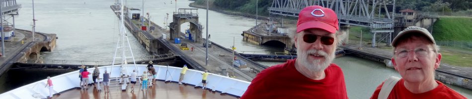
San Juan, Puerto Rico (USA)
April 25 found us docked in San Juan after five sea days. This was the last port visited on this voyage and we were looking forward to getting home.

Maybe we were just tired, but for whatever reason we did not get up early enough to see the sail in, which is a good one (we did see it once, about 10 years ago). We decided to spend the day walking around Old San Juan, the original settlement here in 1509. It is situated on an island joined to the rest of Puerto Rico by several bridges and it is also the location of the cruise ship port. So after breakfast we left the ship to walk up to one of the two great fortresses here.
On the way we walked through Plaza de Colon, named for Christopher Columbus whose statue dominates the square. Although the square is much older, the statue of Columbus was erected in 1893 to commemorate the 400th anniversary of his (European) discovery of the island in 1493. The square is lively a little later in the day; when we were there the vendors were just setting up all around the plaza. On the downhill edge of the plaza is the Teatro Alejandro Tapia y Rivera, built in 1824, which hosts ballet and other cultural events. A number of old trees were blown down in this square by Hurricane Maria in September, 2017, about seven and a half months before our arrival but the plaza seemed in pretty good shape when we were there.


We walked on to the Castillo San Cristóbal, completed in 1783, the largest fortification built by the Spanish in the New World. This is one of two fortresses in San Juan: San Cristobal was designed to defend against land attacks and El Morro to defend against attacks by sea. Today they are both under the jurisdiction of the US National Parks Service, which sells a ticket that admits you to both forts. US citizens of a certain age can buy a lifetime pass that gets you into all American national parks. We bought ours a few years ago when it was $10, an incredible bargain, but recently the price has been raised substantially (still a bargain if you want to visit a number of parks, as you should because they are wonderful). Anyway, we had to pay for admission to the fort; we had left our lifetime passes at home because we would be travelling abroad where they would be of no use, forgetting that our last port would be on US territory. Never again!

The fort has upper and lower courtyards connected by a labyrinth of tunnels that enabled soldiers to rush from one rampart to another without being exposed to enemy fire. In the tunnels was a chamber that was used as a dungeon. It had drawings on the walls that were made by a prisoner in the 19th century.


In 1942 pillboxes were added to enhance the defenses. Through the narrow opening facing the sea is quite a view of the coastline in both directions.


From the ramparts one has a nice view of the upper courtyard and of the city beyond. The domed building is the Puerto Rico capitol, completed in 1929.


Three ships were in port this day and you could see them lined up from the ramparts of the fort. Amsterdam seems pretty big when you are standing next to it but you can see from the picture how small it is by modern cruise ship standards. On the right is a Royal Caribbean ship, the Something (behemoth?) Of The Seas, in the middle is the Carnival Magic, and the little guy on the left is the Amsterdam. We like the smaller ones the best.

The Spanish built five huge cisterns under the fort, holding a total of more than 850,000 gallons of water, with an elaborate system to direct rainwater into them from all over the fort. When the US Army occupied the fort in 1898 it shut down the cisterns out of concern that the retreating Spanish might have poisoned the water. They were reopened in 2011 by the National Parks Service to provide only non-potable water to the fort’s facilities. Amusingly, Rick found a sign in a restroom that contained only a toilet warning not to drink the water because it wasn’t potable (people don’t drink from toilets and dogs can’t read the sign). The Spanish accessed the water in the cisterns from wells dug in the floor of the fort that were surrounded by masonry cylinders. Above the wall overlooking the lower courtyard fly the flags of the United States, Puerto Rico and the Spanish Empire.


We didn’t come across a library in San Juan but we did visit La Casa del Libro, a tiny book museum. For some 10 years it had been without a permanent home but about a year and a half before our visit it was re-established in the house that had been its original home. It has an extensive collection of antique books dating to the 15th century but most of the permanent displays were not open when we were there. We did visit a temporary exhibit of very tiny printed books.


We walked over to the Cathedral of San Juan Bautista. Completed in 1540 on the site of an earlier church, it is the oldest Catholic cathedral in the Americas (there is an older one in the Dominican Republic but it wasn’t always a cathedral). Inside is the tomb of the Spanish explorer Juan Ponce de Leon, founder of the city.


Across the street from the cathedral is a very nice park called the Plaza de la Catedral. This has been maintained as an open space since 1521. A whimsical nautical sculpture sits in the park. The street between the cathedral and the park is paved with cobblestones in the shape of bricks. What is unusual is that the bricks are shiny blue, as can be seen throughout Old San Juan. These bricks were made from slag discarded by Spanish iron foundries and brought to Puerto Rico as ballast in Spanish ships. An early example of efficient recycling!


By now it was mid afternoon and we were hot and tired, so we continued up the street to find a place to sit down and have something to eat. Because of the hour few restaurants were open,but we finally found one called Ostra Cosa. The food was good and the beer was refreshing, sitting in a long room open to the outside. We had a view across the street of San Jose Plaza, named for the church of the same name that sits on the plaza’s east side (left in the picture below). The church was built from 1532 to 1735 and Ponce de Leon was interred there until 1836 when his remains were moved to the cathedral. After eating (a long time because the service was exceedingly slow) we walked over to see the statue. We couldn’t visit the church because it was undergoing renovation.


We walked back toward the ocean and the city walls and first came to the Plaza del Quintro Centenario, built in 1992 to commemorate the 500th anniversary of Columbus’ first voyage to America. It is pretty impressive, if a little sterile. The plaza is dominated by the 40 foot high Totem Telurico, a sculptured column made of clay gathered from across the Americas, representing the origins of the indigenous peoples of America.


We walked toward the Castillo San Felipe del Morro, the fort guarding the entrance to the bay. It is an impressive structure, built in the 16th century. The National Parks ticket we bought to enter San Cristobol would also have admitted us to this fort but it was getting late, we were hot and tired and we had been to El Morro once before. So we just walked by it. In front of El Morro by the water is the Santa Maria Magdalena de Pazzis Cemetery, opened in the mid 19th century. It is filled with above-ground stone tombs and has a nice stone gateway to the older section of the cemetery.
. The brightly colored buildings below are part of the La Perla neighborhood, discussed below.")


We walked along the old city walls toward San Cristobal. At the end of the 18th century these thick walls completely surrounded the city but some inland ones were taken down in the1890’s to permit the city to grow toward the east. Outside the wall on the water’s edge is La Perla, which has been a shanty town housing poor people since the late 19th century. The buildings are painted in very bright colors but many were badly damaged or destroyed by Hurricane Maria in 2017. On the whole San Juan appears to have cleaned itself up nicely, at least on the surface, but we did see a few instances of what looked like hurricane damage. Situated outside the walls and exposed to the sea La Perla didn’t have much of a chance when the hurricane arrived.


 built into the old city wall")

There is an inclined road over a retaining wall running parallel to the city wall built by the Spanish in the 1760’s. It was paved in 1960 for automobile traffic. Somehow the 18th century Spanish engineers didn’t anticipate modern cars and the wall collapsed in 2004, probably from traffic vibration and air pollution. The original façade of the wall has since been restored and strengthened, but we’re not sure we would want to drive over it.

After this we visited a few shops as we walked back to the ship. Actually, walking the streets of San Juan is one of the best things here, for they are lined with different colored colonial era buildings. As we walk back to the ship, here is just a small sample.


And so we took our leave of San Juan, the last port on this world wide voyage before disembarkation.


Love this area. Spent three days here before we left on a cruise. I’m going to have to learn to like beer. It’s so much cheaper than what I drink. What am I’m going to read?? Time for u to go on another trip.
September 12, 2018 at 1:44 pm