In Patagonia
On Thursday evening, January 26, we left Castro & sailed south toward our next stop, Puerto Chacabuco in Patagonia. This area is just stunning. During dinner we watched a glorious sunset, which turned the top part of the mountain range that was along the channel a beautiful pink . Because we were at dinner we didn’t get a picture of the range, but here are a couple of shots of mountains in that range. They really do not do justice to the sunset colors.


Friday morning, January 27, found us in the harbor of Puerto Chacabuco. The weather was quite ugly, so rainy & cloudy you couldn’t see much. We had to go ashore via tender boats & for awhile the water was so choppy they wouldn’t let us board the boats. Happily, the weather in this area can change extremely quickly and for most of the day it turned out to be beautiful & sunny. Here are two views of Puerto Chacabuco from the ship, one in the morning & the second in the evening. Quite a difference.


Puerto Chacabuco was built in 1995; it is just a port & there is no town. The port here used to be at a town called Puerto Aisen. However in the late 1980’s & early 1990’s there was a long series of forest fires causing erosion from the mountains that filled the river with silt, making the river un-navigable. So they built this new port at Puerto Chacabuco, but the nearest town is still Puerto Aisen. Here are a few views of the area around Puerto Chacabuco.


We took a privately arranged tour of the area that took us first to Puerto Aisen. The guide said no one knows the origin of the name but one theory is that when the first settlers came this was the limit of the local ice sheet, so they called it “ice’s end” or Aisen. Sounds dubious to us, particularly since that phrase sounds suspiciously like English. Anyway, it’s a small frontier town on a river nestled among large snow-capped mountains. The weather really changed during just the 20 minutes or so that we were there; I have included at the end of this sequence two pictures of the same mountaintop from the Plaza de Armas taken about 3 minutes apart.


Next we saw a two level waterfall called Cascada de la Virgen, named after the shrine next to it of (what else?) the Virgen de la Cascada. After that we went to a nature preserve including part of the Rio Simpson, a lovely river among the mountains popular with fly fishermen. Among other things, we saw there some wild fuschia & a giant relative of the rhubarb which is eaten by the local folks, but we didn’t see any of the condors that live there.


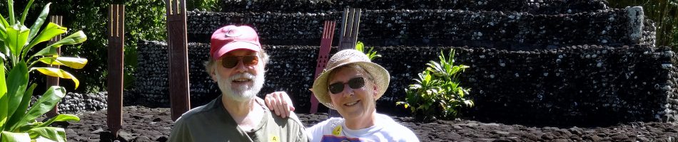
We had lunch at a “campo” or country house in a place called Pangal. This is not a tourist place but a family who are friends of the guide. They grow most of their own food; there is a greenhouse for growing salad greens, and they have llamas, sheep & geese (at least that is all we saw). Lunch was served in their “quincho,” a wooden barbecue house designed for parties & celebrations. Because the van could not cross the suspension bridge on the way to the campo we had to walk about a half mile, across the bridge (which is solid, but does sway a little) and through some beautiful mountain scenery.


In the quincho was a huge fireplace in which a whole lamb was roasting on a spit. We were told that it had been cooking for about 4 hours. We were given a pisco sour & Chilean wine to drink and were served the lamb as “asado al palo,” along with salad & potato & fried bread called sopas. It was all delicious.
")

During the meal we were entertained by a young couple doing local folk dances (one of the dances was called a “cueca”). The gaucho appeared to have a roving eye.


Outside was this little ram making a lot of noise & looking like he really wanted to go inside the quincho. I tried to tell him that it wasn’t pretty for lambs in there but he didn’t seem to believe me.


After that we went back to the ship, making one more pass through this beautiful territory. As usual there was a towel animal to cap off the evening (you wouldn’t want to miss one of those, right?).


Friday night was very rough. The captain came on the speaker around 8:00 to tell us that they were changing course because of bad weather & we would be going out into the ocean at midnight, where we would stay most of Saturday and then go back into the fjords Saturday evening. He told us to prepare for bad weather and to secure everything in our cabins “unless you want to see your Ming vase rolling around the deck on your verandah.” We don’t have a verandah in our cabin (or a Ming vase, for that matter) but we did secure everything in our cabin, putting things in drawers & cabinets. During the night the ship was going up & down quite emphatically; in the middle of the night I was awakened when our bathroom sliding door suddenly slammed shut on its own initiative (Mary, amazingly, slept right through that). The next morning the captain told us we were experiencing 15 foot waves & gale-force winds. It surely felt like it; you couldn’t walk in a straight line around the ship, but were constantly weaving back & forth like a drunk. First the floor would be inclined to the left, so you would lean in that direction to maintain your balance, but suddenly the floor would be inclined to the right instead, so you would stagger to the left while trying to regain your equilibrium by leaning to the right, but just when you thought you had succeeded the floor would suddenly be inclined to the left again & the cycle would repeat. I told Mary we were getting good exercise out of it since you had to walk twice as far to get anywhere on the ship with the constant zig-zagging. I took a couple of pictures of the waves, but because of the height from which they were taken they do not begin to convey what it really looked like.


We did go back inside the fjords around 7:00 & it was much calmer. We could see impressive mountains along the side of the channel but it was too misty to get a decent picture. When on a long voyage like this, away from the normal rhythms of city life, it is easy to lose track of the days. So on Prinsendam they change the floor mats in the elevators every day as a reminder (remember, there are lots of older folks on this cruise, so memories are probably generally less than stellar). And, of course, another towel animal.


From this point on for the next couple of weeks internet access, and therefore blog postings, will probably be pretty spotty. We have ‘”scenic cruising” on Sunday, we are in Punta Arenas on Monday (where I hope to post this blog entry), then Ushuaia, Argentina, on Tuesday (where I may have another blog post),. After that are 5 days of cruising through Antarctica where we will most likely be incommunicado. We are supposed to be in Stanley, Falkland Islands on Monday, Feb. 6 (although we are told that weather prevents going ashore there about half the time), then two more days at sea until we reach Buenos Aires on Feb. 9. After that communications should be better & you will hear from us more often.
Castro, Isla Chiloe, Chile
After a rough day at sea, we arrived this morning at Castro, a town on Isla Chiloe (chee-loe-way) off the coast of southern Chile.


A sharp contrast to Santiago’s teeming millions, Castro has between 20,000 and 30,000 people and its green hills are a welcome change from the deserts of the last week. It’s a small port so I imagine it gets few cruise ships, but it seems to have a thriving tourist trade since there are lots of hotels & restaurants. Established by (who else) the Spanish in 1567, it was then isolated from all European interaction for 200 years after the local Mapuche people drove the Spanish out of the southern Chilean mainland in 1599.
Built on the landward side of the island (the 2d largest island in South America after Tierra del Fuego), Castro was pretty much destroyed by an earthquake & tsunami in 1960. The buildings here are mostly wood, painted a variety of bright colors.


The cathedral, opening (as usual in South American towns) onto the Plaza des Armes, is painted yellow with a purple roof. Because of the unusually high and low tides buildings by the shore are built on stilts and are called Palafitos.


As you can see, it was very low tide when we were there; some boats were on the beach waiting for the water to come back to them.
We walked all the way up the very steep hill to the cathedral. You can see how steep it is from this sidewalk up the hill, which is actually a stairway. If you look very closely, there are two people walking up, near the top of the stairway. They are not us; we took an easier route. Walking back down we passed a couple of dogs in front of a restaurant having a great time chasing cars slowly climbing the street, trying to bite their tires, then returning to the restaurant to await the next driver. Mary turned to me and said “valet barking.” I wish I had thought of that one. Also here are a few other random shots of interesting things in town, like a cow sculpture, some graffiti & a mime playing an accordion. Finally, today’s towel animal, a cobra.


Valparaiso & Santiago, Chile
On Tuesday, January 24, we arrived in Valparaiso, Chile’s third largest city with close to a million people (we think). We were on a bus tour to Santiago, Chile’s capitol, which was to leave at 7:15 AM (!), so we got these pictures of Valparaiso harbor just before sunrise.


Valparaiso is built on a number of steep hills (heard that before?). It has cliffs not far back from the harbor and a whole series of funiculars to carry people to the upper city. We were told that only 4 of them are currently in working order.


Santiago de Chile, the capital, is in a valley in the Andes mountains about 100 miles east of Valparaiso. It was an early Spanish outpost & now has some 7.5 million people spread out for many miles. They told us it never rains there in summer & never snows there in winter, although the surrounding mountains get plenty of snow. Most of our tour was, sadly, spent on the bus. On the way there we saw vineyards in several mountain valleys (Chileans are very proud of their wine, which is supposed to be first-rate).


Now for some pictures as we drove around Santiago. The train station with, if you look very closely behind the pole at the right, a carousel (not great, but the bus was moving). Then an unusual red church, a wall with graffiti (we have seen a lot of graffiti in Chile), a clock tower near the central plaza (where we couldn’t get out because someone was robbed there on our guide’s last trip, which she blamed on Peruvians who hang out there), and the Palace of Justice (which I assume is like a Supreme Court).
")


We did get out to see the Presidential Palace. We were pleased & surprised to see a statue of Salvador Allende there. Our guide’s favorite word was “nice”; everything was “nice” except two things: the earthquake two years ago & Augusto Pinochet (she pronounced the “t” at the end). She said he took away all freedoms & passed laws to benefit himself & his supporters. This was a welcome change from our ship, where we heard two lecturers (one British & one American) praise Pinochet for saving the country from communism & establishing a strong capitalist economy (although the British guy acknowledged that “some people disappeared”). I guess a bloodthirsty police state is OK for some (who don’t live there) so long as free enterprise is protected. There is no statue of General Pinochet at the Presidential Palace.


Before lunch we went up to a scenic overlook on the side of a hill that had great views of the Andes & Santiago in the valley below. Unfortunately there was a blanket of smog that interfered with what would have been quite a picture.


After visiting a disappointingly overpriced artisan place in Santiago the bus took us back. We slept most of the way back but our guide detoured us at the end through a resort town next to Valparaiso called Vina del Mar. Apparently, there is a beach house there for the President and government officials & rich folks from Santiago go there to swim. Tough to get pictures from a moving bus (& we were sitting on the wrong side for pictures).
")


Finally, some views of Valparaiso as we sailed away, the harbor pilot leaving the ship, and yet another towel animal.


I guess that’s all for now. We are headed south to Patagonia right now & it has been a very bumpy ride since yesterday, almost like a roller coaster. And we haven’t even gotten to the really wild water yet! To make it just a little scarier, the ship creaks a lot (it’s pretty old for a cruise ship; built in the early 80’s,). But so far we are holding up pretty well. We have 2 port days in a row, so it will probably be a few days until we post here again.
Antofagasta & Coquimbo, Chile
Long time, no see. Before getting into today’s subject, I wanted to correct my description of Mollendo, which I derided the other day as an ordinary Peruvian town. I have since learned that it is a seaport (once an important one) & one of the top resort towns in southern Peru. Rich folks from Arequipa have beach homes here and there is a castle, which is now apparently owned by the Catholic Church. We (obviously) didn’t see any of that, but then we didn’t stay very long because I was still feeling pretty sick then (much better now, thank you).
Anyway, on Saturday, January 21, we docked at Antofagasta, our first stop in Chile.

As you can see from the mountains this is still on the edge of the Atacama desert. There is a town not too far away called Calama that has never recorded a drop of rain. In the late 19th century Chile fought a war with Peru & Bolivia over this area, with the result that Chile has sovereignty here but Bolivia (which has no coast) is guaranteed a trading outlet at ports in northern Chile, including Antofagasta & Arica. Chileans & Peruvians don’t like each other very much to this day.
This is important because in this area of Bolivia is a place called Potosi, which was basically a volcanic mountain of silver. While most silver ore has less than 5% silver, the ore at Potosi had more than 50%. Nearby was another mountain full of mercury, which is used to extract silver from ore. The Spaniards, true to form, basically enslaved the local Indians & forced them to labor in the mines, most of them dying quite quickly. We were told that in some of the Indian graves from that era, when the bodies decomposed what was left was a pool of Mercury beneath the skeleton. Anyway, Potosi accounted for about half of all the Spanish silver exported from America in the 16th & 17th centuries, which basically doubled the money supply in Europe (and also, incidentally, in China where the Spaniards traded it in Manila for porcelain & silk) & apparently also paid for the Hundred Years War.
After the wonders of Peru, Antofagasta was really not a very interesting city. Here is Mary in the Plaza Colon (Spanish for Columbus) with the dome of the Regional Library in the background. There was also a fountain and a clock tower. The clock tower was contributed by the British community here & is said to be a miniature copy of Big Ben in London, but really looks nothing like it (it does have 4 clock faces).


We noticed quite a lot of dogs lying around the streets, some with collars some not, some looking mangy and some not. Also, I think this is a statue of Ferdinand & Isabella, although it wasn’t labeled. It is at the edge of Plaza Colon, on Avenida Jorge Washington.


Here we are leaving Antofagasta where a small lighthouse sits at the harbor entry, occupied by lots of birds, mostly pelicans.


 near lighthouse")
After a sea day we docked in Coquimbo, Chile, on Monday, January 23. Coquimbo & its sister city La Serena are resort towns on a beautiful bay.


Coquimbo is built on the steep hills surrounding its harbor. On top of the hill where the ship was docked is a huge & very ugly building called the Millennial Cross. Built in 2000, as the name indicates, it memorializes the Pope’s visit to South America. You can go up & look out the windows (we didn’t). The other major landmark in town is, weirdly, a mosque on a hill. We are told that this does not represent a Muslim community in Coquimbo, but was built primarily as a tourist attraction. We’re not sure whether this is true but speaking as tourists it doesn’t do much for us.


The hills are so steep that the sidewalks look like Lombard Street in San Francisco.


They must not get many cruise ships in Coquimbo; they sent out a band to greet us in the morning (way too early) & to send us off in the evening. Not the world’s greatest band, but it was a nice gesture.

We took a van with a few other people for a personal tour. He took us to a spot called Drake’s Castle, where Sir Francis Drake supposedly built an encampment while pirating Spanish ships along the west coast of the Americas. We believe he camped here, but we don’t necessarily believe he built the castle-like structures. However, its a lovely spot, with rock formations, beautiful flowers & bay views, & a rock full of sea lions. I guess in some circumstances people will pay just about anything for a bathroom (it’s really about $.50).


 $250")
We then drove around the bay to La Serena, a beach resort. We stopped at a wimpy lighthouse on the beach then drove up a hill to visit an old fort (still run by the army) built, we were told, by Italians. We were told that a lot of Italians emigrated to this part of Chile at the end of WWII (while the Germans were going to Argentina, I guess), but this fort is a lot older than that. There was a pool with a marble sculpture brought from Italy & some nice Italian marble benches as well.


We went on from there to a shopping square,with artisans, souvenirs, barbers, hat stores, etc. We stopped at a grocery store, mainly to use the bathrooms. Here is Mary in the van with our friends Bing & Barb & a sign for parking for expectant mothers.


The shopping stop was a nice little square with a fountain in which kids played.

Lots of colorful items for sale, some artistic & some not so much.


And finally, for you towel animal fans, here are a couple more:
")

General San Martin & Matarani, Peru
On Tuesday, January 17. we visited a port called, poetically, General San Martin. Its not much in itself, as you can see.


It is located on a sort of large rounded peninsula, described evocatively by the ship’s travel guide as a “carbuncle on the coast of South America.” Up the coast a few miles is the city of Pisco, which was devastated by an earthquake a few years ago & is still not fully rebuilt. But the big attraction here (at least for us) is Isla Ballestras, sometimes described as a poor man’s Galapagos. While it is hardly the rich nature preserve that the Galapagos are, it is a wildlife sanctuary that is home to an unusually diverse and numerous collection of bird and sea animals. One guide told us that this area of Peru has more diversity of species of wildlife than anywhere else in the world. I’m not sure about that grandiose claim, but its pretty impressive.
We took a speedboat to Ballestras holding about 25 people from a little town not far from the port called Paracas. It seems to be building itself into a resort town but is still a pretty sleepy place and, as you can see, it is on the edge of a rather bleak desert. We did, however, enjoy its outdoor statues of a penguin & a sea lion.


After boarding the boat & donning our life jackets the first place we came to was an ancient cliff drawing called the “candalabra” or “trident.” It is quite huge and very old, created by ancient indians, but no one knows why it is there or what it is supposed to represent. It seems to point directly to the Nazca lines (landscape drawings much further inland by the ancient Nazca indians, the shape of which can only be seen from an airplane) but it is not now thought to be related to them.


Then on to Ballestas, about a 25 minute trip at high speed over choppy ocean waters.

So now, before we get to the wildlife you are all waiting to see, my sad story. We were told that we needed to worry about our hats on this trip. You need them not only for protection from the sun but for protection from bird droppings. There is a strong wind while speeding to the island so I put my Cincinnati Reds baseball cap on backwards to avoid having it blown off (as you can see in the picture above). Well, when we got to the island there didn’t seem to be much wind anymore, so I turned the hat around. Almost immediately a gust of wind came along & blew my hat overboard! The guide tried to retrieve it with a pole but the waves were too choppy. So now my hat sleeps with the fishes. Worse, the lack of a hat led to a bad sunburn on my face & the top of my head where my hair used to be (I hadn’t put sunscreen there or on my face because my hat was always sufficient protection), which was probably made worse by windburn on the trip back from the island. As a result I have been feeling pretty sick over the last few days, which Mary attributes to sunstroke, although now it is starting to get better. Enough about me.
As you can see below, Ballestras is completely covered by hundreds of thousands of birds of many varieties. Its a pretty impressive sight.


Herewith some photos of a few of the various species of which I managed to get pictures from a seriously rocking boat. Pelicans & a Kelp Gull:


Humboldt penguins:


Guanay Cormorants:


And my favorite name, Peruvian boobies:


This striking red-headed bird was not in the bird guide we were given, but it looks to me like some kind of vulture. The second one on is eating what appears to be a fish.

 eating its prey")
Sea Lions:


The sea lions are very loud; there is a constant bellowing coming from the group. I don’t know if they do that all the time or just when there is a boat nearby. In the next picture the shadows at the bottom are full of yelping sea lions & some birds, while the white rock is covered with birds.

Well, all these birds are gathered in one spot & you know what birds do best. As a result, this island is very rich in guano (bird droppings) which makes excellent fertilizer (it also makes this island really stink). So every 7 years they harvest the guano from the island. There is a pier built for this purpose which, like everything else, is usually covered with birds. When the Spaniards first collected and shipped guano from here to Europe it caused something of a revolution in agriculture there.
")

This area of Peru, and really most of the coastal area of Peru & northern Chile, is a desert area. In this general area of southern Peru & northern Chile (mostly further inland) is the Atacama Desert, which is the driest spot on the globe. It literally never rains here. We were told that this is the reason all the Indian ruins are so well preserved, particularly the adobe mud bricks & the mummies that would have deteriorated badly in a more temperate environment. But the desert hills around here are sometimes quite beautiful, showing a variation in color and light & shadow, particularly at sunset.


Looking out at the water before sailing we saw a whole lot of these huge brown jellyfish (left above) floating by; Mary thought they might be Men-o-war. And gulls floating on the water; mostly they fly around, then suddenly dive-bomb straight down into the water after fish, but that happened too quickly & unexpectedly to get a picture. We also saw a squadron of Pelicans flying in a V formation, just a few inches above the water. They looked very military in bearing, but again no picture since I didn’t have my camera out in time (d’oh!).
I want to keep you up to date on the towel animals and bread sculpture as well, since we have been enjoying them. Our best towel sculpture by far to this point has been the hanging ape, which we didn’t notice for several minutes after entering our room because it wasn’t on the bed like the others. The cornucopia is all bread (with, I presume, some food coloring), despite what it looks like.

 towel animal")


January 18 was a sea day then on January 19 we docked at Matarani, a very small port in southern Peru. I think this is the first time Holland America has visited here & it appears that they get little or no other cruise traffic. The port itself is pretty, but there is nothing else there except more desert.


The nearest spot of real interest is an old Spanish colonial city called Arequippa but it was an all day bus trip to see it, with 2 1/2 hrs on the bus each way, so we skipped that. (Actually, with the way my innards were acting, I never would have made it that far without a rest stop.) The cruise line was operating a shuttle bus to the closest town, a small town called Mollendo which really had nothing to distinguish it. The shuttle took us through rather barren desert for half an hour, with narrow bumpy roads often hugging the sides of steep hills.


The town had an interesting indoor market with colorful fruits and stalls with hanging meat (hanging unrefrigerated for who knows how long). They had an interesting variety of corn with very large kernels. Peru has more than 300 varieties of potato (!) and also a large variety of corn, both of which originated here.


Mollendo also had the inevitable church and a central plaza. Below right is a picture of Mary walking along a street of food vendors which is, as one of the passengers kept saying, “evidence that we were there.”


So basically nothing special here, but it was interesting to walk around a real Peruvian town that is not set up to cater to tourists.
That brings us up to date (today is a sea day & tomorrow we will dock in our first port in Chile). Before leaving Peru, there is one thing I meant to show you earlier; it doesn’t have anything to do with Mollendo but I am going to put it here anyway because its the only place left. For those of you interested in elections, it seems that they had elections in Peru last year. A whole lot of people were running for President, it seems, and political signs were everywhere, in Trujillo & Lima especially but also in Paracas. Peruvians paint their political signs on walls (there are walls along most streets and hardly any buildings have a front yard without a wall in front of it, often with barbed wire, broken glass and even electrified wire on top of the wall). The signs are still there, of course, even though the election is long over, & I guess they will stay there until someone pays the owners of the walls to paint something else over them. It makes you glad to have all the crappy little political signs we have in the US that look so bad but can at least be cleared away from the landscape once the election is over.


And one last interesting thing we saw all over Peru was a large number of these little 3 wheel cars. We had never seen them before but they are everywhere here, quite often with this kind of original paint job.

That’s it for now. See you in Chile in a few days.

