Walvis Bay, Namibia 2022
We sailed away from Cape Town on the evening of November 24 and the next morning Mary tested negative for Covid and was finally released from detention. The next stop on our itinerary was Luderitz, Namibia, but the captain announced that because of weather and sea conditions we would be skipping that stop. That made no difference for Rick, who was still in quarantine, but Mary could have gone ashore and participated in our scheduled excursion. It is always disappointing to miss a port, but it is not unusual to miss one or two on a long voyage and everybody missed this one.
Our next scheduled port was Walvis Bay, Namibia, where we arrived early in the morning of November 27. We had visited here once before in 2018, so if you want to see more of the Walvis Bay area here it is:
https://baderjournal.com/2018/08/24/walvis-bay-namibia/
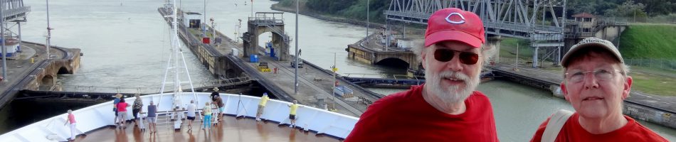
We had a day long excursion booked and Rick was scheduled to be sprung from quarantine that morning if he tested negative for Covid. We had asked in advance for Medical to send someone to our cabin as early as possible for the test, hoping he would be ready to go by the rather early departure time of the excursion. Well, the tester arrived early, but a half hour passed afterward with no notification of the result. We called Medical and found out they had called and left a message at the separate room Rick had been moved to the day after Mary tested positive, even though they had moved him back a week before! Good thing we called. So we hurried out for the next step (it really feels great when you first walk out the door after a quarantine) which was a mandatory face to face passport check being held in the Explorers Lounge. You had to scan your key card before going in, but when Rick’s was scanned an alarm went off: it sounded like a fire truck was on the way! It turned out that Medical had not gotten the quarantine restriction on Rick’s key card removed (apparently because they continued to view him as living in the other room). After that was cleared up with a call to Medical we had our passports cleared and joined the excursion group before the ship was cleared for disembarkation. Of course, when Rick’s card was scanned to leave the ship . . . you guessed it, an alarm went off again, even louder than before. It took a few minutes for them to clear that up and we left the ship to start the excursion. Surely they would have this all cleared up by the time we returned late in the afternoon when his card would have to be scanned to permit Rick to reboard! Right?
The morning part of the excursion was a boat trip around the bay. We boarded a fairly small boat at the dock not very far from the ship.


Before even leaving the dock we met two members of the wildlife crew. A large pelican was sitting on a fence as we boarded and he boarded the boat before we sailed. A very large bird, it was probably a Great White Pelican which are plentiful in this part of Africa. Obviously used to people, it joined the group without hesitation. It didn’t stay with us for the whole trip but was there to greet us when we returned to the dock.


Our second wildlife crew member was a fur seal (named Sammy, we think). He was clearly used to being on this boat with people and was very comfortable mingling with us. The back of the boat was flat except for a railing and he would dive off this platform into the sea to retrieve thrown fish (kind of like a dog except he would eat the fish instead of returning it). Then he would race back to the boat and leap onto the platform again. He wandered around the boat interacting with passengers, even jumping into their laps at times. He came over to us and looked up like a puppy; this was fun except he was standing on Rick’s foot! And a seal weighing several hundred pounds is pretty heavy.


It was quite cold and windy when we set out and we were sitting near the open front of the boat where the wind was blowing in without restriction. Refreshments of various kinds, including champagne and locally grown oysters, were served from time to time. It was a long ride to see the wildlife of the bay. Eventually we came to a very long beach with Cape Fur Seals as far as the eye could see. This was Pelican Point, a large sand peninsula that protects the bay from the ocean. It hosts a seal colony more than 100,000 strong (although not all at the same time). The wind had died down a bit and it was warmer by the time we got there, so Rick walked out on the front deck to get a better view and some pictures.
In the last two pictures here you can see in the distance the Pelican Point Lighthouse, built in 1932 from cast iron. It was originally near the ocean’s edge but over time the sand has built up to the point where it is now about a mile from the shore.


The seals did not have Pelican Point to themselves, however. A flamboyance (yes, that’s the official term) of flamingoes was hunting for food in the shallows of the beach in one area. These are Greater Flamingoes, which are large and have pink and black beaks. The seals didn’t seem to be bothered by them in the least. Flamingoes eat by submerging their heads upside down and using the top part of their beaks as scoops. They are gray at birth and do not acquire their iconic pink coloring until they are two or three years old. The coloring comes from the krill in their diet. When they spread their wings to fly away the colors under their wings are much more intense. The seals didn’t seem to care about the flamingoes’ incursion into the edge of their colony.


As we sailed around in the bay we encountered dolphins and a whale. They were pretty hard to spot because the water was not clear and the weather was overcast. They were hard to identify (at least for us) because they didn’t come far out of the gray water. At one point the whale, probably a humpback, rolled on its side and reached a fin out of the water, appearing to be waving to us.


Heading back to the pier we passed about a dozen bright blue barrels roped together in a long row. It turned out this was an oyster farm and, as we understand it, the oysters were growing attached to ropes hanging down from the barrels which we, of course, couldn’t see. Some seals found the barrels to be a convenient place to hang out. When we got back to the dock we were greeted by our friendly pelican.
")


We were met at the dock by our guides for the afternoon land trip to Sandwich Bay in a national park south of Walvis Bay. This was to be a 4X4 drive over sand dunes to a bay where very large sand dunes come right down to the edge of the ocean. We were all sorted into our vehicles, each of which had two rows of regular seats and a narrow third row apparently intended for children or luggage. Well, they had not brought enough vehicles for all of us to sit in the regular seats so guess where we ended up sitting? I’m sure you guessed it in one . . . because one of our group pleaded disability and we were the smallest ones we ended up (volunteered, actually) squeezed into the children’s seats in the back. And believe me, it was not an easy fit at all.
Before driving down to the sand dunes we stopped at the Walvis Bay lagoon to see more flamingoes. This was the spot where we saw flamingoes during our first visit in 2018. These were different than the ones we encountered at the seal colony, however. These were Lesser Flamingoes, smaller than the Greater Flamingoes and with mostly black beaks and small glowing red eyes.


As we drove south it was hard to see, much less take decent pictures, squeezed into the back seat. We did see another flamboyance of lesser flamingoes in a small bay and we passed a small seal we hoped was resting on a wet gray beach, but he was very still and lying in an odd position so we aren’t entirely sure he was still alive. The surf crashes in pretty aggressively on this part of the coast.


We stopped and got out (yay) in an area near the coast that was full of small sand hills covered with brown vegetation. We aren’t sure, but these may be what is called a hummock dune, which forms around a bush or bushes. Whatever they are, they make an interesting vista.


We never actually reached Sandwich Bay. It appeared the tide was in so, as you can see below, there was no room to drive down between the high dunes and the ocean’s edge. Our guide told us they could have gotten us closer by driving over the dunes but one of the passengers was afraid of that so they wouldn’t do it. That was too bad, but from where we stopped atop one of the dunes on the approach to the bay it was still a beautiful sight.


We drove over the dunes for a while, up and down on the sand, to a spot where we stopped and the guides set up tables and served food and beverages. It was a pretty good spread but we weren’t all that hungry. Even from the back seat the dune driving was rather fun.


While in the national park we saw a number of animals among the dunes or on the shore. The Gemsbok, or Oryx, is a type of antelope with very long thin straight horns and a distinctive black and white face. We saw a related species in Dubai a few years ago, where they had become extinct but had recently been reintroduced from captive stock. The ones we saw here were in a small herd that was feeding on vegetation growing on some dunes.
We were sitting on the edge of a dune overlooking the Gemsboks. The dune was covered by spiky green vines with spotted green fruits. These are called “!nara” (the ! pronounced like a click). They are endemic to the Namib desert and are an important food resource for the indigenous people. Related to the cucumber, they have taproots that can extend 150 feet or more into the sand and the plants can live for 100 years. The fruit we saw were about the size of a golf ball so they must have been quite young since a mature !nara melon weighs in at about 2 pounds.

 !nara
!nara

We saw some Springbok as well, a smaller antelope type animal with shorter curved horns and different coloring.


Lots of boks in this area. We saw some Steenbok, small antelopes with very large ears (like Baby Yoda) and tiny horns.


Namibia is famous for its beautiful red sand dunes, caused by rust on sand particles made of iron ore. We didn’t see those but we drove to a spot on a dune where there was quite a bit of this red sand, which was very pretty. The sand was striped in red and yellow striations. One of the guides held a magnet just above a handful of this sand and the red particles jumped up to the magnet.


Nearby one of the guides found a tiny green lizard that fit in the palm of his hand. We think it may be a Namib Sand Gecko, which is endemic to this part of Africa.


We stopped at the top of a dune and looked over a sand cliff at an Ostrich with two eggs in its nest. And as we drove back toward Walvis Bay along the beach we encountered a Black Backed Jackal lying in the sand.


One last sight on our way back to the harbor was a large salt processing plant. Namibia produces about a million tons of salt each year by drying ocean salt water in the sun. The process takes many months, during which the fields of drying salt water acquire a pinkish cast from organisms living in the water. We had seen similar salt farms on the island of Bonaire in the Caribbean about six months earlier.

We arrived back at the port and boarded the ship. Of course, your room key has to be scanned before you are admitted into the ship and, guess what, the alarms went off again when they scanned Rick’s card. All day & not fixed! Once they cleared him by calling Medical we could go in. But wait, that’s not all! Namibia requires everyone to be cleared for departure by their immigration people, which was again in the Explorers’ Lounge. When they scanned Rick’s card at the entrance, the alarms went off again, for the fourth time. Not only was Rick’s card not recognized by the ship’s system, it also wouldn’t open the door to our room. It seemed like Medical’s failure to log Rick’s return to our room rendered him a nonperson as far as the ship was concerned.
We went up to the main desk and they worked some semi-magic and told us it was fixed. We went back to our cabin and the card still wouldn’t open the door, so back up we went. This time the desk clerk made Rick a new key card and took it down to our room himself to make sure it worked. It did and thankfully continued to work for the rest of the voyage. Covid was bad enough & we sure didn’t need this complication added on.
So ended our first time off the ship since Madagascar and Rick’s first day out of quarantine. He wasn’t sick any more but this was a very full and taxing excursion that left us rather worn out. It was good that we would have two sea days to regain our stamina before the next port.
Mozambique & South Africa (Time Out) 2022
Maputo, Mozambique
We had two sea days after leaving Madagascar before we arrived in Maputo, Mozambique on November 19. You may be wondering about the unusual title of this episode so this is what it means: The morning after we left Madagascar Mary tested positive for Covid and was quarantined in our room. On this trip a quarantine lasts for at least 5 days, starting on the day after you first test positive, so in reality about 6 days. If you test negative on the morning of the 6th day you are supposed to be sprung from your incarceration, but as you will see things don’t always go as anticipated.
Last Spring HAL ships were setting up separate corridors for quarantining covid patients that were off limits to other passengers and at least on some ships crew delivering food wore hazmat suits and left the food trays in the hall to be picked up by the occupants of the room after they left. Nothing so extreme on this cruise; Mary was quarantined in our regular room and we had a hard time convincing our normally attired room attendants not to bring the food inside as they normally do. And even though Rick was sharing a room with a quarantined person his movements about the ship were not restricted. We thought that was rather strange.
Rick was given a choice to remain with Mary or move to another room. He decided to stay but that was very short sighted and foolish. You can probably guess why, but more on that later.
Anyway, because of Mary’s quarantine neither of us left the ship in Maputo (although presumably they wouldn’t have objected if Rick had done so). Maputo is the capital and largest city in Mozambique, which was a Portuguese colony for many years. In fact, this city was originally called Lourenço Marques after a Portuguese ship captain who explored the area in 1544. They built a fort here in the late 18th century and the town grew around it. After a long revolutionary struggle the country achieved independence in 1975 and the next year the city’s name was changed to Maputo, possibly after a river in the area. After independence a destructive civil war raged into the 1990’s and they have been reconstructing ever since. Today it is a mix of newer high rise buildings and older buildings with more charm.

We had been to Maputo once before in 2018, but were only able to drive through the town on our way to Kruger National Park in South Africa. You can see that here:
https://baderjournal.com/2018/08/13/maputo-mozambique-kruger-national-park-south-africa-day-1/
While he stayed on the ship Rick went up to the top deck and took some photos. The ship was docked in Maputo’s large bay. To our left was the mile long bridge to the suburb of Katembe which formerly could be reached only by ferry. Opened for traffic in November, 2018 (about 10 months after our last visit here), this is the longest suspension bridge in Africa. It was built by the Chinese.

From the ship it was possible to see several of the local landmarks that we had planned to visit today, or at least portions of them. Probably the best known is the central railway station with its bronze dome and green and white paint. It opened in 1916 and was not, despite common belief, designed by Gustav Eiffel (although there is a house in this city that he did design). It is considered one of the dozen or so most beautiful train stations in the world. Standing in a traffic circle across Praça dos Trabalhadores (Workers’ Square) from the front of the station is the Monument to the Great War, commemorating the soldiers who fell resisting the Germans during World War I. Since it was dedicated in 1935 while Mozambique was still a colony, it was most likely the Portuguese soldiers they had in mind rather than the Africans.


Independence Square is considered the center of Maputo, with the neo-classical City Hall located on its north edge. Built by the Portuguese and opened in 1947, it has been the seat of city government ever since. In a traffic circle in front of the building is a bronze statue of Samora Machel, Mozambique’s first president after independence. The statue is 30 ft tall and sits on a 9 foot high marble base. It was dedicated in 2011 on the 25th anniversary of Machel’s death in 1986 in an airplane crash. We understand it is somewhat controversial because some people think it doesn’t resemble Machel at all. Extending above the surrounding buildings to the east of the City Hall I could see the upper portion of the Roman Catholic Cathedral of Our Lady of the Immaculate Conception. It opened in 1944 and is constructed of concrete.


Muslims make up about one fifth of the population of Mozambique. The tops of two mosques could be seen from the ship. Jumma Masjid Mosque was built around 1890 and is the oldest place of worship in the city. We don’t know the name of the mosque with the golden dome, possibly Masjid Takwa but more likely not. Still a pretty arresting sight.


The Maputo cruise port sits in the bay and is separate from the commercial port facilities. There is a small green painted gate into the port area. When we sailed away we passed the ferry terminal and dock, which had an interesting older building next to it that we couldn’t identify.


We sailed away back into the Indian Ocean. Although our itinerary took us south from here we had to sail a pretty long way to the northwest from the bay before the pilot left for his yellow boat to take him back to port. This course was marked by buoys so it must be mandatory, but we have no idea why this control extends so far from the port. It played out long enough, with no end in sight, that Rick finally went back down into the ship before the pilot left.


Durban, South Africa
The next morning, November 20, we were in Durban, South Africa. Of course we had canceled the excursion we had booked and stayed on the ship again. If I remember correctly, everyone had to leave the ship for a face to face passport check in the cruise terminal even if you were staying on the ship for the day. So Rick did that, but because of her quarantine the ship’s crew took care of checking in Mary’s passport.
On this day we also came to our senses and asked to have Rick moved to another room, which obviously would make it less likely that he would come down with Covid. They came and moved him to another window room, but one floor down where he had no view of the walking deck. This was not fun.
Rick went up to the top deck again to take pictures of what could be seen of Durban. Unlike in Maputo, however, he didn’t spot any particular sites of interest. So you will have to be satisfied with some panoramas of the city from the port.


 & interesting buildings")
 Feeling completely well and with no restrictions on his movement about the ship, Rick decided to eat with our table mates in the main dining room for dinner. It was a good meal and everyone was glad to see him after several days in which he had eaten in his room out of caution. But later that night he began to feel ill and the next morning, you guessed it, he tested positive for Covid (while others at our table contracted Covid, we hope it wasn’t from us). So the medical staff decided to move him back into our regular room with Mary, who was still quarantined as well. Unfortunately, the medical staff failed to enter this move into their records properly so that the ship continued to think he was in the other room on the second deck for almost a week, until after his quarantine was over. A complication we sure didn’t need.
We left Durban for another two day sailing to Cape town. 
Cape Town, South Africa
We arrived in Cape Town early on November 23. We had anticipated the two day stay in Cape Town to be a highlight of the voyage. It is a very interesting and beautiful place. We had tickets to see Robben Island, where Nelson Mandela was imprisoned, on the first day and had booked an excursion through the wine country on the second day. We had also planned for this to be our prime shopping port, as it was when we visited here during the 2018 world cruise on a double overnight stay after our safari in Kruger National Park. You can see that here:
https://baderjournal.com/2018/08/20/
https://baderjournal.com/2018/08/22/cape-town-south-africa-days-2-3/
We knew that Rick’s quarantine wouldn’t be over until after we left Cape Town but Mary was supposed to be tested early in the morning of November 23 and released if she tested negative. This meant that at least Mary would be able to enjoy all that we had planned. But when the time for her test arrived she received a phone call from the medical staff instead to inform her that the South African authorities had decreed that no Covid testing could be done while the ship was in their port. Sounds strange that they would care about administering a test on the ship rather than just about whether a person disembarked in their port. But the result was that both of us would continue to be quarantined in our cabin throughout the stay in Cape Town.
We were sorry to miss Maputo and Durban, but missing Cape Town was a serious disappointment to us. This lengthy quarantine in a small room with one window was the first time we had felt that lacking a veranda to enable us at least to step outside made a big difference in our experience on board. We have only one picture from Cape Town, a pathetic partial view of Table Mountain over a port building from our window.

So, as we finally sailed away from Cape Town toward our next stop in Namibia, the Covid quarantine continued. Stay tuned.
Andoany, Nosy Be, Madagascar (Day 2) 2022
Because Madagascar has been an isolated island ecosystem for many millions of years its plants and animals have evolved independently from those you find everywhere else. In fact about 90% of the animal and plant species here are endemic to Madagascar and found naturally nowhere else in the world. The most famous of these is the Lemur. So on the morning of November 16 we tendered back in to the dock at Nosy Be to meet up with our excursion to Lokobe National Park for the Lemur part of our visit to Madagascar.
The dock area was very busy, not only with Zaandam passengers but with locals catching a boat to take them to their work places. We had to wait a very long time before our speedboat was ready for us to board for the trip to Lokobe, the primary home of wild lemurs in this area (you can see some in semi-captivity elsewhere but we wanted to visit them in their natural homes).


After a lengthy boat ride we came ashore on a beach. It was a “wet landing,” which means you step out of the boat into the water and wade ashore. There is what appears to be a small village on the edge of the forest by the beach, which we think may be called Ampasipohy. There were boats around so it is likely a fishing village, probably with some agriculture, but it is certainly used to receiving travelers. When we arrived folks were busily setting out their products for sale. We saw no evidence that these clothes, embroidered table cloths and souvenirs were being produced in the village, so were they made in Madagascar or somewhere else, like China? It was hard to tell.


The point of this trip was to walk through the very tall and dense forest to see lemurs and other fauna. We were led by a couple of guides who knew the area very well and were able to spot lemurs high in the tree branches. As we had found on our African safari in 2018, even when they pointed the animals out to us it was often difficult for us to see them.
There are more than 100 species of lemur in Madagascar. There once were some as big as gorillas but they, along with about 15 other species, have become extinct since these islands were populated by humans. Most of the lemur species are now endangered, primarily because of rapidly shrinking habitat, but lemurs are also hunted for food by some. Lokobe has been a protected refuge for these interesting critters since 1927 and it became a national park in 2014.
The lemurs we saw here are called Black Lemurs, something of a misnomer because only the males are black. The females are mostly brown to yellow in color with white around their faces. This forest is populated by very tall trees, some 100 feet tall and hundreds of years old. The lemurs were high in the branches and difficult to see from the ground, particularly when hiding behind leaves. We passed a baby lemur hanging onto a tree trunk in heavy shadow. Lemurs have a very intense countenance, with bright unblinking eyes that we understand are caused by reflective tissue in the back of their eyes.


Lemurs are not the only interesting animals in this park. Almost half of the 200+ species of chameleons in the world are endemic to Madagascar. We saw two species of chameleon. One was relatively large, facing down on a tree trunk. He (or she) was so well camouflaged that even after it was pointed out by others Rick had trouble seeing it until moving to the side (possibly a gecko, but we think it was a chameleon). The others were very tiny, about the size of a thumbnail. One of our guides showed them to us on a leaf. A new species of chameleon was just discovered in 2021 called Brookesia Nana, which is the smallest reptile in the world. But it may also have been Brookesia minima, which is the third smallest reptile in the world and is common in these parts.
")

We also saw a very tiny but brightly colored frog that one of out guides found and showed us, again on a leaf. We think this was an Orange Backed Mantella, also endemic to northern Madagascar, because of its coloring (scientific name Mantella ebenaui ). The bright coloring apparently deters predators wary of eating poisonous frogs (which these may actually be). It appeared that the only reason it didn’t hop away was the guide’s thumb on one of its back feet.

We encountered a boa constrictor, about 5 feet long, entwined on some branches in a tree. Since it was in a tree we think this must be a Madagascar Tree Boa. They live in the trees during the day but hunt on the ground at night.


Finally, there was a tiny gecko (we think), almost invisible among the brown leaves on the path. We might have stepped on it if the guide hadn’t pointed it out in time.

It was a pretty long hike back to the village over tricky terrain and the group got rather strung out. I was near the end and looking up (dangerous when walking because of the roots over the path) when I saw a couple of lemurs high in a tree. I felt pretty good about spotting them all by myself with no guides around. As before they mostly looked like shadows and I couldn’t tell what they were doing, but I took several pictures of them anyway since you never know what you will see when you enlarge and brighten them on the computer.
I was pretty surprised when I saw them on the computer. It was a male (black) and female (mostly brown) lemur and it looked like they were engaged in a passionate activity. As Cole Porter might say, “Birds do it, bees do it, even lemurs high in trees do it . . . . “ You will see what I mean when you get to the pictures. Alas, I later discovered using Google that the mating season for lemurs is in the Spring, and each female’s fertile period only lasts a couple of days. We were there in November so that couldn’t have been what they were doing. Probably grooming each other, although the female sure looked like she was enjoying it, at least until she noticed me watching.


As we neared the village we passed many vendors, mostly of embroidered table cloths, and what looked like a farm. We had to wait in the village for more than an hour for our lunch to be prepared because it apparently wasn’t started until we got back. What, didn’t they think we would make it back? The buffet of local food was eventually set out and was pretty good. Some of the guides and villagers sang for us, including their national anthem, in the thatched lunch hut.


")
After all this we walked down the long beach to the speed boats that would take us back to the tender dock. The tide seemed to have come in somewhat since there was a deeper wet embarkation than in the morning. The beach was quite beautiful. It was a long trip back to the dock and unfortunately we were sitting in the front part of the boat. The boat pilots (there were several boats) seemed to be racing each other and as the boat climbed a wave we were thrown out of our seats about 5 inches and when the boat went back down we hit the seats again, hard. Of course, the pilot in the back of the boat didn’t feel any of this. When you are piloting a speed boat full of older passengers more care should be taken; we had to hold on tight just to stay in our seats. It was a beautiful trip, but by the end of that ride our bodies felt pretty much broken and it took several days to recover. We hope Holland America makes sure that doesn’t happen again on future visits.

 and two other passengers walking down the beach to the boats")

So that was it for our visit to Madagascar. We sailed away toward the southern part of the African continent past a very nice Indian Ocean sunset.

Andoany, Nosy Be, Madagascar (Day 1) 2022
On November 15 we were anchored near Andoany, the largest town on the island of Nosy Be near the northern tip of Madagascar. The fourth largest island in the world, Madagascar is located in the Indian Ocean some 250 miles from the east coast of Africa and Nosy Be is about 5 miles from the coast of Madagascar. Madagascar seems to have been first settled between 1500 and 2500 years ago by people from present day Indonesia and the heritage of the modern Malagasi populace is largely a combination of African and Southeast Asian. Madagascar was ruled by the French from 1897 until independence was achieved in 1960.
Nosy Be, which means “Big Island” in Malagasy, is about 123 square miles and its population is in excess of 109,000. The French took control of Nosy Be in 1840 and founded an outpost named “Hell-Ville,” now Andoany. With a name like that we thought at first this might not be a pleasant visit but it turns out the town was originally named after a French admiral named Anne Chretien Louis de Hell. It is the capital of the island with a population, at last count a decade ago, of about 40,000.
We were scheduled to visit here during the world cruise in 2018. In fact, in anticipation one of the entertainment officers had obtained a lemur suit he wore on occasion on the ship (lemurs are famously endemic to Madagascar and we will get to them in more depth tomorrow). But we were unable to stop in this port in 2018 because of an outbreak of plague(!) in parts of Madagascar. So today was our first visit here. This was a tender port, so in the morning we boarded a tender boat to the port to meet the excursion we had booked. On the way in we passed a number of small boats.


We piled into vans at the dock to begin the excursion, which included a number of lengthy drives over often unpaved roads littered with rocks. As you can imagine, it was a very bumpy ride. But these roads did take us into back country with a passing view of how people live here. We saw quite a lot of poverty and we have read since that they were in the midst of a two year famine. Not pretty, but real life. When we reached the village that was our first stop there was a fairly long walk past what looked like a farm on very uneven ground. They had geese (or ducks?) and what looked like red peppers drying in the sun on a table.


 & chickens")

We stopped here to visit the sacred tree of Nosy Be (yes, that rhymes). Located near the coast by the small village of Mahatsinjo, this huge Banyan tree is said to have been planted in 1800 and was declared sacred by the Queen of the island in 1836. Even today the Queen of Nosy Be makes a sacrifice at this tree every year and several hundred pilgrims pray and leave offerings every month. Banyans are in the Ficus family (like the one you may have in your living room) and as you can see in the pictures they spread by sending new shoots down from branches to the ground, where they root and turn into additional trunks. We have read that lemurs live high in the branches of this tree but we didn’t see any. We think the cloths hung around some of the tree trunks may have been offerings. The tree’s root system is vast with many large and thick roots spreading over each other like a giant web that covers, we are told, some 5,000 square feet (or maybe it was meters).


")


During the long drive on unpaved roads to our lunch spot we passed several ylang-ylang plantations. The aromatic oil from ylang-ylang flowers is widely used in perfumes and is an important export for Madagascar, where it is produced in great quantities. Because of this, Nosy Be has sometimes been known as Nosy Manitra (the scented island). Ylang-Ylang is a Spanish mispronunciation of a Tagalog term for “wilderness,” where these trees originally grew in the Philippines. This tree grows very fast, sometimes in excess of 20 feet per year, to an average height of about 40 feet. But in Madagascar the trees are heavily pruned, which keeps all the flowers within reach of harvesters on the ground and also stimulates the tree to produce more flowers. As a result the trees are very strange looking, close to the ground and wide spreading. Our guide picked a flower for us to see, but we did not get out of the van to examine the trees more closely.

")

We stopped for lunch at a small fishing village reached by a long drive over dirt (and rock) roads. There was a small beach with houses along its edge and a number of small boats on land and in the water. It was low tide so the water’s edge was pretty far from the beach.


A fish lunch was set out on a buffet on the porch of the building where it was cooked (a restaurant? probably not in such a small place). We weren’t particularly hungry and the lunch was not included in the excursion so we sat on the porch and had a local Three Horses beer. There was a beautiful view of the beach and the bay from the thatch covered porch.


We walked around the village, past a colorful monument in the center of town, and viewed some of the agricultural fields and houses. Some young women with engagingly painted faces were operating a souvenir stand.


It was another long drive to our next stopping point. As before, we passed rural buildings with fields and animals. In many parts of Africa, including Madagascar, the traditional method of carrying things on top of the head is still practiced.


Mount Passot is one of the tallest mountains on Nosy Be (it is usually called the tallest, but we have seen maps showing Mount Lokobe being taller, so who knows). We drove there and walked to the top of the mountain to see the magnificent panoramic view of the ocean and the crater lakes below, left there by volcanoes. The hike up the hill was pretty steep but accompanied by many colorful flowers. We believe that the island in the distance is Nosy Sakatia. Coming down we walked through a craft shop and passed more flowers, plus mango and papaya trees.


We drove down the mountain and along some roads to an ocean front town called Dzamandzar, the second largest city on Nosy Be with a population of about 19,000. We passed a number of rural scenes glowing in the setting sun. This city has somewhat famous balloon houses, which we stopped briefly to visit. It was rush hour and the traffic was slow and crowded. We had seen Dzamandzar in the distance from Mt Passot.


From here we started what seemed like a very long and bumpy ride back to the port. By the time we arrived it was dark, so not many pictures in the town. We will leave you here with some of the scenes on the drive to the port, and if you are wondering about all those nasty looking clouds, no it didn’t rain.


Zanzibar, Tanzania (Day 2) 2022
We were still in Zanzibar on November 13 after spending the night anchored beyond the ferry port (which is on the left in this picture from the ship).

After tendering in to shore we had a fun day exploring Stone Town with our friends Bill & Robert. Stone Town is the old part of the city of Zanzibar, located on the edge of the Indian Ocean. It started out in the 11th century as a small fishing village called Shangani. The Portuguese took control of the island in the 15th century and built a church in Shangani in the early 16th and later a fort. But early in the 17th century the Portuguese were ousted and the Omani Sultan invited in to protect the island. When the Omani Sultan moved his capital here from Muscat in 1840 the town’s development escalated. In 1861 Zanzibar was separated from Oman as part of a royal succession dispute and in 1890 the British made it a protectorate, a status that lasted until independence was achieved in the revolution of 1964. Later that year Zanzibar and Tanganyika merged to become Tanzania.
After leaving the ship’s tender at the Ferry Port we started walking along the water, where we passed many boats and could see Zaandam anchored off shore in the Indian Ocean.

")
![]()
In the mid 19th century Zanzibar was something of a boomtown as a major hub for trade in spices, ivory and slaves. It was in the 1830’s that the iconic stone buildings began to appear here. They are mostly built with coral stone and limestone, not particularly sturdy building materials, and in recent years a large number of buildings have deteriorated. Substantial conservation efforts have been underway since the 1990’s but some of the most important buildings have partially collapsed or are too dangerous to enter.
The first important building we came to, the Old Dispensary, was renovated in the 1990’s by the Aga Khan trust (his sister was a high school friend of Rick’s sister back in the 1970’s). Its original construction began in 1887 with the intention that it would be a hospital for the poor. But its sponsor died before completion and the new owner decided to use the ground floor as a dispensary and the floors above for apartments. It fell into disuse and decay after the 1964 revolution when its Indian owners, like most Indians here, fled the country. The building’s delightful architecture is a mixture of Indian, Swahili and European influences. Today it sits behind a construction wall so there must be new problems being addressed.


The Sultan’s Palace was built in the late 19th century. It replaced a previous palace on the same spot that was destroyed in 1896 during the Anglo Zanzibar War. After Britain established its protectorate here in 1890 it expected to be able to choose a Sultan who would be compliant with British policies, the most contentious of which was the abolition of slavery, a lucrative business in Zanzibar. When the Sultan died in 1896 and the British designated a new one, another contender claimed the throne and holed up in the palace with a contingent of almost 3,000 loyal troops and a navy consisting of the armed royal yacht. When he rejected a British ultimatum to stand down by 9:00 AM on August 27 five British ships opened fire on the palace. Within 45 minutes the war ended when the Sultan surrendered, the shortest war on record. The new Sultan selected by the British then had the new palace built to replace the one damaged by the warships. After the 1964 socialist revolution it was renamed “People’s Palace” and became a government office.
Today it is a museum. You will notice that its white facade is marred by black streaks and blotches which we assume is mold. This was true of many of the white buildings in Stone Town. Also like many buildings in Stone Town, the palace has some beautiful carved wood doors not unlike the one we saw in Bagamoyo. There are hundreds of these doors here, some rectangular and others with rounded tops. The pointed brass knob decoration is a style imported from India where they were reputedly used to deter war elephants from bashing the gates of fortified buildings. You will see a lot of these in today’s episode and while they share an overall style each one is different.


![]()

The Old Customs House on the waterfront is where the new sultan was proclaimed in 1896 after the old palace had been destroyed in the war. Originally built in the 18th century, it has a distinctive enclosed veranda added later and a nice Zanzibari door, which might be the one in the picture below.


The House of Wonders was built in 1883 to serve as a ceremonial palace for official receptions. With a 19th century modern design, its name came from being the first building in Zanzibar wired for electricity and the first building in East Africa with an elevator. Its large main door was said to be designed to enable the Sultan to ride an elephant through it. In 1897 it was renovated to repair some damage during the Anglo Zanzibar War and a clock tower was added to the center of the facade. The British used it for government offices after 1911 and it was converted into a school after the revolution in 1964. After the millennium it became the House Of Wonders Museum.
The building is now closed and will hopefully be repaired and restored. Large sections of the veranda collapsed in 2012 and part of the roof in 2015. Then much of the front facade,including the clock tower, collapsed in 2020. As you can see in the pictures, it is now behind a corrugated construction wall and a huge canvas is draped over the right half of the building that now lacks a roof and most of its facade. A sad sight indeed.


The Old Fort was built by the Omanis at the end of the 17th century when they ousted the Portuguese and took control of Zanzibar. It was made of stone and meant largely to protect the city from another European invasion. It was built on the spot where the Portuguese had built the first church on the island and is now the oldest building in the city. It was used as a prison in the 19th century and a railroad depot in the early 20th. In 1994 an amphitheater was built inside and today it is a cultural center and home to the Zanzibar International Film Festival. One of the towers at the fort’s corners is a display space for local arts and crafts and it gives a fine view of the whole courtyard (Rick and Robert climbed up to see it). One side of the wall in the courtyard is lined with vendors’ stands selling clothing and souvenirs.


")


Raise your hand if you recognize the name of Zanzibar native Farrokh Bulsara. He was born here in 1946 and grew up to be the world famous singer Freddie Mercury of the band Queen. Maybe you knew that but we didn’t before we began planning this trip. We visited the Freddie Mercury museum in Stone Town. It is small and filled mostly with photos and explanatory signs with few artifacts other than some costumes and a piano he played here as a boy. The museum opened in 2019.

![]()
![]()
![]()
After this we had an interesting time walking around Stone Town’s spider web of narrow streets, most too narrow for cars but not for motorcycles. We passed many distinctive Zanzibari doors. We have read that in 1990 there were some 400 of them here but now its down to about 250 because of deterioration and selling of doors to wealthy foreigners. The stone benches you can see lining the building walls in some of these streets are called Barazas. They have a long history here, serving as places to sit down and socialize and as elevated walkways when streets are flooded during the rainy season. Many of the streets themselves are paved with stone tiles. You may also notice the maze of electrical and (we presume) telephone wires hanging above the streets, which is a little scary.


During this walk we passed the “Shangan Post Office,” built in 1906. You will recall that Shangani was the name of the original fishing village here and this neighborhood is where it was located. We also passed the impressive and well maintained Sunni Madressa School, painted bright green and white, which was built in 1998 according to the sign over the door.


Christ Church, the Anglican cathedral in Zanzibar, was opened on Christmas day in 1879 and consecrated as a cathedral in 1903. The biggest slave market in Zanzibar operated on these grounds and the church was built here to celebrate the end of slavery, with the altar located where the whipping post had been. Inside there is a cross made from the wood of the tree in modern Zambia where David Livingstone’s heart was buried (at his direction) before his body was carried to Zanzibar for shipment to England. We were told that the marble pillars inside were installed upside down, but when the architect saw them he decided they should be left as is.
![124a.--Zanzibar-Tanzania-Day-1_stitc[2]](https://baderjournal.com/wp-content/uploads/2023/03/124a.-zanzibar-tanzania-day-1_stitc.jpg "Christ Church")


In the church yard is a haunting sculpture group titled “Memory For The Slaves,” made in Bagamoyo and installed here in 1998. There were bright flowers nearby and several carved doors in the side of the church.

![]()
![]()


Under the church is the old slave quarters from when this was a slave market, which we had visited yesterday with Aziza. It is very dark and cramped but some 75 slaves were kept here at a time. Chains with manacles are still attached to some of the benches. This is a very sobering place to visit.


After all this we decided we were hungry so we set out for a late lunch. Bill had read about a couple of restaurants he wanted to try but they were closed. So we walked for a while before coming to a nice beach front restaurant called “6 degrees South,” which is Zanzibar’s location relative to the equator. On the way we passed some more interesting buildings, a market area and, yes, more Zanzibari doors.


The restaurant had very good food, good local beer and a nice view of the ocean. Since it was past the normal lunch hour we had the place almost to ourselves.


We took the ship’s shuttle bus back to the ferry dock. The stop was next to a nice hotel where we waited about 15 minutes for it. Some kids were playing soccer outside. The ferry terminal was very crowded, apparently because a ferry had just arrived and offloaded a lot of passengers. We made our way through to the dock & tendered back to the ship. We sailed away about 5:30 as the sun was going down and later there was a very nice sunset to finish our enriching stay in Zanzibar.


![]()


