South Georgia Island (2019)
February 8 found us sailing from Elephant Island to South Georgia Island, about 800 miles away. We were expecting this to be just a sea day since we weren’t scheduled to go ashore on South Georgia Island until the next day. But in the afternoon South Georgia Island came into view in the distance on the port side.


Although it was probably first sighted by Anthony de la Roche when his ship was blown far off course in 1675, the first landing and mapping of South Georgia Island was by the ubiquitous Captain Cook at the beginning of 1775. Landing at Possession Bay, Cook held a ceremony taking possession in the name of King George III and named the island after him “Isle of Georgia.” While mapping the east coast of the island Cook actually thought he had found the predicted great southern continent (Antarctica), but when he rounded the southeast corner and found himself heading west he discovered that it was just a large island instead. He named that corner Cape Disappointment, representing his feeling at the time, and Cape Disappointment is also where we reached South Georgia Island and turned to the north to follow its northwest coast. In the pictures above Cape Disappointment is on the left; the pictures below are from the vicinity of Cape Disappointment, if not the cape itself.


Just before we reached the island we passed the largest tabular iceberg we had seen. We were told it was some two miles long, and it certainly looked it. But we didn’t sail close to this one like we had to the earlier ones we encountered, but merely saw it in the distance.

")


It was a cold and windy afternoon as we sailed up the coast. The island is about 100 miles long and the mountains reach almost to 10,000 feet. The Captain tried to take us down a large fjord (probably Drygalsky Fjord), but the 80 to 100 mile winds made it impossible. Still, there was plenty to see on this island where the tall craggy mountains rise directly out of the water under the island’s own cloud cover, presenting a beautiful but forbidding countenance.


We sailed by another iceberg. It was big, but nothing like the one we saw in the distance when approaching the island. But it was very distinctive, with two tall towers reaching higher than the ship. It was interesting to see it change shape as we sailed past and the lowering sun cast dramatic shadows as we sailed by it (which actually took quite a while). Notice that as we sail by the tall squared off tower starts on our right and ends up on our left.


A lot of birds were flying around this area (very fast) and a few whales were to be seen as well.


We pulled into a bay (possibly Gold Harbor) to visit a colony of King Penguins. Bigger than the others we had seen, King penguins resemble Emperor penguins that you may have seen in movies, but aren’t as big. More than 900,000 King penguins live on South Georgia (along with more than two million Macaroni penguins) and it seemed like all of them were gathered right here (in actuality nowhere near that many). Like other penguins, they crowd the beaches looking like they are just hanging around with nothing to do. In these pictures you can also see a lot of tussock grass, which accounts for the bulk of native vegetation. There are no trees or bushes on South Georgia.


On a tiny island just offshore was a group of fur seals. It looked like a stage show being watched by a crowd of penguins.


Of course there were also penguins in the water, porpoising as usual. And Antarctic Terns were flying around, some carrying food in their beaks.


The sun was setting as we left the harbor and continued northeast. The spectacular scenery never stops in this place, and the sunset was particularly notable.
")
")


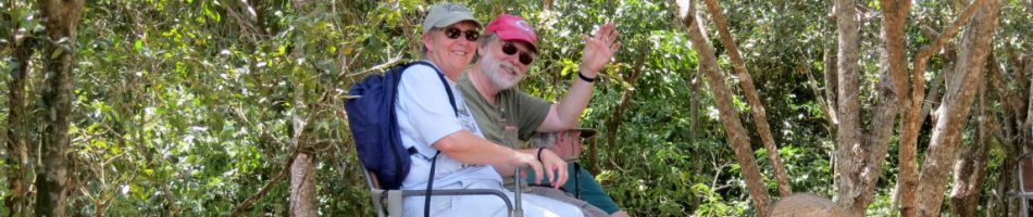
So the day ended on what turned out to be much better than the ordinary sea day we had been expecting. Apparently having little else to do while visiting Antarctica, two of the ship’s penguins were stationed on either end of the front desk. They had nametags that changed periodically, but during this period one of them had a particularly fine name tag on. We will leave you with a couple of pictures of that.


Antarctica (Day 4) King George & Elephant Islands (2019)
We awoke on February 6 in Admiralty Bay at King George Island, the largest of the South Shetland Islands. It was cold, overcast and hazy.


King George Island is the largest of the South Shetland Islands, sitting about 75 miles north of the Antarctic Peninsula. Discovered in 1820, it was named after British King George III. Today it is claimed by Argentina, Chile & Britain (all suspended by the Antarctic Treaty). It is host to the annual Antarctic marathon. We also visited here briefly in 2012 before the captain hightailed it north to avoid a storm, and the weather then was much worse:
https://baderjournal.com/2012/02/09/antarctica-day-3-king-georges-island/


Ten countries have science stations on King George Island, four of which are in Admiralty Bay. We think we saw all of them, but are not 100% sure that all the pictures here are correctly identified. But they probably are.
The first one we encountered was Arctowski Station, operated by Poland. When we passed this station in the fog in 2012 the name of the station was painted in big letters on the side of a building, but we didn’t see that this time. Established in 1977, it is named for Henryk Arctowski, a Polish scientist who was a member of the first expedition to winter over in Antarctica in 1897. It houses some 40 people and the area around it is full of wildlife and whalebones left over from the whaling operations that were here at one time. The base welcomes visitors and maintains a tourist information center where you can purchase souvenirs. Of course, we couldn’t go ashore so no souvenirs for us.


")


Comandante Ferraz Antarctic Station is operated by Brazil. It was first opened in 1984 on the site of an earlier British outpost. But in 2012 most of it burned down in a fire that started with an explosion in the building housing the electricity generators. Two people were killed in the fire and the Brazilians carted away what remained of the base. They have been rebuilding the station, larger than before, ever since. It was scheduled to become operational in 2018 and perhaps it did, but the pictures below show that quite a lot of construction activity is still going on. It is now powered, at least in part, by an array of windmills installed a little way up the hill from the station. Nearby is a graveyard with five crosses, most of which contain the remains of British citizens associated with the old British station that was once here.


Near the station is a skeleton of a Blue Whale. We have read that it was pieced together by a Jacques Cousteau expedition, but aren’t sure about that. Also nearby some Gentoo penguins were hanging around.


We passed two other bases. Peru operates the small Machu Picchu Base, established in 1989. The United States maintains the tiny Captain Pieter J. Lenie Base, situated on Copacabana beach about a mile from Arctowski. It is open only in summer and is devoted to monitoring penguin populations.


We finished sailing around Admiralty Bay before heading out to sea.


About six hours later we caught sight of Elephant Island in the distance. It was originally named by seal hunters in the 1820’s who saw a lot of elephant seals on the island. But today the island’s name is also thought to refer to its shape, which looks a lot like the head of an elephant (with big ears to the west and a long trunk to the east). We think these pictures are all Elephant Island from a distance.


But before reaching Elephant Island we encountered another mile long iceberg. If you look closely at the first picture of the iceberg as we approached from a distance you can make out four extensions on the other side enclosing three bays. Our route to the big iceberg took us through a field of floating ice with a perfectly defined border, all ice on one side and none on the other.


We sailed around to the other side of the iceberg for a close look at the three bays. Pretty impressive; you could definitely sail a pretty good sized boat into those. One of the ship’s penguins was captaining the ship in the window of the bridge one level above us and another of them was assisting in another window. This iceberg may have been anchored on the bottom, as it was taller than the ship and must have extended down quite a way. One of the dining room staff told us he remembered seeing it the last time he was here, three or four years ago. Notably, the pictures here do not really convey how BIG this iceberg was in person.


There was wildlife near the iceberg (not just stuffed penguins). We saw skuas, pintado petrels, southern giant petrels and what we think was a wandering albatross. There were also a few whales nearby and another large iceberg, but nowhere near as big as the one we had just passed.

")


And so in late afternoon we headed toward Elephant Island. This is where Ernest Shackleton finally found refuge after a harrowing winter spent on floating ice after their ship was crushed. They made the long journey across treacherous Antarctic seas in three of the ship’s lifeboats. The island looks pretty forbidding from the sea.


Shackleton’s party first made land at Cape Valentine, at the tip of the elephant’s trunk. As you can see below, this wasn’t much of a place to set up camp, with little land and mostly rocks jutting out from a mountain. But at least they were on land, after surviving more than a year floating on the seas. Dusk was beginning to fall as we reached this point and the air was pretty hazy.


So Shackleton sent his second in command, Frank Wild, to look for a better place. He found one about seven miles further up the elephant’s trunk at a spot now called Point Wild. There was enough of a land shelf here in front of a mountain to set up camp. Most of the crew, 22 men, spent almost five months on this spot, eating seals and penguins and waiting for Shackleton to return to rescue them . . . if he survived the almost impossible 800 mile journey to South Georgia Island in one of the lifeboats, the James Caird. They made a shelter by overturning the other two lifeboats supplemented with tent canvas. They had no idea whether Shackleton had survived the trip or whether anyone in the world knew they were there until on August 30, 1916 they spotted the Chilean Navy boat Yelcho approaching. This was Shackleton’s fourth try at a rescue, the first three failing because of impassible ice or engine trouble. Amazingly, Shackleton’s entire crew survived the entire ordeal.
By the time we reached Point Wild the sun was setting and the skies were hazy. It would be hazardous for a ship Prinsendam’s size to get too close to this rocky shore and really we could hardly see much when we were there. But happily the pictures turned out a little better so you can see Point Wild in them. We have read that the beach has mostly eroded away during the last 100 years, but the rocky outcropping is clearly visible in front of the huge glacier behind. In 1987 the Chileans erected a bronze bust on the rocks of Luis Pardo Villalon, the captain of the Yelcho which finally rescued the men. This is a breeding area for chinstrap penguins and the small white objects you can see around the sculpture are them. The beach, we think, is behind the rocks to the right of the bust.

")
")
")
So that’s it for our four day Antarctica adventure, although we still have South Georgia Island to go. So we will leave you with the traditional towel animals on our bed and a beautiful sculpted watermelon in the Lido.


Antarctica (Day 3) Antarctic Sound (2019)
The morning of February 5 found us in the Antarctic Sound, at the northeast corner of the Antarctic Peninsula.


The Antarctic Sound is not, as one might expect, named after the continent. Instead, it is named after the ship that transported the 1902 Swedish Antarctic expedition here. The six scientists were to winter over on Snow Hill Island, then the Antarctic would pick them up again in the summer. But the ship was prevented by floating ice from reaching the island the next summer. The ship was locked in by the ice, which eventually crushed its hull. The Antarctic crew was able to reach Paulet Island, where they spent the next winter, surviving by eating about a thousand penguins. The original group had no idea what had happened or why the ship failed to return, and had no option but to spend another winter on Snow Hill Island. The next Spring the two groups met by chance while exploring in Hope Sound. An Argentine ship was sent to find them when the Antarctic failed to return. We heard a slide lecture about this expedition while we were here; quite harrowing and the series of unlikely coincidences that led to the rescue would sound entirely implausible if set out in a novel. But it was real & the stone huts in which the groups wintered are still there, although we didn’t see them.
As we entered Hope Bay we passed a large Argentine science station.

Base Esperanza (“Hope”) was built in 1953 on a spot that had housed a naval post since 1930. Some 55 people live here year round (out of a capacity of 100) . What is unusual is that it is set up as a village, with about 10 families including children. This was part of Argentina’s effort to establish sovereignty over the Antarctic Peninsula (Chile has a similar settlement in Antarctica for the same reason). In 1978 the wife of the station’s leader was flown here when seven months pregnant to record the first birth in Antarctica, Emilio Marcos de Palma, and over the next few years there were seven more births. The community has a regular school, a radio station, an infirmary, a chapel, and a scout troop. There is a stone hut nearby where three of the Swedish expedition spent the winter of 1903, living on seal meat, but we didn’t see it.

 near the garage")
 a fuel depot")


The base also has a bust of General San Martin, the liberator of Argentina.
 .
.
You probably notice a lot of penguins hanging about in these pictures. In fact, Esperanza Base was built in the middle of a large penguin rookery, so the penguins have a pre-existing claim to the space. Hope Bay is actually quite full of penguins, more than 200,000 according to what we have read (down about 17% over the last 25 years). They were everywhere, inside the base and out. Most of the penguins in this area seem to be Adelies. Given how bad penguin habitats smell, living in this settlement must take some getting used to!


In addition to the penguins, seals were lounging on the ice. We think they were mostly Weddell seals, but who knows for sure.


Apart from the wildlife, Hope Bay was full of icy scenery.


Leaving Hope Bay we passed Esperanza Base again. Yep, the penguins were still there, standing around waiting for something to happen.


 up")


As we headed out of the bay we spotted penguins in the water and Giant Petrels in flight.


The Antarctic Sound has a lot of floating ice, including large flat icebergs that have broken off from the Larsen ice shelf in the Weddell Sea. These are called tabular icebergs because they are flat like tables. Some are so big they run aground in the Sound, where the can sit for years until worn away by sea and wind forces.


You may wonder how the ship manages to navigate safely among the icebergs. Throughout the Antarctic portion of our voyage there was an experienced ice pilot on board to guide the way. During a Q & A following the Antarctic portion of the cruise he was asked just what his role was on the bridge. He said “I sit there and I say ‘See that iceberg over there? Don’t hit it.’” We are pretty sure he does a good deal more than that.
We approached pretty near that large tabular iceberg you saw above. We were told that it was about a mile long, and it was taller than the ship. That means it reaches pretty far down under the water, perhaps far enough that it was anchored in place on the bottom.


As the ship held its position by the iceberg a small boat was sent out with the ship’s photographer and some members of the Antarctic expedition team. Their mission was to take pictures of the ship next to the iceberg. At about the same time Rick went down to the platform in the very front of the ship to take in the view from that location.


")
")
After the photographs of the ship were done, the folks on the boat didn’t want to come right back. They spent some time at a nearby iceberg photographing penguins (who wouldn’t want to do that?).


While he was on the bow Rick took some pictures back toward the ship.
")
. Yes, they are behind a floodlight on the right side of the ship picture above.")


You might have thought we were done with wildlife for the day, but you would be wrong. Still lots of penguins out on the ice. We were told last time we were here that penguins out on the ice probably means there are Orcas or leopard seals in the water hunting. We didn’t see any of those, but that doesn’t necessarily mean they weren’t there. We did see some penguins diving into the water from the ice, so maybe that wasn’t the case this time. You can tell when a penguin is about to dive because it first bends its neck far forward.


We also saw some penguins sharing an iceberg with a seal.


Birds — including Cape or Pintado (painted) petrels, giant petrels and what we think were Antarctic shags (cormorants) – were flying around the ship and hunting low over the water. We also saw some whales, although not nearly as many as we had seen on previous days. On grand voyages (ie. these long ones), HAL leaves presents on your bed on many of the gala nights. One that came in particularly handy was a set of matching grey gloves, scarf,, stocking hat and blanket. You can see Rick below sporting the hat, scarf & gloves in the cold & windy weather.


")
Our adventurous Captain wanted to take us through the Sound into the Weddell Sea. That would have been pretty cool, but it was not to be. I mentioned earlier that the Antarctic Sound is often crowded with floating ice. As we neared the end toward the Weddell Sea, the Captain & the ice pilot concluded that we might well be able to get through into the Weddell Sea, but that we might not be able to get back again through the gathering ice. So we turned around and headed back north as clouds began to close in and the sun fell toward the sea. So all that is left to show you for this day is some more of Antarctica’s never ending seascapes.


