Ushuaia, Argentina (2019)
Starting the new month in a new country, we woke up February 1 docked in:
Ushuaia is the southernmost city in the world (Puerto Williams, Chile, which sits nearby across the Beagle Channel, is further south but has fewer than 3,000 people). It sits on the southern coast of Isla Grande, the largest island of the Tierra del Fuego archipelago and of South America. Officially founded in 1884, a little more than a decade after the first missionaries arrived, Ushuaia today is a small city of 60 to 80,000 people (depending on the source) in a spectacular setting surrounded by the imposing Martial mountains and the Beagle channel.


Although indigenous people had lived in the area for some 10,000 years, Tierra del Fuego was discovered for Europeans by Fernando Magellan in 1520 during his global circumnavigation. Seeing smoke from so many fires maintained by the locals in this cold area, Magellan called this Tierra del Humo (Land of Smoke). It was the king of Spain who (correctly) concluded that Tierra del Fuego (Land of Fire) would be more evocative.
When we were here in 2012 the water conditions were bad enough that the harbor master would not let us dock or tender, even though we were almost close enough to the pier to swim:
https://baderjournal.com/2012/02/06/ushuaia-argentina-the-beagle-channel/
This time the weather was a whole lot nicer, though still pretty cold & very windy. The worst part was walking down the long pier to shore, during which it felt like you might just be blown into the water. One of our cabin stewards told us he intended to go ashore, but turned back when he encountered the cold wind on the pier, which was nothing like he was used to at home in Indonesia. We were booked on a private tour to Tierra del Fuego National Park during the morning, so we had to be up and off the ship pretty early in the morning.


Our guide drove our small group in a van to Ensenada Bay in the Park. Our first stop was at the Post Office At The End Of The World, the southernmost post office in the Americas (there is one further south at Port Lockroy in Antarctica). It is a corrugated metal shed that looks like a shipping container with a slanted roof, sitting on top of a stilted wooden pier that extends into the bay. The walls are covered with stickers, pictures and advertisements, and there is a wood stove near the door to provide warmth in this frigid environment. As you might expect from such a remote yet popular tourist attraction, the prices in this tiny post office are usurious: $5.00 US to buy and send a postcard to the United States! It is in a beautiful spot though.


Our first hike was along the shore of Ensenada Bay, then up into a forest. The sea views were very nice, including some windblown trees known as “flag trees” because they extend in only one direction.

 & the group look out on the shore")


")

The forest in this area is primarily populated with Lenga beech trees, but there are other species as well. Our guide told us quite a bit about the flora and fauna, but unfortunately too much time has passed for us to remember much of it. We saw a beautiful bird that we think is a Chimango Caracara.


Some of these trees had what looked like tumors around the trunks. It seems that this is Pan de Indio (Indian Bread), a fungus that was an important part of the diet of the Yamana people who lived here before the Europeans came. Apparently bright orange globes of fungus grow out from it, but not while we were there. It is still used in salads and to make jam.


One of the most interesting things in this forest was the wide variety of lovely lichens, often several kinds growing together. The only one whose name we know is “Old Man’s Beard” (Usnea), the fuzzy one that looks a little like Spanish Moss.


And of course there were some woodland flowers too.


We drove in the van to Roca Lake, then walked along the Lapataia River. The lake is large with a mountainous backdrop.


As we set out on our walk (toward the left in the pictures above) we came upon a group of Upland Geese. The darker females were too busy eating to pay any attention to us, but the white headed male kept a wary eye on us the whole time we were nearby.


As we walked along the river there was much flora, including a variety of mistletoe hanging from the tree tops. On our right was the lush marshy river and on our left was a fairly dense lenga forest.


")
The river walk took us to the Alakush lodge, which had a small buffet restaurant where we could eat (but didn’t). It also had a small museum discussing the history and ecosystem of the area, but it was all in Spanish so we mostly just looked at the pictures. A statue of a penguin stood in the hall just outside the large gift shop.


Outside in and near the river was quite a bit of fauna. We saw black necked swans, a Southern (or crested) caracara and ducks that may be pintails that are known to live around here.


We drove from there to a place called the Green Lagoon, which had a nice wooden overlook of the lagoon with a beaver house in the middle. It also afforded a spectacular view of the mountains in the distance, which we think is the Cordilla Darwin.


")

We continued on to Lapataia bay, where there is a wooden walkway out to the scenic water front. We stopped at an overlook, then walked down to the sign marking the end of the Pan American Highway, the other end of which is in Prudhoe Bay, Alaska, some 19,000 miles away. We saw the bridge where it crosses the Panama Canal, but further south in Panama is the Darien Gap, where a rainforest breaks the highway’s continuity. People routinely have their pictures taken with the sign & we were no exception.


We walked across the wooden walkway that protects the environment from tourists’ feet to the dock. From there we could see a family of Steamer Ducks in the water and a group of Upland Geese on the land.


We walked back along the wooden pathway to re-board the van, in a spot where there was a stunning view of the distant snowy peaks.


At the end of World War II the economy of Tierra del Fuego was in a slump. “I have a great idea” someone said to the Argentine Navy Secretary, “lets get some beavers down here & we can start a fur industry!” We don’t know whether the conversation actually went like that, but we do know that in 1946 the Navy Secretary imported 20 beavers from Manitoba, Canada, and released them into the wild for just this purpose. It turned out to be a really bad plan, however. The fur industry never developed but the beavers did and today there are a couple of hundred thousand of them busily destroying the old growth lenga trees in this area. The population became uncontrolled because the alien beavers have no natural predators down here. They are destroying trees by gnawing them down to build dams (as anyone could have predicted they would). Unlike their favorite trees in Canada, the lenga trees do not regenerate after being cut, and the dams built by the beavers have flooded large areas filled with lengas that cannot live in a watery location. So the beavers have changed the ecosystem of some 15% of Tierra del Fuego so far, the largest alteration here since the last ice age.
We visited a site typical of the beavers’ work. There is nothing here but whitened tree stumps and branches, really an image of devastation. Argentina and Chile have recently begun a program to control and hopefully reduce the beaver population, but most experts seem to think that eliminating them is not really possible. An object lesson that a lot of thought is needed about possible consequences before introducing an alien species into a new environment.


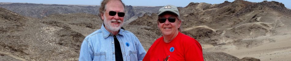
Leaving the park we returned to the ship, stopping on the way to take the picture at the beginning of this episode. We changed our clothes & spent the afternoon exploring the city. Walking up the two steep blocks to San Martin street, the main commercial thoroughfare, we turned left & found the Iglesia Nuestra Senora de la Merced (Our Lady Of Mercy Church). Billed as the southernmost Catholic church on the planet, this simple but brightly painted church was built in 1898 by convicts from the prison (Ushuaia began as a prison colony & the prison was in operation until 1947). The bell tower was added during a restoration in the 1940’s.


We walked a good way further out this commercial street, full of shops & restaurants, to find the public library, the Biblioteca Popular Sarmiento de Ushuaia. Brightly painted on the outside, it is open and airy inside.


As we walked back toward the city center we passed some colorful flowers, then stopped for a late lunch at a place called Tante Sara’s. We had huge and delicious Argentine steak sandwiches (we should have shared one) along with Beagle Beer from (you should have guessed it by now) the southernmost brewery in the world. As we sat by a large street window watching the action on the boulevard, a tall fellow came along wearing a penguin suit. When he saw Rick’s camera he stopped an posed for a picture. You just never know what you are going to see!


Quite a few birds were flying and swimming around the ship when we returned., including cormorants, kelp gulls and (probably) sooty shearwaters.


From the ship we could see the red and yellow church, the old government building (now a museum) and the current government building behind it. Off to the right we could see the old prison, shaped like the spokes of a half wheel and sitting behind some more conventional red roofed buildings. Beginning in the 1890’s Ushuaia served as a penal colony, modeled on the British one in Tasmania & the French one on Devil’s Island. Situated this far from civilization in a forbidding environment, escape was unlikely (only two prisoners managed it, and then for only a few weeks). The convicts actually built the prison, which opened in 1902 and was closed in 1947 by Juan Peron. Today it houses the Maritime Museum.

 & the current seat of the provincial government in the middle")

As we sailed away heading South away from South America, we had a nice view of Ushuaia in its storybook setting.


Loving your photography!
April 22, 2019 at 5:58 pm
Great photos!
April 22, 2019 at 10:02 pm
Thanks guys, I’m glad you enjoyed them.
April 22, 2019 at 10:14 pm
I am still waiting for my $5.00 post card
April 22, 2019 at 11:59 pm