
Ishigaki, Japan (2024)
Ishigaki is situated at the far southwest of Japan, far away from the main home islands. It is one of the largest of the Yaeyama islands and is known for being a great place for a beach vacation and we agree that it is a green and lovely island. In a country having multiple cities with tens of millions in population, Ishigaki’s population of about 48,000 wouldn’t fill up an average neighborhood in a city like Tokyo. We spent the day here on February 23. While the entire island is classified as a single city of Ishigaki within Okinawa Prefect (like a state or province), the most populated area near the port is a fairly drab and boxy looking city, with some brightly colored (but still boxy) buildings.


This was the first time we had set foot in Japan and, since there wasn’t much to see near the port, we booked an excursion that would take us around the island. As we exited the ship there were local dancers in traditional Okinawa dress performing in front of a sign saying “Welcome to Ishigaki.”

Our first stop on the excursion was Yaeyama Village, a collection of old traditional houses moved here from around the island. We are told that sometimes there is traditional dancing and other activities but we didn’t see any of that (there is also a restaurant and, of course, a souvenir shop). We have seen similar collections of traditional buildings in Indonesia and Tanzania, and they are interesting but not too exciting. We think we have these pictures all correctly labeled, but are not certain.
The Makishi residence was originally built in 1923 and represents traditional red tile Yaeyama architecture. It was constructed using a method of interlocking wood that involved no nails. The Morita residence is a typical house of the Yaeyama samurai class. It was built in 1909.


The Kishaba residence was originally built in 1923. This house is said to have an atypical floor plan. The Ohama residence was built in 1907 and (if we remember correctly) had a Shisa sculpture outside the entrance. Unfortunately our only picture here was of a beautiful wall built mostly of curved red roof tiles.

 kept outside buildings in Okinawa & Ishigaki to ward off bad spirits and welcome good ones")


We also saw a typical fisherman’s house, with a stuffed turtle inside. Probably built originally before 1900. Nearby was a Sabani, or traditional fishing boat. They could reputedly reach 10 knots in speed; some were made of a hollowed out log while this one is made of boards. Some are still in use today, fitted with small motors.


The grounds around the houses were lush with plants, from flowers to palm trees.


The village has an enclosed area where about 60 spider monkeys live. They were brought here from their native Bolivia where the climate is similar. They have opposable thumbs on their feet, are yellow with dark gray faces and can be very aggressive, climbing up people’s legs to reach into their pockets. There is a sign disclaiming liability for anything taken by the monkeys. To see them you have to enter through a double enclosure. This was undoubtedly the highlight of the visit to the village.


There is a viewing tower at one edge of the village called Amparu Lookout, which enables you to see as far as Nagura bay, in which are Taketomi Island and Kohama Island.


As we left the compound there were two more things of note. First, there were two more Shisa outside the main entrance. Second there was a young tree covered in pink blossoms, which our guide said were cherry blossoms. Possibly, but we looked it up later and the cherry blossom season in Ishigaki ended about 10 days before we arrived. It turns out that without some knowledge and a close inspection of a blossom it is very hard to tell a cherry blossom from a plum blossom from a peach blossom. So, since the cherry season had ended, these could be plum or peach blossoms. But we prefer to think of them as late cherries, just as the guide said they were.


 blossoms")
Our next stop was Kabira Bay. This is a very beautiful, much heralded place to visit.

Kabira has a perfect beach, with powdery white sand and extremely clear water gently lapping ashore. But swimming is forbidden here because black pearls are cultivated in the water. You can see the floats at the tops of the ropes on which the oysters live.


We had a ride in one of the glass bottom boats stationed here. It moved steadily over a relatively shallow area that was not far down from the glass bottom so we could see coral, giant clams, some fish and a couple of water snakes. Interesting but difficult to capture in a photo, particularly with lights reflecting from the glass. The glass window was in the center of the floor of the boat and we all sat around the periphery looking down.


")


")
Not far from the beach is a tiny temple to the Buddhist deity Kannon. When it was built in the 17th century Kabira Bay was one of the main ports in Okinawa. The legend says that a small boy was ashore when his ship left without him. He prayed for it to return and a north wind developed that forced the ship back to the bay, where he was able to reboard. He grew up to be a monk, returned here and built the Kabira Kannon Temple. The grounds also contained a lot of flowers and other flora.


Our last visit was to the Ishigaki Stalactite Cave, To visit you walk down a long staircase and follow a path about 600 yards long through the cave (which is actually about 2 miles long in its entirety). The cave is dramatically lighted and makes for an interesting walk. This was once the sea floor and there are fossils from that time in the cave. The cave has developed over some 200,000 years, with the stalactites growing about a millimeter every three years.


We drove back to the ship, passing a variety of local buildings and even some unusual flowers. Again, the buildings are mostly kind of drab and boxy, but there was some occasional color.


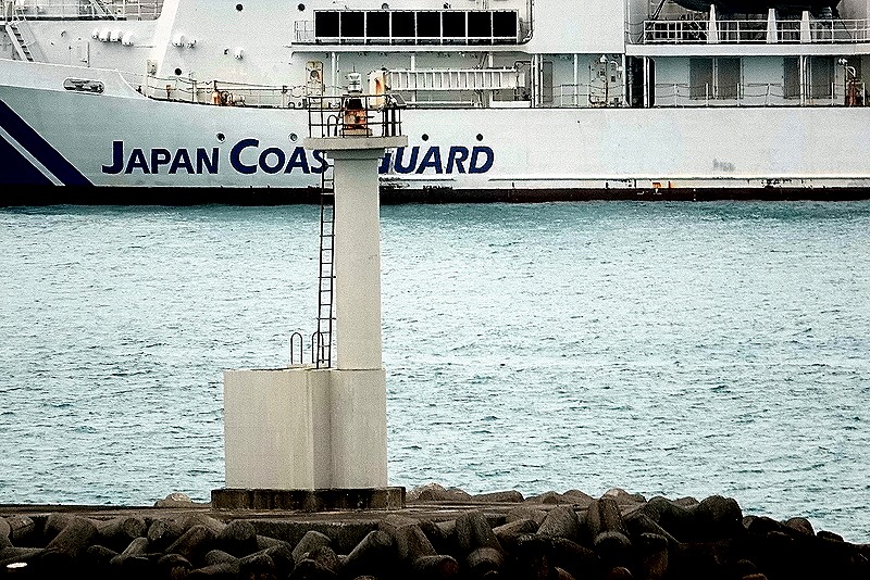
We set sail from Ishigaki around 5:00 PM, passing some white lighthouses on the way out. To be honest, this was a relatively minor stop, but still interesting. And we still had most of Japan yet to go!


Saipan, Northern Marianas (USA) (2024)
We reached Saipan, another important World War II battleground, on the morning of February 19. A welcoming dance troop was performing on the dock below our veranda.


With a population of just over 43,000, Saipan is the largest island of the Northern Marianas, a commonwealth associated with the United States. Its inhabitants are US citizens. This island is smaller than Guam, both in population and in area.
Japan obtained control of Saipan as part of the treaty ending World War I. By the time World War II began most of the inhabitants were Japanese settlers. The Japanese fortified the island and stationed some 30,000 troops here. During the war Japan considered the neighboring islands of Saipan, Guam and Tinian to be essential components of its inner defense perimeter.
During the 1940’s the Americans developed the B-29 bomber, a plane that could fly much further, faster and higher than the bombers then in use in Europe. This made the three islands into important targets for the military because building B-29 airfields there would put the Japanese home islands within reach for bombing missions. A week after the D-Day landings in France the Americans began their campaign to capture these three islands.
Within a few weeks in July and August, 1944, the Americans were in control of these islands and engaged in building airfields with runways long enough to accommodate the B-29’s. Losses were heavy during the battle, with most of the Japanese troops and many Japanese civilians dead and the rest in prison camps and thousands of Americans lost as well. Several hundred B-29’s conducted continuous raids on Japan after that, including conventional and incendiary bombing as well as ultimately the nuclear attacks on Hiroshima and Nagasaki. One of those B-29’s was piloted by Rick’s uncle, Morton Bader, although we do not know which of these islands he was stationed on. We have read that some in the Japanese military hierarchy concluded at the time that the loss of Saipan was the death knell for Japan’s war effort. This campaign has sometimes been called the D-Day of the Pacific.
The Zuiderdam Captain told us that we were lucky not to have missed this port. Apparently the dock in Saipan is notoriously difficult to navigate to, especially when wind and waves are up as they were when we arrived. He said on any previous trip he would have bypassed this port in these conditions, but they tried a new technique involving sophisticated computer simulations that convinced him he could make it in safely. We did, and we are glad we did. Here are some pictures of some of the rugged coast we passed on the way in (although the pictures were actually taken in the evening on the way out).


We joined a private excursion here organized by our friend Tina and we were very glad we did. It was led by Walt Goodridge, a knowledgeable and engaging tour guide who was born in Jamaica. As you will see below, Walt provided a really excellent excursion with knowledgeable commentary. If you are going to visit Saipan, you really can’t do any better than Walt (just google him). We were supposed to meet him at the port gate but he was nowhere to be found when we arrived there. He drove up 20 or 30 minutes later and explained that the company with whom he had reserved a van months before had none available when he arrived this morning so he had to scramble to obtain another one. We were impressed (and relieved) that he accomplished that in so short a time.
We drove to our first stop, the American Memorial Park in Garapan, the largest town in Saipan. The park has a memorial with flags flying which is dedicated to the more than 4,000 Americans and islanders who died during the invasion in 1944. There are also a museum telling the story of Saipan’s war experience, an old Japanese concrete bunker and extensive athletic facilities.


 pilot")
Across the street from the park is the hulk of a large and gaudy casino and hotel that was being built by the Chinese. Construction was halted when the pandemic began and the owners have found themselves in worse and worse financial and legal trouble since then, beginning when one of their workers fell off a scaffolding and several more were found to be illegal workers under US law. At this point it appears that the casino project is dead, but it is unclear what will happen to the uncompleted buildings.


We drove on to an area called Red Beach, one of the first landing sites for the American invaders. In two days of fighting on these beaches the US Marines had some 3500 casualties. During the night of June 16 the Japanese attacked with 44 tanks and 1,000 infantry and lost 31 of the tanks in what is considered the first large tank battle in the Pacific. There was a shelter in the park supported with concrete pillars designed to look like Latte Stones, which had been used centuries ago in Saipan as well as in Guam. Off shore we could see a couple of American patrol ships. Walt said they patrol these waters 24 hours a day and that they have been told if you ever look out there and don’t see them, head for the hills.


Nearby is a sort of memorial, comprised of an old Japanese pillbox, complete with bullet holes, that housed machine gunners defending the beach. On top is a small Japanese tank, very much the worse for wear. And off shore in this area we could see the tops of two amphibious Sherman tanks that never made it to shore during the invasion. Some scuba divers were using one of them as a tether for their boat.


We walked up the beach a little way, passing some traditional open, thatched roof buildings. In one of them was a large outrigger canoe under construction. This was part of a project to create traditional craft and revive the art of Pacific celestial navigation that for hundreds of years had enabled Polynesians and Micronesians to travel between distant islands. The building is called a boat house & itself took months to build using traditional techniques. One of Walt’s assistants, who had been a participant in the project, spoke to us about the canoe under construction and the project.
Afterwards we drove to the home of Lino Olopai, a Carolinian elder who was an accomplished traditional navigator. He used the stars, wave movements and sea animal and bird movements to sail canoes between Saipan and Guam and beyond. The Carolinians are a separate ethnic group that came here from the Caroline Islands during the 200+ years of Spanish control. The Spanish had moved to Guam the small number of Chamorros who survived the conflict and diseases brought to Saipan by Spanish settlers. While the Chamorros were kept in Guam the Carolinians arrived and settled on Saipan. There has been some level of hostility between these groups ever since. Lino’s niece (we think) was one of Walt’s assistants and he spoke to us about his navigation experiences and techniques. Very articulate and interesting.


")

![]()

![]()

Enola Gay, the B-29 that carried the first atomic bomb to Hiroshima, left from the neighboring island of Tinian less than five miles from Saipan. We drove to a beach behind what looked like a hotel or club that we think was called Yellow Beach in 1944. Yellow Beach was another of the first places the Americans landed on June 15, 1944, but we were here mainly to get a look at Tinian, visible across the Saipan Channel. Tinian is mostly flat and almost the entire island was converted into the largest air field of World War II.

![]()

We stopped for a lunch/snack at Herman’s Modern Bakery, a local favorite and historical site in itself. It seems that in late 1944 the US Navy recruited a baker named Herman Guerrero to begin baking bread for the populace with financial and supply support from the US. He gave bread to many people in the area and later converted to a business subsidized by the US, selling bread for 5 cents a loaf. The business thrived and this fall will celebrate its 80th anniversary. Herman Guerrero, Jr. spoke with us and relayed the bakery’s long history. Oh yes, the food was very good and quick so the excursion could continue promptly.
 walking to the bakery")
 (photo from Walt)")

After lunch we visited two small but striking islands just off the coast of Saipan. Forbidden Island is long and flat, looking like a butte that rose out of the water. At low tide it is connected to the main island by a sandy and rocky (and treacherous) land bridge which is under the water when the tide is in. As you can see in the pictures the tide was mostly out when we visited. We only viewed the island from a lookout point on a cliff above but Walt told us that it has watery caves and that a number of people have been drowned or swept out to sea from there. He says legend has it that those who do not respectfully ask permission from the resident spirits before crossing may be in trouble. He told us that he has brought visitors down to the shore but has never crossed to Forbidden Island with them.


Second was Bird Island, a large roundish rock within swimming distance from the shore of Saipan. It is said that hundreds of birds of various species live there, but we really didn’t see them. Their nests may be in shady indentations in the rock or maybe we were just too far away to make them out.


Once the Americans achieved a foothold on Saipan the defending Japanese really had no chance. The Americans’ control of the sea and the air enabled them to reinforce and resupply their troops as needed, while it prevented the Japanese from doing the same. So they had to make do with the 30,000 troops and the weapons and ammunition that were already there. The Japanese steadily lost ground and their ammunition became depleted, so that they were reduced to fighting mostly with bayonets and sticks. They retreated further and further into the mountains in the north of the island, along with many thousands of Japanese civilians living on Saipan who had been convinced by propaganda to fear the Americans. Many took refuge in caves, which the Marines cleared with grenades and flamethrowers. Because it was impossible to tell from the outside what was inside a cave, many civilians as well as soldiers died in this way (although American soldiers managed to coax a significant number of civilians to surrender).
In the end the Japanese were backed into the northern mountains and had nowhere to go. They had been convinced that it was better to be killed than surrender, and in the end fewer than 1,000 Japanese were captured alive. In the last day or two hundreds of Japanese soldiers hurled themselves to their deaths from two cliffs at the northern point of the island. Several hundred civilians who had been convinced by the military that the Americans were beasts who would abuse and torture them followed suit. We saw horrible film in the museum of Japanese women throwing their infants off of cliffs then following them down. It is unclear how many civilians died this way of their own accord and how many were forced to do so by soldiers, but hundreds of bodies were recovered. (We should add that thousands of Japanese civilians were also captured alive and were repatriated to Japan several years later).
We visited two infamous spots where this occurred, which the Americans called Suicide Cliff and Banzai Cliff. They are within eyesight of each other, Suicide Cliff is a tall mountain cliff that overlooks Banzai Cliff, a sea cliff below it. Today Banzai cliff is lined with monuments to those who died here, most we understand erected by Japanese people. But for its history (a big but), it would be a beautiful spot.


As you can see from the last picture above, Suicide Cliff is very high above Banzai Cliff. From there you can look down not only on Banzai Cliff, but also on the little that remains of a Japanese air field called Marpi Point Field. Actually, the air field was uncompleted when the battle of Saipan ended and the Americans completed building it and used the airfield for some time. Walt gave us a talk about Suicide Cliff when we arrived below at Banzai Cliff. The edge of the mountain cliff has cactus that has been carved with graffiti; it was a disquieting view over the edge to the land far below.

![]()


On our way down the mountain we came upon a big “Saipan” sign. Signs like this seem to be becoming more and more popular in cities with big tourist industries. Most of us (not Mary) got out and posed for a picture in front of the sign, which later appeared in the local newspaper.

![]() The northern mountain region also contains what is called the Last Japanese Command Post. It is a fortified cave built into the wall of a cliff, with old Japanese artillery and tanks arrayed on the ground in front. There was a wooden stairway to reach the cave or you could climb up over a few boulders. We have read that this is where General Saito, the top commander on Saipan, committed suicide after sending an order that all soldiers fight to the death.
The northern mountain region also contains what is called the Last Japanese Command Post. It is a fortified cave built into the wall of a cliff, with old Japanese artillery and tanks arrayed on the ground in front. There was a wooden stairway to reach the cave or you could climb up over a few boulders. We have read that this is where General Saito, the top commander on Saipan, committed suicide after sending an order that all soldiers fight to the death.

 joins the line climbing up to the cave")


You can see in the picture above that there is one finished opening that is a window and one jagged opening that could have been a window but is also an explosive opening. We don’t know how many of each there are, but we were told about one incident that created two holes in the wall when a shell from a US Navy ship made one hole penetrating into the cave, then took a chunk out of a concrete pillar, then made a hole on the other side as it exited the cave, all without exploding. Hard to imagine & it must have been quite a shocking experience for the soldiers inside. We think we remember correctly which hole was which, but be a little skeptical in viewing the labelling of the following pictures.


 Our last visit before returning to the ship was to the old Japanese Jail in Garapan. You will recall that the Japanese were awarded control of Saipan in the treaty ending World War I and governed the island until losing the battle of Saipan in July, 1944. This jail was built in 1929 and was probably used by the police in the usual manner and also occasionally for a few war related prisoners, often for a transitory period. Today it is a ruins, but interesting to visit. There are three buildings: a large cell block (reportedly for men), a short cell block (reportedly for women) and what is probably an administrative building (no bars on the windows). You can walk through the hallway outside the long cell block, which no longer has a roof.
There is a theory that Amelia Earhart was imprisoned here with her navigator, Fred Noonan, after their plane disappeared in 1937. Noonan was supposedly beheaded and Earhart kept in the jail until her death sometime before the American invasion. Walt, our guide, is a strong believer in this theory, having interviewed individuals and descendants of people who claim to have seen her (described as a woman with short hair wearing men’s clothing) in the prison. We think that the cell with two openings below was the one pointed out to us as having housed Earhart (although this cell block was reportedly for men). Shortly before our visit there was a report of a claim of discovery of her plane on the ocean bottom, yet to be confirmed. We don’t know the truth of what happened to Amelia Earhart (really, nobody does for certain), but after this visit it will be interesting to follow any additional evidence that may be discovered about her fate.


As we waited to sail away in the late afternoon there was another dance group, with drummers, performing on the dock below our veranda. All of the dancers were holding paddles and some of them looked like they were young girls. It is always nice to receive a welcome or send off on the dock, and this one was very energetic and entertaining. We sailed away in late afternoon, after a very full and rewarding day.


