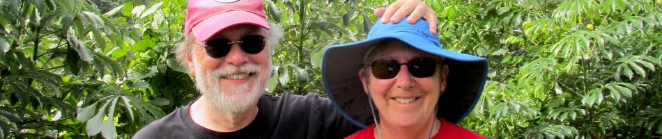
Luderitz & Walvis Bay, Namibia — 2024
Namibia is a fairly large country on the southeast coast of Africa, just north of South Africa. In fact, until it obtained independence in 1990 it was governed by South Africa. From the 1880’s until World War I this area was a German colony called German South West Africa, after which it came under South African control. The driest country in Sub-Sahara Africa, Namibia is largely a desert country, located between the Namib and Kalamari deserts. It is known for its many beautiful sand dunes, some of which come right to the edge of the ocean.
Luderitz
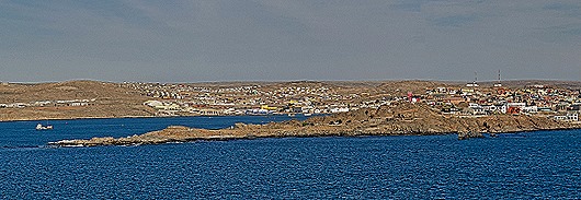
The morning of April 21 found us anchored near the town of Luderitz. Founded in 1883, Luderitz today has a population just over 16,000. Its heyday was from 1909 to World War I when there was a diamond mining boom in the area. There is a heavily German influenced ambiance thanks to its first few decades as part of a German colony. The tender ride into town was not brief, as the tender port is behind the peninsula you can see in the picture below, which is called Shark Island. You can also see in that picture what a bleak desert environment Luderitz sits in.

We were supposed to visit Luderitz on the Grand Africa voyage in 2022, but the weather conditions were bad enough that the Captain skipped this port (Rick was still in Covid quarantine, but because the whole ship missed this port that didn’t make any difference). So this was our first opportunity to visit Luderitz.
The ship’s tender let us off at a long wooden dock near the center of town. There was a view of part of the town from the dock and what looked like a type of seagull was in the water nearby. As we walked through the port we spotted an interesting black bird with a white breast perched on a metal rail above our heads.


The main thing our research indicated we should see here is the Felsenkirche (church on the rocks) which is on the other side of the central town from the tender dock. So we began walking toward it and found that really the best thing about visiting Luderitz is its hundred year old German colonial architecture, heavily influenced by the Art Nouveau style that was popular at that time. Many of these buildings are painted in bright colors. Among other things we passed on our walk through town was a view of the Felsenkirche looming above the Bayview hotel and a bright red restaurant & bar called Barrels. Bismarck Street is one of the oldest streets in town, named for the German chancellor who first established the colony here. On that street was the Deutsche Afrika Bank Building, opened in 1907, in whose vaults the diamond miners kept their diamonds and where the mine workers were paid. The railway station was, as we understand it, built 1914 a few months before the start of World War I to replace a station built in 1904 that became too small during the diamond boom. This was the last building in Namibia built by the Germans and is still in use and shows its original design. It is on the corner of Bismarck Street and Bahnhof Street.


 on the right")
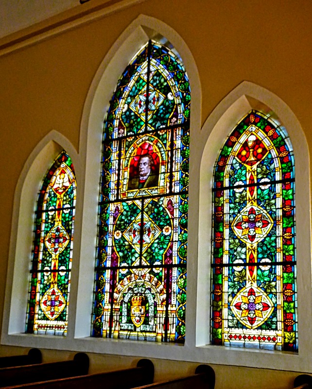
The Evangelical Lutheran Church, the official name of the Felsenkirche, sits on top of the highest hill in Luderitz. It was a very steep walk up a dirt road to the church, past some old colonial houses. Built in Victorian Gothic style, the church opened in 1912.

 approaching the steps to the front entrance")

The church is fairly plain inside but has colorful stained glass windows of a quality you don’t expect in a small desert town. They were all imported from Germany, some contributed by the German Kaiser. One has a portrait of Martin Luther incorporated into its design. When asked who it was, the information person in the church said it was the German Martin Luther. We assumed he was distinguishing it from the American Martin Luther King, but it would have been hard to make that mistake from this picture.
")


We walked around behind the church and were rewarded with a panoramic view of the bay and the modern Nest Hotel at the bottom of the hill on the water. From the front of the church was a panoramic view of Luderitz. We walked down the hill to start heading back to the tender port.


Our walk back to the tender port took us, of course, past more interesting old buildings. Berg Street is topped by the red and blue Haus Grunwald, built in 1910 for Luderitz’s first mayor.


We have some views of notable places from the ship that we took later. Two are of the town’s notable churches, one of the Felsenkirche (of course) sitting on its rock hill and another of the Saints Peter & Paul Catholic Church.


We mentioned Shark Island earlier, which protects the tender dock from the ocean. It has a notable history. The Germans conducted a brutal war from 1904 to 1908 to suppress the resistance to colonial rule by the indigenous Herero and Nama people (some call it a genocide, not without reason). From 1905 to 1907 the Germans ran a concentration camp on Shark Island in which several thousand prisoners died.
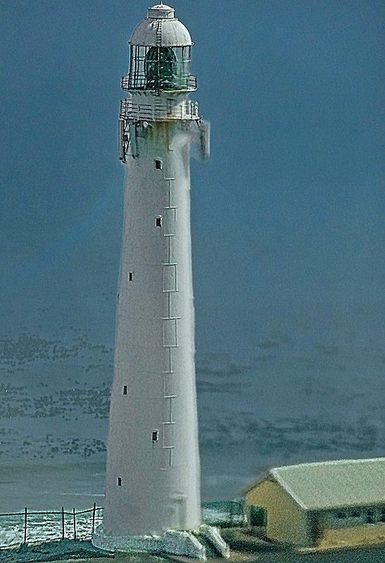
There are two lighthouses here. First is the Shark Island Lighthouse, built in 1903. It was decommissioned and the light was removed in 1910 (today this building can be rented for tourist accommodations). A new light was built very near by, on a steel skeleton tower. In the first picture below the old lighthouse is the bright red building and the newer one can be seen to the left of it rising from a yellow base.
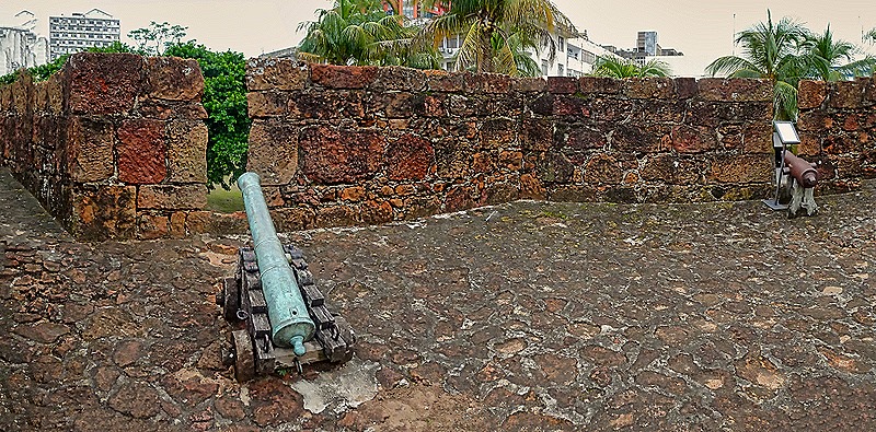
Second is the Diaz Point Lighthouse on the opposite end of the “island.” Built in 1915, the light is 174 feet above sea level and is painted in horizontal white and red stripes. In our previous episode, driving from Cape Town to the Cape of Good Hope, we saw the padrao (cross) erected there by the Portuguese explorer Bartolomeu Dias in 1488. He erected a padrao here as well on July 25, 1488, a little way behind this lighthouse so we can’t see it in the picture. It stood for several centuries before deteriorating enough that it had to be removed to a museum. It was replaced in 1988 (500 years after Dias’s last visit) with a duplicate carefully modeled on contemporaneous pictures of the Dias cross.
 and replacement to its left, with a yellow base.")

So that is Luderitz. We sailed away shortly before dinner time, passing the empty desert land on the shore outside the city.

Walvis Bay
We docked in Walvis Bay the next morning, April 22. There is much of interest to see and do in Walvis Bay, particularly if you like wildlife. During the world cruise in 2018 we had an expedition that took us to the mostly desert interior of this area. https://baderjournal.com/2018/08/24/walvis-bay-namibia/ . And during the Grand Africa voyage in 2022 we had excursions through the bay and down the coast. https://baderjournal.com/2018/08/24/walvis-bay-namibia/ . By the time we reached Namibia on this voyage we were pretty tired of driving excursions, so we decided just to walk to the nearby lagoon where the pink flamingoes hang out, in the company of our friends Robert and Bill.
It was a nice sunny day and the walk was pretty easy. After leaving the port we walked past a large number of vendors with their wares spread out on blankets. Walvis Bay is famous for its many flamingoes and we were not disappointed; they were waiting for us when we arrived. You may notice they are not very pink, but it turns out that the pink color comes from what they eat and doesn’t begin to show up until they are two or three years old.
")


There was also a pelican cavorting on the beach among the seagulls.


 looking at Mary, Bill & Robert and wondering why they are looking the other way")
We walked up along the shore toward the right in the picture above. We passed the Walvis Bay Yacht Club and The Raft, a landmark and restaurant built on stilts over the water.
")


We walked out over the water on a rickety old wooden pier. Looking over the side we saw some impressive orange jellyfish.


We kept walking in the same direction and, after passing an unsettlingly worded sign, came to a small waterfront shop and restaurant complex. It was lunchtime so we sat down at an umbrella table at the water’s edge and ordered a small lunch. This was the Anchor Waterside restaurant, well known in this area. It is famous for its fresh calamari, but that’s not what we ordered (that would never be what we would order). We watched the boats and sea life as we ate, highlighted by a seal swimming around a nearby pier.


")
All of us except Robert had local beer, which was good. We were a little surprised at just how close to the ship our lunch spot turned out to be. After we returned to the ship we found that we could see the restaurant and our table from the veranda in our room! When it came time to pay up the waiter brought a portable credit card reader to our table. It wouldn’t register Robert’s card (which had been giving him trouble), so the waiter held his reader up in the air and waved it back and forth. We all thought this was a joke and laughed, but sure enough the card finally was recognized! Who would have expected that would work?


")

That’s it for Namibia. After this we had four sea days before our next port. We will leave you here with a picture of a towel animal that appeared on our bed during one of those sea days. We aren’t at all sure what animal it is (a pig maybe?).

Cape Town, South Africa (Day 3) — 2024
Surprisingly after our experiences the previous two days, everything went as planned on the morning of April 19. The ship was just where it was supposed to be and everybody showed up at the cruise terminal on time to start our second excursion with Ligia. Yesterday we drove east and today we drove south, heading down to the end of the Cape of Good Hope, a scenic drive with many points of interest along the way.
Our first stop was to be Boulders Beach, home of African Penguins. On our way south we passed mountains and small towns. As we drove through Muizenberg we saw the old post office, a Cape Dutch style building dating (we think) to 1911, which has also served as a magistrate’s court and currently a museum. Muizenberg was the scene of a battle in 1795 that resulted in the first British landing in the Cape. With a population just over 36,000, this is a popular surfing area; Agatha Christie used to surf here back in the day. As we neared Boulders Beach there was a view of the old Simon’s Town waterfront across the waters of False Bay. Established in 1680, Simon’s Town is a popular tourist attraction and home to a large naval base. The old buildings in town are visible just back from the water in our picture below.


Boulder beach is a beautiful spot in Simon’s Town. It has (you probably guessed it) lots of granite boulders. But what it is famous for today is a colony of African penguins. We had to walk a for a bit past many street vendors to reach the entrance, where there is a fee to go in. One penguin was standing on a rock by the fence near the entrance, looking like he was the designated greeter. We entered the site and walked past the information center and gift shop (if you ever want a penguin themed memento, this is the place to come). Then we walked down a wooden stairway toward the beach.


This is one of three penguin colonies in southern Africa. The first penguins showed up here in 1982. From the two mating pairs that were the first arrivals there are now some 3,000 penguins based here. A wooden viewing platform at the end of the lengthy wooden staircase down the hill enables visitors to get pretty close to the penguins, but no one is allowed down onto this beach. We understand that there are other parts of Boulders Beach that are not restricted so people can sometimes get right down among the penguins but we did not see that. The people are restricted here but the penguins are not. The penguins go into the water and are free to swim, and swim away if they like (we understand they do swim away to hunt for food). We did see a couple of people in snorkeling gear among the rocks, but assume they were assessing the conditions to help protect the penguins.
")


The African penguins look almost identical to the Magellanic penguins we had seen several times in the southern part of South America, and they are an endangered species. The beach with the viewing platform is their actual mating area and we were in luck because it was mating season. We saw some chicks and, even better, some pre-chicks (ie. incubating eggs). These penguins dig burrows in the sand to hatch their chicks, in part to protect them from the sun since this area is much warmer than the Antarctic habitat where most penguins live. Males and females take turns incubating their egg, so we aren’t sure whether the penguin with the egg is the mother or father. These penguins generally mate for life.


 a watchful parent")

The most distinguishing feature of these penguins is the naked pink area above their eyes. This helps them regulate body temperature, with more blood coursing through there when it is warm to dissipate body heat and less when it is cold out. When it is hot the pink color intensifies. We have read that the number, size and pattern of spots on their white bellies are unique to each penguin, similarly to human fingerprints. The penguins occupied themselves not only by swimming, but walking around and climbing up and down the sandy hill, singly or in groups, or just standing around doing nothing.
")


")


Meeting up with Ligia again after we left the protected area, we headed further south. We drove through a large area called (we think) the Cape Flats that was mostly scrubland and bushes, with few if any trees. It is scenic, with a few mountains in the distance.


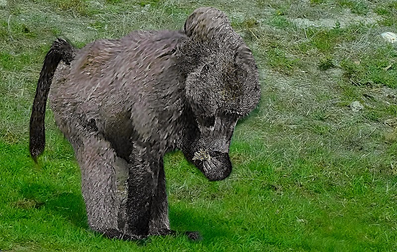
This area is home to several species of wildlife you (or at least we) don’t really see often in the wild. We passed what we assume was a family of ostriches, one male and at least two females, foraging in the bush. They all got together and mooned us. The male is, of course, much bigger and more brightly colored than the females.


We also encountered a baboon foraging by the side of the road. He had no interest in us whatsoever; he must be very used to cars stopping to look at him.

, also eating")

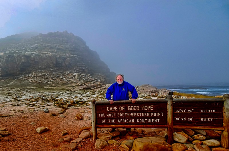
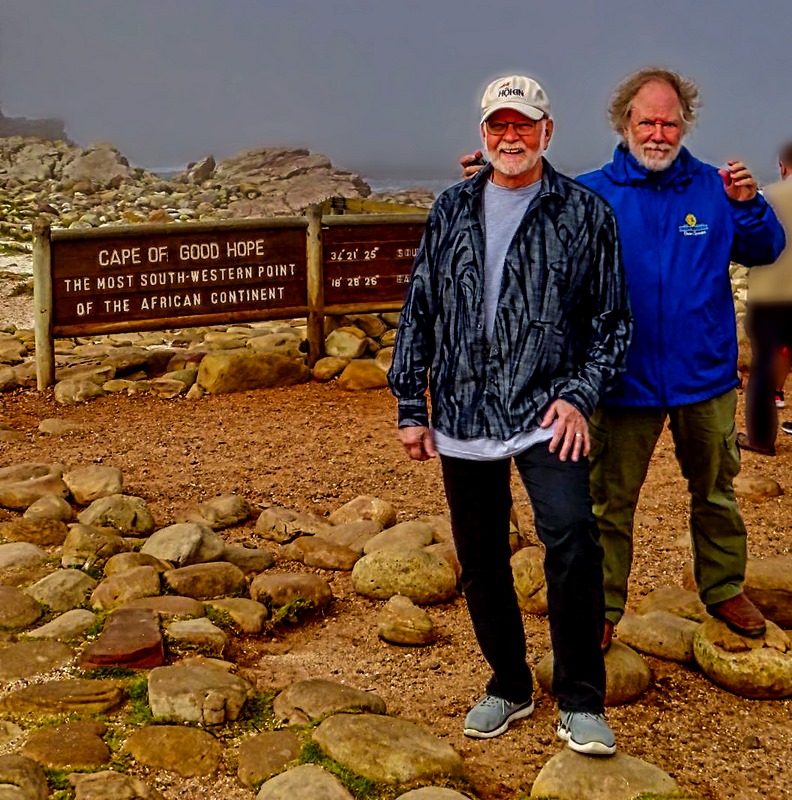
Eventually we reached the official Cape of Good Hope, the end of the Cape Peninsula. Cape Point, the actual tip of the peninsula, is a rocky promontory about a mile and a half away. There is a small lighthouse on top of a large rocky hill that is supposed to have a good view of it, but it was crowded (as it often is) so we didn’t go up there. This spot is the farthest southwest point on the continent of Africa, but it is not the southernmost point, nor is it the place where the Indian and Atlantic oceans meet. Those would both be at Cape Agulhas, which is about 90 miles east of the Cape of Good Hope and extends some 34 miles further south. It was rather chilly and overcast when we reached this area, which is very rocky both on the flat land and in the nearby mountain, and there is a sign giving the exact latitude and longitude.
")
")
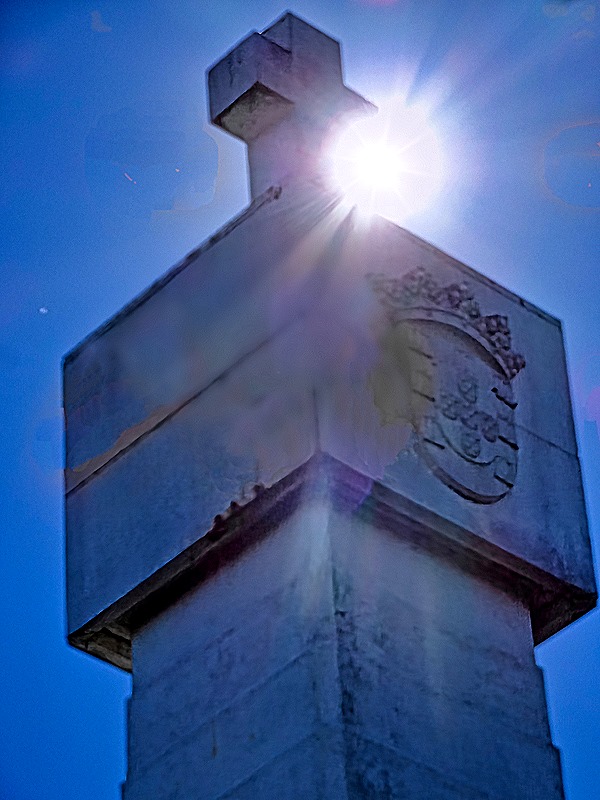
We spent a little time here (the pictures don’t show it, but there were a number of other visitors here), then headed back north. We had come down mostly on the eastern side of the peninsula and we returned along the more scenic west side. Eventually we turned off on a side road that took us to a monument standing alone in the bushlands called the Dias Cross. Bartolomeu Dias was the Portuguese explorer who was the first European to sail this far down the African coast. He reached this spot in March of 1488 and named it the Cape of Storms. The Portuguese king later changed the name to Cape of Good Hope because it gave hope that they would eventually be able to reach India by this route. The Portuguese practice was to erect a “padrao” (a stone cross) on a prominent spot to claim a newly discovered land. Dias erected one here near a rocky point now called Kwaaihoek in 1488. Remnants of it were discovered in 1938 and are now kept at the University of the Witwatersrand in Johannesburg. At some point the Portuguese government erected a monument here to Dias’s expedition. The monument is white with a cross on the top and can be seen on top of a hill from the main road. Around the monument we got a closer view of some of the flowering bushes that are characteristic of this area. Not far away, on a scenic spot overlooking the water near the eastern coast of the peninsula, is a smaller stone cross enclosed in a fence that also commemorates Dias’s voyage, erected by the Portuguese community of Cape Town.


We continued north, passing stark mountainous views. We met a small black pig foraging at the side of the road, perhaps escaped from a local farm. We drove past beaches near Kommetjie, a popular surfing area, and had a view of the Slangkop Lighthouse located there. Dedicated in 1919, it is more than 108 feet tall.


We stopped for lunch in an area called the Farm Village in the town of Noordhoek. The restaurant is called the Foodbarn. Sounds prosaic, but it is run by a chef from France and the food is very good and also creative. Interesting ambience too (notice the wallpaper).


Chapman’s Peak Drive runs about 5.5 miles between Noordhoek and Hout Bay. It is a rather spectacular drive (some say the most beautiful in the world) on a narrow road cut out of a sheer reddish mountain cliff just after World War I. It is a toll road and is said to be safe these days, but it was closed for long periods in the 1990’s and again the 2000’s after several deaths in order to build better safety protections. As you drive along this road there is a sheer mountain cliff going up on one side and a steep drop off toward the water on the other side. Chapman’s Peak is the southern extension of the Constantiaberg, one of the largest mountains in this area.

 from the road")
We and walked a little way down to a viewing platform overlooking Hout Bay. A number of other visitors were there and also some vendors selling interesting local arts and crafts (one of which we purchased). The sun was getting lower in the sky and reflected on the water toward where we stood, which made the view quite special. The closest mountain to the mouth of the bay is called The Sentinel; it is also called Hangberg, as is the town located behind it.


")
We drove back to the wharf where our ship was, miraculously, still docked where we left it. We took some last photos from the top deck of the ship of always photogenic Cape Town under Table Mountain, and of the harbor where a container ship was docked behind us. So after two very full and enriching days (thanks to Bob, Judy & Ligia), we headed back out to sea.


Cape Town, South Africa (Days 1 & 2) (Stellenbosch) — 2024
We were scheduled to arrive in Cape Town just after lunch on April 17, but we had to wait outside the port for an hour or two because it was fogged in. Happily for us, we had no excursions scheduled so we just waited semi-patiently on the ship for the fog to clear so we could dock. This was technically our third visit to Cape Town. In 2018 our ship docked here for a double overnight, but we didn’t arrive from our safari in Kruger National Park until late afternoon on the first day so we actually had only had about a day and a half here:
https://baderjournal.com/2018/08/20/kruger-national-park-day-4-cape-town-south-africa/
https://baderjournal.com/2018/08/22/cape-town-south-africa-days-2-3/
Our second visit was in 2022, and I described it as technical above because we were never able to leave our cabin during this visit because of Covid. All we saw was a bit of the top of Table Mountain through our cabin window.
https://baderjournal.com/2023/03/27/mozambique-south-africa-time-out-2022/
So of all the African reroute stops, we were most looking forward to Cape Town and this stop didn’t disappoint.
")
Day 1
As mentioned above, we were delayed entering the port in Cape Town because of a massive fog bank. When we finally headed into the port we had doubts about being able to see anything today, but once we were in the port the fog cleared and we had a great view of the city. In the past we had always tied up on the eastern end of the long dock but today another ship (a Princess, we think) was already there so we had to proceed a pretty far down the dock.
Because it was late in the day we decided to spend the rest of the afternoon at the Victoria and Alfred Waterfront. Begun in 1654, this was the original port for Cape Town back when the Dutch East India Company first established a reprovisioning station here for their ships heading to Indonesia. It is now named for Queen Victoria and her son Alfred, who visited here in 1860 and applied some of the first stones for a breakwater to enable ships to winter here safely. In the 1930’s the new, larger port where we docked was built on reclaimed land. It was not until the 1980’s that the old Victoria and Alfred Waterfront was developed into a major center for hotels, businesses, entertainment, retail stores and museums.
Today it is a draw for visitors, particularly those docked at the port, for entertainment and (especially) shopping. It is an easy and enjoyable walk from the eastern end of the pier to the V&A, which we did several times in 2018. But since we were docked much further away on our first day this time we boarded a shuttle bus, along with Robert & Bill, to take us there. The V&A has an excellent view of Table Mountain over the water and in 2018 we had lunch at a waterside table with this view. But they have now built a huge yellow frame to view it through, although we think the restaurant tables are still there.

Our main objective in coming here was to shop for African art, mementoes and gifts. There are more than 450 shops here, so plenty to choose from. This is the place, for example, to see and buy wooden masks from all over Africa, painted Ostrich eggs, Zulu beadwork and basketry and much more, in addition to the usual tee shirts, caps and souvenirs. One of the best places is the Watershed, a huge warehouse-like building with many dozens of individual vendors inside selling everything from clothes to arts & crafts to souvenirs. You can spend a lot of time in there.


 walking through sculptures outside a store")
But visiting the V&A is not only about shopping. Throughout the area are local groups performing, in front of stores and in open spaces, singing and/or playing music. They move around so you may encounter a performing group in more than one venue. The performances are usually quite good, featuring African music for the most part. On this visit we saw a capella singing groups and a xylophone group.


")

Day 2
Our friends Judy & Bob had arranged tours for all six of us on both of the full days in Cape Town with a guide they knew named Ligia, who turned out to be excellent. The first day (Day 2 in Cape Town) was to be a wine tasting tour in the area of Stellenbosch. Founded in 1679, this is the second oldest town in South Africa. The name means “Stel’s Bush” (Simon van der Stel, then governor of the Cape Colony, founded the settlement and named it after himself). In 1690 there was an influx of Huguenot refugees (French Protestants fleeing religious persecution in France) who began the wine industry here. Stellenbosch is located about 30 miles from Cape Town and has a population in excess of 75,000.
The day did not begin auspiciously. The previous evening we had been informed that during the night the other ship would be leaving and when we got up in the morning we would already be redocked on the eastern end of the pier in front of the cruise terminal. We had agreed, therefore, to meet in the cruise terminal in the morning. But when we left the ship there was no cruise terminal to be seen. It turned out that we had not moved overnight as advertised but were still docked in the same place as the day before. We had heard no announcement to that effect; we discovered later that a notice had been delivered to our cabin . . . after we had already left the ship.
Bob notified Ligia to pick us up at our old spot instead of the cruise terminal and we waited, expecting Bill & Robert to show up any minute. But they didn’t. After a while Mary asked an officer if he could find out whether they were still in their room and after checking he told us they had left the ship before we had. There was nothing else to do but pile into Ligia’s car and start out, thinking we would probably have to go on without them since we had no way to find out where they were. But we drove past the Cruise Terminal just in case and, lo and behold, there they were walking out the back way toward Victoria and Alfred Waterfront. Apparently since they didn’t see us when they left the ship they decided to go to the Cruise Terminal where we had initially agreed to meet, instead of waiting for us to leave the ship and meeting us there. When we serendipitously spotted them they had given up on meeting up with us and were going to shop at Victoria and Alfred. So our full group of six plus Ligia headed for Stellenbosch, reunited at last.
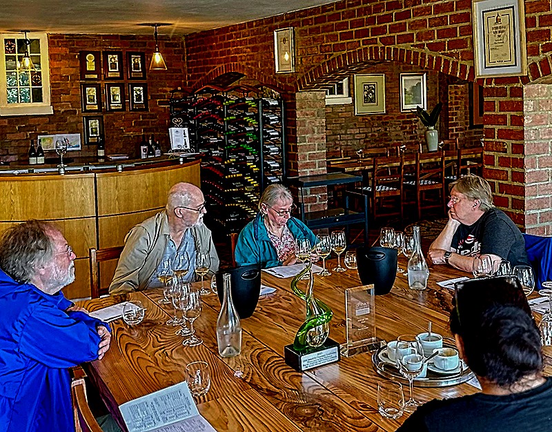
Our first stop was at the Morgenster Estate, which produces olive oil as well as wine, and dates back some 300 years. The tasting room is very nice, clean and modern looking. Presumably because of the relatively early hour, the place was empty but for us. Not far from the entry door was a small olive tree, sporting some ripe looking olives.


")


We were seated around a long wooden table in front of shelves of bottled wines. Our first tasting was olive oil, several varieties in small glasses along with balsamic vinegar and a bowl of delicious bread and olives. Our waiter explained how all of it was made before we dove in. After that we had wine, with the same treatment.


 (photo by Robert)")


It was all really good. In fact, it was good enough that we bought some wine and some olive oil. Behind the desk was a large display of wine barrels that Rick photographed while Mary paid for our purchases, and in another part of the lobby was an interesting glass topped table with a natural wood base and a large pot near the door.
")


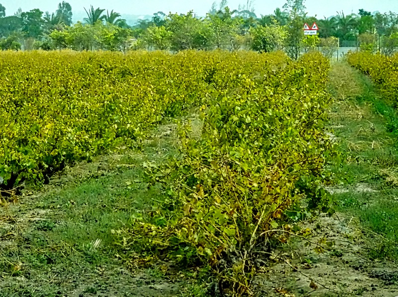
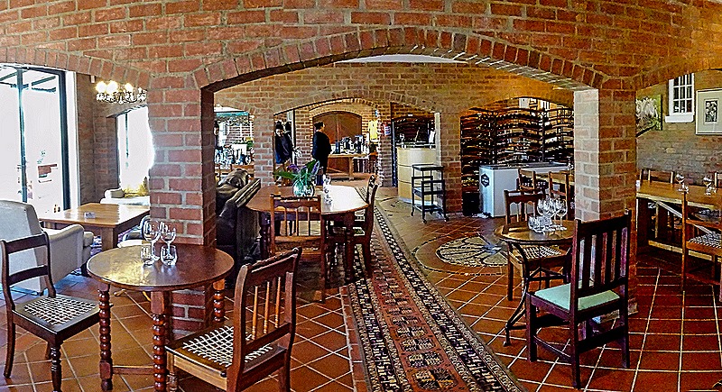
It took about a half hour to reach our second stop, Ken Forrester Vineyards. These vineyards date back to 1689, although Ken Forrester only purchased them in 1993 when they were sold at auction in a derelict state. Today they produce a million bottles of wine each year and are particularly known for award winning Chenin Blanc. They emphasize sustainable farming; they use no pesticides or herbicides and do all their tilling, pruning and harvesting by hand.
The vineyard is located near Helderberg Mountain, of which it has a beautiful view. The tasting room is large with graceful red brick arches and a striking stained glass window at one end. Again we had a good time enjoying the wine and the fine ambience and views of the mountain over the vineyard outside (April is autumn in the Southern Hemisphere, so the leaves of the grape vines were mostly yellow). Near the parking lot was a small whitewashed building with what appeared to be a thatch roof, in the old Cape Dutch style. Unfortunately we don’t know the story behind this building (although there undoubtedly is one).


")
 (photo by Robert)")


It was time for lunch and we drove through the town of Stellenbosch on our way to our lunch spot. We did not have a chance to get out of the car and see some of the town and it was very difficult to get usable pictures from the back seat of a moving car. Rick managed a picture of the 300 year old church, but it was too blurry to be usable. The decent pictures included the Hofmeyer Hall of the Dutch Reformed Church. Named after one of the first two professors at the seminary here, it was built in 1900. The Dutch (or possibly Africaans) words above the columns say this is the Young People’s Christian Association. Another picture is of a green house built in 1923 in the Cape Dutch style (technically, Cape Dutch revival), with a three story addition in the back. As the sign on the fence says, it is for sale. Finally there is a tree shaded house in Cape Dutch style and a sidewalk cafe at an intersection, with people enjoying their lunches.


 tree")
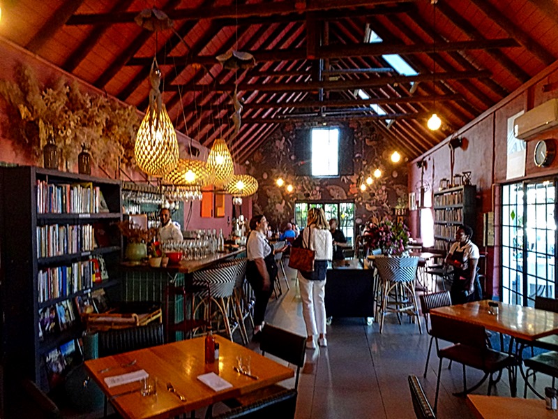
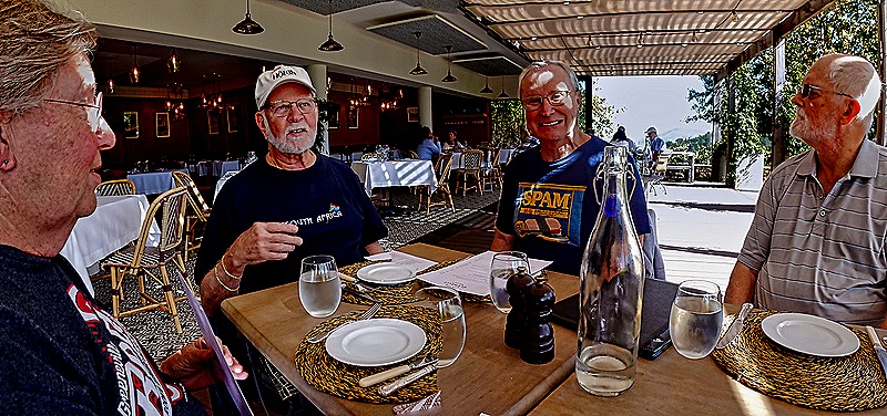
We had lunch at the Vine Bistro at the Glenelly Estate vineyard. This vineyard is owned by a 99 year old French woman who is well known for her wine estate in Bordeaux, France, and we understand that Bordeaux is the featured wine here. However we were here for lunch, not a wine tasting. We were seated on a covered open air patio with a fine view of the mountains beyond the gardens.


The Bistro is run by a French chef and its food was quite delicious on the day we visited. We rarely photograph our food, but this was so nicely presented we couldn’t resist. We can’t recall what these dishes were called, but they were an appetizer and a dessert.

")


While Glenelly is supposed to be in a valley, there was a nice view from here down on what we assume must be Stellenbosch, nestled among trees below the mountains.


Our last visit of the day was to Kanonkop Estate. Kanonkop means Cannon Hill, because in the early years a cannon on a hillock near what is now this estate would be fired whenever a ship approached the Cape Town harbor. This was a signal to local farmers to load up their wagons with vegetables for the ship crew to purchase. Kanonkop has been bottling its own estate wines for 50 years, and if we understood correctly Pinotage wine was first developed here (a cross between Pinot Noir and Hermitage varieties). Pinotage is one of their featured wines today and it was what we were served. After this visit we headed back to the ship, passing one last field of vines with a narrow road winding over a hill.


")

Meanwhile, we had been assured in the morning that the ship would be moved to its new berth by the Cruise Terminal during the day. But when we got back it was still where we had left it in the morning. So we drove over there and arrived just in time to see it pulling away from the dock. Ligia dropped us back at the Cruise Terminal, where we sat and waited as the crowd inside grew steadily. It was probably about an hour before the ship was ready for boarding and we were permitted to join the crowd headed there (the line was slowed because everyone had to go through the metal detectors on the way out of the terminal). But now that we actually knew that the ship would be in front of the terminal we agreed to meet in the terminal in the morning (for real this time) for our second Cape Town excursion.
Durban, South Africa — 2024
We reached Durban, the third largest city in South Africa, on April 15. It is situated on the coast of the Indian Ocean in the province of KwaZulu-Natal. Founded by traders from South Africa in 1824 on land granted by Shaka, the Zulu king, Durban’s population consists not only of Zulu and White residents but also a very large Indian community, one of the largest outside India, which grew from the import of indentured servants and immigrants in the late 19th and early 20th century. Mohandas Gandhi lived here for most of the period 1893 to 1914, and gained experience as a civil rights leader. We had been here once before just a year and a half ago, but because of Covid we stayed on the ship. https://baderjournal.com/2023/03/27/. So this was our first opportunity to see something of this city.
We had been cautioned that exploring Durban on your own could be dangerous because of high crime rates, so we decided to take an excursion to see the high points of the city. Our first stop was the Victoria Market, a two story indoor market with more than 150 vendors. This mostly pink market building was built in the 1980’s, but there was an Indian Market here as far back as 1910 that burned down in 1973. This early in the morning the market was not as busy as we understand it gets later in the day. In addition to the produce and meat areas, there is a great variety of interesting regional clothing, spices, jewelry and crafts, including Indian style items.
On the way to the market we passed the Juma Mosque (also called the Grey Street Mosque), founded in 1884 but greatly expanded over the years since then. Its two golden domed minarets were built in 1904 and 1905, when they were the tallest buildings in town. We also drove past an open air market lined with cloth covered stalls which was very quiet in the early morning.


The Durban Botanic Gardens is the oldest botanical garden in Africa, founded in 1849. It covers 37 acres of land and includes many plant species from elsewhere in addition to native plants and trees. There are more than 1300 trees in the gardens, 90 of which are documented to be more than a century old. It is very nice to walk around here (though less so in the oppressive heat we had during our visit). Just inside the entrance is a whimsical display of four people made mostly of flower pots. Also on display near there is the original front gate to the gardens, painted white with double doors for vehicles and a single door for pedestrians.


There were many colorful flowers in the gardens, including a pond with blooming water lillies. We also saw a more formal garden design, but too early in the year for flowers I guess.


The only animals we saw were birds, although there are probably others too. We are told there is a family of Egyptian geese living here, but we only saw one. There was another bird that looks like some kind of Ibis and a third we can’t identify.

")

We mentioned above that there are many different species of trees in these gardens. One that we liked was a Eucalyptus from New Guinea, looking stately from a distance, with sort of peeling bark in multiple colors when inspected up close.


Leaving the gardens, after sitting on the bus for a while waiting for someone who apparently thought the meeting time wasn’t really for her, we drove up into the hills to a small park with a panoramic overlook of the city. The edge of the park was lined with barbed wire, apparently to ensure the folks living in the apartment buildings below couldn’t use it as an entry to the well off neighborhood behind the park (remember that this city has a crime problem).


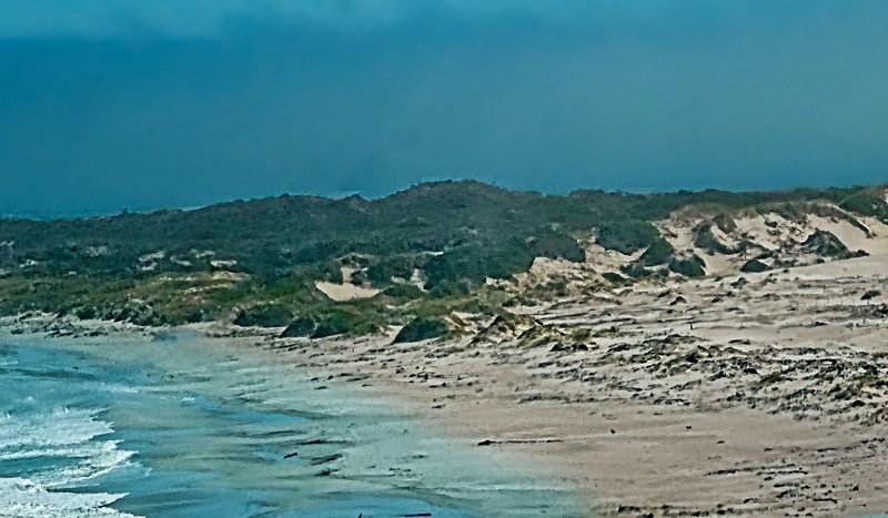
Our last visit was to the Moses Mabhida Stadium, built to host the 2010 World Cup. The locals are very proud of this state of the art sports venue, which seats 56,000 people. We got a picture of it from the overlook, but we didn’t see much when we reached the stadium because we weren’t allowed to exit the bus. We were told that someone on an earlier excursion bus had been mugged here while the passengers were milling around looking at it. So we guess the warnings we received about crime and violence here were not entirely unwarranted. From here we drove back to the port, driving through some parking lots with views of the beach on what is called the Golden Mile, a long stretch of golden sand beaches along the Indian Ocean that is popular for swimming and surfing.
")


So that’s it for this stop. It was not too exciting overall but, as we have seen often, there were still some interesting places to visit (most notably here the botanical gardens). We sailed off in late afternoon, looking forward to a sea day before our next stop.
Maputo, Mozambique — 2024
We reached Maputo on the morning of April 13. Maputo is a city of more than a million people and is the capital and largest city of Mozambique, a former Portuguese colony that achieved independence, through much warfare, in 1975. There was a nasty civil war after that and, even today, there is a good bit of unrest. We had been to Maputo twice but never had a chance to explore the city. In 2018 we drove through the city in a cramped bus on the way to Kruger National Park in South Africa for a wonderful four day safari. https://baderjournal.com/2018/08/13/maputo-mozambique-kruger-national-park-south-africa-day-1/ In 2022 we were unable to leave our ship here because of Covid, although we were able to photograph a surprising number of the city landmarks from the top deck of the ship. https://baderjournal.com/2023/03/27/ There is a good bit of historical background in this last episode much of which we won’t reproduce here, so if you want to read that, this post is where you will find it.

On this visit we wanted to see the city, finally, so we booked an excursion that would take us to most of the high points. Our first visit was to the Central Railway Station, quite close to the entrance to the port. Completed in 1916 it is built in Beaux-Arts style (but not designed by Gustave Eiffel as often claimed) with a distinctive green and white color scheme. We left the bus and had an opportunity to walk around inside the station and along its train platforms, where a couple of locomotives from the early period were on display.

 walking down the platform toward the main part of the station")


Across Workers Square (Praca dos Trabalhadores) from the train station is the Portuguese Monument to the Great War, memorializing those who lost their lives defending Mozambique from the Germans. Built of steel reinforced concrete, it was dedicated in 1935. Since Mozambique was a Portuguese colony it was not surprising to see mosaic sidewalks in front of the railway station.


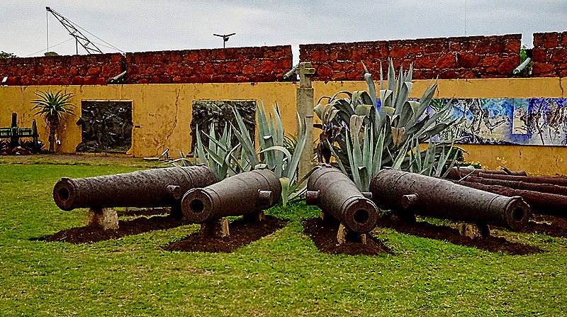
The Fortaleza Nossa Senhora da Conceicao de Lourenco Marques was built by the Portuguese in the late 18th century on a spot where small forts built by the Dutch and Austrians had previously been located. (Lorenzo Marques was the name of Maputo until 1976.) It was restored about 1946 on the foundations of the original fort. It is square in design with a single entrance to the interior courtyard from which doors lead to the rooms built into the fort. Old cannon are arrayed in the courtyard and on the ramparts at the top of the walls, which can be reached by dirt hills built into the corners of the courtyard.


")

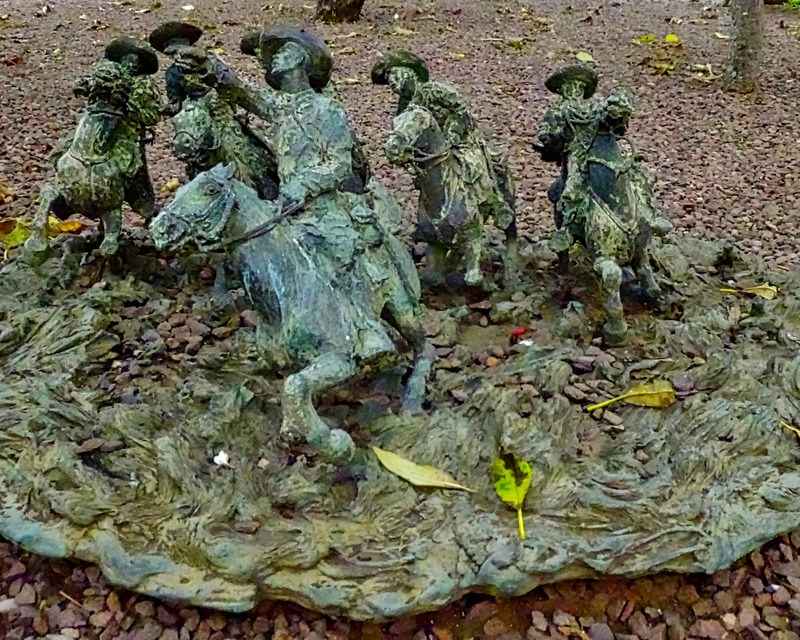
In the courtyard were sculptures of some Portuguese who figured in Maputo’s colonial history. There is an equestrian statue of Joaquim Mouzinho de Albuquerque, Commissioner of Mozambique from 1896 to 1898 and known for leading the occupation of Mozambique in 1895. It was unveiled in 1940 in the center of what is now Independence Square and moved here later. A statue of Antonio Jose Enes, another Portuguese Commissioner of Mozambique active in the 1895 occupation campaigns, was dedicated in 1910. The sculpture we liked best was a bronze group of Portuguese soldiers on horseback, looking a little like something that could have been made by Frederick Remington. It was brought here from elsewhere in 1975 or so. Finally, two large relief panels were on one of the walls of the courtyard. On the left was a panel representing one of Mouzinho de Albuquerque’s successful battles in 1897, and on the right was one depicting the 1895 imprisonment of the emperor of Gaza in Chaimite in 1895. There was also an interesting bird in the courtyard (alive, not a sculpture).


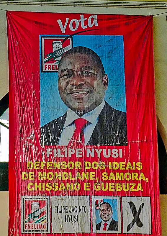
The Mercado Central de Maputo is a an enclosed market building that opened in 1903 with 18 vendors’ stalls. At that time it was named after Vasco da Gama. It was restored in 2001 and space for more than 150 additional vendors was added by 2013. The front facade somewhat recalls the railway station but with a much less grand scale and design. Inside it is a huge open warehouse-like space with countless individual vendors, mostly food but also some arts & crafts and souvenirs. An election campaign was in progress during our visit and several large political signs were on the walls.


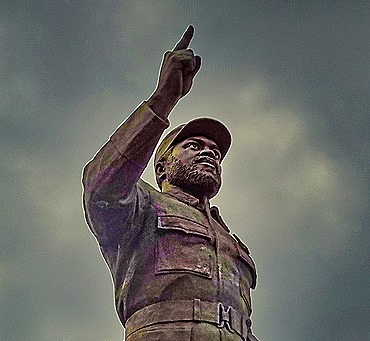
Praca da Independencia (Independence Square) is considered the focal point of the city. Around this square are the Maputo City Hall, the Catholic cathedral, the Iron House and Tunduru Gardens. As we approached in the bus it looked (at least to us) like a political demonstration was in progress in front of the City Hall, but we were told later it was a rally, religious in nature (if we remember correctly). In front of the City Hall in the middle of a traffic circle planted with colorful flowers was a 30 foot tall statue of Samora Machel, the first president of Mozambique who was still in office when he died in a plane crash in 1986. It was designed and built in North Korea before being erected here in 2011. Previously the equestrian statue of Mozinho de Albuquerque that we saw in the fort had stood here since 1940.


To the right of the City Hall is the towering white Roman Catholic Catedral de Nossa Senhora da Imaculada Conceicao, known locally as the Maputo Cathedral. Built of concrete and cement, its construction was completed in 1944. Another Portuguese style mosaic sidewalk was nearby.


The Casa de Ferro (Iron House) was fabricated of iron (of course) in Belgium. It was purchased by the Portuguese and reassembled here in 1892 to be the residence of the governor. But it was never occupied by the governor and instead has housed several groups and institutions over the years. There are two popular myths about this house. First, like the railway station, it was not designed by Gustave Eiffel. Second, the popular story that it was uninhabitably hot in the tropical climate is also false. The governor apparently rejected it initially mainly because he preferred a more traditional house. After all, it has been used more or less continuously over the years by others without apparent difficulty, although not to live in. And it was designed to provide particularly good air circulation both inside the walls and through holes in the walls. Similar buildings by the same firm have been used successfully in other tropical climates, in South America and elsewhere in Africa. The building was moved to this spot in 1966 from its original location and was restored in 2014. But for its iron construction, and the geometric patterns impressed in blocks on its walls, this looks like a rather ordinary gray building, three stories tall. Today it houses the Ministry of Culture and there is a souvenir shop on the patio of the ground floor.


The Tunduru Botanical Gardens is a fairly small park quite close to the iron house. It dates back to 1885 and houses many very tall old trees and a large colony of fruit bats. On the day we visited the bats were very high in the trees and difficult to see, but we took some pictures in the general direction people were indicating and a few of them showed up. To enter the park you walk under an elaborately sculpted white arch. The highlight for us was seeing wedding parties walking through the park. It seems there is a tradition here that weddings take place on Saturday near a hotel not far from the park and before the ceremonies the wedding parties come to these gardens to take wedding pictures. Luckily it was Saturday when we visited so we got to see several wedding parties walking along the paths and gathering under the arch. Very nice place to visit.


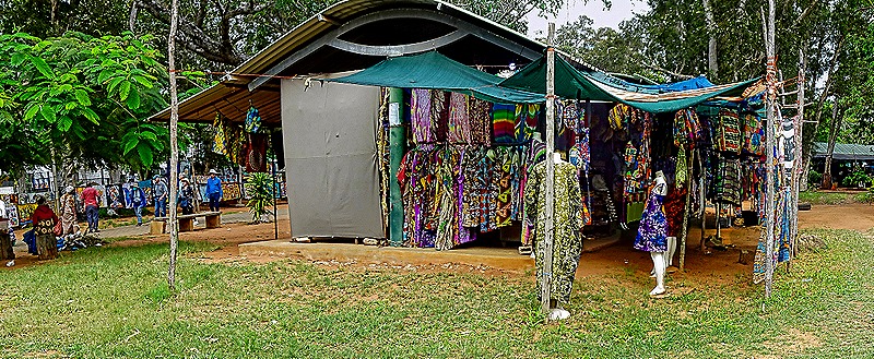
After leaving the gardens we boarded the bus to drive to Feira de Artesanato, Flores e Gastronomia (called FEIMA), a very large and bustling market for arts & crafts, flowers, jewelry, clothing and more, with several restaurants. It is located in a park surrounded by iron fencing. The vendors are friendly but anxious to make a sale, particularly when you show interest in a particular item. The wares are very colorful and it is fun just to walk around and enjoy the ambience. On the way to FEIMA we passed the Museum of Natural History, which had an arresting sculpture of an eagle in flight in front of the entrance.


We sailed away in late afternoon. From our veranda we had a nice view of the nearby port facilities and the gates to the town. This is a very busy port, which has been in operation since 1544. The sun was setting as we left the dock and we watched it drop behind the Maputo-Katembe Bridge, the longest suspension bridge in Africa, which was built by the Chinese and opened in 2018. There has been some controversy over the years about the cost and construction of this bridge, but there is no doubt that the sun setting behind it makes for a lovely sight.


