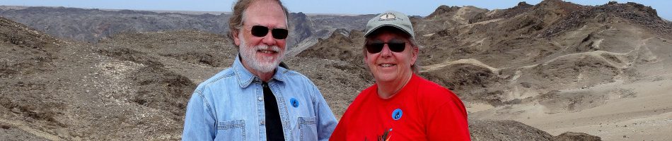
Endicott Arm & Wrangell, Alaska 2025
Endicott Arm & Dawes Glacier
Our itinerary said that we would spend the morning of July 2 viewing the Sawyer glaciers in Tracy Arm. But there was too much ice to sail into Tracy Arm so the Captain took us instead to neighboring Endicott Arm, home of Dawes Glacier. It was a smart move because these two spots are not very different and Endicott Arm is much less visited, we understand.

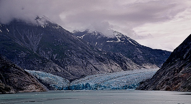
Tracy Arm and Endicott Arm are lengthy fjords branching out from Holkham Bay some 45 miles south of Juneau. Both were carved by glaciers. As we sailed up Endicott Arm we passed nice waterfalls descending from impressive mountains under a low and heavy cloud cover. But no serious ice blockage.


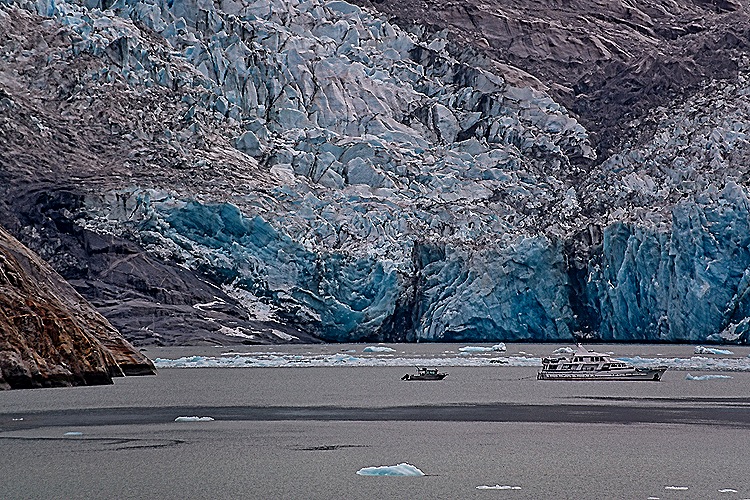
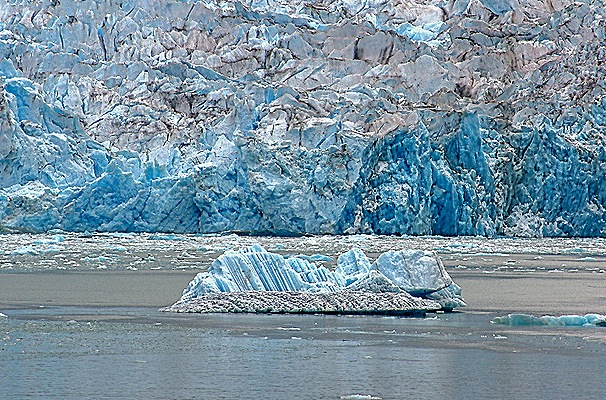
The face of Dawes Glacier is a bit more than half a mile wide and about 600 feet tall (with another 300 feet or so below water). Two glaciers join to form the tidewater terminus. It is known for active calving (it flows toward the water at about 15 feet per day) but we didn’t see any. This glacier is retreating, so at some point in the near future the two flows seen together at its face will likely separate. Harbor seals live and mate on floating ice in this area but we didn’t see them. The face of the glacier is a nice blue color.

 in front of the glacier")


We spent some time in front of the glacier so the Captain could fully rotate the ship and give everyone a good view. We passed floating ice and misty mountains again as we sailed back down Endicott Arm, then headed out into the bay and south to Wrangell.


Wrangell, Alaska
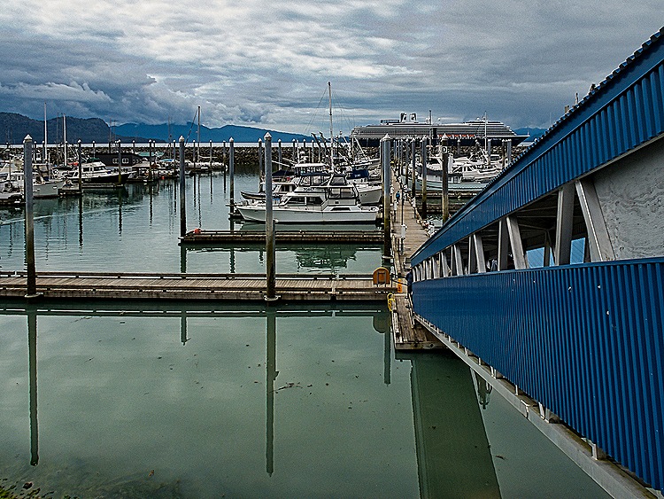
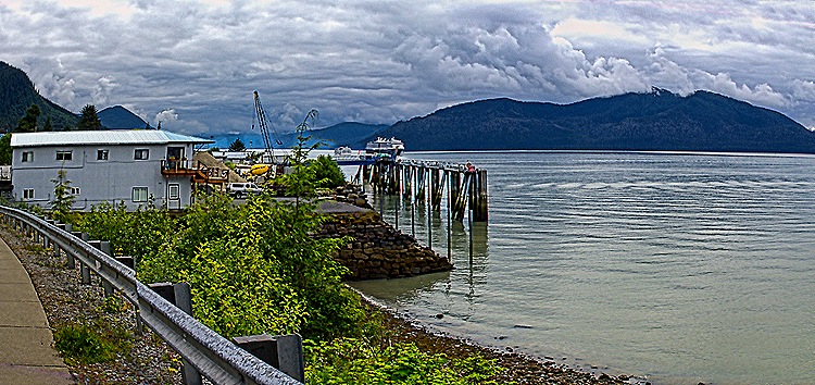
Last year’s cruise had to skip Wrangell because it was the Fourth of July and there was a parade amid other celebrations. This year we were scheduled to arrive on July 3 and, although we weren’t turned away, we had to tender into a small boat harbor well south of town because they would be practicing for a Fourth of July boat race. So we didn’t feel all that welcome as we took the tender ashore, but we were glad to be able to visit here.


Wrangell is on one end of Wrangell Island, one of the 30 largest islands in the United States, about 155 miles south of Juneau. Tlingit people had been living in this area for thousands of years when Russian fur traders built a fort called Redoubt St Dionysus here in 1834. The first European visitor, however, was George Vancouver during his 1793 expedition. The British took possession in 1840, renaming it Fort Stikine (after a nearby river). When the Americans acquired Alaska in 1867 they built a new fort here, called Fort Wrangell, named after Baron von Wrangel (not a typo, different spelling) who had been manager of the Russian-American Company (and effectively governor of Alaska) during the early 1830’s. Wrangell was incorporated as a city in 1903.
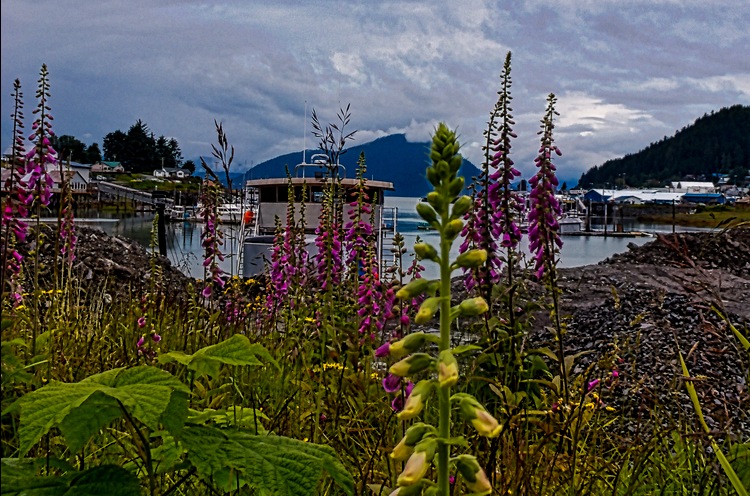
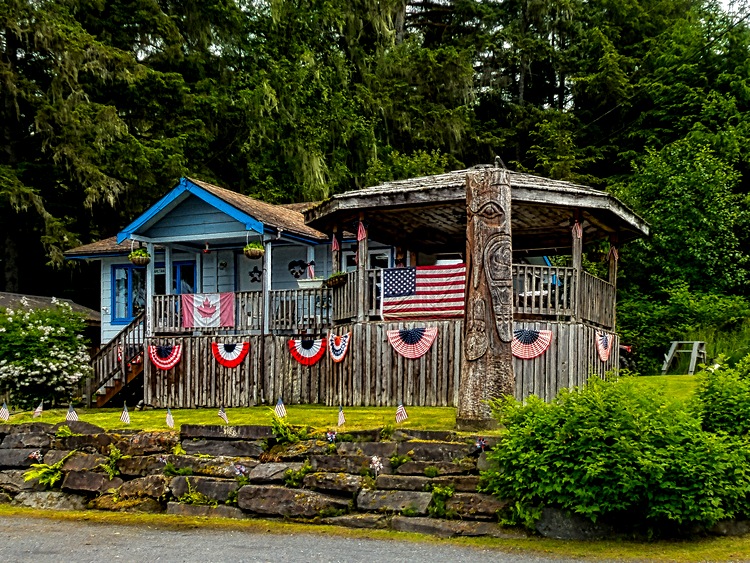
It was a long walk, more than a mile, into town. Just outside the port we saw what appeared to be some kind of fish traps piled high, presumably waiting to be used. We also passed several houses decorated for Fourth of July, a bear sculpture in someone’s front yard, an old car and a lot of flowers. This is a small and remote American town with a population just over 2,000 and that is what it looked like, especially today when it was decked out for a patriotic holiday.


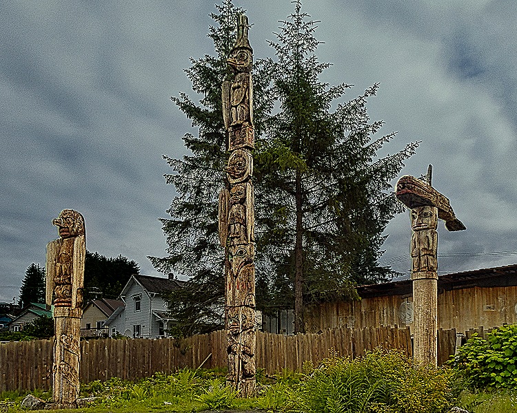
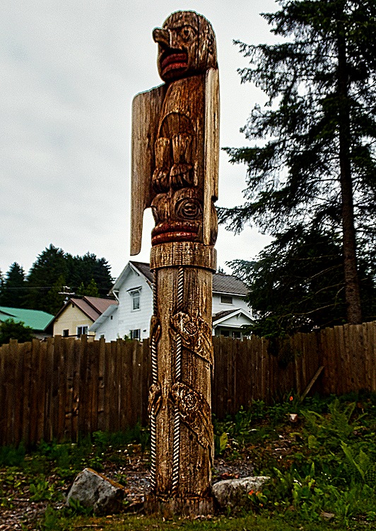
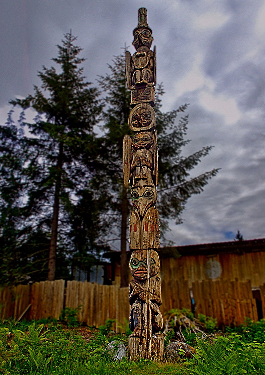
In town we first came to Kiks.ádi Totem Park. Originally opened in 1895 on the site of a clan house, the park now belongs to the local native corporation. The tradition among Native Alaskans is that totem poles are left to deteriorate naturally after they are erected. We saw three poles in the part of the park we visited, all of which appear to be rather aged,mostly brown and gray with some faded colors. While we can’t identify all of the symbols, we understand the pole on the right has a killer whale on top and the one in the center dates from 1987. We understand there is at least one other pole elsewhere in the park but we didn’t see it. About three weeks after our visit a newly carved totem pole was erected in front of the three we saw. Taller than these and weighing quite a lot, the new pole was erected by hand by the local native community. This was the first pole raising in Wrangell in almost four decades. Obviously, no pictures here of that since it happened after our visit.

 on top")


We continued walking into town, passing many more Fourth of July decorations. Our friend Susi was, unbeknownst to us, about a block up the hill and took a picture of us on this walk.


The Irene Ingle Public Library in Wrangell was opened (originally in the city hall) in 1921 on Halloween. The community pitched in with donations, labor and volunteer services to get it done. One vehement supporter wrote to the Wrangell Sentinel in 1921 that he would paint, varnish, subscribe to a magazine for the library shelves and “if it becomes absolutely and unavoidably necessary, I agree to go over to the library one day each week and make ardent love to the librarian in order to keep her on the job.” That’s commitment! Irene Ingle was the head librarian from 1951 (when it had no heat or running water) until 1981.
We visited the library (of course) and it was a very nice, modern space with soaring ceilings. Above the front desk was a fetching glass triptych of a fireweed, a plentiful and popular flower in Alaska.


We wanted to visit Petroglyph Beach, which was a mile or more away on the outskirts of town, so we walked in that direction. Passing the post office, which we understand is on the site of the old Fort Wrangell, we encountered a totem pole called a raven pole, which was carved in the 1960’s. In front of a store was an interesting wooden moose.
")

We took the long (mostly uphill) walk to Petroglyph Beach. It is a fairly large and very rocky area next to the water. This is designated a state historical area and they have built wooden stairs down to a platform just above the beach which contains explanatory signs and replicas of some of the petroglyphs. There are several dozen petroglyphs, designs carved in stone, scattered throughout the beach which are said to date from as long as 8,000 years ago. They are not easy to spot because the stones are rather dark and many of the carvings are monotone. But we did find a few. We understand that some of the better ones are in the local museum, but we didn’t make it there.


")
The view across the water from the beach was pretty stark, at least on this rather gray day. Across the water is uninhabited Woronkovski Island, named for a Russian explorer, which is separated from Wrangell Island by the Zimovia Strait. The northern tip of Woronkovski Island is called Elephant’s Nose Point because it resembles an elephant’s head with a long trunk extending along the water. It was named in 1878.

")

We walked back on the road along the water into the center of town. A pretty long walk & a good bit of holiday decoration.


We walked up the main street in downtown Wrangell, stopping in a few stores on the way. Few really old buildings remain because a large fire in the 1950’s destroyed much of the town. Then we headed back to the tender dock, passing on the way an interesting house fixed up for Fourth of July, but with a Canadian flag tucked into the display.

 walking up the street")


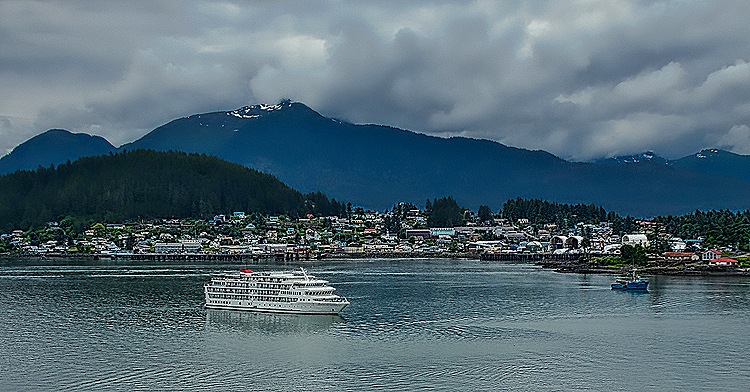
There were still things to see but we had done quite a lot of walking and were pretty tired, so we walked back to the tender port and returned to the ship. We had a nice view of the town as we sailed away toward our last port visit.


