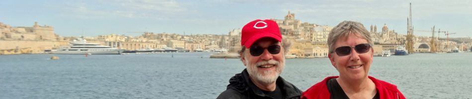
Takoradi, Ghana 2022
After 3 sea days we docked on December 4 in the port of Takoradi, Ghana. It appears that the first organized state in what is now Ghana was established by Akan people in the 16th century (there was a kingdom called Ghana before the 13th century but it was in a different location). The Portuguese were the first Europeans to trade with these people in the 15th century. The primary commodity at that time was gold (still an important export) so Europeans called this area the Gold Coast. By the end of the 15th century they had built the first European strongholds here and by the mid 17th century the Dutch, Swedes and Danes had joined the party. Some 30 European castles were built along the Gold Coast which, during the 17th and 18th centuries, were used as depots to send newly enslaved people to America. The British arrived in the 1870’s and eventually established control of the area after a 100 year war against the Ashanti Empire. In 1957 Ghana became the first African colony to gain independence, under the leadership of Kwame Nkrumah. Particularly in the 21st century the Ghanian economy has grown, its major exports being oil, gold and cocoa beans.
Takoradi has Ghana’s oldest deep water port, established in 1928, which was where we were docked. Takoradi and Secondi were neighboring towns that merged in 1946 into the hyphenated city of Secondi-Takoradi, now with a combined population in excess of 450,000. Both were originally established by the Ahanta people (part of the Akans). The Dutch built a fort in Secondi in 1642 and in Takoradi in 1665. Because the lucrative oil industry is centered here the city is nicknamed Oil City.
We spent the day on a bus excursion along the coast to the east (missing the oil rigs to the west . . . darn) and then into a rain forest. The drive to the Kakum National Park was long so we spent a lot of time watching the streets from our window. Different views of daily life amid a good deal of what we would consider poverty. It was Sunday, so not many crowds out and about in the early morning.
![]()


The people of Ghana are 71% Christian and almost 20% Muslim. We passed some small local mosques and some churches, one of which had congregants out front in their Sunday best even though the church’s roof was under construction.


Kakum Nation Park includes 145 square miles of tropical rainforest. It became a nature reserve in 1931 and a national park in 1992. We have read that there is an abundance of wildlife here but the only ones we saw were a giant worm and a bird near the visitor center.


We came here to visit the Kakum Canopy Walkway, a series of seven hanging bridges 130 feet high connecting the top portions of seven huge trees. It is more than 1,000 feet in length, the largest and highest in West Africa, and enables visitors to walk among the tree tops. It is pretty challenging for people of a certain age because it is suspended from wire ropes strung between the trees and can sway as you walk. You walk on long narrow boards, fastened to the bottom of a rope mesh, which sometimes tilt left or right as people walk along with you at different gaits. And the beginning and end of each bridge tilts up toward the tree because the middle part hangs lower. The walking board is smooth so you could easily slip on the steeper bridges and must hold tight to the rope mesh walls of the bridge.
Before even reaching the canopy walkway, however, we had to climb a long and steep path to the top of a hill that was paved with uneven paving stones, then up a ladder to reach the beginning of the walkway.


It was very difficult to take pictures while walking on the rope walkway because it felt like you had to hold on to the rope with both hands to avoid falling. It was much easier standing on the platforms attached to the trees, which were sturdier and much larger. Rick was walking behind Mary so there are some pictures of her from behind and there are some pictures of us walking on the walkway taken by friends of ours standing on the tree platform we were approaching. We actually have a picture below of our friends Susan and (another) Rick, who took those pictures.


 bedraggled, almost to the next tree platform")
 well behind and a long line of others")


It was, in fact, quite a view up in the treetops, although disappointingly we didn’t spot any birds or animals while we were up there.


There were times it seemed we would never reach the end of the walkway, but we finally did and then walked back down the hill to the visitor center. Ghana is very close to the equator so it was quite hot and we were pretty sweaty by the end. There were signs on the stone pathway telling you not to run, but it was doubtful anyone needed a sign to figure that out. At the bottom we declared victory! This was an unusual and interesting experience and we were glad we did it. But it was comforting to know that now we never have to do it again. The sign suggests we weren’t the only ones who felt that way.


Leaving the park we drove to the Lovers Inn Oil Mill where we saw the palm oil production process.


From there we drove to the Kokodo Guest House where we had lunch on the patio. The sun was very bright and hot, so tables in some shade were at a premium. The food was good and it was a pleasant lunch stop. Throughout Africa women can be seen carrying large baskets or bags on their heads, balanced without support from their hands. We drove through one small town whose main street was lined with unpainted one story wooden buildings, looking like a very poor area. Then as we passed one I looked up and painted along the top of the facade was “Miami University, Oxford, Ohio U.S.A.” We were too close and moving too quickly for a picture and I have no idea what this facility might have been, but it was pretty startling to this Ohio boy.


 where we had lunch")

After lunch we proceeded to the oceanside to visit the Cape Coast Castle, the main reason we chose this excursion. The Portuguese established a trading post here in 1555, trading mostly in gold and timber (especially mahogany) and the Swedes replaced it with a timber fort almost a hundred years later. Between 30 and 40 forts were built by Europeans along the Gold Coast in this period, especially after the Atlantic slave trade heated up. After changing hands a few times the fort was acquired by the British in 1874 and it stayed in their hands until Ghana gained independence in 1957. The British rebuilt the fort out of stone and named it Cape Coast Castle. It has been restored in the 1920’s and again in the 1990’s. We were lucky in that the guide assigned to our bus had a lot of expertise about the Cape Coast Castle and the slave trade in Ghana.


The castle was protected from sea attack by cannons mounted along a sea wall that was pretty much the length of the building.


This building’s primary significance is its role as one of the largest depots for exporting slaves to the Americas during the 17th & 18th centuries and right up to the British abolition of the slave trade in 1807. The British built what they called “slave holes” in the lower areas, huge dungeons with no windows, little light and ventilation and no toilet facilities other than the floor, where up to a thousand slaves could be held until they were sold to a slaving ship. We visited these gloomy spaces, separated into men’s and women’s quarters. In the last room of the men’s quarters was a religious table reflecting, if we understood correctly, the indigenous religions.


In a corridor leading down from the Castle’s courtyard to the sea ends at the “door of no return,” where the enslaved people were taken from the dungeons to the waiting slave ships. The title reflects the fact that once they walked through that door they would never see their homeland again. We had seen another “door of no return” in 2018 on Ile de Goree in Senegal, which opened directly to the ocean. The door here opened onto a shore area of rock and sand where they would have to walk further than in Senegal to reach the ship. A sign saying “Door of Return” is on the outside of this door, but few if any of the enslaved people who walked through this door were ever able to walk back in. President Obama visited both of these slave depots in 2009 and there is a marble plaque here commemorating his visit.


The beach area of the small bay outside the door of no return was really jumping on the day we visited, full of people and boats and flags. We even saw a couple of small goats wandering on the rocks. We have seen many of these dwarf goats in West Africa roaming free like you often see feral dogs in other places. Our guide told us that most of them belong to families who let them run free during the day (to eat elsewhere) and they return home at night. Then when they get fat enough, he said, we eat them.


We were later than scheduled in leaving the Castle to return to the pier. Partly this was due to the previous stops and travel taking longer than anticipated, and also to at least one of the folks in our bus continuing to shop beyond when she was supposed to be back. It seems there is often someone whose personal shopping is more important than everyone else assigned to the bus having to sit in the vehicle to await their leisurely return. So there was some angst among the folks on the bus about getting back before the all aboard time and being left behind (in my opinion, there is no way they are going to leave 30 or so passengers behind for being a few minutes late, but that’s just me). The guide was prevailed upon to phone in and let them know we were on the way, which he did. Then, not very far from the port, we suddenly pulled into a gas station! This was entirely unexpected and of course generated concern that it would make us later. But it took very little time since they prepaid for the gas and bought just enough to get us to the port rather than filling the tank. In the end we made it back shortly before the all aboard time. No problem, right?
As we drove by the water not far from the port we had a view of a Turkish owned ship purpose built to generate electricity from oil or gas. Ghana now gets 20 to 25% of its electricity from this (not sure whether there are other such ships in Ghana). A pipeline has been built from local natural gas fields to the ship to facilitate this. The power ship is the one on the left in the last picture below.


Luanda, Angola 2022
After two days at sea the morning of November 30 found us in Luanda, the capital and largest city of Angola. Angola was another Portuguese colony, first settled by Europeans in the late 16th century. It was a central portal for the export of slaves, mostly to Brazil, during the 17th and 18th centuries. It won its independence in 1975 after a bloody revolutionary war that lasted some 15 years. Then it suffered through a bloody civil war that lasted until 2002. Luanda has been rebuilding since then but many, if not most, of its 6 to 8 million people still live in poverty in shanty towns called musseques. Angola’s huge oil revenues have enriched a tiny elite in the country but have not done so much for most of the population.
We visited Luanda once before in 2018 and took an extensive excursion that enabled us to see much of the city. If you want to see the city you can look here:
https://baderjournal.com/2018/09/03/luanda-angola/
The excursions available here were mostly repeats of what we had seen in 2018 (and they are pretty expensive . . . Luanda is one of the most expensive cities in the world), so we decided not to book one. It was raining pretty vigorously during the morning and Luanda is not a very safe place for visitors to wander about by themselves, at least away from the water front, so we decided not to do that either. Mostly we spent the day on the ship.
However the skies cleared somewhat in late morning so we took the shuttle to the port gate, which has a tall clock tower (far left in this photo). As the photo shows, we were berthed this time on the other side of the port warehouse and unloading area, much further from the main part of the city than last time (when we got much better pictures).

Across from the gate is a large square that is used as a market (at least when a ship is in town). We visited there on our last visit and it was crowded with vendors selling everything from clothing to paintings to crafts. On this occasion, probably because of the rain most of the morning, only a handful of vendors had set up booths. A couple of dancers and musicians were there as well.


One woman from the ship spent a long time examining textiles that a vendor had spread on the ground, collecting quite a few after careful examination of each one. Then they brought out some more and she started again, putting back most of what she had selected and examining all the new ones. She bought some, not sure how many. But Mary bought a nice one that this woman had abandoned. What appeared to be a news crew with a video camera was there for a while and interviewed at least one of the ship passengers in the market. We think we were the first cruise ship in port for several years, since the pandemic began, so our presence must have counted as news.


We returned to the ship, greeted at the gangplank by the usual “Welcome Home” sign although it didn’t feel like we had gone anywhere. We spent the rest of the day on the ship, then sailed away as evening approached. We passed a large cliff looking almost red in the fading light and saw the sun set as we set out to sea.


")

Three days later we arrived at nowhere and saw nothing (at least that is how the captain described it). We were sailing from Luanda to Takoradi, Ghana, a course that takes you through a vast expanse of ocean called the Gulf of Guinea. During the morning we crossed the equator and the prime meridian at the same time, at 0 degrees longitude and 0 degrees latitude. We had done this in 2018 as well, but around midnight so we couldn’t see anything (the ship did hold a pajama party in the Crows’ Nest that time though). You can read about that in the first part of this post:
https://baderjournal.com/2018/09/05/
This time it was broad daylight and we saw . . . nothing but water. So, woo-hoo! We have read online that there is a weather buoy here (called the soul buoy) but we sure didn’t see it and we didn’t hear of anyone else on the ship seeing it either. We don’t actually know for sure that it is still here, but we found a photo online from 2017 that shows what it is supposed to look like. We received a certificate designating us “Emerald Shellbacks" for having done this, although we were already emerald shellbacks from doing this in 2018 (with certificates to prove it).


Walvis Bay, Namibia 2022
We sailed away from Cape Town on the evening of November 24 and the next morning Mary tested negative for Covid and was finally released from detention. The next stop on our itinerary was Luderitz, Namibia, but the captain announced that because of weather and sea conditions we would be skipping that stop. That made no difference for Rick, who was still in quarantine, but Mary could have gone ashore and participated in our scheduled excursion. It is always disappointing to miss a port, but it is not unusual to miss one or two on a long voyage and everybody missed this one.
Our next scheduled port was Walvis Bay, Namibia, where we arrived early in the morning of November 27. We had visited here once before in 2018, so if you want to see more of the Walvis Bay area here it is:
https://baderjournal.com/2018/08/24/walvis-bay-namibia/
We had a day long excursion booked and Rick was scheduled to be sprung from quarantine that morning if he tested negative for Covid. We had asked in advance for Medical to send someone to our cabin as early as possible for the test, hoping he would be ready to go by the rather early departure time of the excursion. Well, the tester arrived early, but a half hour passed afterward with no notification of the result. We called Medical and found out they had called and left a message at the separate room Rick had been moved to the day after Mary tested positive, even though they had moved him back a week before! Good thing we called. So we hurried out for the next step (it really feels great when you first walk out the door after a quarantine) which was a mandatory face to face passport check being held in the Explorers Lounge. You had to scan your key card before going in, but when Rick’s was scanned an alarm went off: it sounded like a fire truck was on the way! It turned out that Medical had not gotten the quarantine restriction on Rick’s key card removed (apparently because they continued to view him as living in the other room). After that was cleared up with a call to Medical we had our passports cleared and joined the excursion group before the ship was cleared for disembarkation. Of course, when Rick’s card was scanned to leave the ship . . . you guessed it, an alarm went off again, even louder than before. It took a few minutes for them to clear that up and we left the ship to start the excursion. Surely they would have this all cleared up by the time we returned late in the afternoon when his card would have to be scanned to permit Rick to reboard! Right?
The morning part of the excursion was a boat trip around the bay. We boarded a fairly small boat at the dock not very far from the ship.


Before even leaving the dock we met two members of the wildlife crew. A large pelican was sitting on a fence as we boarded and he boarded the boat before we sailed. A very large bird, it was probably a Great White Pelican which are plentiful in this part of Africa. Obviously used to people, it joined the group without hesitation. It didn’t stay with us for the whole trip but was there to greet us when we returned to the dock.


Our second wildlife crew member was a fur seal (named Sammy, we think). He was clearly used to being on this boat with people and was very comfortable mingling with us. The back of the boat was flat except for a railing and he would dive off this platform into the sea to retrieve thrown fish (kind of like a dog except he would eat the fish instead of returning it). Then he would race back to the boat and leap onto the platform again. He wandered around the boat interacting with passengers, even jumping into their laps at times. He came over to us and looked up like a puppy; this was fun except he was standing on Rick’s foot! And a seal weighing several hundred pounds is pretty heavy.


It was quite cold and windy when we set out and we were sitting near the open front of the boat where the wind was blowing in without restriction. Refreshments of various kinds, including champagne and locally grown oysters, were served from time to time. It was a long ride to see the wildlife of the bay. Eventually we came to a very long beach with Cape Fur Seals as far as the eye could see. This was Pelican Point, a large sand peninsula that protects the bay from the ocean. It hosts a seal colony more than 100,000 strong (although not all at the same time). The wind had died down a bit and it was warmer by the time we got there, so Rick walked out on the front deck to get a better view and some pictures.
In the last two pictures here you can see in the distance the Pelican Point Lighthouse, built in 1932 from cast iron. It was originally near the ocean’s edge but over time the sand has built up to the point where it is now about a mile from the shore.


The seals did not have Pelican Point to themselves, however. A flamboyance (yes, that’s the official term) of flamingoes was hunting for food in the shallows of the beach in one area. These are Greater Flamingoes, which are large and have pink and black beaks. The seals didn’t seem to be bothered by them in the least. Flamingoes eat by submerging their heads upside down and using the top part of their beaks as scoops. They are gray at birth and do not acquire their iconic pink coloring until they are two or three years old. The coloring comes from the krill in their diet. When they spread their wings to fly away the colors under their wings are much more intense. The seals didn’t seem to care about the flamingoes’ incursion into the edge of their colony.


As we sailed around in the bay we encountered dolphins and a whale. They were pretty hard to spot because the water was not clear and the weather was overcast. They were hard to identify (at least for us) because they didn’t come far out of the gray water. At one point the whale, probably a humpback, rolled on its side and reached a fin out of the water, appearing to be waving to us.


Heading back to the pier we passed about a dozen bright blue barrels roped together in a long row. It turned out this was an oyster farm and, as we understand it, the oysters were growing attached to ropes hanging down from the barrels which we, of course, couldn’t see. Some seals found the barrels to be a convenient place to hang out. When we got back to the dock we were greeted by our friendly pelican.
")


We were met at the dock by our guides for the afternoon land trip to Sandwich Bay in a national park south of Walvis Bay. This was to be a 4X4 drive over sand dunes to a bay where very large sand dunes come right down to the edge of the ocean. We were all sorted into our vehicles, each of which had two rows of regular seats and a narrow third row apparently intended for children or luggage. Well, they had not brought enough vehicles for all of us to sit in the regular seats so guess where we ended up sitting? I’m sure you guessed it in one . . . because one of our group pleaded disability and we were the smallest ones we ended up (volunteered, actually) squeezed into the children’s seats in the back. And believe me, it was not an easy fit at all.
Before driving down to the sand dunes we stopped at the Walvis Bay lagoon to see more flamingoes. This was the spot where we saw flamingoes during our first visit in 2018. These were different than the ones we encountered at the seal colony, however. These were Lesser Flamingoes, smaller than the Greater Flamingoes and with mostly black beaks and small glowing red eyes.


As we drove south it was hard to see, much less take decent pictures, squeezed into the back seat. We did see another flamboyance of lesser flamingoes in a small bay and we passed a small seal we hoped was resting on a wet gray beach, but he was very still and lying in an odd position so we aren’t entirely sure he was still alive. The surf crashes in pretty aggressively on this part of the coast.


We stopped and got out (yay) in an area near the coast that was full of small sand hills covered with brown vegetation. We aren’t sure, but these may be what is called a hummock dune, which forms around a bush or bushes. Whatever they are, they make an interesting vista.


We never actually reached Sandwich Bay. It appeared the tide was in so, as you can see below, there was no room to drive down between the high dunes and the ocean’s edge. Our guide told us they could have gotten us closer by driving over the dunes but one of the passengers was afraid of that so they wouldn’t do it. That was too bad, but from where we stopped atop one of the dunes on the approach to the bay it was still a beautiful sight.


We drove over the dunes for a while, up and down on the sand, to a spot where we stopped and the guides set up tables and served food and beverages. It was a pretty good spread but we weren’t all that hungry. Even from the back seat the dune driving was rather fun.


While in the national park we saw a number of animals among the dunes or on the shore. The Gemsbok, or Oryx, is a type of antelope with very long thin straight horns and a distinctive black and white face. We saw a related species in Dubai a few years ago, where they had become extinct but had recently been reintroduced from captive stock. The ones we saw here were in a small herd that was feeding on vegetation growing on some dunes.
We were sitting on the edge of a dune overlooking the Gemsboks. The dune was covered by spiky green vines with spotted green fruits. These are called “!nara” (the ! pronounced like a click). They are endemic to the Namib desert and are an important food resource for the indigenous people. Related to the cucumber, they have taproots that can extend 150 feet or more into the sand and the plants can live for 100 years. The fruit we saw were about the size of a golf ball so they must have been quite young since a mature !nara melon weighs in at about 2 pounds.

 !nara
!nara

We saw some Springbok as well, a smaller antelope type animal with shorter curved horns and different coloring.


Lots of boks in this area. We saw some Steenbok, small antelopes with very large ears (like Baby Yoda) and tiny horns.


Namibia is famous for its beautiful red sand dunes, caused by rust on sand particles made of iron ore. We didn’t see those but we drove to a spot on a dune where there was quite a bit of this red sand, which was very pretty. The sand was striped in red and yellow striations. One of the guides held a magnet just above a handful of this sand and the red particles jumped up to the magnet.


Nearby one of the guides found a tiny green lizard that fit in the palm of his hand. We think it may be a Namib Sand Gecko, which is endemic to this part of Africa.


We stopped at the top of a dune and looked over a sand cliff at an Ostrich with two eggs in its nest. And as we drove back toward Walvis Bay along the beach we encountered a Black Backed Jackal lying in the sand.


One last sight on our way back to the harbor was a large salt processing plant. Namibia produces about a million tons of salt each year by drying ocean salt water in the sun. The process takes many months, during which the fields of drying salt water acquire a pinkish cast from organisms living in the water. We had seen similar salt farms on the island of Bonaire in the Caribbean about six months earlier.

We arrived back at the port and boarded the ship. Of course, your room key has to be scanned before you are admitted into the ship and, guess what, the alarms went off again when they scanned Rick’s card. All day & not fixed! Once they cleared him by calling Medical we could go in. But wait, that’s not all! Namibia requires everyone to be cleared for departure by their immigration people, which was again in the Explorers’ Lounge. When they scanned Rick’s card at the entrance, the alarms went off again, for the fourth time. Not only was Rick’s card not recognized by the ship’s system, it also wouldn’t open the door to our room. It seemed like Medical’s failure to log Rick’s return to our room rendered him a nonperson as far as the ship was concerned.
We went up to the main desk and they worked some semi-magic and told us it was fixed. We went back to our cabin and the card still wouldn’t open the door, so back up we went. This time the desk clerk made Rick a new key card and took it down to our room himself to make sure it worked. It did and thankfully continued to work for the rest of the voyage. Covid was bad enough & we sure didn’t need this complication added on.
So ended our first time off the ship since Madagascar and Rick’s first day out of quarantine. He wasn’t sick any more but this was a very full and taxing excursion that left us rather worn out. It was good that we would have two sea days to regain our stamina before the next port.
Mozambique & South Africa (Time Out) 2022
Maputo, Mozambique
We had two sea days after leaving Madagascar before we arrived in Maputo, Mozambique on November 19. You may be wondering about the unusual title of this episode so this is what it means: The morning after we left Madagascar Mary tested positive for Covid and was quarantined in our room. On this trip a quarantine lasts for at least 5 days, starting on the day after you first test positive, so in reality about 6 days. If you test negative on the morning of the 6th day you are supposed to be sprung from your incarceration, but as you will see things don’t always go as anticipated.
Last Spring HAL ships were setting up separate corridors for quarantining covid patients that were off limits to other passengers and at least on some ships crew delivering food wore hazmat suits and left the food trays in the hall to be picked up by the occupants of the room after they left. Nothing so extreme on this cruise; Mary was quarantined in our regular room and we had a hard time convincing our normally attired room attendants not to bring the food inside as they normally do. And even though Rick was sharing a room with a quarantined person his movements about the ship were not restricted. We thought that was rather strange.
Rick was given a choice to remain with Mary or move to another room. He decided to stay but that was very short sighted and foolish. You can probably guess why, but more on that later.
Anyway, because of Mary’s quarantine neither of us left the ship in Maputo (although presumably they wouldn’t have objected if Rick had done so). Maputo is the capital and largest city in Mozambique, which was a Portuguese colony for many years. In fact, this city was originally called Lourenço Marques after a Portuguese ship captain who explored the area in 1544. They built a fort here in the late 18th century and the town grew around it. After a long revolutionary struggle the country achieved independence in 1975 and the next year the city’s name was changed to Maputo, possibly after a river in the area. After independence a destructive civil war raged into the 1990’s and they have been reconstructing ever since. Today it is a mix of newer high rise buildings and older buildings with more charm.

We had been to Maputo once before in 2018, but were only able to drive through the town on our way to Kruger National Park in South Africa. You can see that here:
https://baderjournal.com/2018/08/13/maputo-mozambique-kruger-national-park-south-africa-day-1/
While he stayed on the ship Rick went up to the top deck and took some photos. The ship was docked in Maputo’s large bay. To our left was the mile long bridge to the suburb of Katembe which formerly could be reached only by ferry. Opened for traffic in November, 2018 (about 10 months after our last visit here), this is the longest suspension bridge in Africa. It was built by the Chinese.

From the ship it was possible to see several of the local landmarks that we had planned to visit today, or at least portions of them. Probably the best known is the central railway station with its bronze dome and green and white paint. It opened in 1916 and was not, despite common belief, designed by Gustav Eiffel (although there is a house in this city that he did design). It is considered one of the dozen or so most beautiful train stations in the world. Standing in a traffic circle across Praça dos Trabalhadores (Workers’ Square) from the front of the station is the Monument to the Great War, commemorating the soldiers who fell resisting the Germans during World War I. Since it was dedicated in 1935 while Mozambique was still a colony, it was most likely the Portuguese soldiers they had in mind rather than the Africans.


Independence Square is considered the center of Maputo, with the neo-classical City Hall located on its north edge. Built by the Portuguese and opened in 1947, it has been the seat of city government ever since. In a traffic circle in front of the building is a bronze statue of Samora Machel, Mozambique’s first president after independence. The statue is 30 ft tall and sits on a 9 foot high marble base. It was dedicated in 2011 on the 25th anniversary of Machel’s death in 1986 in an airplane crash. We understand it is somewhat controversial because some people think it doesn’t resemble Machel at all. Extending above the surrounding buildings to the east of the City Hall I could see the upper portion of the Roman Catholic Cathedral of Our Lady of the Immaculate Conception. It opened in 1944 and is constructed of concrete.


Muslims make up about one fifth of the population of Mozambique. The tops of two mosques could be seen from the ship. Jumma Masjid Mosque was built around 1890 and is the oldest place of worship in the city. We don’t know the name of the mosque with the golden dome, possibly Masjid Takwa but more likely not. Still a pretty arresting sight.


The Maputo cruise port sits in the bay and is separate from the commercial port facilities. There is a small green painted gate into the port area. When we sailed away we passed the ferry terminal and dock, which had an interesting older building next to it that we couldn’t identify.


We sailed away back into the Indian Ocean. Although our itinerary took us south from here we had to sail a pretty long way to the northwest from the bay before the pilot left for his yellow boat to take him back to port. This course was marked by buoys so it must be mandatory, but we have no idea why this control extends so far from the port. It played out long enough, with no end in sight, that Rick finally went back down into the ship before the pilot left.


Durban, South Africa
The next morning, November 20, we were in Durban, South Africa. Of course we had canceled the excursion we had booked and stayed on the ship again. If I remember correctly, everyone had to leave the ship for a face to face passport check in the cruise terminal even if you were staying on the ship for the day. So Rick did that, but because of her quarantine the ship’s crew took care of checking in Mary’s passport.
On this day we also came to our senses and asked to have Rick moved to another room, which obviously would make it less likely that he would come down with Covid. They came and moved him to another window room, but one floor down where he had no view of the walking deck. This was not fun.
Rick went up to the top deck again to take pictures of what could be seen of Durban. Unlike in Maputo, however, he didn’t spot any particular sites of interest. So you will have to be satisfied with some panoramas of the city from the port.


 & interesting buildings")
 Feeling completely well and with no restrictions on his movement about the ship, Rick decided to eat with our table mates in the main dining room for dinner. It was a good meal and everyone was glad to see him after several days in which he had eaten in his room out of caution. But later that night he began to feel ill and the next morning, you guessed it, he tested positive for Covid (while others at our table contracted Covid, we hope it wasn’t from us). So the medical staff decided to move him back into our regular room with Mary, who was still quarantined as well. Unfortunately, the medical staff failed to enter this move into their records properly so that the ship continued to think he was in the other room on the second deck for almost a week, until after his quarantine was over. A complication we sure didn’t need.
We left Durban for another two day sailing to Cape town. 
Cape Town, South Africa
We arrived in Cape Town early on November 23. We had anticipated the two day stay in Cape Town to be a highlight of the voyage. It is a very interesting and beautiful place. We had tickets to see Robben Island, where Nelson Mandela was imprisoned, on the first day and had booked an excursion through the wine country on the second day. We had also planned for this to be our prime shopping port, as it was when we visited here during the 2018 world cruise on a double overnight stay after our safari in Kruger National Park. You can see that here:
https://baderjournal.com/2018/08/20/
https://baderjournal.com/2018/08/22/cape-town-south-africa-days-2-3/
We knew that Rick’s quarantine wouldn’t be over until after we left Cape Town but Mary was supposed to be tested early in the morning of November 23 and released if she tested negative. This meant that at least Mary would be able to enjoy all that we had planned. But when the time for her test arrived she received a phone call from the medical staff instead to inform her that the South African authorities had decreed that no Covid testing could be done while the ship was in their port. Sounds strange that they would care about administering a test on the ship rather than just about whether a person disembarked in their port. But the result was that both of us would continue to be quarantined in our cabin throughout the stay in Cape Town.
We were sorry to miss Maputo and Durban, but missing Cape Town was a serious disappointment to us. This lengthy quarantine in a small room with one window was the first time we had felt that lacking a veranda to enable us at least to step outside made a big difference in our experience on board. We have only one picture from Cape Town, a pathetic partial view of Table Mountain over a port building from our window.

So, as we finally sailed away from Cape Town toward our next stop in Namibia, the Covid quarantine continued. Stay tuned.
Andoany, Nosy Be, Madagascar (Day 2) 2022
Because Madagascar has been an isolated island ecosystem for many millions of years its plants and animals have evolved independently from those you find everywhere else. In fact about 90% of the animal and plant species here are endemic to Madagascar and found naturally nowhere else in the world. The most famous of these is the Lemur. So on the morning of November 16 we tendered back in to the dock at Nosy Be to meet up with our excursion to Lokobe National Park for the Lemur part of our visit to Madagascar.
The dock area was very busy, not only with Zaandam passengers but with locals catching a boat to take them to their work places. We had to wait a very long time before our speedboat was ready for us to board for the trip to Lokobe, the primary home of wild lemurs in this area (you can see some in semi-captivity elsewhere but we wanted to visit them in their natural homes).


After a lengthy boat ride we came ashore on a beach. It was a “wet landing,” which means you step out of the boat into the water and wade ashore. There is what appears to be a small village on the edge of the forest by the beach, which we think may be called Ampasipohy. There were boats around so it is likely a fishing village, probably with some agriculture, but it is certainly used to receiving travelers. When we arrived folks were busily setting out their products for sale. We saw no evidence that these clothes, embroidered table cloths and souvenirs were being produced in the village, so were they made in Madagascar or somewhere else, like China? It was hard to tell.


The point of this trip was to walk through the very tall and dense forest to see lemurs and other fauna. We were led by a couple of guides who knew the area very well and were able to spot lemurs high in the tree branches. As we had found on our African safari in 2018, even when they pointed the animals out to us it was often difficult for us to see them.
There are more than 100 species of lemur in Madagascar. There once were some as big as gorillas but they, along with about 15 other species, have become extinct since these islands were populated by humans. Most of the lemur species are now endangered, primarily because of rapidly shrinking habitat, but lemurs are also hunted for food by some. Lokobe has been a protected refuge for these interesting critters since 1927 and it became a national park in 2014.
The lemurs we saw here are called Black Lemurs, something of a misnomer because only the males are black. The females are mostly brown to yellow in color with white around their faces. This forest is populated by very tall trees, some 100 feet tall and hundreds of years old. The lemurs were high in the branches and difficult to see from the ground, particularly when hiding behind leaves. We passed a baby lemur hanging onto a tree trunk in heavy shadow. Lemurs have a very intense countenance, with bright unblinking eyes that we understand are caused by reflective tissue in the back of their eyes.


Lemurs are not the only interesting animals in this park. Almost half of the 200+ species of chameleons in the world are endemic to Madagascar. We saw two species of chameleon. One was relatively large, facing down on a tree trunk. He (or she) was so well camouflaged that even after it was pointed out by others Rick had trouble seeing it until moving to the side (possibly a gecko, but we think it was a chameleon). The others were very tiny, about the size of a thumbnail. One of our guides showed them to us on a leaf. A new species of chameleon was just discovered in 2021 called Brookesia Nana, which is the smallest reptile in the world. But it may also have been Brookesia minima, which is the third smallest reptile in the world and is common in these parts.
")

We also saw a very tiny but brightly colored frog that one of out guides found and showed us, again on a leaf. We think this was an Orange Backed Mantella, also endemic to northern Madagascar, because of its coloring (scientific name Mantella ebenaui ). The bright coloring apparently deters predators wary of eating poisonous frogs (which these may actually be). It appeared that the only reason it didn’t hop away was the guide’s thumb on one of its back feet.

We encountered a boa constrictor, about 5 feet long, entwined on some branches in a tree. Since it was in a tree we think this must be a Madagascar Tree Boa. They live in the trees during the day but hunt on the ground at night.


Finally, there was a tiny gecko (we think), almost invisible among the brown leaves on the path. We might have stepped on it if the guide hadn’t pointed it out in time.

It was a pretty long hike back to the village over tricky terrain and the group got rather strung out. I was near the end and looking up (dangerous when walking because of the roots over the path) when I saw a couple of lemurs high in a tree. I felt pretty good about spotting them all by myself with no guides around. As before they mostly looked like shadows and I couldn’t tell what they were doing, but I took several pictures of them anyway since you never know what you will see when you enlarge and brighten them on the computer.
I was pretty surprised when I saw them on the computer. It was a male (black) and female (mostly brown) lemur and it looked like they were engaged in a passionate activity. As Cole Porter might say, “Birds do it, bees do it, even lemurs high in trees do it . . . . “ You will see what I mean when you get to the pictures. Alas, I later discovered using Google that the mating season for lemurs is in the Spring, and each female’s fertile period only lasts a couple of days. We were there in November so that couldn’t have been what they were doing. Probably grooming each other, although the female sure looked like she was enjoying it, at least until she noticed me watching.


As we neared the village we passed many vendors, mostly of embroidered table cloths, and what looked like a farm. We had to wait in the village for more than an hour for our lunch to be prepared because it apparently wasn’t started until we got back. What, didn’t they think we would make it back? The buffet of local food was eventually set out and was pretty good. Some of the guides and villagers sang for us, including their national anthem, in the thatched lunch hut.


")
After all this we walked down the long beach to the speed boats that would take us back to the tender dock. The tide seemed to have come in somewhat since there was a deeper wet embarkation than in the morning. The beach was quite beautiful. It was a long trip back to the dock and unfortunately we were sitting in the front part of the boat. The boat pilots (there were several boats) seemed to be racing each other and as the boat climbed a wave we were thrown out of our seats about 5 inches and when the boat went back down we hit the seats again, hard. Of course, the pilot in the back of the boat didn’t feel any of this. When you are piloting a speed boat full of older passengers more care should be taken; we had to hold on tight just to stay in our seats. It was a beautiful trip, but by the end of that ride our bodies felt pretty much broken and it took several days to recover. We hope Holland America makes sure that doesn’t happen again on future visits.

 and two other passengers walking down the beach to the boats")

So that was it for our visit to Madagascar. We sailed away toward the southern part of the African continent past a very nice Indian Ocean sunset.


