Kotor, Montenegro
We pulled into Kotor early in the morning of April 21. We had been told to be sure to arise early for our sunrise sail-in through the beautiful bay of Kotor, but we were tired from Dubrovnik & decided we need our sleep. Luckily for us our entry into the bay was delayed because the port authorities unaccountably gave preference to another cruise ship (our captain was quite irritated). I say luckily for us because this enabled us to see most of the sail-in, which really was stunning. There were rugged mountains surrounding the water, which was uncommonly still and reflective in the morning sun, and picturesque villages lined the shore. Often called the southernmost fjord in Europe, this is not really a fjord but a river canyon that has been submerged by the sea.
 in the bay of Kotor")


")


In the bay, near the village of Perast, are two islands. The tiny Island of St. George (I am using the English translations, obviously) is surrounded by a dozen Cypress trees and houses a Dominican monastery that has been in operation since the 12th Century. More interesting is the nearby Our Lady of the Rock, which is man made. It seems that on July 22, 1452 some sailors found an icon depicting the Madonna & Child on a rock sticking up out of the water. Thereafter sailors added rocks after every successful voyage and old boats were also filled with rocks and sunk there. Eventually a church was built on the growing island (originally Orthodox, it was later converted to Catholic). To this day, every July 22 the locals fill their boats with rocks & row out to add them to the island.
 & Our Lady Of the Rock on the right")


 & Our Lady of the Rock (right)")
As we were eating breakfast in the Lido during the sail-in an unusual sight appeared on the port side. A small village spotlighted by the morning sun while the surrounding mountains were still in shadow was covered by its own special cloud. I don’t think I have ever seen anything like it before, particularly with the spooky reflection in the water.


Another interesting phenomenon was the abstract patterns that appeared in the clear still water when the reflections were disturbed by the wake of the ship passing by.


So after all that, we arrived at Kotor & docked just outside the city gate. Kotor is a very small town (about 12,000 people, only about 3,000 live inside the walls) but it has a very long history. The Illyrians had a town here in the 3rd Century BC and by the 1st Century AD it was the Roman town of Catarum (meaning “strangled” probably after the turnings in the bay). An important trading port during the middle ages (its bay was considered the best port between Greece and Venice), when the Ottomans threatened in the 15th Century Kotor asked Venice for help and — by now you should know what’s coming – Venice remained in control for the next 350 years. Napoleon controlled Kotor long enough to build one of the first theaters in the Balkans, and then it was awarded to the Austrian Empire (for which it was the main naval base during World War I) by the Congress of Vienna in 1815. After World War I it became part of Yugoslavia (and its name was changed from Cattaro to Kotor). During World War II it was incorporated into the Italian empire, then after the war it was again part of Yugoslavia. In the Balkan war after the breakup of Yugoslavia Montenegro stuck with Serbia in a rump Yugoslavia, but voted for independence in 2006. Like Dubrovnik, Kotor was devastated by the earthquake of 1667 and it suffered another one in 1979, from which it has only recently finished rebuilding (at least it looks like this is finished).
The old town is laid out in a triangle surrounded by imposing walls, some 3 miles long and up to 50 feet thick & 65 feet high, which extend up the mountain behind the city to St. Ivan’s (St. John’s) Fortress at the top. Along one side just outside the walls runs the Skuda River.


")


")
We entered the town through the 16th Century Main Gate (also known as the Sea Gate or Western Gate). There is a pleasant green promenade outside the gate today, but back in the day the water came right up to the gate & security checks were completed (and taxes collected) before a ship could disembark. Above the gate is the seal of Tito’s Yugoslavia and the date when his partisans liberated Kotor from the Nazi puppet regime. There is also a quotation from Tito (translated in the caption of the picture). Nearby is a relief plaque of the Venetian winged lion of St. Mark, which I imagine might have been over the gate during the period of Venetian control.


")
On the inside of the gate as you pass through is a Gothic relief of the Madonna & Child, with the town’s patron Saint Tryphon holding a model of the town on the left & St. Bernard, a descendant of the local Pima family, on the right. Passing through the gate leads to Arms Square, the town’s largest square. Directly across from the gate is the 17th century clock tower with the triangular pillory in front, where miscreants were chained with placards around their necks stating their crimes so that passing citizens could freely humiliate them. To the left is the Rector’s Palace (the Rector was essentially a Venetian governor) & the Napoleonic Theater, both of which are now part of an upscale hotel.

 & St. Bernard (r)")


We wandered through the town a bit on interesting streets of red and white stone blocks highly polished, probably by years of wear. Like many medieval towns Kotor has a maze of narrow streets (which hinder invaders), some with arches above. There are several squares with sidewalk cafes & pumps topping public wells.


The next landmark we came to was the Catholic St. Tryphon’s Cathedral. The story is that in 809 a Venetian ship carrying the relics of St. Tryphon took shelter at Kotor during a storm. Every time they tried to leave the weather worsened, so they concluded that St. Tryphon wanted to stay in Kotor. St. Tryphon became the town’s patron saint & his relics are today in this Cathedral. You will notice that the towers of the Cathedral are not identical, supposedly because they ran out of money before finishing the second tower after the cathedral was damaged by the 1667 earthquake. It was Sunday and religious services were being held, so we didn’t go inside.


St. Luke’s Square contains two Greek Orthodox churches, tiny 12th Century St. Luke’s & the 1909 St. Nicholas which towers over it and whose black domes can be seen prominently over the city. Notice the Greek crosses atop these churches, with two (or even three) horizontal bars. The gold for the crosses atop St. Nicholas was a gift from Russia. You can see the priest in the door of St. Luke’s. When I took the picture he came walking toward us & I thought at first I was going to be admonished for photographing his church (it wouldn’t have been the only time). But he turned out to be unusually friendly. He had noticed me taking the picture & he invited us into his church, showed us around & insisted on taking our picture. All of this with sign language, as he didn’t speak English. At one time during the Venetian period St. Luke’s served both Orthodox & Catholic worshippers with an altar for each. Notice the impressive gold cross over the altar & the icon wall that pretty much filled the tiny adjoining room.


")


We saw one more church of note (seems like a lot of churches for such a small town). The Church of St. Ozana (also called St. Marija) is in a small green square with called Wood Square next to the town wall. Ozama was a local 16th Century nun who inspired resistance to the Turks. Scenes of her life are depicted on the bronze doors of the church.


Behind the church was a steep & narrow street that leads to the entrance to the top of the town walls. As mentioned, many of Kotor’s streets are narrow, many are topped with arches between buildings and many are also steep enough to need steps. This one was all of those, and it had a double arch above it with a medallion of a Venetian winged lion, the date of its construction (1760) & an impressive looking inscription in Latin that turned out to be just a mundane street sign (translated in the picture caption).


So we paid our 3 Euros apiece and entered the wall. Since we had just done the wall circumvention of much larger Dubrovnik the day before we decided we would climb the walls a little way going up the hill for a nice view over the city. From this area of the wall we could see the Prinsendam beyond the red roofs & spotted several of the buildings we had visited. It was not unlike the view from the wall in Dubrovnik.


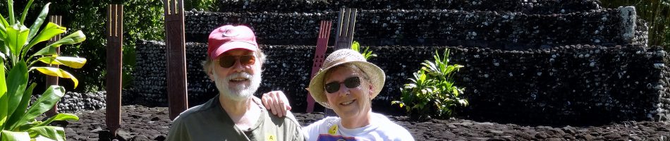
Well, once we started to climb we didn’t turn back until we reached the top. It was exhausting for a couple of old folks and we stopped to rest (& take pictures) often. At one point we were thinking of quitting when we ran into some fellow passengers on their way back down who told us we were near enough to the top that we couldn’t quit, so we didn’t. In the end we were glad we pressed on, as the views were spectacular. We saw a lot of wildflowers on our walk; they were not all in one place but I am going to group them together here. I don’t know many of their names, but maybe some of you will.


The first landmark we reached was the 17th Century Church of Our Lady of Health, almost half way up the mountain. It seems that after the earthquake of 1667 rats poured into the city bringing with them the plague (when it rains it pours!). This Church was built by the survivors to thank God (and to help ward off any recurrence). Thus, the name.


Here is a good place to tell you about the wall walk. As you have seen, the wall snakes up the hill to St. John’s Fortress at the top. It would be much too steep to walk (or build) straight up, so the wall was designed in a series of switchback that zigzag as they rise. There are some 1350 steps on the path from the town wall to St. John’s Fortress. The steps are built next to a wall that is an extension of the downhill side of the wall, and next to the steps is a steep path or ramp. Most of the time you can walk up the steps using the wall extension on the downhill side as a bannister. However, in a lot of places the protective wall is worn down or completely missing (I wonder how many visitors they lose in those sections each year). In those sections we walked on the ramp, which was difficult because it is very uneven and often covered with some loose gravel. So the wall walk was not only exhausting, but sometimes treacherous. I guess this added to the excitement, right? We were amazed to see some badly overweight and even somewhat disabled people up there heading for the top, which of course provided another reason we couldn’t give it up and go back. There were also some people doing this strenuous climb in flip-flops . . . go figure. Here are some indicative wall pictures from various levels.


")


We completed the climb all the way to the top. St. John’s Fortress was the command post for the whole defensive wall system. The earliest ruins here date to the 3rd Century BC but Emperor Justinian built a castle here in the 6th Century AD and it has been substantially modified since, and incorporated into the city walls that were built between the 9th and 19th Centuries (but mostly in the 16th & 17th). Today it is in ruins, but interesting to climb about, and there is a large red Montenegrin flag over the front wall. The views here are spectacular and well worth the effort of the climb (which was actually a lot more fun than my whining about it might make it seem).


So that is pretty much it for Kotor, and it was a lot more than we had expected. We walked back down the mountain & headed back to the ship for a very late lunch (or maybe we just had ice cream). Then, while the shadows lengthened as the sun began to drop behind the mountains we left beautiful Kotor and headed for Korcula, Croatia.


