Southern Caribbean, Part 4: St. Lucia, Antigua, St. Maarten, St. Thomas & Ft. Lauderdale
St. Lucia
We docked at Castries, the capital of St. Lucia, on Sunday, March 30. We had explored Castries during a previous visit in 2012 (our pictures of that visit can be seen at: <https://baderjournal.wordpress.com/2012/03/09/castries-st-lucia/> ). So we decided this time to take a bus expedition to Soufriere, the old French colonial capital, to see the Pitons, twin peaks that are the symbol of St. Lucia. It was a drizzly day, but quite rewarding.
The drive through the mountains to Soufriere was pretty long but quite pretty in the forest & on the hills. We stopped on the way at a small fishing village called Anse La Raye. It was in a nice spot but the town wasn’t much to look at. We drove by another fishing village called Canaries but didn’t stop.


")


As we approached Soufriere we stopped on a mountain side overlooking the town for our first look at the Pitons. The Pitons are twin mountains rising very steeply right out of the sea.


Our next stop, after driving through Soufriere, was the botanical gardens. It was filled with exotic flowers in all shapes and colors (hang on, there are a lot of flower pictures here).


")


Not just flowers here; this is a rainforest, complete with rain. It included some familiar house plants in their natural habitat, dieffenbachia & philodendron. And at the end of the trail was a picturesque waterfall.


We went next to see what is billed as “the world’s only drive in volcano.” Of course, anyone who has been to Yellowstone knows that isn’t really true. But it does have interesting steam vents & boiling mud pools (as does Yellowstone). These are made by pressure from the intense heat below from this active volcano. We were told that you used to be able to walk down to the vents, but one day a guide fell in when the one he was standing by collapsed. He recovered, but you can’t go near them any more.


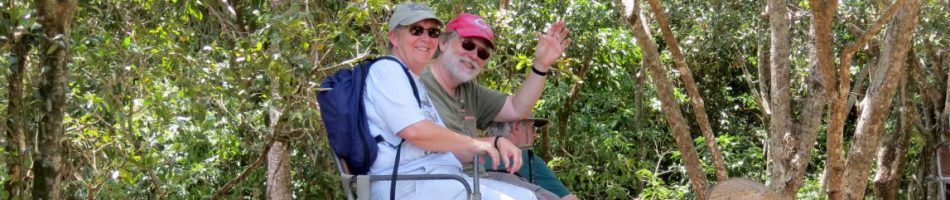
Our last stop was for lunch. We had a very good Caribbean lunch (with a delicious hot sauce) in a restaurant on a mountainside overlooking Soufriere. I’m not sure I have ever eaten in a restaurant with a more spectacular view.

 at lunch")

Antigua
We arrived at St. Johns, Antigua, the last island that was new to us, on Sunday, March 30. St. Johns is the capital of the nation of Antigua & Barbuda.

We left the ship after breakfast & walked along the long pier into town. On the dock was a steel band that was pretty good. The town was pleasant enough, although the streets had deep water ditches similar to Grenada. At the some of the major intersections there were low walls on each corner, presumably to protect pedestrians from cars cutting the corners. Our first visit was to the library. It was founded in 1854, but now is housed modestly on the second floor of a fashion shop. However we did see people coming and going so it must get some use.


Our next stop was the Antigua museum, housed in an old Georgian building that was once the Courthouse. The museum was small but very interesting, with artifacts and explanations about the lives of the Arawak & Carib Indians who once lived on the Island & of the early European settlers. Columbus was the first European to set foot on Antigua, during his second voyage in 1493, and he named the island after a statue of Mary in the Cathedral of Seville. One item of interest here was the Warri board, a game that originated in Africa & was said in the museum to be the oldest board game in the world. I’m not sure about that, though, since last year we saw a game board in Crete dating from 1,500 B.C., and in Turkey we saw a picture from an ancient Greek pot showing Greek soldiers playing a board game. There was also a larger than life statue of Sir Vivian Richards, an Antiguan soccer hero who was knighted for his athletic prowess (unfortunately we didn’t get a picture of that).


The last landmark we visited was St. John’s Cathedral, an Anglican church built in 1845 on a spot where churches had been built twice before. It is the dominant structure of the inner city skyline. Unfortunately it is undergoing extensive renovation so, as has been true too often on this trip, we could not go in to see the interior.


So we walked back to the ship, partly through a lively market. There were lovely flowers, as usual in the Caribbean. As we walked along a wooden sidewalk I was looking at the colorful buildings around us when suddenly my whole leg up to the knee dropped into a space left by a missing board! Fortunately I was wearing leather shoes & long pants, so the scrapes were minimized, but it sure did hurt for a few days. I decided not to sue, and we made our way back to the ship. On the pier was a fellow in an elaborate headdress playing a drum. You never know what you are going to see on a trip like this! Anyway, that was all for Antigua as we spent the rest of the day on deck chairs while my leg recuperated.


Sint Maarten
On the morning of April Fools Day we docked at Philipsburg, St. Maarten. This island is divided between the French & the Dutch & Philipsburg is the capital of the Dutch side. It has a nice beach & mind-boggling shopping, including the funky Guavaberry Emporium that we have always enjoyed.

However, we were tired after 4 consecutive port days, my leg wasn’t completely rehabilitated, and St. Maarten was subject to a State Department health warning about a nasty mosquito borne disease called Chikungunya making its first appearance in the Western Hemisphere. So we decided to spend the day relaxing on the ship instead of going into town. But we made an extensive blog posting of our last visit to St. Maarten during our South America trip in 2012, so if you want to see our adventures in this city use this link: <https://baderjournal.wordpress.com/2012/03/09/philipsburg-sint-maarten/> .
St. Thomas & St. John
We arrived at Charlotte Amalie, St. Thomas on the morning of Wednesday, April 2. St. Thomas & St. John are sister islands in the U.S. Virgin Islands. These islands were owned by Denmark from the mid-17th century until they were bought by the United States in 1917 as part of the effort to protect the Panama Canal. The city of Charlotte Amalie was named in the late 17th century for the queen of Denmark.
The ship was docked about 2 miles from town, but your intrepid travellers walked into town anyway. Much of the walk was along the large and beautiful harbor, in which seaplanes land and take off all day long. We had been here before and had a few places we wanted to visit. However, again our map was poor & the streets here are not easy to follow once you get away from the water, so it took quite a bit of walking to find what we wanted. That is why, despite the relative paucity of pictures here, we ended up walking more than 8 miles on the day.

Our first stop was the St. Thomas synagogue, which is the oldest continuously operating synagogue in the United States. Called Beracha Veshalom Vegmiluth Hasidim, it was built in 1833 to house a congregation founded in 1796. It contains an 11th century Spanish menorah (which may be the one on the wall in the 3rd picture below). The floor is covered in sand. Some say this is to represent the Israelites’ 40 years in the desert, but more likely it derives from the Spanish tradition of the Sephardic Jews who founded the congregation who covered the floors of their secret places of worship during the Inquisition to muffle the sound of their services. As we were walking back down the hill we heard a tourist who obviously had little English asking directions to “the church with a sand floor.” It was amusing, but we presumed that church was the only word she knew for a house of worship. On the wall outside is an unusual “reserved parking” sign. There was a car parked in front of it but I’m pretty sure it hadn’t been there since 1830.
")


As usual in the Caribbean there were a lot of beautiful flowers here. Also some odd sights, like a ramshackle bar apparently run by a large male chicken & Roosevelt Park, named in 1945 after a visit by the President of the United States.


We searched quite a while for the library but it wasn’t anywhere near where our map said it would be. Disappointed by that, we headed uphill to Blackbeard’s Castle. Local tradition has it that the pirate Blackbeard used this as a lookout, but it was built by the Danes in the 1670’s as a watchtower. It sits high on a hill overlooking bright red Fort Christian, named for the Danish King Christian V, built around the same time, where the actual defenses of the town were located. There is a restaurant just below it where we enjoyed lunch on our last visit to St. Thomas in the early 2000’s, with a fabulous view of seaplanes landing and taking off. But sadly today it is restricted to people who buy a ticket for a self-guided walking tour of the tower and a few other sites below that also used to be open to the public. Below the restaurant is the Three Queens Fountain, erected in 2005, commemorating three women who led an uprising in 1878. The approach to this area from below is via the “99 Steps,” a stairway built in the mid-18th century with bricks from Denmark that had been used as ballast in Danish ships. It actually has 103 steps, but who’s counting?


 Steps; still smiling!")


By now we were pretty tired from all the uphill walking, so we headed back toward the ship. We walked through the shopping district (mostly diamonds, watches, t-shirts & trinkets) on the way. I was walking along with my head down looking at the sidewalk (even though this one was safely made of stone) when I noticed a receptacle labeled “book return.” I looked up &, sure enough, this building was the library that we had spent so much time & energy searching for in an entirely different part of town. What serendipity, & a great way to top off our visit to Charlotte Amalie.


Having only 1 day here we chose to spend our time in Charlotte Amalie rather than taking the approximately 1 hour boat trip to St. John, only about 4 miles from St. Thomas. Only a little more than 4,000 people live on St. John & it has no airport, so boat is the only way to get there and it is a full day trip. But in 2011 we did spend a cruise stop here in St. John, so I thought I would include a few pictures from that visit. The boat dropped us in Cruz Bay, the town where the dock is. It is in a lovely spot with very blue & clear water.


In the town the one thing we have pictures of is, of course, the library.


Most of St. John is a U.S. National Park. The land was donated for this purpose by Laurence Rockefeller, with the stipulation that it be forever protected from development. We stopped at the park ranger’s station for directions, then set out to hike through the park on a trail beginning just behind it. It was not a particularly easy walk, lots of up and down and irregular pathways impinged upon by roots and potholes. Notably there were a lot of interesting cactus in the area. Eventually we came to a quite beautiful isolated beach, accessible only from the sea or by this hefty hike. I am not sure what the beach is called, but I have seen a picture of Oppenheimer Beach, once owned by the American physicist J. Robert Oppenheimer, and it looks like it could be the same one. We walked back after that along a different path, then took the boat back to our ship. Notably, the boat trip included unlimited rum punch.


Ft. Lauderdale
After two more days at sea we arrived back in Ft. Lauderdale very early on the morning of April 5. On the last day you are no longer a passenger to the Cruise line but an obstacle to getting the ship ready for the next set of cruisers who will begin boarding before noon. Therefore we were up uncharacteristically early so we could be out of our room before the deadline, & hopefully catch a very quick breakfast before the buffet was shut down to prepare for the new passengers. The upside of this is that we were awake in time to see a very dramatic sunrise over the same bit of land (island?) where we had seen a rainbow when we first set off. After a less than enjoyable disembarkation (it took over an hour from the time they called our disembarkation group to the time we got a taxi, most of it standing in line) we retrieved our car and started for home. A good two weeks & a fun time was had by all.


