Hilo, Hawaii (2024)
After leaving Kona we spent the night sailing around the northern part of the island of Hawaii to reach Hilo, on the eastern side, early in the morning. Sailing along the coast we saw what looked like a pink effect from the sunrise, but on closer inspection of the picture it appears to be mountains. These are probably one or two of the volcanoes that are near Hilo: Kilauea, Mauna Kea and Mauna Loa. As in Kona we saw a rainbow as we reached the port; they seem to be plentiful here from our experience.


Hilo was originally settled by Polynesians between 900 and 1500 years ago and westerners, in the form of missionaries and commercial ships, arrived in the 1820’s. This area had a thriving sugar industry, employing thousands of workers imported from Asia, but the sugar mills closed in the 1990’s. Today Hilo has around 45,000 people and tourism is probably the major industry.
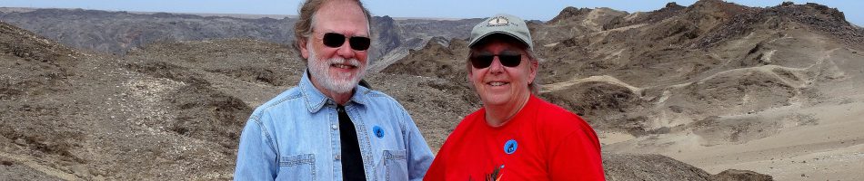
You may well think of Hawaii as a tropical paradise and nothing in our experience today would contradict that (as long as the occasional killer tsunami (1946 & 1960) and town destroying volcanic eruption (last in 2018) don’t contradict your understanding of paradise). We spent the day on a private excursion with our friends Tina and Rick (referred to here for obvious reasons as “the other Rick”) to explore the area, mostly along the coast outside the town.
We drove along Banyan Drive, a road on the Waiakea Peninsula lined with some 50 large banyan trees up to 90 years old. Most were planted by, or to honor, local and national celebrities when they came to town. The first were planted in October, 1933, when Cecil B DeMille was here to film a movie. Babe Ruth was also in town for some exhibition games and he planted one shortly after the movie folks (pictured below). Other celebrities who have planted Banyans include Amelia Earhart, Franklin Roosevelt and Louis Armstrong (whose tree mysteriously disappeared).

From here we drove to Hawaii Tropical Botanical Garden. This is a 17 acre garden running down a hillside to the edge of Onomea Bay. Containing some 2000 species, both Hawaiian and imported from as far away as Madagascar, it has almost 200 species of palm trees (some 100 years old) and numerous others too numerous to list. There is also an excellent system of paths and boardwalks, which is helpful because the walk down (and up) is pretty steep, with a 500 foot drop.
While this area had previously been the site of fishing villages and then sugar mills and shipping, it fell into disuse and by the 1970’s it had become a dense jungle. The founder of the gardens began developing it in 1977 leading with a team of workers, doing all the work by hand in order to avoid damaging the roots of trees and plants. The garden opened in 1984 and today is owned and operated by a nonprofit trust. At the edge of the parking lot was a very dense looking palm jungle that may be what the whole area looked like in 1977 (and also two little yellow birds we think were Saffron Finches). We walked across the road and entered the gardens.


")

We walked down the long boardwalk from the entrance. There are going to be a lot of flowers and trees shown here (paradise, right?), but we only know (or suspect) the names of a relative few. But they are all worth looking at anyway so we will include them here.


We walked on through large stands of very tall palms, some with air plants (bromeliads?)growing on their trunks. Also many more brightly colored flowers.

, Tina, Mary, the other Rick walking under a long Heliconica stalk of flowers")

, a bit blurry")

")


Onomea Falls is a small three tiered waterfall, discovered behind the dense jungle during the original clearing operation. Walking on from there we passed many more beautiful flowers, palms and ferns.


We walked on through a seemingly endless garden of flowers and trees, including tall bamboo and other trees, many with bromeliads growing on trunks and branches.


We came to the orchid garden, with a range of orchid types. There are thousands of orchid varieties so they had plenty to pick from.


After the orchid garden, yet more diverse flowers and trees, including red leaf obake.


 There was a peaceful Lily Lake in lush surroundings amid yet more flowers and plants.


We found ourselves near the water’s edge next to Onomea Bay. A plaque here said that a village called Kahali’i once stood here. According to legend, when many canoes with sails appeared out in the waves the chief called for a pair of young lovers to volunteer to give their lives to protect the village. A couple volunteered and stayed by the shore while everyone else was instructed to stay indoors all night with doors and windows closed. In the morning they went to the shore and the young couple was gone but there was now a pair of rock formations connected to each other barring the way into the bay. Called Twin Rocks, they stand there still, as you can see below.
 at the end of the cliff in the distance.")


In the other direction was an excellent view of surf coming in to the shore. In the distance we could see a mound of rock which we think might be all that is left of the Onomea Arch, a large landmark carved from the cliffs by the Pacific that stood for thousands of years before falling in 1956 during an earthquake. (The remains of the arch might instead be the last part of the ridge into the sea in the first picture of the bay, above. We really aren’t sure, but it’s probably one of those.)


We soon began the long uphill walk back to the park exit. Of course, there were many more flowers and trees to see along the way, including one tall tree sporting a huge number of small brown potato looking fruits (probably growing on a vine).


 g
g")


Leaving the gardens we drove a very short way and walked onto a white wooden bridge spanning Onomea Stream, a picturesque spot with a small waterfall and a lot of boulders in the water.


We stopped for a tasty fish and chips lunch at Kaleo’s Bar & Grill in Kea’au where our guide was a semi-regular, then drove a good way to reach Rainbow Falls. Its name comes from a rainbow that forms sometimes in the mist at the bottom of the falls, usually early on a sunny morning. However we were there later and a fairly heavy rain fell as we drove there, enough that we thought we would be standing in the rain to see the falls. But the rain magically stopped completely just as we got out of the car. We walked a short distance to the falls, where only a few people were gathered. The falls was very nice, with two streams (we are told it can be much larger and faster if a lot of rain has fallen upstream) combining to drop about 80 feet in front of a large natural lava cave that is supposed to be home to the ancient Hawaiian moon goddess Hina. But with our arrival in the afternoon and the rain having suppressed the mist at the bottom there was no rainbow.


We next made a brief stop at Wailoa state park in Hilo. Here we saw one of the large statues of King Kamehameha the Great. Erected here in 1997, it is 14 feet tall (about twice the man’s actual size) and includes a helmet and cloak that are golden. Not far away the graceful Waiolama Footbridge crosses the mouth of Waiākea Pond.


We drove to the Puna district along the east coast where much of the lava from the 2018 eruption of Kilauea reached the ocean, after destroying several towns and burying wide swaths of land and buildings. This area is characterized by black lava cliffs and black sand beaches, ocean waves crashing ashore and palm forests. Our first stop was MacKenzie State Park above some cliffs dropping into the ocean. It has tables and seats carved out of lava where you can picnic and beautiful vistas of waves crashing into the lava cliffs.


The surf rushes into recesses in the cliffs so fast that it leaps into the air and sometimes there are rainbows in the resulting mist.


Isaac Hale Beach Park was a popular location for swimming and boating in Pohoiki Bay, with a boat ramp opening into the ocean. But the 2018 eruption changed all that. The boat ramp is still there, but it leads only into a large pond created when the lava flowed down and filled the bay leading to the ocean. Miraculously, it stopped just short of the boat ramp. Beyond a high ridge of lava rock is a new beach created by the eruption. We have read that the lava extended most of the land along this coast up to a mile further into the ocean, enlarging the island of Hawaii by several square miles. We could see the new black sand beach formed beyond the ridge of lava rocks near the boat ramp (with a few plants already fighting their way to the surface of the lava).

")
As we drove on piles of lava rock lined the road, presumably created when the road was cleared after the eruption ended.


We stopped at one more spot along the coast. We don’t know its name but Laurence told us that it was on this spot that he decided to live in Hawaii forever. It is very beautiful, with many palm trees along a sea cliff with waves bashing the shore, a classic Hawaiian vista. There was also a small natural bridge made of lava; signs said it was dangerous but Tina and the other Rick ventured out there anyway (and lived to tell the tale).


We drove back to the port along the Red Road (we think), which was originally a one lane road of red asphalt but has since been expanded to two lanes of black asphalt. People still call it the red road though. It winds through a variety of settings, most dramatically through tree tunnels like the one below.

So this was a very full day with many spectacular sights, thanks to our guide, Laurence, and Tina who arranged it. There is still a lot to see in this area though, so we are hoping to return here sometime. One day is just not enough. The sun set and we sailed away.
![]()


Leave a comment