
Cape Town, South Africa (Day 3) — 2024
Surprisingly after our experiences the previous two days, everything went as planned on the morning of April 19. The ship was just where it was supposed to be and everybody showed up at the cruise terminal on time to start our second excursion with Ligia. Yesterday we drove east and today we drove south, heading down to the end of the Cape of Good Hope, a scenic drive with many points of interest along the way.
Our first stop was to be Boulders Beach, home of African Penguins. On our way south we passed mountains and small towns. As we drove through Muizenberg we saw the old post office, a Cape Dutch style building dating (we think) to 1911, which has also served as a magistrate’s court and currently a museum. Muizenberg was the scene of a battle in 1795 that resulted in the first British landing in the Cape. With a population just over 36,000, this is a popular surfing area; Agatha Christie used to surf here back in the day. As we neared Boulders Beach there was a view of the old Simon’s Town waterfront across the waters of False Bay. Established in 1680, Simon’s Town is a popular tourist attraction and home to a large naval base. The old buildings in town are visible just back from the water in our picture below.


Boulder beach is a beautiful spot in Simon’s Town. It has (you probably guessed it) lots of granite boulders. But what it is famous for today is a colony of African penguins. We had to walk a for a bit past many street vendors to reach the entrance, where there is a fee to go in. One penguin was standing on a rock by the fence near the entrance, looking like he was the designated greeter. We entered the site and walked past the information center and gift shop (if you ever want a penguin themed memento, this is the place to come). Then we walked down a wooden stairway toward the beach.


This is one of three penguin colonies in southern Africa. The first penguins showed up here in 1982. From the two mating pairs that were the first arrivals there are now some 3,000 penguins based here. A wooden viewing platform at the end of the lengthy wooden staircase down the hill enables visitors to get pretty close to the penguins, but no one is allowed down onto this beach. We understand that there are other parts of Boulders Beach that are not restricted so people can sometimes get right down among the penguins but we did not see that. The people are restricted here but the penguins are not. The penguins go into the water and are free to swim, and swim away if they like (we understand they do swim away to hunt for food). We did see a couple of people in snorkeling gear among the rocks, but assume they were assessing the conditions to help protect the penguins.
")


The African penguins look almost identical to the Magellanic penguins we had seen several times in the southern part of South America, and they are an endangered species. The beach with the viewing platform is their actual mating area and we were in luck because it was mating season. We saw some chicks and, even better, some pre-chicks (ie. incubating eggs). These penguins dig burrows in the sand to hatch their chicks, in part to protect them from the sun since this area is much warmer than the Antarctic habitat where most penguins live. Males and females take turns incubating their egg, so we aren’t sure whether the penguin with the egg is the mother or father. These penguins generally mate for life.


 a watchful parent")

The most distinguishing feature of these penguins is the naked pink area above their eyes. This helps them regulate body temperature, with more blood coursing through there when it is warm to dissipate body heat and less when it is cold out. When it is hot the pink color intensifies. We have read that the number, size and pattern of spots on their white bellies are unique to each penguin, similarly to human fingerprints. The penguins occupied themselves not only by swimming, but walking around and climbing up and down the sandy hill, singly or in groups, or just standing around doing nothing.
")


")


Meeting up with Ligia again after we left the protected area, we headed further south. We drove through a large area called (we think) the Cape Flats that was mostly scrubland and bushes, with few if any trees. It is scenic, with a few mountains in the distance.


This area is home to several species of wildlife you (or at least we) don’t really see often in the wild. We passed what we assume was a family of ostriches, one male and at least two females, foraging in the bush. They all got together and mooned us. The male is, of course, much bigger and more brightly colored than the females.


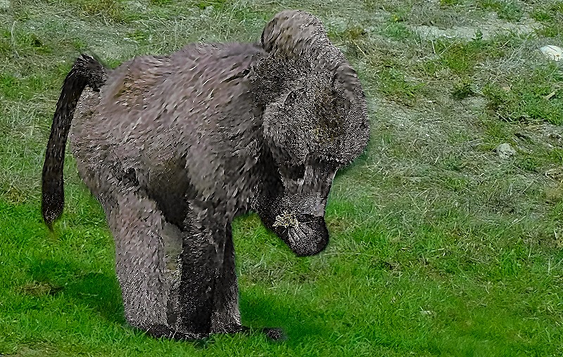
We also encountered a baboon foraging by the side of the road. He had no interest in us whatsoever; he must be very used to cars stopping to look at him.

, also eating")

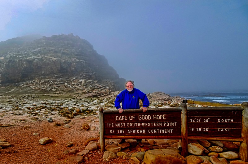
Eventually we reached the official Cape of Good Hope, the end of the Cape Peninsula. Cape Point, the actual tip of the peninsula, is a rocky promontory about a mile and a half away. There is a small lighthouse on top of a large rocky hill that is supposed to have a good view of it, but it was crowded (as it often is) so we didn’t go up there. This spot is the farthest southwest point on the continent of Africa, but it is not the southernmost point, nor is it the place where the Indian and Atlantic oceans meet. Those would both be at Cape Agulhas, which is about 90 miles east of the Cape of Good Hope and extends some 34 miles further south. It was rather chilly and overcast when we reached this area, which is very rocky both on the flat land and in the nearby mountain, and there is a sign giving the exact latitude and longitude.
")
")
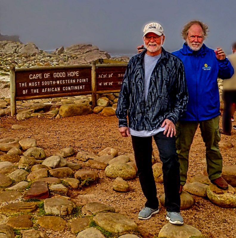
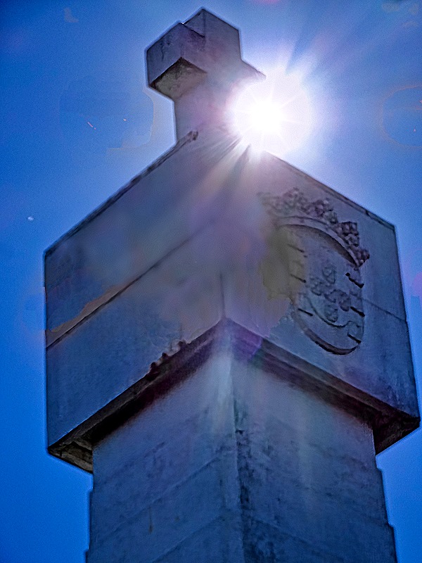
We spent a little time here (the pictures don’t show it, but there were a number of other visitors here), then headed back north. We had come down mostly on the eastern side of the peninsula and we returned along the more scenic west side. Eventually we turned off on a side road that took us to a monument standing alone in the bushlands called the Dias Cross. Bartolomeu Dias was the Portuguese explorer who was the first European to sail this far down the African coast. He reached this spot in March of 1488 and named it the Cape of Storms. The Portuguese king later changed the name to Cape of Good Hope because it gave hope that they would eventually be able to reach India by this route. The Portuguese practice was to erect a “padrao” (a stone cross) on a prominent spot to claim a newly discovered land. Dias erected one here near a rocky point now called Kwaaihoek in 1488. Remnants of it were discovered in 1938 and are now kept at the University of the Witwatersrand in Johannesburg. At some point the Portuguese government erected a monument here to Dias’s expedition. The monument is white with a cross on the top and can be seen on top of a hill from the main road. Around the monument we got a closer view of some of the flowering bushes that are characteristic of this area. Not far away, on a scenic spot overlooking the water near the eastern coast of the peninsula, is a smaller stone cross enclosed in a fence that also commemorates Dias’s voyage, erected by the Portuguese community of Cape Town.


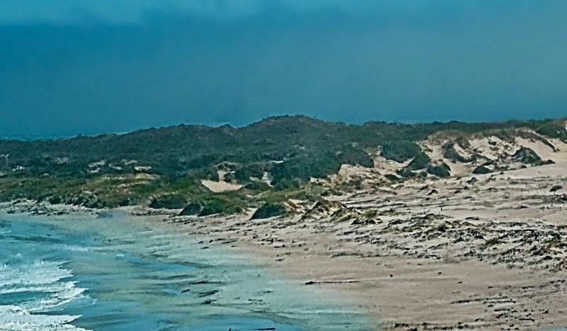
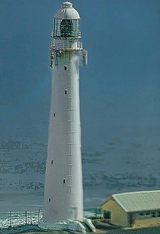
We continued north, passing stark mountainous views. We met a small black pig foraging at the side of the road, perhaps escaped from a local farm. We drove past beaches near Kommetjie, a popular surfing area, and had a view of the Slangkop Lighthouse located there. Dedicated in 1919, it is more than 108 feet tall.


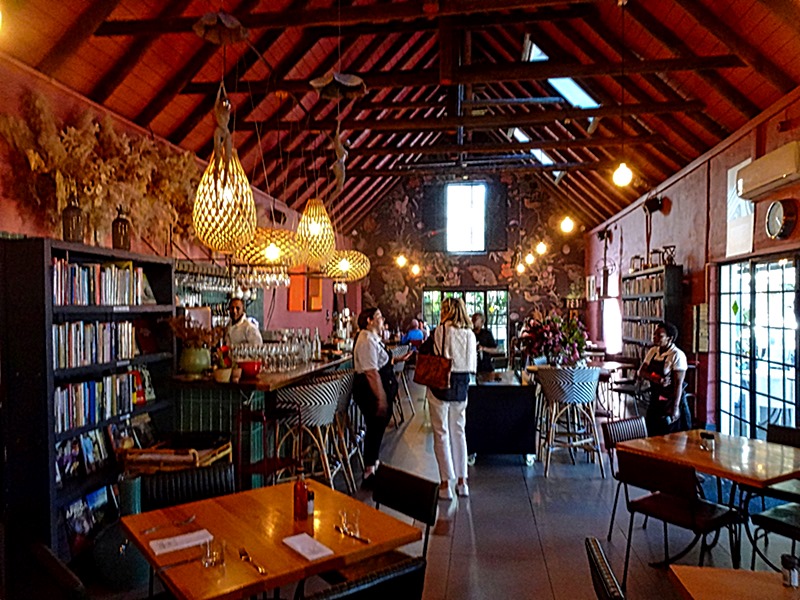
We stopped for lunch in an area called the Farm Village in the town of Noordhoek. The restaurant is called the Foodbarn. Sounds prosaic, but it is run by a chef from France and the food is very good and also creative. Interesting ambience too (notice the wallpaper).


Chapman’s Peak Drive runs about 5.5 miles between Noordhoek and Hout Bay. It is a rather spectacular drive (some say the most beautiful in the world) on a narrow road cut out of a sheer reddish mountain cliff just after World War I. It is a toll road and is said to be safe these days, but it was closed for long periods in the 1990’s and again the 2000’s after several deaths in order to build better safety protections. As you drive along this road there is a sheer mountain cliff going up on one side and a steep drop off toward the water on the other side. Chapman’s Peak is the southern extension of the Constantiaberg, one of the largest mountains in this area.

 from the road")
We and walked a little way down to a viewing platform overlooking Hout Bay. A number of other visitors were there and also some vendors selling interesting local arts and crafts (one of which we purchased). The sun was getting lower in the sky and reflected on the water toward where we stood, which made the view quite special. The closest mountain to the mouth of the bay is called The Sentinel; it is also called Hangberg, as is the town located behind it.


")
We drove back to the wharf where our ship was, miraculously, still docked where we left it. We took some last photos from the top deck of the ship of always photogenic Cape Town under Table Mountain, and of the harbor where a container ship was docked behind us. So after two very full and enriching days (thanks to Bob, Judy & Ligia), we headed back out to sea.


Leave a comment