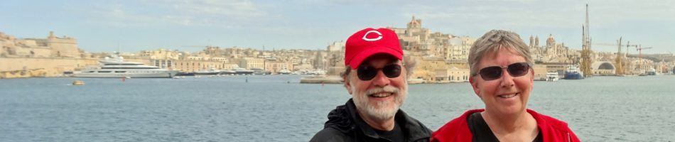
Punta Arenas, Chile
The morning of January 30 found us docked a couple of miles north of Punta Arenas, Chile. Because another cruise ship was due in that day Prinsendam had to move out into the harbor to make way at the dock. So while we left by the dock for our excursion to see the Magellanic penguins at Seno Otway (Otway Sound), we had to return by tender boat from the center of town, which suited us perfectly. Punta Arenas means “Sandy Point,” which was the name of this place until the Spanish took it over. It has between 100,000 & 150,000 people.

The main thing here for us was penguins. You can’t come all this way and not see some penguins. We went on a shore excursion to Otway Sound, about an hour from Punta Arenas (on a bumpy unpaved road), where there is a rookery of Magellanic penguins (named, obviously, after the Magellan Strait where they breed). The place is on private farmland and you have to walk on a boardwalk for about half a mile across some pretty barren land to get to the penguins.


Magellanic penguins mate for life (which can last 30 years) so you usually see them in pairs.


Note that these are not all the same penguins; each pair is different, although they look remarkably alike. There was also a penguin chick (this was near the end of mating season and all the penguins will be gone in another month or so). He still has light gray feathers with a mostly white head and some fluffy chick feathers still on the back of his neck. It was funny to see his parents chasing him around, scolding him (“You get right back here, young man!”), although because he was bigger than they he mostly ignored them. The chicks have to grow up fast; in a few weeks all the penguins will leave & have to fend for themselves in finding food and swimming.


On the beach nearby a lot of penguins were gathered, presumably to look for food.


And here are a few more, just because I have them. They look like they have big smiles on their faces.
.


Near the penguin rookery we also saw some Rheas. They are relatives of the Ostrich and I am told that crossword puzzle fans will be familiar with them (or at least with their name).


While the Otway Sound area looked pretty bleak from afar, with no trees or bushes, if you looked closely there were some striking wildflowers close to the ground.


From Otway we went into Punta Arenas, passing on the way a forlorn looking antique car museum in the middle of nowhere (literally); I can’t imagine how it gets any visitors. In Punta Arenas there was, of course, the Plaza de Armas.
")


In the Plaza de Armas was a monument to Magellan (the city is, after all, on the Strait of Magellan). Across the street was the church & around the plaza were a number of interesting buildings with vintage architecture.


Two more statues: one of Bernardo O’Higgins, one of the leading generals of the South American independence struggle. You will recall statues at previous ports of tuna and penguins & seals; here there is a statue of the tail of a whale, which can be found in the Strait of Magellan (but not by us, alas). There was also a lovely rainbow over the harbor after we got back to the ship.


And finally for today, a look at some old pictures of the original inhabitants of this area, all of whom are long gone. The pictures are outfitted with reproductions of the masks they produced. You will note that they painted their bodies all over (I don’t actually know if that is paint or tatoos). More interesting, however, is that they lived in this area stark naked (if you look closely, you can confirm this for yourself), and believe me it gets cold here (its summer now, & still pretty chilly). Clearly, they were made of sterner stuff than we are.


Strait of Magellan
January 29 was a ship day as we sailed through the Strait of Magellan toward Punta Arenas. The Strait cuts all the way through the continent several hundred miles north of Cape Horn and, as you might have guessed, Fernando Magellan was the first European to go through it.
In the morning we saw our first glacier, called the Amalia Glacier. Most of the glaciers down in this area have been shrinking for the last 200 years, but faster & faster over the last 30 years or so. The Amalia Glacier is the biggest one we have seen in South America (I expect we will see more in Antarctica).


The front wall of the glacier, which you can see above, is about 200 feet high. On the first small picture, after the one with Mary in it, you can see an island in front of the glacier. If you look very closely, there are fairly tall evergreen trees on top of the island, so that gives you an idea of how high the glacier wall is.
We continued through the Strait of Magellan after that. It is lined with impressive hills and mountains but it was pretty overcast & hazy, so the pictures really don’t show the mountains very much. We could see them in person, though, & the swirling clouds around them gave a mysterious air to the whole affair.


In the afternoon we came to a shipwreck from 1969. The story (perhaps apocryphal) is this: The convention at that time for instructing the helmsman was to say “all left” or “all stop” or “all right” or “all ahead.” It seems that a crew member made a proposal about something to the captain, who agreed, saying “Alright.” He said it a little too loudly and the helmsman immediately turned the ship to the right, directly into the big rock you can see in the first picture. It reminds me of the people who follow their GPS directions onto a railroad track or into a lake. I guess (hopefully) they now say “all starboard,” rather than “all right.” Anyway, no one was killed in the mishap, but apparently no one saw any reason to clear it away either.


We spent the rest of the day cruising toward Punta Arenas, with some small lighthouses spotted on top of hills by the water.


In Patagonia
On Thursday evening, January 26, we left Castro & sailed south toward our next stop, Puerto Chacabuco in Patagonia. This area is just stunning. During dinner we watched a glorious sunset, which turned the top part of the mountain range that was along the channel a beautiful pink . Because we were at dinner we didn’t get a picture of the range, but here are a couple of shots of mountains in that range. They really do not do justice to the sunset colors.


Friday morning, January 27, found us in the harbor of Puerto Chacabuco. The weather was quite ugly, so rainy & cloudy you couldn’t see much. We had to go ashore via tender boats & for awhile the water was so choppy they wouldn’t let us board the boats. Happily, the weather in this area can change extremely quickly and for most of the day it turned out to be beautiful & sunny. Here are two views of Puerto Chacabuco from the ship, one in the morning & the second in the evening. Quite a difference.


Puerto Chacabuco was built in 1995; it is just a port & there is no town. The port here used to be at a town called Puerto Aisen. However in the late 1980’s & early 1990’s there was a long series of forest fires causing erosion from the mountains that filled the river with silt, making the river un-navigable. So they built this new port at Puerto Chacabuco, but the nearest town is still Puerto Aisen. Here are a few views of the area around Puerto Chacabuco.


We took a privately arranged tour of the area that took us first to Puerto Aisen. The guide said no one knows the origin of the name but one theory is that when the first settlers came this was the limit of the local ice sheet, so they called it “ice’s end” or Aisen. Sounds dubious to us, particularly since that phrase sounds suspiciously like English. Anyway, it’s a small frontier town on a river nestled among large snow-capped mountains. The weather really changed during just the 20 minutes or so that we were there; I have included at the end of this sequence two pictures of the same mountaintop from the Plaza de Armas taken about 3 minutes apart.


Next we saw a two level waterfall called Cascada de la Virgen, named after the shrine next to it of (what else?) the Virgen de la Cascada. After that we went to a nature preserve including part of the Rio Simpson, a lovely river among the mountains popular with fly fishermen. Among other things, we saw there some wild fuschia & a giant relative of the rhubarb which is eaten by the local folks, but we didn’t see any of the condors that live there.


We had lunch at a “campo” or country house in a place called Pangal. This is not a tourist place but a family who are friends of the guide. They grow most of their own food; there is a greenhouse for growing salad greens, and they have llamas, sheep & geese (at least that is all we saw). Lunch was served in their “quincho,” a wooden barbecue house designed for parties & celebrations. Because the van could not cross the suspension bridge on the way to the campo we had to walk about a half mile, across the bridge (which is solid, but does sway a little) and through some beautiful mountain scenery.


In the quincho was a huge fireplace in which a whole lamb was roasting on a spit. We were told that it had been cooking for about 4 hours. We were given a pisco sour & Chilean wine to drink and were served the lamb as “asado al palo,” along with salad & potato & fried bread called sopas. It was all delicious.
")

During the meal we were entertained by a young couple doing local folk dances (one of the dances was called a “cueca”). The gaucho appeared to have a roving eye.


Outside was this little ram making a lot of noise & looking like he really wanted to go inside the quincho. I tried to tell him that it wasn’t pretty for lambs in there but he didn’t seem to believe me.


After that we went back to the ship, making one more pass through this beautiful territory. As usual there was a towel animal to cap off the evening (you wouldn’t want to miss one of those, right?).


Friday night was very rough. The captain came on the speaker around 8:00 to tell us that they were changing course because of bad weather & we would be going out into the ocean at midnight, where we would stay most of Saturday and then go back into the fjords Saturday evening. He told us to prepare for bad weather and to secure everything in our cabins “unless you want to see your Ming vase rolling around the deck on your verandah.” We don’t have a verandah in our cabin (or a Ming vase, for that matter) but we did secure everything in our cabin, putting things in drawers & cabinets. During the night the ship was going up & down quite emphatically; in the middle of the night I was awakened when our bathroom sliding door suddenly slammed shut on its own initiative (Mary, amazingly, slept right through that). The next morning the captain told us we were experiencing 15 foot waves & gale-force winds. It surely felt like it; you couldn’t walk in a straight line around the ship, but were constantly weaving back & forth like a drunk. First the floor would be inclined to the left, so you would lean in that direction to maintain your balance, but suddenly the floor would be inclined to the right instead, so you would stagger to the left while trying to regain your equilibrium by leaning to the right, but just when you thought you had succeeded the floor would suddenly be inclined to the left again & the cycle would repeat. I told Mary we were getting good exercise out of it since you had to walk twice as far to get anywhere on the ship with the constant zig-zagging. I took a couple of pictures of the waves, but because of the height from which they were taken they do not begin to convey what it really looked like.


We did go back inside the fjords around 7:00 & it was much calmer. We could see impressive mountains along the side of the channel but it was too misty to get a decent picture. When on a long voyage like this, away from the normal rhythms of city life, it is easy to lose track of the days. So on Prinsendam they change the floor mats in the elevators every day as a reminder (remember, there are lots of older folks on this cruise, so memories are probably generally less than stellar). And, of course, another towel animal.


From this point on for the next couple of weeks internet access, and therefore blog postings, will probably be pretty spotty. We have ‘”scenic cruising” on Sunday, we are in Punta Arenas on Monday (where I hope to post this blog entry), then Ushuaia, Argentina, on Tuesday (where I may have another blog post),. After that are 5 days of cruising through Antarctica where we will most likely be incommunicado. We are supposed to be in Stanley, Falkland Islands on Monday, Feb. 6 (although we are told that weather prevents going ashore there about half the time), then two more days at sea until we reach Buenos Aires on Feb. 9. After that communications should be better & you will hear from us more often.
Castro, Isla Chiloe, Chile
After a rough day at sea, we arrived this morning at Castro, a town on Isla Chiloe (chee-loe-way) off the coast of southern Chile.


A sharp contrast to Santiago’s teeming millions, Castro has between 20,000 and 30,000 people and its green hills are a welcome change from the deserts of the last week. It’s a small port so I imagine it gets few cruise ships, but it seems to have a thriving tourist trade since there are lots of hotels & restaurants. Established by (who else) the Spanish in 1567, it was then isolated from all European interaction for 200 years after the local Mapuche people drove the Spanish out of the southern Chilean mainland in 1599.
Built on the landward side of the island (the 2d largest island in South America after Tierra del Fuego), Castro was pretty much destroyed by an earthquake & tsunami in 1960. The buildings here are mostly wood, painted a variety of bright colors.


The cathedral, opening (as usual in South American towns) onto the Plaza des Armes, is painted yellow with a purple roof. Because of the unusually high and low tides buildings by the shore are built on stilts and are called Palafitos.


As you can see, it was very low tide when we were there; some boats were on the beach waiting for the water to come back to them.
We walked all the way up the very steep hill to the cathedral. You can see how steep it is from this sidewalk up the hill, which is actually a stairway. If you look very closely, there are two people walking up, near the top of the stairway. They are not us; we took an easier route. Walking back down we passed a couple of dogs in front of a restaurant having a great time chasing cars slowly climbing the street, trying to bite their tires, then returning to the restaurant to await the next driver. Mary turned to me and said “valet barking.” I wish I had thought of that one. Also here are a few other random shots of interesting things in town, like a cow sculpture, some graffiti & a mime playing an accordion. Finally, today’s towel animal, a cobra.


Antofagasta & Coquimbo, Chile
Long time, no see. Before getting into today’s subject, I wanted to correct my description of Mollendo, which I derided the other day as an ordinary Peruvian town. I have since learned that it is a seaport (once an important one) & one of the top resort towns in southern Peru. Rich folks from Arequipa have beach homes here and there is a castle, which is now apparently owned by the Catholic Church. We (obviously) didn’t see any of that, but then we didn’t stay very long because I was still feeling pretty sick then (much better now, thank you).
Anyway, on Saturday, January 21, we docked at Antofagasta, our first stop in Chile.

As you can see from the mountains this is still on the edge of the Atacama desert. There is a town not too far away called Calama that has never recorded a drop of rain. In the late 19th century Chile fought a war with Peru & Bolivia over this area, with the result that Chile has sovereignty here but Bolivia (which has no coast) is guaranteed a trading outlet at ports in northern Chile, including Antofagasta & Arica. Chileans & Peruvians don’t like each other very much to this day.
This is important because in this area of Bolivia is a place called Potosi, which was basically a volcanic mountain of silver. While most silver ore has less than 5% silver, the ore at Potosi had more than 50%. Nearby was another mountain full of mercury, which is used to extract silver from ore. The Spaniards, true to form, basically enslaved the local Indians & forced them to labor in the mines, most of them dying quite quickly. We were told that in some of the Indian graves from that era, when the bodies decomposed what was left was a pool of Mercury beneath the skeleton. Anyway, Potosi accounted for about half of all the Spanish silver exported from America in the 16th & 17th centuries, which basically doubled the money supply in Europe (and also, incidentally, in China where the Spaniards traded it in Manila for porcelain & silk) & apparently also paid for the Hundred Years War.
After the wonders of Peru, Antofagasta was really not a very interesting city. Here is Mary in the Plaza Colon (Spanish for Columbus) with the dome of the Regional Library in the background. There was also a fountain and a clock tower. The clock tower was contributed by the British community here & is said to be a miniature copy of Big Ben in London, but really looks nothing like it (it does have 4 clock faces).


We noticed quite a lot of dogs lying around the streets, some with collars some not, some looking mangy and some not. Also, I think this is a statue of Ferdinand & Isabella, although it wasn’t labeled. It is at the edge of Plaza Colon, on Avenida Jorge Washington.


Here we are leaving Antofagasta where a small lighthouse sits at the harbor entry, occupied by lots of birds, mostly pelicans.


 near lighthouse")
After a sea day we docked in Coquimbo, Chile, on Monday, January 23. Coquimbo & its sister city La Serena are resort towns on a beautiful bay.


Coquimbo is built on the steep hills surrounding its harbor. On top of the hill where the ship was docked is a huge & very ugly building called the Millennial Cross. Built in 2000, as the name indicates, it memorializes the Pope’s visit to South America. You can go up & look out the windows (we didn’t). The other major landmark in town is, weirdly, a mosque on a hill. We are told that this does not represent a Muslim community in Coquimbo, but was built primarily as a tourist attraction. We’re not sure whether this is true but speaking as tourists it doesn’t do much for us.


The hills are so steep that the sidewalks look like Lombard Street in San Francisco.


They must not get many cruise ships in Coquimbo; they sent out a band to greet us in the morning (way too early) & to send us off in the evening. Not the world’s greatest band, but it was a nice gesture.

We took a van with a few other people for a personal tour. He took us to a spot called Drake’s Castle, where Sir Francis Drake supposedly built an encampment while pirating Spanish ships along the west coast of the Americas. We believe he camped here, but we don’t necessarily believe he built the castle-like structures. However, its a lovely spot, with rock formations, beautiful flowers & bay views, & a rock full of sea lions. I guess in some circumstances people will pay just about anything for a bathroom (it’s really about $.50).


 $250")
We then drove around the bay to La Serena, a beach resort. We stopped at a wimpy lighthouse on the beach then drove up a hill to visit an old fort (still run by the army) built, we were told, by Italians. We were told that a lot of Italians emigrated to this part of Chile at the end of WWII (while the Germans were going to Argentina, I guess), but this fort is a lot older than that. There was a pool with a marble sculpture brought from Italy & some nice Italian marble benches as well.


We went on from there to a shopping square,with artisans, souvenirs, barbers, hat stores, etc. We stopped at a grocery store, mainly to use the bathrooms. Here is Mary in the van with our friends Bing & Barb & a sign for parking for expectant mothers.


The shopping stop was a nice little square with a fountain in which kids played.

Lots of colorful items for sale, some artistic & some not so much.


And finally, for you towel animal fans, here are a couple more:
")


