Latest

Anchorage, Alaska (overnight) 2025

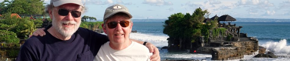
     We docked late on the morning of June 25 at Anchorage for a two day stay.  The dock was part of a military base called Joint Base Elmendorf-Richardson, which is where the Trump-Putin summit was held less than two months later.  Our side of the ship faced the land and in the distance, well beyond the rather uninteresting buildings in the area, was a beautiful mountain range glowing in the sun along with the clouds above it.

DSC09805_stitch

     Anchorage is by far the largest city in Alaska with a population of close to 300,000.  It was named (sort of) by Captain Cook, who visited here in 1778.  He called this area Anchor Point because he anchored his ship here; it was later changed to Anchorage because there was already an Anchor Point near Homer, Alaska.  Cook Inlet, through which we sailed to get here, was named for Captain Cook.  The area has been inhabited by Native people for at least 5,000 years. The city began as a tent city housing American railway workers in 1914 and was incorporated in 1920.

DAY 1

     We were not permitted to walk through the military base toward Anchorage for security reasons so we took the shuttle bus that was provided into downtown Anchorage.  (We were told that this was one of the most secure bases in the country, but they let us ride through it several times requesting, but not checking, that we not take pictures on the way, so that doesn’t seem especially secure.)  We were cautioned that if we were not on time to catch the last shuttle to the ship we would have to find somewhere else to sleep because unauthorized vehicles (like taxi’s) were not permitted to enter the base.

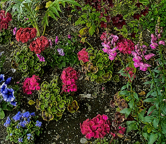
     The shuttle bus dropped us off at the Egan Center, a convention center in the middle of town, and we spent the day walking around.  Across the street was a park with some very colorful flowers.

DSC00340DSC00341DSC00347

     We visited the ceremonial starting line for the annual 1,000 mile Iditerod sled dog race, the finish line for which we had seen in Nome.  There was a statue of a sled dog nearby.  Interestingly, we read that the mushers put booties on their dogs to help them withstand the wear and tear on their paws, typically using between 1500 and 3000 of them during the race.

DSC00343DSC00344

     We discussed the 1964 Anchorage earthquake in the Valdez episode.  This was the largest earthquake ever recorded in North America (9.2 on the Richter scale) and the second largest in the world.  Tsunamis reached as far as Antarctica and Anchorage was devastated.  We walked past the JC Penney Building, which was constructed after their original 5 story building on that site (which had just opened in 1962) was destroyed by the earthquake.  We also walked past the United States Courthouse, which may be famous for other reasons but is notable to us because Rick argued (and won) a case here about 30 years ago.

DSC0034520250625_131843_stitch

     The Anchorage Museum is a sizeable museum in downtown Anchorage devoted to all aspects of Alaska.  Its glass facade faces a lovely green park full of flowers and surrounded by trees.  It also has an interesting gift shop.

DSC00363DSC00360DSC00364

     We spent a good amount of time perusing the exhibit halls in the museum.  There were some rooms devoted to sled dogs and an exhibit of striking blue and white paintings of Alaskan landscapes (the photo does not do them justice).  The Smithsonian’s Arctic Studies Center has a large gallery here of Alaska native artifacts on long term loan.  We found this quite interesting.

DSC00348DSC00356DSC00351DSC00354_stitchDSC00359DSC00352DSC00350DSC00357

     We intended to have a late lunch at a famous pizza restaurant we thought was nearby, but after walking several blocks uphill we found that it was still pretty far away.  So we found another restaurant downtown called Tent City (the original name for Anchorage when folks were still living in tents).  It turned out to be quite interesting with very good food (and beer).  We sat at a long dining bar in the front window and across the street was a colorful mountainous wall mural.  Rick had halibut fish & chips & Mary had a hamburger with the restaurant’s name and logo burned into the bun.  There were some interesting old photos of Anchorage inside from when it actually was a tent city.

20250625_140251DSC00367DSC00366DSC00368

     After lunch we walked back to the Egan Center and waited in a long line to board a shuttle back to the ship.  Still another day to go in Anchorage.

DAY 2

     We had booked an excursion offered by our travel agents for this day that would take us out of town, but it started out pretty badly.  There were supposed to be two vans that would be about half full but at the last minute one of the drivers called in sick.  Instead of finding another driver the local tour company just sent us one van and it was too small to hold the full complement of excursioners.  So Keith and Susie, our travel agent’s hosts on this voyage who were supposed to lead this excursion, had to stay at the ship and miss the tour.  While our driver/guide did a fine job we hope our travel agents find a different company next time.

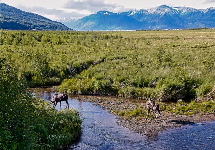
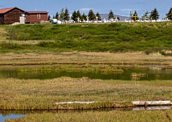
     We visited two locations on this tour.  First was Potter Marsh, at the southern end of the Anchorage Coastal Wildlife Refuge that borders the Turnagain Arm of the Cook Inlet.  The area was originally quite turbulent from the tides of Turnagain Arm but in 1917 railroad construction cut it off from the tides and created the calm water lands we visited today.  The marsh sits between the Seward Highway running along the seashore and the Chugach Mountains, quite visible beyond the marsh.  We walked along a 1500 foot long raised boardwalk through the marshland.  Among other things, there was a culvert built under the highway to enable salmon to enter the marsh and Rabbit Creek to spawn.  Unfortunately no salmon were there when we visited.

DSC00381DSC00376DSC00377DSC00379_stitch

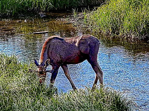
     We saw very little wildlife this morning, at least not sitting still where they could be seen and photographed.  The big exception was moose.  We saw a moose couple grazing and drinking in a creek.  It was early enough in the year that the male’s horns were just beginning, extending maybe 6 inches from his head under his ears (hard to see because his face was obscured by the grass he was eating).

DSC00382PicTours Alaska - 2025-06-26-08-45-49-210-d1tqzDSC00385

     Among the flowers near this place was a bed of Cow Parsnips, large white flowers we saw in many places while in Alaska.  Nice to look at, but don’t touch!  Touching them makes your skin hypersensitive to light, causing painful sunburn, and its effect can last for months.  Ani, our guide in Kodiak, told us she once picked one because she was wearing gloves, but when she later lightly pushed her hair back from her forehead the damage was done.  Driving back along the Seward Highway there was spectacular scenery yet again.

DSC00378DSC00387DSC00370

     The Alaska Native Heritage Center, which opened in 1999, sits in 26 acres of lush green surroundings near the edge of Lake Tiulana about 10 miles south of central Anchorage.

20250626_112505DSC00430PicTours Alaska - 2025-06-26-10-02-14-776-d1tqw

     The Center’s main building contains exhibition space and a large performance venue, as well as an interesting gift shop and space for individual vendors.  Around the lake are six areas displaying traditional dwellings of six native cultures, along with some totem poles and young people explaining each site.  We visited several of these interesting dwellings, which included some beautiful artwork inside in addition to the totem poles outside.

DSC00388_stitchDSC00401DSC00400DSC00392DSC00399DSC00395DSC00394DSC00396DSC00397

     We saw two performances on the stage in the performance hall, both by groups that looked to be high school and/or college age.  First was a group of several fellows demonstrating competitions conducted by the indigenous people.  One of them was a high kick, in which he tried to kick a ball suspended well above his head.  The second group consisted of female dancers in native attire and some males playing drums made of cloth or skin stretched on a wood hoop.  These performances were interesting and fun.

DSC00408DSC00413DSC00419DSC00423DSC00422

     We returned to the  ship, passing more vivid scenery across Cook Inlet, and after lunch spent the rest of the day relaxing.  We watched several groups of military jets passing over our balcony. 

DSC00431

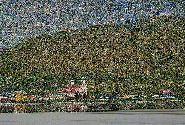
     We departed Anchorage shortly before dinner and watched the city skyline grow smaller as we sailed away.  The yellow building in this picture is the ConocoPhillips Building, the tallest in Alaska.

DSC09810_stitch

Kodiak, Alaska 2025

     After three days at sea we found ourselves on the morning of June 24 anchored outside the port of Kodiak, Alaska.  Those tired of reading about all the good weather we have had so far will be reassured to learn that this day had typical Kodiak weather . . . chilly, heavily overcast and damp.  Here is what it looked like from our veranda.

DSC00251

     Kodiak is a small city of about 5,700 people but still the primary city on Kodiak Island.  Its name is an adaptation of  the native word for “island.”  Kodiak Island had been populated for at least 7,000 years by the Alutiiq people before the Russians established a settlement here in 1792.  It was the capital of Russian America until 1804, when the capital was moved to what is now Sitka.  This was also a center for Russia’s booming fur trade which led to the enslavement of many indigenous people to hunt sea otters for them throughout the Bering Sea area, causing the near extinction of sea otters during the 19th century.  With the sale of Alaska to the US in 1867 Kodiak became an important American fishing center (as it remains today).

     We were booked on a private walking tour of Kodiak, so we tendered into the central port to meet our guide. 

DSC09796_stitch

     Ani was a wonderful guide, leading us on a thorough exploration of the port and the town beyond and regaling us with many entertaining and often hair raising stories from the town’s history.  Her experience on local fishing boats contributed to her extensive knowledge of the area.

     The town is on ground a good bit higher than the port itself and is reached by walking up very steep and fairly long covered ramps.  We met Ani at the top and then spent a good bit of time walking around the edge of the harbor and out onto the wooden docks to see the fishing boats (which required a trip down, then later back up, one of the covered ramps).  A lot of fishing boats were docked here.

DSC00254_stitchDSC00262DSC00263DSC00260DSC00258_stitchDSC00271_stitch

     As we walked around the docks Ani told us about the fishing operations.  Sailors are usually paid a percentage of the profits for a sailing, so it can be quite lucrative if the catch is good and the prices are high that year.  But if the catch fails, because of a scarcity of fish or too much competition or because the catch spoils, they may get little or nothing.  And the work is extremely hazardous, with one of the highest fatality rates in the United States, especially for crab fishermen.  Most of the boats seemed to be in the harbor rather than out fishing on the day we visited, which might have to do with the weather or with fishing season limits or quotas.  Among other things we saw many boats piled high with fishing nets (which are expensive and require constant maintenance) and a vat of bait consisting of pieces of halibut.  Near the port we saw an interestingly painted wall and a hillside neighborhood, in which the building second from left in the front row is claimed to be the oldest bar in Alaska (B&B Bar, which we are told has its 1906 liquor license hanging on a wall).

DSC00266_stitch

DSC00268DSC00257DSC00264_stitch

     Kodiak is the center of King Crab fishing, by far the most hazardous occupation in the United States.  Crab boats drop very large steel & net cages to the floor of the ocean by a winch and cable, attach their cables to a buoy, then return a few days later to haul the cages back onto the ship.  The cages (called pots) weigh at least 600 pounds and when retrieved may weigh a ton with the water inside.  These are swung on board by hand and it is all too easy to get caught in the cable when doing this.  In 1980 Alaska crab boats produced some 200 million pounds of crab but by 1983 the catch had dropped by two-thirds, up to 90 % in some areas.  Since then the crab industry has been more and more regulated to protect the crab population, with the crabbing season now measured in weeks instead of months (sometimes even in days).  The going price for King Crabs varies considerably from year to year, as does the fishing workers’ income.  The price seems pretty high to us right now; we ate in one restaurant in Alaska where a single King Crab leg was on the menu for $80 and a whole crab was around $300 (we didn’t order it).  Ani showed us a display in a local bank that had king crabs of various sizes, with only the two or three largest sizes permitted to be taken (females must also be thrown back).

    One of the precautions to protect fishermen these days is a survival suit, since most of the fatalities are by drowning and hypothermia.  This is a waterproof onesie that is insulated to protect from freezing in the water.  All fishing boats in this area (we understand) are now required to have these suits on board for their crews, and many people working on boats buy their own.  These have to be put on when a boat appears to be sinking.  Ani demonstrated one for us and it is a bit complicated to do correctly (and takes some time, while the ship is about to go down, remember).  She told us about at least one fellow who died because he made a mistake while donning his suit and there was no time to correct it before he found himself in the water.  As a result, training in the use of these suits is now much more uniform and intensive.  When fully deployed the suit is very bright orange (so you can be seen and rescued in the water) and also puffy, with an orange hood over the head, so they are colloquially called Gumby Suits.  The place where Ani demonstrated the suit is a yellow memorial to people who have died on Kodiak fishing boats; there are many small name plaques on the wall, just a few of which you can see behind her in the picture below.

DSC00275DSC00273

     Walking through the downtown area we saw a number of stores and restaurants, many together in shopping centers.  We passed the visitor center of the Kodiak National Wildlife Refuge, an almost 2 million acre wildlife reserve that covers about two thirds of Kodiak Island and several other islands as well.  We didn’t stop to see the visitor center’s wildlife displays.  Kodiak Bears are large and well known but are not near the city so the only one we saw was the large sculpture in  front of the visitor center.  We also walked past the Star Of Kodiak, the last liberty ship completed during World War II.  It was designed to carry aircraft as cargo but was brought here in the 1960’s to serve as a fish cannery and is still in service, though it doesn’t go anywhere.  As we passed through a parking lot a small truck pulled up and the driver and passenger got out and invited us over.  They had just returned from a fishing boat and wanted to show us their catch, contained in a vat in the back of the truck.  Ani picked up one of the salmon to show us & talked a little about salmon fishing.

     The Kodiak History Museum (formerly the Baranov Museum) sits on a hill well above the water.  We didn’t go in but the building is historic in itself, a log building covered in siding that was built by the Russians in 1810, one of the oldest buildings in Alaska.  It was originally a storage building, converted to a residence in 1911 and operated as a museum and offices since 1967.  Ani told us that when Kodiak was seriously damaged by a tsunami after the 1964 Good Friday earthquake in Anchorage the water came within a few feet of this building.  Near here Ani also told us about the 1912 Novarupta volcano eruption, the largest in the world during the 20th century, that produced about 30 times the amount of magma and ash as Mt St Helens.  Although the eruption was about 100 miles away in what is now  Katmai National Park, Kodiak was covered in ash over the three days the eruption lasted.  Even today strong winds sometimes lift remaining ash from the mountain and blow it toward Kodiak.

DSC00276DSC00282_stitchDSC00277DSC00278DSC00279_stitch

     Our walking tour ended at the Russian Orthodox Holy Resurrection Cathedral, a white wooden building with two blue onion domes topped with gold colored Orthodox crosses.  It was first built in 1794, then rebuilt in 1945 after most of it burned down.  Inside are relics of two Russian Orthodox saints.  St Herman of Alaska presided in this church for a few years in the early 19th century and was known for his support of the native people in the face of the Russian fur trading company, and St Olga of Alaska was canonized just 5 days before our visit, the first North American woman to become an Orthodox saint.  The main hall has a number of old icons and a lot of gold colored decoration.  A visit to Kodiak would not be complete without seeing this distinctive and historic building.

DSC00299_stitchDSC00285DSC00289_stitchDSC00293DSC00295DSC00296_stitchDSC00298

     Leaving the church and our walking tour, we headed uphill to find the library.  This was an uphill walk through a residential neighborhood that included colorful flowers and, we think, the old Russian cemetery.

DSC00304DSC00301DSC00321

After a lengthy walk we reached the library.  It is one story but spread out with an imposingly high vaulted ceiling inside supported by pillars that were once local tree trunks. Interesting decorations hang on the walls and elsewhere and the librarians were very friendly to us outlanders.

DSC00308_stitchDSC00310DSC00311DSC00313DSC00314DSC00312DSC00315DSC00316DSC00318

     Walking back down the hill gave us a view of the bay and of other lower parts of the town.  Again we passed many colorful flowers in front yards in this neighborhood and Mary called our daughter Carrie from pretty high on the slope.  One yard had what looked like a tiny Godzilla devouring an even tinier troll on display near its flower box. You just never know what you are going to see when you wander.

20250624_110454DSC00330DSC0031920250624_102335DSC00323DSC00324DSC00328

     We looked through some of the stores back in the port area then boarded the tender to return to the ship.  The clouds had lifted just enough to see a row of electricity windmills on top of the hill near the ship, which had been hidden by the clouds in the morning.  We sailed away in late afternoon watching the nice scenery in this area as we headed for our next port tomorrow morning.

DSC00338DSC09801DSC00331_stitch

Arctic Circle & Diomede Islands 2025

     The Summer Solstice was on June 20, 2025 and the official title of this voyage was “Alaska Arctic Circle Solstice” cruise.  So today, June 20,  has to be the signature event for this journey, right?  Last year HAL did this itinerary for the first time and they were unable to reach the Arctic Circle on this date (or at all) because of massive sea ice blockage.  So we were concerned about that, especially after the presentation on June 18 by the Captain, the ice pilot and an ice expert who told us there was already a great deal of sea ice in the Bering Strait and we were very unlikely to make it through to the Arctic Circle.  Darn!

     But it turns out they were completely wrong about that.  We should have known that weather predictions two days out are really more of a guess than a scientific conclusion.  This was a beautiful clear day and, while we did see some floating ice, it was nowhere near the ship.  The Captain did a great job of steering us where we needed to go while avoiding ice issues and the day (or at least the morning) turned out to be pretty special.

     During the night after we left Nome, however, we still didn’t know whether we would be able to reach the Arctic Circle, the Captain’s discouraging presentation two days earlier having been the last we had heard.  In the middle of the night Rick got out of bed to go to the bathroom, as often happens with people our age, and then looked through the windows to see whether there was any floating ice  No visible ice, but the summer solstice is the longest day of the year especially in northern Alaska, the land of the midnight sun.  So that is what this picture shows, though probably at an hour or two after midnight.

DSC00222_stitch

Looking at this picture as I write this it occurs to me for the first time that this is likely a view from the south of the Diomede Islands, about which more later as we sail back toward them from the north.

     By the time we woke up for the day we were already near the Arctic Circle.  From our veranda we could see Russia across about 40 miles of water.  This is the Chukchi Peninsula, and Cape Dezhnev (on the right in the first picture) is the easternmost point in mainland Asia.  Its highest peaks are about 2600 feet.  The first record of a ship sailing by it was in the mid 17th century and Captain Cook visited in the 18th century.  During the 19th century it was a fur trading hotbed.

20250620_120036DSC00224_stitch

     By this time we were in the Bering Strait, a body of water about 50 miles wide at its narrowest and about 300 ft deep that divides the Bering Sea from the Arctic Ocean.  This is a very shallow part of the ocean and is thought to have been dry land during the height of the glacial period when ocean levels fell as a tremendous amount of water was absorbed into the world wide glaciers.  Scientists today think that humans probably first spread into the Americas across this land bridge between Asia and America.  The islands we will see today were once mountain peaks in this land bridge, which is sometimes called Beringia today.  Like the Bering Sea, the Bering Strait is named for Vitus Bering, a native of Denmark who explored this area under the Russian flag in the 1720’s and 30’s.  Here’s what the Bering Strait looked like from the aft of the ship in the morning before the crowds arrived.

DSC00239_stitchDSC00232_stitch

    While it didn’t interfere with our trip we did see some fields of floating ice.  On one ice floe was a walrus, which we didn’t see before it dove in the water but our friend Susie shared a picture with us.  Some people saw whales and there were sea birds flying and, notably, fishing.

DSC09728_stitchDSC09735_stitchDSC097241000064599DSC09746DSC09781DSC09770

     Later in the morning, but we think while we were still above the Arctic Circle, there was a “polar bear swim” in the aft pool.  Two sizeable vats of ice cubes were emptied into the pool just to make sure it was cold, then interested passengers jumped into the pool in groups of about 15.  When they emerged (usually pretty quickly) staff painted their noses blue.  The master of ceremonies was dressed in a polar bear suit (really).  It appeared that a good time was had by all.

DSC09774DSC09775

     As we sailed south from the Arctic Circle we could see the Diomede Islands far in the distance.  These are two small rocky islands situated close together in the middle of the Bering Strait, about 16 miles from Alaska and some 28 miles from Russia.  Big Diomede Island is Russian territory and Little Diomede Island is part of the United States.  The islands are just 2.5 miles apart but the international date line runs between them.  For this reason some people (including our captain) call Big Diomede “Tomorrow Island” and Little Diomede “Yesterday Island.”  During the winter the sea between them freezes over and it would be possible to walk from one to the other, if that were permitted (it isn’t; this is an international border between Russia & the United States).  A small group of a little over 100 Native people live on Little Diomede (their village is on the west side between the islands where we couldn’t see) and Big Diomede now houses (we understand) only a Russian weather station and some border guards.  After World War II the Native people on Big Diomede were relocated (involuntarily) to the mainland and it became for a while a military outpost.  Vitus Bering named the islands after the Orthodox Saint Diomedes on August 16, 1728, which is the Russian Church’s holiday dedicated to him.

     When HAL first advertised this itinerary a couple of years ago it included a circumnavigation of Little Diomede.  But the people living there objected because they believed a cruise ship would scare away the walrus population during the time of their annual walrus hunt, so HAL cancelled the circumnavigation.  But we ended up sailing fairly close to Little Diomede anyway to avoid ice buildup off the Alaska coast.  We don’t know whether in the end that had any effect on the walrus population or on the walrus hunt.  You will notice in the pictures that the islands appear much further apart when viewed from afar, then as we pass them to the east (left of Little Diomede) they appear closer & finally seem to merge.

DSC09772_stitchDSC09784DSC09788a_stitchDSC09790DSC00244

     The first time we had heard of the Diomede Islands was when Little Diomede was the first stop on an  excellent TV travelogue starring Michael Palin (of Monty Python fame) called “Full Circle.”  He intended to circle the Pacific and end back on Little Diomede, but weather prevented returning there.  We mentioned the ancient land bridge between Asia and North America above, and during that time the Diomedes were the tops of mountains.

     South of the Diomedes we sailed past two more landmarks.  Fairway Rock is a very small island with cliff sides rising abruptly more than 500 feet from the water.  It was first documented by Captain Cook in 1778.  It can be seen from the Alaska mainland 20 miles away and provides a nesting ground for many sea birds.  Cape Prince of Wales is the westernmost point of the American mainland, at the tip of the Seward Peninsula.  It was named by Captain Cook in 1778.  There is a tiny town there called Wales (population 168 in 2020).

DSC00245DSC09792 (1)

   We sailed back into the Bering Sea after a morning that was even better than we had hoped, much less expected.  And we had 3.5 sea days to look forward to before reaching the next port. 

Nome, Alaska 2025

     On the morning of June 19 we were anchored near the harbor of Nome, Alaska.  This is a small town of only about 3,700 people, just a few blocks deep along the coast of the Seward Peninsula in northwest Alaska.  No roads connect it to the main part of Alaska, so the only ways to get to or from here are by plane or ship (or dogsled). 

DSC09707_stitch

     We sailed here from Dutch Harbor across the Bering Sea, one of the richest fishing areas in the world.  It can often be rough water but it was rather calm when we crossed, although we were enclosed by a lot of thick fog.  During our sea day before reaching Nome there was a presentation by the Captain, the Ice Pilot and an ice expert about what to expect.  We were told that there was a lot of sea ice in the Bering Strait that was floating our way and that the weather was expected to be foggy enough that our tendering into Nome would likely be delayed several hours.  This was discouraging . . . but it turned out to be a beautiful day in Nome, mostly sunny and clear and neither windy nor very cold.  So after breakfast we tendered into the port.

DSC09705_stitchDSC00185DSC00119

     While the Inupiaq people had lived in this area for perhaps several thousand years, the town itself began in 1898 as a tent city because of a gold rush.  The first gold strike was registered by three fortune hunters known as the “Three Lucky Swedes.”  Actually, one of them was Norwegian and today it is thought that they were led to the site by two Inupiaq boys who knew what was there.  But indigenous people were not permitted to register mining claims at that time and the three who shared the first strike apparently shared neither their takings nor their credit with them, so their role was not generally known for decades.  Once word of the leaked out gold hunters poured into Nome, on steamships arriving the next spring from Seattle and overland along the rivers from the Klondike (one prospector reputedly rode on a bicycle over the frozen rivers).  At its height it is said that an average of 1,000 people per day poured into the area in the summertime. But by the time most of them arrived the productive areas were already taken.  It was rough on the Alaska frontier and there was a good bit of claim jumping and violence facilitated by a corrupt federal judge.  But the city of Nome was incorporated in 1901 with a population said to be around 20,000, the largest city in Alaska.

     This was, then, a frontier town and as we walked down Front Street, which parallels the seashore, it still had that feeling.  It had surprisingly wide streets lined with telephone poles.  Most of the buildings from its early days have been destroyed over the years by storms or fires, but some have been restored or replaced with buildings in the same style so the ambiance is maintained.  That is not only a lot of work but is also very expensive because all the materials have to be imported by ship (no trees grow in this area).  While the streets seemed very empty, at least in the morning, the people we met were quite friendly and seemed glad to have us there.  Some strangers on the street would wave and say “Welcome to Nome.”  We did feel welcome.

DSC00128DSC00121DSC00160DSC00157

     We walked along Front Street, passing a large carved wood welcome sign held up by pillars sculpted into a miner and an Inupiaq hunter.  Across the street was the city hall, a two story wooden building that we understand was originally built by Wyatt Earp to house the saloon he operated from 1897 to 1901, leaving town with some $80,000, the equivalent of about $3 million today.  In front of the building was a bust of Roald Amundsen commemorating the first flight over the north pole, led by Amundsen in a dirigible named “Norge” that flew from Spitsbergen to Alaska in 1926, executing an emergency landing about 75 miles short of its destination of Nome.

DSC00124DSC00163

   There were two other notable outdoor sculptures on this street.  One was of an indigenous person carrying a rifle, commemorating the Alaska Territorial Guard.  This was a group of several thousand volunteers, of Native and European descent, who patrolled the shores in this area during and after World War II.  The other is of a large polar bear standing on a bay window in front of the Sitnasuak Native Corporation building.

DSC00129DSC00161

     We turned left and walked up Steadman Street, away from the sea, to find the Carrie M. McLain Museum in the Foster building.  It was only about 3 short blocks and well worth it, not only for this small but interesting museum but also because this building houses the Kegoayah Kozga Library.  We got there before the library opened so we toured the museum first, enjoying its exhibits featuring Alaska Native art as well as the long and interesting history of Nome.  Located on Front Street when it opened in 1967 the museum was moved to the larger current space when the Richard Foster building was erected by the city.

DSC00131DSC00136_stitchDSC00132DSC00138DSC00144DSC00145

    The library across the hall was spacious and welcoming.  In addition to all the books it had a variety of local artwork on the walls. The librarian was friendly and showed us around.

DSC00146DSC00143

DSC00140_stitch

DSC00142DSC0014720250619_120346_stitch

     We walked back to Front street in the direction of the port because we had scheduled an excursion for the afternoon that would meet there.  Cutouts of dogs (which are obviously important in a dogsledding area) were mounted on many of the light and telephone poles, each one with a uniquely decorated painting apparently by local folks.  This reminded us of about 20 years ago when the streets of Washington DC had similarly painted sculptures of elephants and donkeys.  We liked the one in the last picture below the best.

DSC00153DSC00154DSC00159DSC00177

     Nome’s original name was Anvil City and we visited Anvil City Square.  This large open space contains what Nome claims is the largest gold pan in the world (disputed, we understand, by a town in Canada), and statues of the “Three Lucky Swedes” and the two indigenous boys thought to have shown them where the gold was.

DSC00167DSC00169DSC00174_stitch20250619_125208

    Also in this square was the finish line for the Iditerod dogsled race from Anchorage to Nome that has been held annually since the 1970’s.  This finish line is moved to Front Street each year for the occasion.  This race was inspired by a 1925 rescue mission to bring diphtheria antitoxin to stop an outbreak in Nome during the winter, when ships cannot reach its ice bound harbor.  The antitoxin was brought as far as possible by train, but the remaining transport over almost 700 miles of hazardous snow covered terrain could only be done by dogsled.  It was an exciting and suspenseful exploit that gripped the nation and it is worth seeking out a book to read the story.  To make a long story short, the toxin arrived safely and stopped the outbreak, although by that time more than two dozen people had died (and perhaps many more that were unreported).  A statue of Balto, the lead dog on the final leg of the sled relay, was erected in Central Park in New York City.

     At the far end of the square was Old St Joe’s Church.  Built in 1901 it was the first Catholic church in Nome and even today appears to be the tallest building in town.  Originally located on Steadman street, the church had an 88 foot steeple with an 8 foot cross at the top that was lighted at night so that it could be seen for miles.  This was an important local navigational beacon, particularly during the long dark winters.  The steeple was dismantled in 1944 for safety reasons and the building became a warehouse.  In 1995 it was donated to the city, moved to Anvil Square and restored to its original design.  It is now used as a community meeting hall.

DSC00171DSC00170

     The Nome Nugget is the oldest newspaper in Alaska, first published near the end of 1899.  It distributes some 2600 newspapers every Thursday throughout northwest Alaska and it is also printed in Anchorage for distribution in airports and libraries throughout the state.  We understand that in the early days the newspaper was written in Nome, then taken elsewhere (Juneau?) for printing, then returned for distribution.  We saw the newspaper’s offices on Front Street and in the Anchorage State Library we found on display the front page of the newspaper’s January 31, 1925 edition, reporting on the progress of the dogsled relay two days before the lifesaving serum arrived.

DSC00162DSC00628    

   We continued to the port.  Among other things we passed a building with two old dogsleds on top and saw a large cemetery on a hill.  We mentioned that prices are high in Nome because everything has to be imported; case in point is gasoline, with regular unleaded selling for $6.29 per gallon when we had paid between 3 and 4 dollars while driving to Portland.  When we reached the dock Mary joined a number of folks sitting under a shade erected by HAL waiting for the excursion to begin.

DSC00166DSC00178DSC00179DSC00180_stitchDSC00183DSC00186

     The afternoon excursion took us by bus through the tundra outside Nome to visit an old gold dredge.  The road stopped well short of the gold dredge so we had to walk a mile or two over very rocky and uneven land to reach it (and then, of course, we had to walk back).  The walk was a good bit longer than advertised and was more challenging than expected.  There are no trees in the tundra but we saw many tiny flowers growing there.  We did cross over a small but pretty creek with reeds growing in it on the way.

DSC00198_stitchDSC00195DSC00192DSC00204DSC00207DSC00191DSC00217DSC00220

     Gold Dredge # 5 was one of a number of such contraptions once utilized in this area to dig for gold on an industrial scale.  We understand that this one operated from about 1941 into the 1990’s.  It has a large hull with several rooms built on top with a long arm sticking out to one side that has a number of very large buckets that are drawn by a moving chain along the floor of the pond or lake like a conveyor belt to scrape up the bottom.  As each bucket reaches the boat its contents are dumped and it continues on, repeating this over and over.  The lake floor sludge is then processed on board to isolate and extract any gold that is there. 

     This facility is now closed to visitors, so we could only look at it from the edge of the large pond in which it sits then head back to the bus.  You can see the row of large buckets still attached to the dredge, and in the town a number of them are being used as planters.  There was also a row of them in front of the museum in the Foster building.

DSC00211_stitchDSC00210DSC00133_stitchDSC00165

     We were pretty tired after that unexpectedly difficult walk and were glad to take the tender back to the ship.  We sailed away before dinner time heading north, where we hoped the ice would not prevent us from sailing above the Arctic Circle as it had during last year’s cruise.  All that is left to show is towel animals.

DSC00221DSC00118

Dutch Harbor (Unalaska), Alaska 2025

     As we pulled into Dutch Harbor early on the morning of June 17 the skies were heavily overcast and the clouds were at the top, and sometimes lower, on the mountains.  Located in an isolated spot in the Aleutian archipelago, this place is notorious for its unpleasant and changeable weather, often cold and windy, which often forces cruise ships to pass by this port.  So as we docked in the harbor we were hoping for a change for the better, but not counting on it.

20250617_10440520250617_104413

     Located 2 or 3 miles from the nearest town, called Unalaska, Dutch Harbor is the largest port in the Aleutian archipelago.  In fact, with a population just over 4,000 Unalaska has about 80% of the population of the entire Aleutians.  We docked in a harbor protected by a long natural spit at the foot of Mt. Ballyhoo, at 1650 feet the highest mountain on Amaknak Island.  The mountain was named by Jack London in 1897 after his lead sled dog Ballyhoo when he stopped here on his way to the Klondike gold fields.  Much of London’s novel The Seawolf is set in this area.

DSC09698DSC00026-gigapixel-very_compressed-scale-6_00x

     The Aleut people lived here for a long time before the Russians showed up in the late 18th century to develop the fur trade, especially in sea otters.  As the only deep water port in the Aleutians, Dutch Harbor developed a good deal of sea traffic and the Russians established a settlement here in the early 19th century.  The area was conveyed to the Americans along with the rest of Alaska in 1867 and it became an important fishing center.  Today it is one of the most productive fishing harbors in the United States; the reality TV show Deadliest Catch has been filmed in this area for the last 20 years.

     HAL had no excursions available here and, as far as we know, there was no shuttle bus into town.  We were able to book a tour conducted by the director of the Museum of the Aleutians.  So in the late morning, after breakfast, we went out on the dock to await the tour van.  This is an industrial dock with no cruise terminal so we waited in the parking lot.  It was not really cold and very little wind, but chilly enough to wear a light jacket.

DSC00022_stitchDSC00025

     The tour took us quickly through the town of Unalaska and on to Summer Bay, which was mostly mountains and fields.  There are very few if any trees in this area but spring flowers were blooming even though it was already the middle of June, apparently because winter weather lasts late in this area.  Unalaska is reputed to have a particularly large community of bald eagles who often feed on the remains left by the fishermen, but we only saw a few and mostly they were flying, preventing decent pictures.

DSC00029DSC00045DSC00049DSC00042DSC00048DSC00035

     The year before the United States entered World War II the government began building up a military presence here.  The Aleutians are close enough to Japan that it could have been used as a convenient base to attack the mainland US.  So bunkers, quonset huts, artillery emplacements and a landing strip started appearing here in anticipation of a possible Japanese invasion.  The Japanese did not actually invade Dutch Harbor but they did conduct bombing raids here on June 3-4, 1942, just six months after Pearl Harbor.  They also occupied two of the more remote islands in the archipelago, Attu and Kislak, for a couple of months before being driven out by the terrible weather and American attacks.  We did not climb Mt Ballyhoo to visit the main fort and guns installed to protect the area, but we did see some of these old fortifications in Summer Bay and also on the side of Mt Ballyhoo near where we were docked.

DSC00039DSC00040DSC00101DSC00033DSC00034

     In passing we saw a fishing boat dock and also the Memorial Park, which includes several memorials to groups who lived and/or died here, including a brass propeller from a ship destroyed by the Japanese in 1942 that was installed here 50 years later and an old graveyard populated with Russian Orthodox crosses.   On the way back toward town we passed a striking landmark called Little Priest Rock.  It is an 80 foot tall rock that we understand some thought was shaped like the hat of a Russian Orthodox priest.  It is on a small sandy beach where the neighboring mountain meets the water, although the tide must have been in when we were there because we couldn’t see much beach.  It was big enough to see from the ship docked on the other side of the bay.

DSC00030DSC00031

DSC00053DSC00111

     Perhaps the most distinctive building in town is the Russian Orthodox Cathedral, officially named the Church of the Holy Ascension.  A chapel was built on this spot in 1808 and the church (with only one tower) replaced it in 1825.  Due to wear and tear, probably due to the usually bad weather here, it was replaced in 1858 using the foundations and many of the timbers from the earlier church, and it finally gained its current form in the 1890’s, again incorporating pieces of the earlier churches.  It very much resembles the Orthodox church we visited in Sitka and is reputedly filled with religious treasures, although we didn’t have time go go inside.  Next to the church is a small graveyard dating to 1825 filled with white crosses in Orthodox style (with an extra cross bar).  Nearby is the dark blue Bishop’s House, built in San Francisco in 1882 before being transported to Unalaska.  The bishop who commissioned it died before having a chance to live there and is buried in the graveyard.

20250617_131149DSC00059DSC00064DSC00065

     We made two more stops.  The Unalaska Public Library was not on our itinerary, but there were at least three librarians in our van who all expressed interest in seeing it.  So our guide compromised, taking us to see the library but not to leave the van for a visit.  It looks like a very nice one.  Then we stopped at the Museum Of The Aleutians, where our guide was the director.  It was an interesting small museum with good information and exhibits, especially about the Aleut people that originally lived here.  But importantly it also had a public restroom, which made the rest of the trip much more pleasant than it might have been!  Outside the museum there was a large field with numerous flowers and a view across the bay.

DSC00071DSC00078DSC0007720250617_12540920250617_125650

     Across the water from the church we visited the underground hospital.  Built during the war, we understand it had (or may still have) about 200 beds.  It was not open to visitors, apparently for safety reasons.  From the shore we had a nice view of the church and the bishop’s house across the water.  Our last stop before returning to the ship (there was another excursion group waiting for our return) was at a red brick Tudor style building built in 1932 to house workers at the nearby Naval Radio Station.  It originally had 6 apartments, but during World War II it was remodeled into housing for chief petty officers.  It is reputed to be the only brick building in the Aleutians, although today it appears to be pretty dilapidated (obviously not a place to enter for a visit).  There was a bald eagle sitting on the left gable.

DSC00085_stitch20250617_130836DSC00055

DSC00098_stitch

     During the remaining time before our departure we took some pictures from the ship.  To the aft was a view of the winding road up Mt Ballyhoo to the World War II ruins and the way we would sail away from Dutch Harbor.  Looking forward was a view of Unalaska.  More fun, though, was the view from our veranda, which was on the side of the ship facing the water.  A ship was out there, probably some kind of work boat, with a thick cable running from its aft to a large round float.  We don’t know why it was there but we do know that there were several seals and/or sea lions on it, sometimes looking relaxed and sometimes looking like they were fighting for position on the float.  Whatever they were about, they were very LOUD.  We heard them long before we saw them and their serenade went on for most of the afternoon.  Very entertaining.

DSC00102_stitchDSC00112_stitchDSC09678DSC09682DSC09694DSC00106_stitch

    We sailed away around 6:00 and headed north.  We passed some more nice scenery on the way out (of course).  After dinner we headed for bed, where another towel animal awaited us.

DSC09701DSC00116