Latest

Dutch Harbor (Unalaska), Alaska 2025

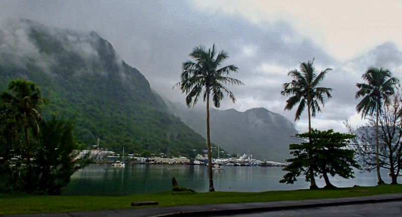
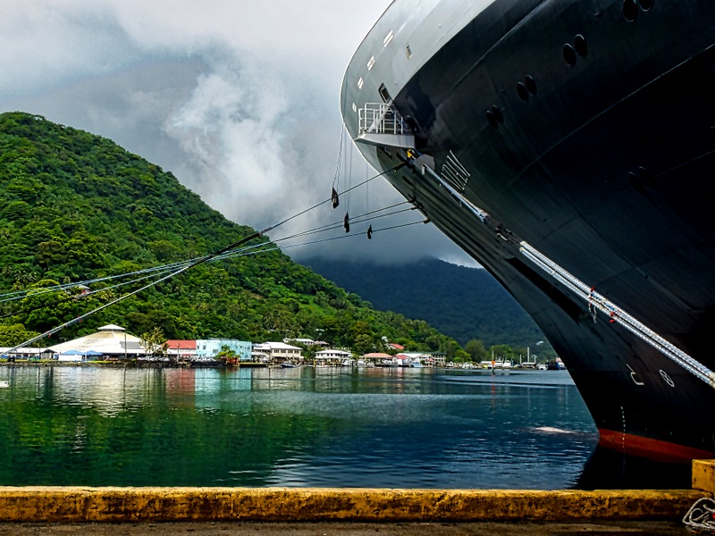
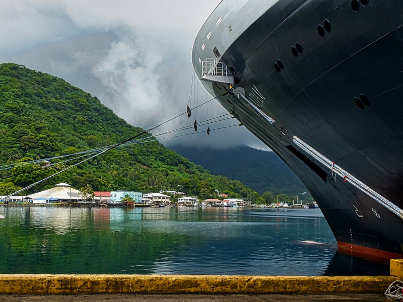
     As we pulled into Dutch Harbor early on the morning of June 17 the skies were heavily overcast and the clouds were at the top, and sometimes lower, on the mountains.  Located in an isolated spot in the Aleutian archipelago, this place is notorious for its unpleasant and changeable weather, often cold and windy, which often forces cruise ships to pass by this port.  So as we docked in the harbor we were hoping for a change for the better, but not counting on it.

20250617_10440520250617_104413

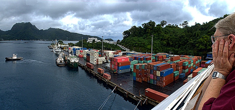
     Located 2 or 3 miles from the nearest town, called Unalaska, Dutch Harbor is the largest port in the Aleutian archipelago.  In fact, with a population just over 4,000 Unalaska has about 80% of the population of the entire Aleutians.  We docked in a harbor protected by a long natural spit at the foot of Mt. Ballyhoo, at 1650 feet the highest mountain on Amaknak Island.  The mountain was named by Jack London in 1897 after his lead sled dog Ballyhoo when he stopped here on his way to the Klondike gold fields.  Much of London’s novel The Seawolf is set in this area.

DSC09698DSC00026-gigapixel-very_compressed-scale-6_00x

     The Aleut people lived here for a long time before the Russians showed up in the late 18th century to develop the fur trade, especially in sea otters.  As the only deep water port in the Aleutians, Dutch Harbor developed a good deal of sea traffic and the Russians established a settlement here in the early 19th century.  The area was conveyed to the Americans along with the rest of Alaska in 1867 and it became an important fishing center.  Today it is one of the most productive fishing harbors in the United States; the reality TV show Deadliest Catch has been filmed in this area for the last 20 years.

     HAL had no excursions available here and, as far as we know, there was no shuttle bus into town.  We were able to book a tour conducted by the director of the Museum of the Aleutians.  So in the late morning, after breakfast, we went out on the dock to await the tour van.  This is an industrial dock with no cruise terminal so we waited in the parking lot.  It was not really cold and very little wind, but chilly enough to wear a light jacket.

DSC00022_stitchDSC00025

     The tour took us quickly through the town of Unalaska and on to Summer Bay, which was mostly mountains and fields.  There are very few if any trees in this area but spring flowers were blooming even though it was already the middle of June, apparently because winter weather lasts late in this area.  Unalaska is reputed to have a particularly large community of bald eagles who often feed on the remains left by the fishermen, but we only saw a few and mostly they were flying, preventing decent pictures.

DSC00029DSC00045DSC00049DSC00042DSC00048DSC00035

     The year before the United States entered World War II the government began building up a military presence here.  The Aleutians are close enough to Japan that it could have been used as a convenient base to attack the mainland US.  So bunkers, quonset huts, artillery emplacements and a landing strip started appearing here in anticipation of a possible Japanese invasion.  The Japanese did not actually invade Dutch Harbor but they did conduct bombing raids here on June 3-4, 1942, just six months after Pearl Harbor.  They also occupied two of the more remote islands in the archipelago, Attu and Kislak, for a couple of months before being driven out by the terrible weather and American attacks.  We did not climb Mt Ballyhoo to visit the main fort and guns installed to protect the area, but we did see some of these old fortifications in Summer Bay and also on the side of Mt Ballyhoo near where we were docked.

DSC00039DSC00040DSC00101DSC00033DSC00034

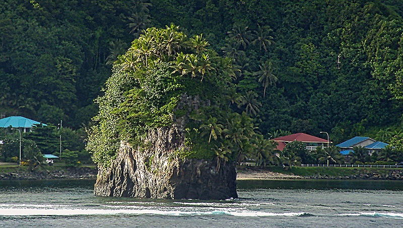
     In passing we saw a fishing boat dock and also the Memorial Park, which includes several memorials to groups who lived and/or died here, including a brass propeller from a ship destroyed by the Japanese in 1942 that was installed here 50 years later and an old graveyard populated with Russian Orthodox crosses.   On the way back toward town we passed a striking landmark called Little Priest Rock.  It is an 80 foot tall rock that we understand some thought was shaped like the hat of a Russian Orthodox priest.  It is on a small sandy beach where the neighboring mountain meets the water, although the tide must have been in when we were there because we couldn’t see much beach.  It was big enough to see from the ship docked on the other side of the bay.

DSC00030DSC00031

DSC00053DSC00111

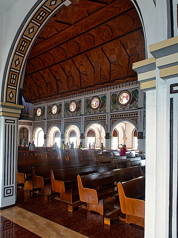
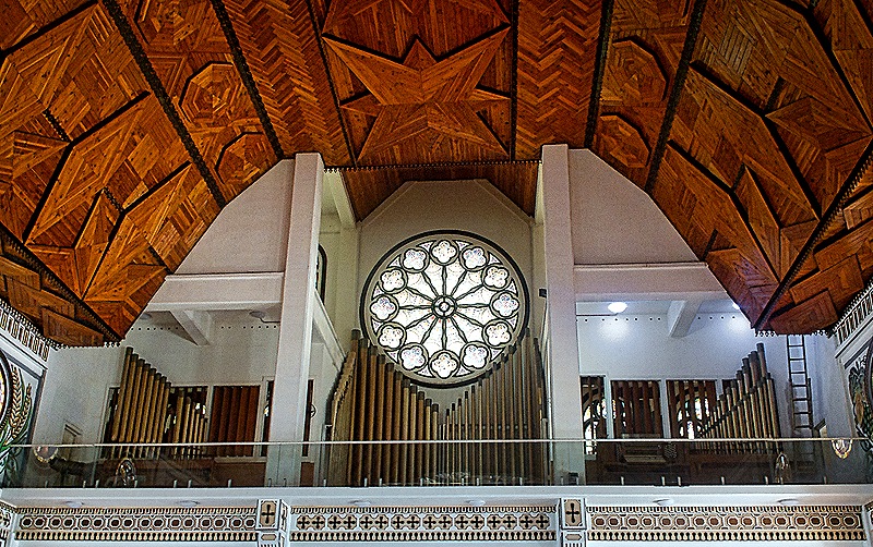
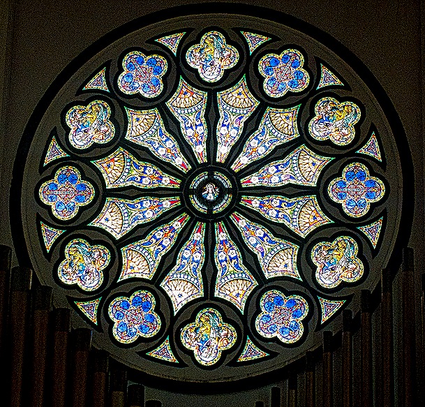
     Perhaps the most distinctive building in town is the Russian Orthodox Cathedral, officially named the Church of the Holy Ascension.  A chapel was built on this spot in 1808 and the church (with only one tower) replaced it in 1825.  Due to wear and tear, probably due to the usually bad weather here, it was replaced in 1858 using the foundations and many of the timbers from the earlier church, and it finally gained its current form in the 1890’s, again incorporating pieces of the earlier churches.  It very much resembles the Orthodox church we visited in Sitka and is reputedly filled with religious treasures, although we didn’t have time go go inside.  Next to the church is a small graveyard dating to 1825 filled with white crosses in Orthodox style (with an extra cross bar).  Nearby is the dark blue Bishop’s House, built in San Francisco in 1882 before being transported to Unalaska.  The bishop who commissioned it died before having a chance to live there and is buried in the graveyard.

20250617_131149DSC00059DSC00064DSC00065

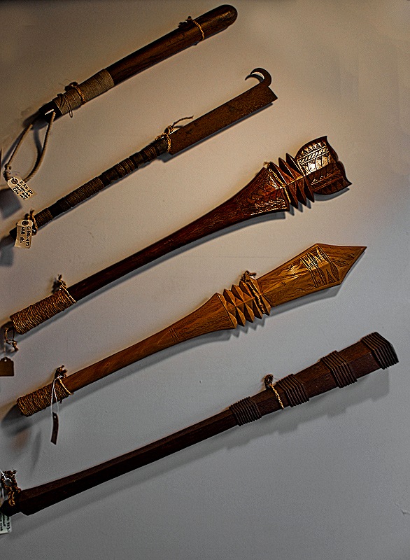
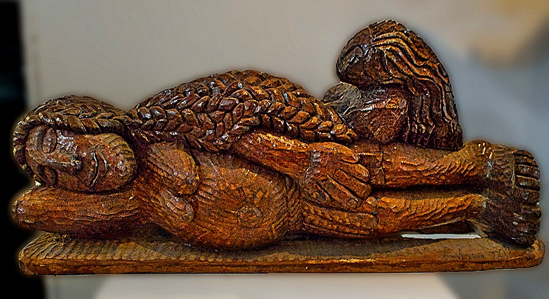
     We made two more stops.  The Unalaska Public Library was not on our itinerary, but there were at least three librarians in our van who all expressed interest in seeing it.  So our guide compromised, taking us to see the library but not to leave the van for a visit.  It looks like a very nice one.  Then we stopped at the Museum Of The Aleutians, where our guide was the director.  It was an interesting small museum with good information and exhibits, especially about the Aleut people that originally lived here.  But importantly it also had a public restroom, which made the rest of the trip much more pleasant than it might have been!  Outside the museum there was a large field with numerous flowers and a view across the bay.

DSC00071DSC00078DSC0007720250617_12540920250617_125650

     Across the water from the church we visited the underground hospital.  Built during the war, we understand it had (or may still have) about 200 beds.  It was not open to visitors, apparently for safety reasons.  From the shore we had a nice view of the church and the bishop’s house across the water.  Our last stop before returning to the ship (there was another excursion group waiting for our return) was at a red brick Tudor style building built in 1932 to house workers at the nearby Naval Radio Station.  It originally had 6 apartments, but during World War II it was remodeled into housing for chief petty officers.  It is reputed to be the only brick building in the Aleutians, although today it appears to be pretty dilapidated (obviously not a place to enter for a visit).  There was a bald eagle sitting on the left gable.

DSC00085_stitch20250617_130836DSC00055

DSC00098_stitch

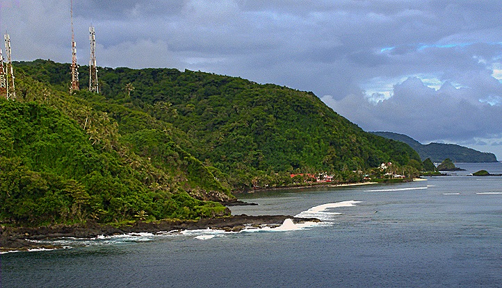
     During the remaining time before our departure we took some pictures from the ship.  To the aft was a view of the winding road up Mt Ballyhoo to the World War II ruins and the way we would sail away from Dutch Harbor.  Looking forward was a view of Unalaska.  More fun, though, was the view from our veranda, which was on the side of the ship facing the water.  A ship was out there, probably some kind of work boat, with a thick cable running from its aft to a large round float.  We don’t know why it was there but we do know that there were several seals and/or sea lions on it, sometimes looking relaxed and sometimes looking like they were fighting for position on the float.  Whatever they were about, they were very LOUD.  We heard them long before we saw them and their serenade went on for most of the afternoon.  Very entertaining.

DSC00102_stitchDSC00112_stitchDSC09678DSC09682DSC09694DSC00106_stitch

    We sailed away around 6:00 and headed north.  We passed some more nice scenery on the way out (of course).  After dinner we headed for bed, where another towel animal awaited us.

DSC09701DSC00116

College Fjord, Alaska 2025

     In 1899 railroad tycoon Edward Harriman, on doctor’s orders to get away from business pressures, put together an epic sea voyage to Alaska.  He bought a ship and set out to hunt bears, but he also filled it with eminent writers, artists and scientists of his day to explore this remote land.  The voyage was much celebrated, garnering headlines throughout the world.  Among their other adventures and accomplishments, on June 25th they sailed up the 20 mile long waterway they christened College Fjord.  We spent the morning of June 14 there.

     College Fjord contains five tidewater glaciers (ie. terminating in the sea water), five valley glaciers, and a number of smaller ones back from the water.  We sailed past the tidewater glaciers and didn’t see the others.  Even if they would otherwise have been viewable, there was a heavy cloud cover that came down to the tops of the tidewater glaciers so we couldn’t see anything above or beyond them.

20250614_082250DSC09593DSC09586_stitch

     You may have noticed that these glaciers are all named after eastern colleges and universities.  They were named by a couple of professors on board who taught at Harvard and Amherst and they named most of the glaciers in the College Fjord area after eastern colleges, reportedly taking some pleasure in pointedly leaving Princeton out. We are not positive we have all the names right, but we think we saw Wellesley, Vassar, Bryn Mawr, and Smith Glaciers on the side as we sailed up the fjord.

DSC0959920250614_08194620250614_085443

     At the end of the fjord was Harvard Glacier, the largest of the bunch.  Its face sitting over the water is about 1.5 miles wide and the ice is some 300 feet thick.  We were told that Downer Glacier (named for a college in Wisconsin) flows in on the right end of the Harvard Glacier, but its ice is black (presumably from dirt) so its hard to make out in the picture (and in person too).  Apparently the folks on the Harriman expedition missed it too, since it wasn’t named until 1910.

DSC09649_stitchDSC09617DSC09644_stitch

    Glaciers are often blue, as in the pictures above, because as the snow compacts into very dense ice it squeezes out air bubbles, with the result that the ice reflects blue wavelengths and absorbs other colored light.  Often the most interesting views of glacier ice are in close ups, showing clearly the varied patterns the ice displays.  It is exciting when a glacier “calves,” meaning that part of the ice breaks off and falls in the water as it is pushed toward the sea.  But this is very hard to capture in a photograph because the loud noise of the ice breaking off does not seem directional and the calving is over very quickly, so by the time you are able to point you camera toward it the calving is over and all that is left is the splash.  Just what happened in the last picture below.

DSC09597_stitchDSC09641DSC09612_stitchDSC09619_stitchDSC09635DSC09642

     After a long time with the ship turning in front of Harvard Glacier so everyone could see it we sailed down the fjord, back the way we came.  Of course, the ship was facing the opposite way from the earlier passage so our veranda looked out on the other side of the fjord.  There was quite a bit of ice in the water in this area that had dropped off the glacier and floated away, but none big enough to be called an iceberg.  It seems odd that the floating ice tends to stay in one area, often near the shore, rather than floating out across the whole fjord.

DSC09656a_stitchDSC09607_stitchDSC09656DSC09661DSC09631_stitch

     So that was it for our morning at college fjord, and we settled down for two & a half sea days until our next port.  But don’t worry, there will be plenty more glaciers in upcoming episodes.  This is Alaska, after all.

Valdez, Alaska 2025

     The morning of June 13 found us anchored across the bay from Valdez, Alaska, a small town (pop. almost 4,000) surrounded by imposing snow capped mountains.  The nearby mountains towered over the upper decks and the view from our veranda included two tiny looking HAL tenders approaching the inlet leading to the protected dock.  So welcome to Valdez!

DSC09580_stitchDSC09575_stitch DSC09923 

     The port of Valdez was named in 1790 by a Spanish explorer in honor of Spain’s Navy minister.  But it was not until 1898 that a town was established here, after some steamship companies who promoted this as a better route than Skagway for prospectors to reach the Klondike gold fields.  It wasn’t and many prospectors died trying to cross the mountains on a much longer and steeper trail than advertised. 

     In 1910 the opening of the Richardson Highway to Fairbanks established Valdez as the primary land route into Alaska’s interior.  This highway started here primarily because this port could be used year round since it was ice free.  But at that time Valdez was about four miles from where we visited it today.  The 1964 Alaska earthquake pretty much destroyed the original town, now recognized as too unsafe to support a municipality.  Over the next three years a new site was cleared and the entire town of Valdez, including 54 homes and buildings, was moved four miles up the coast to its current, more stable, location.  Today there is virtually nothing left of the original town. 

     We had an excursion into the mountains scheduled for the afternoon, so we tendered into the small boat dock in town after breakfast to walk around and see the town.

DSC09917_stitchDSC09920_stitchDSC09915

     Those of you who are familiar with this blog will not be surprised to learn that our first stop in Valdez was at the public library.  For such a small town the Valdez Consortium Library is a very nice and well stocked library.  Two stories with an open staircase and many colorful paintings and murals.  And we can’t forget to mention all the books!

DSC09901DSC09896DSC09900DSC0989920250613_105137DSC09897_stitchDSC09892DSC09894DSC09890

     Across the street is the Valdez City Hall, whose architecture and coloring is similar to the library’s.  In front is a wooden bear sculpture.  There were a number of interesting outdoor wooden sculptures in Valdez.  As we approached the City Hall we passed a couple from the ship talking with a local man.  They left and he walked over to us.  A very friendly guy, looking to be around 40 and wearing casual outdoor clothes, he spent some time telling us about the town and the sights.  As we were leaving he told us he was the mayor of Valdez!  We don’t know whether that’s true, but either way we appreciated that he went out of his way to be helpful to visitors.

DSC09903_stitchDSC0990520250613_121314DSC0988920250613_110502

     We walked over to the Valdez Museum, which is full of very interesting exhibits detailing, among other things, the pioneer period, the earthquake and the Exxon Valdez oil spill disaster.  The main streets of this small town are surprisingly wide with outdoor artwork and interesting buildings displayed against a backdrop of snowy mountains.  It was June so the latest class had just graduated from the local high school and many of the lamp posts lining the sidewalks had banners, each with the name and photo of one of the graduates.  Bear proof trash containers were on the streets as well, with a lever to open the top covered by a metal shield big enough for human fingers but not bear paws.

DSC0991220250613_121314DSC09913DSC09907_stitchDSC09909_stitchDSC09914

     Our favorite Holland America ship was the Prinsendam (sold in 2019), on which we travelled three times.  That ship joined the HAL fleet in 2002, but there was a previous HAL ship with the same name that sank in the gulf of Alaska in October of 1980 after its engine room caught fire.  Despite 25 foot seas and 50 to 60 knot winds the Coast Guard managed to rescue every one of the more than 700 passengers and crew, many elderly, with no fatalities.  The Coast Guard considers this the greatest rescue at sea in its history.  We won’t tell the whole story here, but it is well worth googling. 

     The Prinsendam passengers and crew were crowded into open life boats intended for far fewer people (because some were unusable) and set out into the water a few hours before a typhoon hit.  Most were rescued by helicopter but one boat was still unfound when they initially thought the rescue was finished.  It was found a few hours later and the last of the Prinsendam passengers and crew were picked up.  Many were in pajamas and some had torn curtains from the ship’s walls to use as blankets.  Today that lifeboat is on display at the Valdez museum, in a covered outdoor facility.  We were probably better off not knowing about this harrowing story during the years when we sailed aboard the successor Prinsendam.
DSC09906

     In the afternoon we boarded a bus for our excursion into the mountains.  Our first stop was the Solomon Gulch Fish Hatchery, dating to the early 1980’s, which breeds pink & Coho salmon.  Millions of salmon hatch here each year and leave to spend their lives at sea, then return (as salmon do) to their birthplace at the end of their lives to lay eggs in the hatchery, with the entire cycle repeating each year.  We understand that this place is full of returning salmon climbing the fish ladder to reproduce from July to September and that other wildlife, such as bears, sea lions, seals and eagles can also be seen here feeding on the plentiful fish.  But unfortunately we were here in the middle of June and no salmon were to be seen.  There were sea gulls and it was also a very pretty stop by the water’s edge.  We had a view of Westerdam across the bay dwarfed by the massive mountains behind it.
DSC09928DSC09930_stitchDSC09934DSC09932DSC09935

     We continued up the Richardson Highway into Keystone Canyon, with its high walls and nice waterfalls.  In the first decade of the 20th century there was a heated competition to build a railroad from Valdez to the gold and copper fields inland.  Keystone Canyon was the only route for a railroad through the mountains.  An out of state railroad company financed by J.P. Morgan and the Guggenheims began building a path through the canyon but were challenged by a local company.  So they posted armed guards and built a barricade across the canyon entrance to keep the locals out.  On September 25, 1907, the two sides had a shootout, with one man killed and several injured.  Public opinion favored the locals but both companies pulled out after the gunfight with the outside group building a railroad to the Copper River from Cordova instead (which ran until 1938). The banker who started the local company left town with many of his local financial supporters in debt.  All that is left of this early railroad construction is a tunnel that was hand cut through solid rock.
DSC09939_stitchDSC09942_stitch

     Almost 29 miles from Valdez is the Worthington Glacier, one of the few glaciers in the US accessible by paved highway.  But accessible does not mean there is no walking involved to get from the highway to the glacier.  The area between the highway and the glacier is a small state park, which includes restrooms and a parking lot.  From the parking lot it is a modest but very uneven walk to the glacier view.  Beyond the highway in the opposite direction is a spectacular row of mountain peaks.  Worthington Glacier has been receding for 150 years but much slower than many others in Alaska.  Off to the right of the glacier (where Mary is looking in the first picture) was a picturesque river surrounded by leafless trees and bushes with more white mountains beyond.

DSC09951_stitchDSC09949DSC09955DSC09962_stitchDSC09968DSC09959_stitchDSC09956_stitch

     The pull off to Worthington Glacier is from the Richardson Highway as it passes through Thompson Pass.  Thompson Pass is a 2600 foot high gap in the Chugach Mountains, which is notable as one of the snowiest places in Alaska, averaging 500 inches of snow per year.  It holds the Alaska record for snowiest day . . . 62 inches on December 29, 1955.  Native people had been using this pass for many years when the US Army marked out a trail to the Klondike during the gold rush in 1899.  Cars began driving through the pass in 1913 on what was named the Richardson Road in 1919.  Until 1950, when snowplows were first deployed, this road was only usable in summer, then it was paved in 1955.

     Leaving the Glacier we drove down the sometimes winding road through the Thompson Pass.  It was a winter wonderland, even in the middle of June, with snowy peaks all around.  We stopped at a pull-off viewing spot where we had quite a view of the surrounding peaks and valleys.

DSC0997120250613_155237DSC09972DSC09973_stitchDSC09977DSC09985DSC09987_stitch

     We descended back down into Keystone Canyon and left the bus to look at the waterfalls.  Bridal Veil Falls (we have seen several waterfalls before with this obvious name) is some 600 feet high and Horsetail Falls, less than a mile away, is 300 feet.  There is a third falls, almost as tall but noticeably narrower, not far from Bridal Veil.  The falls are all on the opposite side of the highway from where we were parked and we were asked not to cross the road because it was dangerous.  So the highway cut off our view of where the waterfalls drop into a river below.  Still quite beautiful though.

DSC0999920250613_162608DSC09995DSC00005

     We returned to the tender dock and then to the ship, driving past yet more stunning scenery.  Valdez is the southern terminus of the Alaska Oil Pipeline, which brings crude oil all the way from Prudhoe Bay in Northwestern Alaska to a facility here where it can be loaded onto tankers for transportation to refineries.  Because this is the northernmost ice free port oil can be shipped from Valdez year round.  For those who can remember 1989, the Exxon Valdez oil spill that March let almost 11 million gallons of oil loose into Prince William Sound after the tanker ran aground on a reef.  This was just a little more than a day after leaving Valdez loaded with 53 million gallons.  A great deal of the wildlife in the area was killed and the effects were still evident decades later despite wide ranging efforts to clean it up.  From our veranda we could see the tanks and facilities for handling the oil on this end of the pipeline, including a tanker waiting to load oil.

DSC00012_stitchDSC09575DSC09569_stitch

.     The ship didn’t leave until late at night, after our bedtime.  But here are a couple of towel animals, our nocturnal company in the stateroom, to end this very full day.

DSC00014DSC00015

Sitka, Alaska 2025

     On the morning of June 11 we docked near Sitka, Alaska, which is situated primarily on Baranof island.  With a population of almost 8,500 Sitka is the fifth largest city in Alaska (but with 2, 870 square miles it is the largest city by land area in the US).  The city’s origin was in 1799 when Russian explorers built a settlement called Fort Of Archangel Michael.  It was destroyed by the Tlingit in 1802 but after winning the “Battle of Sitka” in 1804 the Russians established a permanent settlement called New Archangel.  Sitka was the capital of Russian America from 1808 to 1867, when Alaska was purchased by the Americans (for about 2 cents per acre) after Russia lost the Crimean War.  Sitka continued as the capital of the Alaska Territory until 1906, when Juneau became the capital because of its growth in importance during the Klondike Gold Rush.  Before tendering into town we took in the view from our veranda of the islands and mountains in the bay.

Islands in the morning lightDSC09779DSC09787Mountains, islands, water and clouds

     Our tender dropped us off near a bridge in the center of downtown, a very convenient spot.  We had booked an excursion with our travel agents for the morning, then we spent the afternoon walking around the town on our own.  This plan worked out quite well for us.

DSC09788

     Our first visit was to the Alaska Raptor Center, established in 1980 to care for birds of prey that have suffered trauma, such as collisions, gunshot wounds, starvation and disease.  While bald eagles predominate the Center will help any bird in need, and birds are brought here from all over Alaska for that purpose.

DSC09789DSC09804DSC09797DSC0980320250611_124402     When healthy enough, eagles are moved into the large indoor Eagle Flight Training Center, a transition facility on the campus where they can fly, bathe and meet other eagles until their release into the wild (our view into this facility was through a black netting).  Birds that are unable to live in the wild are given homes in zoos and wildlife centers throughout the US, and some live out their lives at the Center.    

DSC09790    20250611_122117

     Our next stop was at the Fortress of the Bear, a refuge for bears unable to fend for themselves in the wild, often cubs whose mothers have died.  It is situated on the site of a former pulp mill and the habitat area that can be visited looks like two huge (192 feet in diameter) vats with round concrete walls.  The facility received its first bear in 2007.  Not a lot of bears live here; we think when we visited there were about 5 brown bears and 3 black bears.  Apparently it would be unsafe to release fully grown and healthy bears into the wild, but some of the bears are eventually transferred to new homes in zoos and wildlife facilities elsewhere.  Others live out their lives here.

DSC09844DSC09823DSC09814DSC09809DSC09832DSC09817DSC09839DSC09842DSC09827

    There were Bald Eagles at the Fortress as well, flying among the trees and roofs of the buildings.

DSC09829DSC09821

   We drove back to the tender port in downtown Sitka, past one of the nice sea vistas that abound here.  From there we began to walk up and explore the central part of the town.  As we walked up we had a good view of Mt Edgecumbe, the large volcano sitting on a neighboring island about 15 miles away.  Its Tlingit name is L’ux, meaning flashing, reputedly because it was erupting when they first discovered it, although the volcano has been dormant for more than 800 years.  Captain Cook named it Mt Edgecumbe, possibly after an Earl of that name or a hill near Plymouth, England.  On a clear day the mountain’s snowy summit and caldera are visible from Sitka but on the day we visited they were covered by clouds.

DSC09847DSC09850

     Upon reaching the top of the climb up to the city we encountered the Cable House.  Built in 1908 it was originally the northern terminus of the underwater telegraph cable that was the first communication link between Alaska and the main United States.  Today it houses Raven Radio, Sitka’s public radio station, with a restaurant on the first floor.  Across the street is Totem Square with the Baranov totem pole first erected in 1942 and restored in 2011.  At its top is an image of Alexander Baranov, the founder of Russian Sitka, and second from the bottom is a two-headed Russian eagle.  Nearby is the yellow Sitka Pioneer Home, a retirement home built in 1913.  In front of the home is a large sculpture called “The Prospector” that has been here since 1949.  It is supposed to have been modeled after William Clark "Skagway Bill" Fonda, a pioneer who is said to have arrived in Skagway in 1896 and is credited with breaking first ground in the building of the White Pass Railway there.

DSC09853DSC09854DSC09855

     We walked toward the East down the street toward St Michael’s Cathedral. Originally dedicated in 1848, this is the oldest Orthodox cathedral in the western hemisphere.  It burned to the ground at the beginning of 1966 but was rebuilt following detailed drawings of the original and reopened in 1977.  The surrounding streets are largely commercial, including the Sitka Hotel.  Rick encountered a large bear nearby, who then agreed to pose with us and our friends Keith and Susie, our travel agent’s hosts on the cruise.

DSC09858DSC09859DSC09869_stitch20250611_1445341000063121

     During Russian rule in the first two thirds of the 19th century many artistic treasures were contributed to the cathedral by Russian nobility.  Some of it was lost in the fire of 1966 but most was saved, including the icon wall and the chandelier that can still be seen inside the building.  The carved wooden doors in the middle of the icon wall, leading to some chapels, are notable for their intricate carvings.  The room is lit during the day through windows circling the dome.

DSC09861DSC09860DSC09862

DSC09559

     The Sitka Public Library first opened in 1923.  It moved a number of times before settling in its current building in 1968.  It has an inventory of some 75,000 books and other items.  After seeing the library we had a late lunch at a very good pizza restaurant called Mean Queen that had been recommended by our morning excursion leader. It had a very nice view of the harbor.

DSC09872DSC09874DSC09873DSC09876DSC09875

     After lunch we climbed up to Baranof Castle, located on a high bluff above the harbor.  Also called Castle Hill, this was originally right on the water and was fortified by the Tlingit.  They abandoned it during the Russo-Tlingit war and it came under Russian control in 1806 at the end of that war.  They refortified it and it served as the center of Russian administration of Alaska until 1867 when the United States got control.  The formal transfer and first raising of the American flag took place here in 1867 and when Alaska became a state in 1959 this is where the first 49 star US flag was raised.  Today it is a state park with several old cannon on the level top of the hill surrounded by a stone wall.  Because it is some 60 feet above sea level it commands an excellent view all around (which would be even better if there weren’t so many tall trees in the way).

DSC09882_stitchDSC09879_stitch

     We returned to the tender dock and then back to the ship, from which we had a panoramic view of Sitka.  We had a sea day to rest up before our next port visit.

DSC09884DSC09553a_stitch

Ketchikan, Alaska (& Misty Fjords) 2025

     After a day sailing through the inside passage we arrived in the morning of June 10 at Ketchikan.  A city of just over 8,000 located on an island in the inside passage Ketchikan is a very popular cruise port (we were one of five cruise ships in port this day).  It was incorporated in 1900 as the first city in Alaska and is currently the sixth largest.  Displaying many totem poles, old and relatively new, it was once a summer fishing camp of the Tlingit people and was known for its thriving salmon canning industry beginning in the late 19th century.  As our ship approached the city there was beautiful scenery and a number of houses isolated in the forest by the water, which must be a picturesque place to live.

DSC09661_stitchDSC09664DSC09665DSC09666DSC09667

     We have visited Ketchikan before and spent a day exploring this interesting town on foot:

https://baderjournal.com/2017/08/16/ketchikan-alaska/ 

So this time we signed up for an excursion to Misty Fjords National Monument about 40 miles away.  Many people visit there by float plane but we did it by boat, a longer trip but quite enjoyable on a clear sunny day like we had.  Leaving the ship we had to walk along the waterfront past a couple of other cruise ships to reach our cruise boat.  In this area is an iconic arch welcoming visitors to Ketchikan, a sculpture of a bald eagle in flight called “Thundering Wings” carved in cedar by renowned totem sculptor Nathan Jackson, and a set of bronze sculptures called “The Rock” representing historic groups of residents of Ketchikan: a miner, a bush pilot, a fisherman, a native drummer, a logger, a frontierswoman and (on top) a Tlingit named Chief Johnson.

Mary (right) walking with our group down the wooden waterfront toward our tour boat's dockThundering WingsDSC09770DSC09771

     Misty Fjords is an area of more than 2 million acres in the Tongass National Forest that has been a protected National Monument since 1978.  It was covered by ice for millennia and the receding glaciers carved long and deep fjords in the rock that today are filled with water and bordered by tall cliffs.  The first European expedition to visit here, in 1793, was captained by George Vancouver who originated the current names used in this region.  After leaving Ketchikan our boat sailed up the Behm Canal (actually a natural fjord rather than a man made canal) toward Misty Fjords, just as Captain Vancouver did.

DSC09673DSC09683DSC09686DSC09694DSC09700_stitchDSC09690_stitch

     This area has an abundance of wildlife, although we only saw a few.  We saw whales spouting.  Photographing whales is difficult because they mostly stay under water so you have to watch for them to spout.

DSC09703_stitchWhale spouting

     We also saw a bald eagle on the rocky shore eating a fish it had dragged out of the water.  This is, apparently, not a common sight since our boat captain later came out of the bridge to tell us that he had never seen anything like this before.

DSC09710DSC09721DSC09713_stitch

     We sailed past New Eddystone Rock, a narrow rock more than 200 feet tall that is a remnant of the top of a volcano that erupted some 15.000 years ago. The base of the volcano extends more than 800 feet to the bottom under the water for a total height of about 1,000 feet.  The tide here varies by about 20 feet and at low tide there is a sandy beach surrounding the rock (and we were told that this is a popular wedding spot when the tide is low).  Captain Vancouver and his men stopped on this beach for a picnic breakfast on August 9, 1793.  He named it for a lighthouse near Plymouth, England, that he thought it resembled.

New Eddystone Rock

     Eventually we reached Misty Fjords itself, an area with high cliffs up to about 2,000 feet tall, water depth around 1,000 feet and numerous waterfalls running down from the top of the cliffs.  We don’t know why this is called Misty Fjords.  Perhaps on days with cloud cover and/or rain showers there is a mist that envelops the cliffs and mountains.  But our day here was beautifully clear and sunny and there was no mist in evidence at all.  That is not a complaint, just an observation, and we will take a beautiful day like this every time.  Because the trip to Misty Fjords and back to the ship was so long we only had about 45 minutes in the Monument itself, but it was well worth seeing.

DSC09742DSC09743_stitchDSC09753DSC09747DSC0974820250610_123319DSC09764_stitchDSC09745DSC09760DSC09740DSC09752DSC09755_stitch     Returning to the ship, we sailed away around 5:00.  We had another long day to look forward to as we retired for the night, so we will leave you here to look at some towel animals.

DSC09887DSC09777