Albany, Australia
After two fairly rough days at sea crossing the Australian bight we reached Albany on the morning of February 20.

Founded in 1826 by a group sent out from Sydney, Albany was a home to whalers until 1978 & was an important stop on the shipping route from Britain to Sydney. Until 1897 it was the only deep water port in Western Australia. Situated on Princess Royal Harbor inside the much larger King George Sound, Its population is about 34,000.
The coast in this region can be quite dramatic & our excursion set out early in the morning to see some of it. We visited Torndirrup National Park to see two formations in the coastal rocks that are within walking distance of each other. The first is called “The Gap,” an inlet into the rocky shore where the tides rush in. A walkway has been built part of the way over the gap to give a better view.


Not far away is the Natural Bridge. You can walk near, but not over, the Bridge.


This rocky and inhospitable area had quite a few flowers & also some unusual plants whose trunks stretched far over the rocks, looking dead but supporting greenery at the end.


Driving back from the National Park we passed a field with a horse feeding while wild kangaroos breakfasted in the field behind him.


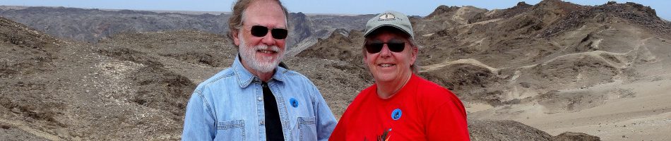
We returned to Albany & drove up Mt Clarence. Near the top is a monument to the ANZAC troops who fought in Palestine during World War I (ANZAC is an acronym for Australian and New Zealand Army Corp). This monument was originally erected in Port Said, Egypt, in 1932 but was destroyed during the Suez crisis in 1956. The base & plinth were sent back to Australia but the sculpture had been irreparably destroyed. A new version of the monument was created and the whole thing was erected here in 1964. The sculpture shows a mounted Australian and a dismounted New Zealand soldier in action.


Albany is a center for ANZAC remembrance because it was from this harbor that the more than 40,000 ANZAC volunteers set sail in two convoys to fight in World War I. The first convoy left on November 1, 1914. Many of those troops fought in the battle of Gallipoli in Turkey, an unsuccessful amphibious campaign designed to take Turkey out of the war early. One of the famous battles there was for “One Pine Hill,” so named because a single pine tree was at the top. Near the monument here is the Lone Pine memorial, consisting of a pine tree planted in 1974 from a pine cone collected by some soldiers from the top of One Pine Hill, after the original pine tree had been destroyed in the battle.

At the top of the mountain above these memorials is the Mt Clarence Lookout, with fabulous views over Albany and King George Sound. Ships have to come through the narrow passage in the foreground to enter Princess Royal Harbor and the Albany dock. This passage is called Ataturk Entrance, apparently named after Kemal Ataturk, the first president of modern Turkey and also a general who fought against the ANZAC troops at Gallipoli.

")


Next we toured the nearby National Anzac Centre, a museum dedicated to the ANZAC troops of World War I. It was very interesting with cutting edge interactive technology, although a little light on artifacts. The focus was on individuals who were part of the Anzac force. Each visitor receives a card describing one Anzac member, then you can follow their personal experiences as you proceed through the museum, reading about the battles & the people who fought in them. The museum opened on November 1, 2014, the 100th anniversary of the departure of the first convoy of troops. It is very evocative.

We drove back into town & the bus dropped us off on York Street, the main street in town. Albany has no stoplights, only roundabouts at the intersections. We walked up the street, lined with old Victorian buildings. Among other things, we passed the Town Hall, erected in 1888, which was also the place to catch the shuttle back to the ship. There was also an interesting statue of Mokare, an elder of the Noongar Aboriginal people who was instrumental in establishing good relations with the British settlers in 1826. Monuments to Aboriginal people seem to be pretty rare in our limited experience. A plaque explained that this was a “reconciliation project.” Near the Town Hall was a large poster depicting the head of this statue.


We stopped for lunch at the Albany Hotel, built in 1835. Among the best fish & chips we have ever had, along with some tasty local brew.


The public library was under renovation so it didn’t look like much from the outside. But it was still in operation inside, although a two week closure was imminent.


We saw more flora after our return from the National Park in the morning. So here is what some of it looked like.


Last but not least we walked up to visit the Dog Rock. It looks very much like a dog’s head, especially since someone has painted a collar around the dog’s neck. We have read that the Noongar Aborginal people called this “Boondie Yokine” before the Europeans came, which translates as “Dog Rock.”


Back on the ship, we had nice views of the port and of the wind farm on the opposite side of the harbor. Some 18 huge windmills sit atop a ridge. We were told that there are only 7 days a year when there is insufficient wind to turn the turbines (the day we were there was certainly not one of them) and that the wind farm supplies about 80% of all the local electricity. Solar panels provide most of the rest.


We pulled away from the dock and headed out through Ataturk Entrance. On the island to our right was a flock of Cormorants.


A lot of locals had parked their cars on the mountain beside Albany to watch us sail out.


As evening fell we sailed out into King George Sound and thence into the Southern Ocean.

Adelaide, Australia
We spent February 17 in Adelaide, having docked during the night after the very short sail from Penneshaw (less than 10 miles). Adelaide was first settled by Europeans in 1836, displacing the Aboriginal Kaurna people whose culture was destroyed within a couple of decades. It was named for Queen Adelaide of England, the wife of William IV. It is the only state capital in Australia that was settled and built by free settlers rather than convicts, and it has been known from the beginning as a pioneer in civil and religious liberty. Adelaide is a sizable city, with a population in excess of 1.3 million.
The port is a good way from the city, so we had to take a train into town. The train runs between the port and the city center and it was $10 for an all day pass (but really, it was only useful for two trips: into and out of town). At the railway station we met our friends Robert & Bill, with whom we spent the day. Leaving the downtown train station we walked down the street past a number of sculptures & monuments, most notably the War Memorial.

.")


We visited the State Library, which had a gorgeous old part & a snazzy new one full of glass. We were puzzled by all the old books in the original library, which didn’t seem to have any clear scheme for organizing all of its old books. Rick suggested maybe it was in order of acquisition, which would be particularly useless. In front of the library was a statue of Robert Burns, who seems to have been very popular in the Antipodes.


We spent some time in the South Australia Museum, which includes the largest collection of Aboriginal artifacts in the world & a very extensive natural history exhibit.

 of a giant squid, which extends through 3 floors of the museum (too dark to photograph clearly")

We walked down the part of Rundle Street that is a pedestrian mall. It is lined with shops & large stores and has street performers and sculptures, including one called Silver Balls. We also saw signs for the Adelaide Fringe Festival, a three week arts festival that was in progress. In one of the large stores we found the Adelaide City Library, but it was on the top floor and the escalators didn’t go that high. Puzzled, we walked around and found the entrance in what looked like an alley behind the store.


The city library was very nice inside, with a board game area & all the modern conveniences, including a usb charging station.


After this it was time to eat. But that wasn’t so easy. It was Saturday and a lot of stores & restaurants were closed, though we aren’t sure why. Anyway we did a LOT of walking looking for a pub & eventually settled for what turned out to be a very good pizza restaurant. It was the first pizza with pumpkin we have had & it turned out to be surprisingly good. We then walked a long way to a couple of stores we had read about, but they were closed. So we walked all the way across town to some other stores, which were very expensive and a bit disappointing.

We were all tired by this time so we headed back to the ship, where we heard that a passenger had been removed by police in handcuffs. We don’t know why, but suspect it was drugs. Anyway, that’s it for Adelaide, a pleasant but unspectacular city based on our short experience.


Penneshaw, Kangaroo Island (Australia)
After two sea days we finally anchored off Penneshaw shortly before noon on February 16. You may recall from the last episode that we left Hobart on the evening of February 13 with the plan of avoiding the worst of the storm by sailing back up the east coast of Tasmania then west along the south coast of Australia to Kangaroo Island, located just 6 miles from the Australian coast. Well, we took that route but we certainly didn’t avoid the storm. In fact, as we turned the corner from north to west at the top of Tasmania we hit winds so hard that the ship tipped to starboard and some deck chairs tried to blow away from the aft pool into the sea (photos excerpted from someone’s phone video).


The Captain reported wind gusts up to 100 mph (well into hurricane territory, although its called a cyclone in Asia) and swells up to 26 feet. Mary saw a wave hit the windows on deck 5. We were rocking so badly it was very difficult to walk inside the ship.
The Valentine’s Ball was cancelled and the gala night dress code was dropped, primarily so women wouldn’t feel the need to wear high heels (surprisingly to us, a majority of folks seemed to be wearing formal clothes anyway). We have seen some rough seas in our time, but this was probably the worst. So little progress was being made sailing into the wind through these high swells that the Captain “hove to,” slowing the engines down to a crawl through the night. The doors to the outside decks were sealed, so the only pictures we could get of the rough seas were through dirty and water streaked windows. They don’t really convey how nasty the ocean looked or how high the waves & swells were, but they will give some idea.


Here is a picture sequence excerpted from someone’s smartphone video that will give you a real idea of the severity of this storm. These pictures were taken through the window of the Crow’s Nest, we were told, on the top floor of the ship 8 or 10 decks high, showing a wave that actually hit that window!


Kangaroo Island is a tender port & it sure looked like we would be unable to tender ashore in this kind of sea. But when we arrived, shortly before noon, the seas were calm. As the Captain noted, it was like waking up on a different planet.

Kangaroo Island is Australia’s third largest island (after Tasmania & Melville’s Island) at 96 miles long and 34 miles wide. Aboriginal people lived here at least 16,000 years ago but had abandoned it by 2,000 years ago after the water rose and it became an island. Matthew Flinders was the first European to land here in 1802 & named it after the animals that were the main course at a feast. Settlement began in 1836 and today there are some 4500 people living on the island, 300 of whom live in Penneshaw, the island’s second largest town & best port.
We were scheduled for a 9 hour bus tour that would have enabled us to see all the best natural sights on the island, most of which are far from Penneshaw. Unfortunately, because of the storm we arrived about 4 hours later than scheduled and all the long excursions that would have taken more than about 4 hours were cancelled. So we tendered ashore around 1:30 (because the tendering was slowed by some difficult swells that made boarding difficult) & just walked into town.
 dock is behind this seawall.")
As we approached the ferry dock we saw a number of birds we think were Cormorants relaxing on the edge of the sea wall.


Walking up toward the town we passed Hog Bay, a white sand swimming beach. A colony of small penguins lives on the hill above the beach, but they are only there at night. We stopped at a market with stalls set up in an open field called the Oval, where local produce and crafts were offered for sale (apparently this market is set up whenever a cruise ship is in port). There were some nice flowers and also some birds that might be New Holland Honeyeaters.


We continued through the tiny town to Christmas Cove, which we understand is where the first settlers of the town landed. There was a black swan in the cove.


We visited the Visitor’s Center, which included a small museum. There we got directions to the library, an annex to the library of Kingscote, the largest town on the island about a 45 minute drive away. Unfortunately it turned out that the Penneshaw branch of the library was inside the local elementary school. School was in session, so we didn’t try to go inside.

Since we made it onto the island late it was already nearing the time we had to be back on board. We had, in any event, pretty much made it all the way to the other side of town. So we walked back, hoping in vain to find a place to eat. The most famous fish & chips establishment, called Fish, was closed for renovations. We did stop in the grocery store & buy some local honey, produced by the only pure strain of Ligurian bees in the world. On the way back to the pier we passed some interesting metal sculptures outside a hotel and some more nice flowers.


So our stop in Kangaroo Island wasn’t really all that we had hoped, but we were happy that we had been able to visit here at all after such a memorable and difficult voyage from Tasmania.

