Almeria & Granada, Spain
We arrived in Almeria, Spain early in the morning on March 28, our fourth port day in a row (exhausting!). Almeria is a very old city; the irrigation system in this area was laid out by the Romans, and improved but not really changed from that time. It used to be a thriving port and, like all of this part of Spain, was under Moorish control from the 8th to the 15th Centuries. During the Spanish Civil War Almeria was a trade union & Republican stronghold (while Granada, which we visited today, supported the Fascists). Almeria has an impressive old Moorish fortress overlooking the harbor called the Alcazaba. One story about the city’s name is that it was named after this fortress and means “Watchtower.” The other story we heard is that it means “Mirror of the sea.” I think I like the second one better.


We took a bus excursion to Granada to visit the Alhambra, the best example of Moorish architecture still in existence. Built in 1013, the Alhambra is having its 1000th birthday this year (decacentenial? millenial? something else?), although most of it was only completed over the next few centuries. It was the last holdout of the Moors in Spain during the reconquista (the Christian reconquest). Its young king, Boabdil, surrendered the fortress to Ferdinand & Isabella on January 2, 1492 after a long siege (it was pretty much impregnable to attack) pursuant to a treaty in which they promised to respect the rights & religion of the inhabitants. But the Jews who failed to convert to Christianity were booted out before the end of the year & the Moslems were expelled within 8 years. So much for treaties. After leaving the Alhambra, Boabdil reputedly turned for one last look & shed a tear (“the last sigh of the Moor”). His lovely mother, seeing this, gently consoled him: “Do not weep like a woman for what you could not defend like a man.” Life must have been hard with a mother like that.
Anyway, it was a long bus ride to Granada but the various territories we traversed were quite interesting. We drove through some sparsely vegetated hills with ridges & dry riverbeds (called Ramblas in Spain, like the Wadies in North Africa). This country may look familiar to you.


If that looks like the Old West to you, it is because you have seen it playing the old west in many movies. Almeria is a film mecca, and hundreds of films have been made here, most notably the Sergio Leone / Clint Eastwood spaghetti westerns (also Indiana Jones & the Last Crusade, Conan the Barbarian, & many more). Not far from Almeria we saw some of the buildings erected for sets in the Leone / Eastwood films.

We also saw a whole lot of power generating windmills. Spain is a leader in this industry because it has to import 100% of its oil. We saw several interesting villages, a castle built by Christians during the Reconquista in the 15th century, and buildings that are built into the side of mountain cliffs. This idea apparently started with the Gypsies that live in this area, but now it is very chic (& it saves on air conditioning, although I imagine most of the rooms don’t have a view).


We also drove past the Sierra Nevada mountain range, whose snowcap provides much of the water for this region. Some of the mountains in this range are higher than the Pyranees.


So finally we reached the Alhambra. The Alhambra is not just a palace, but a citadel on a mountain overlooking Granada. It has massive defensive walls, and housed military barracks and a small town full of civilians along with an elaborate palace complex for the sultan & his family. We entered through the Gate of Justice which, if I remember correctly, was so named because it was the place of execution for offenders. 


So now, another book. In the mid-19th Century, American writer Washington Irving (of Rip Van Winkle & Ichabod Crane fame) lived in the Alhambra for several months. As you might expect, he wrote a book about the Alhambra’s history and his experiences there called “Tales of the Alhambra.” It was a huge success and led directly to a movement to save and renovate the Alhambra, which had fallen into abject disrepair particularly after Napoleon’s troops had demolished some of it & turned it into an army barracks & stable (they tried to blow up the whole palace, but fortunately one soldier removed all the fuses & saved the palace). The work of renovation, which picked up steam at the beginning of the 20th Century, continues today. I read Irving’s book a few weeks ago, and found it pretty interesting. The first part is mostly history & a vivid portrayal of the people who lived there in his time (many people lived there; whole families were born & lived out their lives in the Alhambra at that time). The last part contains some stories & myths about often supernatural goings-on, including tales of buried Moorish gold, an enchanted Moorish army underground waiting for the time to retake the area, etc., which I found less compelling (but you might like better). Its certainly a classic & a book that had a large impact in its time. There is even a plaque on the wall outside the Justice Gate commemorating Washington Irving.


The first thing we came to inside the Alhambra was the rather ugly palace built there by Holy Roman Emperor Charles V, the grandson of Ferdinand & Isabella. He demolished part of the Moorish structure to build this Renaissance palace, which would look more at home in Vienna than Granada. His plan was to make this his capital, but he abandoned it early on & never even visited it after its completion. But we did, as you can see below.


We visited the famous Patio de los Leones (Court of the Lions), named for a fountain in the middle surrounded by sculptures of lions. This is a violation of Islamic law, which forbids artistic representations of people or animals. A poem inscribed on the fountain says that they would look much fiercer if they were not so restrained by respect for the sultan.


Off this court is the Sala de los Abencerrajes, where 16 members of the prominent Abencerraj family were murdered by the sultan (read about it in Tales of the Alhambra). It has a particularly beautiful ceiling dome.


On the other side of the court is the Sala de las Dos Hermanas (Hall of the Two Sisters), the principal room of the Sultan’s favorite (full disclosure: I have lots of pictures & am having some difficulty remembering which picture goes with which room, so dividing these out is really just my best guess). It has another ornate domed ceiling.


We visited another courtyard with a pool in the center. Water was an important part of the Alhambra, and really to all Moorish architecture, since it was highly valued by these people whose history was largely in desert areas. There are no pumps to supply the pools & fountains in the Alhambra. The water was diverted from a river about 8 kilometers away, which in turn is fed by the snow atop the Sierra Nevada. They used an elaborate system of aqueducts, above & below ground, to route the flowing water to the Alhambra’s fountains.


There was quite a lot of elaborate tile work on the walls of many of these rooms, sometimes topped with a border of stucco carvings to stunning effect. Often the carvings contain sayings or names written in Arabic (We think the one above says “There is no Conqueror but God”).


There is a large open area between the Alhambra palace & the military fortifications, from which there is a great view of Granada below the hill on which the fortress sits. The Alhambra was once a working town with many houses & shops, and even after its demise there were a lot of people living there (several portrayed by Washington Irving), so there are a number of other structures in that area that are of interest.


Next we walked up to the Generalife, which was the summer palace that included elaborate gardens. Its an easy walk today because they have built a bridge to it, but when the sultans lived here you had to ride a horse down the mountain and up another hill to get to it. Unfortunately, it was too early for the gardens to be in full bloom, but they were very interesting nonetheless. They are divided into courtyards surrounded by cedars pruned into the shape of castle-like walls, some of which contain fountains. The sidewalks were mosaic; our guide pointed out that the mosaic tradition was picked up by the Moors from the Romans, although the Iberian mosaics look very different from the Roman ones. There is also a fabulous view of Granada beyond the Alhambra walls from the Generalife.


Inside the Generalife was yet another beautiful courtyard, this one with fountains bordering a pool the full length of the courtyard that is planted with flowers. Remember that the water here is natural flow & not pumped.


Well, that is really just a glimpse at the Alhambra. There is so much of beauty everywhere you look, and there is insufficient time on a tour to really take in all the details or to contemplate the harmonious whole. But some 3 million people visit it every year now, so crowds are inevitable even though tickets are restricted (you can’t expect to walk up and buy a ticket on the day of your visit). It would be nice to be able to stay in Granada a couple of days for a more leisurely visit, but of course on a cruise that is impossible. After leaving the Alhambra we ate lunch at a hotel nearby, with musical accompaniment consisting of well-worn Spanish flavored standards. Also touring the Alhambra were some of our friends, John & Mary Ann Darcy & Ed and Mary Ritter. So hello to the Darcy grandchildren from their grandparents! And because I have one more picture space to fill, here is the towel animal we received that night before departing for Malta.


Gibralter
A little before noon on March 27 we docked at the British territory of Gibralter, just south of Spain at the entrance of the Mediterranean. Just 17 miles from Africa, Gibralter was one of the Pillars of Hercules that marked the boundary of the known world to the ancients (the other was probably Mount Acho on the African shore). Like much of Spain, Gibralter was under Moorish rule from the 8th until the 15th Centuries. The name evolved from the Moorish name “Jabel Tariq” (Tariq’s rock) in honor of the Moorish general who invaded Spain in the 8th Century. The English took over in 1704, and there is a cemetery in town for sailors who died at Trafalgar. The British fortified it by digging tunnels through the rock for gun emplacements (you can visit them, but we didn’t). During World War II the civilian population was evacuated & it was made into a fortress controlling entry into the Mediterranean.

The town of Gibralter is actually pretty small, about 2 square miles & 30,000 people, so we decided to walk around on our own, although we only had about 6 hours before departure. Gibralter is very British, with pubs & red telephone booths & currency (there is a Gibralter pound, but it is interchangeable with the pound sterling) & British stores like Miarks & Spencer. They drive on the right, and there are signs painted on the pavement reminding British visitors to “look left.”


The first place we visited was Casemates Square, which is a large open area in the center of town. Beyond that we walked down Main Street, which is a pedestrian only street lined with British stores & local shops. The streets in Gibralter are pretty narrow, and there are more motorbikes than cars.


OK library fans, here is your first spot. Gibralter has a very nice little library originally built for the British regiment here (called “Garrison Library”), located on a street called “Library Ramp.” It has a walled courtyard with flowers & trees, including a tree-like plant whose branches look like very long stemmed Yucca. A very nice attendant showed us around & told us some if its history.


We continued on toward the cable car that will take you to the top of the rock. In the panoramic picture at the top you can barely see the route of the cable car just to the left of the big dip on the right hand side. But first, for our firehouse fans, the Fire Station is right next to the cable car station.


So we went to the top on the cable car and walked around. The rock is some 1400 feet high, and we got up over 1200 feet at least. The views were spectacular; you can see all the way to Africa on a clear day, but it was a little hazy so we could just make it out in the mist. You can see the whole town far below, including the airport runway. You can see the end of the runway in one of the pictures below, but in fact the planes approach from the other side of the rock & have to stop there short of the water. The only road to the mainland crosses the runway, so they have to stop traffic to Spain in order for a plane to land. Not surprisingly, this was recently voted the scariest airport in Europe.


The most entertaining thing in Gibralter is the Barbary Apes that live on the rock. They are actually monkeys (technically Macaques), about 1 1/2 to 2 feet tall. They are wild animals – the only wild primates in Europe – but are used to tourists. They have a reputation for stealing sunglasses & cameras, although we didn’t see any of that, and there is a 500 pound fine for feeding them (but we saw some taxi drivers give them food to attract them to approach their passengers). As you can imagine, the tourists love them & sometimes get closer than they should. No one knows how the apes got here (probably brought originally by people from Africa), but there is a legend that if the apes ever leave Gibralter the British will too. Because of this, during World War II Winston Churchill issued orders that the apes be well cared for, and today they are still fed regularly by (presumably) officials.


There were some moments that reminded us of the Robin Williams film Jumanji, when one or several of these monkeys would jump on someone’s back or leap onto the windshield of a taxi. They are not at all shy.


We walked quite a way around the top, which was very rocky & steep, often without handrails. It makes you wonder how many people they lose up there every year, especially kids. But the views, the rocks & the flowers were quite beautiful.


After descending on the cable car we visited the botanical gardens & saw the 11th Century Moorish castle (although it may have been started as early as the 8th Century) on our way back to the ship. In total we walked close to 7 miles.


As we sailed away before sundown, the ship circled around Gibralter from west to east, and we saw (inter alia) the mosque (only a few years old) & the lighthouse, both on the southernmost tip of Gibralter called Europa Point.


And so, as the sun sinks slowly behind the Rock to our west, we bid a fond farewell to enjoyable Gibralter & head for bed (& Spain).


Casablanca & Marrakesh, Morocco
On March 26 we arrived in Casablanca, Morocco. Despite Americans’ romantic notion of this city from the movie of the same name (which was actually shot entirely in Hollywood), Casablanca is a large commercial city (3.5 million people) with a reputation for having little charm.


We opted to spend the day on an excursion to Marrakesh, about 150 miles to the south. We travelled by bus, rather than the Marrakesh Express, and managed to get there after a long drive (about 3.5 hours each way). We saw many villages, each with a minaret, & flocks of sheep & goats. One interesting thing was the widespread use of prickly pear cactus as hedgerows & fencing for grazing animals. We were told that they don’t eat the cactus, but they do make oil from it & some other products. We even saw a large hill planted with rows of prickly pears like a farmer’s field.


Casablanca is known as the “white city”; the name means “white house” & originated in the fact that it had so many white housesthat sailors could easily identify it from sea. Marrakesh (which is inland, at the foot of the High Atlas mountains) is called the “red city” because most of its buildings are made of reddish materials (originally they used the local red mud). It is a pretty large city & very busy and crowded on the streets. The name of the country, Morocco, is derived from the name Marrakesh. Our first stop was at a hotel for lunch. It was a beautiful hotel, but the lunch was disappointing in that it was not Moroccan cuisine (we did get some very good Moroccan cuisine, but it was on the ship after our return!).


The air conditioning in the bus didn’t work during the long hot (sun in my face) drive to Marrakesh, but while we ate lunch they fixed it. The guide told us (with a straight face) that the bus driver had explained that someone on the bus must have been using a computer, which caused a virus to infect the air conditioning system. This is the “computers work by magic” school of technology, which reminded me of the film Independence Day, in which Jeff Goldblum was able to tap into the alien computer system in a few minutes through wifi internet with his laptop & read their plans to conquer Earth (apparently the aliens not only had the same technology we do, but also communicated digitally in English, even though they also possessed scary mental powers). These aliens also generously provided free Earth-style wifi in their mothership, without even using password protections, to enable Jeff to upload a virus to their system that destroyed all their ships in just a few minutes (but there was no wifi on our bus, so even that theory wouldn’t apply). Isn’t magic technology wonderful?
The first place we visited after lunch was the Bahia (“Brilliant”) Palace. It is relatively new for a Marrakesh landmark, having been built in the 19th century. But it is full of lavish Moorish decoration. The intricate carving in the walls that looks like sculpted stone is actually sculpted stucco. The ceilings of this building are made of carved cedarwood. You are going to see a lot of this stuff, both in this posting and in the Grenada, Spain posting yet to come, because we really liked it. So bear with me & enjoy it.


We also visited the Saadian Tombs. Members of the Saadian dynasty (15th & 16th centuries) are buried here. The first sultan of the next dynasty wanted to eliminate all such recollections of the Saadians, but because it would have been bad luck to desecrate the tombs he left them intact but blocked off all access. They were mostly forgotten until rediscoved in 1917.


Outside the tombs is the Kasbah Mosque, built in the 12th Century. We continued to the carpet store (don’t ask), through the colorful streets of this part of Marrakesh. The city is home to storks, who nest on top of urban walls & buildings here.


Last, but far from least, we visited the Djemaa el Fna (assembly of the dead) and the nearby Koutoubia minaret, which is the symbol of Marrakesh. If you have seen the remake of Hitchcock’s “The Man Who Knew Too Much,” you may recognize the Djemaa el Fna as the large colorful plaza where Jimmy Stewart learns the secret from a dying man that causes him and Doris Day so much trouble for the rest of the film. It is a large open area surrounded by cafes & vendors that fills up as the day lengthens with food carts (particularly orange juice – Moroccan oranges are bitter and tough, not great to eat) & snake charmers,monkeys, acrobats & other entertainers (who charge a Euro, or more if they think you are gullible, to take their picture). We were there in late afternoon, so many people were still setting up their stalls; things reportedly get really interesting at night. Although you have to be careful (you have seen Indiana Jones, so you know how easy it is to get abducted in such places); I turned away for a minute to take a picture and some guy came up and took Mary’s hand & tried to pick her up.


The Koutoubia Minaret is about 180 feet tall. It was built in the 12th Century, and the mosque associated with it had to be rebuilt twice (once to correct its alignment with Mecca). It can be seen all over the old part of the city & is quite beautiful.


Then there were a few more random things worth seeing: the Theatre Royale, a view of the High Atlas mountains from Marrakesh, and the city walls (which look a lot like Taroudent’s, but aren’t quite as old).


The trip back to Casablanca was long, but there was a dramatic sunset about halfway there.

Back in Casablanca there were two more stops before reaching the ship (where they had kept the dining room open for us, and we enjoyed a terrific Morrocan style dinner). First we stopped to see the Hassan II Mosque, which was near the ship. Built recently (1989) this is supposedly the largest mosque in the world. It holds about 20,000 worshipers inside the sanctuary and another 80-100,000 in the courtyard. It has a retractable roof (3.5 minutes to open) & has the world’s tallest minaret at 689 feet. OK, that was pretty impressive, but the other stop was at (what else?) Rick’s Cafe. As I mentioned at the beginning, the film Casablanca was filmed entirely in Hollywood, so Humphrey Bogart & Ingrid Bergman never set foot in this place. It was built just 9 years ago by a woman from Portland Oregon named Kathy Kriger, so it is strictly a tourist attraction. I am sure that if we had gone inside Sam would have played it again (and again), but we didn’t get out of the bus for this one, and were only too happy to finally reach the ship.


Agadir & Taroudant, Morocco
Early in the morning of March 25 we docked at Agadir, Morocco. Agadir is pretty old: the Portuguese established a trading center here in the 15th Century or so, and there was a famous incident at Agadir in 1912 when the Germans sent in a gunboat to challenge the French & almost ignited World War I a couple of years early. But in 1960 there was a devastating earthquake that destroyed more than 80% of the city & killed about 15,000 people in 15 seconds, so little remains of historic Agadir. It has been rebuilt as a resort town, and also seems to have a busy commercial port, but there was little to see here that interested us.

So we opted instead for a land excursion to ancient Taroudant, about 50 miles inland at the foot of the High Atlas mountains. Taroudant is a walled city that is about 1000 years old, and was the capital of Morocco for a while in the 15th or 16th century. It was also an important trading stop on the old caravan routes.
On the way to Taroudant we saw vast areas, both flat & mountainous, that are full of Argan trees. This is a tree that only grows in this part of Morocco, and produces a fruit similar to an olive but much harder. We visited a women’s cooperative in Taroudant that was producing an impressive variety of oils & creams from this fruit, which is still stone ground by hand. What was most interesting, however, is that goats actually climb into these trees to eat the fruit; we had heard of this but never seen it before.


Just outside the walls of Taroudant we stopped at a restaurant for coffee & a cookie. We ate in a courtyard & the grounds were lush with orange trees, palms, etc.


Taroudant is surrounded by high medieval looking walls with a reddish color that comes from the local soil. The walls are somewhat in disrepair in some areas, but are pretty impressive nonetheless. This is pretty much the signature view of Taroudant (I think we will see more of this at Marrakesh tomorrow).


We spent most of the time at Taroudant walking around the souks (open air markets), which were labyrinthine. It is amazing that no one was lost from the group. Many of the vendors were nixing photos, but I got a few of the souks & of some of the wares, including spices, fruits, clothes & art objects (read the captions).


We spent some time in an artisan cooperative store that had many beautiful things, probably at good prices (if you bargain effectively), but still quite a lot of money. And after all, how could we tell if something is really worth what they are charging? Mary bought an unusual pair of moonstone & silver earrings.


You might have noticed in that last picture that the silver piece has a star of David in the middle and Hebrew lettering on tablets at the top. Our guide told us that, until the Arab conquest in (I think) the 8th Century, the Berbers who were the indigenous population of Morocco (she is a Berber) were Jews & Christians. Many Jews moved to Morocco after the Spanish reconquista in Spain, and they were known hereabouts for their metalworking skills. She says that there were many Jews living in Morocco until 1948, when almost all of them moved to Israel. Anyway, Taroudant has a Jewish Quarter to this day (although I think it is now a geographic designation rather than an actual Jewish neighborhood). We saw a number of items in the craft cooperative with Jewish themes & Hebrew lettering, although I doubt they are still made by Jews today.


As I mentioned, the Berbers were the original inhabitants of this area; they are not ethnic Arabs and have their own language, which is one of the three official languages of Morocco (along with Arabic & French). The ancient Greeks called them “barbarians,” as they did anyone who didn’t speak Greek. From this they became known as Barbary (as in Barbary pirates, of Thomas Jefferson fame), and this was later updated to Berber. We saw many of them around Taroudant dressed in traditional robes for men & veiled outfits for women. I only have a few pictures, since I didn’t want to offend anybody.


So, to finish up Taroudant, I told you we visited a women’s cooperative, & it had beautiful old tiling on the walls. We saw a bridal boutique and some familiar looking signs with Arabic (or maybe Berber?) writing. And a gas station selling Libyan oil.


On the trip back to Agadir we passed the High Atlas mountains & some currently dry riverbeds that are called “Wadies” in North Africa & the Middle East.


Before returning to the ship we visited the old Casbah of Agadir, among the few buildings to survive the earthquake (although its not in great shape). It is on top of a hill, giving a great view of Agadir, and there were some guys there selling camel rides. One of our party rode a camel, & seemed to come through it OK.


So that’s it for a very full day on an excursion that was finished by 1:30! No towel animals, so I will leave you with some fruit art (I bet you weren’t expecting that).


Madeira (day 2), Around the Island
On our second day in Madeira we were on a private bus tour that took us throughout the western portion of this beautiful island. Madeira really has everything: seashores & fishing villages, cliffs & mountains, flowers rocks & surf. This was a long (8 hours) tour & we visited a number of places, so this post is going to be mostly made up of pictures (I’m sure you are grateful to hear that).
First we visited the picturesque fishing village of Camara de Lobos, a favorite vacation spot during the 1950’s of Winston Churchill, who liked to paint the scenery here. The town was full of beautiful plants & flowers. I wish I could name all the flowers, but I can’t (as you will see from the captions).


A little further along the coast we stopped at Cabo Girao, at 580 meters the second highest sea cliffs in the world (our guide thought the highest might be in Taiwan, but wasn’t sure). There is a glass platform to walk on extending out over the cliff.


OK, next was Ribeira Brava, a small resort town (village). They had a lot of construction going on, apparently moving rocks & rubble from the river to the shore, where they are building up the area behind their sea wall, which held off a roaring surf. There was a lovely little 16th century church, all dressed up for Lent. Mary bought a t-shirt here with an embroidered bird of paradise on it – less than half the price asked for the same shirt in Funchal.


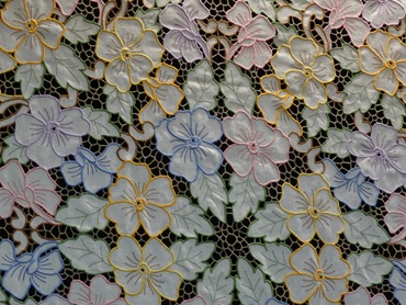
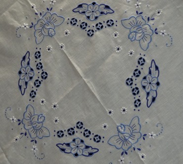
Next we drove way up into the mountains and, after a stop for some photos & to visit a tourist store, we drove across a relatively flat, soggy high plans called Paul da Sierra. It was really foggy during this part of the trip, so very few pictures (and much sleeping). I may have mentioned that, in addition to wine, Madeira is known for its fine embroidery. Not cheap though: we saw an embroidered table cloth in a Funchal window selling for about $9000.00! And you know that if you bought it someone would spill the wine the first time you used it. In the mountaintop shop was some nice embroidery selling for hundreds rather than thousands of dollars, but we took a pass anyway.




We stopped for lunch (marinated tuna for us) in the little village of Porto Moniz on the northwest tip of Madeira, about as far (47 miles) from Funchal as you can go without getting wet. About 4000 people live there. We stopped for pictures on the mountainside above the town, but the best views were at the ocean where the surf pounded some fabulous black rocks. Madeira is a volcanic island (some say it is what is left of the lost continent of Atlantis) & we saw quite a lot of volcanic rock, natural and used to build walls & buildings. I mentioned that the whole island is heavily terraced for houses and small fields, and you can see below some of the terracing above Porto Moniz with grape vines (not yet green) on some levels.


You are probably wondering by now how many more stops, but there are just two more. Seixal is a very small village with a profusion of wildflowers on the hillside, including a whole field of wild lillies.


And finally, Sao Vicente. This village was originally at the seashore, but was repeatedly pillaged by pirates. So in the 16th century they moved the whole village inland about a mile & rebuilt it in a valley behind some cliffs & rocks where it could no longer be seen from the sea.


And so back to Prinsendam, well in time to make the all aboard deadline of 4:30. But then the Captain announced that they were about to replace the capstan on one of the engines, a huge piece of metal that could prove dangerous at sea. So our departure was delayed until 8:00. And Funchal looked quite beautiful after dark.

But then departure was delayed until 10:00. Then about 1:00 in the morning the ship was filled with a loud grinding sound that lasted quite a while, which seems to have been the testing for the work that had been again delayed. So we didn’t set sail for Agadir until about 2:00 AM, but we still made it to Agadir Morocco on time early Monday morning. However, that is another story. I will close this installment with a couple of more towel animals.


 BADER JOURNAL

