Haifa, Israel (Caesarea, Akko)
[Note: As I write this we are at home. As you can see, the blog fell behind a bit in the last portion of the trip, but rest assured that the entire thing will be completed, despite all the competing demands on our time here in our natural habitat. Hopefully, it won’t take too long, although we are leaving town again in June for a few weeks. It should be completed by then, but who knows?]
_________________________________________________
On April 9 we docked in Haifa, Israel. When we visited here before, https://baderjournal.wordpress.com/2013/05/01/israel-day-2-jerusalem-to-haifa/, we arrived at night after a two day tour of Israel and thus had no time to see the city. This time we took an excursion to the ancient cities of Caesarea and Akko that was promised to finish with a visit to the Bahai Gardens in Haifa. But to our disappointment it didn’t. So after two visits we have not had a chance to see Haifa at all beyond the view from the port. Maybe next time.
Caesarea
Located on the coast halfway between Haifa & Tel Aviv, Caesarea was initially built on some Phoenician ruins by Herod the Great in the last two decades BC. Named after Herod’s patron, the Emperor Augustus Caesar, it was an important port & served as the capital of the province of Palestine under the Romans and Byzantines. It was conquered by the Muslims in the 7th century & then by the Crusaders in the 12th. The Crusaders were ousted in 1265 by the Mamluks, and the town then lay largely uninhabited until 1884 when a group of Bosnian Muslims settled there. It was occupied by Israelis at the beginning of the 1947 war, when the remaining occupants were expelled and the village houses destroyed. Since then the area has been largely devoted to archaeological excavation, and is owned today by a foundation. A lot of these ruins have been reconstructed & it is difficult to tell what is original and what has been added. There are about 5,000 inhabitants in the area.
Our first stop was on the beach outside the town where a Roman aqueduct traverses the beach. This is one of three aqueducts that served Caesarea. It has two channels, built at different times, which are visible from below as a seam in the ceiling of the arches. An impressive structure, it originally extended some 11 miles.


Our first stop inside the city was at the Roman theater. It has been restored and often hosts concerts. While we were sitting in the seats another group of visitors standing on the stage sang a hymn. It was very nice, but seemed a little out of place in a Roman theater.


After viewing a movie we walked down to the harbor, which is broad and picturesque.

On the left of the harbor are the ruins of the palace built by Herod that was the residence of the Roman governors of the province. Notably visible is the swimming pool built on the edge of the sea. A stone was unearthed near here inscribed with the message that “Pontius Pilatus” had erected a building dedicated to the emperor Tiberius. Part of the palace was later partitioned into private quarters & the palace was abandoned entirely at the end of the Byzantine era.


In the middle, facing the harbor, was the Hippodrome, built in 9 BC and described by Josephus. The “Actian Games,” instituted by Herod & named for the naval battle in which Augustus defeated Marc Antony & Cleopatra to claim the empire, were held here every four years. In addition to athletics & gladiatorial combat, they included chariot races that went seven laps of this track, one of the largest in the Roman Empire. One part of the wall in front of the grandstand was covered by faux marble fresco, but we couldn’t tell whether that was original or a modern demonstration of something that might have been there.


Beyond the hippodrome was a complex of walls of various buildings, some with (rebuilt?) archways.


Some of the buildings in this area had mosaic floors (some reproductions?) that must have been beautiful when in use.


Of particular note is the public bathhouse, which is particularly well preserved (or restored), with marble columns & mosaic floors. This was a public meeting place where, in addition to bathing, one could exercise & get a shave, haircut or massage.


On our way to a huge & delicious lunch in a restaurant near the water we walked along the city wall built by the Crusaders, complete with moat. Near the restaurant we saw some Roman sculpture & the minaret of the mosque built by the Bosnian settlers in the 19th century. No work was being done because it was Saturday, the Jewish Sabbath. Across from the restaurant was a hillside covered with ongoing excavations called the Crusaders’ Market, thought to contain houses & commercial buildings.


After lunch we left the city through a gate built by Crusaders, designed with sharp turns inside to deter invaders, and boarded the bus for the trip to Akko.


Before leaving Caesarea, here are some of the flowers we encountered there.


Akko (Acre)
First settled about 5,000 years ago, Akko is one of the oldest continuously occupied cities in the Middle East. During the Biblical period it was a Phoenician city. While Akko is its official name today, it was known as Ptolemais during the Hellenistic through the Byzantine eras & as Acre during its occupation by the Crusaders.
Acre was an important port in the middle ages under Islamic rule starting in the 7th century. It was captured after some four years of siege by the Crusaders in 1104 and became their main port.and provided great wealth to the Crusader Kingdom of Jerusalem. Saladin recaptured it for Islam in 1187 but in 1191 it was restored to the Crusaders by forces under Richard the Lionheart of England & Philip II of France. They retained it until 1291 when the Mamluks took over. Acre was the last Crusader foothold in the Middle East.
Our first visit was to the ruins of the fortress built in the 12th century by the Knights of St John Hospitallers. It was unearthed in recent times under a prison built by the Turks. A number of Zionist underground fighters were imprisoned here by the British during the period after World War II when the Zionists were pushing for independence, and some were executed here. Apparently in the movie Exodus Paul Newman’s character was imprisoned here. In 1947 the Irgun, Zionist independence fighters, broke into the prison & released the Zionist inmates (and more than 200 Arab inmates as well).


Inside the fortress were several halls and/or chambers with vaulted ceilings, all nicely lighted with historical exhibits and some art on display, called Crusader Halls. Our guide told us that before the underground fortress was discovered there were rumors of underground passage. Some of the Zionist prisoners dug down through the floor of their cell & discovered a bit of stone ceiling of a room filled to the top with dirt. Obviously this was no use for escape, but it was apparently the first modern evidence that the Crusaders’ fortress was still there.


The largest Crusader hall is the Refectory, or dining hall.


Under the Refectory is a tunnel. There is a famous tunnel here that leads to the waterfront, thought to be a means of escape in the event of a successful attack, but this was not that tunnel since it ended in what was once the Crypt of the Crusaders’ Church of St. John. The Turks used this area as a post office. This tunnel was very narrow & there were parts where even short people like us had to bend over to avoid the ceiling. It was fairly dark in the tunnel & we were moving the whole time, so the pictures are a little unfocused. As should be obvious, Mary was in front of Rick in line.


We walked up some steps to the street level where we passed through a shop & into a corridor that seems to have been part of the old prison. Today it is something of a shopping mall, with restaurants & shops (many closed for the Sabbath). We left through the souk, teeming with vendors & shoppers, & walked back to the bus through the very crowded streets. Then we drove back to Haifa, without stopping at the Baha’i Gardens.


We sailed that night to Ashdod, the port nearest Jerusalem. But we had visited Jerusalem & Masada, the prime sites in that area, just three years ago. https://baderjournal.wordpress.com/2013/04/27/israel-day-1-ashdod-to-jerusalem/. We thought about going into Ashdod for a look around (it is a very ancient port city), but Mary was still not recovered from the desert fever she picked up in Dubai & we were both quite tired. So we stayed on the ship & treated it as a sea day in the hope that some extra rest would prepare us for the port-intensive run through the Mediterranean (7 ports in 9 days).
Suez Canal
The first canal in this area was built almost 4,000 years ago, connecting the Red Sea to the Nile River. It was used off and on for a thousand years, alternately silting up and being cleared again for use. Napoleon looked into building a canal here in 1799, but his engineers erroneously calculated that the Mediterranean was 33 feet lower than the Red Sea. Forty years later it was discovered that the two seas are at the same level and in the 1850’s Said Pasha, the Ottoman governor of Egypt, approved a French canal effort directed by Ferdinand de Lesseps. Because the canal required no locks it could be built primarily by digging and moving sand & in 1869 the Suez Canal was opened to shipping. When de Lesseps tried to use the same method to dig a canal through Panama, of course, he failed miserably. Opening the canal also provided a route into the Mediterranean for numerous flora & fauna previously resident only in the Red Sea, altering its ecosystem permanently. This is called the Lessepian Migration.
After a sea day sailing around the Sinai Peninsula we found ourselves anchored before sunup on April 8 off the city of Suez at the northern end of the Red Sea. There were a lot of other ships anchored nearby.


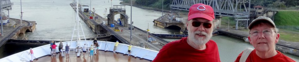
We were to be the second ship in a convoy that was set to enter the Suez Canal before sunrise to spend most of the day sailing through it into the Mediterranean Sea. The Canal is about 121 miles long and and at least two convoys of ships traverse it every day, one north bound and one south bound. Our lead ship, which looked like a small military vessel, headed for the canal as the skies began to lighten & we followed it in.


As we began sailing slowly north, the city of Suez was on our left & the barren Sinai Peninsula was on our right.


Entering the canal behind us was a huge container ship which we were told was one of several identical ships that are the largest container ships in the world. If memory serves, it has a capacity of 22,000 containers and was carrying 14,000. Each container is the size of a large tractor trailer.


All along the canal were military posts & watchtowers. Some were obviously occupied & some less clear, & some had messages for us on the ground outside. They looked like lonely places to be stationed.


We continued up the canal, which is actually the dividing line between Asia, on our starboard (right) side, and Africa on our port (left) side. We saw some of the tall conical dovecotes common in Egypt. The pigeons drop guano on the inside that is used for fertilizer and are also eaten as squab. We came to the first of several lakes in the canal where convoys used to wait for ships going the other way to pass by (no more, as we will soon see).


We passed an oil tanker that had become disabled and had been sitting here for several months while its oil is drained into another ship, repairs are made, and the oil is pumped back in to complete the canal journey. This must be pretty unpleasant for the crew, not to mention very expensive for the owner.

We next came to the place where the canal divides into two parallel channels, one for northbound and one for southbound. This is brand new; the channel on the east (right) side for northbound ships just opened in August. Before this one of the convoys had to wait in a lake until the other passed by, slowing everything down considerably since there are quite a few ships in each convoy. The new parallel channels will enable traffic to increase by about 40%, and this will greatly increase Egypt’s income from the canal.

In this area from the lakes to the divided channels were a number of small fishing boats. After entering the parallel channel we continued to sail north. Most of the scenery consisted of large hills of sand, but they are laying asphalt roads on both sides along the waterfront.


The ongoing canal upgrade project includes more than the new channel. They are building several tunnels under the canal & a new town on the Sinai side, which we were told is expected to be a vacation destination for Egyptians. We saw a mosque & apartment buildings under construction there. Currently crossing the canal is done mostly by ferry, of which we saw a few. There is an old bridge at one point that rotates to let ships through, but it doesn’t reach across the new channel, so its difficult to see what use it will be in the future, unless they build a tunnel there to complete the journey to the Sinai side. In this area there were some statues & logos in the area between the channels relating to the canal.


We passed Ismailia, where the canal headquarters are located, but it was on the side of the other channel so we only got a distant view. This town was named after Ismail, the Egyptian pasha at the time the canal was opened. It has two noticeable monuments: a concrete monolith commemorating World War I dead, and a monument shaped (we were told) like an AK-47 to commemorate the Egyptian dead in the 6 day war with Israel.


Once we reached Ismailia we began to see ships from the southbound convoy in the opposite channel. the hills of sand (perhaps the material removed in digging the second channel) made it impossible to see more than the very top of the ships at first, but later the sandbanks in the center became lower & a better view of the ships was available. As you can see from the pictures, the ships maintain a pretty good distance between them, presumably for safety reasons.


As we neared the northern end of the canal we came to the one bridge that spans the entire canal. It was built by the Japanese & is called the Japan Egypt Friendship Bridge. We spent a long time approaching it at the slow speed used by canal traffic, & only saw one car cross this imposing bridge. It reminded us of the infamous “bridge to nowhere” that was supposed to be built in Alaska a few years back.


After the bridge came Port Said, the city at the Mediterranean entrance to the canal that was named for the Pasha who granted de Lesseps authority to build the canal. We had docked in Port Said during our Grand Mediterranean cruise in 2013, although we spent the day visiting Cairo rather than in Port Said. See https://baderjournal.wordpress.com/2013/04/23/port-said-cairo-egypt/. The canal was widened long ago to permit northbound ships to exit directly into the Mediterranean, bypassing Port Said. We did that, so our only glimpse of Port Said was from a distance. Having thus completed our interesting encounter with the Suez Canal, which is so different from the canal in which we crossed Panama, we sailed on toward more adventures in the Mediterranean Sea.

Aqaba, Jordan (Petra & Wadi Rum)
At its northern end the Red Sea divides in two: the left fork leads to the Suez Canal & the right fork is the Gulf of Aqaba. We sailed up the gulf & docked in Aqaba early in the morning on April 6. Aqaba is an ancient town & was an important stop on caravan routes. In biblical times the town here was called Elot. Because of its access to fresh water as well as the Red Sea this was a strategic location during World War I, when T.E. Lawrence and an Arab raiding party captured it by approaching over the desert while all of Aqaba’s defensive weapons faced the sea. This is a climactic moment in the film Lawrence of Arabia, but the director didn’t like the look of Aqaba so he shot this sequence in Spain.
Today Aqaba is the only port of the otherwise landlocked country of Jordan. It has become a flourishing beach resort area & a popular diving spot with submerged coral reefs. Right next to Aqaba, just across the border, is the Israeli city of Eilat. From the ship we looked out on Aqaba from the seaboard & Eilat from the port side.


We spent the day on a private excursion. Heading out of Aqaba early in the morning, we saw a huge Jordanian flag flying on a very tall flagpole that our guide said had been the tallest in the world until (who else?) Dubai built a taller one. We drove through the mountains, passing desert villages & Bedouin encampments.


PETRA
Our major stop for the day was Petra, an ancient city carved out of rock some 2000 years ago by a group called the Nabateans. This is where Indiana Jones found the holy grail in Indiana Jones and the Last Crusade, it is the setting for Agatha Christie’s Appointment With Death, and it is on the modern list of the seven wonders of the world. Petra was an important trading center in ancient times, a crossroads on several caravan routes where the Nabateans extracted payments for passage. At the end of the first century AD it came under Roman control (the Emperor Hadrian visited), but its importance declined as sea routes replaced desert crossings for trade and the city was largely destroyed by earthquakes. Hidden away in a valley that is difficult to see, much less to visit, Petra was lost to everyone but the bedouins living in its caves for some 500 years, until rediscovered in 1812 by Jean Louis Burkhardt. After another visitor’s drawings were published in 1839 Petra became a destination for particularly hearty travellers & near the turn of the 20th century archaeological excavations began.
One approaches Petra through a town called Wadi Musa. This means “Valley of Moses,” and the name comes from the Bible. There is a spring here (called the Spring of Moses) that is supposed to be where Moses struck the rock with his staff to produce water for the Israelites during their wandering in the desert. The local king (of what was then Edom) is said to have denied them permission to travel through the area, but Moses’ brother Aaron died before they left & was buried on top of a nearby mountain called Jebel Haroun (Haroun is Aaron in Arabic), where there is still a white shrine visited by Jewish, Muslim & Christian pilgrims.


It is a very long walk (about 2 miles) into Petra from the gate, and the ground is very rocky & uneven. For those who can’t do that, horses & carriages are available (for a price). It is all downhill going in, so you know it will be uphill coming out (when you are already tired). While the slope is a moderate 5%, it adds up: one book said it amounted to a total equal to a 45 story building. The Romans built a road here, but most of it is still covered by rock & dirt from the flash floods that sometimes inundate the lower part of this area. They have dug down to the Roman road in some places, but it is made of worn down rocks & is almost as uneven to walk on as the rest of the path.
Most of what is left in Petra are tombs & caves where the Nabateans buried their dead. First we came to some “god-blocks,” huge rocks about 20 feet tall carved into cubes that may represent gods protecting the city’s water supply. A little further on is the Obelisk Tomb & Triclinium (or dining room), which may be one monument or two. The top is a cave containing graves fronted by four large obelisks, with a figure carved into the rock between the middle obelisks. The bottom is a single room with tables & chairs for holding banquets for the dead.


We passed some goats grazing near the path & came to the small bridge over the Wadi Musa stream. A dam has been built here in modern times to deflect the water during the wet season, which otherwise would flood the canyon that contains the path into Petra from here. A tunnel on one side of the road was used by the Nabateans to divert this flow.


The last mile or so into Petra is along a path through a very narrow & beautiful canyon called the Siq. This narrow split in the rock was probably first opened up by an earthquake & its tall wavy walls of various colors were developed slowly by wind, sandstorms & flash floods.


There has been a lot said about the colors of Petra. A famous 1845 poem, written by a man who had never been there, called it “a rose-red city half as old as time.” Agatha Christie described it as “blood-red” & had one of her characters say it is “very much the color of raw beef.” In actuality, as you can see from these pictures, the rocks are mostly beige or reddish brown (although some say at dusk it has a rosier hue), but on closer inspection there is great variety in the color. The variety is probably more beautiful than a flat red color would be. Some of the pictures below were taken in the Siq & some inside a restroom built inside a cave in Petra. Our guide announced a rest stop there & told those of us who declined that we really should stop in there to see the rocks, if nothing else. He was right.


The Siq has a number of stone carvings & shapes. It has a very long but narrow aqueduct running along one wall, which presumably brought water from Wadi Musa into the city.


At the end of the Siq the first thing in Petra to come into view is the most famous, the so-called Treasury. Carved out of the solid rock wall, with no freestanding components (other than one pillar that replaced one that collapsed in antiquity), this is the building where Indiana Jones found the Holy Grail. The sudden appearance of this sophisticated carved building between the natural wavy walls of the Siq is quite dramatic.


This building was probably a place of worship, built in the 1st century BC. It is called the Treasury because of a rumor that the urn carved into the top façade was full of money. You can still see the bullet marks where early visitors tried to release the money by shooting at the urn, which is actually solid rock. You can’t approach the Treasury today beyond the foot of the stairs, but there are a few rooms inside (although they are bare with none of the stuff Indiana Jones encountered there). The parallel lines up the sides of the building may have been footholds for the workers carving the rock. The Treasury from some angles actually has a reddish hue.


Recent excavations in front of the Treasury have disclosed two tombs built on a lower level. Presumably that was the original level of the ground here & the Treasury was built above these tombs. The area in front of the Treasury is the scene of a lot of hustle & bustle since it’s the entrance to the city, including souvenir stands & camel rides. There were a lot more people than normal on the day we visited, a large proportion young girls on school trips from Amman who were here on some kind of special school day. They seemed to be particularly interested in having their pictures taken with Western women for some reason.


From the Treasury we continued walking downhill into what was the city. We passed several structures carved into the walls, and also some mounted police and an old man playing a string instrument. We also ran into some of our tablemates down here, who had come on a HAL excursion.


At the end of this road, where it angles to the right, is the theater, built in the 1st century AD before the Romans took over. The entire edifice, other than the pillars behind the stage & the ends of the rows of seats, is carved out of solid rock. The openings above are all that remains of some buildings that were superseded by the theater. Originally there was a high wall behind the stage that would have cut off the view of the interior from the outside. Notice how the colors can vary, depending on your perspective & the amount of sunlight.


After the theater we came to what is called the Royal Tombs, a row of the biggest and most elaborate tombs in Petra high on the face of the East Cliff. There is a modern stairway up to this level. Rick climbed up for a few photos, while Mary stopped halfway up because she wasn’t feeling well. In this area there were souvenir stands, some selling “ancient coins” that our guide said were about a week old.


Among the tombs along this wall from Rick’s perspective (they continue around the cliff out of sight), three stood out. From left to right are the Corinthian Tomb, with a design similar to the Treasury but in far worse condition, the Silk Tomb, notable mainly for its multiple layers of bright colors, and the Urn Tomb. The Urn Tomb is in excellent condition, with several rows of arches below its façade supporting a large forecourt. It appears that its good condition stems from its conversion into a church (or perhaps even a cathedral) in the 5th century. The Urn Tomb & the Corinthian Tomb are thought to have been built for Nabatean kings.


From this height one could see a number of caves that have been eroded by wind & water into wavy multicolored natural sculptures. You could also see further into the valley, which was once full of houses in a teeming city of some 30,000, all of which were destroyed by earthquakes. Some archaeologists think they are all still buried there & that what has so far been uncovered here is only the bare beginning.


Sadly, we had no more time to explore further. It really takes 2 or 3 days to fully explore Petra, particularly its high places. Even if more time had been available we probably couldn’t have done much more, since there was still a 2 mile uphill climb to leave Petra & we were already pretty worn down. So we turned around and trudged back up through all the wonders we had already visited. Afterwards we had lunch in a restaurant in Wadi Musa. And even in the desert there are flowers. Summing up, Petra was one of the real highlights of the entire voyage; in fact at the end of the trip the passengers voted it the top sight (& site) of the entire trip.


WADI RUM
By now it was mid-afternoon and after the experience and challenges of seeing Petra one might think that would be enough for one day. But no! We climbed on the bus for the long drive to Wadi Rum, a mountainous desert area that rivals Petra for spectacular beauty.
You have probably seen Wadi Rum without knowing it, for many of the beautiful desert scenes in Lawrence of Arabia were filmed here, where Lawrence spent quite a lot of time. This is where (in the movie) Lawrence meets the Howeitat tribe’s difficult leader played by Anthony Quinn & this is where the Arab force sets out to cross the desert to capture Aqaba. (We traveled from here to Aqaba on a highway in about 1.5 hours & I have read that people often hike it, without the camels Lawrence’s forces rode, in four days, which sounds quite different from the epic & lethal desert crossing depicted in the movie.)
We only had a couple of hours here, driving in a caravan of 3 4X4 trucks, so we saw very little of it, but what we saw was more than worth the trip. After boarding our 4X4 we drove into the desert past some mountains shining in the late afternoon sun. One is called “The Seven Pillars of Wisdom,” although it only seems to have five pillars. This is also the name of T.E. Lawrence’s memoir of the Arab Revolt & the locals will tell you the book was named after the mountain, but in fact it is the other way around.


Our first stop was at a place called “Lawrence’s Spring.” There is supposed to be a spring on the mountainside where T.E. Lawrence wrote that he often brought his camel to drink. Be that as it may, we didn’t go up the mountain, but there is a water trough here that is fed by a long pipe disappearing up the mountainside. There is a Bedouin tent and nearby are some ancient inscriptions on rocks, some of which may be Nabatean & some Aramaic (if we understood correctly).


Our next stop was the most fun. It was a tall hill of red sand up against the side of a rock cliff. The sand here is very red because it is rich in iron ore. Some of us climbed the sand hill (not easy, small steps are better) from which there were wonderful views in all directions.


We drove to another mountain (perhaps Jebel Khazali) which had on outcropping that looked like a face, we don’t know if it is natural or not but it looks sculpted. This mountain is split by a narrow canyon on the wall of which are ancient Thalmudic petroglyphs, made by a tribe related to the Nabateans. We had to negotiate a narrow ledge well into the canyon to see all this.


We stopped for some supersweet tea in a Bedouin tent (where souvenirs were also available), then we drove to a spot to watch the sunset. In a ravine nearby was a Bedouin encampment with a solar panel to provide electricity. We saw a number of Bedouin encampments in Wadi Rum & we were told that they are no longer nomadic because they want their children to get an education in the local schools.


We returned to the Amsterdam too late for dinner, so we ate in our room. We later discovered that while we were away most of the razor wire was removed from the ship, the water & acoustic cannons were taken down & the supplemental security team disembarked. Having made it through the danger zone unscathed, we set sail around midnight around the Sinai Peninsula toward the Suez Canal.
Salalah, Oman
On April 1 we were in Salalah, the largest city (175,000+) in the southern part of Oman, not far from the border with Yemen (I know it was April Fools Day, but this really happened). Salalah is the capital of Dhofar province, which is separated from Muscat by the huge desert called the Empty Quarter. In ancient times this area thrived as the source of frankincense, which was shipped from here to Africa, Europe & Asia. Most of the frankincense today comes from Somalia & Yemen, but Omani frankincense is considered the highest quality. This was also a major source for Arabian horses in the 19th century. The Omani court was located in Salalah under the last Sultan, who rarely left his palace here. But when Sultan Qaboos overthrew him in a bloodless coup in 1970 the court was moved back to Muscat.
In Muscat we were told that the people there (and really all over the Arabian peninsula) consider Salalah a “paradise” because of its substantial rainfall & moderate temperatures. In July & August, when the temperatures in Muscat & Dubai hover well above 100 degrees, the annual Khareef (monsoon) keeps things fairly cool here. As a result, tourists from the north stream to Salalah during that time of year for a beach holiday.
The port is a long way from Salalah, there is nothing of interest near it and a taxi to town is quite expensive. So we signed up for a HAL tour of the area. We drove into the city to visit the Sultan’s palace, where the coup was staged in 1970. But there is a high wall around the palace so you can’t see very much. The area is nice though, with palm trees & lots of green.


In back of the palace is the Al Husn Souk. It was Friday, the Muslim sabbath, so more than half of the shops in the souk were closed. But most of them sold mainly the same goods so that wasn’t really a problem. The souk is atmospheric so it was interesting to walk around even if you weren’t interested in buying anything.


From the souk you could see into the back side of the palace.
We next stopped at a row of fruit stands in front of a plantation. Salalah’s ample rainfall makes it possible to grow coconuts, bananas & a variety of vegetables here. There are a number of plantations growing this kind of produce, with extensive irrigation. Notable at the fruit stands were the tiny & flavorful Lady Finger bananas, coconuts & okra.


We drove through town & up into the mountains. The town has a lot of buildings with pointed or round topped windows, giving it a character often lacking in cities with a lot of modern square buildings. As mentioned last time, we were told that Oman has a policy requiring some traditional Arabic features in new buildings, so they aren’t just concrete boxes. Here are a few examples, taken from the bus window.


In the mountains we visited the supposed tomb of Job, the character from the Bible who never lost his faith even though God deprived him of everything & everyone he loved. In front is what is supposed to be Job’s footprint (it’s big, so he must have been a huge guy). On the grounds was a great variety of colorful flowers. This is a Muslim holy place, so there was a mosque.


We saw a great many camels in this area, mostly wandering by themselves or in small groups. Our guide told us that all of these camels are owned by someone, but they let them roam free because camels form a strong attachment to their homes & will always return on their own. He said that in the past there have been camels stolen by Yemenis and Saudis, but their owners didn’t worry & a year or two later they showed up back home. Camels were in the mountains, some wandering up to folks at Job’s tomb, & they were in the valley as well. Our bus was held up a couple of times by camels very slowly crossing, or walking along, the road. One group of camels being led by their owner had to move out of the center of the road to let the bus pass & the owner was none too happy about it.


We came down from the mountains and drove along the plain past Salalah. We passed several villages in the desert.


We finally reached the hilly area where Boswellia trees, which produce frankincense, grow wild. These trees are short & gnarled, but very tough, & have a peeling bark. It appeared that the trees were just beginning to grow leaves when we were there (makes sense, since it was April). These trees begin producing the frankincense sap when they are about 10 years old & can be tapped (by making a small incision) several times a year. Just about all frankincense is taken from wild trees because they are very difficult to cultivate. Frankincense smoke is aromatic (if you like that sort of thing) & supposedly repels mosquitos. The sap can also be eaten, which reputedly gives a very clean feeling in the mouth. Research is being conducted to use it as a medicine for several diseases, including cancer.


Our last stop was at Al-Mughsail Beach. The beach is beautiful but was pretty deserted the day we visited. Next to it, though, is Marneef Cave, which was well attended. It is more a rock formation on the side off a hill than a cave, but it is quite nice. A little down from the cave are some blowholes. During the summer when the tides are heavy water shoots up through these holes for about 20 yards. At least that is what our guide said; all we saw was a little mist coming from the holes. Oh, well.


After leaving Salalah Amsterdam headed southwest, to round the southern point of the Arabian Peninsula & head into the Red Sea. Through this period we had Yemen on our starboard side; this is also one of the areas where pirates are most active. We found out later that a second security team was on board all the way to Aqaba (the deck lights were turned off so they could watch the seas at night) but fortunately there were no incidents. Last year this part of the trip came just after the war in Yemen began & we were told that Yemeni planes were often overhead, but there was nothing like that this year. We entered the Red Sea through the very narrow Strait of Tears, at which point you can see Yemen on the starboard side & a couple of islands belonging to Djibouti on the port side. We also passed some fishing boats in this area.


The day after leaving Salalah we attended the Lebanese dinner in the Pinnacle Grill. It was really good & was accompanied by a couple of performances by the belly dancer on board.


Muscat, Oman
March 30 found us in Muscat, the capital of Oman. It was occupied by the Portuguese from about 1508 to 1650, when their ouster was completed by the capture of Muscat. Oman was something of a naval power in the the 18th & 19th centuries, its control extending as far as Zanzibar on the southeast African coast, and Muscat became its capital in 1793. But Oman became a backwater by the mid-20th century, when it was under the control of Sultan Said, who never left Salalah & wouldn’t spend his substantial oil wealth to improve the country. In 1970 his son, now Sultan Qaboos (pronounced like the last car of a train), staged a coup supported by a disgruntled populace. Having received a modern education in Europe, he has spent lavishly to modernize the country & improve the well being of its people, & he seems to be more than popular among Omanis. But this is still an absolute monarchy & is socially conservative. Sultan Qaboos was in Germany when we visited, where he has gone several times in the last few years for treatment of apparently serious health issues. He apparently has no children and has named no heir, so no one knows what will happen after he dies.
Although we had intended to explore this port on foot Mary’s illness from Dubai dictated signing up for a bus tour, which turned out to be a pretty good one. We left early in the morning for a fairly long drive along some busy thoroughfares through the more recently built areas of town to visit the Sultan Qaboos Grand Mosque, opened in 2001 to mark the 30th anniversary of the Sultan’s rule. With a central dome & 5 minarets it is the third largest mosque in the world. It can accommodate 20,000 worshippers in its two gender-segregated prayer rooms & adjacent courtyards.


The buildings & courtyards here are all made of brightly shining marble. We walked through some of them to visit the women’s prayer room, which can hold 750 worshippers. In addition to the marble buildings and arches, a lot of very fine woodwork can be found at this mosque, especially in the doors & ceilings. As in most mosques, shoes must be removed before entering & there were racks provided to hold them. There is a strict dress code as well, particularly for women whose heads must be covered with a scarf and who must wear clothing reaching to neck, wrists & ankles. You are scrutinized before entering & we saw a group of women who had folded their bare arms under large headscarves being turned away.


We walked through courtyards to the men’s prayer room under the dome, carrying our shoes to a new rack there. Stepping inside this vast room is literally breathtaking. At first the massive chandelier hanging from the domed roof in the center seems unreal (the pictures don’t capture this). It is crystal and was made in Germany, the second largest in the world; just cleaning it (after it is lowered to floor level) is a massive undertaking.


Measuring some 70 yards by 60 yards, the carpet in this room is the 2d largest hand-loomed Persian carpet in the world (after the mosque in Abu Dhabi). It took 600 women four years to complete it.


Our guide showed us around the room & explained its contents at length. When asked why the men’s room is so much bigger than the women’s he said that many fewer women come to the mosque, and less often, because it is not a religious obligation for them as it is for the men. He showed us where the Imam stands & gave us a short lesson on the Koran. The mosque was full of interesting artistic details.


Outside in the courtyard we retrieved our shoes & walked to another courtyard where dates & coffee had been prepared for us. We were also given booklets promoting Islam. One area had a series of colorful tile work niches that were inspired by the 15th century architecture of Samarkand in the time of Tamerlane.


As we drove back to the old part of the city we passed government buildings & modern neighborhoods. These were basically commercial & residential neighborhoods of little intrinsic interest, but apparently there is a policy in Oman requiring all new buildings to have some traditional Arabic features, such as pointed windows or crenelated or domed roofs, and there is a rather low height limit. This keeps the city from becoming characterless, as have parts of some of the cities we have visited. In this spirit, even our bus had traditional looking drapery along the tops of its windows.


We passed through the city gate to Muttrah, the old port area of town near where Amsterdam was docked. Here we visited the Muttrah Souk, a labyrinth of shops under a wooden roof. Unfortunately we only had about half an hour here, but it was a fun half hour.


After the souk we visited the Bait al Zubair museum. This was the home of a prominent family, built about 100 years ago. They still own & operate the museum. There were interesting displays of traditional clothing, jewelry & weaponry, representing something of a social history of the region. Unfortunately, photography was not permitted inside, but outside in the courtyard was a colorful collection of variously painted statues of goats or sheep. It looked like the public art sometimes seen in American cities, in which each of a series of identical statues of animals is decorated by a different local artist – in Washington, DC, we had donkeys & elephants & in Nags Head, North Carolina they had flying horses. On the front of the building was an enormous poster of Sultan Qaboos, whose face can be seen a lot in Oman.


Next we visited Al Alam Palace, the Sultan’s offices & formal reception place. He does not live here. It was built in 1972 & looks like it. It is right on the waterfront between two forts built by the Portuguese in the 1580’s, Al Jalali & Al Mirani. You can see the large flagpole atop the central building is empty; we were told that this flag only flies when the Sultan is in Oman & this day he was in Germany.


Notable was the palace’s amazing flower garden, full of all manner of very bright flowers.


On a large hill near the palace is a section of the original city wall & three Portuguese watch towers. A lot of these small, often round structures can be seen in the old part of Muscat around the port area.


The sail away party had an Arabian theme, with colorful divan pillows, water pipes & a belly dancer (who stayed on the ship until Aqaba, giving lessons in Arabic & belly dancing). We were told that some of the passengers made off with divan pillows, big water pipes and perhaps even rugs. These were not party favors, but the real thing that the ship stores for occasions like this. It never ceases to amaze what some people feel entitled to do. This is especially dumb, if it really happened, because there are security cameras all over the ship, so they undoubtedly know who the culprits are.


We went out on the aft deck for the sailaway. From the ship you could see a watchtower shaped like a giant incense burner, the Muscat Fort (really a couple of watchtowers on the waterfront), and the sun setting over the mountains behind the port. I forgot to show you the Sultan’s yacht, looking like a cruise ship, so I will include that here even thought it wasn’t taken from the ship.


As we sailed away we had a very nice view of the Corniche, a curved waterfront row of houses & shops (including the Souk) across from the harbor. Anchored near our ship were three Iranian military ships. Further out in the bay we passed the palace, with its forts on either side, looking quite different from the water. We saw some dhows (wooden boats of the type that used to do all the shipping in this part of the world) & mountains. And then we were once more at sea.


 BADER JOURNAL