Bora Bora & Fakarava, French Polynesia 2026
Bora Bora
On March 27 we were anchored in the lagoon near the tender port of Bora Bora. Bora Bora is a beautiful island and if the weather is right the sail in with the sun rising behind the huge central mountain is spectacular. Today the weather was very cloudy and rainy though, so if you want to see what such a sail in looks like you will have to go to our posting from our previous visit in 2016. https://baderjournal.com/2018/05/23/viatape-bora-bora/
Bora Bora was most likely settled by Polynesians between the 3rd and 9th centuries and the first European sighting was in 1722. Captain Cook saw it in 1769 and Protestant missionaries from London arrived in 1820. The island was annexed by France along with others in the Society Islands in 1888 and today it is still part of the French overseas territory of French Polynesia. The Americans fortified Bora Bora during World War II and, although no fighting took place here during the war, American gun emplacements and roads can still be seen there today. Viatape is the capital and largest town on Bora Bora, with a population around 5,000, which is almost half of the population of the entire island.
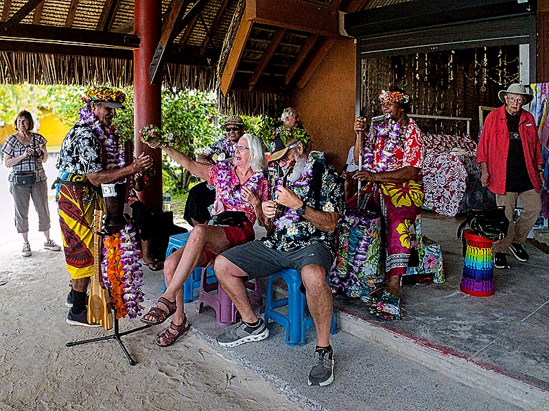
We had previously seen most of the sights on Bora Bora and in Viatape and the primary activities here involve hiking or water activities, which we rarely do at our age and which probably wouldn’t have attracted us on this day anyway because of the weather. But we don’t really like to stay on the ship on port days so we boarded the tender in mid morning for the relatively short trip into Viatape. Boarding the tender was complicated by delays and bouncy waves due to bad weather, but eventually we were able to board and by the time we reached shore the weather had improved (though not by too much). There is a large structure at the dock with open space in front and vendors in back. A musical group was performing in the front area, very informal with Zaandam passengers invited to sit in for pictures. Several dogs were asleep on the sand floor ignoring the activity around them, looking like they hang out here all the time (perhaps hoping for edible handouts). We also walked through the vendors’ displays in the back.


Vaitape is a small town sitting between the water and the foot of Mount Pahia, more than 2,000 feet high. Walking out the back of the building by the wharf gave us an imposing view of the nearby mountain.

We walked up and down the main street in front of us. The town is small but because this is the only real street the traffic is pretty busy. It is lined with commercial stores and art galleries along with a grocery store. We looked for a store we had visited on our first visit that belonged to an uncle of the Polynesian ambassador on the ship (the Amsterdam) that brought us here that time. We found it (we think) under a new name and much reduced in size and variety of goods for sale. But the most interesting buildings in town were churches.
The first was the Eglise Evangelique (Evangelical Church). It is a nice traditional looking church with a steeple/clock tower over the front entrance. This church is well known for being pink but it was repainted a bright yellow during renovations in the summer of 2021, although its red roof remains. It was closed (as it had been on our previous visit) so we could not go inside.
The second church was Paroisse Saint Pierre-Celestin, a small Catholic church down the street in the opposite direction from the pier. This one was open for visitors so we went inside. At the far end behind the altar is a unique stained glass window. Much of the window is clear so if you look closely you can see the mountain through it. The altar below the window is carved from a tree trunk. A large fenced back yard gives a beautiful view of the mountain.


We walked back to the pier to board the tender. By now the crowd had dissipated, although the weather was still pretty unfriendly. You can see below that the ship was not all that far away. We want to end with a picture of Vivace, the name HAL gives its classical strings groups on all of its ships. This talented trio played almost every day (usually 3 or 4 identical sets) in the Explorer’s Lounge and we made it to the pre-dinner set on most days. But on the day after Bora Bora they were featured on the main stage, along with a multitalented guest flutist who was actually the ship’s dance instructor. After this concert there were only two more port stops as this voyage neared its end.


Fakarava
March 29 found us anchored in the lagoon of Fakarava, the second largest atoll in the Tuamotu archipelago which is part of French Polynesia. The Tuamotus include almost 80 islands, most of which are part of the largest chain of coral atolls in the world. An atoll is a ring of coral reefs and small islets around a large central lagoon, formed when a volcanic island is surrounded by coral and then mostly sinks below the water from erosion, leaving only water inside the surrounding reefs. The first person to realize how atolls like Fakarava are formed was Charles Darwin during his voyage on the Beagle, who published this theary in 1842. Fakarava was first visited by Europeans in the 1830’s and Catholic missionaries arrived in 1849. Along with the rest of the archipelago, Fakarava was annexed by France in the 1840’s.
Fakarava’s lagoon is more than 429 square miles while its land area is only 9 square miles . . . very long and skinny. Between 800 and 850 people live on the island, most in its main village of Rotoava. We tendered to the pier there in mid-morning after open tendering (ie. no waiting for tickets) was announced. It was a beautiful sunny day but, as usual in this part of the world, very hot. Not many people were in the pier area when we arrived, but there was an unusual looking red and white bus waiting, perhaps for a tour.


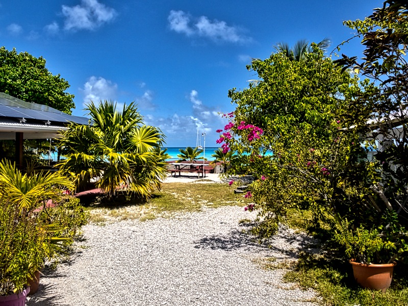
After visiting the gift emporium, which included a table of beautiful shell jewelry, we started walking inland to find the main road running the length of the island. You can see that this is everything you expect in a remote tropical island . . . sun, white sand, coconut palms, blue sea, beautiful flowers and a laid back ambience.


We turned right at the main road and walked among the palm tree lined road parallel to the nearby shore where people (locals and ship passengers) were swimming, sunning and snorkeling. We ran into our table mates Steve and Kelly who had been in the water. Kelly told us someone had spotted a nearby shark and she had insisted that they abandon the spot immediately. We have read, though, that the sharks in this lagoon are mostly not dangerous. Still, we probably wouldn’t have waited around to find out whether this was one of those either.
Eventually we came to a small Catholic church, the Église Saint-Jean-de-la-Croix. First opened in 1850, the year after Honore Laval, the first Catholic missionary, arrived, it was most recently rebuilt in 1950. It was Palm Sunday (as you can tell from the large palm frond decorations) and the church was filled with worshipers, ship passengers as well as locals, so we didn’t have a chance to go inside. But the front door was left open so we were able to take some pictures through the doorway. The church is built with coral and the inside is quite colorful. The lighting fixtures hanging from the ceiling seem to be made of shells possibly with macrame.


We walked back down the road toward the dock area, enjoying the palms, water and beaches. But for the heat this is a really nice place for walking.


Rotoava, the village by the dock, is not only the largest in Fakarava but also the seat of government. We sat for awhile on a bench in the shade in the square near the dock to rest up and decide what to do next. Across the road we had just walked down was a small government complex, including the Maire de Fakarava (town hall). A couple of low walls along the road were topped with balustrades and a few had paintings on the side (as did the wall of a building in front of us).


After sitting for a while we decided to return to the ship. There was really only one thing to see walking the other direction from the dock, an old lighthouse, and we decided it was too hot to be worth doing. So we stopped back at the vendors’ where Mary spent our last Pacific Francs on some earrings she had seen earlier and boarded a tender back to the ship.
This is a small area, however, and the ship was anchored pretty close to the shore. So we were able to take decent pictures from there of the church we had visited and the lighthouse we didn’t walk down to visit. The stone lighthouse shaped like a stepped pyramid, called Phare de Topaka, is about 45 feet tall. While there was a primitive pyramidal structure with a white flag on top to guide vessels to the pass into the lagoon as early as the 19th century, this lighthouse was built in 1957. The lighthouse was shut down when automated technology (like GPS) made it obsolete. It was saved from destruction by a vehement preservation campaign by the local populace.


We sailed away before dinner time for two sea days before the last port on this voyage.
 RSS - Posts