Latest

Tokyo, Japan (Day 1) 2024

     We arrived at the new cruise port in Tokyo around 8:00 AM on February 28 for a two day stay.  You may have read that, although the iconic Mt Fuji is more than 60 miles away, it can be seen from Tokyo.  That’s true, but not most of the time because rain or hazy weather in Tokyo or the clouds often generated by the mountain’s own weather system hide the view more often than not (and some say much more often than not).  But it was a very clear morning as we approached the dock and there was a stunning view of Mt Fuji.  At least there was if you were on the port side of the ship.  Alas, we were on the starboard side and had no idea this was even happening until much later in the morning when the mountain was behind nearby buildings.  But our friend Jean was on the port side and she shared this picture taken from her veranda (I have enlarged the portion of the photo containing the mountain).

Mt Fui morning 2-28 (Jeanne)-gigapixel-standard-scale-6_00x-topaz-enhance-2x

     Tokyo is really big.  Most sources list it as the world’s largest city, with some 40 million people (give or take a couple million) in its metropolitan area, including Yokohama.  Excluding the metropolitan area some 14 million people live within the city limits.  We aren’t really clear about the differences in counting, but we have read that the United Nations uses the bigger number, so that’s good enough for us.

     The city started out as a fishing village called Edo (or Yedo).  If you are familiar with the book or TV series called Shogun, you probably know that while the emperor lived in Kyoto, Edo became the capital of the actual ruling government headed by the military leader called the shogun.  The Tokagawa clan held this position for about 265 years until the 1860”s when the Emperor was restored to actual power in what was called the Meiji Restoration.  The shogun had lived in a highly fortified compound called Edo Castle, which became the Imperial Palace when Emperor Meiji took up residence there.  At about the same time the name of the city was changed from Edo to Tokyo (meaning “eastern capital”).

     Tokyo’s history is characterized by a number of destructive disasters followed by energetic rebuilding and modernization.  It sits on the confluence of three tectonic plates that make earthquakes a common occurrence.  Great fires have consumed large parts of the city several times.  In modern times Tokyo has been decimated by a great earthquake in 1923 that killed more than 100,000 people and again in 1945 by Allied incendiary bombing that by some measures was more destructive in total than the atomic bombing of Hiroshima and Nagasaki.  After 1923 buildings began to be constructed with concrete that is much more resistant to earthquakes and fire than the wood widely used for building before that.  After World War II Tokyo was rebuilt in a more modern way, but the many ancient buildings destroyed in the bombing were meticulously recreated using largely traditional methods but less vulnerable materials, such as copper or titanium for roofs instead of wood.  Probably because almost every building in town was constructed in a hurry after 1945, the main impression we had driving through the city was of block after block of gray boxy buildings.  Not all of them, of course, and we saw a good bit of very distinctive modern architecture and also distinctive reconstructions of important buildings that had been destroyed.  But the gray and boxy ones seemed to predominate in most neighborhoods.

    Never having been here before, we spent our first day in Tokyo on an excursion to see some of the highlights.  Unsurprisingly for a city this large and crowded, the traffic seemed pretty bad to us and it took a long time to reach our first stop, the Imperial Palace.  The palace is a large green area in the center of the city with a number of buildings, including the ceremonial palace and a separate living quarters for the royal family.  This is where Edo Castle once sat and we understand that some ruins from the castle can still be seen on the grounds.  The main buildings of the palace complex were destroyed during the Allied incendiary bombing in 1945 and rebuilt after the war.  

     On the way we drove past the building Douglas MacArthur used as his headquarters as commander of the occupation after the war.  It was built in 1933 and survived the war. We had a fairly long walk through the many carefully landscaped pine trees in Kokyo Gaien National Garden to the viewing area near the palace. We stopped to look at the bronze equestrian statue of Kusunoki Masashige, a 14th century samarai considered the ideal embodiment of loyalty, courage, and devotion to the Emperor.  This statue was erected in 1900.

DSC05539-topaz-enhance-2xDSC05542-topaz-enhance-2x DSC05543-topaz-enhance-2x

DSC05545-topaz-enhance-2x   DSC05547-topaz-sharpen-denoise-enhance-2x

DSC05570_stitch-topaz-enhance-2x

     The outside spaces inside the palace grounds are open to the public for a few hours twice a year, on January 2 and the Emperor’s birthday.  At other times members of the public without a reservation for a private tour (still only outside) can enter some of the peripheral gardens and also the plaza leading to the Main Gate.  The latter spot is where we arrived after our walk.  We walked up along a moat with heavy stone castle walls and where the moat turned left we could see the Nijubashi Bridge and an Edo era building beyond (which survived the war) called the Fashimi-yaguri Watchtower.  There are actually two parallel bridges across the moat, each with unusual lamps on top of its uprights.  The stone bridge in front is called the Meganebashi (Eyeglass) Bridge (because the double arches look like round glasses when reflected in the water) and the metal bridge behind it is called Nijubashi (double) Bridge.  This name comes from the original two level wooden bridge built here during the Edo period  which was replaced by the current steel bridge in 1964.  We were able to walk up a ramp on top of the wall on the right as far as the entrance to the stone bridge.

DSC05550_stitch-topaz-enhance-2x20240227_151158-topaz-enhance-2x_genErase20240227_150758-topaz-faceai-enhance-2x

     We were lucky to be there just at the right time to see the changing of the guard (actually we think our guide carefully timed our arrival).  The Main Gate is located on the left side of the stone bridge and in front of it are two white guard houses with metal roofs.  The guards came out, saluted each other, then went back (we didn’t notice any new guards replacing the old ones, but we could have missed that).

DSC05567-topaz-sharpen-denoise-enhance-2x (1)DSC05558-topaz-enhance-2xDSC05560-topaz-faceai-enhance-2xDSC05562-topaz-faceai-enhance-2xDSC05557-topaz-faceai-enhance-2x

     High above the moat beyond the bridges is the old Fashimi-yagura watchtower, built in the old Japanese style common in castles of the era.  Quite a sight above the stone bridge in front of it.  If you look closely at the second picture below on the right you should see a row of black decorative metalwork running along the top of the stone railing; this was all we could see from our viewing point of the metal bridge behind the stone bridge.

DSC05554-topaz-enhance-2xDSC05555-topaz-enhance-2x

     After the lengthy but pleasant walk back to our bus we drove to the Asakusa district to visit the Senso-ji Temple.  First established in 645, this is the oldest Buddhist temple in Tokyo.  With some 30 million visitors a year it is also, according to some, one of the two most visited religious sites in the world (we would visit the other one this afternoon).  The story of its founding is that two fisherman brothers found a tiny golden statue of the Buddhist deity Kannon in their catch one day.  They presented it to the headman of their village and about 17 years later the temple was opened.

     As with so many important sites in Japan this temple has been destroyed and rebuilt a number of times over the centuries, most recently after it was destroyed by the Allied bombing near the end of World War II.  So the current structures are not all that old (rebuilt from the 1950’s to 1970’s), but they are very impressive and accurately represent what was here before.

     It seems that it is always a fairly long walk from where a bus can find parking to the site you want to visit, and this was no exception.  When we finally reached the temple complex we entered through the Nitenmon gate and proceeded to the main temple building.  This gate was created in 1619 and brought here from another religious site in 1642.

DSC05575-topaz-enhance-2xDSC05577-topaz-enhance-2xDSC05579-topaz-enhance-2x

     We walked through the very crowded interior of the main hall.  Inside were a number of paintings and in the center a shrine-like area behind a metal screen containing many objects that must have important religious significance.  It is said that the original tiny (less than 3” tall) statue of Kannon that led to the founding of the temple is still there, housed in an elaborately decorated three layer box, but no one has seen it since 645 when it was first decided that it was too sacred to be seen.  We did not see this box and are not sure which building it might be in.  We exited the packed hall on the other side, relieved to leave that crowd behind.

DSC05617-topaz-faceai-enhance-2xDSC05580_stitch-topaz-enhance-2xDSC05583-topaz-enhance-2xDSC05585_stitch-topaz-faceai-enhance-2x

     Beyond the main hall on this side was a garden area, with sculptures and a stone bridge over a koi pond.  Very pleasant and picturesque.

DSC05588-topaz-enhance-2xDSC05590-topaz-faceai-enhance-2xDSC05593-topaz-enhance-2x

     We went out through the Hōzōmon Gate to walk down Nakamise Dori, a long crowded pedestrian shopping street lined on both sides with vendors’ kiosks.  It is within the temple complex, inside the largest gate.  Vendors have been selling many different wares here for centuries.  Above some of the shops were branches with pink blossoms (probably too early for cherries in Tokyo).  Among the crowds were a number of women dressed in kimonos.  We wondered who they were, but it turned out they were visitors like us (the ones pictured are from Korea).   There is a popular tradition here of renting (by the hour) period costumes to feel more a participant in the activities.  We saw this at a number of places throughout Japan and China, not just here.

DSC05608_stitch-topaz-faceai-enhance-2xDSC05603-topaz-faceai-enhance-2xDSC05604-topaz-faceai-enhance-2xDSC05606-topaz-faceai-enhance-2xDSC05597-topaz-faceai-enhance-2x

    We walked back toward the temple, reentering through the Hōzōmon (Treasure House) Gate.  First built in 942, the gate was burned down and reconstructed in the 1630’s, then destroyed again by the Allied bombing raids in 1945.  It was rebuilt in 1964, made of steel reinforced concrete.  Because it is made of fire resistant materials many of the temple’s treasures, including old sacred scriptures, are stored in the gate’s upper story. The gate is 74 feet tall and 69 feet wide.  The large red lantern in the middle is more than 12 feet tall and about 6.5 feet wide.  As you approach this gate you can see on the left the 5 story pagoda, at 175 feet the tallest pagoda in Tokyo and one of the tallest in Japan.  Originally built in 942 it was also destroyed in the 1945 air raids and reconstructed in 1973.  It is not open to the public, but is said to contain 1,000 statues and 10,000 Buddhist tablets.  Ashes of the Buddha are said to be on the top floor.

DSC05615-topaz-faceai-enhance-2xDSC05616-topaz-faceai-enhance-2xDSC05611_stitch-topaz-enhance-2xDSC05584-topaz-faceai-enhance-2xDSC05600_stitch-topaz-faceai-enhance-2x

     Tokyo has two broadcasting towers that loom high over the rest of the city.  The orange and white painted Tokyo Tower opened in 1958 and is more than 1000 feet tall.  Its design was inspired by the Eiffel Tower and until 2012 it was the tallest tower in Japan.  In that year the Tokyo Skytree opened, less colorful but much taller at more than 2,000 feet.  Its name was chosen in a nationwide straw poll.  It is the third tallest structure in the world.  Today most TV broadcasting is through the new tower which is tall enough for effective digital broadcasting.  We saw the Tokyo Tower from the bus on our way into town in the morning and the Skytree rose well above the rooftops in Asakusa.

DSC05541-topaz-sharpen-enhance-2xDSC05614-topaz-enhance-2x

     At the time scheduled for departure we went to the area where we entered the temple grounds, as we had been instructed.  As often happens, however, there were a few stragglers who either didn’t get the message or were too busy to show up when everybody else did.  While we waited we took one last picture with Bill & Robert near the main hall.  When our excursion leaders finally rounded up everybody else we walked back to the bus and headed for lunch in a hotel. 

IMG-20240227-WA0001-topaz-faceai-enhance-2xIMG_5438-topaz-faceai-enhance-2x

     The Meiji Restoration in the 1860’s removed the Shogun and returned effective rule to the Emperor.  The Meiji emperor (whose birth name was Matsuhito) ended the Shogunate’s isolationist policies and led Japan through an era of rapid modernization until his death in 1912.  Meiji-jingu, a government sponsored Shinto shrine honoring the Meiji Emperor and Empress Shoken, opened to the public in 1926.  (Note: our guide helpfully explained that in Japan temples are Buddhist and shrines are Shinto.)  It does not contain their graves, which are in Kyoto.  The shrine was destroyed in the 1945 bombings and the current reconstruction opened in 1958.  We have read that this shrine receives 30 million visitors each year.

     We left the bus in a parking lot in the grounds of the shrine.  It was a fairly long walk on gravel paths through a forest of more than 120,000 trees to reach the shrine itself.  On the way we stopped to see a wall of some 200 (empty) barrels of sake donated by all the major breweries in Japan in exchange for prayers for the breweries’ prosperity.  Each barrel had the donating brewery’s name and logo painted on it.  Our guide pointed out one barrel he said was from the oldest brewery in Japan.  There was also a smaller wall of French wine barrels, apparently representing the Emperor’s embrace of the modern world (and perhaps he liked French wine too).  At wide intervals along the path were attractive lights in a traditional Japanese pattern.  Finally there was an attractive low white building whose name and function we do not know.

DSC05626_stitch-topaz-enhance-2xDSC05633-topaz-enhance-2xDSC05635-topaz-enhance-2xDSC05620_stitch-topaz-enhance-2xDSC05646-topaz-enhance-2x

     Torii gates are ubiquitous throughout Japan.  There are some 90,000 Shinto shrines in the country and each one has at least one Torii gate.  They are erected to mark the boundary between the sacred ground of the shrine and the profane ground outside.  They are generally very graceful and simple in design, mostly just two pillars connected by one or two cross beams, sometimes with a small sign in the center between the beams.  The Meiji Shrine has Torii gates in the woods at each entrance and also nearer the shrine itself.  We walked through several large wooden ones to reach the shrine and there was another inside the outer gate of the shrine.

DSC05642-topaz-faceai-enhance-2xIMG-20240228-WA0000-topaz-faceai-enhance-2xIMG-20240228-WA0002-topaz-faceai-enhance-2x

  We entered the outer courtyard of the shrine through a very tall and intricately designed gate.

DSC05651_stitch-topaz-enhance-2xDSC05655_stitch-topaz-enhance-2x     At this point things became a little chaotic.  One of the people on the excursion, a woman named Sue who lived in the cabin next to ours, apparently tripped on the concrete stairs leading up to the gate.  The steps are a little odd, with the bottom step set maybe an inch above the pavement, difficult to see as you walk but a problem if someone inadvertently catches their cane there, as Sue did.  Everything stopped and Keith, who was leading this excursion, and our guide quickly called for help.  A medical team showed up pretty quickly given how far we were from the street, and they took Sue away presumably to an ambulance.  She was back in her cabin on the ship that night but the next day she was evacuated home to the US.  Yikes, things sure can go completely wrong really quickly.  We felt pretty bad for Sue; terrible way to end a grand voyage.

   While we were waiting for the medics I walked through this into the main sanctuary, which included a courtyard with the entrance to the main shrine on the far side.  To its right was a place where you could purchase a prayer paper, sign it, and hang it on a rack set up to receive them.

DSC05660-topaz-faceai-enhance-2xDSC05657_stitch-topaz-enhance-2xDSC05668-topaz-enhance-2x


       I walked up the steps of the inner shrine and, although entrance was not permitted, took a couple of pictures through a window of the courtyard within.  Well it turned out that photography through the window wasn’t allowed either . . . who knew?  To be fair there was a sign nearby that I hadn’t noticed.  An attendant ran up and pointed the sign out, so I stopped and rather sheepishly walked away.  After Sue was taken away we left the compound through the gate where we had entered it and returned to the bus.  In the parking lot we saw what looked like a line of monks or priests all dressed in white heading toward the shrine.

DSC05659-topaz-enhance-2xDSC05661_stitch-topaz-enhance-2xDSC05667-topaz-faceai-enhance-2xDSC05670-topaz-faceai-enhance-2x

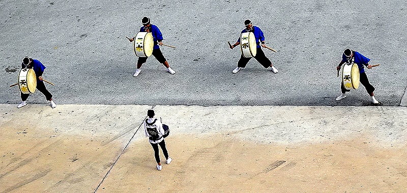
     Back on the ship there were two shows that evening.  First a group of drummers performed on a balcony of the cruise terminal right across from our balcony.  Second a young Japanese dance group performed on the main stage, accompanied by their own drumming.  This was apparently a modern take on traditional dancing and was pretty interesting.

DSC09050-topaz-faceai-enhance-2xDSC09046-topaz-enhance-2xDSC05694-topaz-faceai-enhance-2xDSC05697-topaz-faceai-enhance-2xDSC05688-topaz-faceai-enhance-2x

     Our overnight stay gave a chance for some night time pictures..I went up to the top deck after the show and got a nice picture of the Rainbow Bridge across which we had driven into Tokyo in the morning.  It is called the Rainbow Bridge because sometimes it is lighted in multiple colors, but when we were looking it was all white.  We think the red and yellow tower on the left is the Tokyo Tower.

DSC05684_stitch-topaz-sharpen-enhance-2x

     Earlier I went to the top deck to see if there was a nice sunset.  It didn’t seem all that great at first, until I moved around a bit and spotted Mt Fuji in the distance.  We started this episode with Mt Fuji in the morning so it seems appropriate to end it with Mt Fuji at sunset.

DSC05683-topaz-enhance-2x

Naha, Okinawa, Japan (Day 2) (2024)

     The morning of February 24 found us, of course, still in Naha.  For today we had joined another all day excursion arranged by Tina and (the other) Rick and, like Tina’s other excursions, it turned out to be excellent. 

     The World War II Battle of Okinawa was fought for more than two months, from early April to late June of 1945.  It was the bloodiest battle of the Pacific war, with some 12,500 Americans and more than 100,000 Japanese dead, and estimates of another 40,000 to 150,000 civilian deaths (many of the last two categories by suicide).  The commanding generals on both sides died near the end of the battle, the American general by artillery shells and the Japanese general by suicide. 

     When the battle began the US goal was to seize Okinawa to use as a staging area for the final invasion of the Japanese homeland.  But that invasion never occurred because less than two months after the Battle of Okinawa ended the Japanese surrendered, following the atomic bombing of Hiroshima and Nagasaki.  It is thought that the fierce resistance and high casualty rate in Okinawa played an important role in President Truman’s decision to use the atomic bomb in an effort to make an invasion of the main Japanese islands unnecessary.

     Our first stop today was at one of the battle sites.  The Maeda Escarpment is a 400 foot high cliff.  From the top there is a view over a large expanse of land to the seashore, where the US Marines landed and fought their way across to the cliff.  On April 26 they began to try to take the escarpment, which they called Hacksaw Ridge.  The Japanese were dug in, not only on top of the ridge but also in caves and tunnels further down, but after 10 days of brutal hand to hand fighting the Americans finally captured the top on May 6. From the top we had quite a view over the town of Urasoe to the sea.

DSC05373a_stitchDSC05394_stitch-topaz-enhance-2x

     As we walked up from the parking lot that was (thankfully) not too far from the top, we passed a restored wall from Urasoe castle, a 14th century Ryukyu castle wrecked during the Japanese invasion in 1609 and used by the Japanese soldiers during the World War II battle.  Though completely destroyed during the fighting this wall was restored after the war (as we understand it).  We also passed the entrance to one of the tunnels used by the Japanese in defending the ridge.

DSC05379_stitch-topaz-enhance-2xDSC05388-topaz-enhance-2x

     If Hacksaw Ridge sounds familiar it is probably because of the popular film by that name that was nominated for multiple Oscars (and won two) in 2017.  It focused on the true story of a conscientious objector named Desmond Doss who served as a medic during this battle.  One day the Americans managed to get close to the top of the ridge, suffering heavy casualties on the way, then were driven back down.  Doss stayed behind treating the injured and then, one by one, lowered 75 wounded men down the cliff in a rope sling.  For this heroism he became the first conscientious objector to be awarded the Medal of Honor.  It seems that the engagement at Hacksaw Ridge was not well known before the movie; it was not specifically mentioned in several general histories of the Battle of Okinawa I found online.  Our guide told us that before the movie no one asked him to take them here, but since the movie it is on everyone’s list.

     The top of the ridge is an expansive grassy plateau with protective fences at the cliff edges and several small war memorials, mostly in Japanese only.  We walked around this area for a while, taking in the views and seeing some nice plant life.  On the side opposite the cliff was a forest, turning green in the Spring weather.  Then we walked back down to the parking lot to head for our next destination.

DSC05397_stitch-topaz-enhance-2xDSC05370-topaz-enhance-2xDSC05404-topaz-enhance-2xDSC05401-topaz-enhance-2xDSC05409-topaz-enhance-2xDSC05403-topaz-sharpen-enhance-2x

DSC05405-topaz-enhance-2x

     Hacksaw Ridge was one of several battles fought as the Americans drove south toward Shuri-jo (Shuri castle), an important Japanese stronghold.  Originally built in the 15th century, this palace was the capital of the Ryukyu kingdom for 450 years until the kingdom was annexed by Japan in 1879 and the Ryukyu royalty were sent to live in Tokyo as Japanese nobles.

     In the 1890’s the occupying Japanese military built a series of tunnels and caverns below the castle. During World War II the Japanese army set up a headquarters in this complex under the castle and built extensive lines of communication and defense from there throughout the entire southern portion of Okinawa.  A massive American assault on this key position continued from April until late May, 1945.  An American battleship shelled the castle continuously for three days and by May 27 it was on fire and the Japanese withdrew to the south.  The American capture of the castle on May 29 was important both strategically and symbolically.  Nothing was left of the castle beyond rubble and some foundations of the former buildings. 

     Shuri castle had burned down and been rebuilt several times over its long history and after the war the Japanese set out to do it again.  Shureimon gate was reconstructed in 1958 and the reconstruction of the rest was begun in 1992.  So everything we saw there was built in the last 75 years, but it all reflects care in recreating the original appearance of the castle complex based on old pictures and plans.  We passed through several gates to reach the main buildings.  The first was Shureimon, a free standing gate mostly in Chinese style with three entrances.  Only royalty and high nobles could use the center entrance. 

DSC05415-topaz-enhance-2xDSC05414-topaz-enhance-2xDSC05417-topaz-enhance-2x

     Second was Kankaimon, a single entry gate attached on both sides to the outer walls of the castle.

DSC05423-topaz-enhance-2xDSC05428-topaz-faceai-enhance-2xDSC05429_stitch-topaz-enhance-2xDSC05478-topaz-enhance-2x

     On our way to this gate we passed a small shrine built into the castle wall.

DSC05479_stitch-topaz-enhance-2x

    Zuisenmon gate is situated in the wall at the top of a long stairway.

DSC05432-topaz-faceai-enhance-2x

     Well, I thought I knew which gates I had pictures of, but now it turns out on closer inspection a few are not the ones I had thought.  But the pictures are interesting (at least to me), so here are some other gates whose names I don’t know (as you will see we walked through at least one of them).

DSC05436-topaz-faceai-enhance-2x (1)DSC05440-topaz-enhance-2xDSC05474_stitch-topaz-enhance-2x

     We entered the castle proper through the ticket building, also considered a gate, a large red building that leads to the central square.  Unfortunately, in October, 2019, an electrical fire destroyed all the restored main castle buildings that used to surround this square.  The primary castle building, called the Seiden, is currently undergoing reconstruction inside a huge temporary metal building, so all we saw of it were paintings on the front and back walls of the construction enclosure.  It is said that the design of this building was influenced more by Chinese architecture than Japanese, and it was not hard to see that it doesn’t look much like other Japanese castles we visited later.  Reconstruction of the Seiden is scheduled to be completed in 2026.

DSC05443_stitch-topaz-enhance-2xDSC05470-topaz-enhance-2xDSC05449-topaz-enhance-2x

     We were able to view some of the construction work taking place by climbing up the “observation deck” and looking through windows in the construction building.  This was a Sunday and no work was being done, but we saw what was being worked on, most notably a new roof.

DSC05452_stitch-topaz-enhance-2xDSC05462-topaz-enhance-2xDSC05465-topaz-enhance-2xDSC05466-topaz-enhance-2x

     After climbing several flights of stairs to look through all the windows we were rewarded with several nice views, both inside the castle walls and a long distance outside.  We particularly liked the distant view being watched by a shisa sitting outside the building.

DSC05437_stitch-topaz-enhance-2xDSC05463-topaz-enhance-2xDSC05433-topaz-enhance-2xDSC05473-topaz-enhance-2xOkinawan red tile roof

     After gathering up our group, somewhat dispersed while wandering through the castle grounds, we walked back to the van past some more nice flowers.  On a roof across the street from where we were parked was a small pair of shisa, looking home made and rather crude but colorful.

DSC05472-topaz-enhance-2xDSC05477-topaz-enhance-2xDSC05476-topaz-enhance-2xDSC05481-topaz-enhance-2x

     Not very far from the castle is Shikinaen Royal Garden, a UNESCO World Heritage site (as are the old foundations and surviving walls of the castle).  The garden was first established in 1799 and the palace on the grounds was built in 1800.  Unfortunately the entire garden was destroyed during the Battle of Okinawa in 1945.  Restoring a huge garden with woodlands takes many years as new plants and trees mature and the 20 years it took to restore this one began in 1975, shortly after Okinawa was given back to Japan by the United States.  It is a beautiful spot and we enjoyed walking the rustic but sometimes steep paths through the forest.

DSC05483-topaz-faceai-enhance-2xDSC05493-topaz-enhance-2x

     The centerpiece is the one story Udun palace sitting near the edge of a small lake, a second home for the Ryukyu royal family.  It has a very open floor plan and a peaceful, relaxing view of the lake, which has a small hexagonal pavilion on an island in the water called Rokkako-do.

DSC05492-topaz-enhance-2xDSC05486-topaz-enhance-2xDSC05489-topaz-enhance-2xDSC05487_stitch-topaz-enhance-2x

     To reach the Udun we walked over two stone bridges built in semi-circular arches to allow small boats to pass underneath.  Called Ishibashi, their design is Chinese and they are built of coral limestone.  One has a formal design and the other is considered rustic, with rocks brought from the seashore.

DSC05484-topaz-enhance-2xDSC05491-topaz-faceai-enhance-2x_genErase

     When we left the garden it was time for lunch.  Of course, it was lunchtime for many other people as well and we visited several restaurants in the area before our guide found one that could accommodate our party.  But the restaurant was nice and the lunch was good.  We had Soba noodles, served in broth with pork.  Our guide was at our table eating the same thing and he picked the bowl up near his mouth and started slurping loudly.  We must have looked a little taken aback because he smiled at us and said “In Japan it is OK to make noise when eating.”  So we did.

DSC05494_stitch-topaz-faceai-enhance-2x

     After lunch we went to Okinawa World, a sort of theme park with a number of attractions and plenty of food and souvenirs to buy.  We were welcomed by shisa, of course.  One pair was made of flowers and there was an installation of not one, not two, but five shisa inside the entrance.

DSC05498-topaz-enhance-2xDSC05496-topaz-enhance-2x

     What we were there to see was Gyokusendo Cave, at six kilometers in length the largest in Okinawa.  Less than one kilometer is open to the public.  The cave has more than a million stalactites and stalagmites that have formed over about 300,000 years.  It is pretty well lighted inside, with colored lights giving an eerie glow in some areas.  This cave is bigger and apparently more famous than the one we visited in Ishigaki two days before, but really this was mostly more of the same kind of ambience.  It felt like a pretty long walk on the uneven pathway so we were glad at the end to find an escalator to take us back to the top. 

DSC05499-topaz-enhance-2xDSC05503-topaz-enhance-2xDSC05500-topaz-enhance-2xDSC05501_stitch-topaz-enhance-2x

     After leaving the cave we had a fairly long walk to reach a performance stage where we watched some traditional dancing accompanied by a drum group.  It was an upbeat and interesting show but photos were not allowed.  We then returned to the van, passing the shisa group near the entrance once again.

DSC05504-topaz-enhance-2x

     In 1944 the Japanese built a large underground complex in southern Okinawa to house their naval headquarters in Okinawa.  It was dug by hand, using picks and shovels, and reinforced with wooden supports and concrete.  The complex was about 450 meters in length but only about two thirds of that can be visited by the public today.  This is where the Japanese naval leaders spent the last weeks of the battle, along with probably a couple of thousand sailors.  They all committed suicide on June 13 as the US Marines were closing in for a final onslaught.  Apparently the Marines reported finding 175 bodies at the time, but they sealed the entrances rather than exploring the tunnels and when it was unsealed in the 1950’s the remains of some 2,000 sailors were found (presumably many were not intact corpses because grenades were used in the suicides).

     The tunnels are lengthy and small in size, and with the yellow lighting they seem a bit claustrophobic.

DSC05508-topaz-enhance-2xDSC05511-topaz-enhance-2xDSC05505-topaz-enhance-2x

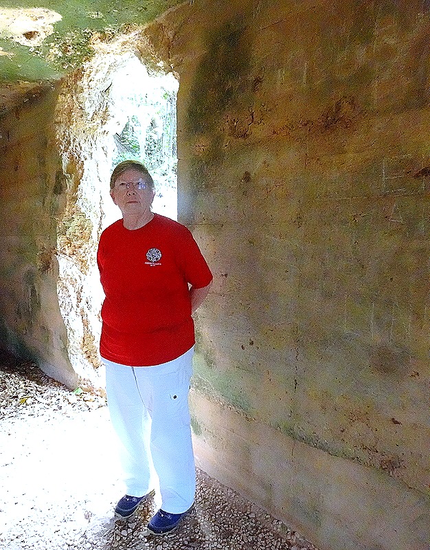
     We saw several rooms dug out of the walls lining the tunnels.  The nicest was the Commanding Officer’s room, with a dining table set with flowers.  There was a large room that, if we remember correctly, housed quite a few sailors, and the signals room with period radios on display (not sure whether they were actually found here).  Then there was the staff room, where the walls still bear the marks of shrapnel from grenades used for mass suicide.

DSC05506-topaz-enhance-2xDSC05509-topaz-enhance-2xDSC05512-topaz-enhance-2xDSC05516_stitch-topaz-enhance-2x

     Finally we visited a long hallway leading to what once was an exit from the complex.  Our guide told us that every night during the last few weeks a small group of sailors, some armed only with knives or sticks, would be sent out through this exit during the night to conduct harassment operations against the US forces.  He said none of them ever returned, but new groups continued to be sent out every night regardless.

DSC05513-topaz-enhance-2x

     Altogether, this was a very interesting, but grim, conclusion for our excursion.  We returned to the ship and sailed away at night for the main Japanese home islands.

     Finally, after a day full of war and death we will leave you with something brighter to look at.  Before reaching Okinawa there was a show on the Main Stage featuring a balloon bender.  I’m sure we have all seen these guys before, twisting together a few long balloons into various animal shapes.  It didn’t sound like much of a show so we didn’t attend.  This was a mistake. Over the next couple of days we saw several of his creations displayed around the ship and, really, we had never seen anything like it.  Large, complex, colorful and whimsical; very much worth seeing.  Here are two of them on display by the front desk.

DSC05313-topaz-enhance-2x

Naha, Okinawa, Japan (Day 1) 2024

     We arrived at the port of Naha early on the morning of Saturday, February 24, for a two day visit.  Naha is the capital of Okinawa Prefect (which includes Ishigaki), located about a thousand miles southwest of Tokyo at a large distance from the main Japanese islands.  The island of Okinawa was unified in the 15th century, forming the Ryukyu kingdom.  For most of its 300 year existence the kingdom was a tributary of China and Naha was a hub for trade throughout eastern Asia.  The Meiji emperor incorporated it into Japan as the Okinawa Prefecture in 1879.  In World War II it was the site of the only battle on Japanese soil, which lasted several months and cost the island more than a quarter of its population (including many by suicide).  The Americans occupied Okinawa for about 25 years after the war, but in 1972 it was repatriated to Japan and has been a Japanese prefecture ever since, although the Americans still maintain a very large and controversial military presence here.

     We had a private excursion scheduled for our second day in Naha so we decided to spend our first day visiting the main shopping area of the town, which was within reasonable walking distance from the port.  As we left the port we passed what looked at first like a tree, but closer inspection revealed that it was actually a bush growing out of an inscribed rock.

DSC05315-topaz-enhance-2x (1)DSC05316-topaz-enhance-2x (1)

     Turning up another street heading away from the water we came to two dragon pillars, erected in 2015 to commemorate the 30th anniversary of Naha’s friendship agreement with Fuzhou City, China, which was celebrated in 2011.  Each dragon is 15 meters high and 3 meters wide.  They were modeled on dragon sculptures that were in the main hall of Shuri-jo Castle, the home of the Ryuku monarchy, which were lost in a 2019 fire that destroyed the castle.

DSC05317-topaz-enhance-2x (1)DSC05318-topaz-enhance-2x (1)

     Further up the street we happened upon a low building housing public restroom facilities.  After availing ourselves of the facilities we continued on toward our goal, the main shopping street.  We passed what we learned later was Matsuyama Park, much larger than what we could see from the sidewalk.  It had nice flowers and a monument shaped like a boat dedicated to Kume Village, a settlement established here more than 600 years ago by a group of 36 families who travelled by sea from Fujian, China, and greatly influenced the political, cultural and economic development of Okinawa.

DSC05323-topaz-enhance-2xDSC05325-topaz-sharpen-enhance-2x (1)DSC05324-topaz-enhance-2x (1)DSC05327-topaz-enhance-2x (1)

     We crossed a river lined with pillars holding up the monorail track and reached our goal, called Kokusai-dori (International Street).  As we turned left onto this street we were met by a sculpture of a shisa (lion/dog).

DSC05329a_stitch-topaz-enhance-2x-2 (1)DSC05326-topaz-enhance-2x (1)

     It was just about then that Mary noticed her bag wasn’t hanging over her shoulder.  Time to panic!  We looked all over the area to no avail and were about to give it up as lost or stolen when she suddenly remembered that she had hung it on the back of the stall door at the restroom facility and did not recall taking it back down.  So with little hope of actually finding it still there, back we went (at a much faster speed than our original leisurely stroll).  To our surprise, after what must have been 40 minutes or more, Mary found her bag exactly where she had left it, hanging on the restroom door!  There are probably few places where we would have found it again after leaving it alone for so long, although we once had a similar experience in Singapore.  What a relief.

     We walked down Kokusai street, enjoying the very Japanese looking signs for stores and restaurants, looking in windows and nosing around in some of the many open front stores selling everything from cheap little plastic shisa to hats and tee shirts to much more expensive ceramic works of art.  In front of one store was a huge pair of red and yellow colored shisa, which could not fail to attract the attention of passers by.  By reputation this street is often quite busy with traffic but on the Saturday we visited it wasn’t very crowded.  We understand that on Sunday this street is pedestrians only.

DSC05331_stitch-topaz-enhance-2x-2 (1)DSC05334-topaz-enhance-2x-2DSC05333-topaz-enhance-2x-2DSC05365_stitch-topaz-faceai-enhance-2xDSC05368-topaz-enhance-2xDSC05367-topaz-enhance-2x

DSC05335-topaz-faceai-enhance-2x

     Several blocks along we turned off Kokusai and walked through the covered open-air market.  There were two long glass topped buildings containing stalls selling everything from fresh fish to clothing and a variety of other things in between.  Stores along the sides also had entrances opening into the market.  Bustling and very eclectic.

DSC05336-topaz-faceai-enhance-2xDSC05337-topaz-faceai-enhance-2x

    It took a while to find in the maze of often unmarked streets behind the markets, but we finally came to the Tsuboya Pottery Museum.  It sits in the Tsuboya neighborhood, which has been the center of Okinawa pottery making for centuries and still has a good number of pottery shops and workshops.  The museum is quite interesting (although most of the signage is only in Japanese), with exhibits old and recent plus an interesting video showing how the distinctive Okinawan red tile roofs are made.  A number of ceramic sculptures were on display, including several shisa. 

     As we mentioned in the Ishigaki episode, shisa are a combination lion and dog and they generally come in pairs.  The female that is usually on the right has a closed mouth to retain good spirits, while the male that usually sits on her left has an open mouth to scare away evil spirits.  They are thought to have been first brought here from China in the 14th century as gifts for Ryukyu royalty and today you can see them everywhere, placed on roofs and in front of houses and other buildings to protect the premises.  Many of the shisa in the museum are single sculptures, perhaps because their pairs have been lost.  The shops on Kokusai street are full of colorful shisa, mostly small and looking mass produced for the tourist trade, although some are much nicer than that.  We really liked the more artistic shisa, which are all similar in design but each one distinct, and you will see a lot of them here (and tomorrow) since they are such an important part of this island.

DSC05343-topaz-enhance-2xDSC05344-topaz-enhance-2xDSC05345-topaz-enhance-2x (1)DSC05351-topaz-enhance-2x (1)DSC05346-topaz-enhance-2x (1)DSC05348_stitch-topaz-enhance-2x (1)DSC05350-topaz-enhance-2xDSC05347-topaz-enhance-2xDSC05352-topaz-enhance-2xDSC05354-topaz-faceai-enhance-2xDSC05353-topaz-faceai-enhance-2xDSC05355-topaz-faceai-enhance-2x

     After exploring some of the very interesting shops near the museum we headed back to Kokusai Street and the ship.  Along the way, we noticed some colorful flora, one of which was a young tree covered with pink buds.  Our first reaction was that this must be one of Japan’s famous cherry trees, but we found out later that cherry season had ended in Okinawa about 10 days earlier.  So more likely these were plum or peach buds (or maybe we were just lucky).  We also encountered more shisa, large and small, on the street level and also on roofs.  The facade of one building closer to the port sported an interesting relief.

DSC05340-topaz-faceai-enhance-2xDSC05357-topaz-enhance-2x (1)DSC05341_stitch-topaz-enhance-2xDSC05361-topaz-enhance-2xDSC05359-topaz-enhance-2xDSC05358-topaz-enhance-2xDSC05364-topaz-enhance-2xDSC05369-topaz-enhance-2xDSC05321-topaz-enhance-2x (1)        So that is the end of our first day in Naha.  But we stayed there overnight, so there is much more to come tomorrow.  This was the night view from our balcony. 

DSC09033_stitch-topaz-enhance-1.4x (1)

Ishigaki, Japan (2024)

     Ishigaki is situated at the far southwest of Japan, far away from the main home islands. It is one of the largest of the Yaeyama islands and is known for being a great place for a beach vacation and we agree that it is a green and lovely island.  In a country having multiple cities with tens of millions in population, Ishigaki’s population of about 48,000 wouldn’t fill up an average neighborhood in a city like Tokyo.  We spent the day here on February 23.  While the entire island is classified as a single city of Ishigaki within Okinawa Prefect (like a state or province), the most populated area near the port is a fairly drab and boxy looking city, with some brightly colored (but still boxy) buildings.

DSC09015_stitchDSC09015b_stitch

     This was the first time we had set foot in Japan and, since there wasn’t much to see near the port, we booked an excursion that would take us around the island.  As we exited the ship there were local dancers in traditional Okinawa dress performing in front of a sign saying “Welcome to Ishigaki.”

DSC05145

     Our first stop on the excursion was Yaeyama Village, a collection of old traditional houses moved here from around the island.  We are told that sometimes there is traditional dancing and other activities but we didn’t see any of that (there is also a restaurant and, of course, a souvenir shop).  We have seen similar collections of traditional buildings in Indonesia and Tanzania, and they are interesting but not too exciting.  We think we have these pictures all correctly labeled, but are not certain.

     The Makishi residence was originally built in 1923 and represents traditional red tile Yaeyama architecture.  It was constructed using a method of interlocking wood that involved no nails.  The Morita residence is a typical house of the Yaeyama samurai class.  It was built in 1909.

DSC05151DSC05153

     The Kishaba residence was originally built in 1923.  This house is said to have an atypical floor plan.  The Ohama residence was built in 1907 and (if we remember correctly) had a Shisa sculpture outside the entrance.  Unfortunately our only picture here was of a beautiful wall built mostly of curved red roof tiles.

DSC05159_stitchDSC05156DSC05169_stitchDSC05167_stitch

     We also saw a typical fisherman’s house, with a stuffed turtle inside.  Probably built originally before 1900.  Nearby was a Sabani, or traditional fishing boat.  They could reputedly reach 10 knots in speed; some were made of a hollowed out log while this one is made of boards.  Some are still in use today, fitted with small motors.

DSC05193DSC05194DSC05191

     The grounds around the houses were lush with plants, from flowers to palm trees.

DSC05148DSC05163DSC05164_stitchDSC05185DSC05186DSC05195DSC05197DSC05196DSC05207DSC05214

     The village has an enclosed area where about 60 spider monkeys live.  They were brought here from their native Bolivia where the climate is similar.  They have opposable thumbs on their feet, are yellow with dark gray faces and can be very aggressive, climbing up people’s legs to reach into their pockets.  There is a sign disclaiming liability for anything taken by the monkeys.  To see them you have to enter through a double enclosure.  This was undoubtedly the highlight of the visit to the village.

DSC05180DSC05176DSC05175DSC05183DSC05177DSC05179DSC05180a

     There is a viewing tower at one edge of the village called Amparu Lookout, which enables you to see as far as Nagura bay, in which are Taketomi Island and Kohama Island.

DSC05198DSC05202_stitch

     As we left the compound there were two more things of note.  First, there were two more Shisa outside the main entrance.  Second there was a young tree covered in pink blossoms, which our guide said were cherry blossoms.  Possibly, but we looked it up later and the cherry blossom season in Ishigaki ended about 10 days before we arrived.  It turns out that without some knowledge and a close inspection of a blossom it is very hard to tell a cherry blossom from a plum blossom from a peach blossom.  So, since the cherry season had ended, these could be plum or peach blossoms.  But we prefer to think of them as late cherries, just as the guide said they were.

DSC05209DSC05218DSC05212

     Our next stop was Kabira Bay.  This is a very beautiful, much heralded place to visit.

DSC05265_stitch

     Kabira has a perfect beach, with powdery white sand and extremely clear water gently lapping ashore.  But swimming is forbidden here because black pearls are cultivated in the water.  You can see the floats at the tops of the ropes on which the oysters live.

DSC05263DSC05269_stitch

     We had a ride in one of the glass bottom boats stationed here.  It moved steadily over a relatively shallow area that was not far down from the glass bottom so we could see coral, giant clams, some fish and a couple of water snakes.  Interesting but difficult to capture in a photo, particularly with lights reflecting from the glass.  The glass window was in the center of the floor of the boat and we all sat around the periphery looking down.

DSC05219a_stitchDSC05222DSC05223DSC05229DSC05230DSC05231DSC05233DSC05241DSC05236DSC05238DSC05244DSC05258DSC05251DSC05252DSC05235DSC05253DSC05254DSC05255DSC05257DSC05240

     Not far from the beach is a tiny temple to the Buddhist deity Kannon.  When it was built in the 17th century Kabira Bay was one of the main ports in Okinawa.  The legend says that a small boy was ashore when his ship left without him.  He prayed for it to return and a north wind developed that forced the ship back to the bay, where he was able to reboard.  He grew up to be a monk, returned here and built the Kabira Kannon Temple.  The grounds also contained a lot of flowers and other flora.

DSC05277DSC05276DSC05279DSC05280DSC05262DSC05272_stitch

     Our last visit was to the Ishigaki Stalactite Cave,  To visit you walk down a long staircase and follow a path about 600 yards long through the cave (which is actually about 2 miles long in its entirety).  The cave is dramatically lighted and makes for an interesting walk.  This was once the sea floor and there are fossils from that time in the cave.  The cave has developed over some 200,000 years, with the stalactites growing about a millimeter every three years.

DSC05282DSC05283DSC05286DSC05295DSC05287DSC05285DSC05288_stitchDSC05290DSC05292DSC05293DSC05296DSC05297

     We drove back to the ship, passing a variety of local buildings and even some unusual flowers.  Again, the buildings are mostly kind of drab and boxy, but there was some occasional color.

DSC05299DSC05309DSC05307DSC05308DSC05306

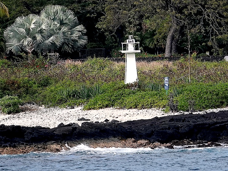
     We set sail from Ishigaki around 5:00 PM, passing some white lighthouses on the way out.  To be honest, this was a relatively minor stop, but still interesting.  And we still had most of Japan yet to go!

DSC09024DSC09023DSC09022DSC09024_stitch

Saipan, Northern Marianas (USA) (2024)

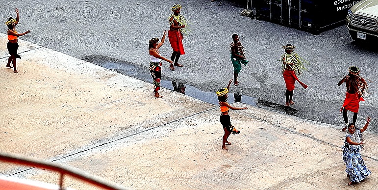
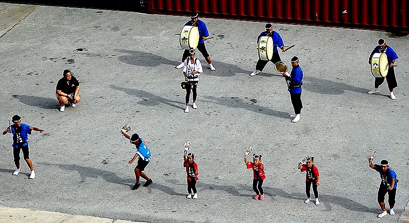
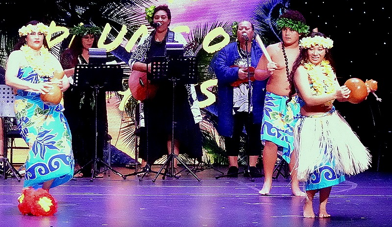
     We reached Saipan, another important World War II battleground, on the morning of February 19.  A welcoming dance troop was performing on the dock below our veranda.

DSC09000DSC09001DSC08998DSC09007

     With a population of just over 43,000, Saipan is the largest island of the Northern Marianas, a commonwealth associated with the United States.  Its inhabitants are US citizens.  This island is smaller than Guam, both in population and in area.

     Japan obtained control of Saipan as part of the treaty ending World War I.  By the time World War II began most of the inhabitants were Japanese settlers.  The Japanese fortified the island and stationed some 30,000 troops here.  During the war Japan considered the neighboring islands of Saipan, Guam and Tinian to be essential components of its inner defense perimeter.

     During the 1940’s the Americans developed the B-29 bomber, a plane that could fly much further, faster and higher than the bombers then in use in Europe.  This made the three islands into important targets for the military because building B-29 airfields there would put the Japanese home islands within reach for bombing missions.   A week after the D-Day landings in France the Americans began their campaign to capture these three islands. 

     Within a few weeks in July and August, 1944, the Americans were in control of these islands and engaged in building airfields with runways long enough to accommodate the B-29’s.  Losses were heavy during the battle, with most of the Japanese troops and many Japanese civilians dead and the rest in prison camps and thousands of Americans lost as well.  Several hundred B-29’s conducted continuous raids on Japan after that, including conventional and incendiary bombing as well as ultimately the nuclear attacks on Hiroshima and Nagasaki.  One of those B-29’s was piloted by Rick’s uncle, Morton Bader, although we do not know which of these islands he was stationed on.  We have read that some in the Japanese military hierarchy concluded at the time that the loss of Saipan was the death knell for Japan’s war effort. This campaign has sometimes been called the D-Day of the Pacific.

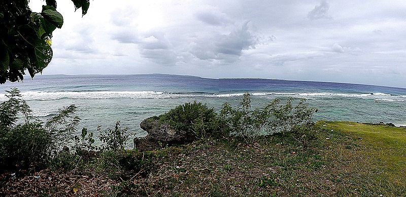
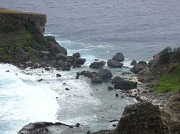
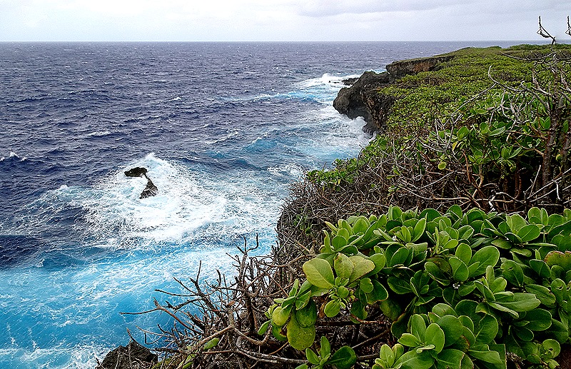
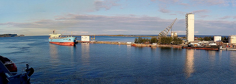
     The Zuiderdam Captain told us that we were lucky not to have missed this port.  Apparently the dock in Saipan is notoriously difficult to navigate to, especially when wind and waves are up as they were when we arrived.  He said on any previous trip he would have bypassed this port in these conditions, but they tried a new technique involving sophisticated computer simulations that convinced him he could make it in safely.  We did, and we are glad we did.  Here are some pictures of some of the rugged coast we passed on the way in (although the pictures were actually taken in the evening on the way out).

DSC08991DSC08992DSC08991_stitch

     We joined a private excursion here organized by our friend Tina and we were very glad we did.  It was led by Walt Goodridge, a knowledgeable and engaging tour guide who was born in Jamaica.  As you will see below, Walt provided a really excellent excursion with knowledgeable commentary.  If you are going to visit Saipan, you really can’t do any better than Walt (just google him).  We were supposed to meet him at the port gate but he was nowhere to be found when we arrived there.  He drove up 20 or 30 minutes later and explained that the company with whom he had reserved a van months before had none available when he arrived this morning so he had to scramble to obtain another one.  We were impressed (and relieved) that he accomplished that in so short a time. 

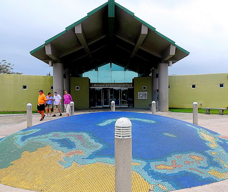
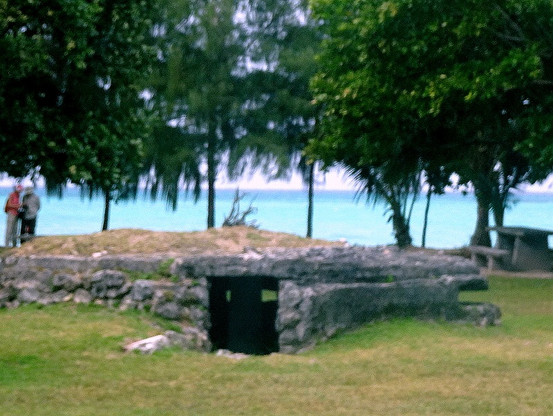
     We drove to our first stop, the American Memorial Park in Garapan, the largest town in Saipan.  The park has a memorial with flags flying which is dedicated to the more than 4,000 Americans and islanders who died during the invasion in 1944.  There are also a museum telling the story of Saipan’s war experience, an old Japanese concrete bunker and extensive athletic facilities.

DSC04974DSC04975Mort (uniform) Bader (2)

     Across the street from the park is the hulk of a large and gaudy casino and hotel that was being built by the Chinese.  Construction was halted when the pandemic began and the owners have found themselves in worse and worse financial and legal trouble since then, beginning when one of their workers fell off a scaffolding and several more were found to be illegal workers under US law.  At this point it appears that the casino project is dead, but it is unclear what will happen to the uncompleted buildings.

DSC04972_stitchDSC04978DSC04981

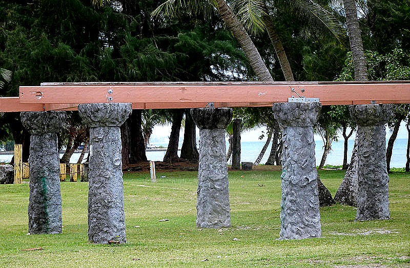
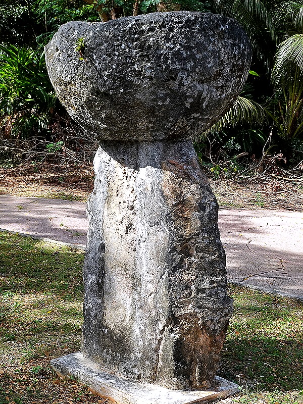
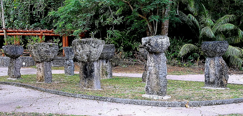
     We drove on to an area called Red Beach, one of the first landing sites for the American invaders.  In two days of fighting on these beaches the US Marines had some 3500 casualties.  During the night of June 16 the Japanese attacked with 44 tanks and 1,000 infantry and lost 31 of the tanks in what is considered the first large tank battle in the Pacific.  There was a shelter in the park supported with concrete pillars designed to look like Latte Stones, which had been used centuries ago in Saipan as well as in Guam.  Off shore we could see a couple of American patrol ships.  Walt said they patrol these waters 24 hours a day and that they have been told if you ever look out there and don’t see them, head for the hills.

DSC04991_stitchDSC04994_stitchDSC04982_stitchDSC04985_stitchDSC05012

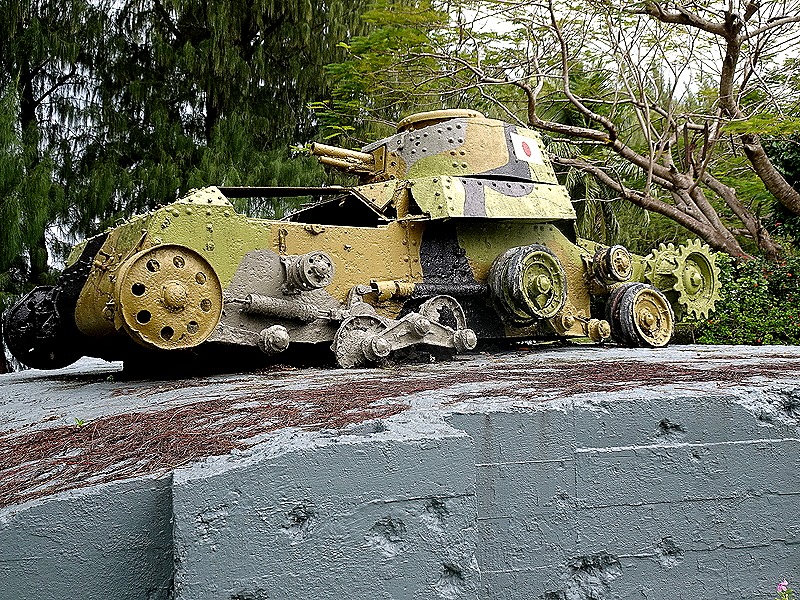
     Nearby is a sort of memorial, comprised of an old Japanese pillbox, complete with bullet holes, that housed machine gunners defending the beach.  On top is a small Japanese tank, very much the worse for wear.  And off shore in this area we could see the tops of two amphibious Sherman tanks that never made it to shore during the invasion.  Some scuba divers were using one of them as a tether for their boat.

DSC04996DSC04997DSC04998_stitchDSC05015_stitchDSC05019DSC05006

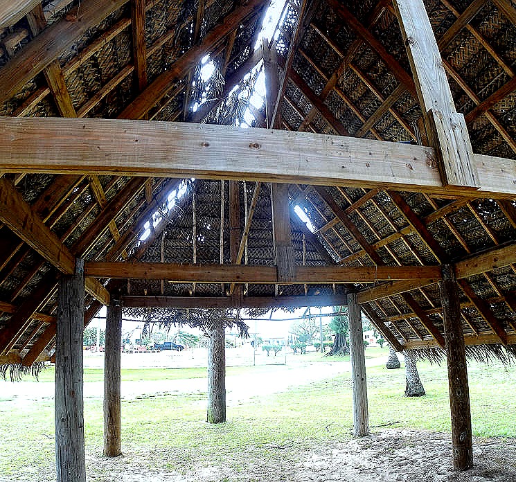
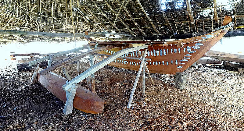
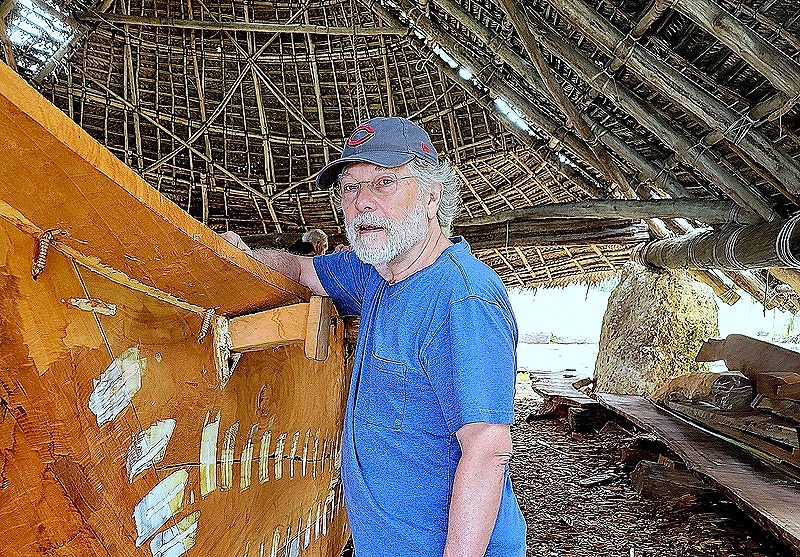
     We walked up the beach a little way, passing some traditional open, thatched roof buildings.  In one of them was a large outrigger canoe under construction.  This was part of a project to create traditional craft and revive the art of Pacific celestial navigation that for hundreds of years had enabled Polynesians and Micronesians to travel between distant islands.  The building is called a boat house & itself took months to build using traditional techniques.  One of Walt’s assistants, who had been a participant in the project, spoke to us about the canoe under construction and the project.

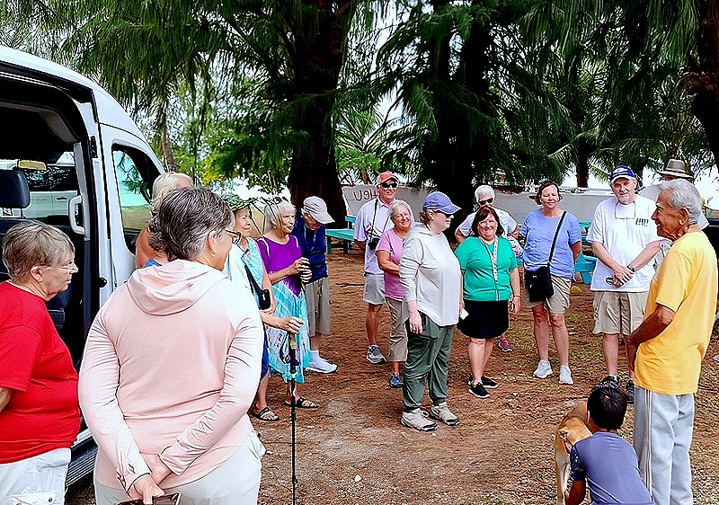
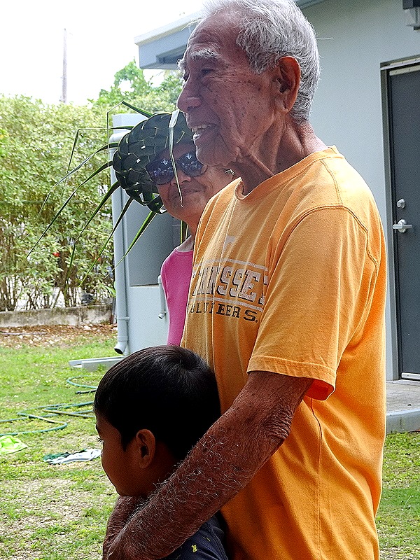
     Afterwards we drove to the home of Lino Olopai, a Carolinian elder who was an accomplished traditional navigator.  He used the stars, wave movements and sea animal and bird movements to sail canoes between Saipan and Guam and beyond.  The Carolinians are a separate ethnic group that came here from the Caroline Islands during the 200+ years of Spanish control.  The Spanish had moved to Guam the small number of Chamorros who survived the conflict and diseases brought to Saipan by Spanish settlers.   While the Chamorros were kept in Guam the Carolinians arrived and settled on Saipan.  There has been some level of hostility between these groups ever since.  Lino’s niece (we think) was one of Walt’s assistants and he spoke to us about his navigation experiences and techniques.  Very articulate and interesting.

DSC05007DSC04989DSC05010_stitchDSC05013_stitch65d44336aa038-gigapixel-very_compressed-scale-6_00x20240218_14421065d44352f2f69-gigapixel-very_compressed-scale-6_00xDSC05021

    Enola Gay, the B-29 that carried the first atomic bomb to Hiroshima, left from the neighboring island of Tinian less than five miles from Saipan.   We drove to a beach behind what looked like a hotel or club that we think was called Yellow Beach in 1944.  Yellow Beach was another of the first places the Americans landed on June 15, 1944, but we were here mainly to get a look at Tinian, visible across the Saipan Channel.  Tinian is mostly flat and almost the entire island was converted into the largest air field of World War II.

DSC05022_stitchDSC05025_stitch (1)-gigapixel-very_compressed-scale-4_00xDSC05029a_stitch (1)

     We stopped for a lunch/snack at Herman’s Modern Bakery, a local favorite and historical site in itself.  It seems that in late 1944 the US Navy recruited a baker named Herman Guerrero to begin baking bread for the populace with financial and supply support from the US.  He gave bread to many people in the area and later converted to a business subsidized by the US, selling bread for 5 cents a loaf.  The business thrived and this fall will celebrate its 80th anniversary.  Herman Guerrero, Jr. spoke with us and relayed the bakery’s long history.  Oh yes, the food was very good and quick so the excursion could continue promptly.

DSC0504565d44319c2f67DSC05046

     After lunch we visited two small but striking islands just off the coast of Saipan.  Forbidden Island is long and flat, looking like a butte that rose out of the water.  At low tide it is connected to the main island by a sandy and rocky (and treacherous) land bridge which is under the water when the tide is in.  As you can see in the pictures the tide was mostly out when we visited.  We only viewed the island from a lookout point on a cliff above but Walt told us that it has watery caves and that a number of people have been drowned or swept out to sea from there.  He says legend has it that those who do not respectfully ask permission from the resident spirits before crossing may be in trouble.  He told us that he has brought visitors down to the shore but has never crossed to Forbidden Island with them.

DSC05049_stitchDSC05047_stitchDSC05051

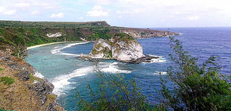
     Second was Bird Island, a large roundish rock within swimming distance from the shore of Saipan.  It is said that hundreds of birds of various species live there, but we really didn’t see them.  Their nests may be in shady indentations in the rock or maybe we were just too far away to make them out. 

DSC05086a_stitchDSC05091

     Once the Americans achieved a foothold on Saipan the defending Japanese really had no chance.  The Americans’ control of the sea and the air enabled them to reinforce and resupply their troops as needed, while it prevented the Japanese from doing the same.  So they had to make do with the 30,000 troops and the weapons and ammunition that were already there.  The Japanese steadily lost ground and their ammunition became depleted, so that they were reduced to fighting mostly with bayonets and sticks.  They retreated further and further into the mountains in the north of the island, along with many thousands of Japanese civilians living on Saipan who had been convinced by propaganda to fear the Americans.  Many took refuge in caves, which the Marines cleared with grenades and flamethrowers.  Because it was impossible to tell from the outside what was inside a cave, many civilians as well as soldiers died in this way (although American soldiers managed to coax a significant number of civilians to surrender). 

     In the end the Japanese were backed into the northern mountains and had nowhere to go.  They had been convinced that it was better to be killed than surrender, and in the end fewer than 1,000 Japanese were captured alive.  In the last day or two hundreds of Japanese soldiers hurled themselves to their deaths from two cliffs at the northern point of the island.  Several hundred civilians who had been convinced by the military that the Americans were beasts who would abuse and torture them followed suit.  We saw horrible film in the museum of Japanese women throwing their infants off of cliffs then following them down.  It is unclear how many civilians died this way of their own accord and how many were forced to do so by soldiers, but hundreds  of bodies were recovered.  (We should add that thousands of Japanese civilians were also captured alive and were repatriated to Japan several years later).

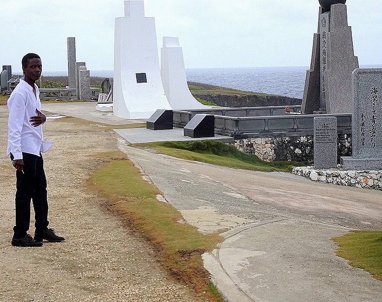
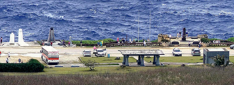
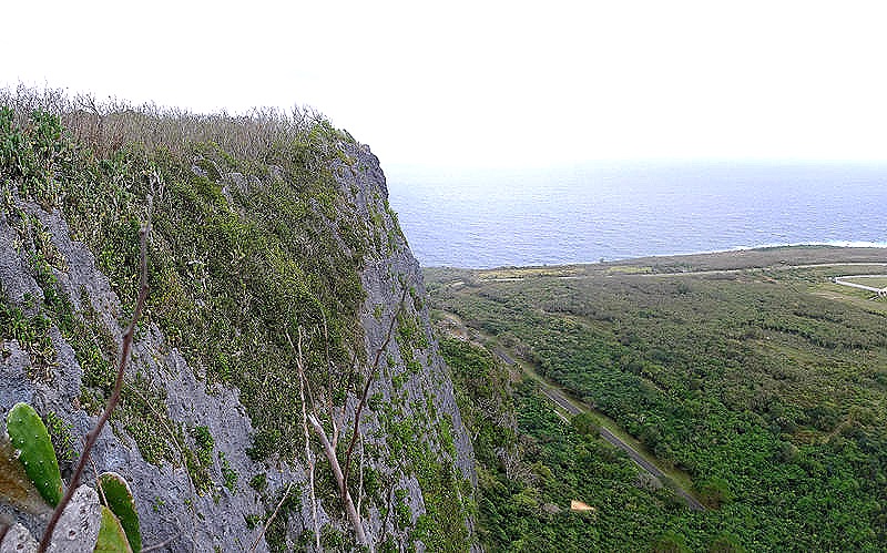
     We visited two infamous spots where this occurred, which the Americans called Suicide Cliff and Banzai Cliff.  They are within eyesight of each other,  Suicide Cliff is a tall mountain cliff that overlooks Banzai Cliff, a sea cliff below it.  Today Banzai cliff is lined with monuments to those who died here, most we understand erected by Japanese people.  But for its history (a big but), it would be a beautiful spot.

DSC05058_stitchDSC05060_stitchDSC05063DSC05064DSC05069a_stitch

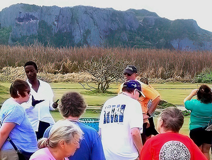
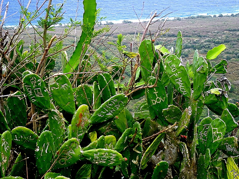
     As you can see from the last picture above, Suicide Cliff is very high above Banzai Cliff.  From there you can look down not only on Banzai Cliff, but also on the little that remains of a Japanese air field called Marpi Point Field.  Actually, the air field was uncompleted when the battle of Saipan ended and the Americans completed building it and used the airfield for some time.  Walt gave us a talk about Suicide Cliff when we arrived below at Banzai Cliff.  The edge of the mountain cliff has cactus that has been carved with graffiti; it was a disquieting view over the edge to the land far below.

DSC05056_stitch65d441a4eb131.image-gigapixel-very_compressed-scale-6_00xDSC05068DSC05065_stitchDSC05069DSC05082DSC05079_stitch

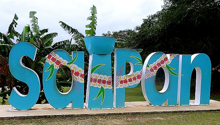
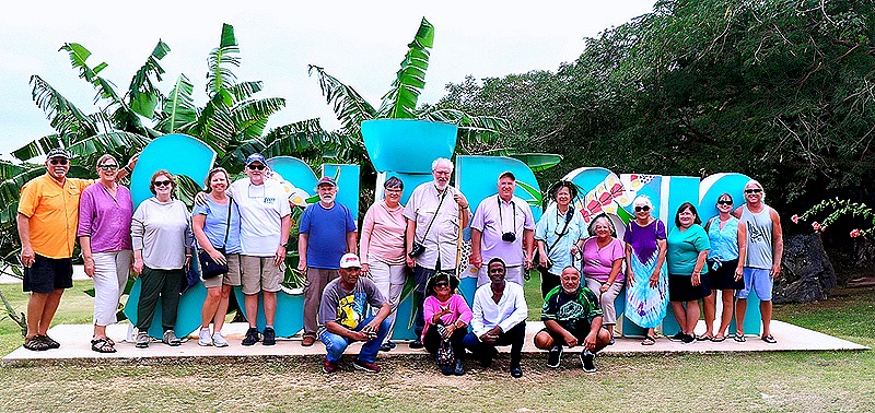
     On our way down the mountain we came upon a big “Saipan” sign.  Signs like this seem to be becoming more and more popular in cities with big tourist industries.  Most of us (not Mary) got out and posed for a picture in front of the sign, which later appeared in the local newspaper.

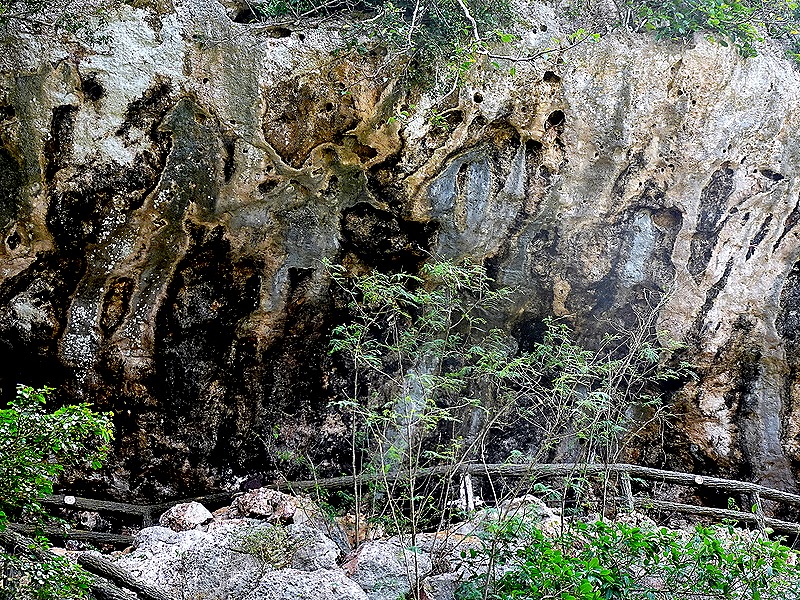
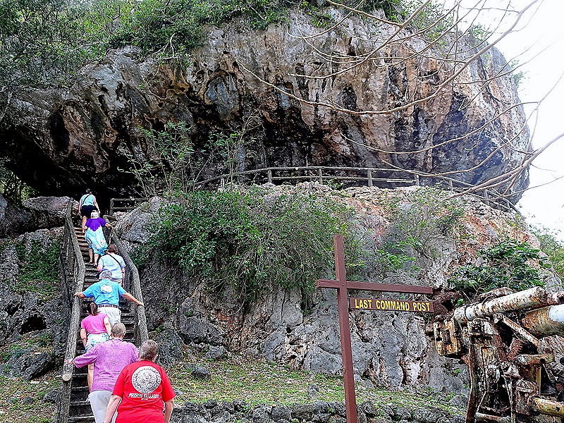
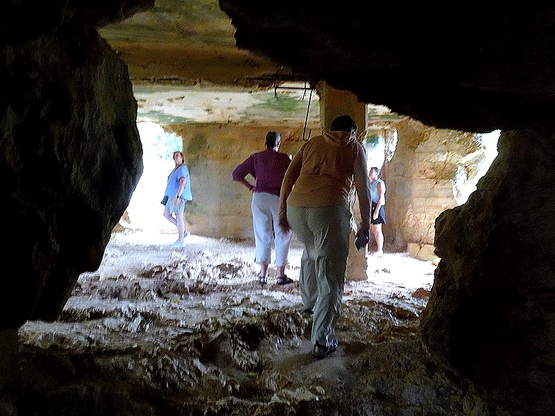
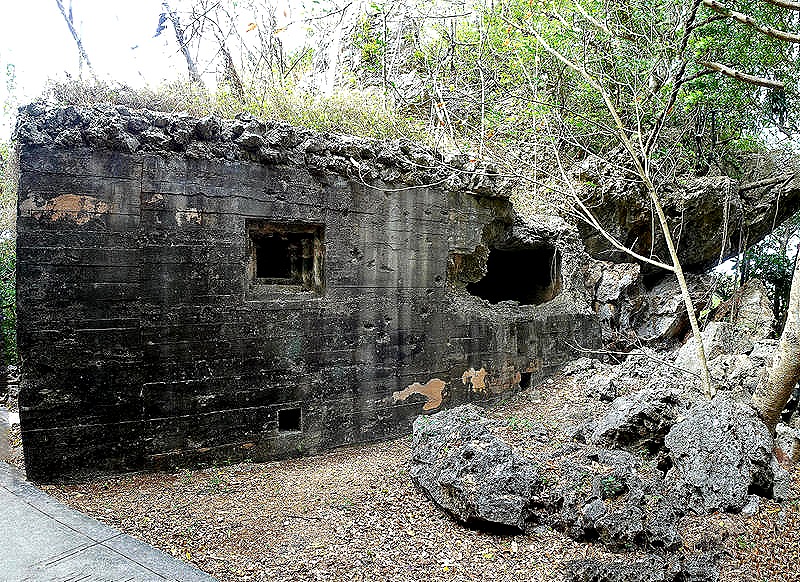
DSC0508365d4436e2365b-gigapixel-very_compressed-scale-6_00x     The northern mountain region also contains what is called the Last Japanese Command Post.  It is a fortified cave built into the wall of a cliff, with old Japanese artillery and tanks arrayed on the ground in front.  There was a wooden stairway to reach the cave or you could climb up over a few boulders.  We have read that this is where General Saito, the top commander on Saipan, committed suicide after sending an order that all soldiers fight to the death.

DSC05106DSC05093DSC05094DSC05097a Luminar AIDSC05096DSC05098DSC05102_stitch

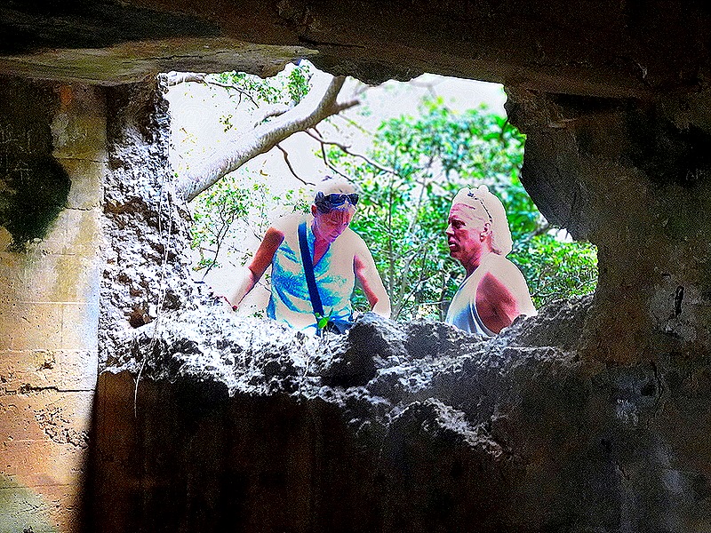
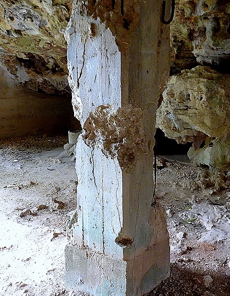
     You can see in the picture above that there is one finished opening that is a window and one jagged opening that could have been a window but is also an explosive opening.  We don’t know how many of each there are, but we were told about one incident that created two holes in the wall when a shell from a US Navy ship made one hole penetrating into the cave, then took a chunk out of a concrete pillar, then made a hole on the other side as it exited the cave, all without exploding.  Hard to imagine & it must have been quite a shocking experience for the soldiers inside.  We think we remember correctly which hole was which, but be a little skeptical in viewing the labelling of the following pictures.

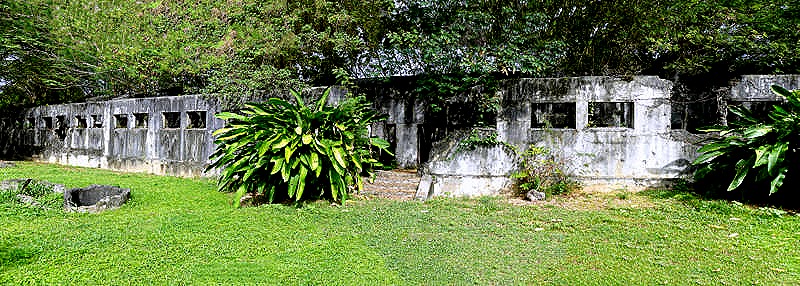
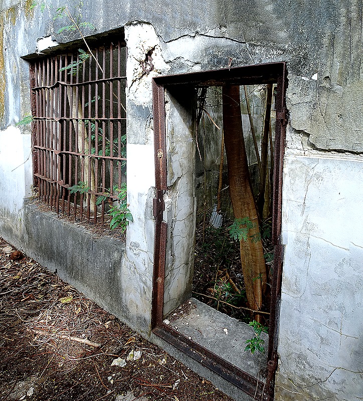
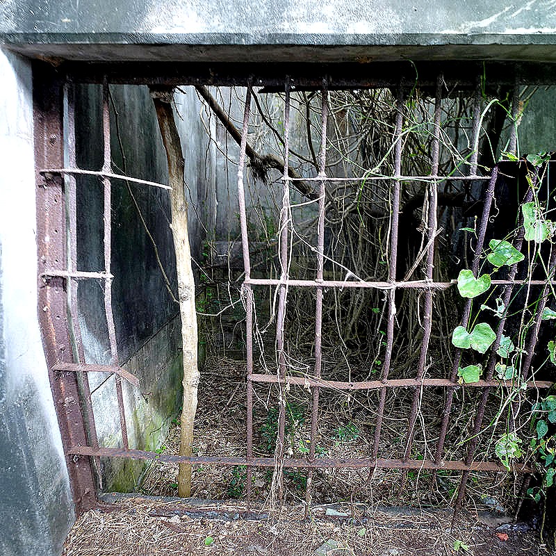
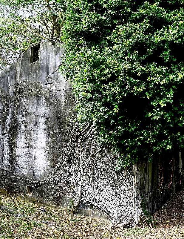
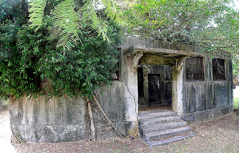
DSC05099DSC05101DSC05100      Our last visit before returning to the ship was to the old Japanese Jail in Garapan.  You will recall that the Japanese were awarded control of Saipan in the treaty ending World War I and governed the island until losing the battle of Saipan in July, 1944.  This jail was built in 1929 and was probably used by the police in the usual manner and also occasionally for a few war related prisoners, often for a transitory period.  Today it is a ruins, but interesting to visit.  There are three buildings: a large cell block (reportedly for men), a short cell block (reportedly for women) and what is probably an administrative building (no bars on the windows).  You can walk through the hallway outside the long cell block, which no longer has a roof.

    There is a theory that Amelia Earhart was imprisoned here with her navigator, Fred Noonan, after their plane disappeared in 1937.  Noonan was supposedly beheaded and Earhart kept in the jail until her death sometime before the American invasion.  Walt, our guide, is a strong believer in this theory, having interviewed individuals and descendants of people who claim to have seen her (described as a woman with short hair wearing men’s clothing) in the prison.  We think that the cell with two openings below was the one pointed out to us as having housed Earhart (although this cell block was reportedly for men).  Shortly before our visit there was a report of a claim of discovery of her plane on the ocean bottom, yet to be confirmed.  We don’t know the truth of what happened to Amelia Earhart (really, nobody does for certain), but after this visit it will be interesting to follow any additional evidence that may be discovered about her fate.

DSC05123_stitchDSC05111_stitchDSC05109_stitchDSC05108DSC05120_stitchDSC05115_stitch

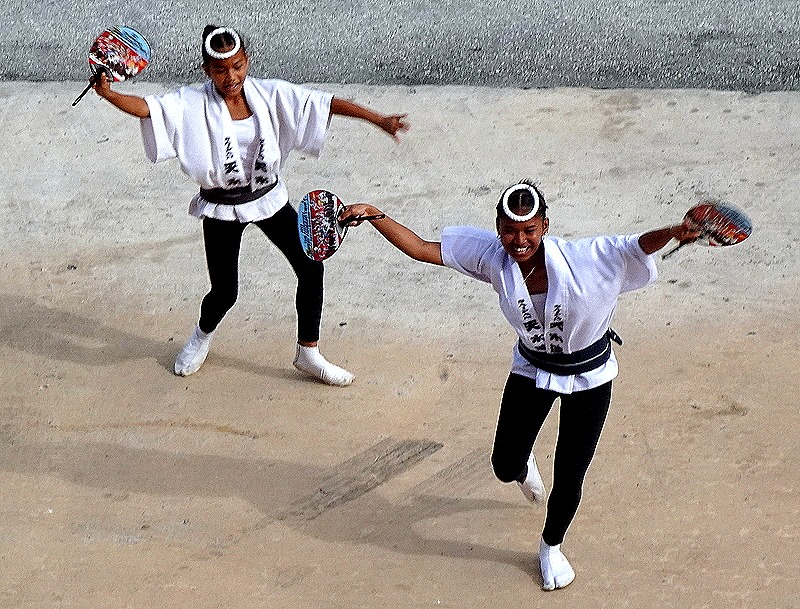
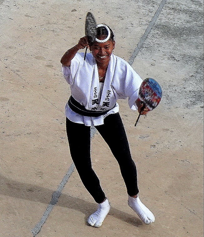
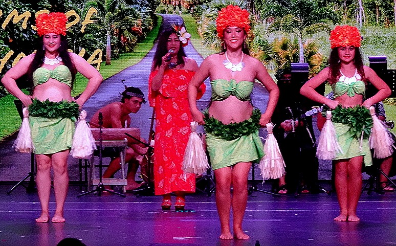
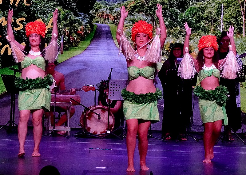
     As we waited to sail away in the late afternoon there was another dance group, with drummers, performing on the dock below our veranda.  All of the dancers were holding paddles and some of them looked like they were young girls. It is always nice to receive a welcome or send off on the dock, and this one was very energetic and entertaining.  We sailed away in late afternoon, after a very full and rewarding day.

DSC05134DSC05136DSC05137DSC05141DSC05144DSC05138DSC05140