Latest

Santarem, Brazil (2024)

    Founded in 1661 and named after a Portuguese city, Santarem is now a metropolis of more than 300,000 people.  Interestingly, in 1867 a contingent of die hard former US Confederates immigrated here rather than accepting reintegration into the United States.  Some of their descendants still live here.

DSC03557_stitch

     We were anchored opposite the upriver part of town on the morning of January 16, the last of five Brazilian ports all on consecutive days.  Santorem is situated at the confluence of the clear blue Tapajos river and the brown Amazon and the two rivers run together for several miles without merging.  The Amazon’s brown color is partly due to silt from the Andes that flows with the river all the way to the Atlantic Ocean.  This stretch of brown water on one side and blue on the other is known as the “Meeting of the Waters” (which can also be seen at Manaus where the Rio Negro flows into the Amazon).  On our last visit to Santarem we had a wonderful boat excursion into the rainforest and sailed right through the meeting of the waters on our return:

https://baderjournal.com/2019/11/04/santarem-brazil/

On this trip this phenomenon was clearly visible from our anchored ship.

DSC03506_stitch

    Santorem is about half way between Manaus and the Atlantic Ocean.  It was once a center for rubber shipment and other products later, but today the big product is soybeans.  A good deal of rainforest has been cleared south of here to plant soy beans and Cargill corporation has a huge facility here for processing and transporting this stuff down river.  Their plant, with huge storage tanks and very long conveyor belts to move product to ships in the river, dominates the up river part of town.

DSC03511

     We didn’t have anything special we wanted to see so we just tendered to a dock near the Cargill plant, where a shuttle bus took us downtown to a centrally located square called Praca do Pescador (Fishermen’s Square).  On one side of the square was a phone booth that looked like a parrot (really) and on the other was a long riverside promenade called Orla de Santarem.  Fishing boats and ferries were lined up along the shore and we saw one boat (perhaps a ferry) being loaded with goods the old fashioned way, by hand.

DSC03512 - Copy_stitchDSC03518Santarem (Mary) Rick & phone boothDSC03519DSC03520

     We walked over to visit the Catedral Metropolitana Nossa Senhora de Conceicao, the city’s distinctive blue cathedral first built in 1761.  Inside was a baptism chapel behind a brightly colored curtain of hangings that would seem out of place anywhere but in the Amazon.

DSC03527_stitchDSC03529_stitchDSC03533DSC03534DSC03560

     In front of the cathedral was a large outdoor market made up of rows of individual vendor kiosks.  Many things were for sale, but the predominant products seemed to be backpacks and flip flops.  We walked across the street to visit the Theatro Municipal Victoria, which looks relatively new and has a nice facade with a sweeping double stairway.  Unfortunately, it was closed so we couldn’t go inside.

DSC03541DSC03536_stitch

     There wasn’t anything else here we wanted to seek out in this heat, humidity and very hot sun, so we took the shuttle back to the tender port and tendered back to the ship.  As we sailed away we had a further view of the meeting of the waters. Notice that Zuiderdam was anchored in the blue water of the Tapajos River and you can see the brown Amazon entering in the background beyond the point of land.

 DSC03555_stitch

     That evening the Oi Brazil! group put on its farewell performance on the Main Stage, and what a show it was.  They presented several different styles of Brazilian song and dance in different settings.  For example, the first set was a street scene with a very acrobatic primary dancer doing back flips and such.  Then was some singing with precision dancing by a couple who were also quite athletic (and practiced!), who ended up dancing on top of a small table.  The guitarist from the jazz trio in the Ocean Bar was part of that and accompanied a performance of Girl From Ipanema on solo guitar.  Background pictures of Brazilian locations were projected on the screen behind the stage.

DSC03569DSC03570DSC03573DSC03574

     The main singer came out for another set dressed like Carmen Miranda, a popular Brazilian appearing in US movies in the 30’s who was famous for her fruit basket hat.

DSC03575DSC03576DSC03578

     The final set was the samba, with the dancers and the singer wearing Rio de Janeiro Carnaval costumes. Kimberly even came on stage in the Carmen Miranda get up.  They danced up a storm then paraded up the aisles of the theater and continued throughout the ship, with audience in tow.  They danced and sang and played into the Rolling Stone Lounge, where a show was in session, and basically took over the stage.  The singer for the Rolling Stones band took out his phone and enthusiastically videoed the whole thing, before they danced out of the Lounge and on through the corridors toward the rear of the ship.  That is where we left them.  A good time was had by all.

DSC03582DSC03586DSC03587DSC03590DSC03589DSC03591     Well, for a day that started off relaxed enough, it sure ended with a bang.  We will leave you with a final view of the city of Santorem and the meeting of the waters as we close out our last Brazilian port.

DSC03552_stitchDSC03562_stitch

Parintins, Brazil (2024)

     January 15 found us anchored in the Amazon River farther upriver from the tender dock than in the past.  Perhaps this more distant anchorage had to do with the water level in the river.  The water level this trip is noticeably lower than on past trips, but it is much better than a couple of months ago when several cruise ships had to abandon sailing up the river.  We understand that the navigation has been more challenging than normal, but we have had no incidents interfering with our itinerary.

DSC03444_stitch

    Founded more than 200 years ago, Parintins is a river town of something over 110,000 people located on a large island in the Amazon river.  There are no roads to this town so transportation in and out is limited, we understand, to river traffic.  The town is named for the indigenous people who lived here before the coming of Europeans and this heritage of Amerindian culture is still evident today.

     More than anything else, this town is renowned for its Boi Bumba festival every June, which draws more than 35,000 visitors, many sleeping on the river boats on which they arrived.  The festival centers on performances of a musical show about the resurrection of a bull killed by a local, based on an old story that we were told originated in Portugal.  The whole town is divided into rival groups (gangs?) who stage competing performances in the Bumbodromo, a 35,000 seat stadium purpose built for the festival (although other events may take place there in other parts of the year).  The Garantido group is represented by a red bull (really, white with red or pink highlights) and the Caprichoso group is represented by a blue bull.  It sounds like Romeo & Juliet, right?  Competition between these rival color groupings is so intense that blue group people avoid products that are red and red group people avoid products that are blue.  Apparently Coca-Cola has marketed special blue cans of Coke only sold here so that the blue group people would buy their product.

DSC03476DSC03489

DSC03500

     Obviously we were not here for the festival, which was some 5 months away.  But when a cruise ship is in town the group that won the previous competition puts on a scaled down version of the show in an auditorium near the tender boat pier.  We have seen it twice and it is a marvelous show, but since the tickets are $100 per person we decided we didn’t need to see it a third time.  If you would like to see pictures of this rousing performance from 2019 you can look here (worth seeing):

https://baderjournal.com/2019/11/18/parintins-brazil-2/

     Instead we decided to walk through the town, looking particularly for what appeared to be the red group’s headquarters and workshop where we hoped to see preparations for the festival in progress.  So we tendered ashore, but not in a Zuiderdam tender boat.  It appears that local regulations require tendering to shore in local river boats, so that is what we did.  It was actually a more pleasant and interesting ride than a normal tender, although it was much longer than last time we were here when the ship was anchored quite close to the tender pier.

DSC03454_stitchParentins (Mary) Rick in local tenderDSC03456DSC03457DSC03437

     After reaching shore we began walking up river toward the Red part of town.  It was very hot and humid but it was nice walking in town near the river.  We walked past the busy Municipal Market which had vendors inside and out.  We saw a very tall sculpture of an indigenous man, possibly part of the sign for a business, and a number of people having lunch at tables near the river served by cafes across the street.  As you might surmise from these pictures, the predominant forms of local transportation appeared to be of the two wheel variety, bicycles and motorcycles.

DSC03460DSC03462DSC03461DSC03463DSC03464_stitchDSC03467DSC03470

     We continued walking further into Red territory.  Not many people were on the streets, which were lined with small businesses and shops, many with the red bull incorporated into their signs.  We walked quite a way, at least it seemed so with the heat and humidity, but we didn’t find our objective.  What we found was a red and white painted facility that looked like a small arena, probably a practice area.  We didn’t see anyone there and it was fenced, so we took a few pictures and headed back toward town.

DSC03479_stitchDSC03473_stitchDSC03481DSC03487_stitchDSC03483DSC03472

   We saw many nice flowers during this walk and some wildlife too, notably a red topped bird and a long bright green iguana crossing the street (traffic stopped for him).  One tree, we noticed, had air plants growing on its trunk.

DSC03484DSC03486DSC03469DSC03482DSC03409DSC03490

    We walked past the local cathedral, which we had been able to enter on a previous visit.  Nearing the tender port we came to what seems to be the no man’s land between the red territory and the blue territory.  The crosswalk here had blue stripes on one side of the street and red on the other.  These folks seem to be really serious about their rivalry.  At the tender port we took a regular HAL tender back to the ship, but to reach it we had to walk through one of the local boats like the one on which we rode into town.  Apparently, they wouldn’t allow the HAL tenders to dock at the actual pier.  We think it must be some kind of local regulation to generate business for the river boats.  Presumably the local boat owner was paid to allow us to walk through their boat to the HAL tender.

DSC03491DSC03492DSC03458

    Thus ends our third visit to Parentins.  The clouds in the sky over the city were a pretty pink as we departed downstream, with one more stop in the Amazon remaining.

DSC08785_stitch

Manaus, Brazil (2024)

     We spent January 14 in Manaus, a city of some 2 million residents located about 1,000 miles up the Amazon River in the Brazilian rainforest, where the Rio Negro and Rio Solimoes come together to form the Amazon.  Because the Amazon rises and falls about 40 feet every year we were docked at a floating pier that rises and falls with the water.  With the water so low right now there was a steep ramp from the pier to the mainland part of the dock area.  These are new piers and mostly for cargo, so ship passengers are not permitted to walk out of the dock area on their own.  A shuttle bus was provided to take us from the ship to the cruise terminal a few blocks away on the mainland.

DSC03419_stitch

     We had been to Manaus twice before, both overnight stays.  The first time, in 2012, we explored the city by ourselves on foot and had a boat trip into the rain forest.  The second time, in 2019, we had an overnight excursion at a camp in the forest, seeing dancing in an indigenous village, hunting baby caimens by boat at night and hiking through the forest, among other things.  If you want to read more about Manaus & see more pictures, you can do that here (the pictures are much better in 2019):

https://baderjournal.com/2012/03/05/manaus-brazil-day-1/

https://baderjournal.com/2012/03/05/201204manaus-brazil-day-2/

https://baderjournal.com/2019/11/11/manaus-brazil-day-1-2019/

https://baderjournal.com/2019/11/15/manaus-brazil-day-2-2019/

     This time we had only one day and decided to spend it walking through the city seeing the sights we had missed before.  Our first stop was the Municipal Cathedral, first built in 1695.  It was Sunday so Mass was in progress but we were permitted to come in and sit in the back seats.  The people were not dressed up for the most part, but a little dog with its hair made up for a Sunday visit came in with its mistress and sat in front of us.  The church was set in a large green park and in the street next to it was the Relógio Municipal de Manaus (sounds much grander than “Municipal Clock Tower,” doesn’t it).

DSC03385_stitchDSC03384Manaus3Mary Dog in cathedralDSC03387

     One place we had not been able to walk through when we were here before was the Mercado Municipal Adolfo Lisboa.  The masonry portion of this large market was opened in 1883 and the additional iron Art Nouveau structures opened about 30 years later.  All of the materials for these buildings were prefabricated in Europe and shipped up the Amazon to Manaus.  The market is supposed to have been modeled on Les Halles in Paris.  We entered the tourist market building through the masonry facade on one of the streets running up from the river.

DSC03388_stitchDSC03402

    Running parallel to the river are several long iron buildings that house produce, meat and fish markets.  Under the roof in each end wall is a large stained glass window.  The complex has restaurants, iron gates, flowers and bushes aplenty.

DSC03392DSC03394_stitchDSC03393DSC03400DSC03398DSC03399DSC03401

     We had toured the Teatro Amazonas, the opera house that is the city’s most famous building, on both of our prior visits, so we didn’t need to do that again.  But we decided to walk up there again because Mary wanted to get an opera house T-shirt.  We walked up a couple of very long blocks lined on both sides with closed up vendors’ carts; it was a bit eerie because almost no one else was in this street that looked like it would be very busy on any day but Sunday.  We walked past a very large mural of an indigenous woman covering the side of a multi-story building and then through a park with an iron pavilion, some dry ponds and a good bit of nice flora.  Again, hardly anybody there other than us on a Sunday.

DSC03404DSC03405DSC03406

     We finally arrived at the Teatro Amazonas, a large pink building with a dome tiled in the colors of the Brazilian flag.  Opened in 1896, it was financed by the huge fortunes accumulated by the rubber barons during the period when this part of Brazil had a world monopoly on rubber, just as the auto industry was beginning to need large amounts of it.  Everything here, from tiles to marble for the stairs and columns, to the 32 Murano chandeliers, was made in Europe and shipped up the Amazon by boat.  This imposing building, which would have looked more at home in a large European city, must have been quite a sight when it was opened here in the middle of a rainforest!

DSC03407DSC03408Manaus 2DSC03410

     It was disappointing after the long walk in the high heat and humidity to find that the Teatro was closed on Sunday, including its gift store.  So no T-shirt for Mary after all!  We started walking back downhill toward the port, or so we thought.  We were using a smartphone navigation program called Maps.me (which we had already decided to abandon for a newer, and still free, program but we had one more map already downloaded so we used it here).  It let us down completely, guiding us off in the wrong direction (up river) and changing its walking directions multiple times.  One time before, in Barbados a couple of years ago, it guided us in a complete circle back to our starting point instead of to the Synagogue, so we probably should have known better. 

     Anyway, we spent several hours wandering around the more western part of town trying to find our way back to the port, in neighborhoods where nobody spoke English and, of course, we couldn’t speak Portuguese.  We didn’t feel much like taking pictures as we concentrated on figuring out where we were, and really there was little worth photographing.  We saw a few interesting wall paintings and passed a neighborhood that looked like one of the favelas in Rio.

DSC03411_stitchDSC03413DSC03414

     It was getting late, only about an hour before all-aboard time, and we had no idea where we were or how far it was to the port terminal.  One man in a car stopped to give us directions, but he only spoke Portuguese.  It seemed he was telling us to walk up three blocks then to the right.  We started to do that, but then another man in a car stopped.  He only spoke Portuguese too, but he motioned us to get in the car.  Somewhat suspiciously, we did so and Mary saw a taxi license posted in the car.  A woman nearby was shaking her head no as we approached the car, but we really had no alternative at that point.  The driver was very talkative (in Portuguese, of course), but in the end he dropped us off right across from the shuttle bus waiting at the terminal.  It turned out we really hadn’t been that far from the terminal after all and could have walked it, but we didn’t know that.  We are pretty sure the driver charged us well over the usual price, but we were so happy to be back at the ship on time that we really didn’t care.

     Back on the ship we went up to the top floor for picture taking.  We had a view from the ship of the mural of the indigenous woman we had passed, along with the 19th century Customs House we had wanted to visit (closed Sundays) below it and, below that, the top of the green port terminal building.  We could see the towers of the Cathedral and also a neighborhood up river that looked like it might have been near where we were lost.  Notice in the last picture how far the water is from the sea wall on the lower hillside.

DSC03417DSC03418DSC03422     That evening we had a reservation for a special Brazilian dinner in the Pinnacle Restaurant, along with our table mates Bob, Judy, Robert and Bill.  But for the reservations we probably would have eaten in our room because we were so worn out from all that walking on the hot, humid and irregular streets of Manaus.  But we were glad we went because it was quite a delicious dinner, accompanied by Brazilian dancing among the tables by the Oi Brazil cultural group on board.  The highlight of the meal was thick ribeye steak sliced near our table, but everything was quite delicious.

DSC03426DSC03429-aDSC03429DSC03435

     So that is the end for our day in Manaus.  We were very happy to get to bed since there was yet another port day ahead.  So we will end now with a picture of six happy diners.

Pinnacle Brazilian dinner

Alter do Chao & Boca da Valeria, Brazil (2024)

Alter do Chao

     Located just a few miles up from where the Rio Tapajos flows into the Amazon, Alter do Chao is a beach town of about 3,500.  Because of the very low level of the rivers here we anchored early on January 12 a good bit away and had to tender into town.  Although not particularly well known outside Brazil the town has been here for almost 400 years, founded in 1626 and named after a Portuguese city of the same name.  It is well known to people in this part of Brazil as a vacation destination, however, because of its beaches, said to be the best freshwater beaches in Brazil, if not the world.  They give the town its nickname: “Caribbean in Brazil.”  We were warned that stingrays of all sizes live in these waters, so that if you enter the water you should shuffle your feet rather than chance stepping on one of them.

 20240112_182431-a_stitch

     We tendered ashore with our friend Bill.  The water was so low in the river that we had to disembark onto a floating platform and walk across a board to the beach, then a good way up the beach to reach the town.  We had visited this town in 2019 (look at the beginning and especially at the end of this post):

https://baderjournal.com/2019/11/27/alter-do-cho-brazil/

At that time we disembarked from the tender at a platform in the water near the small port building and walked up a boardwalk with blue and white railings over a wet, marshy area to reach the town.  This time the marshy areas were completely dry and there was a very tall platform rising from the sand near the port building.  That may be the platform where we disembarked last time or perhaps a new embarkation platform built since we were here.  Either way, it appears that the water level when the river is high is normally near the top of this platform, so it gives an idea of how really low the river water is right now.

DSC03343DSC03344DSC03345

DSC03364

     There is a square just in front of the port that is surrounded by vendors’ carts (and, when we arrived, by tour buses).  After looking at some of their wares we walked into town along what is probably a waterfront walk when the water is high.  A very sandy island sits just off shore extending to just a few yards from the town, called Ilha do Amor (Island of Love).  When the water is low it is possible to walk to the island through chest high water, which we saw a few people doing.  There were many boats in this area and it looked like a nice place to spend a free day.

DSC03346_stitchDSC03349DSC03350

     We walked into the town and came to the central square, where we saw the town’s yellow church, Igreja Nossa Senhora da Saude (Our Lady of Health).  On the other side of the square was a park with statues of two dolphins, one gray and one pink.  Pink dolphins are found mostly in the Amazon and neighboring rivers in this part of South America.  They can only live in fresh water and are an endangered species.  A few months ago it was reported that because of the drought in the Amazon basin more than a hundred bodies of pink dolphins had washed ashore further up the river.  We saw some of them (not the dead ones) on our last Amazon visit in 2019, but this statue was the only one we saw on this trip.

DSC03351DSC0335420240112_101217

     Our main objective for this visit was a store called Arariba Cultura Indigena.  This is a store well known for having one of the best collections of art and crafts made by indigenous people of Amazonia.  We visited it last time we were here and really enjoyed perusing their goods, some of which are inexpensive and many of which cost hundreds of dollars. We did buy a few things, but when you see things so heavily crowded together in a store it is difficult to envision what any one item will look like by itself when you get home.  I would show pictures, but a sign was posted asking that pictures not be taken so we respected that.

     Leaving the store, we walked around the town on our way back to the tender pier.  This is a quiet, pleasant town to walk through.  We passed some animal sculptures on the sidewalk outside businesses and a number of wall paintings, many of which are actually signs for the businesses within the buildings.  We also saw the local cemetery, complete with a model of the church facade and mostly above ground graves.

Wall DSC03358DSC03362_stitch

    Back at the ship we had a late lunch and went up to the Aft pool deck to watch the sail away.  Among other things we watched some people in boats that looked like jet skis speed out to the ship and then around it.  We also watched as they lifted the last tender boat into its position outside deck 4.  Then we sailed away to our next stop tomorrow.

DSC03368DSC03366_stitchDSC03369_stitch

Boca Da Valeria

     On January 13 we anchored in the Amazon just upriver from where it intersects with a tributary called Rio Valeria.  The village of Boca de Valeria is located in the rainforest on the Rio Valeria within walking distance of the Amazon confluence.  This tiny village (75 to 100 residents) was once just a typical Amazon fishing and trading village.  Then, we are told, a number of years ago a ship sailing up the Amazon had engine trouble at this spot and tendered passengers to shore to occupy them while repairs were completed  The inhabitants thought they were being invaded and fled into the forest, returning only after the ship passengers were gone. 
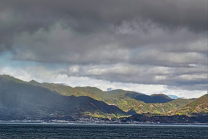
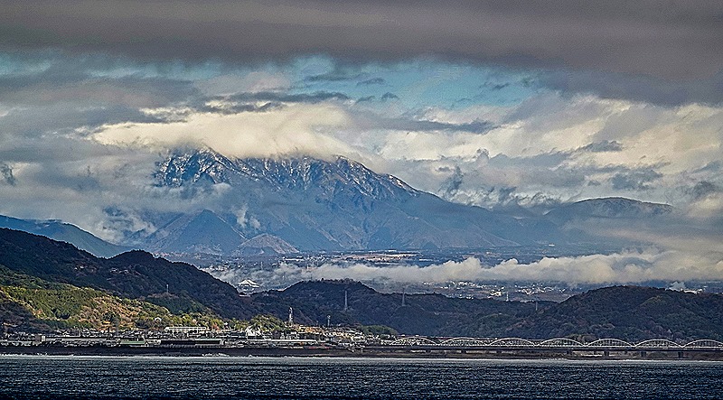
     Since then it has become a regular stop on the Amazon cruise route. The income from cruise ship visits has provided the village with electricity, satellite dish TV, computers and refrigerators, and on cruise ship days people come from miles around and dress up in costumes to pose for pictures at $1 per picture.  The locals also sell arts and crafts and provide canoe rides for about $10 per person.  It is worth visiting because it is the only place you are likely to see anything like the indigenous villages in this area, but in our opinion it is only worth visiting once since it is so small and there is so little to see. 
     We went ashore on our first visit here in 2012 and you can see pictures of the village and read about it here:

https://baderjournal.com/2012/03/01/boca-de-valeria-brazil/

On our second visit we stayed on the ship, but the ship’s location and the sunny weather enabled us to take some pretty good pictures of the town and the surrounding area, as well as the folks in canoes who came out to the ship to try to sell things or just get a look at it.  You can see that here:

https://baderjournal.com/2019/11/07/boca-da-valeria-brazil-2019/

     This time we were anchored a little up river from the Rio Valeria (perhaps because of the low water), so we could not see the village locate around the bend behind the mountain.  In the past the ship’s tenders always dropped folks off at a pier in the center of town near the church, but this time a new, apparently floating, pier had been built right on the corner where the two rivers meet and passengers had to alight there and walk to the town.  The river beyond the new pier looked too small, because of the low water, for a ship tender to sail through.  And no canoes came out to the ship on this visit, perhaps because there was a sign at the pier forbidding it (we didn’t see one but have heard one was there).  So here is what we saw from the ship . . . people walking toward the village from the new covered pier.  Note that on our last visit all of the land around the new pier, on both sides of the small river behind it, was completely under water.

DSC08774_stitchDSC08774_stitch-aDSC08778

     After we left Boca da Valeria in early afternoon there were two notable events on board.  First was a cake extravaganza in the Lido buffet called “For Cakes’ Sake.”  Dozens of different cakes had been baked by the kitchen staff and you could walk around and get a slice of as many as you liked, for as long as they lasted. We have been to similar events in the past and the desserts always look fabulous, but often don’t live up to their appearance in the taste test.  This time was different; each of us had slices of two different cakes and all were quite delicious.  Our friend Robert had a slice of a rainbow cake he said was quite good; we had never seen anything quite like that.  Then dinner was a dressy night and we received a towel animal.  We used to get these every night but we guess that was a lot of work and now they only come on formal and dressy nights.  (You ask what the difference is between a formal and a dressy night?  As far as we can tell, on formal nights pillow gifts are sometimes left on our bed when we return from dinner while on dressy nights there are none.)

DSC03379DSC03382

Scarborough, Tobago – Devil’s Island, French Guiana – Macapa, Brazil (2024)

Scarborough, Tobago

     Located about 23 miles from Trinidad, Tobago is the much smaller second island in the nation of Trinidad And Tobago, sometimes called TT locally.  We arrived at Scarborough, the capital and largest city on Tobago, on the morning of January 7.  This was our first visit, never having been to Trinidad either.DSC03298-topaz-enhance-2x

     Tobago was inhabited by Carib people when Columbus became the first European to sight it in 1498 (although he didn’t land there).  Over the years the indigenous people adamantly resisted colonization, although the Spanish began raiding it for slaves in the early 16th century.  The island was constantly fought over by the British, Dutch and French, changing hands 31 times before it was finally awarded to the British in 1814 (presumably in the settlement of the Napoleonic Wars).  A destructive hurricane and the end of slavery in 1834 doomed the island’s productive sugar industry and in 1889 Tobago became a ward of Trinidad. The two-island nation achieved independence from Britain in 1962 and in 1976 became a republic.  Today Tobago has a legislature and some internal home rule, but is otherwise dominated by Trinidad.  Tourism is its largest industry.

     Scarborough is the largest town on Tobago with only about 18,000 people, whose homes are spread out over the beautiful green hills surrounding the town.  It was very hot and humid when we were there and it was also Sunday, so not much was happening and most businesses were closed.

     After a delicious breakfast (the food on this voyage has been really good so far) we left the ship and walked down the dock into the town.  If you have read this blog before you won’t be surprised that our first objective was the library.  Unlike in most cities, the library here is one of the largest buildings in town and it is located just a block across from the dock.

DSC03299_stitch

     We walked around it until we found the main entrance.  It was completely dark inside but we walked up the stairs to see if there was a listing of hours. There wasn’t but we tried looking through the glass door to see the inside (too dark to see anything).  Then a nice young guard came over and opened the door to inform us that the library was closed on Sundays.  We were disappointed but at least we got to see the outside of the building, which seemed to us rather large and imposing for a town of 18,000 people.  It probably serves the whole island, which is rather sparsely populated.

DSC03277-topaz-enhance-2xDSC03279-topaz-enhance-2x-faceaiDSC03280-topaz-enhance-2x

     We decided to visit the Botanical Gardens, located on the hills behind the library.  The gardens cover some 18 acres that the British requisitioned for this purpose in the late 19th century from what was once a couple of sugar plantations.  They are quite beautiful but mostly up a steep hill that left us rather worn out by the time we reached the top.  Extensive Christmas lights were still in evidence on the buildings and trees but were not lit in the daytime (of course).

DSC03281-topaz-enhance-2xDSC03283-topaz-enhance-2xDSC03297-topaz-enhance-2xDSC03282-topaz-enhance-2xDSC03288_stitch-topaz-enhance-2x-faceaiDSC03291-topaz-enhance-2xDSC03292_stitch-topaz-denoise-enhance-2x-faceai-sharpen

     Thereafter we looked for the fort the British built here in the 18th century, but we didn’t find it before we were pretty worn out.  Mary had a knee replaced in July & neither of us is as young as we once were, and did we mention it was hilly and hot and very humid?  So we returned to the ship after what turned out to be a brief look at this town.  We tried to spot the fort as we sailed away but never saw it (or perhaps we just failed to recognize it).  We backed well away from the pier before turning around to sail into the ocean.  As we did so a colorful kite came flying over, apparently from shore, and after a while sank slowly into the water.  A boat came speeding up looking for it, but the kite had submerged by the time it arrived.  Later, after the boat had gone, the kite bobbed back to the surface, where we last saw it.

DSC03303_stitch-topaz-denoise-enhance-2x-sharpen

Devil’s Island, French Guiana

     We were awoken very early on January 9 by the noise of the tender boat hanging just outside our stateroom veranda being lowered into the water.  This was our announcement that we were anchored off this three island archipelago (called Iles de Salut) about 9 miles from the shore of French Guiana.  Thanks a lot; wasn’t this supposed to be a vacation?

     Devil’s Island was, of course, a notorious French prison for about 100 years, ending in 1953.  If you have seen the movie Papillion, you should know a lot about it, although the book on which the movie is based has been debunked as fictional rather than the memoir it purported to be.  The author had actually been imprisoned on the mainland and had never even visited Devil’s Island, much less escaped from it.  Still, the prison was pretty horrible.  Its most famous inmate was Alfred Dreyfus, a Jewish officer in the French army who in the late 19th century was framed and convicted of treason, spending about 5 years in seclusion on Devil’s Island before his conviction was overturned and he was returned to France.  Today you can see a restoration of his stone hut from the nearby island of Ile Royale, although no one can actually visit the true Ile Diablo because the waters are too dangerous.

      From our anchorage we could see two of the three islands: Ile Royale (at left in picture below) and Ile St Joseph (at right).  Ile Royale was the main prison installation, housing most of the prisoners and administration of the prison.  Ile St Joseph housed problem prisoners, often held in harsher conditions such as solitary confinement, darkness and enforced silence.  Ile Diablo (Devil’s Island) was for political prisoners, which included Dreyfus and more than twenty republicans who resisted the coup d’etat of Louis Bonaparte, among others.  Devil’s island was on the other side of Ile Royale from where we anchored, so we couldn’t see it from the ship, although you can see it from the other side of Ile Royale.DSC03306_stitch          This was our third visit to this archipelago and Ile Royale is not, for all of its beauty and interest, a metropolis like Paris or Rome where there is always something new to do or see on return visits.  So we stayed on board rather than tendering to the small dock on Ile Royale. 

DSC03311

But if you want to know what we did and saw on previous visits, as well as see and read much more about these islands and the prison and its ruins, you can look at our previous Devil’s Island blog posts, from 2012 and 2019:

https://baderjournal.com/2012/03/07/devils-island-french-guyana/

https://baderjournal.com/2019/12/12/devils-island-french-guiana-2019/

     We were told by some who did go ashore that the restaurant and gift shop were closed as was the church, possibly for additional restoration.  So we weren’t too sorry to miss it.  If it had been our first visit it would have been a very different story.  From the ship we were able to see the top of the modern lighthouse above the trees and another ruins we couldn’t identify visible through an opening in the foliage.  In the opposite direction we could see the shore of French Guiana about 9 miles away.  You can see why few attempted to escape through this long stretch of shark infested waters.

DSC03313_stitchDSC03317_stitchDSC03319_stitch

     As an aside, because our veranda was smack up against tender/life boat #11 we had in interesting view of the lowering and raising of the tenders.  Below is a picture of the opened tender cranes after the boats are in the water, taken through the rain spotted glass under the rail across our veranda.  Below that is a view of the tender boats stored in their raised position along the ship and the same view after they are lowered into the sea, showing the walking deck below.  We had never been in quite that position before.

DSC03341DSC03323DSC03322

Macapa, Brazil

     The morning of January 11 found us anchored in the Amazon near Macapa, Brazil.  We had crossed the Amazon Bar (where the river meets the ocean) the day before.  There is a dispute whether the Amazon or the Nile is the longest river in the world, but there is no dispute that the Amazon is the biggest in every other way, particularly volume of water.  The river is spectacularly wide; in fact there is an island the size of Switzerland situated near its mouth.  Sailing this river is quite beautiful and varied, with wonderful cloud formations and many different looking villages and isolated houses along its shores.  Mary noted that whoever christened the Mississippi “The Big Muddy” must not have been here, because the Amazon is much bigger and much muddier than the Mississippi.

     The water in the Amazon is historically low this year because of drought throughout the Amazon basin.  This has killed many wildlife, including more than a hundred of the endangered pink dolphins that live here, whose bodies have washed up on shore.  It has also made navigating the river, always a challenge for ocean going ships, much more perilous and a number of them have cancelled Amazon trips.  Although it has double the passenger capacity of the Prinsendam, in which we have cruised the Amazon before, we are told that Zuiderdam has a shallow enough draft to make it through the river with an expert pilot on board.   We picked up three pilots in Macapa, we understand, and will have replacements come aboard several times, kind of like the old Pony Express I guess.  The captain said that the most valuable thing on board the ship right now is the pilots’ paper charts, which show which areas are too shallow and which are still deep enough for Zuiderdam to sail through.

      Although Macapa is a large city of more than 500,000 people, this was not actually a port stop.  No one was allowed off the ship to explore the city.  This stop, only a few hours long, was designated a “service stop” to enable the ship to complete Brazilian paperwork (we know a little about how that can be from our visa fiasco), be inspected by Brazilian officials, and board the pilots.  You would never know this was a big city from the ship’s anchorage, however, because all of it but a small dock was obscured by forest.  In addition to the dock we saw the pilot boats that brought the Brazilian officials and the pilots, one with scaffolding an a raised platform for a pilot to safely jump from the ship.

DSC03325DSC03330DSC03326DSC03335DSC03328

     It was too bad we couldn’t go ashore because this is one of a handful of cities in the world that the Equator runs through.  There is a tall monument marking the spot, called “Marco Zero,” with a line from the monument to the local soccer stadium where it becomes the center line on the field.  When we had a service stop here in 2019 we couldn’t see Marco Zero from the ship but we were anchored much closer to the center of town so that it actually looked like a city.  The different anchorage is probably attributable to the much lower water level.  You can see our 2019 stop here:

https://baderjournal.com/2019/12/02/three-days-at-sea-2019/

     The rest of the day was basically a sea day (or river day) as we continued our journey up the scenic but muddy Amazon.