Latest

Alter do Chao & Boca da Valeria, Brazil (2024)

Alter do Chao

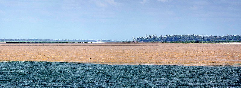
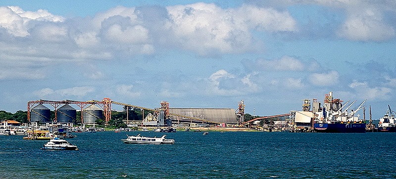
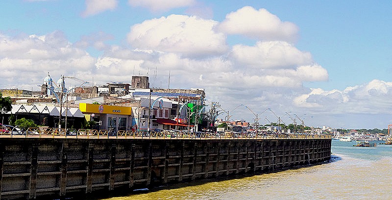
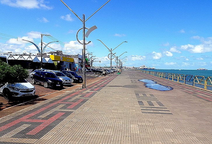
     Located just a few miles up from where the Rio Tapajos flows into the Amazon, Alter do Chao is a beach town of about 3,500.  Because of the very low level of the rivers here we anchored early on January 12 a good bit away and had to tender into town.  Although not particularly well known outside Brazil the town has been here for almost 400 years, founded in 1626 and named after a Portuguese city of the same name.  It is well known to people in this part of Brazil as a vacation destination, however, because of its beaches, said to be the best freshwater beaches in Brazil, if not the world.  They give the town its nickname: “Caribbean in Brazil.”  We were warned that stingrays of all sizes live in these waters, so that if you enter the water you should shuffle your feet rather than chance stepping on one of them.

 20240112_182431-a_stitch

     We tendered ashore with our friend Bill.  The water was so low in the river that we had to disembark onto a floating platform and walk across a board to the beach, then a good way up the beach to reach the town.  We had visited this town in 2019 (look at the beginning and especially at the end of this post):

https://baderjournal.com/2019/11/27/alter-do-cho-brazil/

At that time we disembarked from the tender at a platform in the water near the small port building and walked up a boardwalk with blue and white railings over a wet, marshy area to reach the town.  This time the marshy areas were completely dry and there was a very tall platform rising from the sand near the port building.  That may be the platform where we disembarked last time or perhaps a new embarkation platform built since we were here.  Either way, it appears that the water level when the river is high is normally near the top of this platform, so it gives an idea of how really low the river water is right now.
DSC03343DSC03344DSC03345

DSC03364

     There is a square just in front of the port that is surrounded by vendors’ carts (and, when we arrived, by tour buses).  After looking at some of their wares we walked into town along what is probably a waterfront walk when the water is high.  A very sandy island sits just off shore extending to just a few yards from the town, called Ilha do Amor (Island of Love).  When the water is low it is possible to walk to the island through chest high water, which we saw a few people doing.  There were many boats in this area and it looked like a nice place to spend a free day.

DSC03346_stitchDSC03349DSC03350

     We walked into the town and came to the central square, where we saw the town’s yellow church, Igreja Nossa Senhora da Saude (Our Lady of Health).  On the other side of the square was a park with statues of two dolphins, one gray and one pink.  Pink dolphins are found mostly in the Amazon and neighboring rivers in this part of South America.  They can only live in fresh water and are an endangered species.  A few months ago it was reported that because of the drought in the Amazon basin more than a hundred bodies of pink dolphins had washed ashore further up the river.  We saw some of them (not the dead ones) on our last Amazon visit in 2019, but this statue was the only one we saw on this trip.

DSC03351DSC0335420240112_101217

     Our main objective for this visit was a store called Arariba Cultura Indigena.  This is a store well known for having one of the best collections of art and crafts made by indigenous people of Amazonia.  We visited it last time we were here and really enjoyed perusing their goods, some of which are inexpensive and many of which cost hundreds of dollars. We did buy a few things, but when you see things so heavily crowded together in a store it is difficult to envision what any one item will look like by itself when you get home.  I would show pictures, but a sign was posted asking that pictures not be taken so we respected that.

     Leaving the store, we walked around the town on our way back to the tender pier.  This is a quiet, pleasant town to walk through.  We passed some animal sculptures on the sidewalk outside businesses and a number of wall paintings, many of which are actually signs for the businesses within the buildings.  We also saw the local cemetery, complete with a model of the church facade and mostly above ground graves.

Wall DSC03358DSC03362_stitch

    Back at the ship we had a late lunch and went up to the Aft pool deck to watch the sail away.  Among other things we watched some people in boats that looked like jet skis speed out to the ship and then around it.  We also watched as they lifted the last tender boat into its position outside deck 4.  Then we sailed away to our next stop tomorrow.
DSC03368DSC03366_stitchDSC03369_stitch

Boca Da Valeria

     On January 13 we anchored in the Amazon just upriver from where it intersects with a tributary called Rio Valeria.  The village of Boca de Valeria is located in the rainforest on the Rio Valeria within walking distance of the Amazon confluence.  This tiny village (75 to 100 residents) was once just a typical Amazon fishing and trading village.  Then, we are told, a number of years ago a ship sailing up the Amazon had engine trouble at this spot and tendered passengers to shore to occupy them while repairs were completed  The inhabitants thought they were being invaded and fled into the forest, returning only after the ship passengers were gone. 

     Since then it has become a regular stop on the Amazon cruise route. The income from cruise ship visits has provided the village with electricity, satellite dish TV, computers and refrigerators, and on cruise ship days people come from miles around and dress up in costumes to pose for pictures at $1 per picture.  The locals also sell arts and crafts and provide canoe rides for about $10 per person.  It is worth visiting because it is the only place you are likely to see anything like the indigenous villages in this area, but in our opinion it is only worth visiting once since it is so small and there is so little to see. 

     We went ashore on our first visit here in 2012 and you can see pictures of the village and read about it here:

https://baderjournal.com/2012/03/01/boca-de-valeria-brazil/

On our second visit we stayed on the ship, but the ship’s location and the sunny weather enabled us to take some pretty good pictures of the town and the surrounding area, as well as the folks in canoes who came out to the ship to try to sell things or just get a look at it.  You can see that here:

https://baderjournal.com/2019/11/07/boca-da-valeria-brazil-2019/

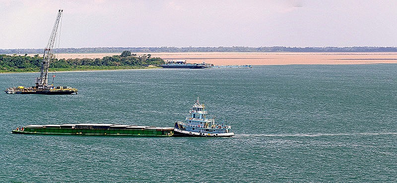
     This time we were anchored a little up river from the Rio Valeria (perhaps because of the low water), so we could not see the village locate around the bend behind the mountain.  In the past the ship’s tenders always dropped folks off at a pier in the center of town near the church, but this time a new, apparently floating, pier had been built right on the corner where the two rivers meet and passengers had to alight there and walk to the town.  The river beyond the new pier looked too small, because of the low water, for a ship tender to sail through.  And no canoes came out to the ship on this visit, perhaps because there was a sign at the pier forbidding it (we didn’t see one but have heard one was there).  So here is what we saw from the ship . . . people walking toward the village from the new covered pier.  Note that on our last visit all of the land around the new pier, on both sides of the small river behind it, was completely under water.

DSC08774_stitchDSC08774_stitch-aDSC08778

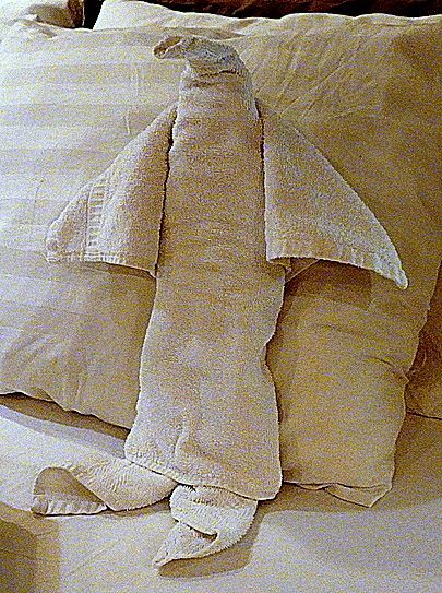
     After we left Boca da Valeria in early afternoon there were two notable events on board.  First was a cake extravaganza in the Lido buffet called “For Cakes’ Sake.”  Dozens of different cakes had been baked by the kitchen staff and you could walk around and get a slice of as many as you liked, for as long as they lasted. We have been to similar events in the past and the desserts always look fabulous, but often don’t live up to their appearance in the taste test.  This time was different; each of us had slices of two different cakes and all were quite delicious.  Our friend Robert had a slice of a rainbow cake he said was quite good; we had never seen anything quite like that.  Then dinner was a dressy night and we received a towel animal.  We used to get these every night but we guess that was a lot of work and now they only come on formal and dressy nights.  (You ask what the difference is between a formal and a dressy night?  As far as we can tell, on formal nights pillow gifts are sometimes left on our bed when we return from dinner while on dressy nights there are none.)

DSC03379DSC03382

Scarborough, Tobago – Devil’s Island, French Guiana – Macapa, Brazil (2024)

Scarborough, Tobago

     Located about 23 miles from Trinidad, Tobago is the much smaller second island in the nation of Trinidad And Tobago, sometimes called TT locally.  We arrived at Scarborough, the capital and largest city on Tobago, on the morning of January 7.  This was our first visit, never having been to Trinidad either.DSC03298-topaz-enhance-2x

     Tobago was inhabited by Carib people when Columbus became the first European to sight it in 1498 (although he didn’t land there).  Over the years the indigenous people adamantly resisted colonization, although the Spanish began raiding it for slaves in the early 16th century.  The island was constantly fought over by the British, Dutch and French, changing hands 31 times before it was finally awarded to the British in 1814 (presumably in the settlement of the Napoleonic Wars).  A destructive hurricane and the end of slavery in 1834 doomed the island’s productive sugar industry and in 1889 Tobago became a ward of Trinidad. The two-island nation achieved independence from Britain in 1962 and in 1976 became a republic.  Today Tobago has a legislature and some internal home rule, but is otherwise dominated by Trinidad.  Tourism is its largest industry.

     Scarborough is the largest town on Tobago with only about 18,000 people, whose homes are spread out over the beautiful green hills surrounding the town.  It was very hot and humid when we were there and it was also Sunday, so not much was happening and most businesses were closed.

     After a delicious breakfast (the food on this voyage has been really good so far) we left the ship and walked down the dock into the town.  If you have read this blog before you won’t be surprised that our first objective was the library.  Unlike in most cities, the library here is one of the largest buildings in town and it is located just a block across from the dock.

DSC03299_stitch

     We walked around it until we found the main entrance.  It was completely dark inside but we walked up the stairs to see if there was a listing of hours. There wasn’t but we tried looking through the glass door to see the inside (too dark to see anything).  Then a nice young guard came over and opened the door to inform us that the library was closed on Sundays.  We were disappointed but at least we got to see the outside of the building, which seemed to us rather large and imposing for a town of 18,000 people.  It probably serves the whole island, which is rather sparsely populated.

DSC03277-topaz-enhance-2xDSC03279-topaz-enhance-2x-faceaiDSC03280-topaz-enhance-2x

     We decided to visit the Botanical Gardens, located on the hills behind the library.  The gardens cover some 18 acres that the British requisitioned for this purpose in the late 19th century from what was once a couple of sugar plantations.  They are quite beautiful but mostly up a steep hill that left us rather worn out by the time we reached the top.  Extensive Christmas lights were still in evidence on the buildings and trees but were not lit in the daytime (of course).

DSC03281-topaz-enhance-2xDSC03283-topaz-enhance-2xDSC03297-topaz-enhance-2xDSC03282-topaz-enhance-2xDSC03288_stitch-topaz-enhance-2x-faceaiDSC03291-topaz-enhance-2xDSC03292_stitch-topaz-denoise-enhance-2x-faceai-sharpen

     Thereafter we looked for the fort the British built here in the 18th century, but we didn’t find it before we were pretty worn out.  Mary had a knee replaced in July & neither of us is as young as we once were, and did we mention it was hilly and hot and very humid?  So we returned to the ship after what turned out to be a brief look at this town.  We tried to spot the fort as we sailed away but never saw it (or perhaps we just failed to recognize it).  We backed well away from the pier before turning around to sail into the ocean.  As we did so a colorful kite came flying over, apparently from shore, and after a while sank slowly into the water.  A boat came speeding up looking for it, but the kite had submerged by the time it arrived.  Later, after the boat had gone, the kite bobbed back to the surface, where we last saw it.

DSC03303_stitch-topaz-denoise-enhance-2x-sharpen

Devil’s Island, French Guiana

     We were awoken very early on January 9 by the noise of the tender boat hanging just outside our stateroom veranda being lowered into the water.  This was our announcement that we were anchored off this three island archipelago (called Iles de Salut) about 9 miles from the shore of French Guiana.  Thanks a lot; wasn’t this supposed to be a vacation?

     Devil’s Island was, of course, a notorious French prison for about 100 years, ending in 1953.  If you have seen the movie Papillion, you should know a lot about it, although the book on which the movie is based has been debunked as fictional rather than the memoir it purported to be.  The author had actually been imprisoned on the mainland and had never even visited Devil’s Island, much less escaped from it.  Still, the prison was pretty horrible.  Its most famous inmate was Alfred Dreyfus, a Jewish officer in the French army who in the late 19th century was framed and convicted of treason, spending about 5 years in seclusion on Devil’s Island before his conviction was overturned and he was returned to France.  Today you can see a restoration of his stone hut from the nearby island of Ile Royale, although no one can actually visit the true Ile Diablo because the waters are too dangerous.

      From our anchorage we could see two of the three islands: Ile Royale (at left in picture below) and Ile St Joseph (at right).  Ile Royale was the main prison installation, housing most of the prisoners and administration of the prison.  Ile St Joseph housed problem prisoners, often held in harsher conditions such as solitary confinement, darkness and enforced silence.  Ile Diablo (Devil’s Island) was for political prisoners, which included Dreyfus and more than twenty republicans who resisted the coup d’etat of Louis Bonaparte, among others.  Devil’s island was on the other side of Ile Royale from where we anchored, so we couldn’t see it from the ship, although you can see it from the other side of Ile Royale.DSC03306_stitch          This was our third visit to this archipelago and Ile Royale is not, for all of its beauty and interest, a metropolis like Paris or Rome where there is always something new to do or see on return visits.  So we stayed on board rather than tendering to the small dock on Ile Royale. 

DSC03311

But if you want to know what we did and saw on previous visits, as well as see and read much more about these islands and the prison and its ruins, you can look at our previous Devil’s Island blog posts, from 2012 and 2019:

https://baderjournal.com/2012/03/07/devils-island-french-guyana/

https://baderjournal.com/2019/12/12/devils-island-french-guiana-2019/

     We were told by some who did go ashore that the restaurant and gift shop were closed as was the church, possibly for additional restoration.  So we weren’t too sorry to miss it.  If it had been our first visit it would have been a very different story.  From the ship we were able to see the top of the modern lighthouse above the trees and another ruins we couldn’t identify visible through an opening in the foliage.  In the opposite direction we could see the shore of French Guiana about 9 miles away.  You can see why few attempted to escape through this long stretch of shark infested waters.

DSC03313_stitchDSC03317_stitchDSC03319_stitch

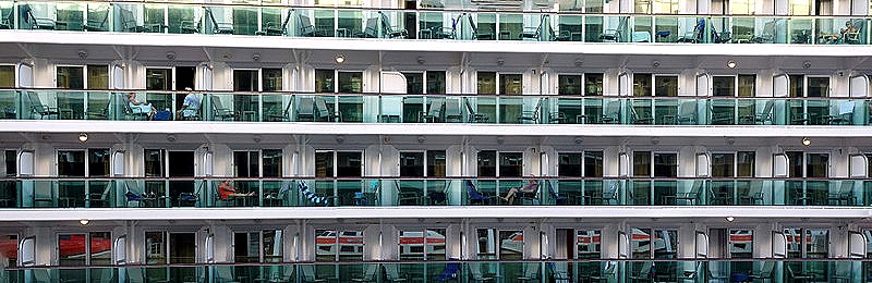
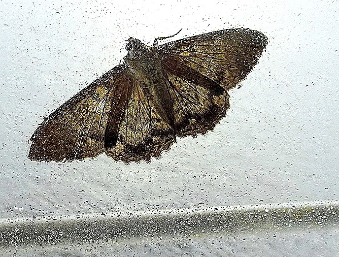
     As an aside, because our veranda was smack up against tender/life boat #11 we had in interesting view of the lowering and raising of the tenders.  Below is a picture of the opened tender cranes after the boats are in the water, taken through the rain spotted glass under the rail across our veranda.  Below that is a view of the tender boats stored in their raised position along the ship and the same view after they are lowered into the sea, showing the walking deck below.  We had never been in quite that position before.
DSC03341DSC03323DSC03322

Macapa, Brazil

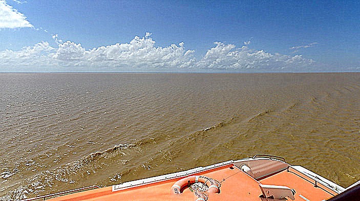
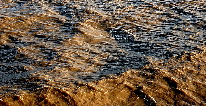
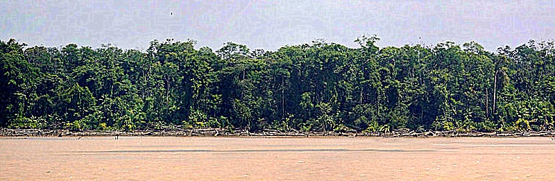
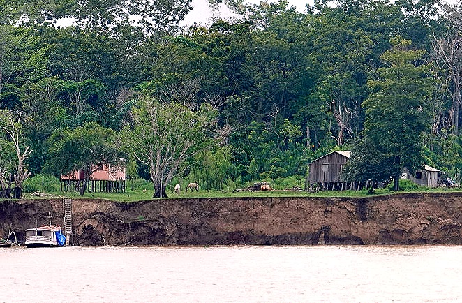
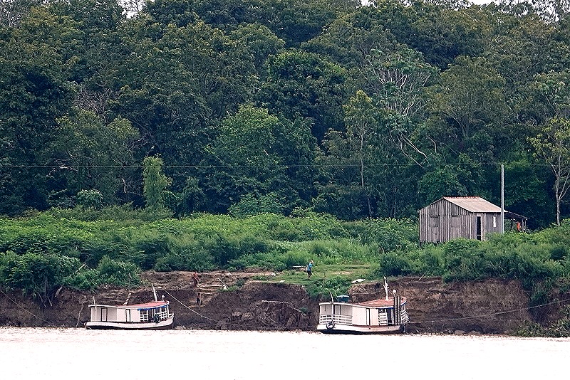
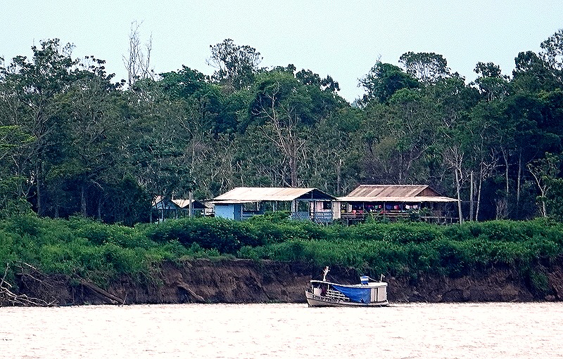
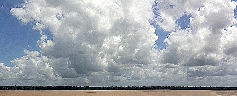
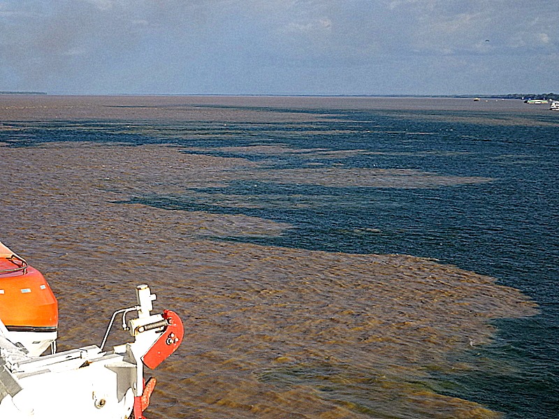
     The morning of January 11 found us anchored in the Amazon near Macapa, Brazil.  We had crossed the Amazon Bar (where the river meets the ocean) the day before.  There is a dispute whether the Amazon or the Nile is the longest river in the world, but there is no dispute that the Amazon is the biggest in every other way, particularly volume of water.  The river is spectacularly wide; in fact there is an island the size of Switzerland situated near its mouth.  Sailing this river is quite beautiful and varied, with wonderful cloud formations and many different looking villages and isolated houses along its shores.  Mary noted that whoever christened the Mississippi “The Big Muddy” must not have been here, because the Amazon is much bigger and much muddier than the Mississippi.

     The water in the Amazon is historically low this year because of drought throughout the Amazon basin.  This has killed many wildlife, including more than a hundred of the endangered pink dolphins that live here, whose bodies have washed up on shore.  It has also made navigating the river, always a challenge for ocean going ships, much more perilous and a number of them have cancelled Amazon trips.  Although it has double the passenger capacity of the Prinsendam, in which we have cruised the Amazon before, we are told that Zuiderdam has a shallow enough draft to make it through the river with an expert pilot on board.   We picked up three pilots in Macapa, we understand, and will have replacements come aboard several times, kind of like the old Pony Express I guess.  The captain said that the most valuable thing on board the ship right now is the pilots’ paper charts, which show which areas are too shallow and which are still deep enough for Zuiderdam to sail through.

      Although Macapa is a large city of more than 500,000 people, this was not actually a port stop.  No one was allowed off the ship to explore the city.  This stop, only a few hours long, was designated a “service stop” to enable the ship to complete Brazilian paperwork (we know a little about how that can be from our visa fiasco), be inspected by Brazilian officials, and board the pilots.  You would never know this was a big city from the ship’s anchorage, however, because all of it but a small dock was obscured by forest.  In addition to the dock we saw the pilot boats that brought the Brazilian officials and the pilots, one with scaffolding an a raised platform for a pilot to safely jump from the ship.

DSC03325DSC03330DSC03326DSC03335DSC03328

     It was too bad we couldn’t go ashore because this is one of a handful of cities in the world that the Equator runs through.  There is a tall monument marking the spot, called “Marco Zero,” with a line from the monument to the local soccer stadium where it becomes the center line on the field.  When we had a service stop here in 2019 we couldn’t see Marco Zero from the ship but we were anchored much closer to the center of town so that it actually looked like a city.  The different anchorage is probably attributable to the much lower water level.  You can see our 2019 stop here:

https://baderjournal.com/2019/12/02/three-days-at-sea-2019/

     The rest of the day was basically a sea day (or river day) as we continued our journey up the scenic but muddy Amazon.


Third Voyage Around The World, in 2024

    On January 3, 2024, we set sail from Ft Lauderdale on an epic 128 day voyage around the world, scheduled to return to Ft Lauderdale on May 11.  We are sailing on the Holland America ship Zuiderdam which has a passenger capacity of more than 1900.  This is much larger than any ship on which we have taken a long voyage before, but we are told that only a little more than 1200 passengers are actually on board.  This will certainly make the ship less crowded but it’s still pretty big for our tastes and we are still trying to remember where everything is located two days later as I write this. 

zuiderdam_hal.jpg-topaz-enhance-6x-sharpen     We joined this voyage primarily because its itinerary was so good for us, sailing to a number of interesting places we have never been, including Japan, China, India & Hawaii.  So far we have had two itinerary changes before sailing, with three Israeli ports cancelled after war broke out there on October 7, and a reversal of our port stops in China that would enable many of us to visit those cities without obtaining a Chinese visa.  As of today, here is our scheduled itinerary, first a map and then a list of port stops (the flaming round map icons denote overnight stops and the moon icons denote late night departures):2024 World Cruise map (revised 11-18-2023)   

 Day         Date          Itinerary                                                Arrival      Departure


 WED         03JAN24          Sail from Fort Lauderdale, Florida, US                         5:00pm


 SUN         07JAN24          Scarborough, Trinidad and Tobago        8:00am           5:00pm


 TUE         09JAN24          Devils Island, French Guiana                  8:00am           5:00pm


 THU        11JAN24          Macapa, Brazil                                       6:00am           11:00am


 FRI         12JAN24          Alter Do Chao, Brazil                              11:00am          6:00pm


 SAT        13JAN24          Boca da Valeria, Brazil                             7:00am           2:00pm 


  SUN      14JAN24          Manaus, Brazil                                         8:00am           5:00pm


  MON     15JAN24          Parintins, Brazil                                       10:00am          6:00pm


 TUE       16JAN24          Santarem, Brazil                                       8:00am           5:00pm


 SAT        20JAN24          Saint Georges, Grenada                           8:00am           5:00pm


 MON      22JAN24          Willemstad, Curacao                                8:00am           6:00pm


 WED      24JAN24          Panama Canal                                           5:00am           5:00pm


 FRI        26JAN24         Quepos, Costa Rica                                    7:00am          4:00pm


 MON     29JAN24         Manzanillo, Mexico                                   12:00n          9:00pm


 TUE      30JAN24         Puerto Vallarta, Mexico                               8:00am          5:00pm


 TUE      06FEB24         Kona, Hawaii, US                                         10:00am         8:00pm


 WED     07FEB24         Hilo, Hawaii, US                                            8:00am          5:00pm


 THU     08FEB24         Honolulu, Hawaii, US                                    7:00am          11:00pm


SUN      18FEB24         Guam (US Territory), Guam                           8:00am          5:00pm


MON     19FEB24         Saipan, Northern Mariana Islands                  8:00am          5:00pm


 FRI       23FEB24         Ishigaki Island, Japan                                    7:00am          5:00pm


SAT       24FEB24         Naha, Japan                                                  7:00am


SUN       25FEB24         Naha, Japan                                                                        11:00pm


 WED      28FEB24         Tokyo, Japan                                                  8:00am

 THU      29FEB24         Tokyo, Japan                                                                       6:00pm


 FRI       01MAR24         Omaezaki, Japan                                          7:00am          5:00pm


SAT      02MAR24         Kobe, Japan                                                    9:00am


SUN      03MAR24         Kobe, Japan                                                                        5:00pm

 MON    04MAR24          Scenic Cruising Kanmon Strait


 TUE      05MAR24          Fukuoka (Hakata), Japan                               7:00am          4:00pm

THU      07MAR24          Shanghai, China                                            8:00am

 FRI       08MAR24          Shanghai, China                                                                 5:00pm


 SUN     10MAR24          Dalian, China                                                  8:00am          5:00pm


 MON    11MAR24          Tianjin (Beijing), China                                    8:00am


 TUE     12MAR24          Tianjin (Beijing), China                                                         6:00pm


 SAT     16MAR24          Hong Kong, China                                           8:00am


 SUN     17MAR24          Hong Kong, China                                                                3:30pm


 TUE     19MAR24          Da Nang (Hue), Vietnam                                 8:00am             11:00pm


 THU     21MAR24          Phu My, Vietnam                                           6:00am               6:00pm

 SAT     23MAR24          Singapore                                                       8:00am


 SUN     24MAR24          Singapore                                                                                5:00pm

 THU    28MAR24          Colombo, Sri Lanka                                         8:00am              11:00pm


 SUN    31MAR24          Mumbai (Bombay), India                                  6:00am


 MON   01APR24          Mumbai (Bombay), India                                                             5:00pm


 THU    04APR24          Fujairah, United Arab Emirates                        8:00am                6:00pm


 FRI      05APR24          Dubai, United Arab Emirates                           7:00am                11:00pm


 SAT    06APR24          Abu Dhabi, United Arab Emirates                    8:00am                 11:00pm


 MON   08APR24          Muscat, Oman                                               8:00am                    6:00pm

 WED    10APR24          Salalah, Oman                                               8:00am                    5:00pm

 MON    15APR24          Sharm el Sheikh, Egypt                                7:00am                    8:00pm


TUE      16APR24          Aqaba (for Petra), Jordan                               6:00am                  8:00pm

 THU     18APR24          Suez Canal                                                   6:00am                  6:00pm


 SAT      20APR24          Rhodes, Greece                                            8:00am                   9:00pm


 SUN      21APR24          Bodrum, Turkey                                           8:00am                   6:00pm


 MON     22APR24          Kusadasi (Ephesus), Turkey                         8:00am                    6:00pm


 TUE       23APR24          Cruising The Dardanelles


 TUE       23APR24          Istanbul, Turkey                                          4:00pm


 WED      24APR24          Istanbul, Turkey                                                                        4:00pm


 THU      25APR24          Mykonos, Greece                                      11:00am                   11:00pm


 FRI        26APR24          Piraeus (Athens), Greece                            7:00am                     5:00pm


 SUN      28APR24          Naples (Pompeii/Amalfi), Italy                    8:00am                    7:00pm


 WED      01MAY24          Malaga, Spain                                           7:00am                    5:00pm

 SAT      04MAY24          Ponta Delgada, Sao Miguel, Azores,           8:00am                    5:00pm


SAT      11MAY24         Debark Ship Fort Lauderdale                        7:00am

     The itinerary for this voyage has been uncertain from the beginning and we are still not sure how it will turn out. Notably:

Brazil:  When we first visited Brazil in 2012 we purchased a visa that lasted 10 years.  We visited again in 2019, when our visa would still have been good but Brazil had eliminated visas for US citizens.  Earlier this year they announced they were reinstating a visa requirement for Americans at the beginning of 2014, about a year after our old visa, unused since 2012, ran out.  The new visa requirement was to start for people entering Brazil on January 11, 2024 . . . the day we would arrive (coincidence? We wonder).

     The date on which they would accept visa applications was delayed from early October until about a week into December, less than a month before we were to depart.   This created a lot of pressure on passengers because we were told, repeatedly, that no one would be permitted to board the ship on January 3 without a Brazilian visa, thus putting the entire voyage in doubt for anyone who didn’t obtain a visa by then.  And, of course, obtaining a visa turned out to be excruciatingly difficult.  After filling out their form each of us had to upload a picture of ourself and of our picture passport page, in specified format with vague sizing requirements.  We had to upload a copy of our Airline itinerary to and from Brazil (they later agreed to accept our ship itinerary) and a bank statement showing the names of the bank and the account holder and transactions for the last month demonstrating that we have at least $2,000 (ie. enough to get home again).  The reviewing process was very slow (sometimes more than a week or even two) and arbitrary, since different demands for reuploading unaccepted documents were issued.  Often no explanation was given about what was wrong with the initial document provided and there was no one you could contact for explanation or assistance.  And remember, with the departure date fast approaching, the entire cruise was in jeopardy.

       Was anybody nervous?  You bet!  Shortly before Christmas Holland America announced that no one would be denied boarding for lack of a visa after all and if Brazil wouldn’t accommodate us they would change the itinerary to skip Brazil.  Then about a week later, as we were preparing to leave, HAL announced that Brazil had agreed that the ship could sail up the Amazon so long as passengers without a visa did not leave the ship.  So at least no one was going to miss the entire cruise.  Rick’s evisa finally arrived in his inbox the day before we sailed and Mary’s came today, three days into the voyage.  We understand that about half the passengers hadn’t received visas by the time we sailed.  Then yesterday Brazil announced that they were postponing the visa requirement for three months (what they should have done in the first place).  So now everyone is free to visit the Brazilian ports (assuming we will be able to sail up the Amazon, which is suffering from a historic drought that kept some ships from visiting it a month or so ago).  All we are out, therefore, is the $160 we paid for a Brazilian visa we probably will never need (no refunds, at least so far).  That is not counting any health effects of a month of unnecessary tension for a bunch of people who are no longer as young as they once were.

The Red Sea:   As I mentioned above, we originally had three stops in Israel that were changed in October.  But we have no idea what may happen when we arrive at the southern entry to the Red Sea in April.  The war in Israel continues, ships are avoiding the Red Sea and Suez Canal because some are being attacked with missiles and drones from Yemen, the US is threatening the Houthis in Yemen with military force if they don’t stop doing that, and Iran has reportedly sent war ships to the Red Sea and the Mediterranean.  By April this may all be over, or it may have spread into a wider conflict shutting down the Red Sea.  If the Red Sea is not open for cruise ships it seems we will have to be redirected around Africa, missing the Mediterranean portion of this itinerary.  That would be pretty drastic and disappointing to us, first because it would mean more and wider suffering for the people in the region, but also because we visited most of the ports in Africa last year and were looking forward to some of the stops in the Mediterranean.  Still, such a drastic alteration of a world cruise is not unprecedented:  in 2020 HAL’s world cruise was aborted in Australia at the beginning of the COVID pandemic and passengers had to leave the ship in Perth and find a flight home from there.  It was more than half a year before they saw their luggage again.  So detouring around Africa wouldn’t be the worst that can happen (while being hit by a missile in the Red Sea would be).  Obviously, we are hoping it doesn’t come to that.

     Anyway, however it goes we intend to enjoy this voyage.  We have a lot of great experiences planned and life aboard the ship is also enjoyable (unless you really enjoy washing dishes, making beds and doing laundry, which is all done for us here).  Some people post to their blogs every day, it seems, but we don’t know how they do it.  Blog writing can only be done on sea days and each episode seems to take us a long time to compose.  Our main goal in this blog is to create a record of what we have done and seen on our travels that will serve as a diary/photo album, allowing us to look back on them and remember what we have experienced.  So the permanent product is more important to us than keeping up with daily events.  The result is that our postings will fall further and further behind the ship’s actual progress and we will not finish blogging this journey until months after we return. 

     If you are interested in following where we and the Zuiderdam are at any particular time you can see it on this page:

https://www.seascanner.com/ships-position-zuiderdamr

    If you would like to receive an email when a new episode is posted to this blog there is a link where you can subscribe at the very bottom of this page.  Because episodes will, at best, be posted intermittently on fairly random dates (on Grand Africa nothing was posted before we returned), and this blog is old-fashioned and not well indexed, subscribing is probably the easiest way to follow it.  If you have subscribed in the past I don’t think you have to do it again (unless your email has changed).

     If you click the “About” button at the top of this page you will learn more about this blog than you probably want to, including past voyages that are included here.

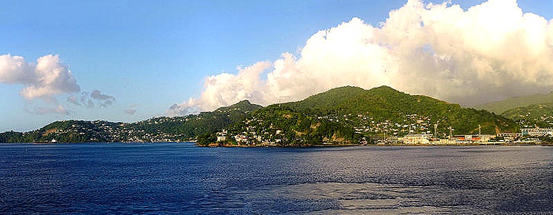
     So that’s it for now.  If you see this you will know that we were able to upload to our blog site (this didn’t work at all on our Grand Africa voyage last year).  If you don’t, then nothing I say here will matter.  We will leave you with two pictures.  The first is us (on the left) with our friends Bill, Robert, Judy and Bob at dinner on the first night of the cruise.  We all met during our first world cruise in 2016 when HAL threw us together to share a dining table, along with our friend Lee.  All seven of us travelled together again on a world cruise in 2018.  Only six of us are together this time, but only because Lee died during the 2018 voyage; otherwise we are sure he would have been here.  The second picture is our first glorious Caribbean sunset.  See you next time.
IMG_7755

DSC03270_stitch

San Juan, Puerto Rico (USA) 2022

     “It was a dark and stormy night . . . .”  How many works of fiction start like that?  Well, this isn’t a work of fiction and it was morning rather than night when we sailed into San Juan’s harbor on December 17, but the rest of that phrase applied.  We got up early in the hope of seeing the sail in past the fort of El Morro that is supposed to be a good one.  But the captain double-crossed us by arriving about a half hour before the scheduled time.  So we missed it, getting out on deck only after we were well into the harbor.  It was pretty dark still and rainy and overcast, so we probably wouldn’t have seen much anyway (those grapes were probably sour anyway, right?).

     We have been to San Juan a few times, most recently on the 2018 world cruise.  On that occasion we were docked right by the old town, where you could step off the ship and walk into town.  You can see that visit, and read more about San Juan, here:

https://baderjournal.com/2018/09/12/san-juan-puerto-rico-usa/

This time we were docked quite a distance away so that we had to take a shuttle bus to get into town.  Here is what it looked like from there.

13a.  San Juan, Puerto Rico_stitch-topaz-enhance-faceai10a.  San Juan, Puerto Rico_stitch-topaz-sharpen

     It rained off and on for most of the morning and a lot of passengers decided to spend the day on the ship.  But not us!  Carrying our umbrellas we ran through the rain to the shuttle bus and boarded for the lengthy trip into old town.  The old town is built on a fairly steep hill up from the waterfront and the shuttle dropped us off in Columbus Square, a little way up.  We walked around that delightful neighborhood for awhile, uncharacteristically gray from rain and overcast, and had to run for cover several times.

19.  San Juan, Puerto Rico-topaz-enhance17.  San Juan, Puerto Rico-topaz-enhance

18.  San Juan, Puerto Rico-topaz-enhance

     We walked over to the Parque de las Palomas (Park of the Pigeons).  The park sits on top of the old city walls where it was originally built in the second half of the 18th century as a gun emplacement.  Its name comes from all the pigeons that can usually be seen here (but not on the rainy day we visited) and the fact that part of this park is the only place were it is legal to feed pigeons in San Juan.  The park was closed for renovation in 2015 and after being damaged by Hurricane Maria in 2017 it did not reopen until May of 2022, about 7 months before we arrived.  A brick and stone wall lining the city side of the park has holes, like a dovecote, where the pigeons hang out.  There are some old gnarled looking trees, colorful decorations and a killer view of the bay over the top of the city wall that must be even more spectacular when the sun is out.  There were pigeons in residence but nothing like the huge crowds of birds that can be seen here on nice days when local folks are out spreading corn meal for them to eat.  An arch was above the walkway in the park with a blue sign next to it:  “Please do not feed the birds beyond this point.”

22.  San Juan, Puerto Rico-topaz-enhance20.  San Juan, Puerto Rico-topaz-enhance23.  San Juan, Puerto Rico-topaz-enhance24a.  San Juan, Puerto Rico_stitch-topaz-enhance33.  San Juan, Puerto Rico-topaz-enhance26.  San Juan, Puerto Rico-topaz-enhance28.  San Juan, Puerto Rico-topaz-enhance29.  San Juan, Puerto Rico-topaz-enhance-faceai30a.  San Juan, Puerto Rico_stitch-topaz-enhance-sharpen

     Leaving the park we headed up to the top of the hill where we walked along the cobblestone street past the Cathedral of San Juan Bautista (the city’s namesake) to the statue of the conquistador Ponce de Leon, who founded the city in the early 16th century.  The statue is in a park next to a church called Iglesia de San Jose, built shortly after the city was founded, where Ponce de Leon’s body was interred for almost 300 years before being moved to the cathedral.

38.  San Juan, Puerto Rico-topaz-enhance40.  San Juan, Puerto Rico-topaz-enhance-sharpen32b.  San Juan, Puerto Rico_stitch-topaz-enhance

     Finally getting our bearings we realized that El Castillo San Felipe del Morro, the fort we primarily wanted to visit today, was actually in the opposite direction.  So we walked back along the soggy streets a good way until we finally spotted it.

42a.  San Juan, Puerto Rico_stitch-topaz-enhance

    San Juan was a very valuable city for the Spanish, known as the “key to the Antilles.”  So they built several fortifications to defend it from attack.  The two largest forts in old San Juan are Fort San Cristobal, built in the 16th and 17th centuries, and El Morro, first constructed in 1540.  We explored San Cristobal when we were last here in 2018 so this time we decided to visit El Morro, which we had once visited many years ago.

     El Morro is built on an imposing spot, on a high rocky promontory (which is what el morro means) at the entrance to the bay.  It was originally just a round tower with four cannon, but by the end of the 18th century it looked pretty much as it does today.  It held off repeated attacks by the British and Dutch and in 1898 the Americans attacked the fort three times, but took over only after Spain ceded Puerto Rico to the US at the end of the Spanish American War.  It was transferred from the military to the National Park Service in 1961 and restored mostly to its appearance during Spanish rule.

     We entered through the front gate passing what used to be a moat and were given a booklet with our free admission.  Admission to this fort is $10 for each adult, but if you have a National Parks Service Senior Pass it is free, so we saved $20.  We learned about this on our last visit to Puerto Rico when we had to pay full admission to Fort San Cristobal because we had left our Senior passes at home, forgetting that the last stop on our world cruise was actually in the United States where that pass would be honored.  I guess we are not yet too old to learn a new trick.

47a.  San Juan, Puerto Rico_stitch-topaz-enhance

    We walked around the main courtyard and looked at the museum exhibits inside the rooms there.  Then we climbed up to the top of the walls, which are some 18 feet thick.  At the corners of the walls are turrets called garitas that were used as sentry posts and sea watchtowers.  From the walls was a nice view of the city beyond the large grassy open space in front of the fort.  This open space had been a defensive feature, providing a vast area without shelter that any enemy attacking by land would have to cross under heavy fire from the fort.  When the American military occupied the fort after the Spanish American war they built recreation facilities there, including a baseball field and a golf course.

50.  San Juan, Puerto Rico-topaz-enhance-sharpen72.  San Juan, Puerto Rico63.  San Juan, Puerto Rico62.  San Juan, Puerto Rico69a.  San Juan, Puerto Rico_stitch

     The gray tower visible over the top of the fort’s walls is a lighthouse.  It was first built in 1846, making it the oldest lighthouse in Puerto Rico, but it became unusable after American naval bombardment in May of 1898 during the Spanish American War.  The Americans had it up and running less than a year later but in 1905 it developed a dangerous crack and had to be replaced with the current tower.   When we visited the lighthouse was closed and fenced off, perhaps for more repair and renovation.

75a.  San Juan, Puerto Rico_stitch66.  San Juan, Puerto Rico20221217_141124-topaz-enhance-faceai

     On the ocean side of the fort was a triangular extension on a lower level that once contained cannon emplacements (I’m pretty sure each of the circular markings was for one cannon).  This must have been a formidable barrier for any hostile ship trying to turn this corner to enter the bay.  The surf was vigorous on the rocky promontory and there was a long island with palm trees in the distance.

55a.  San Juan, Puerto Rico_stitch-topaz-enhance60.  San Juan, Puerto Rico-topaz-enhance61.  San Juan, Puerto Rico77a.  San Juan, Puerto Rico_stitch83.  San Juan, Puerto Rico65.  San Juan, Puerto Rico

     We left the fort and headed back into town to find somewhere for a late lunch.  Because of the intermittent rain we wanted to eat and, more importantly, sit down inside.  We ended up having two generous plates full of delicious empanadas at a small place called La Danza.  We were seated at a nice table in an open doorway on a side street, which was blocked off for some reason and guarded by police.  With the rain outside not quite hitting our table it was a very pleasant place to eat and relax after a lot of walking on wet and uneven surfaces. 

     Then, a bonus!  looking across the side street from our seats in the open door we spotted a sign on the wall for Anita’s gelato place.  Jeremy, our cruise and travel director, had raved about this gelato place during his port talk so we decided to have dessert there.  And boy was Jeremy right!  We have had gelato in a lot of cities around the world but this was certainly one of the best.  Not only was the gelato really good but they dished it out very generously.  Only in New Zealand can we recall them packing more gelato into a single scoop.  Its fun to watch them keep adding more after your cup or cone already looks more than full.  We have never seen anything like that in the US before.

20221217_121756-topaz-enhance88.  San Juan, Puerto Rico84a.  San Juan, Puerto Rico_stitch87.  San Juan, Puerto Rico90.  San Juan, Puerto Rico91a.  San Juan, Puerto Rico_stitch

     It turned out we had inadvertently come full circle.  At the end of the street our restaurant was on we saw the Capilla del Cristo, a small chapel built in the 18th century.  Legend has it that during a horse race one rider lost control and went over the wall.  A bystander invoked the deity to save him and although the horse died the rider lived.  This chapel was reputedly built as a monument to this miracle.  The chapel is only open one day a week and it wasn’t the day we were there, so we weren’t able to see the inside.  But the left side of the chapel in the picture below is also one side of the Parque de las Palomas we had visited in the morning and a number of the park’s denizens were perched on top under a dull gray sky.  We walked on toward the shuttle bus stop, stopping for a while in a small park full of flowers where we talked to our daughter on the phone (easy since this was in the US).  The bus was waiting when we arrived and took us back to the ship.

96.  San Juan, Puerto Rico97.  San Juan, Puerto Rico98.  San Juan, Puerto Rico102.  San Juan, Puerto Rico99.  San Juan, Puerto Rico103.  San Juan, Puerto Rico105.  San Juan, Puerto Rico

101.  San Juan, Puerto Rico

     Thus ended our voyage around Africa, since San Juan was our last port before disembarking in Ft Lauderdale on December 20.  It was a fascinating and eye opening journey with many new and different areas and peoples to see and meet.  It had its downside (particularly the time in quarantine) but overall it was well worth doing, with many experiences we will long remember.

     But before we leave it should be recalled that one of the downsides to this trip was the timing, getting us home (after a two day drive) on December 22, just two nights before Christmas Eve, with no time to prepare our usual family activities.  The ship’s crew began decorating the ship for Christmas shortly before we left the continent of Africa, however.  There were decorations all over, but Christmas Central was in the atrium with a large display that took about four days for them to complete.  And when we arrived home we still had the best part of the Christmas season, spending several days with our family and watching our usual Christmas fare together on TV, primarily that old Christmas favorite the original Star Wars trilogy on Christmas day.  So we will leave this episode of the blog and the entire voyage with a few Christmas pictures from the ship’s atrium.

95a.  Mindelo, Cabo Verde_stitch-topaz-enhance98.  Mindelo, Cabo Verde-topaz-enhance-sharpen99.  Mindelo, Cabo Verde-topaz-enhance91.  Mindelo, Cabo Verde-topaz-enhance-faceai100.  Mindelo, Cabo Verde-topaz-enhance-sharpen91a.  Mindelo, Cabo Verde_stitch-topaz-enhance-faceai

Mindelo, Cabo Verde 2022

     The morning of December 11 dawned for us in Porto Grande Bay in Mindelo, another city in Cabo Verde.  Founded in 1793 by the Portuguese, the town was named Mindelo in 1838 to commemorate a successful military landing near Porto during the Portuguese Liberal War.  Its population is around 70,000, accounting for most of the population of the island of São Vicente.  As a long voyage starts coming to an end one begins to tire of long excursions (particularly on a bus) so unless there is something we really want to see we tend toward just walking around the port city on our own.  We had never been to Mindelo so this seemed a good plan here, a relaxing walk around the town.  We set out on the shuttle bus with our friends Robert and Bill to get a feel for the city. 

IMG_8853-topaz-enhance-faceai-gigapixel-very_compressed-scale-6_00xIMG_8855-topaz-enhance-faceai-gigapixel-very_compressed-scale-6_00x1.  Mindelo, Cabo Verde-topaz-enhance-faceai

     The Portuguese discovered this island around 1460 and its discovery is attributed to Diogo Afonso, one of the explorers sponsored by Henry the Navigator.  A large statue of him sits on the waterfront facing the bay.  Also near the waterfront, located in a traffic circle, is a tall sculpture of an eagle on top of what looks like a tower of rocks.  In 1922 the aviators Sacadura Cabral and Gago Coutinho made the first air crossing of the South Atlantic, flying in several stages (with 3 different planes) from Lisbon to Rio de Janeiro. The trip, to commemorate the 100th anniversary of Brazil’s declaration of independence, took almost 3 months because of having to ditch and replace their plane several times on the way,  Their last stops before crossing the ocean were in Mindelo and Praia, Cabo Verde.  The eagle sculpture was erected on the 76th anniversary of their flight, which would have been 1998.

11.  Mindelo, Cabo Verde-topaz-enhance-sharpen44.  Mindelo, Cabo Verde-topaz-enhance45.  Mindelo, Cabo Verde-topaz-enhance23.  Mindelo, Cabo Verde-topaz-enhance

     We visited a souvenir store in an art gallery down the way where we learned about Cabo Verde’s favorite folk singer, Cesária Évora, known as the “Barefoot Diva.”  A native of Mindelo, the airport is named after her.  We walked further down the street to where the library was located, according to Mary’s research.  The three story building was there but it was closed up tight and it took us a while to find a small sign, not on the front.  We hope it wasn’t closed for good.  On the back was a building sized wall painting of Cesaria Evora (photo rather blurred but you get the idea).

2a.  Mindelo, Cabo Verde_stitch-topaz-enhance4.  Mindelo, Cabo Verde-topaz-enhance5.  Mindelo, Cabo Verde-topaz-enhance-sharpen

     The Tower of Belem was built in Lisbon in the late 16th century on the Tagus River to defend the city, and it also served as the departure and return port for Portuguese explorers.  A three story replica of that tower sits on the waterfront in Mindelo.  Opened in 1921, it now houses Mindelo’s sea museum and has a nice view from the top.  We didn’t know about that when we visited, but here are some pictures of the outside.

63.  Mindelo, Cabo Verde-topaz-enhance7.  Mindelo, Cabo Verde-topaz-enhanceIMG_8862-topaz-enhance-faceai-gigapixel-very_compressed-scale-6_00x

     The Pro-Cathedral of Our Lady of the Light was built in 1862 and is one of the oldest buildings in town.  As we understand it, a pro-cathedral is a parish church that temporarily plays the role of a cathedral in a diocese that doesn’t have one.  It is smaller than most actual cathedrals but was expanded in recent years so that only the facade is original.

40a.  Mindelo, Cabo Verde_stitch-topaz-enhance20.  Mindelo, Cabo Verde-topaz-enhance41.  Mindelo, Cabo Verde-topaz-enhance

     Not far from the church was a delightful souvenir store, brightly painted inside and out, called IstanBlue.  Another building had an interesting painted door and there were trees and flowers in the neighborhood as well.

38a.  Mindelo, Cabo Verde_stitch-topaz-enhance19.  Mindelo, Cabo Verde-topaz-enhance-faceai42c.  Mindelo, Cabo Verde-topaz-enhance-faceai_stitch17.  Mindelo, Cabo Verde-topaz-enhance24a.  Mindelo, Cabo Verde_stitch-topaz-enhance27.  Mindelo, Cabo Verde-topaz-enhance18.  Mindelo, Cabo Verde-topaz-enhance-faceai32.  Mindelo, Cabo Verde-topaz-enhance33.  Mindelo, Cabo Verde-topaz-enhance

    Originally opened in 1874, with a second floor added in 1934, is the bright pink Palacio do Povo (People’s Palace).  Originally intended to house the government if the capital of Cabo Verde was moved to Mindelo (it wasn’t), this striking building now contains a museum space.

28a.  Mindelo, Cabo Verde_stitch-topaz-enhance34a.  Mindelo, Cabo Verde_stitch-topaz-enhance

     Our last stop was at an open air market where vendors were selling clothes, crafts and souvenirs.  Some were set up inside a covered area and others had their wares spread out on the ground.  There were interesting items to be had and at very reasonable prices.  After that we walked back to the shuttle bus stop to return to the ship.  All in all we really hadn’t strayed too far from the waterfront where the bus let us off.

  15.  Mindelo, Cabo Verde-topaz-enhanceIMG_8868-topaz-enhance-faceai-gigapixel-very_compressed-scale-6_00x

     This being our last African port there was a sail away party on the aft deck with the very good Ocean Bar band playing rock music.  It was nice out except for a very strong wind.  To our left in the port was what looked like a huge rock emerging from the water to form an island called Ilheu dos Passaros.  On top of the dark rock island was a white structure leading from the top to half way down.  This turned out to be the Farol de D. Luis, a lighthouse.  We were gone by the time the sun set so we didn’t see it lighted up but we understand that the light is right at the top of the rock with a small 15 foot tower and a white stairway down to the keeper’s house halfway down.  The lighthouse was built in the early 1880’s and named for the then king of Portugal.  Also to our left on top of a tall hill was the Fortim d’El Rei, a fort built in 1852 to defend the Porto Grande Bay and the city.  Its military use ended in 1930 and it has since fallen into disrepair from neglect.  We saw this fort from the shore in town as well.

76.  Mindelo, Cabo Verde-topaz-enhance-faceai80.  Mindelo, Cabo Verde-topaz-enhance-faceai56.  Mindelo, Cabo Verde-topaz-enhance84.  Mindelo, Cabo Verde-topaz-enhance-sharpen10.  Mindelo, Cabo Verde-topaz-enhance50a.  Mindelo, Cabo Verde_stitch-topaz-enhance-sharpen

     Very near our ship on our left was the Mein Schiff Herz, a German cruise ship.  We waved back & forth.  We had some very nice views of the harbor and the city as we prepared to leave.

52a.  Mindelo, Cabo Verde_stitch-topaz-enhance-sharpen66.  Mindelo, Cabo Verde-topaz-enhance57a.  Mindelo, Cabo Verde_stitch-topaz-enhance-sharpen67a.  Mindelo, Cabo Verde_stitch-topaz-enhance

     As we sailed away from Mindelo after a very nice day in our last foreign port there were some memorable vistas in the fading sunlight.

85a.  Mindelo, Cabo Verde_stitch-topaz-enhance87.  Mindelo, Cabo Verde-topaz-enhance88.  Mindelo, Cabo Verde-topaz-enhance