Latest

Aqaba, Jordan (Day 1)–Wadi Rum 2022

     We arrived in the port of Aqaba, Jordan, early in the morning of October 30 for an overnight stay.  This seaport on the Red Sea is Jordan’s only sea outlet.  If you have seen Lawrence of Arabia you probably know that one of the key moments in the Arab uprising against the Turks during World War I was the capture of this town.  It was a much smaller town then and because it was backed by a large desert all of its guns were pointed toward the sea, from which any attack was expected to come.  But the Arabs and Lawrence instead endured a punishing trek across the desert from Wadi Rum to attack from the land side & took the town easily.  Wadi Rum, from which this attack originated, was where we were going today.  Actually, we were on an overnight excursion in which the first day would be spent in Wadi Rum and the second in the ancient city of Petra.  This was our second visit to Aqaba and to Wadi Rum & Petra, although in our first visit we explored both areas in a single exhausting day; you can read a lot more about Wadi Rum there:

https://baderjournal.com/2016/05/16/aqaba-jordan-petra-wadi-rum/

    Our excursion met on the ship then we rode in a bus to Wadi Rum.  Flying above Aqaba as we left town was a Jordanian flag on a skyscraper sized flagpole that is one of the largest in the world.  The drive to Wadi Rum took us through some rugged mountains and past some small hardscrabble villages.

IMG_68451.  Aqaba (Wadi Rum)3.  Aqaba (Wadi Rum)12.  Aqaba (Wadi Rum)

13.  Aqaba (Wadi Rum)18.  Aqaba (Wadi Rum)20.  Aqaba (Wadi Rum)

     Wadi Rum is run by Bedouins; only they can drive you through in an open deck truck & no outside guides are permitted.  Therefore, at the entrance to the area we had to leave our bus and climb into the back of an open bed truck that had bench seats for three people along each side.  The step up to the truck bed was quite tall; one of our Bedouin guides found a concrete block to carry with us that could be put on the ground to serve as a step up (still pretty challenging for some folks).  Leaving the entrance we drove out across the desert, past beautiful mountains and rock formations.

25a.  Aqaba (Wadi Rum)_stitch21.  Aqaba (Wadi Rum)IMG_686527a.  Aqaba (Wadi Rum)_stitch22.  Aqaba (Wadi Rum)29.  Aqaba (Wadi Rum)30a.  Aqaba (Wadi Rum)_stitch40a.  Aqaba (Wadi Rum)_stitch

     Wadi Rum has been inhabited for more than 10,000 years, during which it has been a crossroads for camel caravans.  There are some 25,000 petroglyphs in the area, many dating back that far.  We stopped at one of the petroglyph sites.  It is an interesting feeling, receiving a communication set down by someone living thousands of years in the past.

49.  Aqaba (Wadi Rum) - Copy50.  Aqaba (Wadi Rum)54.  Aqaba (Wadi Rum)

     This area was also a camel gathering place.  A number of folks leading camels stopped here, apparently for a rest since they weren’t trying to sell camel rides.  They kept coming and going while we were there. 

71.  Aqaba (Wadi Rum)59.  Aqaba (Wadi Rum)55.  Aqaba (Wadi Rum)56a.  Aqaba (Wadi Rum)_stitch-00158.  Aqaba (Wadi Rum)64.  Aqaba (Wadi Rum)60a.  Aqaba (Wadi Rum)_stitch63.  Aqaba (Wadi Rum)67.  Aqaba (Wadi Rum)69.  Aqaba (Wadi Rum)70.  Aqaba (Wadi Rum)75.  Aqaba (Wadi Rum)

     One thing new since our last visit was a series of tent camps in the desert.  We saw nothing like that in 2018.  They must have been built by entrepreneurial Bedouins. They look like interesting places to spend a night or two.

45.  Aqaba (Wadi Rum)77a.  Aqaba (Wadi Rum)_stitch

     We drove past a guy sandboarding in the desert, pulled by a truck.  It looked like fun.

82.  Aqaba (Wadi Rum)80.  Aqaba (Wadi Rum)84.  Aqaba (Wadi Rum)

    A couple of other stops took us to beautiful mountain and desert vistas.

85a.  Aqaba (Wadi Rum)_stitch93a.  Aqaba (Wadi Rum)_stitchIMG_687599.  Aqaba (Wadi Rum)90.  Aqaba (Wadi Rum)92.  Aqaba (Wadi Rum)123a.  Aqaba (Wadi Rum)_stitchDSC00138104a.  Aqaba (Wadi Rum)_stitch

     We stopped in the shadow of a mountain where our guides built a fire and prepared tea.  On a mountain across from us someone spotted some climbers about two thirds of the way up a stone mountain.  We found out later that climbing these mountains is a popular activity (for some folks).  Despite looking carefully through the camera zoom lens at the spot where we were told the climbers were, Rick was not able to see them (old eyes, I guess).  But he took some pictures of that area anyway and when we got home and enlarged them two climbers turned out to be in there.  Better yet, Robert got individual pictures of two of the climbers moving up the rocky face.127a.  Aqaba (Wadi Rum)_stitch112.  Aqaba (Wadi Rum)IMG_6951110a.  Aqaba (Wadi Rum)_stitch100.  Aqaba (Wadi Rum)IMG_6967IMG_6981121.  Aqaba (Wadi Rum)

     Our last stop in the desert was at a very large gift shop (yes, in the middle of the desert).  We didn’t buy anything, but it was impressive enough just that it was being operated out there.

132a.  Aqaba (Wadi Rum)_stitch130.  Aqaba (Wadi Rum)

     At this point we were driven to a large geodesic dome set up as a buffet restaurant where we had lunch.  It was a good lunch and a better view.

IMG_6882a134.  Aqaba (Wadi Rum)140a.  Aqaba (Wadi Rum)_stitch139.  Aqaba (Wadi Rum)20221030_113310-001136a.  Aqaba (Wadi Rum)_stitch

     After lunch we all piled back into the bus for the approximately 2 hour drive to Wadi Musa, the town at the entrance to Petra.  Musa is Arabic for Moses and this town was named after a spring that they say is where Moses made water flow from a rock for his thirsty people by hitting the rock with his walking stick.  On the way there we stopped at a large gift shop/cafeteria sitting on top of a cliff for a rest stop.  The bathrooms were down a couple of flights of steps and the wall across from them had a very large picture window with a pretty spectacular view of the surrounding mountains and desert.  Their sign said it is the best view in Jordan (or maybe it said in the world).  We don’t know about that, but it was pretty good.  Unfortunately there was some fog that obscured the view somewhat.

145a.  Aqaba (Wadi Rum)_stitch148a.  Aqaba (Wadi Rum)_stitch150a.  Aqaba (Wadi Rum)_stitch

     As mentioned above, Wadi Musa (Moses’s Valley) is supposed to be where Moses got water for his thirsty people from a rock (and got in trouble with God, but that’s another story).  Moses’s brother Aaron is said to have died not far away (I’m not sure whether before or after the water incident) and there is a shrine commemorating him on top of a nearby mountain that we drove past, although quite a distance away.  On the way there we passed shepherds herding sheep and goats.

154.  Aqaba (Wadi Rum)156.  Aqaba (Wadi Rum)

165.  Aqaba (Wadi Rum)-gigapixel-very_compressed-scale-4_00x

     Wadi Musa is built on a steep hill leading up from Petra.  We entered on one side and had to drive around the town near the top of the hill to find our hotel.  This was the newly opened Petra Moon Luxury Hotel and while we probably wouldn’t describe it as “Luxury” it was more than adequate.  It was the end of a very long and rewarding day and we were glad to get to bed after our buffet dinner, since we had to leave early in the morning for our walk down into Petra.

159.  Aqaba (Wadi Rum)169.  Aqaba (Wadi Rum)4a.  Aqaba (Petra)_stitch

Sharm el Sheikh, Egypt 2022

     October 29 found us in Sharm el Sheikh, a resort town at the tip of the Sinai Peninsula on the Red Sea.  We had booked a long excursion to St Catherine’s Monastery, several hours by bus each way into the central Sinai desert.  This is the oldest functioning Christian monastery in the world, in part because it is fortified, established in 565 by order of Roman Emperor Justinian I.  It sits at the foot of Mt Sinai on the spot where Moses is supposed to have seen the burning bush (a claimed descendant of which can still be seen there) and contains the oldest continuously operating library in the world, among other treasures.  So you can see why this sounded interesting, but upon learning that the monastery usually closes to visitors by noon and being told that our stop in port was barely enough for the round trip bus ride we decided to back out.  From what we heard it was a long and difficult bus ride with only about 45 minutes at the monastery and the scheduled restaurant meal and tour of a Bedouin town was cancelled for lack of time.  So we were glad we cancelled.

     We signed up instead for a HAL excursion to see the highlights of Sharm el Sheikh along with our friends and tablemates Peggy & Kay.  Until the last few decades there was nothing here but sand, water and a camp occasionally used by local fishermen.  The Israelis built a settlement called Ofira during their occupation of the Sinai Peninsula betweem the Six Day War in 1967 until the Egyptian Israeli peace agreement of 1979.  They built a hotel and a barracks for their troops, which was pointed out to us as the oldest building in town.

1.   Sharm el Sheik2.   Sharm el Sheik

     A natural diving and snorkeling wonderland with 25 coral reefs and more than 1,000 species of fish, the town really took off as a vacation hub after its repatriation to Egypt.  From 1982 to 2,000 it went from 3 resorts to more than 90, and from 16,000 nights of vacation bookings to more than 5 million.  With a current population around 70,000+ there was quite a bit of visible building activity still going on during our visit.  Sharm el Sheikh is also a favorite site for international conferences; the COP27 international climate conference was to begin here the week after our visit.  So there is plenty of hustle and bustle.  But its quick development to serve the international tourist trade has left it with an ambiance that is something of a cross between Las Vegas and Disney World.

     After it was returned to Egypt after the peace accords with the Israelis, Sharm el Sheik was designated by the government “The Peace City.”  The first stop on our city tour was to the Peace Icon Memorial, one of the largest metal artworks in the world, measuring more than 125 ft tall.  It depicts a lotus flower holding up eight wings with the world above.  Across the street from the parking lot is a gilded metal sculpture of a group of camels relaxing on the sidewalk.  Nearby were some palm trees . . . and some not palm trees (cell towers)>

5.   Sharm el Sheik4.   Sharm el Sheik55.   Sharm el Sheik (Mary)el Sheik (Mary)6.   Sharm el Sheik10a.   Sharm el Sheik_stitch

     Our next visit was to a Coptic church.  The Coptics are the Egyptian branch of the Greek Orthodox Church and we had never visited one of their churches before.  As with everything in Sharm el Sheikh, of course, this church is not very old although we don’t know when it was built.  The outside is a smooth beige in what appears to be concrete, with Greek crosses atop the domed roof and towers.There was a sculpture of a lion wearing a crown near the front entrance.

15a.   Sharm el Sheik_stitch67.   Sharm el Sheik (Mary) el Sheik (Mary)60.   Sharm el Sheik (Mary)el Sheik (Mary)

      A  large domed porch covered the church’s main entrance, the walls of which were covered with paintings.

57.   Sharm el Sheik (Mary)el Sheik (Mary)58.   Sharm el Sheik (Mary)el Sheik (Mary)

     The inside of the church is filled with elaborate decoration, wall and ceiling art as well as chandeliers and other objects.

20a.   Sharm el Sheik_stitch22.   Sharm el Sheik31a.   Sharm el Sheik_stitch30.   Sharm el Sheik66.   Sharm el Sheik (Mary) el Sheik (Mary)63.   Sharm el Sheik (Mary)el Sheik (Mary)64.   Sharm el Sheik (Mary) el Sheik (Mary)31.   Sharm el Sheik

     We stopped by a large bay called Ras Um Sid, which is supposed to be one of the best diving and snorkeling sites in the area.  We didn’t see much happening there (I guess it was mostly under the water), but there were people swimming in what looked like a private beach for a resort hotel.  The water here was very blue and clear, relatively shallow well out into the bay.

37.   Sharm el Sheik38.   Sharm el Sheik42.   Sharm el Sheik40a.   Sharm el Sheik_stitch

     We saw two large mosques in Sharm el Sheikh.  Al Mustafa Mosque is the older (2008) and larger (236 ft minarets) of the two, but unfortunately we did not get anywhere close to it.

12.   Sharm el Sheik

     We walked by the second, the Al Sahaba Mosque, which looks more like something from Disney World, with lots of carefully designed and rendered decorative details, than from the desert.  It was opened in 2017 and is the second biggest mosque in Sharm el Sheik.  Unfortunately it was closed so we couldn’t see the inside (not clear to us whether it is ever open to non-Muslim visitors).

44.   Sharm el Sheik_ShiftN48.   Sharm el Sheik49a.   Sharm el Sheik_stitch

     The mosque is situated next to the old market, a neighborhood with several streets of vendors and restaurants.  Most of the vendors had their wares displayed on the sidewalk and there was even a souvenir shop next to the mosque.  Some kind of event was being prepared in the park in front of the mosque, which included a camel made entirely from used soda cans.

47.   Sharm el Sheik53.   Sharm el Sheik54.   Sharm el Sheik

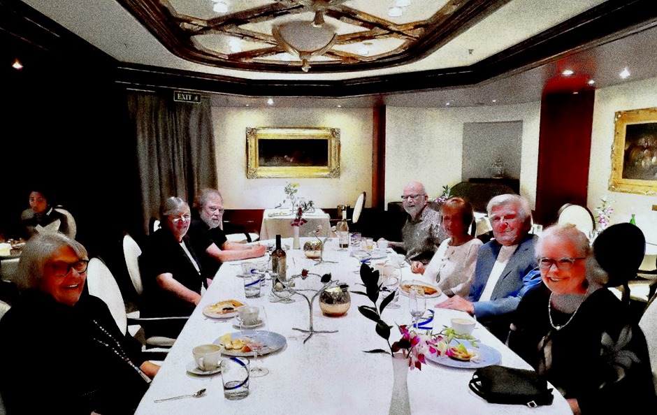
     Back on the ship, a group picture was made of the Table 65 inmates, a compatible and fun set of table mates.  And as we left Sharm el Sheikh we were favored with a dramatic sunset.

IMG_465168a.  Sharm el Sheik sunset_stitch

Suez Canal 2022

    We spent the day of October 28 transiting the Suez Canal.  We did this once before during the World Cruise in 2016, but that time we went from south to north. 

https://baderjournal.com/2016/05/19/suez-canal/

This time, of course, we sailed through it north to south, beginning in the Mediterranean at Port Said and exiting into the Red Sea at Suez.  Either way it’s a lot of sand!  There is a lot of information about the canal in the previous post linked above and I will try not to repeat much of it here.  Ships sail through the canal in convoys, two heading south and one north each day.  It seemed like we were the lead ship in our convoy. 

136. Suez Canal (Egypt)

     It takes all day (about 11 to 16 hours) to sail through the canal, partly because the speed limit is only about 8 knots.  The slower speed helps reduce the water turbulence that encourages sand to slide back into the canal.  As it is dredging of the canal seems to be pretty constant.  We have pictures of what we think are dredging operations, but they could be something else (for example, traffic tunnels are being constructed under the canal).  Whether digging or dredging, the removed sand is being blown out on top of the existing dunes.

128. Suez Canal (Egypt)124. Suez Canal (Egypt)140. Suez Canal (Egypt)137. Suez Canal (Egypt)

     The canal divides Africa from Asia & the main part of Egypt from the Sinai peninsula.  It was built by the French under Ferdinand de Lesseps in the mid 19th century.  Because the sea level varies by only 3 or 4 feet between the Mediterranean and the Red seas there was no need for locks here. It was mostly a matter of digging up sand and moving it aside, accomplished in large part by hand, as we understand it.  De Lesseps tried to do the same thing (canal without locks) a few years later in Panama but failed spectacularly because of the mountainous terrain, with the loss of many thousands of lives.

     The peninsula is sparsely populated and you will see in many of the pictures the contrast between the Africa side, which is well built up much of the way, and the Sinai side, which is mostly sand. As we sailed through the canal the forward deck was opened for passengers (it is usually closed) and coffee and “Suez Rolls” were distributed on all the outside decks during the early morning.

135a. Suez Canal (Egypt)_stitch8. Suez Canal (Egypt)

     The first landmark we came to after entering the canal was the Japan Egypt Friendship Bridge.  This bridge, built with Japanese assistance, crosses the canal at a height that permits large ships to sail under it, but it rarely has any traffic.

1a. Suez Canal (Egypt)_stitch9. Suez Canal (Egypt)

     In addition to this big bridge the locals cross the canal through tunnels (most still works in progress), ferries and swinging pontoon bridges.  There was a swiveling bridge across the canal that could be swung away to align with the canal’s edges when ships approached, but it no longer operates because the widening of the canal in 2015 made the bridge too short to reach across.  We have read that it is being lengthened to permit crossing again.
18. Suez Canal (Egypt)29. Suez Canal (Egypt)

     During the long, sunny & hot passage through the canal we saw many small fishing boats in the water along with some small sail boats and two guys who appeared to be walking the length of the canal.

52. Suez Canal (Egypt)54. Suez Canal (Egypt)81. Suez Canal (Egypt)96. Suez Canal (Egypt)58. Suez Canal (Egypt)93. Suez Canal (Egypt)

     During most of its existence the Canal has been a single trench through the sand.  This meant that ship convoys in one direction had to pull off into one of the lakes along its path to allow convoys headed the opposite way to pass, much like a railway bypass.  Just before our first transit in early 2016, however, the first length of a second channel was opened, allowing ship convoys to pass each other with neither having to pull aside.  This undoubtedly reduced transit time noticeably and it appears that the double channel has been lengthened now.  Between the channels is a huge sand pile, of course, which often makes it difficult to see the opposite shore at all.  Sometimes we could still see the tops of large cargo ships passing through the other channel.  Periodically we also passed cut throughs allowing for passage between the channels when needed.

61. Suez Canal (Egypt)63. Suez Canal (Egypt)78. Suez Canal (Egypt)72. Suez Canal (Egypt)

     The folks on board seemed to be enjoying the transit.  A lot were out on deck watching the scenery, some with other occupations such as one fellow sharing his cello practice with the rest of us.  The worst part (assuming you did not forget sunblock) was a plague of flies that followed us through the canal constantly flying in our faces and landing on our skin.  I had the brilliant idea of applying mosquito repellant, hoping it would work on flies too, but they actually seemed to like the deet and were in no way deterred.

90. Suez Canal (Egypt)97. Suez Canal (Egypt)134. Suez Canal (Egypt)

     The city of Ismailia is located near the shores of Lake Timsah, one of the larger cities on the canal.  Near it is a tall monument erected in 1930 to commemorate the defense of the canal from the Turks by Egyptian and Allied forces in 1915.  On a sandbank near the city were several large memorial plaques set into a sand bank near the city, but they were in Arabic so we have no idea what they said.

36. Suez Canal (Egypt)32. Suez Canal (Egypt)33. Suez Canal (Egypt)34. Suez Canal (Egypt)38. Suez Canal (Egypt)40. Suez Canal (Egypt)41. Suez Canal (Egypt)44. Suez Canal (Egypt)47a. Suez Canal (Egypt)_stitch

     Not far from Ismailia we passed a sandbank that was lined with large paintings.  These seemed to be important people but we don’t know who.

21a. Suez Canal (Egypt)_stitch

     A variety of buildings appeared along the sides of the canal, from long blocks of apparently new apartments to military installations with watchtowers to single houses to mosques, along with some mystery structures.  We also passed a date orchard.  Last time we were here, in 2016, several of the military posts had nice welcoming signs etched into the sand banks, but we didn’t see any of that on this visit.

14a. Suez Canal (Egypt)_stitch5. Suez Canal (Egypt)20. Suez Canal (Egypt)16. Suez Canal (Egypt)74. Suez Canal (Egypt)110. Suez Canal (Egypt)50. Suez Canal (Egypt)109. Suez Canal (Egypt)67a. Suez Canal (Egypt)_stitch111. Suez Canal (Egypt)127. Suez Canal (Egypt)129a. Suez Canal (Egypt)_stitch

     At the southern end of the Little Bitter Lake we passed the dock for the town of Gineifa and then reached the outskirts of Suez, the southern gate to the canal.

119. Suez Canal (Egypt)122. Suez Canal (Egypt)141a. Suez Canal (Egypt)_stitch

     There was a particularly attractive mosque on the waterfront as we sailed through Suez, leading our convoy, and passed out into the Red Sea.

146b. Suez Canal (Egypt)_stitch148. Suez Canal (Egypt)154. Suez Canal (Egypt)
     That evening there was a really nice Red Sea sunset capping a long but enjoyable day.

155a. Suez Canal (Egypt)_stitch

Souda Bay (Chania), Crete 2022

     As we were having breakfast by the large aft window in the Main Dining Room on the morning of October 26 the Zaandam sailed in through Souda Bay.  On one shore we passed the ruins of an old stone fortification on the water.  Located in Northwest Crete, this bay has been an important port for commercial and military ships since at least the 7th century BCE when the Minoans ruled the island.  It has since been held by the Venetians and Ottomans as well as the Greeks who rule here now.   There is an Allied cemetery nearby and today there is a Greek & NATO naval base.

1a. Souda (Chania), Crete_stitch2. Souda (Chania), Crete6. Souda (Chania), Crete4a. Souda (Chania), Crete_stitch

     There is a small town at the end of the bay but not much to see there.  So we caught the local shuttle bus to the nearby city of Chania (pronounced with a silent C).  Dating back more than 3500 years, when it was a city called Kydonia in the Minoan civilization, this is one of the oldest continuously operating towns in the world.  In fact, Kydonia’s citizens are mentioned in the Odyssey.  In the ensuing centuries it has been controlled by Greeks, Romans, Byzantines, Venetians, Turks, Germans and Cretans.  With a population a bit over 100,000 it is a delightful city to explore, which is what we spent this day doing.

     The shuttle dropped us off in a green square across from the Agora, a huge enclosed marketplace built in 1913.  Unfortunately we couldn’t visit the Agora because it had been completely gutted, with only most of the outside walls still standing.  We hope it is being renovated rather than demolished, but on this day there were no vendors (or much of anyone else) there. 

     We had read about archaeological excavations not far away trying to uncover Minoan ruins (although many of them are covered by modern buildings).  We didn’t find them, but we did have a chance to wander some through an atmospheric neighborhood of narrow maze-like streets that we think is called Splantzia.  On one of these back streets was a tiny Greek Orthodox church.

10. Souda (Chania), Crete9. Souda (Chania), Crete11. Souda (Chania), Crete13. Souda (Chania), Crete14. Souda (Chania), Crete12. Souda (Chania), Crete

     We came out to a wide street with high retaining walls and ruined buildings on top.  With think this hill is called Kastelli. We aren’t sure what to make of it (the signs are in Greek), but it might be the remains of old city walls and we understand that Minoan excavations are in progress there.  As we walked along the road at the base of the walls we encountered several nice domestic gardens.

15a. Souda (Chania), Crete_stitch20221026_09323320221026_112440

20. Souda (Chania), Crete

     We continued walking north until we came to the center of town, which is arrayed around its old harbor.  It was a beautiful day and the area almost glowed in the sunshine.  The harbor is not big as harbors go and it has a narrow entrance from the sea between the lighthouse at the end of a long seawall and a fort, all of which were built by the Venetians in the 16th century.  The water is remarkably clear.

22a. Souda (Chania), Crete_stitch31. Souda (Chania), Crete28. Souda (Chania), Crete68. Souda (Chania), Crete20221026_09515681a. Souda (Chania), Crete_stitch

     Small but quite distinctive, the Mosque of the Janissaries sits near the center of the harbor promenade.  Built in 1645, the year the Turks took control of the city, it is no longer used for religious purposes.  It has been an art gallery but was completely closed when we were there.

63. Souda (Chania), Crete35. Souda (Chania), Crete89. Souda (Chania), Crete75. Souda (Chania), Crete

     Up the road a bit from the harbor is the Cathedral Trimartiti, which appears to be Greek Orthodox.  It was built in 1860 on a spot where an earlier Byzantine church had been destroyed by the Turks in 1645. The cathedral sits back from the road on a nice plaza with benches and a statue we think is of an 18th century Cretan martyr who was tortured to death here.

47. Souda (Chania), Crete48a. Souda (Chania), Crete_stitch55a. Souda (Chania), Crete_stitch55. Souda (Chania), Crete58. Souda (Chania), Crete

     We set off to find the Etz Hayyim Synagogue, originally built in the 15th century.  There had been a Jewish community in Crete for more than 2000 years when World War II broke out.  The British controlled the island at that time and were, we have read, confident of defending it because of their sea power.  But the first successful paratroop invasion in history bypassed the naval defense and, after 10 days of intense fighting, the Germans took control of the island in May, 1941. Chania suffered extensive damage in the fighting. 

      In 1944 all but one of Chania’s 276 Jews were rounded up by the Germans and placed on a transport ship along with 500 resistance fighters, heading for Auschwitz.  They escaped that gruesome fate when a British submarine torpedoed the transport, which sank with all aboard.  The names of the 276 are now inscribed on a plaque near the synagogue.  The synagogue deteriorated over the decades from disuse, but in the 1990’s a group of local Christians, Muslims and Jews led an effort to restore it.  The synagogue reopened in 1999 and is once again the center of a local Jewish community.

     The synagogue was difficult to find because it is on a dead end back street.  We walked around the area in which we understood it to be (the area of the medieval Jewish ghetto) but couldn’t find it.  We asked a woman who was managing a sidewalk café and she said you reach it by walking through my restaurant!  We did that and behind the restaurant, invisible from the main street, we found the synagogue.  A sign on the gate said it was open during business hours and to ring the bell to gain admittance.  We rang it several times but nobody came to open the gate so we were unable to view the inside.  But we did get a couple of pictures of the building and its green gate with a star of David.

59. Souda (Chania), Crete59a. Souda (Chania), Crete_stitch62. Souda (Chania), Crete

     We walked through some interesting back streets and along the waterfront to the Firkas Fortress, across from the lighthouse.

67. Souda (Chania), Crete66. Souda (Chania), Crete64. Souda (Chania), Crete

     Constructed in 1629 by the Venetians to protect the harbor from raiders, the fortress was originally named Revellino del Porto.  Control of the island passed to the Turks in 1645, however, and the name was changed to Firkas which means barracks, because Turkish troops were housed in it.  At one time there was a chain that could be stretched from the fortress to the lighthouse to bar harbor entrance to hostile ships.  Made of stone, it seems very sturdy and many cannon were installed on its high walls.  The fort had great views of the harbor and lighthouse.  In addition to the long barracks building on the side away from the water there were a number of what looked like skylights that covered former dungeons.  A lookout tower was at the corner of the fort facing the lighthouse, but it was a difficult climb so Rick went up there alone.

69a. Souda (Chania), Crete_stitch72. Souda (Chania), Crete73. Souda (Chania), Crete20221026_11263174. Souda (Chania), Crete78. Souda (Chania), Crete78a. Souda (Chania), Crete_stitch

     After leaving the fort we had a late lunch at a waterfront restaurant nearby called Amphora.  There are quite a few waterfront restaurants around the harbor, so we had a lot of choices.  This one advertised that they had been recommended by Tripadvisor and Lonely Planet, so we almost passed it up as a likely tourist trap.  But we were glad we didn’t because we had a delicious souvlaki lunch along with a nice view.  We planned to stop for gelato at a stand we spotted that was on the way back to the shuttle stop but when we asked for the bill the waiter brought us some tasty chocolate tarts and a small flagon of dessert wine on the house.  We couldn’t turn that down, but what the heck we were on vacation so we stopped for the gelato as well.

28. Souda (Chania), Crete-gigapixel-very_compressed-scale-00520221026_121955-1 -gigapixel-very_compressed-scale-2_00x20221026_121955 2-gigapixel-very_compressed-scale-2_00x84a.     Souda (Chania), Crete_stitch

     Lastly, a few miscellaneous photos that didn’t fit anywhere else.  Notably, we passed a human statue of Atlas; we didn’t see him move but we know he can.  He is standing in front of a building that looked like a warehouse (ergo no picture), but is actually the 500 year old Venetian Arsenal where they repaired their ships (today an office building).

8. Souda (Chania), Crete21. Souda (Chania), Crete27a. Souda (Chania), Crete_stitch39. Souda (Chania), Crete88. Souda (Chania), Crete

     So that’s pretty much all there is to tell about our delightful day in Chania.  We had our gelato on the walk to the shuttle bus stop then went back to the ship, which later that evening set sail to leave the Mediterranean Sea.  The last sight before retiring was a muted sunset over the port of Souda.

92a. Souda (Chania), Crete_stitch

Tunis, Tunisia 2022

     Upon leaving Casablanca we sailed north and entered the Mediterranean Sea the next morning, October 22, sailing through the Pillars of Hercules past the Rock of Gibraltar.

1.  Rock of Gibralter (Oct 22)

     By the morning of October 24 we were docked in La Goulette, the port for the city of Tunis.  It lies across a large but shallow salt lake from the city.  Dating back some 2,500 years or more, Tunis was originally a Berber settlement that was taken over by Phoenicians from Tyre in modern Lebanon after they founded Carthage nearby.  Today it is one of the largest cities in northern Africa with a metropolitan population of about 2.7 million.  This was our first visit here.

     As mentioned, ancient Carthage was located near Tunis on Byrsa Hill and this was our first destination.  As we walked to our excursion bus there were camels and musicians in the port area.

4.  Tunis, Tunisia5.  Tunis, Tunisia

     Founded in the 9th or 8th Century BCE, Carthage grew to become a great power in the Mediterranean world. After three major wars with Rome (the Punic wars), Carthage was completely destroyed in 146 BCE by the Roman general Scipio Africanus.  About a century later Julius Caesar established a colony on the site which later grew to become the largest Roman city in Africa.  The Romans levelled off the hill, pushing what was left of Carthage to the sides and burying it.  So little is left to see of Carthage itself, because of its destruction & burial and because the Romans and others later built on top of its remains.  Byrsa Hill provides a panoramic view of Tunis laid out below.

10A.  Tunis, Tunisia_stitch13a.  Tunis, Tunisia_stitch11.  Tunis, Tunisia

     We stood on a large open area in front of the Carthage Museum (which we didn’t get to visit).  At one end was a large ancient column in good shape. There were a few statutory remains in that area.  Below the column on a lower level were the excavated ruins of the “Hannibal” section of the city, one of the few remnants of ancient Carthage that have been uncovered.  This was a residential neighborhood built in the 2d Century BCE on a site previously housing metal workshops.  In the distance below is the site of ancient Carthage’s ports (they had two, one commercial and the other military).

23a.  Tunis, Tunisia_stitch26.  Tunis, Tunisia28a.  Tunis, Tunisia_stitch31.  Tunis, Tunisia27.  Tunis, Tunisia33a.  Tunis, Tunisia_stitch

    Dominating the view of Byrsa Hill behind us was the Cathedral of Saint Louis.  Built by the French in the 1880’s while they controlled Tunisia, it sits on top of the ruins of a Punic temple.  It was dedicated to King Louis IX of France, canonized as St Louis, who died near here trying to conquer the area during the 8th Crusade in 1270.  It has not been an actual cathedral for several decades but still dominates the skyline.  Across the parking area from the cathedral was a row of vendors, one invoking the name of St Louis.

68.  Tunis, Tunisia42.  Tunis, Tunisia44.  Tunis, Tunisia40a.  Tunis, Tunisia_stitch

     We next visited the Roman amphitheater, which supposedly was the site of some Christian martyrdoms.  It looked pretty much like all the other amphitheaters we have seen.  It has been restored (notice the smooth seats nearby and the stone ones further away) and is used for performances.

49a.  Tunis, Tunisia_stitch54a.  Tunis, Tunisia_stitch53.  Tunis, Tunisia

     Our next stop was the Tophet, a cemetery for children.  The Romans promoted the view that the Carthaginians regularly practiced the sacrifice of children.  This Roman propaganda about their greatest enemies is neither supported nor refuted by Carthaginian records because they were virtually all destroyed by the Romans in 146 BCE at the end of the Punic wars.  It seems likely that there was child sacrifice here, but probably only in times of extreme crisis.  Many children are buried in the Tophet but there is no definitive evidence of which we are aware as to which were sacrificed and which died naturally.  The grave stones generally lack inscriptions but contain simple carved images, probably to represent who was buried there.  Below the graveyard we walked through a Roman cistern.

56.  Tunis, Tunisia60.  Tunis, Tunisia58.  Tunis, Tunisia59.  Tunis, Tunisia67.  Tunis, Tunisia66.  Tunis, Tunisia

     We were told that the Emperor Hadrian (we think) visited Carthage and was appalled by the lack of water, necessary among other things for a public bath.  He ordered the building of an aqueduct to supply water, which took some 20 years to complete.  We passed by the remains of the aqueduct as well as some huge pipes that were used to distribute the water.  The public baths were built and their remains can still be seen, although we didn’t visit them.

69.  Tunis, Tunisia72.  Tunis, Tunisia73.  Tunis, Tunisia78.  Tunis, Tunisia

     Although it wasn’t on the excursion agenda, we were taken next to the WWII American North Africa cemetery.  In addition to lots of graves of Americans who died here during World War II laid out in neat rows, they had large mosaic maps of the North Africa campaigns.  In Egypt we have seen cell phone towers disguised as very tall palm trees.  Here we passed some cell towers disguised as some sort of evergreen trees, looking something like ornaments in the branches of an artificial Christmas tree.

46.  Tunis, Tunisia46a.  Tunis, Tunisia81a.  Tunis, Tunisia_stitch80.  Tunis, Tunisia85.  Tunis, Tunisia86a.  Tunis, Tunisia_stitch

     Sidi Bou Said is a town perched on a hilltop overlooking the Mediterranean.  The name is derived from a holy man who lived here centuries ago but it wasn’t until the early 20th century that it became a fashionable retreat for the rich and famous.  Many well known artists and authors have lived or visited here.  Since the 1920’s the buildings here have been painted blue and white.  It would be a very charming place but for the hordes of tourists and vendors crowding the streets of the town and the challenging steep uphill walk to reach the Mediterranean views, but it is well worth a visit regardless.  The vendors here are known for their ceramics, some very fine and some just souvenirs.

91.  Tunis, Tunisia-topaz-denoise-sharpen93.  Tunis, Tunisia-topaz-denoise-faceai-sharpen95.  Tunis, Tunisia-topaz-denoise-sharpen92.  Tunis, Tunisia-topaz-denoise-sharpen94.  Tunis, Tunisia-topaz-denoise-sharpen97.  Tunis, Tunisia-topaz-denoise-sharpen90.  Tunis, Tunisia-topaz-denoise-sharpen96.  Tunis, Tunisia-topaz-denoise-faceai-sharpen98.  Tunis, Tunisia-topaz-denoise-faceai-sharpen101.  Tunis, Tunisia-topaz-denoise-enhance102.  Tunis, Tunisia-topaz-denoise-faceai-sharpen103.  Tunis, Tunisia-topaz-denoise-sharpen89.  Tunis, Tunisia-topaz-denoise-enhance-sharpen104.  Tunis, Tunisia-topaz-denoise-sharpen105.  Tunis, Tunisia-topaz-denoise-sharpen

    After Sidi Bou Said we went to a local restaurant for lunch.  Happily the restaurant served Tunisian food (and lots of it).  Our Zaandam table mates Robert, Bill, Karen & Mel were at a table behind us and beyond them was a patio with a nice Mediterranean view.

109.  Tunis, Tunisia110.  Tunis, Tunisia111a.  Tunis, Tunisia_stitch

     After lunch we drove into Tunis, passing what looked likeit might once have been gates to the city.

113.  Tunis, Tunisia114.  Tunis, Tunisia

     Begun in 698, about the time the Muslims took control of Tunis, the Medina covers some 700 acres and houses a population of more than 100,000 people.  We left the bus in Kasbah (or Government) Square and walked past a famous old Madrassa (school) and the National Monument of Independence toward the Medina.  A large mosque was on our left and some government buildings were on our right.  We think the mosque is the Kasbah Mosque, built in the 13th century.  After entering the Medina we walked past the Youssef Dey Mosque.  Built in the 17th Century, it was the 11th mosque in Tunis and its large eight sided minaret was the first built here in the Turkish style.  Next to the Mosque is the mausoleum of Youssef Dey and his family.

118.  Tunis, Tunisia120.  Tunis, Tunisia119.  Tunis, Tunisia139.  Tunis, Tunisia121.  Tunis, Tunisia122.  Tunis, Tunisia

     The streets of the Medina are mostly narrow, crooked and crowded with visitors, vendors and cafes.   Some are open and some are covered.  It is a fun place to explore. At one point we spotted what we think is the minaret of the Al-Zaytuna Mosque looming above the rooftops.  This is the oldest mosque in Tunis, built mostly in the 7th – 9th centuries.  Its current minaret was built in 1894, replacing a much shorter one constructed several centuries earlier.

123.  Tunis, Tunisia129.  Tunis, Tunisia128.  Tunis, Tunisia124.  Tunis, Tunisia125.  Tunis, Tunisia126.  Tunis, Tunisia137.  Tunis, Tunisia138.  Tunis, Tunisia

     As we came to the exit from the Medina we stopped for a while to permit the rest of the group to catch up before leaving.  On our right was a colonnaded wall that we think is the eastern wall of the Al-Zaytouna Mosque.  We have read that rooftop patios are important social venues here and we saw one above where we were waiting.  And of course there were vendors, including one with a stack of stuffed camels.

132.  Tunis, Tunisia135.  Tunis, Tunisia131.  Tunis, Tunisia136.  Tunis, Tunisia133a.  Tunis, Tunisia_stitch

     So we left the Medina, climbed on the bus and headed back to the port after a very interesting day.  Driving past the salt lake toward the port we saw pink flamingoes (standing on the very shallow lake bottom), but they were too far away for a picture.  There was no dramatic sunset today, so I will leave you with one we saw out in the Atlantic.

35a.  Crossing Atlantic._stitch