Latest

Mindelo, Cabo Verde — 2024

     We docked in the bay near Mindelo on the morning of May 3.  Dating to the late 18th century, Mindelo and the other islands in this archipelago were settled by the Portuguese, and today Cabo Verde (Cape Verde Islands) is an independent country.  It was a beautiful day and there was quite a nice view of the town from our veranda. 
DSC09437_stitchDSC09440DSC09468_stitch

     In the bay was a conical rock island that has been turned into a lighthouse.  And on a mountainside on shore was an old fortress.
DSC09465_stitchDSC09467DSC09470

     We had visited here once before, in 2022:  https://baderjournal.com/2023/04/26/mindelo-cabo-verde-2022/ .  On that occasion we walked around the town (population about 70,000) on our own with Bill and Robert.  When nearing the end of a long voyage like this one it would take something pretty special to entice us to book yet another bus excursion and nothing available here was on that level for us.  We were scheduled for an early departure anyway, so we would have had to be back to the ship before 2:30, which would be a restricted time for an excursion.  So we went into the town with Bill and Robert again and walked around.  It is a nice enough city that doing this again was still enjoyable.  There was a shuttle bus from the pier to the middle of the downtown seafront that dropped us off near a large statue in the water of what appears to be a sailfish.  Before boarding the shuttle, though, we debarked from the ship near a long open building housing pipes that had a series of intermittent walls painted by the crews of visiting ships.

DSC09471DSC09509DSC09506_stitch

     Mindelo is a a very nice walking town, open and airy with buildings painted a variety of bright colors and many flowers.  Some areas could benefit from a little more maintenance but that is true of many, if not most, cities in our experience.  We walked past the old (closed) public library, which has an impressive mural on one side of Cesária Évora, Mindelo’s favorite folk singer, who died in 2011.  We passed the shocking pink People’s Palace, built in 1874, and also what appeared to be an outdoor storage area for floats used in Mindelo’s celebrated Carnaval.

DSC09480DSC09473DSC09475DSC09494DSC09478_stitchDSC09481

     Probably the most striking feature on the waterfront is a three story tower built in 1921, modeled on the Tower of Belem in Lisbon.  It houses a museum but we just went inside and admired the view of the bay through the waterfront door.

DSC09449DSC09477

     The marketplace has a number of vendors, some outside and some under cover, selling everything from wood carvings to baskets to clothing.  Of special interest were several large blue and white Portuguese style tile displays on the walls of the market buildings, depicting (we think) some historic scenes of this area.

DSC09482_stitchDSC09492DSC09486DSC09488DSC09487DSC09489

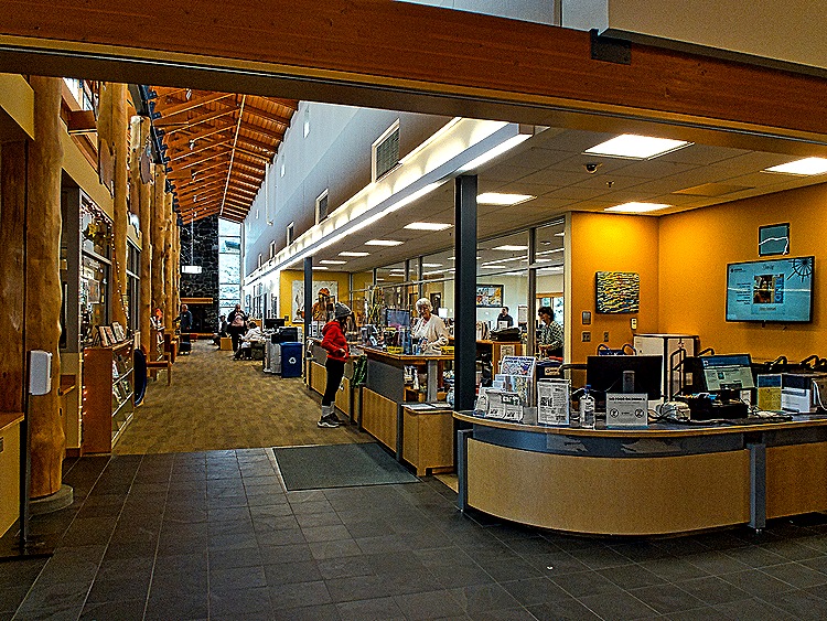
     We walked along for a while, then went into the Mindelo Cultural Center (Centro Cultural de Mindelo) facing the waterfront.  Inside were some craft shops and, lo and behold, the public library!  We knew its old location was closed but didn’t know where (or if) there was a new one.  Robert stumbled upon it here by happenstance.  It seems much smaller than the previous location, probably with a lot fewer books, so hopefully a larger home will be found eventually.  Still, with its second floor on a raised platform inside the high ceilinged room, it was an interesting space.  A variety of artworks was mounted in the building (outside the library) and, as at the tower, there was a nice bay view out the front door.  While we were resting up to leave the building Robert took pictures of both of us.

DSC09493DSC09495DSC09491DSC09501DSC09443_stitchDSC09496DSC09497DSC09498_stitchDSC09502DSC09503IMG-20240503-WA0002IMG-20240503-WA0000

     As mentioned above we had an early departure today so we took the shuttle back to the ship to be in plenty of time.  Before boarding we took pictures of some of the crew painted walls on the building across the pier.

DSC09472DSC09511DSC09512IMG-20240503-WA0004

     That was the end of our visit to the last foreign port on this long voyage.  We set sail in mid afternoon for our final port before reaching Florida again.  It would take four sea days to get there.  One last look from our veranda before we departed.

DSC09515_stitch

Banjul, The Gambia — 2024

     After three more sea days we reached Banjul on May 1.  The Gambia is a tiny country in northwest Africa whose land borders are completely surrounded by Senegal  Not only does The Gambia have about the highest visa charges on this voyage ($145 per person, if memory serves), but you have to pay it even if you don’t leave the ship and step foot in their country.  We saw a lot and had a very good time the first time we visited here in 2018, and you can read and see a lot more about this country in that blog episode.  https://baderjournal.com/2018/09/05/banjul-the-gambia/  But this time we decided once again to forego the badly overpriced excursions, none of which really appealed to us anyway, and stay on the dock.  We had thought about taking the shuttle to the market and walking around some of the city on our own (especially to see the library, of course), but we were warned this wouldn’t really be safe so we passed on it.

     We had a leisurely breakfast in the main dining room.  Sitting by the aft windows we had a very nice view of egrets and gulls in the early morning light sitting on a platform in the water to which our ship was tied up.  Beyond that we watched commuters piling into open boats called pirogues that would take them to their places of employment.

DSC09446

DSC09443_stitch (2)DSC09453_stitch (2)

     From the ship we had a good view of the port area, which has a causeway over the water to reach the city.  It was a pretty foggy day, but in the distance we were able to see the towers of a large mosque and Arch 22, a monument to the coup in 1994 that installed a dictator who ruled Gambia for the next 22 years.  On the opposite shore was a large boat pulled up onto the sand and we also had a view of a street and houses located near the port.

DSC09459_stitchDSC09424DSC09410DSC09415_stitchDSC09417DSC09411_stitch

     In addition to the pirogues there were larger ferries at this port.  One of them was named the “Kunta Kinteh,” which you may recognize as the main character in the book and TV miniseries “Roots.”  Kunta Kinteh was an actual person who was captured and sold into slavery from the Gambia.  There is also an island nearby that is named for him.

DSC09399_stitchDSC09459DSC09407

     As in Ghana, a large vendors’ market was set up on the dock in front of our ship.  You could buy just about any kind of African arts & crafts, from masks to carved animals to clothing to baskets.  Bargaining was very much in order, but the vendors were friendly and not demanding.  We went out on the dock for a while to explore the market.

DSC09373_stitchDSC09385DSC09385_stitchDSC09406DSC09421DSC09466DSC09465DSC09467

     Also on the dock near the ship was a group of drummers and dancers.  They had a lot of stamina, performing pretty much all day with very little in the way of breaks (although the dancers took turns to get a breather).  We saw one passenger who joined in the dancing.

DSC09433DSC09381_stitchDSC09421 (2)DSC09369DSC09416 (2)DSC09436DSC09438

     The Banjul port is located up the Gambia River from the coast.  The river is 700 miles long but we docked near the beginning, maybe a mile or two from the coast.  But still, arrival and departure times here are always subject to the tides.  In 2022 we had to skip this port on our itinerary because of the tide schedules.  So when the tides were right we sailed away, probably around 5 or 6 PM.  As we sailed down the river we saw pirogues by the shore as in the morning, probably bringing back the commuters they transported in the morning.  We also passed a Turkish power ship.  We have seen these before in Africa so they must be a profitable industry for the Turks.  They sit stationary near the coast and provide electrical power for the local city.  After that it was clear sailing into the ocean after our last stop on the African continent.

DSC09388_stitchDSC09430DSC09431DSC09424_stitchDSC09463

Takoradi, Ghana — 2024

     We docked in the port of Takoradi on the morning of April 27 after four sea days.  Those of you who have carefully perused the itinerary (probably fewer than one) will notice that the day before this we were scheduled to be at Null Island.  The truth is that there is no island at Null Island; that’s why its called “null” . . . you get the joke, right?  This is actually the spot in the Atlantic Ocean where the Prime Meridian crosses the Equator, so its zero degrees latitude and zero degrees longitude.  There was, we are told, a weather buoy here at one time but we have now crossed this spot three times and seen nothing but water, just like on every other sea day.  Our first visit here in 2018 can be seen here: https://baderjournal.com/2018/09/05/ .  Our second visit in 2022 can be seen at the bottom of this post:  https://baderjournal.com/2023/04/05/luanda-angola-2022/ .  There is a good bit more information about this in those posts.  For what its worth, here is what we saw this time when we got there:

DSC09362DSC09363

     We had been to Takoradi before, just 16 months earlier.  On that visit we were on a private excursion that was quite interesting (not to mention somewhat challenging).  You can see that, and read a lot more about Takoradi & Ghana, here:  https://baderjournal.com/2023/04/10/takoradi-ghana-2022/ .  By the time we reached Takoradi on this trip we were pretty tired of bus tours and there really weren’t any offered that piqued our interest.  And there was no place to go on foot from this port.  So we stayed on the dock.  There was a pretty good vendor market set up in tents on the dock for our visit, so we left the ship to spend some time perusing their goods.  From our veranda we also saw a local working boat.

DSC09343_stitchDSC09342DSC09341DSC09340DSC09347_stitchDSC09346

     We did have one highlight activity during our day on the ship.  It seems they were inviting passengers in groups to tour the bridge, something we had been wanting to do.  We aren’t sure whether everybody was invited to do this but quite a few were included.  They ran us through in shifts at predetermined times.  We were part of a group of about 12 or 15 and if we remember correctly we were allotted about 15 minutes on the bridge before the next group was scheduled to replace us.  The bridge is (as you might have guessed if you haven’t seen one) long and narrow with the front array of windows on one of the long sides.  There are basically two rows of consoles with many complicated looking bells and whistles and controls.  Since we were docked not many officers were needed to handle the bridge (ie. no navigation needed), so most of the people in the room were visitors.  A young officer was assigned to explain everything to us and he did a good job on what must have been a trying assignment as tour groups trooped in one after the other.  He explained a lot, most of which we have probably forgotten by now.  But we do have some pictures. First some general pictures of the navigation consoles.

DSC09354DSC09352_stitchDSC09365DSC09367

     The bowed line of front windows provides a panoramic view of everything in front and curving to the sides.  In this case it showed the dock in front of us (we were docked facing the shore).  In the floor was a window providing a view of the water below.

DSC09357_stitchDSC09369DSC09364

     Finally, here is a picture of the young sailor in mid-talk, another of the joystick used for maneuvering the ship especially in tight circumstances (just like a video game), and several closer pictures of some of the lighted consoles.

DSC09361DSC09372_stitchDSC09370DSC09377DSC09371DSC09374

     Here are two panoramas.  The first is of the shoreline around the port, showing many small wooden houses that look from a distance almost like unstacked piles of boards.  On the far right is smoke rising from a fire (hopefully one that was planned).  The second is of the sun setting behind one of the piers in the port.

DSC09378_stitch_2DSC09390_stitch

     Holland America is now a US corporation (wholly owned by Carnival Corp.), but it started out 150+ years ago as a Dutch line and it still sails under the Dutch flag.  The royal family of the Netherlands is the house of Orange and there is a picture of the current royals hanging near the main information desk on all the HAL ships we have been on.  In that tradition most of HAL’s cruises include an “Orange Party,” in which passengers and crew are encouraged to wear something orange in tribute to HAL’s origins and on this voyage the party was tonight.  Unfortunately they advertised it with something like “Wear something orange to show your loyalty to the House of Orange.”  We actually have no loyalty to the House of Orange or any other royals, being Americans, so we did not wear any orange clothes (also, we didn’t have any other than a tee shirt which wouldn’t have cut it in the dining room at dinner).  But many others did.  Orange items were for sale in the shops (of course), including bizarre orange wigs, but we thought that the prize should go to our travel agency’s onboard hosts: Tom, Keith and Susie.  Fun was had by all.

DSC09395_stitchIMG-20240429-WA0001IMG-20240429-WA0003IMG-20240429-WA0006IMG-20240429-WA0000

Luderitz & Walvis Bay, Namibia — 2024

     Namibia is a fairly large country on the southeast coast of Africa, just north of South Africa.  In fact, until it obtained independence in 1990 it was governed by South Africa.  From the 1880’s until World War I this area was a German colony called German South West Africa, after which it came under South African control.   The driest country in Sub-Sahara Africa, Namibia is largely a desert country, located between the Namib and Kalamari deserts.  It is known for its many beautiful sand dunes, some of which come right to the edge of the ocean.

Luderitz

     The morning of April 21 found us anchored near the town of Luderitz.  Founded in 1883, Luderitz today has a population just over 16,000. Its heyday was from 1909 to World War I when there was a diamond mining boom in the area. There is a heavily German influenced ambiance thanks to its first few decades as part of a German colony.  The tender ride into town was not brief, as the tender port is behind the peninsula you can see in the picture below, which is called Shark Island.  You can also see in that picture what a bleak desert environment Luderitz sits in.

DSC09340_stitch_1

     We were supposed to visit Luderitz on the Grand Africa voyage in 2022, but the weather conditions were bad enough that the Captain skipped this port (Rick was still in Covid quarantine, but because the whole ship missed this port that didn’t make any difference).  So this was our first opportunity to visit Luderitz.

     The ship’s tender let us off at a long wooden dock near the center of town.  There was a view of part of the town from the dock and what looked like a type of seagull was in the water nearby.  As we walked through the port we spotted an interesting black bird with a white breast perched on a metal rail above our heads.

DSC09269_stitchDSC09271  DSC09233

     The main thing our research indicated we should see here is the Felsenkirche (church on the rocks) which is on the other side of the central town from the tender dock.  So we began walking toward it and found that really the best thing about visiting Luderitz is its hundred year old German colonial architecture, heavily influenced by the Art Nouveau style that was popular at that time.  Many of these buildings are painted in bright colors.  Among other things we passed on our walk through town was a view of the Felsenkirche looming above the Bayview hotel and a bright red restaurant & bar called Barrels.  Bismarck Street is one of the oldest streets in town, named for the German chancellor who first established the colony here.  On that street was the Deutsche Afrika Bank Building, opened in 1907, in whose vaults the diamond miners kept their diamonds and where the mine workers were paid.  The railway station was, as we understand it, built 1914 a few months before the start of World War I to replace a station built in 1904 that became too small during the diamond boom. This was the last building in Namibia built by the Germans and is still in use and shows its original design.  It is on the corner of Bismarck Street and Bahnhof Street.

DSC09234DSC09237DSC09266DSC09235DSC09236DSC09267

     The Evangelical Lutheran Church, the official name of the Felsenkirche, sits on top of the highest hill in Luderitz.  It was a very steep walk up a dirt road to the church, past some old colonial houses.  Built in Victorian Gothic style, the church opened in 1912.

DSC09240_stitchDSC09243DSC09258_stitch

     The church is fairly plain inside but has colorful stained glass windows of a quality you don’t expect in a small desert town.  They were all imported from Germany, some contributed by the German Kaiser.   One has a portrait of Martin Luther incorporated into its design.  When asked who it was, the information person in the church said it was the German Martin Luther.  We assumed he was distinguishing it from the American Martin Luther King, but it would have been hard to make that mistake from this picture.

DSC09248DSC09252DSC09250DSC09251

     We walked around behind the church and were rewarded with a panoramic view of the bay and the modern Nest Hotel at the bottom of the hill on the water.  From the front of the church was a panoramic view of Luderitz.  We walked down the hill to start heading back to the tender port.

DSC09255_stitch

DSC09245_stitchDSC09254DSC09260DSC09261_stitchDSC09242

     Our walk back to the tender port took us, of course, past more interesting old buildings.  Berg Street is topped by the red and blue Haus Grunwald, built in 1910 for Luderitz’s first mayor.

DSC09238DSC09264_stitchDSC09268

     We have some views of notable places from the ship that we took later.  Two are of the town’s notable churches, one of the Felsenkirche (of course) sitting on its rock hill and another of the Saints Peter & Paul Catholic Church.

DSC09339DSC09340

     We mentioned Shark Island earlier, which protects the tender dock from the ocean.  It has a notable history.  The Germans conducted a brutal war from 1904 to 1908 to suppress the resistance to colonial rule by the indigenous Herero and Nama people (some call it a genocide, not without reason).  From 1905 to 1907 the Germans ran a concentration camp on Shark Island in which several thousand prisoners died. 

     There are two lighthouses here.  First is the Shark Island Lighthouse, built in 1903.  It was decommissioned and the light was removed in 1910 (today this building can be rented for tourist accommodations).  A new light was built very near by, on a steel skeleton tower.  In the first picture below the old lighthouse is the bright red building and the newer one can be seen to the left of it rising from a yellow base.

     Second is the Diaz Point Lighthouse on the opposite end of the “island.”  Built in 1915, the light is 174 feet above sea level and is painted in horizontal white and red stripes.  In our previous episode, driving from Cape Town to the Cape of Good Hope, we saw the padrao (cross) erected there by the Portuguese explorer Bartolomeu Dias in 1488.  He erected a padrao here as well on July 25, 1488, a little way behind this lighthouse so we can’t see it in the picture.  It stood for several centuries before deteriorating enough that it had to be removed to a museum.  It was replaced in 1988 (500 years after Dias’s last visit) with a duplicate carefully modeled on contemporaneous pictures of the Dias cross. 

DSC09340_stitch_3DSC09338

So that is Luderitz.  We sailed away shortly before dinner time, passing the empty desert land on the shore outside the city.

DSC09355_stitch

Walvis Bay

     We docked in Walvis Bay the next morning, April 22.  There is much of interest to see and do in Walvis Bay, particularly if you like wildlife.  During the world cruise in 2018 we had an expedition that took us to the mostly desert interior of this area. https://baderjournal.com/2018/08/24/walvis-bay-namibia/ .  And during the Grand Africa voyage in 2022 we had excursions through the bay and down the coast.  https://baderjournal.com/2018/08/24/walvis-bay-namibia/ .  By the time we reached Namibia on this voyage we were pretty tired of driving excursions, so we decided just to walk to the nearby lagoon where the pink flamingoes hang out, in the company of our friends Robert and Bill.

     It was a nice sunny day and the walk was pretty easy.  After leaving the port we walked past a large number of vendors with their wares spread out on blankets.  Walvis Bay is famous for its many flamingoes and we were not disappointed; they were waiting for us when we arrived.  You may notice they are not very pink, but it turns out that the pink color comes from what they eat and doesn’t begin to show up until they are two or three years old.

IMG-20240422-WA0000DSC09292DSC09272_stitchDSC09293DSC09299

     There was also a pelican cavorting on the beach among the seagulls.

DSC09297DSC09301DSC09302_stitch

     We walked up along the shore toward the right in the picture above.  We passed the Walvis Bay Yacht Club and The Raft, a landmark and restaurant built on stilts over the water.

DSC09289DSC09291DSC09284_stitch

     We walked out over the water on a rickety old wooden pier.  Looking over the side we saw some impressive orange jellyfish.

DSC09318DSC09317DSC09319

     We kept walking in the same direction and, after passing an unsettlingly worded sign, came to a small waterfront shop and restaurant complex.  It was lunchtime so we sat down at an umbrella table at the water’s edge and ordered a small lunch.  This was the Anchor Waterside restaurant, well known in this area.  It is famous for its fresh calamari, but that’s not what we ordered (that would never be what we would order). We watched the boats and sea life as we ate, highlighted by a seal swimming around a nearby pier.

DSC09320DSC09330DSC09321a_stitch

     All of us except Robert had local beer, which was good.  We were a little surprised at just how close to the ship our lunch spot turned out to be.  After we returned to the ship we found that we could see the restaurant and our table from the veranda in our room!  When it came time to pay up the waiter brought a portable credit card reader to our table.  It wouldn’t register Robert’s card (which had been giving him trouble), so the waiter held his reader up in the air and waved it back and forth.  We all thought this was a joke and laughed, but sure enough the card finally was recognized!  Who would have expected that would work?

DSC09326DSC09328IMG-20240422-WA0008DSC09332_stitch

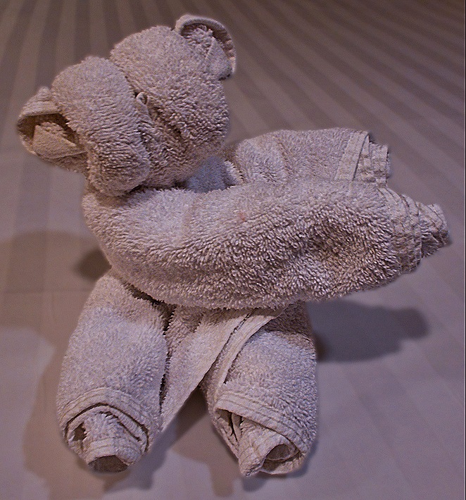
     That’s it for Namibia.  After this we had four sea days before our next port.  We will leave you here with a picture of a towel animal that appeared on our bed during one of those sea days.  We aren’t at all sure what animal it is (a pig maybe?).

DSC09338

Cape Town, South Africa (Day 3) — 2024

     Surprisingly after our experiences the previous two days, everything went as planned on the morning of April 19.  The ship was just where it was supposed to be and everybody showed up at the cruise terminal on time to start our second excursion with Ligia.  Yesterday we drove east and today we drove south, heading  down to the end of the Cape of Good Hope, a scenic drive with many points of interest along the way. 

     Our first stop was to be Boulders Beach, home of African Penguins.  On our way south we passed mountains and small towns.  As we drove through Muizenberg we saw the old post office, a Cape Dutch style building dating (we think) to 1911, which has also served as a magistrate’s court and currently a museum.  Muizenberg was the scene of a battle in 1795 that resulted in the first British landing in the Cape.  With a population just over 36,000, this is a popular surfing area; Agatha Christie used to surf here back in the day.  As we neared Boulders Beach there was a view of the old Simon’s Town waterfront across the waters of False Bay.  Established in 1680, Simon’s Town is a popular tourist attraction and home to a large naval base.  The old buildings in town are visible just back from the water in our picture below.

DSC09033DSC09034_stitchDSC09037

     Boulder beach is a beautiful spot in Simon’s Town.  It has (you probably guessed it) lots of granite boulders.  But what it is famous for today is a colony of African penguins.  We had to walk a for a bit past many street vendors to reach the entrance, where there is a fee to go in.  One penguin was standing on a rock by the fence near the entrance, looking like he was the designated greeter. We entered the site and walked past the information center and gift shop (if you ever want a penguin themed memento, this is the place to come).  Then we walked down a wooden stairway toward the beach.

DSC09046_stitchIMG-20240420-WA0004DSC09039DSC09078

     This is one of three penguin colonies in southern Africa.  The first penguins showed up here in 1982.  From the two mating pairs that were the first arrivals there are now some 3,000 penguins based here.  A wooden viewing platform at the end of the lengthy wooden staircase down the hill enables visitors to get pretty close to the penguins, but no one is allowed down onto this beach.  We understand that there are other parts of Boulders Beach that are not restricted so people can sometimes get right down among the penguins but we did not see that.  The people are restricted here but the penguins are not.  The penguins go into the water and are free to swim, and swim away if they like (we understand they do swim away to hunt for food).  We did see a couple of people in snorkeling gear among the rocks, but assume they were assessing the conditions to help protect the penguins.

DSC09081DSC09055DSC09096DSC09060

     The African penguins look almost identical to the Magellanic penguins we had seen several times in the southern part of South America, and they are an endangered species.  The beach with the viewing platform is their actual mating area and we were in luck because it was mating season.  We saw some chicks and, even better, some pre-chicks (ie. incubating eggs).  These penguins dig burrows in the sand to hatch their chicks, in part to protect them from the sun since this area is much warmer than the Antarctic habitat where most penguins live. Males and females take turns incubating their egg, so we aren’t sure whether the penguin with the egg is the mother or father.  These penguins generally mate for life.

DSC09065DSC09064DSC09090DSC09069

     The most distinguishing feature of these penguins is the naked pink area above their eyes.  This helps them regulate body temperature, with more blood coursing through there when it is warm to dissipate body heat and less when it is cold out.  When it is hot the pink color intensifies.  We have read that the number, size and pattern of spots on their white bellies are unique to each penguin, similarly to human fingerprints.  The penguins occupied themselves not only by swimming, but walking around and climbing up and down the sandy hill, singly or in groups, or just standing around doing nothing.

DSC09077DSC0906320240419_122527DSC09057DSC09068DSC09098DSC09056DSC09085DSC09087_stitch

     Meeting up with Ligia again after we left the protected area, we headed further south.  We drove through a large area called (we think) the Cape Flats that was mostly scrubland and bushes, with few if any trees.  It is scenic, with a few mountains in the distance.

DSC09170_stitchDSC09174

     This area is home to several species of wildlife you (or at least we) don’t really see often in the wild.  We passed what we assume was a family of ostriches, one male and at least two females, foraging in the bush.  They all got together and mooned us.  The male is, of course, much bigger and more brightly colored than the females.

DSC09106DSC09108DSC09157DSC09116DSC09105

     We also encountered a baboon foraging by the side of the road.  He had no interest in us whatsoever; he must be very used to cars stopping to look at him.

DSC09139DSC09128DSC09146

     Eventually we reached the official Cape of Good Hope, the end of the Cape Peninsula.  Cape Point, the actual tip of the peninsula, is a rocky promontory about a mile and a half away.  There is a small lighthouse on top of a large rocky hill that is supposed to have a good view of it, but it was crowded (as it often is) so we didn’t go up there.  This spot is the farthest southwest point on the continent of Africa, but it is not the southernmost point, nor is it the place where the Indian and Atlantic oceans meet.  Those would both be at Cape Agulhas, which is about 90 miles east of the Cape of Good Hope and extends some 34 miles further south.  It was rather chilly and overcast when we reached this area, which is very rocky both on the flat land and in the nearby mountain, and there is a sign giving the exact latitude and longitude.

DSC09148_stitch_stitchIMG-20240420-WA0003

     We spent a little time here (the pictures don’t show it, but there were a number of other visitors here), then headed back north.  We had come down mostly on the eastern side of the peninsula and we returned along the more scenic west side.  Eventually we turned off on a side road that took us to a monument standing alone in the bushlands called the Dias Cross.  Bartolomeu Dias was the Portuguese explorer who was the first European to sail this far down the African coast.  He reached this spot in March of 1488 and named it the Cape of Storms.  The Portuguese king later changed the name to Cape of Good Hope because it gave hope that they would eventually be able to reach India by this route.  The Portuguese practice was to erect a “padrao” (a stone cross) on a prominent spot to claim a newly discovered land.  Dias erected one here near a rocky point now called Kwaaihoek in 1488.  Remnants of it were discovered in 1938 and are now kept at the University of the Witwatersrand in Johannesburg.  At some point the Portuguese government erected a monument here to Dias’s expedition.  The monument is white with a cross on the top and can be seen on top of a hill from the main road.  Around the monument we got a closer view of some of the flowering bushes that are characteristic of this area.  Not far away, on a scenic spot overlooking the water near the eastern coast of the peninsula, is a smaller stone cross enclosed in a fence that also commemorates Dias’s voyage, erected by the Portuguese community of Cape Town.

DSC09127DSC09124DSC09156DSC09169DSC09164DSC09162_stitchDSC09184DSC0917320240419_142500DSC09181DSC09179_stitchDSC09176DSC09182

     We continued north, passing stark mountainous views.  We met a small black pig foraging at the side of the road, perhaps escaped from a local farm.  We drove past beaches near Kommetjie, a popular surfing area, and had a view of the Slangkop Lighthouse located there.  Dedicated in 1919, it is more than 108 feet tall.

DSC09189_stitchDSC09195DSC09197_stitchDSC09199_stitch

     We stopped for lunch in an area called the Farm Village in the town of Noordhoek.  The restaurant is called the Foodbarn.  Sounds prosaic, but it is run by a chef from France and the food is very good and also creative.  Interesting ambience too (notice the wallpaper).

DSC09207DSC09202DSC09206

     Chapman’s Peak Drive runs about 5.5 miles between Noordhoek and Hout Bay.  It is a rather spectacular drive (some say the most beautiful in the world) on a narrow road cut out of a sheer reddish mountain cliff just after World War I.  It is a toll road and is said to be safe these days, but it was closed for long periods in the 1990’s and again the 2000’s after several deaths in order to build better safety protections. As you drive along this road there is a sheer mountain cliff going up on one side and a steep drop off toward the water on the other side.  Chapman’s Peak is the southern extension of the Constantiaberg, one of the largest mountains in this area.

DSC09219DSC09228

  We and walked a little way down to a viewing platform overlooking Hout Bay.  A number of other visitors were there and also some vendors selling interesting local arts and crafts (one of which we purchased).  The sun was getting lower in the sky and reflected on the water toward where we stood, which made the view quite special.  The closest mountain to the mouth of the bay is called The Sentinel; it is also called Hangberg, as is the town located behind it.

DSC09223DSC09214_stitchDSC09209_stitch

     We drove back to the wharf where our ship was, miraculously, still docked where we left it.  We took some last photos from the top deck of the ship of always photogenic Cape Town under Table Mountain, and of the harbor where a container ship was docked behind us.  So after two very full and enriching days (thanks to Bob, Judy & Ligia), we headed back out to sea.

DSC09329_stitchDSC09336_stitch