Latest

Singapore (overnight) — 2024

     We spent March 23 and 24 in Singapore, an island nation whose city has the same name as the country.  This was our third visit to Singapore.  In 2016 we spent three days (more accurately, about 2 and a half) here.  You can read all about that (and see a lot more pictures) here:

https://baderjournal.com/2016/04/22/singapore-day-1/

https://baderjournal.com/2016/04/25/singapore-day-2/

https://baderjournal.com/2016/04/28/singapore-day-3/

In 2018 we had two days here:

https://baderjournal.com/2018/07/30/singapore-day-1-2/

https://baderjournal.com/2018/08/01/singapore-day-2-2/

Day 1 (March 23)

     We decided to spend our first day walking around Singapore on our own, since we were already pretty familiar with the town.  We set out Just after breakfast.  The day was very sunny but also very hot and humid.  On our way to the Sands hotel, an icon in Singapore, we walked past the Gardens by the Bay, which we had visited on our last visit.  While we only walked along the edge this time there were many colorful flowers to see.

DSC07987DSC07984DSC07992DSC07988DSC07993DSC07995DSC07996

     As we passed the gardens we had nice views of the three-tower, one-roof Sands hotel and the Singapore Flyer Ferris wheel, and also of the downtown clump of high rises.  And as we approached the hotel there were (as always, it seems, in Singapore) more nice flowers.

DSC07985_stitchDSC08003DSC08005DSC07997DSC07999DSC08000DSC07998

     The Sands has a famous infinity pool on its roof with a spectacular view but we were told that it is now limited to hotel guests, so we didn’t go up into the hotel.  There were a lot of people crowding the sidewalks in front of the hotel.  We took an elevator up a couple of floors to an overpass to a convention center across the street (which we couldn’t enter).  The overpass was laid out kind of like a park, with benches and many flowers.

DSC08010_stitchDSC08017_stitchDSC08006_stitchDSC08023DSC08024DSC08015_stitch

     We crossed the Helix Bridge to reach the Marina Bay area.  Opened in 2010, the design of this metal pedestrian bridge is based on the structure of the DNA molecule and the views of and from the bridge as you cross are endlessly interesting.  Looking back as we crossed we also had a different view of the Sands hotel.

DSC08025_stitchDSC08027_stitch20240322_173428DSC08033DSC08034_stitchDSC08039_stitch

     From a viewing platform on the bridge we could see several important structures. 

     *The green domed former home of the Supreme Court, opened in 1937, is now part of the national art gallery. 

     *The Victoria Theater and Concert Hall, built in parts between 1862 and 1909, has a distinctive white clock tower.

     *The Esplanade – Theaters By the Bay opened in 2001.  It is referred to colloquially as the “Durian” because of its resemblance to that popular but foul smelling fruit. 

     *The Merlion is a large sculpture/fountain of a beast that is part lion and part fish and spits a stream of water into the bay.  It was created in 1972 and moved to its present location in 2002.  The Merlion was dreamed up by the local tourist board  in 1964 to be a symbol of Singapore and part of the board’s logo. 

     *Finally, the ArtScience Museum, which is associated with the Sands hotel complex, is shaped like a giant white water lily.  It opened in 2011 and is a venue for exhibitions involving arts, sciences, culture and technology.

DSC08032DSC08036DSC08037DSC08038DSC08029

     After leaving the bridge we walked past the Merlion and stopped briefly at the Esplanade, taking a breather on some small bleacher seats on the bay side of the building,  We crossed a large and busy street through a large subterranean passage under an intersection and walked to the Civilian War Memorial.  The Japanese occupation of Singapore from 1942 to 1945 was quite brutal.  In particular, tens of thousands of men of Chinese ethnicity were massacred in a drive to suppress opposition to Japanese rule.  This memorial was begun in 1963 to commemorate them, but was broadened to include victims of other ethnicities as well.  The memorial was officially unveiled in February, 1967, but the year before a ceremony was held to inter more than 600 urns containing remains of unknown civilians killed during the occupation.  The memorial is a very tall white obelisk divided into four sections representing different ethnicities honored by the memorial.  It is surrounded by a fountain and a park, which is in turn surrounded by many tall downtown buildings.  The official name is “Memorial To The Civilian Victims Of the Japanese Occupation 1942 – 1945.”

DSC08043DSC08045DSC08046_stitch

     The Raffles Hotel has long been a prime landmark in Singapore.  It began as a private beach house in the early 1830’s and was expanded into the 10 room Raffles Hotel in 1887.  It has been expanded and renovated and has changed ownership a number of times over the years and is a good bit larger today, but still has a reputation as an elite hotel.  Its most recent renovation had it closed on our last visit to Singapore in 2018 but it was open for business when we visited today.

DSC08063_stitch

     Behind the hotel is an upscale shopping arcade containing boutiques and restaurants, with a large courtyard in the center with a fountain where people can sit at tables and presumably eat or drink if they like.  We walked back there with the intention of visiting the hotel’s famous Long Bar, which was moved here from the hotel’s lobby during a renovation in 1991.  The Long Bar is famous as a hangout of famous people like the writer Somerset Maugham and was also known for its patrons’ practice of throwing used peanut shells on the floor.  We thought we might try a Singapore Sling here at the drink’s birthplace (although we understand it can be shockingly expensive).  But it was not to be.  When we reached the second floor after following signs for the Long Bar there was a very long line of people waiting to get in.  So we moved on.  A series of interesting murals based on old pictures from the Long Bar was exhibited on the walls nearby.

DSC08054DSC08052DSC08053DSC08055_stitchDSC08057_stitchDSC08059

     Before walking back to the ship we visited the library, one part of a large building.  It wasn’t open but we rested a bit in a covered patio outside (did we mention it was REALLY hot and humid?).  Through a back window of the patio we saw the blue domed tower of St Joseph’s Catholic Church, which opened in 1912 to serve the Portuguese community.  On a wall of the building housing the library was a mural of children enjoying books.  On the way there we passed an interesting block of old buildings painted in a variety of bright colors.

DSC08067DSC08068DSC08071

     The walk back to the ship seemed much longer than the walk into town in the morning, mostly because we were tired and it was so hot and muggy.  We saw some nice flowers and we stopped just before reaching the Helix Bridge for a drink and a bite to eat in a small Italian fast food restaurant.  We walked back across the bridge, through all the construction and along the long covered walk parallel to the ocean front (where local folks were fishing) to the cruise terminal.  If I remember correctly, we ended up walking a total of about 13 miles in these sauna-like conditions and by the time we got back we were running on fumes.

DSC08065DSC08073DSC08075_stitch

     We got dinner in the Lido buffet and ate it on the aft deck, which had a great view of Singapore, looking fine as the city lights started coming on at twilight.

DSC08078_stitch

     After dark the Supertrees in the Gardens by the Bay were lighted.  These are more than a dozen towering structures (about the height of a 16 story building), each with an inverted cone at the top to emulate the look of a tree, and each filled with many plants filling up its trunk.  At night these Supertrees are lighted in ever changing colors (with musical accompaniment we are told, although we couldn’t hear that from the ship).  Quite an unusual sight, with some of Singapore’s other iconic buildings (such as the Sands hotel and the Singapore Flyer) lighted up as well.

DSC08092DSC08104DSC08084DSC08093DSC08098DSC08101

     Docked next to us was the Queen Mary 2, which left before the night was over.  One more look at Singapore from the Zaandam, and then to bed.

DSC08114_stitchDSC08087_stitch

Day 2 (March 24)

     There was no way we would be walking anywhere for a second day here, so it was a good thing we had booked an excursion for today with our travel agency to visit some World War II sites.  Before the war Singapore was a British colony, very important because it was the hub for trade going by sea between the Indian and Pacific oceans (as it still is today).  It is an island just off the southern tip of the Malay Peninsula.  The peninsula to the north was largely forests, which the British thought would be impassable to an army, so the island was heavily fortified with large cannons designed to fire hull penetrating shells to stave off any attack from the sea.  It was called “Fortress Singapore” and was thought to be impregnable.

     Within hours of the attack on Pearl Harbor, however, the Japanese attacked the upper Malay peninsula.  After destroying two of the UK’s best warships they were able to land on the peninsula and began moving south.  They used bicycles and light tanks to maneuver through the woods.  The British, who had more than twice as many men (though many not fully trained and poorly supplied) were convinced that they were greatly outnumbered, and retreated down the peninsula to Singapore, then blew up the causeway bridge that connected the island to the mainland.  They were sure the Japanese would try to invade from the northeast and, ignoring intelligence to the contrary, concentrated their forces there.  But the Japanese actually invaded in the northwest of the island and pushed the British (and Australians) back to the outskirts of Singapore city in the south.  Despite Churchill’s insistence that they fight to the last man, with water, food and ammunition running out (and more than a million civilians crowded into the few square miles of the city), the British commander surrendered on February 15.  What the British didn’t know at the time was that the Japanese were also at the end of their tether and were certain they would lose if it came down to street warfare in the city of Singapore.

      The Japanese occupied Singapore until the end of the war in 1945, brutally suppressing all opposition (including the killing of thousands of ethnic Chinese men who were assumed to be in opposition to the Japanese).  A complex of POW camps was established, with prisoners divided by sex and, sometimes, ethnicity.  The central prison, which also gave its name to the whole complex of several prison camps, was in Changi.  That was the first place we saw today.

DSC08147

    Changi prison was built by the British in 1936.  It was designed to hold 600 prisoners, but during the Japanese occupation some 3,000 civilian prisoners were held there.  It was a British barracks near the prison that was converted into a POW camp, holding some 50,000 mostly British and Australian soldiers.  About 850 POWs died there, and more of these prisoners died after being transferred to forced labor sites (like the Burma-Thailand railroad depicted in Bridge Over The River Kwai).  One of the POWs interned here was James Clavell (author of Shogun), whose first novel, King Rat, was based on his experiences as a POW.  After the war Changi was used by the British to house Japanese prisoners of war, a handful of whom were executed here.  Today it is part of a larger modern prison complex, although at the request of the Australians much of the original prison building has been preserved.

     Since it is still a prison we were not able to visit inside the prison walls.  So the pictures here were taken from the bus as we drove by it.

DSC08139_stitch  DSC08141

     A museum has been established not far from the prison, which presents an eye opening depiction of life in the POW camp.  There are a number of artifacts but the museum mainly presents wall boards with photos and written explanations.  It is very well done and quite educational.  Among other things, one notable artifact is a large quilt sewn by inmates of the women’s prison.  A number of these were made for use in the hospital and the women concealed in their designs the names of inmates and meaningful symbols which, had the Japanese recognized them, could have resulted in serious punishment.  Apparently the Japanese did not try to restrict religious observances and the prisoners built several chapels during the occupation.  One of them is in a museum in Canberra and there is a reconstruction of another one, called St George’s Church, just outside this museum.  On the altar sits a metal cross made by one of the inmates from a used shell casing.  There is quite a bit more to this museum and it was well worth visiting.

DSC08143DSC08144

     We visited the Kranji War Cemetery, which contains the remains of almost 4,500 Allied soldiers (850 unidentified) who died during the Battle of Singapore and the Japanese occupation.  During the war this area held a POW camp and a hospital, and after the war Kranji was designated to be Singapore’s War Cemetery; war graves from other parts of Singapore were moved here.

     At the top of the hill is the Kranji War Memorial, etched with the names of more than 24,000 service personnel for whom no remains could be identified (including a number from India who had been cremated in accord with their religious beliefs).  Its columns represent soldiers standing at attention, its roof is shaped like the wings of an airplane, and the tall portion behind represents the fin of a submarine.  A tall cross in front of the Memorial marks the mass grave of more than 400 wounded who died in the nearby hospital at the end of the occupation.  This mass grave preceded the establishment of the War Cemetery and the cross was erected later.

DSC08151DSC08152

     Our final stop was at the former Ford Factory, the site of the British surrender to the Japanese in 1942.  Ford built the factory to serve the southeast Asian market for automobiles, but Ford’s timing was not good.  The factory was completed in October of 1941 and just two months later the Royal Air Force took it over to assemble fighter planes to defend Singapore.  The fighters assembled here were flown out of Singapore near the end of January, 1942, to keep them out of the hands of the advancing Japanese, and on February 15 the Japanese army took control and made the factory its temporary military headquarters. The Japanese company Nissan operated the plant during the occupation to assemble military vehicles.   After the war Ford regained control of the factory and was finally able to operate it as a vehicle construction plant, which it continued to do until 1980.

DSC08163a_stitchDSC08153

     The Ford plant’s special place in history stems from its role as the site of the British surrender of Singapore.  On February 15 the British commander, General Arthur Percival, surrendered Singapore unconditionally to Japanese General Yamashita Tomoyuka in the boardroom of the factory.  That room is preserved much as it looked then, with a replica of the original conference table (the original is now in Australia) and a clock set to 6:40, the time of the signing.  The room has full size statues of the two generals standing at one side.

DSC08158_stitchDSC08157DSC08160a_stitch

     After this we drove back to the ship, through this neighborhood that now has a number of high rise residential developments.  We set sail before dinner time, looking forward to the three upcoming sea days to recuperate from all the exertion on our first day in Singapore.

Ho Chi Minh City (Saigon), Vietnam — 2024

     March 21 found us docked in Phu My, the port for Ho Chi Minh City (previously named Saigon, and still often referred to by that name colloquially).  There is nothing to see or do in Phu My, which is just a small town with an industrial port, so we spent the day in Saigon.  It is about an hour and a half drive to Saigon but HAL was offering an excursion that would take you there, leave you for about 5 hours, then take you back to the ship.  Saigon is a very walkable city with very friendly and helpful people, a large percentage of whom speak English, so that is what we decided to do.  It helps that we had been here twice before:  the first visit we went on a tour of the major sights ( https://baderjournal.com/2016/04/16/phu-my-vietnam-ho-chi-minh-city/ ) and we spent the second visit walking around the city on our own as we would do today ( https://baderjournal.com/2018/07/27/ho-chi-minh-city-saigon-vietnam/ ).  Because of the long drive our bus left pretty early in the morning.

     The bus dropped us off at the Bitexco Financial Tower, the second tallest building in Saigon, which has a well known observation deck on one of its upper stories.  This was also the place where we would meet the bus for the return journey, but in between we were on our own.  We walked up toward the heart of town passing, among other things, a vendor lounging comfortably on his cart.

DSC07916DSC07917DSC07921DSC07922DSC07920DSC07923_stitch

     We stopped to visit the Hồ Chí Minh City General Sciences Library.  Built on the site that had held a somewhat notorious prison since 1865, this library opened near the end of 1971 as the National Library (in South Vietnam).  It was renamed the General Sciences Library 1976, shortly after reunification of North and South Vietnam.  The building has a white facade with an abstract design and looks very much a mid-century style.  It is surrounded by a narrow moat and a nice park where people were eating or reading.

DSC07925a_stitchDSC07927DSC07930a_stitchDSC07937DSC07938

     Inside the first floor (we couldn’t go up the stairs) the library had a bright and open design.

DSC07932_stitchDSC07934DSC07930_stitch

     We wandered on, generally in the direction of the Ben Thanh market, a large single story building housing many individual vendors (Mary bought a hat there last time).  On our last visit we had been impressed by the silk embroidery for sale in a shop not far from this market and we were hoping to find it again.  There had been a lot of construction in this area when we were here before and we weren’t certain we could find the shop, whose name we had not written down, particularly since it was not large on the outside.  But to our surprise it was just where we thought we remembered it, a narrow unimposing building in a long block of commercial stores.

DSC07939_stitchDSC07948

     Just two weeks earlier, in Suzhou, China, we had visited an institute where we watched silk embroiderers at work.  https://baderjournal.com/2024/08/26/shanghai-china-day-2-suzhou-2024/  It is very painstaking work using silk threads that are so thin as to be barely visible and the production of a midsize embroidery can take many months.  We spent a good deal of time exploring this shop in Saigon, which had three stories full of framed silk embroideries in a large variety of shapes, sizes and designs.  One of the shop ladies was working on an embroidery in the front of the shop during our visit.  While all of these works were beautiful, we were particularly taken with the two sided embroideries, stitched on a sheer see through (silk?) canvas that could be viewed from both sides.  Most of these were mounted in carved wood framed screens.

DSC07941_stitchDSC07943DSC07943_stitchDSC07944

     Well, those screens were way above our budget (and were far too big to bring home on a ship).  But we did find a smaller embroidery framed as a wall hanging that we could afford.  And they threw in the frame, which we really liked, for just another $20 or so.  We waited for what seemed a long time for them to package it (extremely well), and they made a carrying handle on one side out of ribbon.  It turned out to be rather heavy and unwieldy but Rick managed to carry it all the way around town and back to the bus.  And his arm didn’t even fall off.

DSC09593DSC09590

     We walked quite a way back to the center of town and saw several landmarks we had visited before.  We saw the old presidential palace (now a museum) in the distance as we crossed a street in front of its park.  The facade and towers of Notre Dame Cathedral, built by the French, were covered in construction scaffolding, apparently getting a renovation.  Across the street was the General Post Office, which was so full of visitors we only stayed briefly.  The portrait in the distance in the post office is Ho Chi Minh.

DSC07950DSC07951DSC07953DSC07969DSC07954_stitchDSC07957DSC07958_stitch

     We had lunch on the next block in a small Banh Mi restaurant.  Banh Mi refers to a small baguette sliced lengthwise and filled with meat and other ingredients to make a very tasty sandwich.  This tiny restaurant looks bigger in the pictures because the walls were lined with mirrors.  If you look very closely in the middle of the second picture you may see the photographer reflected in the far mirror.

DSC07965a_stitchDSC07965_stitch

     Outside the post office were a number of vendors selling souvenirs.  One inexpensive type of souvenir that we had seen here, but nowhere else, before is a card that opens up like a child’s pop-up book to show a fold-up cardboard structure.  Some are Vietnamese landmarks, some are flowers, some are dragons, etc.  We had looked at these before lunch and had told the vendor we would be back after lunch.  I doubt she believed us, but she looked happy when we showed up again.  We bought several of these cards, among them the Dragon Bridge in Da Nang (but the wrong color), the Ben Thanh market, the Japanese Bridge in Hoi An and a dragon boat.  Each of these folds completely flat when you close the card, but stands up on its own when you leave the card open.

DSC09598DSC09599DSC09608DSC09603

     It was time to start the long walk back to the Bitexco Tower to meet the bus.  We walked over to the Hotel de Ville, built by the French in 1908 as the city hall and now housing the People’s Committee that governs Saigon.  A statue of Ho Chi Minh stands in the park in front of the building.

DSC07975_stitchDSC07918_stitchDSC07972DSC07973

     We walked down this park to where we would meet the bus.  The park was decked out in festive attire, with a colorful sign welcoming people to Saigon for the Spring (if we understood correctly).  As we neared the Bitexco Tower we passed streets jammed with motorcycles, a common sight in this area of the world.

DSC07979_stitchDSC07978_stitchDSC07982

     We got back to the meeting place with time to spare, so we sat for a while in a cafe in the lobby of the Tower and had a snack and a drink (much needed after the long walk in the hot weather).  After the long ride back to the ship (somewhat marred by the bus driver’s piping his favorite radio music through the bus PA system) we sailed away from Vietnam around dinner time.

Da Nang, Vietnam — 2024

     We spent March 19 docked in Da Nang, the third most important city in Vietnam with a population of about 1.3 million people.  It is the most important port in central Vietnam, becoming that only when the Vietnamese king barred western ships from entering the previously dominant harbor of Hoi An.  We visited Da Nang previously in 2016 for an overnight stay.  We spent the first day in Hue, the last imperial capital:  https://baderjournal.com/2016/04/10/; we spent the second day in Hoi An: https://baderjournal.com/2016/04/13/danang-vietnam-day-2-hoi-an/,  Today our prime objective was the  ruins of the ancient temple complex of the Cham people in My Son.  This was about a two hour bus ride away, so we got started early.  Passing through small towns and countryside we saw some interesting buildings, including several cemeteries, and a class of schoolchildren.

DSC07683Probably a cemeteryDSC07685DSC07687DSC07691DSC07690DSC07699DSC07703

     My Son was the religious and cultural center of Champa, which occupied most of what today is central Vietnam and was populated by the Cham people.  The Cham were the original indigenous people in this area, having immigrated by sea some 2,000 years ago.  They were heavily influenced by India and practiced Hinduism.  My Son was a large complex of Hindu (and later Buddhist) temples built between the 4th and the 13th centuries, with each new king adding a new temple complex.  The temples were dedicated to the Hindu god Shiva.  It is thought to be the longest inhabited archaeological site on the Southeast Asia mainland.

     Over the centuries there was a great deal of fighting between the Cham and others in the area, particularly the Viets and the Chinese.  In 1832 the Vietnamese annexed what remained of the Champa kingdom.  My Son fell into disuse after that and was largely forgotten, reclaimed by the jungle.  A French archaeologist rediscovered it in 1898 and in 1937 the French began to restore the temples.  But during the war in the 1960’s the Viet Cong established a base there and in August of 1969 US B-52s carpet bombed the area for a week.  Of the more than 70 temples documented by the French at the beginning of the 20th century only 18 structures remain.

     The bus dropped us off near the entrance but there was still quite a walk to reach the archaeological site.  As we walked down the road our bus surprisingly pulled up, apparently having talked the guards into letting it drive us further, and took us to a spot near a bridge over the river where there were some small snack and souvenir shops.  Beyond that point the road became a narrow walking path so the bus could go no further, but there was still a good distance to the site . . . and it was getting pretty hot.  Nonetheless, we persevered and reached the first of two temple complexes we visited.

DSC07706DSC07707DSC07708DSC07734_stitch

     While we have been calling this a temple complex, not all the buildings are temples.  There are storage buildings, perhaps some living quarters for religious personnel and the Champa monarchs were buried here, so there may be some tombs.  Unfortunately we can’t really tell you which buildings are which, but it seems that the larger buildings are the temples and the smallest ones the storage units.  These structures are built mostly of red brick and held together by a substance that is not visible from the outside.  Originally, in the 4th century or so, temples here were made of wood.  But a huge fire destroyed them early on and after that brick was used instead.  Some of these buildings rise to a narrow, almost blunt, top.  But others are topped by what looks like a smaller building with a saddle shaped roof.

DSC07713_stitchDSC07711_stitchDSC07784DSC07721DSC07722DSC07744a_stitch

     Most of the artwork from this site that survives has been moved to European museums or the museum in Da Nang we visited later.  We did see what is left of a sitting headless sculpture and there are other relief sculptures that were carved directly into the brick walls.

DSC07710DSC07719_stitchDSC07741DSC07742DSC07743

     The Cham people often included a phallic fertility symbol called a lingam in their temple complexes.  Sometimes these are reduced to a cylinder shape, and they are sometimes enclosed in a metal cover called a Kosa which can have relief decorations.  Some of them are gone and only the round base remains.

DSC07737___stitchDSC07732DSC07739

     As we have mentioned, much of this area was destroyed or badly damaged by US bombing during the war and bomb craters can still be seen.  But reconstruction is continuing.  The French archaeologists took many pictures and made many drawings and wrote descriptions of what was here early in the 20th century, which gives a lot of guidance to the restorers.  You can tell what is restoration work because the bricks are a lighter color and look newer than the old ones worn over time.  We also noticed several buildings with scaffolding, but we are not sure whether that is for restoration work or just to give extra support to buildings in danger of collapse.

DSC07749DSC07713a_stitchDSC07718DSC07733

DSC07737_stitch

     Some of the later buildings (still quite old) have details, like pillars, made of stone with carved decorations.  There are also some steles with  writing carved into them, although we don’t know what language they are.  We understand that some of these memorialize the kings who built the temples.

DSC07728DSC07729DSC07750DSC07740DSC07723_stitchDSC07726_stitch20240318_184900DSC07731

DSC07744_stitch

     We walked a little way through the woods and came upon another complex of temples.  On the way we passed a few more that were partially hidden by the jungle.  The second complex had a much greater concentration of lighter colored new bricks, so it must have received a large amount of restoration already.

DSC07751DSC07752DSC07783DSC07760DSC07759DSC07753_stitch

     Among other things, this complex had triangular niches in some of the walls that may once have contained sculptures.  It also had some well preserved (or well restored) pillars, doorways and corridors.  You could really see the new bricks, sometimes looking more like piles than buildings (maybe some of them were).

20240318_190018DSC07762DSC07763DSC07766_stitchDSC07780_stitchDSC07779DSC07770_stitchDSC07763_stitchDSC07769DSC07782DSC07774_stitch

    We left the archaeological site to return to the bus at the entrance.  This time we had to walk the whole way and, although the surroundings were nice, it was really very hot.  Probably not a good choice for people with walking difficulties especially since our guide was always in a hurry.  We saw many flowers in the woods and fields and along a man made water feature, perhaps a reservoir.  We did pass one more of the old buildings up on a hill in the woods.

DSC07790DSC07786DSC07788DSC07792DSC07787

     Driving back toward Da Nang we passed some more colorful buildings and made a pit stop in a small town at the foot of the Marble Mountains, where a number of shops had large marble sculptures on display (way too big to carry home).

DSC07799DSC07794DSC07796DSC07801DSC07807DSC07810DSC07803DSC07816DSC07813DSC07819DSC07820

     Back in Da Nang, we stopped for lunch in a nice restaurant off on a side street away from the busy traffic.  Several courses of good Vietnamese food, some in sculptured presentations, and outside it was surrounded by gardens.

DSC07832DSC07824DSC07825DSC07826DSC07827DSC07829_stitchDSC07828DSC07833

     After lunch it was time for a rickshaw ride through this neighborhood and up along the river.  We had a rickshaw tour of the Hutongs in Beijing just a week before, but this time it was one person per vehicle, the driver was behind instead of in front and, of course, it was an entirely different city in a different country.  Our rickshaw drivers wore a uniform (of sorts) consisting of a cowboy hat and a loud Hawaiian style yellow shirt with palm trees.  Very subtle.

DSC07838DSC07843DSC07850

     There was a sculpture display on the riverside walk but the main feature was the Dragon Bridge.  Opened in 2013, it is quite arresting in the daytime but at night it is completely lit up and it spits smoke and sparks.  Sadly we didn’t see that.  The end of the dragon on our side of the river looks like it might be the head, but it is actually the tail with the head on the other side.

DSC07846_stitchDSC07859DSC07872

     During this tour we saw the bright pink cathedral built by the French in 1923.  It is called locally the rooster church because of a weather vane on top of the tower that is just outside the picture.  There are some other street pictures here including a cafe with motorcycles parked on the sidewalk out front.

DSC07862DSC07865DSC07864DSC07867

     Speaking of motorcycles, anyone who has visited Southeast Asia knows that this (along with bicycles) is the ubiquitous form of transportation here.  We have seen many creative uses of motorcycles to transport tools, boxes and even a family of five.  Creative and interesting, but it doesn’t always look very safe. Some people here also bundle up in the heat of summer as if it were winter time, to protect their skin from the sun we have been told. 

DSC07806DSC07909DSC07809DSC07910

     The last stop on our excursion was the Museum of Cham Sculpture, not far from the river walk.  The museum was first opened to the public in 1919 and has been substantially expanded twice since then.  It has the world’s largest collection of Cham artifacts, many from My Son, totaling more than 2,000 items.  Most of the sculptures on display in the museum are more than 1,000 years old. 

DSC07874

    Some of the notable items there were a sculpture of Vishnu with four arms, a stone panel with a relief of the god Yaksa with curled hair, a sandstone guardian demigod dvarapala stomping on a bull, a 7th century male dancer carved into a step leading up to an altar pedestal, and a god (or goddess) sitting with hands on knees, possibly Lakshmi.  Buddhism came to Champa late in the 9th century and the museum had an impressive display surrounding the largest Cham statue of Buddha on record.

DSC07877DSC07878DSC07905DSC07895DSC07888DSC07903    

     In addition to individual sculptures there were a number of excellent reliefs carved into the edges of platforms or pedestals.  The first picture here is of a pediment showing the birth of Brahma from a lotus flower growing out of Vishnu’s navel.  We have read that the second one, depicting a dancer and musician (who may be goddesses) wearing many strings of beads and whose clothing is evidenced only by a cloth hanging between their legs, is considered one of the Chan masterpieces.  The third is a flute player that is a detail from a much longer platform edge.  Next are, apparently, two depictions of the goddess Durga, and below them is a platform edge showing the court of Champa, with the king in the middle and apparently a number of dancing women.

DSC07900_stitchDSC07883DSC07893DSC07904DSC07896DSC07897_stitch

     There was a large variety of other artworks on display, but our time was short and we only have pictures of a few more.

DSC07886DSC07876DSC07889

DSC07880_stitch

     We returned to the ship, from where we had a wide view of the harbor with many fishing boats.  The Thuan Phuoc Bridge, Vietnam’s longest suspension bridge at 1850 meters, which opened in 2009.  The Tran Thi Ly Bridge has a single pylon and cables reaching out in both directions looking like a sail.  When we saw it the cables looked red but we understand that it sometimes gets more colorful.   We sailed away at about 11:00 after a rather fiery sundown.

DSC09188_stitchDSC07907DSC09192_stitchDSC09184DSC09194DSC09195_stitch

Hong Kong, China (overnight) — 2024

     Between Tianjin and Hong Kong we had three relaxing sea days to recharge our batteries from the intensive days in Shanghai and Beijing.  We spent time in our usual hangout, the Ocean Bar, for reading and catching up on the internet news.  Zuiderdam has a lot of fairly quiet venues with upholstered chairs and tables but we have found few that feel comfortable for very long, particularly for folks like us who aren’t as young as we once were.  But we settled on the Ocean Bar as the best of an unsatisfactory lot, better yet if you put your feet up on a table or another chair (although near the end of the cruise Henk, the hotel manager, distributed memos to everybody’s rooms asking that we not do this).  One of our friends, Steve, is a watercolor artist who does a painting in each port.  We bought his painting of the Meiji Shrine in Tokyo, which he delivered to us in the Ocean Bar on one of these sea days.

DSC07445IMG-20240314-WA0000IMG-20240314-WA0002

     But the biggest event during these days was Mary’s 75th birthday on March 15, the day before we reached Hong Kong.  We had originally planned to commemorate it by going to tea at the Peninsula Hotel on our second day in Hong Kong, but it turned out that would not have fit into the time available before our early departure that day, maybe next time.  So we ended up celebrating at our usual table in the main dining room with our usual table mates:  Bill, Robert, Bob & Judy.  Robert provided a birthday cake and the restaurant staff, and some of the diners, sang the Indonesian birthday song.  Robert (as usual) also provided the fireworks.

DSC07448IMG-20240316-WA0006DSC07451IMG-20240316-WA0000IMG-20240316-WA0002

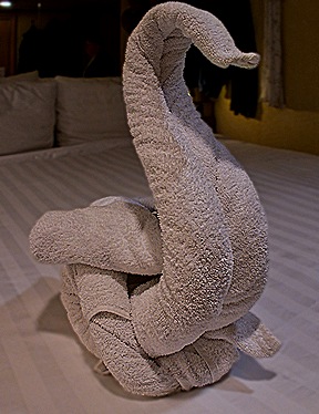
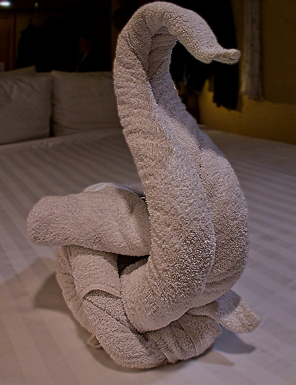
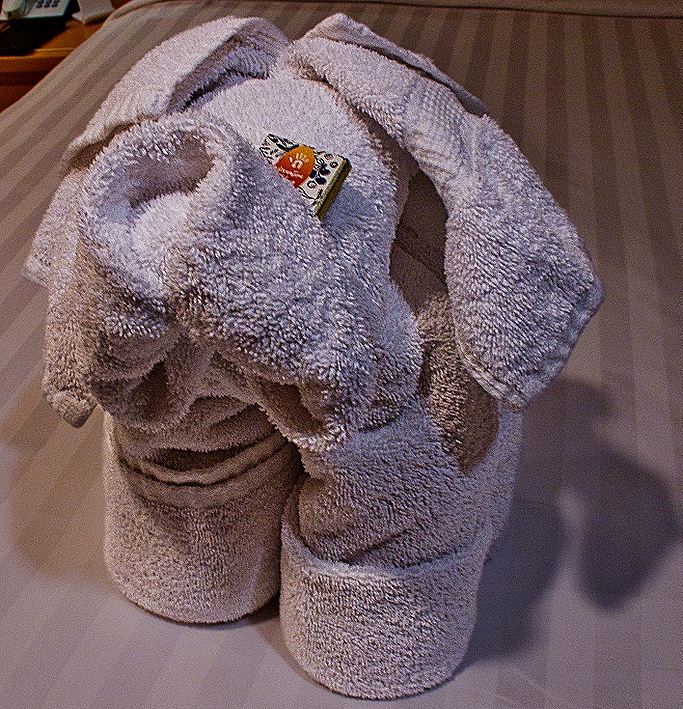
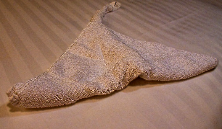
     When we got back to our cabin after dinner we found that our room stewards had been busy too, leaving a very tall birthday cake (made of towels) on the bed, with a (towel) flame on top.

DSC07446DSC07457

     By about 8:00 AM on March 16 we were docked at Kai Tak cruise terminal in Kowloon, across the water from Hong Kong.  (For those who haven’t been here, Hong Kong is an island and Kowloon is a peninsula extending from the mainland that was also part of the British colony.)  This was our third visit to Hong Kong, the first place on this voyage since the Panama Canal crossing on January 24 that we had visited before.  On our first visit in 2016 we were docked for two nights right in the center of Kowloon, next to the Peninsula Hotel and the Star Ferry terminal, just about the most convenient place in Hong Kong.  You could see downtown Hong Kong across the water from the ship:  

https://baderjournal.com/2016/03/20/hong-kong-china-day-1/ 

https://baderjournal.com/2016/03/22/hong-kong-china-day-2/

https://baderjournal.com/2016/03/24/hong-kong-china-day-3/

Our second visit was in 2018 and we were docked overnight at Kai Tak cruise terminal, formerly the Hong Kong airport, which was miles away with no view of the central part of Hong Kong island.  But there was a shuttle bus that took us (on a pretty long ride) to the Peninsula Hotel, so that wasn’t nearly as good as the first visit but still enabled us to go where we wanted pretty conveniently.

https://baderjournal.com/2018/07/23/hong-kong-china-day-1-2/

https://baderjournal.com/2018/07/25/hong-kong-china-day-2-2/

     This time we were docked again at Kai Tak terminal, but there was no shuttle bus to the Peninsula Hotel area.  There was a shuttle bus, but it was provided by a nearby shopping mall and that was the only place it would take you.  We were told (by HAL staff who had never done this) that there was a subway stop near the shopping mall where you could make connections for wherever you wanted to go, but we didn’t want to go to the mall and the connections sounded too iffy to us in a city where we can’t speak or read the language.  We heard later that at least some passengers who took the shuttle had a difficult, at best, time trying to find the subway, so we were glad we didn’t do that.  We thought about walking out of the port to explore the neighboring area, but it is a very long walk from the terminal to the exit (this used to be an airport with long runways) and a lot of construction was blocking the way.

     Our choice came down to stay on the ship or sign up for an excursion, and we sure didn’t want to spend our entire visit to Hong Kong on the ship.  So the day before we arrived we booked an excursion that would take us to several places in the general vicinity of the port.  We didn’t have high hopes for this excursion but it turned out to be much more interesting than we had anticipated.

     Our first stop was at Kowloon Walled City Park.  This enclave’s history dates back to the 15th century when the Chinese established a military garrison to manage the local salt trade.  It became a fort in 1810 and in 1847, after the British took control of Hong Kong island, a strong defensive wall was built.  In 1898 China agreed to give the UK a 99 year lease on a Hong Kong concession extending for 200 miles . . . except for the Walled City that remained under Chinese jurisdiction.  Chinese troops were withdrawn the next year but the British did little to control the area.  The walls were demolished by the Japanese occupiers in 1943 to obtain stones to extend runways at the airport (now our cruise terminal).  After the war the area was inundated by refugees from the Chinese civil war, who wanted to avoid British jurisdiction by staying in this nominally Chinese enclave.  The rapidly increasing population density (some 3.25 million per square mile in a 1987 census, the most densely populated place in the world at that time) along with the failure of Britain and China to police the area, led to it becoming a haven for crime of all kinds (including, for example, unlicensed “doctors” and “dentists”).  After decades of false starts, the population was moved out (finally overcoming their longstanding resistance) and the densely packed buildings were demolished in 1993 under an agreement between Britain and China.  The almost 8 acre park we visited, which once had hosted more than 500 10-12 story buildings, opened in 1995.

     Our bus dropped us outside the park, which is now once again surrounded by a wall, although not a defensive one.  On the way to the park we passed a tall building construction site with scaffolding made of bamboo, something we have seen before in Hong Kong. Near the entrance was a colorful bilingual recycling center.

DSC0746020240315_164228DSC07500_stitch

     Two original parts of the old Walled City remain in the park.  First is the Yamen, a single story building that was the house and offices of the Chinese administrator of the city, called the Mandarin.  It had lovely carved doors in some of the doorways and several rooms of very interesting exhibits about the Walled City and its history, complete with period pictures.  Second is the old South Gate entrance through the original wall, an archeological site that was about 10 feet below the current ground level.

DSC07467_stitchDSC07470DSC07466

     We walked around a white building with a row of bonsai trees along one wall and some cactus in front of another.  The patio in front was covered in stone pebble mosaics and there were flowers around.

DSC07480DSC07479DSC07477DSC07493DSC07476DSC07482_stitch

     We walked past several other buildings.  One that we think may be the Fui Sing Pavilion, had a nice moon gate inside a pavilion extension.  Nearby was Guibi Rock, a stone quarried near Suzhou, whose name comes from its resemblance to ancient jade.  It is difficult to miss the neighborhood skyscrapers towering over the perimeter wall of the garden, and there are several graceful moon gates and windows throughout the park.

DSC07484_stitchDSC07487DSC07490_stitchDSC07489DSC0748820240315_162508

     We also wandered past a lovely small pavilion sitting on concrete pilings in a small lake fed by an artificial waterfall.  The building had moon windows and door and there were flowers nearby.

DSC07494DSC07495DSC07496DSC07497DSC07498

     As with so many places we visited today (and previously), we would have enjoyed more time here.  But the departure time was approaching so we hurried back to the bus.  

     Our second visit was to the Wong Tai Sin Taoist Temple.  This place was quite interesting, but boy was it crowded.  Wong Tai Sin (meaning “Great Immortal Wong”) is the deity name for a 4th century Chinese Taoist hermit. He was largely unknown in Hong Kong before 1916 when an immigrant from Guangdong province set up an herbal medicine shop in Kowloon with an altar to Wong Tai Sin in the back.  Patrons could pray for advice at the altar and then the proprietor would sell them the recommended medicines.  In 1921 he said he received instructions from Wong Tai Sin to construct a shrine.  He and his coreligionists were told through divination exactly where and when to build it.  It was funded by four rich businessmen who had probably been happy users of the herbal medicines.  While Won Tai Sin was a Taoist, the temple accommodates Buddhist and Confucian worshippers as well.

     The small parking lot was quite crowded and we had to wait for a spot to open up.  Then our driver exhibited his notable skill by backing us into a barely accessible spot.  We had to walk a good way to the entry gate of the temple, which had dragon statues on each side that were shiny bronze (probably), where people rubbed them for good luck on the way in.  Then we passed a number of black statues of Chinese zodiac animals, about 6 feet tall.  Some were wearing large red ribbons, perhaps for a special occasion but we don’t know what.  Inside the gate was a small altar pavilion with brightly painted and carved pillars, possibly dedicated to seeking good luck.

DSC07506DSC07507DSC07509DSC07510DSC07519DSC07514DSC07520_stitch

     Another larger stone gate was at the top of the broad stairs leading to the Great Hall, the main Taoist temple.  The center portion of the stairway was filled with what looked like a very colorful relief, perhaps a map?  The plaza in front of the Great Hall had a number of red cushions for kneeling, most of which were in use, and an array of Chinese lanterns strung overhead.  To its sides were kiosks for worshipping and also for obtaining and burning incense sticks.

DSC07515DSC07516_stitchDSC07525DSC07527DSC07528_stitchDSC07533DSC07522_stitch

     One reason for this temple’s popularity is Wong Tai Sin’s reputation for granting wishes.  “What you ask is what you get” is the motto here.  Worshippers seek spiritual guidance through a practice called kau chim.  They light incense sticks and shake a bamboo cylinder containing numbered fortune sticks.  When one falls out it is traded for a paper with the same number which is taken to a soothsayer’s booth for interpretation (sometimes to several booths for a second or third opinion).  A long curved hall on a lower level is lined with soothsayer booths that seemed to be doing a good business interpreting fortunes (and they also had shelves of items presumably for sale).  As we walked out of this hallway to return to the bus we passed a long row of kiosks selling religious articles and souvenirs, mostly in red and gold.

DSC07536DSC07534_stitchDSC07537DSC07539

     Hong Kong is a crowded city and housing is at a premium.  Near the temple we passed a multicolored housing development.  The apartments are tiny and are reserved for young people who haven’t been able to find a permanent place to live.  If we remember correctly, these are allotted by lottery and tenancy is limited to three years.  The theory is that you should be able to find permanent lodging within that time but whether or not you are able to do so you must move out when the tenancy period ends.  To us they looked a lot like a the stacks of ship containers you see in shipyards (except for the bright colors and small windows).

DSC07502DSC07503_stitch

     Our last visit was to Chi Lin nunnery and the adjacent Nan Lian Garden.  The nunnery dates to 1934 when it was opened as a retreat for Buddhist nuns.  It was rebuilt in 1998 using traditional wooden, nail free architecture from the Tang dynasty period (7th – 10th centuries).  The gardens across the street with an overpass bridge to the nunnery were opened in 2006, also designed in Tang dynasty style.  They are laid out with a circular path leading all the way around the park.

     We entered the park through the Black Lintel Gate and walked among carefully sculptured trees to the Chinese Timber Architecture Gallery, which displays scale models of old Chinese wooden architecture.  One model on display was of the Hall of Supreme Harmony we had visited in the Forbidden City in Beijing just four days before.

DSC07616_stitchDSC07548DSC07546_stitch

    We walked past the large white Lamp of Enlightenment in its own garden spot in front of the golden Pavilion of Absolute Perfection, which sits on an island in the lotus pond between the striking orange Wu and Zi bridges.

DSC07552_stitchDSC07555DSC07557

     We crossed the stone bridge over a busy street to enter the Chi Lin Nunnery.  Inside the gatehouse we saw across the large plaza the Hall of Heavenly Kings, the main hall of this large religious complex.  Inside were, among other things, statues of Buddha and some disciples.  But photography was not permitted inside.  Behind this hall is a smaller courtyard and then a larger hall.  The last two pictures in this group may be of that courtyard seen from the Hall of Heavenly Kings, but we aren’t really sure.

DSC0755620240315_183411DSC07564_stitch

DSC07577DSC07578

  Exiting the Hall we had a nice view of the whole plaza surrounded by wooden buildings.  In the plaza were several stone lotus ponds fed by lion head spigots and a number of bonsai trees.

DSC07579_stitchDSC07562DSC07581DSC07558_stitchDSC07582DSC07583DSC07584DSC07568DSC07574DSC07585DSC07588DSC07589

     Leaving the nunnery we had a last view of the gate from the overpass and an interesting view of the Pavilion of Absolute Perfection from behind a large rock.

DSC07587_stitchDSC07593

     Reentering the gardens we continued along the path, passing a gallery, souvenir shops and restaurant.  The gallery was quite elegant with a number of beautiful (and pricey) items of art.  In front of these shops were more bonsai and flowers and at the end an (artificial) waterfall.

DSC07594DSC07597DSC07596DSC07598_stitch

     Turning the corner to head back to the entrance we came to the Blue Pond, a scenic lake full of orange koi.  Along one side is the long Song Cha Xie, a tea house, and on the upper right is the Pavilion Bridge.  Further along we came to the Xiang Hai Xuan Multi-purpose Hall, which had a very nice rock garden in its interior courtyard.

DSC07605a_stitchDSC07601_stitchDSC07603DSC07605_stitch

     So that was the end of the excursion.  Not sure why the time at these places had to be so limited since it ended in early afternoon and we weren’t sailing away until the next day, but I guess it is what it is.  Back on the dock, just before we reached the cruise terminal, we passed several ugly blocks of identical buildings.  Our guide told us these were built early in the Covid pandemic and people (including cargo ship sailors) arriving from outside China were detained here in quarantine for weeks and sometimes months, unable to leave their rooms.  Presumably food was brought to them.  This doesn’t sound like much fun.

DSC07619

     When we reboarded the ship the view from our balcony was completely foggy, a condition that would last until we sailed away the next afternoon.  This evening a local group of dancers performed on the main stage.

DSC07620_stitchDSC07657DSC07668

     Since this was an overnight stay we obviously woke up the next morning in . . . Hong Kong!  It was still quite foggy and chilly, all aboard was about 3:00 for an early departure, and it had been such a hassle finding something worth doing the day before that we decided just to spend this day on the ship.  It was Sunday and a number of folks were out in their boats during part of the day despite the weather.

DSC07675_stitch20240315_215500

     We sailed away in late afternoon, still with low visibility, although the conditions made for some interesting ambiance.

DSC09171_stitchDSC09182DSC09183

Tianjin, China (Beijing) Day 2 — 2024

     We woke up early in our hotel room on March 12.  Already in Beijing, at least there would be no long bus ride to get there, but we were scheduled to check out and leave at 7:30 for the short ride to Tiananmen Square to try to beat most of the crowds that visit there every day.  And before that was a vast buffet breakfast with many Chinese and Western foods, far more than anyone could even sample before a long day of walking.  I was more than satisfied with a couple of croissants.  We checked out of our hotel, quite beautiful inside with many flowers, and boarded the bus.

DSC07099DSC07097DSC07098

     We walked from our bus to Tiananmen Square, entering from a bit to the side of the Quinmen, the huge gate at the front of the square.  It is a beautiful building, which we saw from a distance all lit up the previous night, but by the time our guide pointed it out to us today the sun was directly behind it so our picture is pretty woeful.  Far away on the opposite edge of the vast square we had our first view of the Tiananmen (Gate Of Heavenly Peace), with a painting of Mao Zedong above the entrance in the wall below.  Tiananmen Square was first built in 1651 and greatly enlarged in the 1950’s.  It measures some 835 yards long by 310 yards wide (think 8 football fields long by 3 wide) and will accommodate a crowd up to about 600,000 (thankfully not that many the day we visited).

DSC07106DSC07109

     Most people reading this will probably associate this square with the violent suppression of student democracy protests in 1989, in which it is estimated that hundreds (some say thousands) were killed.  In China no one speaks of this in public and most Chinese are not even aware that it happened.  It is our understanding that the only public entrance to the Forbidden City requires walking across this huge square to the entrance below the painting of Chairman Mao.  So that is what we did.  Walking along we passed the Monument to the People’s Heroes, a 125 foot tall obelisk completed in 1958 and saw the National Museum of China behind it on the eastern side of the square.  The museum, first opened in 1959, is the largest single museum building in the world. It has a vast and varied collection and it looks like one easily could spend a day or two just exploring this museum.  We did not have that kind of time, so walked on by.  In the center of the square just south of the Monument is Chairman Mao Memorial Hall, the mausoleum that is his final resting place.  It was completed on May 24, 1977, about 8 months after Mao’s death.

DSC07113 DSC07104

     Along the western edge of the square is the Great Hall of the People, meeting place of the National People’s Congress and the National Congress of the Chinese Communist Party, along with other official and ceremonial functions.  Its construction was completed on September 9, 1959.  A large building with a long and low profile, it is 1,168 feet long and 677 feet wide.

DSC07120_stitchDSC07127DSC07129

     There would be more than enough time to spend in the square before we would be admitted to the Forbidden City and this apparently is a traditional place for visitors to take pictures.  Well, we were visitors so here are some pictures of us and our companions with the Tiananmen as the background.

IMG_4292DSC07133IMG-20240312-WA0007IMG-20240312-WA0006IMG-20240312-WA0018DSC07137_stitch

     The Tiananmen itself (“Tiananmen Gate” is redundant, since “men” apparently means gate) is a widely recognized symbol of modern China.  First built in 1420, this “Gate of Heavenly Peace” has been damaged or destroyed and rebuilt several times, most recently in 1970.  It is 217 feet long, 121 feet wide and 105 feet tall.  Across the front are two large inscriptions in Chinese: the left one means “Long Live The People’s Republic of China,” and on the right “Long Live the Great Solidarity of the World’s Peoples.”  In front, between the building and the street, is part of the old Imperial moat that still surrounds the Forbidden City with carved marble bridges leading over it to the entrances.  Decorative fountains shoot up from the moat on each side of the building.  Over the main entry is a huge painting of Mao Zedong, which weighs 1.5 metric tons.

DSC07153DSC07142_stitchDSC07147

     Two marble lions stand guard near the front of the building and there are two tall marble columns called “huabiao” standing just beyond each end of the building.  With marble wing-like appendages near the top they look a lot like Alaskan totem poles.  These date to the 15th century. 

DSC07151DSC07148DSC07158DSC07150

     Finally it was our turn to proceed through the central front gate into a large courtyard leading to the Meridian gate, which is the actual entrance into the Forbidden City.  This side of the Tiananmen is called the Upright Gate.  There was quite a long wait here (just like Disney World, where you wait in line and when you finally enter you find yourself in another long line).

DSC07163DSC07160_stitch

     We spent quite a bit of time in this courtyard before being permitted to move on to the next one.  The courtyard is surrounded by buildings in traditional Chinese style, much red, green and yellow.  Yellow roofs like those seen on some of these buildings were permitted only for the Emperor’s buildings.  Notable here and on other buildings are the decorations on the ends of the roof eaves, made up of a row of golden animals, including dragons, phoenixes and lions.  They are quite beautiful and the number of animals indicates the importance of the building, from just a couple to as many as nine. The long rows of buildings along the sides of the square used to be administrative offices.  Young men in uniform were in this courtyard to keep order, and as the courtyard got more crowded we were all required to stand in parallel lines, with each set of visitors in a different line headed by its guide carrying a numbered white sign.

DSC07176_stitch

DSC07193DSC07167_stitch

DSC07178

     We have seen before in Japan and China that some young people like to dress up in rented period costumes when visiting historical venues.  While we waited in line there was a group near us dressed in what we understand were Ming period costumes.  Very colorful, and they happily posed for pictures.  There was also a man with a baby in a beautifully embroidered backpack.

DSC07189_stitchDSC07184DSC07197DSC07199DSC07200

     Of course, what we were all waiting for was our turn to go through the Meridian Gate.  Unlike all the other gates in the Forbidden City, the Meridian has large side walls stretching forward along the sides of the courtyard like the arms of the Sphinx, each with a building on top.  The Meridian Gate is the actual entrance to the Forbidden City proper.

DSC07174_stitchDSC07173DSC07194DSC07182DSC07191_stitchDSC07201_stitch

     We finally walked through the Meridian Gate.  There was a security check inside the gate where we had to show our passports and (if I remember correctly) walk through a metal detector.  A bit irritating because there was a line, but not a big deal.  Except for our travel agency’s host Susie.  She was taken aside as the rest of us went on through.  She was detained for about half an hour before being allowed to rejoin us, causing some concern because no one told us why.  It turned out that she was carrying all our tickets for the Forbidden City and whoever had filled out a form to accompany them had miscopied one of the digits in her passport number so that they didn’t match.  One of our guide’s assistants made the trip back to their office to obtain a corrected form, stepping up like a pro to fix the situation.  We were all glad to see Susie finally return.  Enough excitement for one day!

    We emerged from the Meridian gate into another courtyard where we could see the Gate of Supreme Harmony on the opposite side. Through the middle of this courtyard runs a man made stream called the Inner River of the Golden Water, with five marble bridges over it.  Green sculpted lions (perhaps old tarnished bronze) stood guard in front of it. 

DSC07204_stitchDSC07207DSC07212_stitchDSC07217DSC07218DSC07216

     Walking through this gate (after Susie finally returned) we came out into a much larger courtyard leading to the Hall of Supreme Harmony, the largest building in the Forbidden City.  This large building sits atop three levels of marble.  The buildings in the Forbidden City are all made of wood, the largest collection of wooden buildings in the world.  And they were constructed without nails, which were viewed as violent and non-harmonious at the time.  Instead they are held together entirely by mortise and tenon joints.  Large bronze cauldrons were distributed throughout the complex, which were once kept filled with water as a precaution against fires (always a danger with wooden buildings).

DSC07226DSC07228DSC07229DSC07238DSC07240IMG-20240312-WA0012IMG-20240312-WA0013DSC07227

     We climbed up the steps to the large stone veranda in front of the building.  Bronze sculptures of animals and a large incense burner were out on the patio and inside the central entrance was the Emperor’s throne room where his Dragon Throne still sits.  Unfortunately entrance to the building was not allowed and there was a big crowd of people behind a fence in front of this room angling for position to take pictures, even though the room was on a higher level.  The room inside was dark and outside the sun was very bright, so we really couldn’t see anything inside the opening from where we stood behind the crowd other than some windows that were (un)helpfully backlighting the dark throne.  But standing behind the crowd we raised our cameras over our heads and took some pictures blind in the hope that we could coax something out of them on the computer, because you never know.  The images are there in the pictures below, but they look like they were retrieved from film that has been sitting in water a long time.  Still, the throne (which actually is golden in color) must have been pretty impressive to court visitors.

DSC07278DSC07279DSC07259DSC07265DSC07258

     The carved marble staircases and veranda fencing were quite beautiful in themselves, with dragon heads lining the bottom at floor level serving as rainwater runoff spouts.  It was quite a view from the veranda down the steps and across the courtyard to the Gate of Supreme Harmony through which we had entered.  The central carriageway is covered with intricately carved marble reliefs.  Back in the day, no one but the Emperor was permitted to use it.

DSC07241DSC07288DSC07269DSC07275_stitchDSC07271

     Behind the big hall is the much smaller square shaped Hall of Central Harmony.  We walked through a small gate to the side of the Hall of Supreme Harmony to reach it.  Walking through another gate we looked up and saw its elaborate ceiling, made of wood with mortise and tenon joints.  And nearby were several side buildings with gracefully interacting eaves.  Behind the Hall of Central Harmony is the larger rectangular Hall of Preserving Harmony.

DSC07290DSC07289DSC07282DSC07294_stitchDSC07296_stitchDSC07298b_stitchDSC07292_stitch

     We walked further back, along a corridor between the walls enclosing the inner court on one side and the western palaces on the other.  We passed gates in the wall that led to the western palaces, but we didn’t have time to go in.  Several walls in this area sported glazed decorations that were quite nice. We also had a chance to rest and listen to our guide explain what we were seeing.

DSC07308DSC07310DSC07317IMG-20240312-WA0016DSC07304DSC07313_stitch

     The last area inside the Forbidden City is the Imperial gardens.  It has several pavilions, rock gardens and imposing trees, some we were told are well over a century old.  Living quarters for the Emperor’s concubines and offspring were also located in this area.  Many of the garden paths had stone mosaic designs.

DSC07307DSC07330a_stitchDSC07316DSC07312DSC07318DSC07338DSC07319DSC07328DSC07341DSC07319a_stitch

      We left the Forbidden City through the Gate of Divine Might opening on a view of Jingshan Park across the street.  What you see is an artificial hill (considered the highest point in Beijing) built in 1751 from soil excavated when digging the moats and canals in the Forbidden City.  It was originally a private domain for the imperial family but was opened to the public in 1928.  At the top of the hill, above the entry gate across the street from us, is the Wanchun Pavilion which sits on the central of five summits on the hill.  To its left on another summit is Guanmiao Pavilion, which we were able to see over the roofs of the last part of the Forbidden City.  From the Wanchun Pavilion on a clear day one has a panoramic view over the rooftops of the entire Forbidden City, but we didn’t have time to climb the hill to see that.

DSC07342_stitchDSC07346DSC07305

     So that seemed like a pretty full day, right?  It did to us.  But no!  There was more to come.  We boarded the bus to drive to the nearby neighborhood where we would board bicycle rickshaws (pedicabs) for a driving tour of Beijing’s hutong neighborhoods.  Hutongs are old Beijing neighborhoods, some up to 800 years old, populated by connected one story houses, each with a courtyard in the center.  Most are built of gray brick and many of those left are hundreds of years old and lack plumbing and individual bathrooms.  A courtyard house is called a Siheyuan, and a street or neighborhood of connected Siheyuan is called a Hutong.  The Forbidden City was, in imperial times, surrounded by hutongs, with wealthier people living in more elaborate houses closer to the Forbidden City and less important and wealthy people living in more modest houses further out.  In the mid 20th century there were thousands of hutongs in the area of Beijing surrounding the Forbidden City, but beginning in the 1990’s a majority of them have been destroyed to make way for high rise apartments and office buildings.  Today there is a movement, supported by the government according to our guide, to preserve those that are left as a cultural treasure, although she also told us that many current residents are unhappy about restrictions on selling their property to developers for what can be a huge profit.  We were very happy that they were still there when we visited.

DSC07355DSC07352DSC07357

     We saw several two story buildings lining the roads, mostly stores it seemed.  We have read that the old Siheyuan are almost all single story buildings and the two story emulations have been built in recent years, many for commercial uses.

DSC07360DSC07364

     We can’t tell you which hutongs we visited but most of them were lined with what seemed like continuous gray walls with periodic openings or doors, mostly red.  We understand that these are very tight communities (after all, most people living in them meet at the public bathrooms), with much visiting, conversation and game playing.  Some are very narrow and some very wide . . . from a couple of feet to perhaps 100 feet in width.

DSC07387DSC07395DSC07399DSC07406DSC07400DSC07403DSC07421DSC07422DSC07402

     Rather than tear them down, the government has encouraged the conversion of some buildings in this area into restaurants, bars and stores.  Not all of these are old single story hutong houses, but they are still part of the neighborhood.

DSC07370DSC07372DSC07413DSC07423DSC07426DSC07428_stitchDSC07433_stitch

    Our ride took us along Shichahai Lake. In the 13th and 14th centuries this was the northern terminus of the Grand Canal (discussed in our visit to Suzhou:  https://baderjournal.com/2024/08/26/shanghai-china-day-2-suzhou-2024/) and was then a bustling commercial area.  After the canal was extended to other destinations it became a noted scenic area, the largest body of water in Beijing and lined with green trees.  We noticed that it is also lined with stone walls that look very similar to the ones lining the Golden Water channel running through the Forbidden City and wonder if the two are connected.  Today the area is becoming a mecca for popular bars and restaurants.  On the day we visited the water was still and reflective.

DSC07374DSC07383DSC07369DSC07375_stitchDSC07410DSC07411DSC07416_stitchDSC07424

     Leaving the rickshaws we had to walk back to meet the bus.  Among other things, we walked down Yandaixie Street (we think).  Before World War II this street was known for antiques, then in the 1950’s much of it was converted to residences.  Beginning in 2007 it has been redeveloped to revive its historical appearance.  This is a fairly narrow stone paved pedestrian street and many clothing, craft, pottery and souvenir stores have relocated here, along with various bars and restaurants.  As we walked down the street toward a large arch at the end, festive red lanterns were strung over our heads.  At one point we walked past a store advertising antiques and when one person asked about it our guide quipped “Yes, we have several antiques factories in Beijing.”

DSC07427DSC07430DSC07438DSC07432

     After all that we finally stopped for lunch in a restaurant serving good Chinese food.  It was a bit of a rush, though, because our group was being divided here with some folks heading to the airport to begin a longer trip for several more days in China while the rest of us headed back to the port. On the way out of town we passed a guard tower on top of what we were told is a remnant of the ancient Beijing city walls.  It was another very long drive and we were glad to get back on board the ship after such a full day.  So ends our first visit to mainland China, where we felt we saw quite a lot but there is still much more to see if we ever get the chance.
DSC07439_stitchDSC07442_stitch